ARTIFACT SV-A-0001143
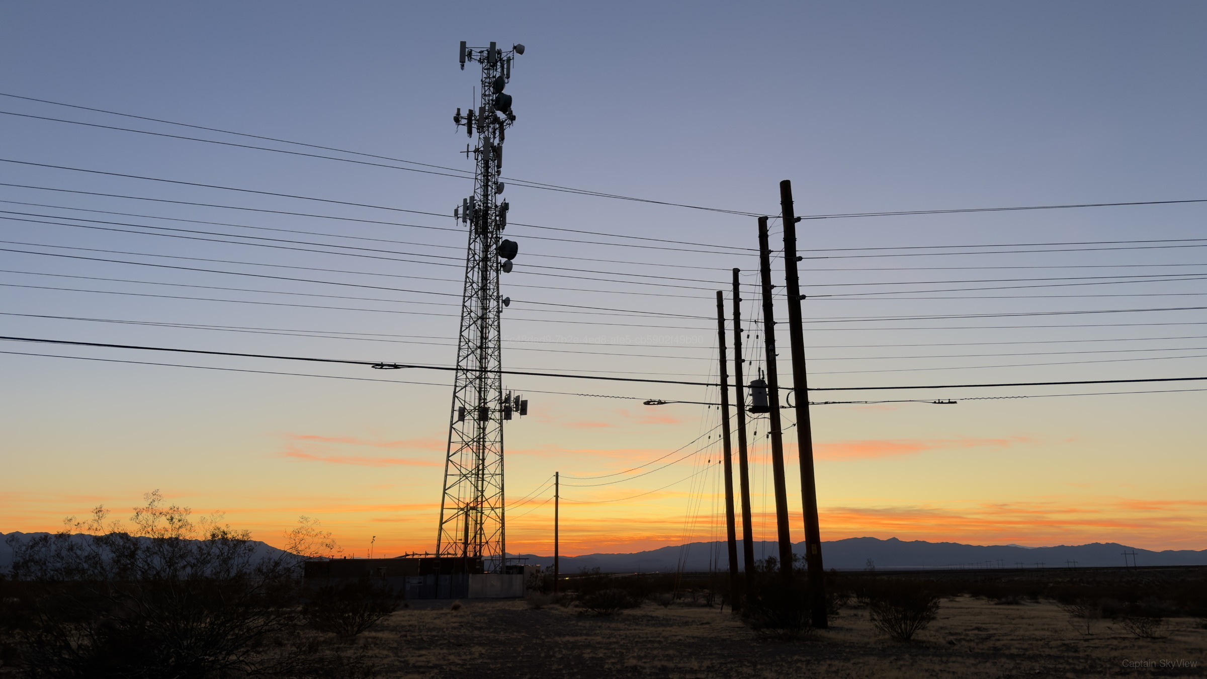
An Evening at Griffith Peak, Looking Southwest
5 page views
ABOUT THIS IMAGE
An Evening at Griffith Peak, Looking Southwest
This photograph was carefully recorded on Sunday, October 25, 2026 at 6:10 PM local time during the dusk around Griffith Peak. At that moment, conditions corresponded to dusk and civil twilight. The recorded camera was a Apple iPhone 17 Pro Max. The camera was oriented toward southwest (SW) at approximately 229.9°. Available weather records indicated 51°F, mostly clear to partly cloudy skies, 62% humidity, NE winds around 4 mph, and precipitation 0.00 in, using a source approximately 1.7 mi from the public capture area. The camera recorded an altitude of approximately 3,969 ft.
USGS geologic mapping associates the capture location with Alluvial sediment, undifferentiated and Qa. USGS mineral-resource records identify nearby recorded sites including Akron Claim, Bill Nye Mine, Chaquita Mine, and Clementina Mine. Mine status may be historical because the source database is not an operating-status registry. USGS 3DEP reports terrain elevation at the capture coordinate near 3,981 ft.
TECHNICAL DETAILSMetadata, capture data & integrityExpand
Public Metadata
Place Resolution
| Candidate | Feature | Source | Distance | Score |
|---|---|---|---|---|
| Griffith Peak | natural / peak | skyview | 16 mi | 130.0 |
| Blue Diamond | place / village | skyview | 13 mi | 123.4 |
| Las Vegas | place / city | skyview | 29 mi | 33.2 |
| Harris Mountain | natural / peak | skyview | 16 mi | 10.0 |
| Mazie Spring | natural / spring | skyview | 16 mi | 10.0 |
| Echo Overlook | place / landmark | skyview | 16 mi | 10.0 |
| Cathedral Rock | natural / peak | skyview | 17 mi | 10.0 |
| Charleston Peak Trail South Loop | highway / path | skyview | 17 mi | 10.0 |
| Connector trail | highway / path | skyview | 17 mi | 10.0 |
| Spring Mountains | natural / ridge | skyview | 17 mi | 10.0 |
| Upper Duck Creek Detention Basin | place / natural | skyview | 18 mi | 10.0 |
| Stanley B Springs Trail | highway / path | skyview | 18 mi | 10.0 |
| Stanley B Springs | natural / spring | skyview | 18 mi | 10.0 |
| 1955 C-54 crash site | historic / historic | skyview | 18 mi | 10.0 |
| Silent Heroes of the Cold War National Memorial | historic / memorial | skyview | 18 mi | 10.0 |
| Fletcher Spring | natural / spring | skyview | 18 mi | 10.0 |
| Cockscomb Ridge | natural / ridge | skyview | 19 mi | 10.0 |
| Fletcher Peak | natural / peak | skyview | 19 mi | 10.0 |
| Nathaniel Jones Park | leisure / park | skyview | 19 mi | 10.0 |
| Mummy Spring | natural / spring | skyview | 20 mi | 10.0 |
| Mountains Edge Regional Park | leisure / park | skyview | 20 mi | 10.0 |
| Paiute Park | leisure / park | skyview | 20 mi | 10.0 |
| Mummy Mountain | natural / peak | skyview | 20 mi | 10.0 |
| Exploration Peak Park | leisure / park | skyview | 21 mi | 10.0 |
| Exploration Peak | natural / peak | skyview | 21 mi | 10.0 |
Context & Provenance
| Context | Value | Relationship | Source location | Source / provider | Observed / retrieved |
|---|---|---|---|---|---|
| camera_direction capture | 229.94 degrees | nearby | Not location-based | Original Artifact EXIF / Embedded Metadata · GPSImgDirection provider_distance | Retrieved: 2026-10-26 04:28:52.821732+00 |
| Griffith Peak place | nearby | 36.23244, -115.64604 16 mi from public capture point | SkyView Internal Resolver · place:62 point_to_point | Retrieved: 2026-10-26 04:28:36.398071+00 | |
| local_date time | 2026-10-25 | nearby | Not location-based | SkyView Astronomy Engine · solar-v1 provider_distance | Observed: 2026-10-26 01:10:14+00 Retrieved: 2026-10-26 04:28:52.845384+00 |
| local_time time | 6:10 PM | nearby | Not location-based | SkyView Astronomy Engine · solar-v1 provider_distance | Observed: 2026-10-26 01:10:14+00 Retrieved: 2026-10-26 04:28:52.846319+00 |
| month time | October | nearby | Not location-based | SkyView Astronomy Engine · solar-v1 provider_distance | Observed: 2026-10-26 01:10:14+00 Retrieved: 2026-10-26 04:28:52.843662+00 |
| season time | fall | nearby | Not location-based | SkyView Astronomy Engine · solar-v1 provider_distance | Observed: 2026-10-26 01:10:14+00 Retrieved: 2026-10-26 04:28:52.842747+00 |
| solar_azimuth time | 257.60 degrees | nearby | Not location-based | SkyView Astronomy Engine · solar-v1 provider_distance | Observed: 2026-10-26 01:10:14+00 Retrieved: 2026-10-26 04:28:52.848104+00 |
| solar_elevation time | -4.01 degrees | nearby | Not location-based | SkyView Astronomy Engine · solar-v1 provider_distance | Observed: 2026-10-26 01:10:14+00 Retrieved: 2026-10-26 04:28:52.847234+00 |
| solar_period time | civil twilight | nearby | Not location-based | SkyView Astronomy Engine · solar-v1 provider_distance | Observed: 2026-10-26 01:10:14+00 Retrieved: 2026-10-26 04:28:52.840007+00 |
| time_period time | dusk | nearby | Not location-based | SkyView Astronomy Engine · solar-v1 provider_distance | Observed: 2026-10-26 01:10:14+00 Retrieved: 2026-10-26 04:28:52.840956+00 |
| timezone time | America/Los_Angeles | nearby | Not location-based | Open-Meteo · timezone:36.008,-115.631 provider_distance | Effective: 2026-10-26 01:10:14+00 Retrieved: 2026-10-26 04:28:52.836525+00 |
| weekday time | sunday | nearby | Not location-based | SkyView Astronomy Engine · solar-v1 provider_distance | Observed: 2026-10-26 01:10:14+00 Retrieved: 2026-10-26 04:28:52.841882+00 |
| year time | 2026 | nearby | Not location-based | SkyView Astronomy Engine · solar-v1 provider_distance | Observed: 2026-10-26 01:10:14+00 Retrieved: 2026-10-26 04:28:52.844519+00 |
| 3DEP EPQS.locationId usgs | 0.00 | nearby | 36.00759, -115.63071 0 ft from public capture point | U.S. Geological Survey — The National Map / 3DEP · 3dep-epqs:36.007586,-115.630706|locationId point_to_point | Retrieved: 2026-10-26 04:28:36.429248+00 |
| 3DEP EPQS.location.spatialReference.latestWkid usgs | 4,326.00 | nearby | 36.00759, -115.63071 0 ft from public capture point | U.S. Geological Survey — The National Map / 3DEP · 3dep-epqs:36.007586,-115.630706|location.spatialReference.latestWkid point_to_point | Retrieved: 2026-10-26 04:28:36.426782+00 |
| 3DEP EPQS.location.spatialReference.wkid usgs | 4,326.00 | nearby | 36.00759, -115.63071 0 ft from public capture point | U.S. Geological Survey — The National Map / 3DEP · 3dep-epqs:36.007586,-115.630706|location.spatialReference.wkid point_to_point | Retrieved: 2026-10-26 04:28:36.425619+00 |
| 3DEP EPQS.location.x usgs | -115.63 | nearby | 36.00759, -115.63071 0 ft from public capture point | U.S. Geological Survey — The National Map / 3DEP · 3dep-epqs:36.007586,-115.630706|location.x point_to_point | Retrieved: 2026-10-26 04:28:36.423252+00 |
| 3DEP EPQS.location.y usgs | 36.01 | nearby | 36.00759, -115.63071 0 ft from public capture point | U.S. Geological Survey — The National Map / 3DEP · 3dep-epqs:36.007586,-115.630706|location.y point_to_point | Retrieved: 2026-10-26 04:28:36.424451+00 |
| 3DEP EPQS.rasterId usgs | 71,801.00 | nearby | 36.00759, -115.63071 0 ft from public capture point | U.S. Geological Survey — The National Map / 3DEP · 3dep-epqs:36.007586,-115.630706|rasterId point_to_point | Retrieved: 2026-10-26 04:28:36.428107+00 |
| 3DEP EPQS.resolution usgs | 1.00 | nearby | 36.00759, -115.63071 0 ft from public capture point | U.S. Geological Survey — The National Map / 3DEP · 3dep-epqs:36.007586,-115.630706|resolution point_to_point | Retrieved: 2026-10-26 04:28:36.430531+00 |
| 3DEP EPQS.value usgs | 1,213.30 | nearby | 36.00759, -115.63071 0 ft from public capture point | U.S. Geological Survey — The National Map / 3DEP · 3dep-epqs:36.007586,-115.630706|value point_to_point | Retrieved: 2026-10-26 04:28:36.421905+00 |
| GNIS.Historical Cultural-Political Points.county_name usgs | Clark | nearby | 36.00759, -115.63071 0 ft from public capture point | U.S. Geological Survey — The National Map / 3DEP · gnis:12:765|county_name point_to_point | Retrieved: 2026-10-26 04:28:37.197424+00 |
| GNIS.Historical Cultural-Political Points.county_name usgs | Clark | nearby | 36.00759, -115.63071 0 ft from public capture point | U.S. Geological Survey — The National Map / 3DEP · gnis:12:13465|county_name point_to_point | Retrieved: 2026-10-26 04:28:37.208148+00 |
| GNIS.Historical Cultural-Political Points.fcode usgs | 61,500.00 | nearby | 36.00759, -115.63071 0 ft from public capture point | U.S. Geological Survey — The National Map / 3DEP · gnis:12:13465|fcode point_to_point | Retrieved: 2026-10-26 04:28:37.202727+00 |
| GNIS.Historical Cultural-Political Points.fcode usgs | 61,500.00 | nearby | 36.00759, -115.63071 0 ft from public capture point | U.S. Geological Survey — The National Map / 3DEP · gnis:12:765|fcode point_to_point | Retrieved: 2026-10-26 04:28:37.192145+00 |
| GNIS.Historical Cultural-Political Points.gaz_featureclass usgs | Populated Place | nearby | 36.00759, -115.63071 0 ft from public capture point | U.S. Geological Survey — The National Map / 3DEP · gnis:12:13465|gaz_featureclass point_to_point | Retrieved: 2026-10-26 04:28:37.212468+00 |
| GNIS.Historical Cultural-Political Points.gaz_featureclass usgs | Populated Place | nearby | 36.00759, -115.63071 0 ft from public capture point | U.S. Geological Survey — The National Map / 3DEP · gnis:12:765|gaz_featureclass point_to_point | Retrieved: 2026-10-26 04:28:37.201682+00 |
| GNIS.Historical Cultural-Political Points.gaz_id usgs | 846,711.00 | nearby | 36.00759, -115.63071 0 ft from public capture point | U.S. Geological Survey — The National Map / 3DEP · gnis:12:13465|gaz_id point_to_point | Retrieved: 2026-10-26 04:28:37.203927+00 |
| GNIS.Historical Cultural-Political Points.gaz_id usgs | 851,516.00 | nearby | 36.00759, -115.63071 0 ft from public capture point | U.S. Geological Survey — The National Map / 3DEP · gnis:12:765|gaz_id point_to_point | Retrieved: 2026-10-26 04:28:37.19318+00 |
| GNIS.Historical Cultural-Political Points.gaz_name usgs | Mandolin (historical) | nearby | 36.00759, -115.63071 0 ft from public capture point | U.S. Geological Survey — The National Map / 3DEP · gnis:12:13465|gaz_name point_to_point | Retrieved: 2026-10-26 04:28:37.205974+00 |
| GNIS.Historical Cultural-Political Points.gaz_name usgs | Platina (historical) | nearby | 36.00759, -115.63071 0 ft from public capture point | U.S. Geological Survey — The National Map / 3DEP · gnis:12:765|gaz_name point_to_point | Retrieved: 2026-10-26 04:28:37.195296+00 |
| GNIS.Historical Cultural-Political Points.incounty_id usgs | 598,312.00 | nearby | 36.00759, -115.63071 0 ft from public capture point | U.S. Geological Survey — The National Map / 3DEP · gnis:12:765|incounty_id point_to_point | Retrieved: 2026-10-26 04:28:37.198446+00 |
| GNIS.Historical Cultural-Political Points.incounty_id usgs | 115,834.00 | nearby | 36.00759, -115.63071 0 ft from public capture point | U.S. Geological Survey — The National Map / 3DEP · gnis:12:13465|incounty_id point_to_point | Retrieved: 2026-10-26 04:28:37.209219+00 |
| GNIS.Historical Cultural-Political Points.isunknowncoords usgs | 2.00 | nearby | 36.00759, -115.63071 0 ft from public capture point | U.S. Geological Survey — The National Map / 3DEP · gnis:12:13465|isunknowncoords point_to_point | Retrieved: 2026-10-26 04:28:37.211405+00 |
| GNIS.Historical Cultural-Political Points.isunknowncoords usgs | 2.00 | nearby | 36.00759, -115.63071 0 ft from public capture point | U.S. Geological Survey — The National Map / 3DEP · gnis:12:765|isunknowncoords point_to_point | Retrieved: 2026-10-26 04:28:37.200538+00 |
| GNIS.Historical Cultural-Political Points.OBJECTID usgs | 13,465.00 | nearby | 36.00759, -115.63071 0 ft from public capture point | U.S. Geological Survey — The National Map / 3DEP · gnis:12:13465|OBJECTID point_to_point | Retrieved: 2026-10-26 04:28:37.204952+00 |
| GNIS.Historical Cultural-Political Points.OBJECTID usgs | 765.00 | nearby | 36.00759, -115.63071 0 ft from public capture point | U.S. Geological Survey — The National Map / 3DEP · gnis:12:765|OBJECTID point_to_point | Retrieved: 2026-10-26 04:28:37.194243+00 |
| GNIS.Historical Cultural-Political Points.objectid_1 usgs | 286,060.00 | nearby | 36.00759, -115.63071 0 ft from public capture point | U.S. Geological Survey — The National Map / 3DEP · gnis:12:13465|objectid_1 point_to_point | Retrieved: 2026-10-26 04:28:37.207079+00 |
| GNIS.Historical Cultural-Political Points.objectid_1 usgs | 286,447.00 | nearby | 36.00759, -115.63071 0 ft from public capture point | U.S. Geological Survey — The National Map / 3DEP · gnis:12:765|objectid_1 point_to_point | Retrieved: 2026-10-26 04:28:37.196405+00 |
| GNIS.Historical Cultural-Political Points.state_alpha usgs | NV | nearby | 36.00759, -115.63071 0 ft from public capture point | U.S. Geological Survey — The National Map / 3DEP · gnis:12:765|state_alpha point_to_point | Retrieved: 2026-10-26 04:28:37.199526+00 |
| GNIS.Historical Cultural-Political Points.state_alpha usgs | NV | nearby | 36.00759, -115.63071 0 ft from public capture point | U.S. Geological Survey — The National Map / 3DEP · gnis:12:13465|state_alpha point_to_point | Retrieved: 2026-10-26 04:28:37.210298+00 |
| GNIS.Historical Hydrographic Points.county_name usgs | Clark | nearby | 36.00759, -115.63071 0 ft from public capture point | U.S. Geological Survey — The National Map / 3DEP · gnis:13:7727|county_name point_to_point | Retrieved: 2026-10-26 04:28:37.220103+00 |
| GNIS.Historical Hydrographic Points.fcode usgs | 43,600.00 | nearby | 36.00759, -115.63071 0 ft from public capture point | U.S. Geological Survey — The National Map / 3DEP · gnis:13:7727|fcode point_to_point | Retrieved: 2026-10-26 04:28:37.214624+00 |
| GNIS.Historical Hydrographic Points.gaz_featureclass usgs | Reservoir | nearby | 36.00759, -115.63071 0 ft from public capture point | U.S. Geological Survey — The National Map / 3DEP · gnis:13:7727|gaz_featureclass point_to_point | Retrieved: 2026-10-26 04:28:37.224459+00 |
| GNIS.Historical Hydrographic Points.gaz_id usgs | 864,301.00 | nearby | 36.00759, -115.63071 0 ft from public capture point | U.S. Geological Survey — The National Map / 3DEP · gnis:13:7727|gaz_id point_to_point | Retrieved: 2026-10-26 04:28:37.2157+00 |
| GNIS.Historical Hydrographic Points.gaz_name usgs | Rose Tank (historical) | nearby | 36.00759, -115.63071 0 ft from public capture point | U.S. Geological Survey — The National Map / 3DEP · gnis:13:7727|gaz_name point_to_point | Retrieved: 2026-10-26 04:28:37.217821+00 |
| GNIS.Historical Hydrographic Points.incounty_id usgs | 1,133,183.00 | nearby | 36.00759, -115.63071 0 ft from public capture point | U.S. Geological Survey — The National Map / 3DEP · gnis:13:7727|incounty_id point_to_point | Retrieved: 2026-10-26 04:28:37.221227+00 |
| GNIS.Historical Hydrographic Points.isunknowncoords usgs | 2.00 | nearby | 36.00759, -115.63071 0 ft from public capture point | U.S. Geological Survey — The National Map / 3DEP · gnis:13:7727|isunknowncoords point_to_point | Retrieved: 2026-10-26 04:28:37.223425+00 |
| GNIS.Historical Hydrographic Points.OBJECTID usgs | 7,727.00 | nearby | 36.00759, -115.63071 0 ft from public capture point | U.S. Geological Survey — The National Map / 3DEP · gnis:13:7727|OBJECTID point_to_point | Retrieved: 2026-10-26 04:28:37.21673+00 |
| GNIS.Historical Hydrographic Points.objectid_1 usgs | 281,833.00 | nearby | 36.00759, -115.63071 0 ft from public capture point | U.S. Geological Survey — The National Map / 3DEP · gnis:13:7727|objectid_1 point_to_point | Retrieved: 2026-10-26 04:28:37.218991+00 |
| GNIS.Historical Hydrographic Points.state_alpha usgs | NV | nearby | 36.00759, -115.63071 0 ft from public capture point | U.S. Geological Survey — The National Map / 3DEP · gnis:13:7727|state_alpha point_to_point | Retrieved: 2026-10-26 04:28:37.222255+00 |
| GNIS.Landforms.county_name usgs | Clark | nearby | 36.00759, -115.63071 0 ft from public capture point | U.S. Geological Survey — The National Map / 3DEP · gnis:5:20921|county_name point_to_point | Retrieved: 2026-10-26 04:28:36.874786+00 |
| GNIS.Landforms.county_name usgs | Nye | nearby | 36.00759, -115.63071 0 ft from public capture point | U.S. Geological Survey — The National Map / 3DEP · gnis:5:29914|county_name point_to_point | Retrieved: 2026-10-26 04:28:36.918135+00 |
| GNIS.Landforms.county_name usgs | Clark | nearby | 36.00759, -115.63071 0 ft from public capture point | U.S. Geological Survey — The National Map / 3DEP · gnis:5:42113|county_name point_to_point | Retrieved: 2026-10-26 04:28:36.93876+00 |
| GNIS.Landforms.county_name usgs | Clark | nearby | 36.00759, -115.63071 0 ft from public capture point | U.S. Geological Survey — The National Map / 3DEP · gnis:5:29913|county_name point_to_point | Retrieved: 2026-10-26 04:28:36.907166+00 |
| GNIS.Landforms.county_name usgs | Clark | nearby | 36.00759, -115.63071 0 ft from public capture point | U.S. Geological Survey — The National Map / 3DEP · gnis:5:24010|county_name point_to_point | Retrieved: 2026-10-26 04:28:36.884661+00 |
| GNIS.Landforms.county_name usgs | Clark | nearby | 36.00759, -115.63071 0 ft from public capture point | U.S. Geological Survey — The National Map / 3DEP · gnis:5:11374|county_name point_to_point | Retrieved: 2026-10-26 04:28:36.829165+00 |
| GNIS.Landforms.county_name usgs | Clark | nearby | 36.00759, -115.63071 0 ft from public capture point | U.S. Geological Survey — The National Map / 3DEP · gnis:5:53689|county_name point_to_point | Retrieved: 2026-10-26 04:28:36.94817+00 |
| GNIS.Landforms.county_name usgs | Clark | nearby | 36.00759, -115.63071 0 ft from public capture point | U.S. Geological Survey — The National Map / 3DEP · gnis:5:20826|county_name point_to_point | Retrieved: 2026-10-26 04:28:36.865118+00 |
| GNIS.Landforms.county_name usgs | San Bernardino | nearby | 36.00759, -115.63071 0 ft from public capture point | U.S. Geological Survey — The National Map / 3DEP · gnis:5:29912|county_name point_to_point | Retrieved: 2026-10-26 04:28:36.896204+00 |
| GNIS.Landforms.county_name usgs | Clark | nearby | 36.00759, -115.63071 0 ft from public capture point | U.S. Geological Survey — The National Map / 3DEP · gnis:5:41741|county_name point_to_point | Retrieved: 2026-10-26 04:28:36.929947+00 |
| GNIS.Landforms.county_name usgs | Clark | nearby | 36.00759, -115.63071 0 ft from public capture point | U.S. Geological Survey — The National Map / 3DEP · gnis:5:11692|county_name point_to_point | Retrieved: 2026-10-26 04:28:36.84625+00 |
| GNIS.Landforms.county_name usgs | Clark | nearby | 36.00759, -115.63071 0 ft from public capture point | U.S. Geological Survey — The National Map / 3DEP · gnis:5:11729|county_name point_to_point | Retrieved: 2026-10-26 04:28:36.855906+00 |
| GNIS.Landforms.fcode usgs | 15,042.00 | nearby | 36.00759, -115.63071 0 ft from public capture point | U.S. Geological Survey — The National Map / 3DEP · gnis:5:29913|fcode point_to_point | Retrieved: 2026-10-26 04:28:36.901181+00 |
| GNIS.Landforms.fcode usgs | 15,042.00 | nearby | 36.00759, -115.63071 0 ft from public capture point | U.S. Geological Survey — The National Map / 3DEP · gnis:5:29914|fcode point_to_point | Retrieved: 2026-10-26 04:28:36.912077+00 |
| GNIS.Landforms.fcode usgs | 15,050.00 | nearby | 36.00759, -115.63071 0 ft from public capture point | U.S. Geological Survey — The National Map / 3DEP · gnis:5:11729|fcode point_to_point | Retrieved: 2026-10-26 04:28:36.85089+00 |
| GNIS.Landforms.fcode usgs | 15,030.00 | nearby | 36.00759, -115.63071 0 ft from public capture point | U.S. Geological Survey — The National Map / 3DEP · gnis:5:53689|fcode point_to_point | Retrieved: 2026-10-26 04:28:36.942858+00 |
| GNIS.Landforms.fcode usgs | 15,048.00 | nearby | 36.00759, -115.63071 0 ft from public capture point | U.S. Geological Survey — The National Map / 3DEP · gnis:5:11374|fcode point_to_point | Retrieved: 2026-10-26 04:28:36.821975+00 |
| GNIS.Landforms.fcode usgs | 15,048.00 | nearby | 36.00759, -115.63071 0 ft from public capture point | U.S. Geological Survey — The National Map / 3DEP · gnis:5:11692|fcode point_to_point | Retrieved: 2026-10-26 04:28:36.839566+00 |
| GNIS.Landforms.fcode usgs | 15,050.00 | nearby | 36.00759, -115.63071 0 ft from public capture point | U.S. Geological Survey — The National Map / 3DEP · gnis:5:41741|fcode point_to_point | Retrieved: 2026-10-26 04:28:36.923966+00 |
| GNIS.Landforms.fcode usgs | 15,050.00 | nearby | 36.00759, -115.63071 0 ft from public capture point | U.S. Geological Survey — The National Map / 3DEP · gnis:5:20826|fcode point_to_point | Retrieved: 2026-10-26 04:28:36.86004+00 |
| GNIS.Landforms.fcode usgs | 15,042.00 | nearby | 36.00759, -115.63071 0 ft from public capture point | U.S. Geological Survey — The National Map / 3DEP · gnis:5:29912|fcode point_to_point | Retrieved: 2026-10-26 04:28:36.889265+00 |
| GNIS.Landforms.fcode usgs | 15,030.00 | nearby | 36.00759, -115.63071 0 ft from public capture point | U.S. Geological Survey — The National Map / 3DEP · gnis:5:20921|fcode point_to_point | Retrieved: 2026-10-26 04:28:36.869328+00 |
| GNIS.Landforms.fcode usgs | 15,030.00 | nearby | 36.00759, -115.63071 0 ft from public capture point | U.S. Geological Survey — The National Map / 3DEP · gnis:5:24010|fcode point_to_point | Retrieved: 2026-10-26 04:28:36.87904+00 |
| GNIS.Landforms.fcode usgs | 15,050.00 | nearby | 36.00759, -115.63071 0 ft from public capture point | U.S. Geological Survey — The National Map / 3DEP · gnis:5:42113|fcode point_to_point | Retrieved: 2026-10-26 04:28:36.933848+00 |
| GNIS.Landforms.gaz_featureclass usgs | Summit | nearby | 36.00759, -115.63071 0 ft from public capture point | U.S. Geological Survey — The National Map / 3DEP · gnis:5:11692|gaz_featureclass point_to_point | Retrieved: 2026-10-26 04:28:36.849846+00 |
| GNIS.Landforms.gaz_featureclass usgs | Gap | nearby | 36.00759, -115.63071 0 ft from public capture point | U.S. Geological Survey — The National Map / 3DEP · gnis:5:53689|gaz_featureclass point_to_point | Retrieved: 2026-10-26 04:28:36.951166+00 |
| GNIS.Landforms.gaz_featureclass usgs | Gap | nearby | 36.00759, -115.63071 0 ft from public capture point | U.S. Geological Survey — The National Map / 3DEP · gnis:5:20921|gaz_featureclass point_to_point | Retrieved: 2026-10-26 04:28:36.877984+00 |
| GNIS.Landforms.gaz_featureclass usgs | Range | nearby | 36.00759, -115.63071 0 ft from public capture point | U.S. Geological Survey — The National Map / 3DEP · gnis:5:29914|gaz_featureclass point_to_point | Retrieved: 2026-10-26 04:28:36.922523+00 |
| GNIS.Landforms.gaz_featureclass usgs | Valley | nearby | 36.00759, -115.63071 0 ft from public capture point | U.S. Geological Survey — The National Map / 3DEP · gnis:5:20826|gaz_featureclass point_to_point | Retrieved: 2026-10-26 04:28:36.868279+00 |
| GNIS.Landforms.gaz_featureclass usgs | Valley | nearby | 36.00759, -115.63071 0 ft from public capture point | U.S. Geological Survey — The National Map / 3DEP · gnis:5:11729|gaz_featureclass point_to_point | Retrieved: 2026-10-26 04:28:36.858813+00 |
| GNIS.Landforms.gaz_featureclass usgs | Valley | nearby | 36.00759, -115.63071 0 ft from public capture point | U.S. Geological Survey — The National Map / 3DEP · gnis:5:41741|gaz_featureclass point_to_point | Retrieved: 2026-10-26 04:28:36.932886+00 |
| GNIS.Landforms.gaz_featureclass usgs | Range | nearby | 36.00759, -115.63071 0 ft from public capture point | U.S. Geological Survey — The National Map / 3DEP · gnis:5:29913|gaz_featureclass point_to_point | Retrieved: 2026-10-26 04:28:36.910843+00 |
| GNIS.Landforms.gaz_featureclass usgs | Gap | nearby | 36.00759, -115.63071 0 ft from public capture point | U.S. Geological Survey — The National Map / 3DEP · gnis:5:24010|gaz_featureclass point_to_point | Retrieved: 2026-10-26 04:28:36.888+00 |
| GNIS.Landforms.gaz_featureclass usgs | Valley | nearby | 36.00759, -115.63071 0 ft from public capture point | U.S. Geological Survey — The National Map / 3DEP · gnis:5:42113|gaz_featureclass point_to_point | Retrieved: 2026-10-26 04:28:36.941838+00 |
| GNIS.Landforms.gaz_featureclass usgs | Range | nearby | 36.00759, -115.63071 0 ft from public capture point | U.S. Geological Survey — The National Map / 3DEP · gnis:5:29912|gaz_featureclass point_to_point | Retrieved: 2026-10-26 04:28:36.899939+00 |
| GNIS.Landforms.gaz_featureclass usgs | Summit | nearby | 36.00759, -115.63071 0 ft from public capture point | U.S. Geological Survey — The National Map / 3DEP · gnis:5:11374|gaz_featureclass point_to_point | Retrieved: 2026-10-26 04:28:36.837105+00 |
| GNIS.Landforms.gaz_id usgs | 845,365.00 | nearby | 36.00759, -115.63071 0 ft from public capture point | U.S. Geological Survey — The National Map / 3DEP · gnis:5:11374|gaz_id point_to_point | Retrieved: 2026-10-26 04:28:36.823284+00 |
| GNIS.Landforms.gaz_id usgs | 861,549.00 | nearby | 36.00759, -115.63071 0 ft from public capture point | U.S. Geological Survey — The National Map / 3DEP · gnis:5:29913|gaz_id point_to_point | Retrieved: 2026-10-26 04:28:36.902427+00 |
| GNIS.Landforms.gaz_id usgs | 861,549.00 | nearby | 36.00759, -115.63071 0 ft from public capture point | U.S. Geological Survey — The National Map / 3DEP · gnis:5:29914|gaz_id point_to_point | Retrieved: 2026-10-26 04:28:36.913334+00 |
| GNIS.Landforms.gaz_id usgs | 860,424.00 | nearby | 36.00759, -115.63071 0 ft from public capture point | U.S. Geological Survey — The National Map / 3DEP · gnis:5:41741|gaz_id point_to_point | Retrieved: 2026-10-26 04:28:36.925465+00 |
| GNIS.Landforms.gaz_id usgs | 844,979.00 | nearby | 36.00759, -115.63071 0 ft from public capture point | U.S. Geological Survey — The National Map / 3DEP · gnis:5:20921|gaz_id point_to_point | Retrieved: 2026-10-26 04:28:36.870368+00 |
| GNIS.Landforms.gaz_id usgs | 861,779.00 | nearby | 36.00759, -115.63071 0 ft from public capture point | U.S. Geological Survey — The National Map / 3DEP · gnis:5:42113|gaz_id point_to_point | Retrieved: 2026-10-26 04:28:36.934805+00 |
| GNIS.Landforms.gaz_id usgs | 861,549.00 | nearby | 36.00759, -115.63071 0 ft from public capture point | U.S. Geological Survey — The National Map / 3DEP · gnis:5:29912|gaz_id point_to_point | Retrieved: 2026-10-26 04:28:36.89098+00 |
| GNIS.Landforms.gaz_id usgs | 845,801.00 | nearby | 36.00759, -115.63071 0 ft from public capture point | U.S. Geological Survey — The National Map / 3DEP · gnis:5:53689|gaz_id point_to_point | Retrieved: 2026-10-26 04:28:36.943922+00 |
| GNIS.Landforms.gaz_id usgs | 861,091.00 | nearby | 36.00759, -115.63071 0 ft from public capture point | U.S. Geological Survey — The National Map / 3DEP · gnis:5:24010|gaz_id point_to_point | Retrieved: 2026-10-26 04:28:36.88014+00 |
| GNIS.Landforms.gaz_id usgs | 855,603.00 | nearby | 36.00759, -115.63071 0 ft from public capture point | U.S. Geological Survey — The National Map / 3DEP · gnis:5:20826|gaz_id point_to_point | Retrieved: 2026-10-26 04:28:36.861026+00 |
| GNIS.Landforms.gaz_id usgs | 841,218.00 | nearby | 36.00759, -115.63071 0 ft from public capture point | U.S. Geological Survey — The National Map / 3DEP · gnis:5:11729|gaz_id point_to_point | Retrieved: 2026-10-26 04:28:36.851903+00 |
| GNIS.Landforms.gaz_id usgs | 844,796.00 | nearby | 36.00759, -115.63071 0 ft from public capture point | U.S. Geological Survey — The National Map / 3DEP · gnis:5:11692|gaz_id point_to_point | Retrieved: 2026-10-26 04:28:36.841044+00 |
| GNIS.Landforms.gaz_name usgs | Sandstone Canyon | nearby | 36.00759, -115.63071 0 ft from public capture point | U.S. Geological Survey — The National Map / 3DEP · gnis:5:20826|gaz_name point_to_point | Retrieved: 2026-10-26 04:28:36.863069+00 |
| GNIS.Landforms.gaz_name usgs | Black Butte | nearby | 36.00759, -115.63071 0 ft from public capture point | U.S. Geological Survey — The National Map / 3DEP · gnis:5:11374|gaz_name point_to_point | Retrieved: 2026-10-26 04:28:36.825715+00 |
| GNIS.Landforms.gaz_name usgs | Spring Mountains | nearby | 36.00759, -115.63071 0 ft from public capture point | U.S. Geological Survey — The National Map / 3DEP · gnis:5:29913|gaz_name point_to_point | Retrieved: 2026-10-26 04:28:36.904775+00 |
| GNIS.Landforms.gaz_name usgs | Spring Mountains | nearby | 36.00759, -115.63071 0 ft from public capture point | U.S. Geological Survey — The National Map / 3DEP · gnis:5:29914|gaz_name point_to_point | Retrieved: 2026-10-26 04:28:36.915813+00 |
| GNIS.Landforms.gaz_name usgs | Red Rock Summit | nearby | 36.00759, -115.63071 0 ft from public capture point | U.S. Geological Survey — The National Map / 3DEP · gnis:5:24010|gaz_name point_to_point | Retrieved: 2026-10-26 04:28:36.882474+00 |
| GNIS.Landforms.gaz_name usgs | Columbia Pass | nearby | 36.00759, -115.63071 0 ft from public capture point | U.S. Geological Survey — The National Map / 3DEP · gnis:5:53689|gaz_name point_to_point | Retrieved: 2026-10-26 04:28:36.946087+00 |
| GNIS.Landforms.gaz_name usgs | Trout Canyon | nearby | 36.00759, -115.63071 0 ft from public capture point | U.S. Geological Survey — The National Map / 3DEP · gnis:5:42113|gaz_name point_to_point | Retrieved: 2026-10-26 04:28:36.936812+00 |
| GNIS.Landforms.gaz_name usgs | Spring Mountains | nearby | 36.00759, -115.63071 0 ft from public capture point | U.S. Geological Survey — The National Map / 3DEP · gnis:5:29912|gaz_name point_to_point | Retrieved: 2026-10-26 04:28:36.89341+00 |
| GNIS.Landforms.gaz_name usgs | Lovell Canyon | nearby | 36.00759, -115.63071 0 ft from public capture point | U.S. Geological Survey — The National Map / 3DEP · gnis:5:41741|gaz_name point_to_point | Retrieved: 2026-10-26 04:28:36.927647+00 |
| GNIS.Landforms.gaz_name usgs | White Rock Hills | nearby | 36.00759, -115.63071 0 ft from public capture point | U.S. Geological Survey — The National Map / 3DEP · gnis:5:11692|gaz_name point_to_point | Retrieved: 2026-10-26 04:28:36.843848+00 |
| GNIS.Landforms.gaz_name usgs | Wilson Pass | nearby | 36.00759, -115.63071 0 ft from public capture point | U.S. Geological Survey — The National Map / 3DEP · gnis:5:20921|gaz_name point_to_point | Retrieved: 2026-10-26 04:28:36.872444+00 |
| GNIS.Landforms.gaz_name usgs | Icebox Canyon | nearby | 36.00759, -115.63071 0 ft from public capture point | U.S. Geological Survey — The National Map / 3DEP · gnis:5:11729|gaz_name point_to_point | Retrieved: 2026-10-26 04:28:36.853855+00 |
| GNIS.Landforms.isunknowncoords usgs | 2.00 | nearby | 36.00759, -115.63071 0 ft from public capture point | U.S. Geological Survey — The National Map / 3DEP · gnis:5:11729|isunknowncoords point_to_point | Retrieved: 2026-10-26 04:28:36.857882+00 |
| GNIS.Landforms.isunknowncoords usgs | 2.00 | nearby | 36.00759, -115.63071 0 ft from public capture point | U.S. Geological Survey — The National Map / 3DEP · gnis:5:20826|isunknowncoords point_to_point | Retrieved: 2026-10-26 04:28:36.867263+00 |
| GNIS.Landforms.isunknowncoords usgs | 2.00 | nearby | 36.00759, -115.63071 0 ft from public capture point | U.S. Geological Survey — The National Map / 3DEP · gnis:5:42113|isunknowncoords point_to_point | Retrieved: 2026-10-26 04:28:36.940826+00 |
| GNIS.Landforms.isunknowncoords usgs | 2.00 | nearby | 36.00759, -115.63071 0 ft from public capture point | U.S. Geological Survey — The National Map / 3DEP · gnis:5:41741|isunknowncoords point_to_point | Retrieved: 2026-10-26 04:28:36.93193+00 |
| GNIS.Landforms.isunknowncoords usgs | 2.00 | nearby | 36.00759, -115.63071 0 ft from public capture point | U.S. Geological Survey — The National Map / 3DEP · gnis:5:29914|isunknowncoords point_to_point | Retrieved: 2026-10-26 04:28:36.920765+00 |
| GNIS.Landforms.isunknowncoords usgs | 2.00 | nearby | 36.00759, -115.63071 0 ft from public capture point | U.S. Geological Survey — The National Map / 3DEP · gnis:5:11692|isunknowncoords point_to_point | Retrieved: 2026-10-26 04:28:36.848595+00 |
| GNIS.Landforms.isunknowncoords usgs | 2.00 | nearby | 36.00759, -115.63071 0 ft from public capture point | U.S. Geological Survey — The National Map / 3DEP · gnis:5:11374|isunknowncoords point_to_point | Retrieved: 2026-10-26 04:28:36.834445+00 |
| GNIS.Landforms.isunknowncoords usgs | 2.00 | nearby | 36.00759, -115.63071 0 ft from public capture point | U.S. Geological Survey — The National Map / 3DEP · gnis:5:53689|isunknowncoords point_to_point | Retrieved: 2026-10-26 04:28:36.95016+00 |
| GNIS.Landforms.isunknowncoords usgs | 2.00 | nearby | 36.00759, -115.63071 0 ft from public capture point | U.S. Geological Survey — The National Map / 3DEP · gnis:5:29913|isunknowncoords point_to_point | Retrieved: 2026-10-26 04:28:36.909626+00 |
| GNIS.Landforms.isunknowncoords usgs | 2.00 | nearby | 36.00759, -115.63071 0 ft from public capture point | U.S. Geological Survey — The National Map / 3DEP · gnis:5:29912|isunknowncoords point_to_point | Retrieved: 2026-10-26 04:28:36.89873+00 |
| GNIS.Landforms.isunknowncoords usgs | 2.00 | nearby | 36.00759, -115.63071 0 ft from public capture point | U.S. Geological Survey — The National Map / 3DEP · gnis:5:24010|isunknowncoords point_to_point | Retrieved: 2026-10-26 04:28:36.886949+00 |
| GNIS.Landforms.isunknowncoords usgs | 2.00 | nearby | 36.00759, -115.63071 0 ft from public capture point | U.S. Geological Survey — The National Map / 3DEP · gnis:5:20921|isunknowncoords point_to_point | Retrieved: 2026-10-26 04:28:36.876855+00 |
| GNIS.Landforms.OBJECTID usgs | 42,113.00 | nearby | 36.00759, -115.63071 0 ft from public capture point | U.S. Geological Survey — The National Map / 3DEP · gnis:5:42113|OBJECTID point_to_point | Retrieved: 2026-10-26 04:28:36.935787+00 |
| GNIS.Landforms.OBJECTID usgs | 11,374.00 | nearby | 36.00759, -115.63071 0 ft from public capture point | U.S. Geological Survey — The National Map / 3DEP · gnis:5:11374|OBJECTID point_to_point | Retrieved: 2026-10-26 04:28:36.82458+00 |
| GNIS.Landforms.OBJECTID usgs | 11,729.00 | nearby | 36.00759, -115.63071 0 ft from public capture point | U.S. Geological Survey — The National Map / 3DEP · gnis:5:11729|OBJECTID point_to_point | Retrieved: 2026-10-26 04:28:36.852873+00 |
| GNIS.Landforms.OBJECTID usgs | 41,741.00 | nearby | 36.00759, -115.63071 0 ft from public capture point | U.S. Geological Survey — The National Map / 3DEP · gnis:5:41741|OBJECTID point_to_point | Retrieved: 2026-10-26 04:28:36.926549+00 |
| GNIS.Landforms.OBJECTID usgs | 24,010.00 | nearby | 36.00759, -115.63071 0 ft from public capture point | U.S. Geological Survey — The National Map / 3DEP · gnis:5:24010|OBJECTID point_to_point | Retrieved: 2026-10-26 04:28:36.881199+00 |
| GNIS.Landforms.OBJECTID usgs | 29,913.00 | nearby | 36.00759, -115.63071 0 ft from public capture point | U.S. Geological Survey — The National Map / 3DEP · gnis:5:29913|OBJECTID point_to_point | Retrieved: 2026-10-26 04:28:36.903623+00 |
| GNIS.Landforms.OBJECTID usgs | 20,826.00 | nearby | 36.00759, -115.63071 0 ft from public capture point | U.S. Geological Survey — The National Map / 3DEP · gnis:5:20826|OBJECTID point_to_point | Retrieved: 2026-10-26 04:28:36.862022+00 |
| GNIS.Landforms.OBJECTID usgs | 29,914.00 | nearby | 36.00759, -115.63071 0 ft from public capture point | U.S. Geological Survey — The National Map / 3DEP · gnis:5:29914|OBJECTID point_to_point | Retrieved: 2026-10-26 04:28:36.914549+00 |
| GNIS.Landforms.OBJECTID usgs | 29,912.00 | nearby | 36.00759, -115.63071 0 ft from public capture point | U.S. Geological Survey — The National Map / 3DEP · gnis:5:29912|OBJECTID point_to_point | Retrieved: 2026-10-26 04:28:36.892191+00 |
| GNIS.Landforms.OBJECTID usgs | 11,692.00 | nearby | 36.00759, -115.63071 0 ft from public capture point | U.S. Geological Survey — The National Map / 3DEP · gnis:5:11692|OBJECTID point_to_point | Retrieved: 2026-10-26 04:28:36.842503+00 |
| GNIS.Landforms.OBJECTID usgs | 20,921.00 | nearby | 36.00759, -115.63071 0 ft from public capture point | U.S. Geological Survey — The National Map / 3DEP · gnis:5:20921|OBJECTID point_to_point | Retrieved: 2026-10-26 04:28:36.871437+00 |
| GNIS.Landforms.OBJECTID usgs | 53,689.00 | nearby | 36.00759, -115.63071 0 ft from public capture point | U.S. Geological Survey — The National Map / 3DEP · gnis:5:53689|OBJECTID point_to_point | Retrieved: 2026-10-26 04:28:36.944984+00 |
| GNIS.Landforms.objectid_1 usgs | 253,766.00 | nearby | 36.00759, -115.63071 0 ft from public capture point | U.S. Geological Survey — The National Map / 3DEP · gnis:5:29912|objectid_1 point_to_point | Retrieved: 2026-10-26 04:28:36.894921+00 |
| GNIS.Landforms.objectid_1 usgs | 253,766.00 | nearby | 36.00759, -115.63071 0 ft from public capture point | U.S. Geological Survey — The National Map / 3DEP · gnis:5:29914|objectid_1 point_to_point | Retrieved: 2026-10-26 04:28:36.916979+00 |
| GNIS.Landforms.objectid_1 usgs | 236,609.00 | nearby | 36.00759, -115.63071 0 ft from public capture point | U.S. Geological Survey — The National Map / 3DEP · gnis:5:11374|objectid_1 point_to_point | Retrieved: 2026-10-26 04:28:36.826828+00 |
| GNIS.Landforms.objectid_1 usgs | 2,226,511.00 | nearby | 36.00759, -115.63071 0 ft from public capture point | U.S. Geological Survey — The National Map / 3DEP · gnis:5:42113|objectid_1 point_to_point | Retrieved: 2026-10-26 04:28:36.937789+00 |
| GNIS.Landforms.objectid_1 usgs | 253,766.00 | nearby | 36.00759, -115.63071 0 ft from public capture point | U.S. Geological Survey — The National Map / 3DEP · gnis:5:29913|objectid_1 point_to_point | Retrieved: 2026-10-26 04:28:36.905929+00 |
| GNIS.Landforms.objectid_1 usgs | 239,864.00 | nearby | 36.00759, -115.63071 0 ft from public capture point | U.S. Geological Survey — The National Map / 3DEP · gnis:5:20921|objectid_1 point_to_point | Retrieved: 2026-10-26 04:28:36.873681+00 |
| GNIS.Landforms.objectid_1 usgs | 2,284,458.00 | nearby | 36.00759, -115.63071 0 ft from public capture point | U.S. Geological Survey — The National Map / 3DEP · gnis:5:11692|objectid_1 point_to_point | Retrieved: 2026-10-26 04:28:36.845082+00 |
| GNIS.Landforms.objectid_1 usgs | 232,855.00 | nearby | 36.00759, -115.63071 0 ft from public capture point | U.S. Geological Survey — The National Map / 3DEP · gnis:5:53689|objectid_1 point_to_point | Retrieved: 2026-10-26 04:28:36.947168+00 |
| GNIS.Landforms.objectid_1 usgs | 2,291,345.00 | nearby | 36.00759, -115.63071 0 ft from public capture point | U.S. Geological Survey — The National Map / 3DEP · gnis:5:20826|objectid_1 point_to_point | Retrieved: 2026-10-26 04:28:36.864119+00 |
| GNIS.Landforms.objectid_1 usgs | 256,637.00 | nearby | 36.00759, -115.63071 0 ft from public capture point | U.S. Geological Survey — The National Map / 3DEP · gnis:5:24010|objectid_1 point_to_point | Retrieved: 2026-10-26 04:28:36.883518+00 |
| GNIS.Landforms.objectid_1 usgs | 2,284,036.00 | nearby | 36.00759, -115.63071 0 ft from public capture point | U.S. Geological Survey — The National Map / 3DEP · gnis:5:11729|objectid_1 point_to_point | Retrieved: 2026-10-26 04:28:36.854809+00 |
| GNIS.Landforms.objectid_1 usgs | 2,278,629.00 | nearby | 36.00759, -115.63071 0 ft from public capture point | U.S. Geological Survey — The National Map / 3DEP · gnis:5:41741|objectid_1 point_to_point | Retrieved: 2026-10-26 04:28:36.928744+00 |
| GNIS.Landforms.state_alpha usgs | NV | nearby | 36.00759, -115.63071 0 ft from public capture point | U.S. Geological Survey — The National Map / 3DEP · gnis:5:29914|state_alpha point_to_point | Retrieved: 2026-10-26 04:28:36.919351+00 |
| GNIS.Landforms.state_alpha usgs | NV | nearby | 36.00759, -115.63071 0 ft from public capture point | U.S. Geological Survey — The National Map / 3DEP · gnis:5:20826|state_alpha point_to_point | Retrieved: 2026-10-26 04:28:36.866257+00 |
| GNIS.Landforms.state_alpha usgs | NV | nearby | 36.00759, -115.63071 0 ft from public capture point | U.S. Geological Survey — The National Map / 3DEP · gnis:5:29913|state_alpha point_to_point | Retrieved: 2026-10-26 04:28:36.908371+00 |
| GNIS.Landforms.state_alpha usgs | NV | nearby | 36.00759, -115.63071 0 ft from public capture point | U.S. Geological Survey — The National Map / 3DEP · gnis:5:11729|state_alpha point_to_point | Retrieved: 2026-10-26 04:28:36.856928+00 |
| GNIS.Landforms.state_alpha usgs | NV | nearby | 36.00759, -115.63071 0 ft from public capture point | U.S. Geological Survey — The National Map / 3DEP · gnis:5:11374|state_alpha point_to_point | Retrieved: 2026-10-26 04:28:36.83185+00 |
| GNIS.Landforms.state_alpha usgs | NV | nearby | 36.00759, -115.63071 0 ft from public capture point | U.S. Geological Survey — The National Map / 3DEP · gnis:5:24010|state_alpha point_to_point | Retrieved: 2026-10-26 04:28:36.885854+00 |
| GNIS.Landforms.state_alpha usgs | NV | nearby | 36.00759, -115.63071 0 ft from public capture point | U.S. Geological Survey — The National Map / 3DEP · gnis:5:20921|state_alpha point_to_point | Retrieved: 2026-10-26 04:28:36.875837+00 |
| GNIS.Landforms.state_alpha usgs | NV | nearby | 36.00759, -115.63071 0 ft from public capture point | U.S. Geological Survey — The National Map / 3DEP · gnis:5:42113|state_alpha point_to_point | Retrieved: 2026-10-26 04:28:36.939801+00 |
| GNIS.Landforms.state_alpha usgs | NV | nearby | 36.00759, -115.63071 0 ft from public capture point | U.S. Geological Survey — The National Map / 3DEP · gnis:5:11692|state_alpha point_to_point | Retrieved: 2026-10-26 04:28:36.847437+00 |
| GNIS.Landforms.state_alpha usgs | NV | nearby | 36.00759, -115.63071 0 ft from public capture point | U.S. Geological Survey — The National Map / 3DEP · gnis:5:41741|state_alpha point_to_point | Retrieved: 2026-10-26 04:28:36.930954+00 |
| GNIS.Landforms.state_alpha usgs | NV | nearby | 36.00759, -115.63071 0 ft from public capture point | U.S. Geological Survey — The National Map / 3DEP · gnis:5:29912|state_alpha point_to_point | Retrieved: 2026-10-26 04:28:36.897485+00 |
| GNIS.Landforms.state_alpha usgs | NV | nearby | 36.00759, -115.63071 0 ft from public capture point | U.S. Geological Survey — The National Map / 3DEP · gnis:5:53689|state_alpha point_to_point | Retrieved: 2026-10-26 04:28:36.949155+00 |
| GNIS.Other Hydrographic Features.county_name usgs | Clark | nearby | 36.00759, -115.63071 0 ft from public capture point | U.S. Geological Survey — The National Map / 3DEP · gnis:7:14639|county_name point_to_point | Retrieved: 2026-10-26 04:28:37.136889+00 |
| GNIS.Other Hydrographic Features.county_name usgs | Clark | nearby | 36.00759, -115.63071 0 ft from public capture point | U.S. Geological Survey — The National Map / 3DEP · gnis:7:2445|county_name point_to_point | Retrieved: 2026-10-26 04:28:37.09578+00 |
| GNIS.Other Hydrographic Features.county_name usgs | Clark | nearby | 36.00759, -115.63071 0 ft from public capture point | U.S. Geological Survey — The National Map / 3DEP · gnis:7:27130|county_name point_to_point | Retrieved: 2026-10-26 04:28:37.165336+00 |
| GNIS.Other Hydrographic Features.county_name usgs | Clark | nearby | 36.00759, -115.63071 0 ft from public capture point | U.S. Geological Survey — The National Map / 3DEP · gnis:7:27312|county_name point_to_point | Retrieved: 2026-10-26 04:28:37.18489+00 |
| GNIS.Other Hydrographic Features.county_name usgs | Clark | nearby | 36.00759, -115.63071 0 ft from public capture point | U.S. Geological Survey — The National Map / 3DEP · gnis:7:10376|county_name point_to_point | Retrieved: 2026-10-26 04:28:37.125935+00 |
| GNIS.Other Hydrographic Features.county_name usgs | Clark | nearby | 36.00759, -115.63071 0 ft from public capture point | U.S. Geological Survey — The National Map / 3DEP · gnis:7:2373|county_name point_to_point | Retrieved: 2026-10-26 04:28:37.085875+00 |
| GNIS.Other Hydrographic Features.county_name usgs | Clark | nearby | 36.00759, -115.63071 0 ft from public capture point | U.S. Geological Survey — The National Map / 3DEP · gnis:7:16800|county_name point_to_point | Retrieved: 2026-10-26 04:28:37.14636+00 |
| GNIS.Other Hydrographic Features.county_name usgs | Clark | nearby | 36.00759, -115.63071 0 ft from public capture point | U.S. Geological Survey — The National Map / 3DEP · gnis:7:2606|county_name point_to_point | Retrieved: 2026-10-26 04:28:37.105788+00 |
| GNIS.Other Hydrographic Features.county_name usgs | Clark | nearby | 36.00759, -115.63071 0 ft from public capture point | U.S. Geological Survey — The National Map / 3DEP · gnis:7:9835|county_name point_to_point | Retrieved: 2026-10-26 04:28:37.115861+00 |
| GNIS.Other Hydrographic Features.county_name usgs | Clark | nearby | 36.00759, -115.63071 0 ft from public capture point | U.S. Geological Survey — The National Map / 3DEP · gnis:7:17255|county_name point_to_point | Retrieved: 2026-10-26 04:28:37.155731+00 |
| GNIS.Other Hydrographic Features.county_name usgs | Clark | nearby | 36.00759, -115.63071 0 ft from public capture point | U.S. Geological Survey — The National Map / 3DEP · gnis:7:27278|county_name point_to_point | Retrieved: 2026-10-26 04:28:37.175165+00 |
| GNIS.Other Hydrographic Features.county_name usgs | Clark | nearby | 36.00759, -115.63071 0 ft from public capture point | U.S. Geological Survey — The National Map / 3DEP · gnis:7:2372|county_name point_to_point | Retrieved: 2026-10-26 04:28:37.07594+00 |
| GNIS.Other Hydrographic Features.fcode usgs | 45,800.00 | nearby | 36.00759, -115.63071 0 ft from public capture point | U.S. Geological Survey — The National Map / 3DEP · gnis:7:9835|fcode point_to_point | Retrieved: 2026-10-26 04:28:37.110643+00 |
| GNIS.Other Hydrographic Features.fcode usgs | 45,800.00 | nearby | 36.00759, -115.63071 0 ft from public capture point | U.S. Geological Survey — The National Map / 3DEP · gnis:7:27312|fcode point_to_point | Retrieved: 2026-10-26 04:28:37.179714+00 |
| GNIS.Other Hydrographic Features.fcode usgs | 45,800.00 | nearby | 36.00759, -115.63071 0 ft from public capture point | U.S. Geological Survey — The National Map / 3DEP · gnis:7:2372|fcode point_to_point | Retrieved: 2026-10-26 04:28:37.070423+00 |
| GNIS.Other Hydrographic Features.fcode usgs | 45,800.00 | nearby | 36.00759, -115.63071 0 ft from public capture point | U.S. Geological Survey — The National Map / 3DEP · gnis:7:2606|fcode point_to_point | Retrieved: 2026-10-26 04:28:37.100144+00 |
| GNIS.Other Hydrographic Features.fcode usgs | 45,800.00 | nearby | 36.00759, -115.63071 0 ft from public capture point | U.S. Geological Survey — The National Map / 3DEP · gnis:7:14639|fcode point_to_point | Retrieved: 2026-10-26 04:28:37.131269+00 |
| GNIS.Other Hydrographic Features.fcode usgs | 45,800.00 | nearby | 36.00759, -115.63071 0 ft from public capture point | U.S. Geological Survey — The National Map / 3DEP · gnis:7:27278|fcode point_to_point | Retrieved: 2026-10-26 04:28:37.169746+00 |
| GNIS.Other Hydrographic Features.fcode usgs | 45,800.00 | nearby | 36.00759, -115.63071 0 ft from public capture point | U.S. Geological Survey — The National Map / 3DEP · gnis:7:27130|fcode point_to_point | Retrieved: 2026-10-26 04:28:37.16008+00 |
| GNIS.Other Hydrographic Features.fcode usgs | 45,800.00 | nearby | 36.00759, -115.63071 0 ft from public capture point | U.S. Geological Survey — The National Map / 3DEP · gnis:7:2445|fcode point_to_point | Retrieved: 2026-10-26 04:28:37.090245+00 |
| GNIS.Other Hydrographic Features.fcode usgs | 45,800.00 | nearby | 36.00759, -115.63071 0 ft from public capture point | U.S. Geological Survey — The National Map / 3DEP · gnis:7:16800|fcode point_to_point | Retrieved: 2026-10-26 04:28:37.141127+00 |
| GNIS.Other Hydrographic Features.fcode usgs | 45,800.00 | nearby | 36.00759, -115.63071 0 ft from public capture point | U.S. Geological Survey — The National Map / 3DEP · gnis:7:17255|fcode point_to_point | Retrieved: 2026-10-26 04:28:37.150507+00 |
| GNIS.Other Hydrographic Features.fcode usgs | 45,800.00 | nearby | 36.00759, -115.63071 0 ft from public capture point | U.S. Geological Survey — The National Map / 3DEP · gnis:7:10376|fcode point_to_point | Retrieved: 2026-10-26 04:28:37.12012+00 |
| GNIS.Other Hydrographic Features.fcode usgs | 45,800.00 | nearby | 36.00759, -115.63071 0 ft from public capture point | U.S. Geological Survey — The National Map / 3DEP · gnis:7:2373|fcode point_to_point | Retrieved: 2026-10-26 04:28:37.080301+00 |
| GNIS.Other Hydrographic Features.gaz_featureclass usgs | Spring | nearby | 36.00759, -115.63071 0 ft from public capture point | U.S. Geological Survey — The National Map / 3DEP · gnis:7:16800|gaz_featureclass point_to_point | Retrieved: 2026-10-26 04:28:37.14949+00 |
| GNIS.Other Hydrographic Features.gaz_featureclass usgs | Spring | nearby | 36.00759, -115.63071 0 ft from public capture point | U.S. Geological Survey — The National Map / 3DEP · gnis:7:14639|gaz_featureclass point_to_point | Retrieved: 2026-10-26 04:28:37.140086+00 |
| GNIS.Other Hydrographic Features.gaz_featureclass usgs | Spring | nearby | 36.00759, -115.63071 0 ft from public capture point | U.S. Geological Survey — The National Map / 3DEP · gnis:7:27130|gaz_featureclass point_to_point | Retrieved: 2026-10-26 04:28:37.168591+00 |
| GNIS.Other Hydrographic Features.gaz_featureclass usgs | Spring | nearby | 36.00759, -115.63071 0 ft from public capture point | U.S. Geological Survey — The National Map / 3DEP · gnis:7:10376|gaz_featureclass point_to_point | Retrieved: 2026-10-26 04:28:37.129872+00 |
| GNIS.Other Hydrographic Features.gaz_featureclass usgs | Spring | nearby | 36.00759, -115.63071 0 ft from public capture point | U.S. Geological Survey — The National Map / 3DEP · gnis:7:9835|gaz_featureclass point_to_point | Retrieved: 2026-10-26 04:28:37.119087+00 |
| GNIS.Other Hydrographic Features.gaz_featureclass usgs | Spring | nearby | 36.00759, -115.63071 0 ft from public capture point | U.S. Geological Survey — The National Map / 3DEP · gnis:7:2606|gaz_featureclass point_to_point | Retrieved: 2026-10-26 04:28:37.10952+00 |
| GNIS.Other Hydrographic Features.gaz_featureclass usgs | Spring | nearby | 36.00759, -115.63071 0 ft from public capture point | U.S. Geological Survey — The National Map / 3DEP · gnis:7:27278|gaz_featureclass point_to_point | Retrieved: 2026-10-26 04:28:37.17846+00 |
| GNIS.Other Hydrographic Features.gaz_featureclass usgs | Spring | nearby | 36.00759, -115.63071 0 ft from public capture point | U.S. Geological Survey — The National Map / 3DEP · gnis:7:2445|gaz_featureclass point_to_point | Retrieved: 2026-10-26 04:28:37.099011+00 |
| GNIS.Other Hydrographic Features.gaz_featureclass usgs | Spring | nearby | 36.00759, -115.63071 0 ft from public capture point | U.S. Geological Survey — The National Map / 3DEP · gnis:7:2373|gaz_featureclass point_to_point | Retrieved: 2026-10-26 04:28:37.089196+00 |
| GNIS.Other Hydrographic Features.gaz_featureclass usgs | Spring | nearby | 36.00759, -115.63071 0 ft from public capture point | U.S. Geological Survey — The National Map / 3DEP · gnis:7:2372|gaz_featureclass point_to_point | Retrieved: 2026-10-26 04:28:37.07921+00 |
| GNIS.Other Hydrographic Features.gaz_featureclass usgs | Spring | nearby | 36.00759, -115.63071 0 ft from public capture point | U.S. Geological Survey — The National Map / 3DEP · gnis:7:27312|gaz_featureclass point_to_point | Retrieved: 2026-10-26 04:28:37.188221+00 |
| GNIS.Other Hydrographic Features.gaz_featureclass usgs | Spring | nearby | 36.00759, -115.63071 0 ft from public capture point | U.S. Geological Survey — The National Map / 3DEP · gnis:7:17255|gaz_featureclass point_to_point | Retrieved: 2026-10-26 04:28:37.159012+00 |
| GNIS.Other Hydrographic Features.gaz_id usgs | 855,699.00 | nearby | 36.00759, -115.63071 0 ft from public capture point | U.S. Geological Survey — The National Map / 3DEP · gnis:7:2373|gaz_id point_to_point | Retrieved: 2026-10-26 04:28:37.081414+00 |
| GNIS.Other Hydrographic Features.gaz_id usgs | 844,802.00 | nearby | 36.00759, -115.63071 0 ft from public capture point | U.S. Geological Survey — The National Map / 3DEP · gnis:7:2372|gaz_id point_to_point | Retrieved: 2026-10-26 04:28:37.07157+00 |
| GNIS.Other Hydrographic Features.gaz_id usgs | 845,945.00 | nearby | 36.00759, -115.63071 0 ft from public capture point | U.S. Geological Survey — The National Map / 3DEP · gnis:7:2445|gaz_id point_to_point | Retrieved: 2026-10-26 04:28:37.091421+00 |
| GNIS.Other Hydrographic Features.gaz_id usgs | 862,892.00 | nearby | 36.00759, -115.63071 0 ft from public capture point | U.S. Geological Survey — The National Map / 3DEP · gnis:7:2606|gaz_id point_to_point | Retrieved: 2026-10-26 04:28:37.101257+00 |
| GNIS.Other Hydrographic Features.gaz_id usgs | 859,115.00 | nearby | 36.00759, -115.63071 0 ft from public capture point | U.S. Geological Survey — The National Map / 3DEP · gnis:7:27312|gaz_id point_to_point | Retrieved: 2026-10-26 04:28:37.180774+00 |
| GNIS.Other Hydrographic Features.gaz_id usgs | 862,890.00 | nearby | 36.00759, -115.63071 0 ft from public capture point | U.S. Geological Survey — The National Map / 3DEP · gnis:7:9835|gaz_id point_to_point | Retrieved: 2026-10-26 04:28:37.111678+00 |
| GNIS.Other Hydrographic Features.gaz_id usgs | 864,308.00 | nearby | 36.00759, -115.63071 0 ft from public capture point | U.S. Geological Survey — The National Map / 3DEP · gnis:7:10376|gaz_id point_to_point | Retrieved: 2026-10-26 04:28:37.121171+00 |
| GNIS.Other Hydrographic Features.gaz_id usgs | 847,295.00 | nearby | 36.00759, -115.63071 0 ft from public capture point | U.S. Geological Survey — The National Map / 3DEP · gnis:7:27278|gaz_id point_to_point | Retrieved: 2026-10-26 04:28:37.17084+00 |
| GNIS.Other Hydrographic Features.gaz_id usgs | 847,501.00 | nearby | 36.00759, -115.63071 0 ft from public capture point | U.S. Geological Survey — The National Map / 3DEP · gnis:7:14639|gaz_id point_to_point | Retrieved: 2026-10-26 04:28:37.132578+00 |
| GNIS.Other Hydrographic Features.gaz_id usgs | 859,187.00 | nearby | 36.00759, -115.63071 0 ft from public capture point | U.S. Geological Survey — The National Map / 3DEP · gnis:7:16800|gaz_id point_to_point | Retrieved: 2026-10-26 04:28:37.142157+00 |
| GNIS.Other Hydrographic Features.gaz_id usgs | 849,334.00 | nearby | 36.00759, -115.63071 0 ft from public capture point | U.S. Geological Survey — The National Map / 3DEP · gnis:7:27130|gaz_id point_to_point | Retrieved: 2026-10-26 04:28:37.161112+00 |
| GNIS.Other Hydrographic Features.gaz_id usgs | 841,762.00 | nearby | 36.00759, -115.63071 0 ft from public capture point | U.S. Geological Survey — The National Map / 3DEP · gnis:7:17255|gaz_id point_to_point | Retrieved: 2026-10-26 04:28:37.151561+00 |
| GNIS.Other Hydrographic Features.gaz_name usgs | White Rock Spring | nearby | 36.00759, -115.63071 0 ft from public capture point | U.S. Geological Survey — The National Map / 3DEP · gnis:7:2372|gaz_name point_to_point | Retrieved: 2026-10-26 04:28:37.0738+00 |
| GNIS.Other Hydrographic Features.gaz_name usgs | Shovel Spring | nearby | 36.00759, -115.63071 0 ft from public capture point | U.S. Geological Survey — The National Map / 3DEP · gnis:7:2373|gaz_name point_to_point | Retrieved: 2026-10-26 04:28:37.083655+00 |
| GNIS.Other Hydrographic Features.gaz_name usgs | Cave Spring | nearby | 36.00759, -115.63071 0 ft from public capture point | U.S. Geological Survey — The National Map / 3DEP · gnis:7:16800|gaz_name point_to_point | Retrieved: 2026-10-26 04:28:37.144295+00 |
| GNIS.Other Hydrographic Features.gaz_name usgs | Keystone Spring | nearby | 36.00759, -115.63071 0 ft from public capture point | U.S. Geological Survey — The National Map / 3DEP · gnis:7:10376|gaz_name point_to_point | Retrieved: 2026-10-26 04:28:37.123442+00 |
| GNIS.Other Hydrographic Features.gaz_name usgs | Rainbow Spring | nearby | 36.00759, -115.63071 0 ft from public capture point | U.S. Geological Survey — The National Map / 3DEP · gnis:7:2445|gaz_name point_to_point | Retrieved: 2026-10-26 04:28:37.093632+00 |
| GNIS.Other Hydrographic Features.gaz_name usgs | CC Spring | nearby | 36.00759, -115.63071 0 ft from public capture point | U.S. Geological Survey — The National Map / 3DEP · gnis:7:27312|gaz_name point_to_point | Retrieved: 2026-10-26 04:28:37.182833+00 |
| GNIS.Other Hydrographic Features.gaz_name usgs | Lone Grapevine Spring | nearby | 36.00759, -115.63071 0 ft from public capture point | U.S. Geological Survey — The National Map / 3DEP · gnis:7:17255|gaz_name point_to_point | Retrieved: 2026-10-26 04:28:37.153647+00 |
| GNIS.Other Hydrographic Features.gaz_name usgs | Stump Spring | nearby | 36.00759, -115.63071 0 ft from public capture point | U.S. Geological Survey — The National Map / 3DEP · gnis:7:14639|gaz_name point_to_point | Retrieved: 2026-10-26 04:28:37.134805+00 |
| GNIS.Other Hydrographic Features.gaz_name usgs | Bootlegger Spring | nearby | 36.00759, -115.63071 0 ft from public capture point | U.S. Geological Survey — The National Map / 3DEP · gnis:7:2606|gaz_name point_to_point | Retrieved: 2026-10-26 04:28:37.103578+00 |
| GNIS.Other Hydrographic Features.gaz_name usgs | Appaloosa Springs | nearby | 36.00759, -115.63071 0 ft from public capture point | U.S. Geological Survey — The National Map / 3DEP · gnis:7:27130|gaz_name point_to_point | Retrieved: 2026-10-26 04:28:37.163222+00 |
| GNIS.Other Hydrographic Features.gaz_name usgs | Cane Spring | nearby | 36.00759, -115.63071 0 ft from public capture point | U.S. Geological Survey — The National Map / 3DEP · gnis:7:9835|gaz_name point_to_point | Retrieved: 2026-10-26 04:28:37.11377+00 |
| GNIS.Other Hydrographic Features.gaz_name usgs | Cottonwood Spring | nearby | 36.00759, -115.63071 0 ft from public capture point | U.S. Geological Survey — The National Map / 3DEP · gnis:7:27278|gaz_name point_to_point | Retrieved: 2026-10-26 04:28:37.173044+00 |
| GNIS.Other Hydrographic Features.isunknowncoords usgs | 2.00 | nearby | 36.00759, -115.63071 0 ft from public capture point | U.S. Geological Survey — The National Map / 3DEP · gnis:7:10376|isunknowncoords point_to_point | Retrieved: 2026-10-26 04:28:37.128301+00 |
| GNIS.Other Hydrographic Features.isunknowncoords usgs | 2.00 | nearby | 36.00759, -115.63071 0 ft from public capture point | U.S. Geological Survey — The National Map / 3DEP · gnis:7:27312|isunknowncoords point_to_point | Retrieved: 2026-10-26 04:28:37.187107+00 |
| GNIS.Other Hydrographic Features.isunknowncoords usgs | 2.00 | nearby | 36.00759, -115.63071 0 ft from public capture point | U.S. Geological Survey — The National Map / 3DEP · gnis:7:27278|isunknowncoords point_to_point | Retrieved: 2026-10-26 04:28:37.177424+00 |
| GNIS.Other Hydrographic Features.isunknowncoords usgs | 2.00 | nearby | 36.00759, -115.63071 0 ft from public capture point | U.S. Geological Survey — The National Map / 3DEP · gnis:7:27130|isunknowncoords point_to_point | Retrieved: 2026-10-26 04:28:37.16752+00 |
| GNIS.Other Hydrographic Features.isunknowncoords usgs | 2.00 | nearby | 36.00759, -115.63071 0 ft from public capture point | U.S. Geological Survey — The National Map / 3DEP · gnis:7:17255|isunknowncoords point_to_point | Retrieved: 2026-10-26 04:28:37.157929+00 |
| GNIS.Other Hydrographic Features.isunknowncoords usgs | 2.00 | nearby | 36.00759, -115.63071 0 ft from public capture point | U.S. Geological Survey — The National Map / 3DEP · gnis:7:16800|isunknowncoords point_to_point | Retrieved: 2026-10-26 04:28:37.148428+00 |
| GNIS.Other Hydrographic Features.isunknowncoords usgs | 2.00 | nearby | 36.00759, -115.63071 0 ft from public capture point | U.S. Geological Survey — The National Map / 3DEP · gnis:7:14639|isunknowncoords point_to_point | Retrieved: 2026-10-26 04:28:37.139022+00 |
| GNIS.Other Hydrographic Features.isunknowncoords usgs | 2.00 | nearby | 36.00759, -115.63071 0 ft from public capture point | U.S. Geological Survey — The National Map / 3DEP · gnis:7:9835|isunknowncoords point_to_point | Retrieved: 2026-10-26 04:28:37.118029+00 |
| GNIS.Other Hydrographic Features.isunknowncoords usgs | 2.00 | nearby | 36.00759, -115.63071 0 ft from public capture point | U.S. Geological Survey — The National Map / 3DEP · gnis:7:2606|isunknowncoords point_to_point | Retrieved: 2026-10-26 04:28:37.108087+00 |
| GNIS.Other Hydrographic Features.isunknowncoords usgs | 2.00 | nearby | 36.00759, -115.63071 0 ft from public capture point | U.S. Geological Survey — The National Map / 3DEP · gnis:7:2445|isunknowncoords point_to_point | Retrieved: 2026-10-26 04:28:37.097952+00 |
| GNIS.Other Hydrographic Features.isunknowncoords usgs | 2.00 | nearby | 36.00759, -115.63071 0 ft from public capture point | U.S. Geological Survey — The National Map / 3DEP · gnis:7:2373|isunknowncoords point_to_point | Retrieved: 2026-10-26 04:28:37.088109+00 |
| GNIS.Other Hydrographic Features.isunknowncoords usgs | 2.00 | nearby | 36.00759, -115.63071 0 ft from public capture point | U.S. Geological Survey — The National Map / 3DEP · gnis:7:2372|isunknowncoords point_to_point | Retrieved: 2026-10-26 04:28:37.078158+00 |
| GNIS.Other Hydrographic Features.OBJECTID usgs | 27,278.00 | nearby | 36.00759, -115.63071 0 ft from public capture point | U.S. Geological Survey — The National Map / 3DEP · gnis:7:27278|OBJECTID point_to_point | Retrieved: 2026-10-26 04:28:37.171902+00 |
| GNIS.Other Hydrographic Features.OBJECTID usgs | 10,376.00 | nearby | 36.00759, -115.63071 0 ft from public capture point | U.S. Geological Survey — The National Map / 3DEP · gnis:7:10376|OBJECTID point_to_point | Retrieved: 2026-10-26 04:28:37.122355+00 |
| GNIS.Other Hydrographic Features.OBJECTID usgs | 27,130.00 | nearby | 36.00759, -115.63071 0 ft from public capture point | U.S. Geological Survey — The National Map / 3DEP · gnis:7:27130|OBJECTID point_to_point | Retrieved: 2026-10-26 04:28:37.16215+00 |
| GNIS.Other Hydrographic Features.OBJECTID usgs | 9,835.00 | nearby | 36.00759, -115.63071 0 ft from public capture point | U.S. Geological Survey — The National Map / 3DEP · gnis:7:9835|OBJECTID point_to_point | Retrieved: 2026-10-26 04:28:37.112721+00 |
| GNIS.Other Hydrographic Features.OBJECTID usgs | 2,372.00 | nearby | 36.00759, -115.63071 0 ft from public capture point | U.S. Geological Survey — The National Map / 3DEP · gnis:7:2372|OBJECTID point_to_point | Retrieved: 2026-10-26 04:28:37.07269+00 |
| GNIS.Other Hydrographic Features.OBJECTID usgs | 2,373.00 | nearby | 36.00759, -115.63071 0 ft from public capture point | U.S. Geological Survey — The National Map / 3DEP · gnis:7:2373|OBJECTID point_to_point | Retrieved: 2026-10-26 04:28:37.082527+00 |
| GNIS.Other Hydrographic Features.OBJECTID usgs | 17,255.00 | nearby | 36.00759, -115.63071 0 ft from public capture point | U.S. Geological Survey — The National Map / 3DEP · gnis:7:17255|OBJECTID point_to_point | Retrieved: 2026-10-26 04:28:37.152601+00 |
| GNIS.Other Hydrographic Features.OBJECTID usgs | 14,639.00 | nearby | 36.00759, -115.63071 0 ft from public capture point | U.S. Geological Survey — The National Map / 3DEP · gnis:7:14639|OBJECTID point_to_point | Retrieved: 2026-10-26 04:28:37.133722+00 |
| GNIS.Other Hydrographic Features.OBJECTID usgs | 2,445.00 | nearby | 36.00759, -115.63071 0 ft from public capture point | U.S. Geological Survey — The National Map / 3DEP · gnis:7:2445|OBJECTID point_to_point | Retrieved: 2026-10-26 04:28:37.092555+00 |
| GNIS.Other Hydrographic Features.OBJECTID usgs | 27,312.00 | nearby | 36.00759, -115.63071 0 ft from public capture point | U.S. Geological Survey — The National Map / 3DEP · gnis:7:27312|OBJECTID point_to_point | Retrieved: 2026-10-26 04:28:37.181804+00 |
| GNIS.Other Hydrographic Features.OBJECTID usgs | 2,606.00 | nearby | 36.00759, -115.63071 0 ft from public capture point | U.S. Geological Survey — The National Map / 3DEP · gnis:7:2606|OBJECTID point_to_point | Retrieved: 2026-10-26 04:28:37.102449+00 |
| GNIS.Other Hydrographic Features.OBJECTID usgs | 16,800.00 | nearby | 36.00759, -115.63071 0 ft from public capture point | U.S. Geological Survey — The National Map / 3DEP · gnis:7:16800|OBJECTID point_to_point | Retrieved: 2026-10-26 04:28:37.143259+00 |
| GNIS.Other Hydrographic Features.objectid_1 usgs | 911,907.00 | nearby | 36.00759, -115.63071 0 ft from public capture point | U.S. Geological Survey — The National Map / 3DEP · gnis:7:16800|objectid_1 point_to_point | Retrieved: 2026-10-26 04:28:37.145339+00 |
| GNIS.Other Hydrographic Features.objectid_1 usgs | 267,678.00 | nearby | 36.00759, -115.63071 0 ft from public capture point | U.S. Geological Survey — The National Map / 3DEP · gnis:7:2372|objectid_1 point_to_point | Retrieved: 2026-10-26 04:28:37.074844+00 |
| GNIS.Other Hydrographic Features.objectid_1 usgs | 914,630.00 | nearby | 36.00759, -115.63071 0 ft from public capture point | U.S. Geological Survey — The National Map / 3DEP · gnis:7:14639|objectid_1 point_to_point | Retrieved: 2026-10-26 04:28:37.135834+00 |
| GNIS.Other Hydrographic Features.objectid_1 usgs | 281,839.00 | nearby | 36.00759, -115.63071 0 ft from public capture point | U.S. Geological Survey — The National Map / 3DEP · gnis:7:10376|objectid_1 point_to_point | Retrieved: 2026-10-26 04:28:37.124671+00 |
| GNIS.Other Hydrographic Features.objectid_1 usgs | 284,800.00 | nearby | 36.00759, -115.63071 0 ft from public capture point | U.S. Geological Survey — The National Map / 3DEP · gnis:7:2606|objectid_1 point_to_point | Retrieved: 2026-10-26 04:28:37.104619+00 |
| GNIS.Other Hydrographic Features.objectid_1 usgs | 911,213.00 | nearby | 36.00759, -115.63071 0 ft from public capture point | U.S. Geological Survey — The National Map / 3DEP · gnis:7:27312|objectid_1 point_to_point | Retrieved: 2026-10-26 04:28:37.183851+00 |
| GNIS.Other Hydrographic Features.objectid_1 usgs | 913,275.00 | nearby | 36.00759, -115.63071 0 ft from public capture point | U.S. Geological Survey — The National Map / 3DEP · gnis:7:2445|objectid_1 point_to_point | Retrieved: 2026-10-26 04:28:37.094742+00 |
| GNIS.Other Hydrographic Features.objectid_1 usgs | 283,705.00 | nearby | 36.00759, -115.63071 0 ft from public capture point | U.S. Geological Survey — The National Map / 3DEP · gnis:7:27130|objectid_1 point_to_point | Retrieved: 2026-10-26 04:28:37.164302+00 |
| GNIS.Other Hydrographic Features.objectid_1 usgs | 913,125.00 | nearby | 36.00759, -115.63071 0 ft from public capture point | U.S. Geological Survey — The National Map / 3DEP · gnis:7:27278|objectid_1 point_to_point | Retrieved: 2026-10-26 04:28:37.17412+00 |
| GNIS.Other Hydrographic Features.objectid_1 usgs | 894,346.00 | nearby | 36.00759, -115.63071 0 ft from public capture point | U.S. Geological Survey — The National Map / 3DEP · gnis:7:17255|objectid_1 point_to_point | Retrieved: 2026-10-26 04:28:37.154724+00 |
| GNIS.Other Hydrographic Features.objectid_1 usgs | 898,273.00 | nearby | 36.00759, -115.63071 0 ft from public capture point | U.S. Geological Survey — The National Map / 3DEP · gnis:7:9835|objectid_1 point_to_point | Retrieved: 2026-10-26 04:28:37.114819+00 |
| GNIS.Other Hydrographic Features.objectid_1 usgs | 253,699.00 | nearby | 36.00759, -115.63071 0 ft from public capture point | U.S. Geological Survey — The National Map / 3DEP · gnis:7:2373|objectid_1 point_to_point | Retrieved: 2026-10-26 04:28:37.084703+00 |
| GNIS.Other Hydrographic Features.state_alpha usgs | NV | nearby | 36.00759, -115.63071 0 ft from public capture point | U.S. Geological Survey — The National Map / 3DEP · gnis:7:9835|state_alpha point_to_point | Retrieved: 2026-10-26 04:28:37.1169+00 |
| GNIS.Other Hydrographic Features.state_alpha usgs | NV | nearby | 36.00759, -115.63071 0 ft from public capture point | U.S. Geological Survey — The National Map / 3DEP · gnis:7:2373|state_alpha point_to_point | Retrieved: 2026-10-26 04:28:37.086981+00 |
| GNIS.Other Hydrographic Features.state_alpha usgs | NV | nearby | 36.00759, -115.63071 0 ft from public capture point | U.S. Geological Survey — The National Map / 3DEP · gnis:7:27130|state_alpha point_to_point | Retrieved: 2026-10-26 04:28:37.166356+00 |
| GNIS.Other Hydrographic Features.state_alpha usgs | NV | nearby | 36.00759, -115.63071 0 ft from public capture point | U.S. Geological Survey — The National Map / 3DEP · gnis:7:2372|state_alpha point_to_point | Retrieved: 2026-10-26 04:28:37.077032+00 |
| GNIS.Other Hydrographic Features.state_alpha usgs | NV | nearby | 36.00759, -115.63071 0 ft from public capture point | U.S. Geological Survey — The National Map / 3DEP · gnis:7:17255|state_alpha point_to_point | Retrieved: 2026-10-26 04:28:37.15681+00 |
| GNIS.Other Hydrographic Features.state_alpha usgs | NV | nearby | 36.00759, -115.63071 0 ft from public capture point | U.S. Geological Survey — The National Map / 3DEP · gnis:7:16800|state_alpha point_to_point | Retrieved: 2026-10-26 04:28:37.147388+00 |
| GNIS.Other Hydrographic Features.state_alpha usgs | NV | nearby | 36.00759, -115.63071 0 ft from public capture point | U.S. Geological Survey — The National Map / 3DEP · gnis:7:14639|state_alpha point_to_point | Retrieved: 2026-10-26 04:28:37.137908+00 |
| GNIS.Other Hydrographic Features.state_alpha usgs | NV | nearby | 36.00759, -115.63071 0 ft from public capture point | U.S. Geological Survey — The National Map / 3DEP · gnis:7:10376|state_alpha point_to_point | Retrieved: 2026-10-26 04:28:37.127077+00 |
| GNIS.Other Hydrographic Features.state_alpha usgs | NV | nearby | 36.00759, -115.63071 0 ft from public capture point | U.S. Geological Survey — The National Map / 3DEP · gnis:7:27278|state_alpha point_to_point | Retrieved: 2026-10-26 04:28:37.176198+00 |
| GNIS.Other Hydrographic Features.state_alpha usgs | NV | nearby | 36.00759, -115.63071 0 ft from public capture point | U.S. Geological Survey — The National Map / 3DEP · gnis:7:2606|state_alpha point_to_point | Retrieved: 2026-10-26 04:28:37.106924+00 |
| GNIS.Other Hydrographic Features.state_alpha usgs | NV | nearby | 36.00759, -115.63071 0 ft from public capture point | U.S. Geological Survey — The National Map / 3DEP · gnis:7:2445|state_alpha point_to_point | Retrieved: 2026-10-26 04:28:37.096848+00 |
| GNIS.Other Hydrographic Features.state_alpha usgs | NV | nearby | 36.00759, -115.63071 0 ft from public capture point | U.S. Geological Survey — The National Map / 3DEP · gnis:7:27312|state_alpha point_to_point | Retrieved: 2026-10-26 04:28:37.185994+00 |
| GNIS.Populated Places.county_name usgs | Clark | nearby | 36.00759, -115.63071 0 ft from public capture point | U.S. Geological Survey — The National Map / 3DEP · gnis:3:196094|county_name point_to_point | Retrieved: 2026-10-26 04:28:36.804037+00 |
| GNIS.Populated Places.county_name usgs | Clark | nearby | 36.00759, -115.63071 0 ft from public capture point | U.S. Geological Survey — The National Map / 3DEP · gnis:3:196925|county_name point_to_point | Retrieved: 2026-10-26 04:28:36.814955+00 |
| GNIS.Populated Places.county_name usgs | Clark | nearby | 36.00759, -115.63071 0 ft from public capture point | U.S. Geological Survey — The National Map / 3DEP · gnis:3:142065|county_name point_to_point | Retrieved: 2026-10-26 04:28:36.792801+00 |
| GNIS.Populated Places.county_name usgs | Inyo | nearby | 36.00759, -115.63071 0 ft from public capture point | U.S. Geological Survey — The National Map / 3DEP · gnis:3:96264|county_name point_to_point | Retrieved: 2026-10-26 04:28:36.770775+00 |
| GNIS.Populated Places.county_name usgs | Clark | nearby | 36.00759, -115.63071 0 ft from public capture point | U.S. Geological Survey — The National Map / 3DEP · gnis:3:34925|county_name point_to_point | Retrieved: 2026-10-26 04:28:36.728979+00 |
| GNIS.Populated Places.county_name usgs | Inyo | nearby | 36.00759, -115.63071 0 ft from public capture point | U.S. Geological Survey — The National Map / 3DEP · gnis:3:15372|county_name point_to_point | Retrieved: 2026-10-26 04:28:36.717569+00 |
| GNIS.Populated Places.county_name usgs | Clark | nearby | 36.00759, -115.63071 0 ft from public capture point | U.S. Geological Survey — The National Map / 3DEP · gnis:3:76001|county_name point_to_point | Retrieved: 2026-10-26 04:28:36.753393+00 |
| GNIS.Populated Places.county_name usgs | Clark | nearby | 36.00759, -115.63071 0 ft from public capture point | U.S. Geological Survey — The National Map / 3DEP · gnis:3:117888|county_name point_to_point | Retrieved: 2026-10-26 04:28:36.781831+00 |
| GNIS.Populated Places.county_name usgs | Clark | nearby | 36.00759, -115.63071 0 ft from public capture point | U.S. Geological Survey — The National Map / 3DEP · gnis:3:67541|county_name point_to_point | Retrieved: 2026-10-26 04:28:36.740115+00 |
| GNIS.Populated Places.fcode usgs | 61,500.00 | nearby | 36.00759, -115.63071 0 ft from public capture point | U.S. Geological Survey — The National Map / 3DEP · gnis:3:15372|fcode point_to_point | Retrieved: 2026-10-26 04:28:36.712307+00 |
| GNIS.Populated Places.fcode usgs | 61,500.00 | nearby | 36.00759, -115.63071 0 ft from public capture point | U.S. Geological Survey — The National Map / 3DEP · gnis:3:67541|fcode point_to_point | Retrieved: 2026-10-26 04:28:36.734486+00 |
| GNIS.Populated Places.fcode usgs | 61,500.00 | nearby | 36.00759, -115.63071 0 ft from public capture point | U.S. Geological Survey — The National Map / 3DEP · gnis:3:96264|fcode point_to_point | Retrieved: 2026-10-26 04:28:36.763526+00 |
| GNIS.Populated Places.fcode usgs | 61,500.00 | nearby | 36.00759, -115.63071 0 ft from public capture point | U.S. Geological Survey — The National Map / 3DEP · gnis:3:34925|fcode point_to_point | Retrieved: 2026-10-26 04:28:36.723484+00 |
| GNIS.Populated Places.fcode usgs | 61,500.00 | nearby | 36.00759, -115.63071 0 ft from public capture point | U.S. Geological Survey — The National Map / 3DEP · gnis:3:117888|fcode point_to_point | Retrieved: 2026-10-26 04:28:36.776346+00 |
| GNIS.Populated Places.fcode usgs | 61,500.00 | nearby | 36.00759, -115.63071 0 ft from public capture point | U.S. Geological Survey — The National Map / 3DEP · gnis:3:196094|fcode point_to_point | Retrieved: 2026-10-26 04:28:36.798437+00 |
| GNIS.Populated Places.fcode usgs | 61,500.00 | nearby | 36.00759, -115.63071 0 ft from public capture point | U.S. Geological Survey — The National Map / 3DEP · gnis:3:196925|fcode point_to_point | Retrieved: 2026-10-26 04:28:36.809401+00 |
| GNIS.Populated Places.fcode usgs | 61,500.00 | nearby | 36.00759, -115.63071 0 ft from public capture point | U.S. Geological Survey — The National Map / 3DEP · gnis:3:76001|fcode point_to_point | Retrieved: 2026-10-26 04:28:36.745587+00 |
| GNIS.Populated Places.fcode usgs | 61,500.00 | nearby | 36.00759, -115.63071 0 ft from public capture point | U.S. Geological Survey — The National Map / 3DEP · gnis:3:142065|fcode point_to_point | Retrieved: 2026-10-26 04:28:36.787234+00 |
| GNIS.Populated Places.gaz_featureclass usgs | Populated Place | nearby | 36.00759, -115.63071 0 ft from public capture point | U.S. Geological Survey — The National Map / 3DEP · gnis:3:67541|gaz_featureclass point_to_point | Retrieved: 2026-10-26 04:28:36.744454+00 |
| GNIS.Populated Places.gaz_featureclass usgs | Populated Place | nearby | 36.00759, -115.63071 0 ft from public capture point | U.S. Geological Survey — The National Map / 3DEP · gnis:3:76001|gaz_featureclass point_to_point | Retrieved: 2026-10-26 04:28:36.762076+00 |
| GNIS.Populated Places.gaz_featureclass usgs | Populated Place | nearby | 36.00759, -115.63071 0 ft from public capture point | U.S. Geological Survey — The National Map / 3DEP · gnis:3:34925|gaz_featureclass point_to_point | Retrieved: 2026-10-26 04:28:36.733262+00 |
| GNIS.Populated Places.gaz_featureclass usgs | Populated Place | nearby | 36.00759, -115.63071 0 ft from public capture point | U.S. Geological Survey — The National Map / 3DEP · gnis:3:196094|gaz_featureclass point_to_point | Retrieved: 2026-10-26 04:28:36.808369+00 |
| GNIS.Populated Places.gaz_featureclass usgs | Populated Place | nearby | 36.00759, -115.63071 0 ft from public capture point | U.S. Geological Survey — The National Map / 3DEP · gnis:3:196925|gaz_featureclass point_to_point | Retrieved: 2026-10-26 04:28:36.819331+00 |
| GNIS.Populated Places.gaz_featureclass usgs | Populated Place | nearby | 36.00759, -115.63071 0 ft from public capture point | U.S. Geological Survey — The National Map / 3DEP · gnis:3:15372|gaz_featureclass point_to_point | Retrieved: 2026-10-26 04:28:36.72242+00 |
| GNIS.Populated Places.gaz_featureclass usgs | Populated Place | nearby | 36.00759, -115.63071 0 ft from public capture point | U.S. Geological Survey — The National Map / 3DEP · gnis:3:117888|gaz_featureclass point_to_point | Retrieved: 2026-10-26 04:28:36.786195+00 |
| GNIS.Populated Places.gaz_featureclass usgs | Populated Place | nearby | 36.00759, -115.63071 0 ft from public capture point | U.S. Geological Survey — The National Map / 3DEP · gnis:3:142065|gaz_featureclass point_to_point | Retrieved: 2026-10-26 04:28:36.797308+00 |
| GNIS.Populated Places.gaz_featureclass usgs | Populated Place | nearby | 36.00759, -115.63071 0 ft from public capture point | U.S. Geological Survey — The National Map / 3DEP · gnis:3:96264|gaz_featureclass point_to_point | Retrieved: 2026-10-26 04:28:36.77521+00 |
| GNIS.Populated Places.gaz_id usgs | 1,666,924.00 | nearby | 36.00759, -115.63071 0 ft from public capture point | U.S. Geological Survey — The National Map / 3DEP · gnis:3:15372|gaz_id point_to_point | Retrieved: 2026-10-26 04:28:36.713376+00 |
| GNIS.Populated Places.gaz_id usgs | 854,717.00 | nearby | 36.00759, -115.63071 0 ft from public capture point | U.S. Geological Survey — The National Map / 3DEP · gnis:3:34925|gaz_id point_to_point | Retrieved: 2026-10-26 04:28:36.724506+00 |
| GNIS.Populated Places.gaz_id usgs | 847,248.00 | nearby | 36.00759, -115.63071 0 ft from public capture point | U.S. Geological Survey — The National Map / 3DEP · gnis:3:67541|gaz_id point_to_point | Retrieved: 2026-10-26 04:28:36.73591+00 |
| GNIS.Populated Places.gaz_id usgs | 856,119.00 | nearby | 36.00759, -115.63071 0 ft from public capture point | U.S. Geological Survey — The National Map / 3DEP · gnis:3:76001|gaz_id point_to_point | Retrieved: 2026-10-26 04:28:36.746639+00 |
| GNIS.Populated Places.gaz_id usgs | 2,804,176.00 | nearby | 36.00759, -115.63071 0 ft from public capture point | U.S. Geological Survey — The National Map / 3DEP · gnis:3:96264|gaz_id point_to_point | Retrieved: 2026-10-26 04:28:36.765113+00 |
| GNIS.Populated Places.gaz_id usgs | 846,714.00 | nearby | 36.00759, -115.63071 0 ft from public capture point | U.S. Geological Survey — The National Map / 3DEP · gnis:3:117888|gaz_id point_to_point | Retrieved: 2026-10-26 04:28:36.777414+00 |
| GNIS.Populated Places.gaz_id usgs | 845,578.00 | nearby | 36.00759, -115.63071 0 ft from public capture point | U.S. Geological Survey — The National Map / 3DEP · gnis:3:142065|gaz_id point_to_point | Retrieved: 2026-10-26 04:28:36.788442+00 |
| GNIS.Populated Places.gaz_id usgs | 855,973.00 | nearby | 36.00759, -115.63071 0 ft from public capture point | U.S. Geological Survey — The National Map / 3DEP · gnis:3:196094|gaz_id point_to_point | Retrieved: 2026-10-26 04:28:36.799498+00 |
| GNIS.Populated Places.gaz_id usgs | 856,129.00 | nearby | 36.00759, -115.63071 0 ft from public capture point | U.S. Geological Survey — The National Map / 3DEP · gnis:3:196925|gaz_id point_to_point | Retrieved: 2026-10-26 04:28:36.810446+00 |
| GNIS.Populated Places.gaz_name usgs | Lincoln City | nearby | 36.00759, -115.63071 0 ft from public capture point | U.S. Geological Survey — The National Map / 3DEP · gnis:3:117888|gaz_name point_to_point | Retrieved: 2026-10-26 04:28:36.779563+00 |
| GNIS.Populated Places.gaz_name usgs | Calvada Springs | nearby | 36.00759, -115.63071 0 ft from public capture point | U.S. Geological Survey — The National Map / 3DEP · gnis:3:15372|gaz_name point_to_point | Retrieved: 2026-10-26 04:28:36.715454+00 |
| GNIS.Populated Places.gaz_name usgs | Blue Diamond | nearby | 36.00759, -115.63071 0 ft from public capture point | U.S. Geological Survey — The National Map / 3DEP · gnis:3:67541|gaz_name point_to_point | Retrieved: 2026-10-26 04:28:36.738015+00 |
| GNIS.Populated Places.gaz_name usgs | Sandy Mill | nearby | 36.00759, -115.63071 0 ft from public capture point | U.S. Geological Survey — The National Map / 3DEP · gnis:3:196925|gaz_name point_to_point | Retrieved: 2026-10-26 04:28:36.81267+00 |
| GNIS.Populated Places.gaz_name usgs | Sandy Valley | nearby | 36.00759, -115.63071 0 ft from public capture point | U.S. Geological Survey — The National Map / 3DEP · gnis:3:34925|gaz_name point_to_point | Retrieved: 2026-10-26 04:28:36.726772+00 |
| GNIS.Populated Places.gaz_name usgs | Charleston View | nearby | 36.00759, -115.63071 0 ft from public capture point | U.S. Geological Survey — The National Map / 3DEP · gnis:3:96264|gaz_name point_to_point | Retrieved: 2026-10-26 04:28:36.768311+00 |
| GNIS.Populated Places.gaz_name usgs | Ripley | nearby | 36.00759, -115.63071 0 ft from public capture point | U.S. Geological Survey — The National Map / 3DEP · gnis:3:76001|gaz_name point_to_point | Retrieved: 2026-10-26 04:28:36.748768+00 |
| GNIS.Populated Places.gaz_name usgs | Mountain Springs | nearby | 36.00759, -115.63071 0 ft from public capture point | U.S. Geological Survey — The National Map / 3DEP · gnis:3:142065|gaz_name point_to_point | Retrieved: 2026-10-26 04:28:36.79062+00 |
| GNIS.Populated Places.gaz_name usgs | Bonnie Springs | nearby | 36.00759, -115.63071 0 ft from public capture point | U.S. Geological Survey — The National Map / 3DEP · gnis:3:196094|gaz_name point_to_point | Retrieved: 2026-10-26 04:28:36.801751+00 |
| GNIS.Populated Places.incounty_id usgs | 2,153,104.00 | nearby | 36.00759, -115.63071 0 ft from public capture point | U.S. Geological Survey — The National Map / 3DEP · gnis:3:96264|incounty_id point_to_point | Retrieved: 2026-10-26 04:28:36.771832+00 |
| GNIS.Populated Places.incounty_id usgs | 386,415.00 | nearby | 36.00759, -115.63071 0 ft from public capture point | U.S. Geological Survey — The National Map / 3DEP · gnis:3:76001|incounty_id point_to_point | Retrieved: 2026-10-26 04:28:36.75597+00 |
| GNIS.Populated Places.incounty_id usgs | 1,134,104.00 | nearby | 36.00759, -115.63071 0 ft from public capture point | U.S. Geological Survey — The National Map / 3DEP · gnis:3:117888|incounty_id point_to_point | Retrieved: 2026-10-26 04:28:36.782884+00 |
| GNIS.Populated Places.incounty_id usgs | 1,410,830.00 | nearby | 36.00759, -115.63071 0 ft from public capture point | U.S. Geological Survey — The National Map / 3DEP · gnis:3:196094|incounty_id point_to_point | Retrieved: 2026-10-26 04:28:36.80514+00 |
| GNIS.Populated Places.incounty_id usgs | 1,135,719.00 | nearby | 36.00759, -115.63071 0 ft from public capture point | U.S. Geological Survey — The National Map / 3DEP · gnis:3:142065|incounty_id point_to_point | Retrieved: 2026-10-26 04:28:36.793851+00 |
| GNIS.Populated Places.incounty_id usgs | 1,252,571.00 | nearby | 36.00759, -115.63071 0 ft from public capture point | U.S. Geological Survey — The National Map / 3DEP · gnis:3:15372|incounty_id point_to_point | Retrieved: 2026-10-26 04:28:36.718927+00 |
| GNIS.Populated Places.incounty_id usgs | 254,423.00 | nearby | 36.00759, -115.63071 0 ft from public capture point | U.S. Geological Survey — The National Map / 3DEP · gnis:3:34925|incounty_id point_to_point | Retrieved: 2026-10-26 04:28:36.730034+00 |
| GNIS.Populated Places.incounty_id usgs | 904,191.00 | nearby | 36.00759, -115.63071 0 ft from public capture point | U.S. Geological Survey — The National Map / 3DEP · gnis:3:196925|incounty_id point_to_point | Retrieved: 2026-10-26 04:28:36.81602+00 |
| GNIS.Populated Places.incounty_id usgs | 805,620.00 | nearby | 36.00759, -115.63071 0 ft from public capture point | U.S. Geological Survey — The National Map / 3DEP · gnis:3:67541|incounty_id point_to_point | Retrieved: 2026-10-26 04:28:36.741226+00 |
| GNIS.Populated Places.isunknowncoords usgs | 2.00 | nearby | 36.00759, -115.63071 0 ft from public capture point | U.S. Geological Survey — The National Map / 3DEP · gnis:3:196925|isunknowncoords point_to_point | Retrieved: 2026-10-26 04:28:36.818071+00 |
| GNIS.Populated Places.isunknowncoords usgs | 2.00 | nearby | 36.00759, -115.63071 0 ft from public capture point | U.S. Geological Survey — The National Map / 3DEP · gnis:3:67541|isunknowncoords point_to_point | Retrieved: 2026-10-26 04:28:36.743375+00 |
| GNIS.Populated Places.isunknowncoords usgs | 2.00 | nearby | 36.00759, -115.63071 0 ft from public capture point | U.S. Geological Survey — The National Map / 3DEP · gnis:3:96264|isunknowncoords point_to_point | Retrieved: 2026-10-26 04:28:36.774114+00 |
| GNIS.Populated Places.isunknowncoords usgs | 2.00 | nearby | 36.00759, -115.63071 0 ft from public capture point | U.S. Geological Survey — The National Map / 3DEP · gnis:3:76001|isunknowncoords point_to_point | Retrieved: 2026-10-26 04:28:36.76047+00 |
| GNIS.Populated Places.isunknowncoords usgs | 2.00 | nearby | 36.00759, -115.63071 0 ft from public capture point | U.S. Geological Survey — The National Map / 3DEP · gnis:3:34925|isunknowncoords point_to_point | Retrieved: 2026-10-26 04:28:36.732111+00 |
| GNIS.Populated Places.isunknowncoords usgs | 2.00 | nearby | 36.00759, -115.63071 0 ft from public capture point | U.S. Geological Survey — The National Map / 3DEP · gnis:3:196094|isunknowncoords point_to_point | Retrieved: 2026-10-26 04:28:36.807301+00 |
| GNIS.Populated Places.isunknowncoords usgs | 2.00 | nearby | 36.00759, -115.63071 0 ft from public capture point | U.S. Geological Survey — The National Map / 3DEP · gnis:3:15372|isunknowncoords point_to_point | Retrieved: 2026-10-26 04:28:36.721365+00 |
| GNIS.Populated Places.isunknowncoords usgs | 2.00 | nearby | 36.00759, -115.63071 0 ft from public capture point | U.S. Geological Survey — The National Map / 3DEP · gnis:3:142065|isunknowncoords point_to_point | Retrieved: 2026-10-26 04:28:36.796052+00 |
| GNIS.Populated Places.isunknowncoords usgs | 2.00 | nearby | 36.00759, -115.63071 0 ft from public capture point | U.S. Geological Survey — The National Map / 3DEP · gnis:3:117888|isunknowncoords point_to_point | Retrieved: 2026-10-26 04:28:36.785069+00 |
| GNIS.Populated Places.OBJECTID usgs | 34,925.00 | nearby | 36.00759, -115.63071 0 ft from public capture point | U.S. Geological Survey — The National Map / 3DEP · gnis:3:34925|OBJECTID point_to_point | Retrieved: 2026-10-26 04:28:36.725655+00 |
| GNIS.Populated Places.OBJECTID usgs | 142,065.00 | nearby | 36.00759, -115.63071 0 ft from public capture point | U.S. Geological Survey — The National Map / 3DEP · gnis:3:142065|OBJECTID point_to_point | Retrieved: 2026-10-26 04:28:36.789575+00 |
| GNIS.Populated Places.OBJECTID usgs | 196,094.00 | nearby | 36.00759, -115.63071 0 ft from public capture point | U.S. Geological Survey — The National Map / 3DEP · gnis:3:196094|OBJECTID point_to_point | Retrieved: 2026-10-26 04:28:36.800707+00 |
| GNIS.Populated Places.OBJECTID usgs | 117,888.00 | nearby | 36.00759, -115.63071 0 ft from public capture point | U.S. Geological Survey — The National Map / 3DEP · gnis:3:117888|OBJECTID point_to_point | Retrieved: 2026-10-26 04:28:36.778446+00 |
| GNIS.Populated Places.OBJECTID usgs | 15,372.00 | nearby | 36.00759, -115.63071 0 ft from public capture point | U.S. Geological Survey — The National Map / 3DEP · gnis:3:15372|OBJECTID point_to_point | Retrieved: 2026-10-26 04:28:36.714415+00 |
| GNIS.Populated Places.OBJECTID usgs | 196,925.00 | nearby | 36.00759, -115.63071 0 ft from public capture point | U.S. Geological Survey — The National Map / 3DEP · gnis:3:196925|OBJECTID point_to_point | Retrieved: 2026-10-26 04:28:36.811517+00 |
| GNIS.Populated Places.OBJECTID usgs | 96,264.00 | nearby | 36.00759, -115.63071 0 ft from public capture point | U.S. Geological Survey — The National Map / 3DEP · gnis:3:96264|OBJECTID point_to_point | Retrieved: 2026-10-26 04:28:36.766751+00 |
| GNIS.Populated Places.OBJECTID usgs | 76,001.00 | nearby | 36.00759, -115.63071 0 ft from public capture point | U.S. Geological Survey — The National Map / 3DEP · gnis:3:76001|OBJECTID point_to_point | Retrieved: 2026-10-26 04:28:36.747672+00 |
| GNIS.Populated Places.OBJECTID usgs | 67,541.00 | nearby | 36.00759, -115.63071 0 ft from public capture point | U.S. Geological Survey — The National Map / 3DEP · gnis:3:67541|OBJECTID point_to_point | Retrieved: 2026-10-26 04:28:36.736964+00 |
| GNIS.Populated Places.objectid_1 usgs | 234,563.00 | nearby | 36.00759, -115.63071 0 ft from public capture point | U.S. Geological Survey — The National Map / 3DEP · gnis:3:142065|objectid_1 point_to_point | Retrieved: 2026-10-26 04:28:36.791743+00 |
| GNIS.Populated Places.objectid_1 usgs | 2,184,418.00 | nearby | 36.00759, -115.63071 0 ft from public capture point | U.S. Geological Survey — The National Map / 3DEP · gnis:3:96264|objectid_1 point_to_point | Retrieved: 2026-10-26 04:28:36.769675+00 |
| GNIS.Populated Places.objectid_1 usgs | 257,859.00 | nearby | 36.00759, -115.63071 0 ft from public capture point | U.S. Geological Survey — The National Map / 3DEP · gnis:3:67541|objectid_1 point_to_point | Retrieved: 2026-10-26 04:28:36.739039+00 |
| GNIS.Populated Places.objectid_1 usgs | 284,916.00 | nearby | 36.00759, -115.63071 0 ft from public capture point | U.S. Geological Survey — The National Map / 3DEP · gnis:3:196925|objectid_1 point_to_point | Retrieved: 2026-10-26 04:28:36.813787+00 |
| GNIS.Populated Places.objectid_1 usgs | 283,756.00 | nearby | 36.00759, -115.63071 0 ft from public capture point | U.S. Geological Survey — The National Map / 3DEP · gnis:3:34925|objectid_1 point_to_point | Retrieved: 2026-10-26 04:28:36.727851+00 |
| GNIS.Populated Places.objectid_1 usgs | 286,063.00 | nearby | 36.00759, -115.63071 0 ft from public capture point | U.S. Geological Survey — The National Map / 3DEP · gnis:3:117888|objectid_1 point_to_point | Retrieved: 2026-10-26 04:28:36.780701+00 |
| GNIS.Populated Places.objectid_1 usgs | 281,971.00 | nearby | 36.00759, -115.63071 0 ft from public capture point | U.S. Geological Survey — The National Map / 3DEP · gnis:3:196094|objectid_1 point_to_point | Retrieved: 2026-10-26 04:28:36.802784+00 |
| GNIS.Populated Places.objectid_1 usgs | 533,445.00 | nearby | 36.00759, -115.63071 0 ft from public capture point | U.S. Geological Survey — The National Map / 3DEP · gnis:3:15372|objectid_1 point_to_point | Retrieved: 2026-10-26 04:28:36.716525+00 |
| GNIS.Populated Places.objectid_1 usgs | 2,003,946.00 | nearby | 36.00759, -115.63071 0 ft from public capture point | U.S. Geological Survey — The National Map / 3DEP · gnis:3:76001|objectid_1 point_to_point | Retrieved: 2026-10-26 04:28:36.750809+00 |
| GNIS.Populated Places.state_alpha usgs | CA | nearby | 36.00759, -115.63071 0 ft from public capture point | U.S. Geological Survey — The National Map / 3DEP · gnis:3:15372|state_alpha point_to_point | Retrieved: 2026-10-26 04:28:36.720293+00 |
| GNIS.Populated Places.state_alpha usgs | NV | nearby | 36.00759, -115.63071 0 ft from public capture point | U.S. Geological Survey — The National Map / 3DEP · gnis:3:67541|state_alpha point_to_point | Retrieved: 2026-10-26 04:28:36.742314+00 |
| GNIS.Populated Places.state_alpha usgs | NV | nearby | 36.00759, -115.63071 0 ft from public capture point | U.S. Geological Survey — The National Map / 3DEP · gnis:3:196094|state_alpha point_to_point | Retrieved: 2026-10-26 04:28:36.806225+00 |
| GNIS.Populated Places.state_alpha usgs | NV | nearby | 36.00759, -115.63071 0 ft from public capture point | U.S. Geological Survey — The National Map / 3DEP · gnis:3:117888|state_alpha point_to_point | Retrieved: 2026-10-26 04:28:36.783954+00 |
| GNIS.Populated Places.state_alpha usgs | NV | nearby | 36.00759, -115.63071 0 ft from public capture point | U.S. Geological Survey — The National Map / 3DEP · gnis:3:196925|state_alpha point_to_point | Retrieved: 2026-10-26 04:28:36.817026+00 |
| GNIS.Populated Places.state_alpha usgs | NV | nearby | 36.00759, -115.63071 0 ft from public capture point | U.S. Geological Survey — The National Map / 3DEP · gnis:3:142065|state_alpha point_to_point | Retrieved: 2026-10-26 04:28:36.794927+00 |
| GNIS.Populated Places.state_alpha usgs | CA | nearby | 36.00759, -115.63071 0 ft from public capture point | U.S. Geological Survey — The National Map / 3DEP · gnis:3:96264|state_alpha point_to_point | Retrieved: 2026-10-26 04:28:36.773069+00 |
| GNIS.Populated Places.state_alpha usgs | NV | nearby | 36.00759, -115.63071 0 ft from public capture point | U.S. Geological Survey — The National Map / 3DEP · gnis:3:34925|state_alpha point_to_point | Retrieved: 2026-10-26 04:28:36.731084+00 |
| GNIS.Populated Places.state_alpha usgs | NV | nearby | 36.00759, -115.63071 0 ft from public capture point | U.S. Geological Survey — The National Map / 3DEP · gnis:3:76001|state_alpha point_to_point | Retrieved: 2026-10-26 04:28:36.758529+00 |
| GNIS.Streams (Mouth).county_name usgs | Clark | nearby | 36.00759, -115.63071 0 ft from public capture point | U.S. Geological Survey — The National Map / 3DEP · gnis:6:213710|county_name point_to_point | Retrieved: 2026-10-26 04:28:37.064636+00 |
| GNIS.Streams (Mouth).county_name usgs | Clark | nearby | 36.00759, -115.63071 0 ft from public capture point | U.S. Geological Survey — The National Map / 3DEP · gnis:6:198973|county_name point_to_point | Retrieved: 2026-10-26 04:28:37.054222+00 |
| GNIS.Streams (Mouth).county_name usgs | Clark | nearby | 36.00759, -115.63071 0 ft from public capture point | U.S. Geological Survey — The National Map / 3DEP · gnis:6:14333|county_name point_to_point | Retrieved: 2026-10-26 04:28:36.966773+00 |
| GNIS.Streams (Mouth).county_name usgs | Clark | nearby | 36.00759, -115.63071 0 ft from public capture point | U.S. Geological Survey — The National Map / 3DEP · gnis:6:14427|county_name point_to_point | Retrieved: 2026-10-26 04:28:36.982289+00 |
| GNIS.Streams (Mouth).county_name usgs | Clark | nearby | 36.00759, -115.63071 0 ft from public capture point | U.S. Geological Survey — The National Map / 3DEP · gnis:6:62274|county_name point_to_point | Retrieved: 2026-10-26 04:28:36.991956+00 |
| GNIS.Streams (Mouth).county_name usgs | Inyo | nearby | 36.00759, -115.63071 0 ft from public capture point | U.S. Geological Survey — The National Map / 3DEP · gnis:6:62275|county_name point_to_point | Retrieved: 2026-10-26 04:28:37.002255+00 |
| GNIS.Streams (Mouth).county_name usgs | Clark | nearby | 36.00759, -115.63071 0 ft from public capture point | U.S. Geological Survey — The National Map / 3DEP · gnis:6:124801|county_name point_to_point | Retrieved: 2026-10-26 04:28:37.012709+00 |
| GNIS.Streams (Mouth).county_name usgs | Clark | nearby | 36.00759, -115.63071 0 ft from public capture point | U.S. Geological Survey — The National Map / 3DEP · gnis:6:124827|county_name point_to_point | Retrieved: 2026-10-26 04:28:37.023382+00 |
| GNIS.Streams (Mouth).county_name usgs | Clark | nearby | 36.00759, -115.63071 0 ft from public capture point | U.S. Geological Survey — The National Map / 3DEP · gnis:6:124988|county_name point_to_point | Retrieved: 2026-10-26 04:28:37.03361+00 |
| GNIS.Streams (Mouth).county_name usgs | Clark | nearby | 36.00759, -115.63071 0 ft from public capture point | U.S. Geological Survey — The National Map / 3DEP · gnis:6:135028|county_name point_to_point | Retrieved: 2026-10-26 04:28:37.04395+00 |
| GNIS.Streams (Mouth).fcode usgs | 46,000.00 | nearby | 36.00759, -115.63071 0 ft from public capture point | U.S. Geological Survey — The National Map / 3DEP · gnis:6:62275|fcode point_to_point | Retrieved: 2026-10-26 04:28:36.996345+00 |
| GNIS.Streams (Mouth).fcode usgs | 46,000.00 | nearby | 36.00759, -115.63071 0 ft from public capture point | U.S. Geological Survey — The National Map / 3DEP · gnis:6:14333|fcode point_to_point | Retrieved: 2026-10-26 04:28:36.954895+00 |
| GNIS.Streams (Mouth).fcode usgs | 46,000.00 | nearby | 36.00759, -115.63071 0 ft from public capture point | U.S. Geological Survey — The National Map / 3DEP · gnis:6:198973|fcode point_to_point | Retrieved: 2026-10-26 04:28:37.048699+00 |
| GNIS.Streams (Mouth).fcode usgs | 46,000.00 | nearby | 36.00759, -115.63071 0 ft from public capture point | U.S. Geological Survey — The National Map / 3DEP · gnis:6:124988|fcode point_to_point | Retrieved: 2026-10-26 04:28:37.027727+00 |
| GNIS.Streams (Mouth).fcode usgs | 46,000.00 | nearby | 36.00759, -115.63071 0 ft from public capture point | U.S. Geological Survey — The National Map / 3DEP · gnis:6:213710|fcode point_to_point | Retrieved: 2026-10-26 04:28:37.058811+00 |
| GNIS.Streams (Mouth).fcode usgs | 46,000.00 | nearby | 36.00759, -115.63071 0 ft from public capture point | U.S. Geological Survey — The National Map / 3DEP · gnis:6:62274|fcode point_to_point | Retrieved: 2026-10-26 04:28:36.986669+00 |
| GNIS.Streams (Mouth).fcode usgs | 46,000.00 | nearby | 36.00759, -115.63071 0 ft from public capture point | U.S. Geological Survey — The National Map / 3DEP · gnis:6:124827|fcode point_to_point | Retrieved: 2026-10-26 04:28:37.017891+00 |
| GNIS.Streams (Mouth).fcode usgs | 46,000.00 | nearby | 36.00759, -115.63071 0 ft from public capture point | U.S. Geological Survey — The National Map / 3DEP · gnis:6:124801|fcode point_to_point | Retrieved: 2026-10-26 04:28:37.00706+00 |
| GNIS.Streams (Mouth).fcode usgs | 46,000.00 | nearby | 36.00759, -115.63071 0 ft from public capture point | U.S. Geological Survey — The National Map / 3DEP · gnis:6:14427|fcode point_to_point | Retrieved: 2026-10-26 04:28:36.974938+00 |
| GNIS.Streams (Mouth).fcode usgs | 46,000.00 | nearby | 36.00759, -115.63071 0 ft from public capture point | U.S. Geological Survey — The National Map / 3DEP · gnis:6:135028|fcode point_to_point | Retrieved: 2026-10-26 04:28:37.038178+00 |
| GNIS.Streams (Mouth).gaz_featureclass usgs | Stream | nearby | 36.00759, -115.63071 0 ft from public capture point | U.S. Geological Survey — The National Map / 3DEP · gnis:6:135028|gaz_featureclass point_to_point | Retrieved: 2026-10-26 04:28:37.047606+00 |
| GNIS.Streams (Mouth).gaz_featureclass usgs | Stream | nearby | 36.00759, -115.63071 0 ft from public capture point | U.S. Geological Survey — The National Map / 3DEP · gnis:6:62274|gaz_featureclass point_to_point | Retrieved: 2026-10-26 04:28:36.995189+00 |
| GNIS.Streams (Mouth).gaz_featureclass usgs | Stream | nearby | 36.00759, -115.63071 0 ft from public capture point | U.S. Geological Survey — The National Map / 3DEP · gnis:6:14333|gaz_featureclass point_to_point | Retrieved: 2026-10-26 04:28:36.973424+00 |
| GNIS.Streams (Mouth).gaz_featureclass usgs | Stream | nearby | 36.00759, -115.63071 0 ft from public capture point | U.S. Geological Survey — The National Map / 3DEP · gnis:6:213710|gaz_featureclass point_to_point | Retrieved: 2026-10-26 04:28:37.067807+00 |
| GNIS.Streams (Mouth).gaz_featureclass usgs | Stream | nearby | 36.00759, -115.63071 0 ft from public capture point | U.S. Geological Survey — The National Map / 3DEP · gnis:6:124988|gaz_featureclass point_to_point | Retrieved: 2026-10-26 04:28:37.036974+00 |
| GNIS.Streams (Mouth).gaz_featureclass usgs | Stream | nearby | 36.00759, -115.63071 0 ft from public capture point | U.S. Geological Survey — The National Map / 3DEP · gnis:6:124801|gaz_featureclass point_to_point | Retrieved: 2026-10-26 04:28:37.016835+00 |
| GNIS.Streams (Mouth).gaz_featureclass usgs | Stream | nearby | 36.00759, -115.63071 0 ft from public capture point | U.S. Geological Survey — The National Map / 3DEP · gnis:6:14427|gaz_featureclass point_to_point | Retrieved: 2026-10-26 04:28:36.985572+00 |
| GNIS.Streams (Mouth).gaz_featureclass usgs | Stream | nearby | 36.00759, -115.63071 0 ft from public capture point | U.S. Geological Survey — The National Map / 3DEP · gnis:6:62275|gaz_featureclass point_to_point | Retrieved: 2026-10-26 04:28:37.005829+00 |
| GNIS.Streams (Mouth).gaz_featureclass usgs | Stream | nearby | 36.00759, -115.63071 0 ft from public capture point | U.S. Geological Survey — The National Map / 3DEP · gnis:6:198973|gaz_featureclass point_to_point | Retrieved: 2026-10-26 04:28:37.057708+00 |
| GNIS.Streams (Mouth).gaz_featureclass usgs | Stream | nearby | 36.00759, -115.63071 0 ft from public capture point | U.S. Geological Survey — The National Map / 3DEP · gnis:6:124827|gaz_featureclass point_to_point | Retrieved: 2026-10-26 04:28:37.026661+00 |
| GNIS.Streams (Mouth).gaz_id usgs | 840,460.00 | nearby | 36.00759, -115.63071 0 ft from public capture point | U.S. Geological Survey — The National Map / 3DEP · gnis:6:198973|gaz_id point_to_point | Retrieved: 2026-10-26 04:28:37.049763+00 |
| GNIS.Streams (Mouth).gaz_id usgs | 842,824.00 | nearby | 36.00759, -115.63071 0 ft from public capture point | U.S. Geological Survey — The National Map / 3DEP · gnis:6:124827|gaz_id point_to_point | Retrieved: 2026-10-26 04:28:37.018979+00 |
| GNIS.Streams (Mouth).gaz_id usgs | 861,092.00 | nearby | 36.00759, -115.63071 0 ft from public capture point | U.S. Geological Survey — The National Map / 3DEP · gnis:6:14333|gaz_id point_to_point | Retrieved: 2026-10-26 04:28:36.957268+00 |
| GNIS.Streams (Mouth).gaz_id usgs | 841,843.00 | nearby | 36.00759, -115.63071 0 ft from public capture point | U.S. Geological Survey — The National Map / 3DEP · gnis:6:14427|gaz_id point_to_point | Retrieved: 2026-10-26 04:28:36.976654+00 |
| GNIS.Streams (Mouth).gaz_id usgs | 842,963.00 | nearby | 36.00759, -115.63071 0 ft from public capture point | U.S. Geological Survey — The National Map / 3DEP · gnis:6:62274|gaz_id point_to_point | Retrieved: 2026-10-26 04:28:36.987693+00 |
| GNIS.Streams (Mouth).gaz_id usgs | 842,578.00 | nearby | 36.00759, -115.63071 0 ft from public capture point | U.S. Geological Survey — The National Map / 3DEP · gnis:6:135028|gaz_id point_to_point | Retrieved: 2026-10-26 04:28:37.039404+00 |
| GNIS.Streams (Mouth).gaz_id usgs | 842,963.00 | nearby | 36.00759, -115.63071 0 ft from public capture point | U.S. Geological Survey — The National Map / 3DEP · gnis:6:62275|gaz_id point_to_point | Retrieved: 2026-10-26 04:28:36.997522+00 |
| GNIS.Streams (Mouth).gaz_id usgs | 841,486.00 | nearby | 36.00759, -115.63071 0 ft from public capture point | U.S. Geological Survey — The National Map / 3DEP · gnis:6:124988|gaz_id point_to_point | Retrieved: 2026-10-26 04:28:37.028788+00 |
| GNIS.Streams (Mouth).gaz_id usgs | 841,499.00 | nearby | 36.00759, -115.63071 0 ft from public capture point | U.S. Geological Survey — The National Map / 3DEP · gnis:6:213710|gaz_id point_to_point | Retrieved: 2026-10-26 04:28:37.059922+00 |
| GNIS.Streams (Mouth).gaz_id usgs | 846,721.00 | nearby | 36.00759, -115.63071 0 ft from public capture point | U.S. Geological Survey — The National Map / 3DEP · gnis:6:124801|gaz_id point_to_point | Retrieved: 2026-10-26 04:28:37.008383+00 |
| GNIS.Streams (Mouth).gaz_name usgs | Keystone Wash | nearby | 36.00759, -115.63071 0 ft from public capture point | U.S. Geological Survey — The National Map / 3DEP · gnis:6:124988|gaz_name point_to_point | Retrieved: 2026-10-26 04:28:37.031257+00 |
| GNIS.Streams (Mouth).gaz_name usgs | Potosi Wash | nearby | 36.00759, -115.63071 0 ft from public capture point | U.S. Geological Survey — The National Map / 3DEP · gnis:6:62274|gaz_name point_to_point | Retrieved: 2026-10-26 04:28:36.989842+00 |
| GNIS.Streams (Mouth).gaz_name usgs | Pine Creek | nearby | 36.00759, -115.63071 0 ft from public capture point | U.S. Geological Survey — The National Map / 3DEP · gnis:6:124827|gaz_name point_to_point | Retrieved: 2026-10-26 04:28:37.021091+00 |
| GNIS.Streams (Mouth).gaz_name usgs | Kirby Wash | nearby | 36.00759, -115.63071 0 ft from public capture point | U.S. Geological Survey — The National Map / 3DEP · gnis:6:213710|gaz_name point_to_point | Retrieved: 2026-10-26 04:28:37.062423+00 |
| GNIS.Streams (Mouth).gaz_name usgs | Red Rock Wash | nearby | 36.00759, -115.63071 0 ft from public capture point | U.S. Geological Survey — The National Map / 3DEP · gnis:6:14333|gaz_name point_to_point | Retrieved: 2026-10-26 04:28:36.961445+00 |
| GNIS.Streams (Mouth).gaz_name usgs | Oak Creek | nearby | 36.00759, -115.63071 0 ft from public capture point | U.S. Geological Survey — The National Map / 3DEP · gnis:6:135028|gaz_name point_to_point | Retrieved: 2026-10-26 04:28:37.04159+00 |
| GNIS.Streams (Mouth).gaz_name usgs | Galena Wash | nearby | 36.00759, -115.63071 0 ft from public capture point | U.S. Geological Survey — The National Map / 3DEP · gnis:6:124801|gaz_name point_to_point | Retrieved: 2026-10-26 04:28:37.010631+00 |
| GNIS.Streams (Mouth).gaz_name usgs | Lovell Wash | nearby | 36.00759, -115.63071 0 ft from public capture point | U.S. Geological Survey — The National Map / 3DEP · gnis:6:14427|gaz_name point_to_point | Retrieved: 2026-10-26 04:28:36.979729+00 |
| GNIS.Streams (Mouth).gaz_name usgs | Potosi Wash | nearby | 36.00759, -115.63071 0 ft from public capture point | U.S. Geological Survey — The National Map / 3DEP · gnis:6:62275|gaz_name point_to_point | Retrieved: 2026-10-26 04:28:36.99996+00 |
| GNIS.Streams (Mouth).gaz_name usgs | First Creek | nearby | 36.00759, -115.63071 0 ft from public capture point | U.S. Geological Survey — The National Map / 3DEP · gnis:6:198973|gaz_name point_to_point | Retrieved: 2026-10-26 04:28:37.051857+00 |
| GNIS.Streams (Mouth).isunknowncoords usgs | 2.00 | nearby | 36.00759, -115.63071 0 ft from public capture point | U.S. Geological Survey — The National Map / 3DEP · gnis:6:62274|isunknowncoords point_to_point | Retrieved: 2026-10-26 04:28:36.994167+00 |
| GNIS.Streams (Mouth).isunknowncoords usgs | 2.00 | nearby | 36.00759, -115.63071 0 ft from public capture point | U.S. Geological Survey — The National Map / 3DEP · gnis:6:213710|isunknowncoords point_to_point | Retrieved: 2026-10-26 04:28:37.066709+00 |
| GNIS.Streams (Mouth).isunknowncoords usgs | 2.00 | nearby | 36.00759, -115.63071 0 ft from public capture point | U.S. Geological Survey — The National Map / 3DEP · gnis:6:124988|isunknowncoords point_to_point | Retrieved: 2026-10-26 04:28:37.035867+00 |
| GNIS.Streams (Mouth).isunknowncoords usgs | 2.00 | nearby | 36.00759, -115.63071 0 ft from public capture point | U.S. Geological Survey — The National Map / 3DEP · gnis:6:135028|isunknowncoords point_to_point | Retrieved: 2026-10-26 04:28:37.046322+00 |
| GNIS.Streams (Mouth).isunknowncoords usgs | 2.00 | nearby | 36.00759, -115.63071 0 ft from public capture point | U.S. Geological Survey — The National Map / 3DEP · gnis:6:124827|isunknowncoords point_to_point | Retrieved: 2026-10-26 04:28:37.025582+00 |
| GNIS.Streams (Mouth).isunknowncoords usgs | 2.00 | nearby | 36.00759, -115.63071 0 ft from public capture point | U.S. Geological Survey — The National Map / 3DEP · gnis:6:124801|isunknowncoords point_to_point | Retrieved: 2026-10-26 04:28:37.015608+00 |
| GNIS.Streams (Mouth).isunknowncoords usgs | 2.00 | nearby | 36.00759, -115.63071 0 ft from public capture point | U.S. Geological Survey — The National Map / 3DEP · gnis:6:198973|isunknowncoords point_to_point | Retrieved: 2026-10-26 04:28:37.056525+00 |
| GNIS.Streams (Mouth).isunknowncoords usgs | 2.00 | nearby | 36.00759, -115.63071 0 ft from public capture point | U.S. Geological Survey — The National Map / 3DEP · gnis:6:62275|isunknowncoords point_to_point | Retrieved: 2026-10-26 04:28:37.004647+00 |
| GNIS.Streams (Mouth).isunknowncoords usgs | 2.00 | nearby | 36.00759, -115.63071 0 ft from public capture point | U.S. Geological Survey — The National Map / 3DEP · gnis:6:14427|isunknowncoords point_to_point | Retrieved: 2026-10-26 04:28:36.984531+00 |
| GNIS.Streams (Mouth).isunknowncoords usgs | 2.00 | nearby | 36.00759, -115.63071 0 ft from public capture point | U.S. Geological Survey — The National Map / 3DEP · gnis:6:14333|isunknowncoords point_to_point | Retrieved: 2026-10-26 04:28:36.971881+00 |
| GNIS.Streams (Mouth).OBJECTID usgs | 14,427.00 | nearby | 36.00759, -115.63071 0 ft from public capture point | U.S. Geological Survey — The National Map / 3DEP · gnis:6:14427|OBJECTID point_to_point | Retrieved: 2026-10-26 04:28:36.978189+00 |
| GNIS.Streams (Mouth).OBJECTID usgs | 213,710.00 | nearby | 36.00759, -115.63071 0 ft from public capture point | U.S. Geological Survey — The National Map / 3DEP · gnis:6:213710|OBJECTID point_to_point | Retrieved: 2026-10-26 04:28:37.061048+00 |
| GNIS.Streams (Mouth).OBJECTID usgs | 62,274.00 | nearby | 36.00759, -115.63071 0 ft from public capture point | U.S. Geological Survey — The National Map / 3DEP · gnis:6:62274|OBJECTID point_to_point | Retrieved: 2026-10-26 04:28:36.988741+00 |
| GNIS.Streams (Mouth).OBJECTID usgs | 124,827.00 | nearby | 36.00759, -115.63071 0 ft from public capture point | U.S. Geological Survey — The National Map / 3DEP · gnis:6:124827|OBJECTID point_to_point | Retrieved: 2026-10-26 04:28:37.020046+00 |
| GNIS.Streams (Mouth).OBJECTID usgs | 135,028.00 | nearby | 36.00759, -115.63071 0 ft from public capture point | U.S. Geological Survey — The National Map / 3DEP · gnis:6:135028|OBJECTID point_to_point | Retrieved: 2026-10-26 04:28:37.040494+00 |
| GNIS.Streams (Mouth).OBJECTID usgs | 14,333.00 | nearby | 36.00759, -115.63071 0 ft from public capture point | U.S. Geological Survey — The National Map / 3DEP · gnis:6:14333|OBJECTID point_to_point | Retrieved: 2026-10-26 04:28:36.959763+00 |
| GNIS.Streams (Mouth).OBJECTID usgs | 124,801.00 | nearby | 36.00759, -115.63071 0 ft from public capture point | U.S. Geological Survey — The National Map / 3DEP · gnis:6:124801|OBJECTID point_to_point | Retrieved: 2026-10-26 04:28:37.009479+00 |
| GNIS.Streams (Mouth).OBJECTID usgs | 62,275.00 | nearby | 36.00759, -115.63071 0 ft from public capture point | U.S. Geological Survey — The National Map / 3DEP · gnis:6:62275|OBJECTID point_to_point | Retrieved: 2026-10-26 04:28:36.998635+00 |
| GNIS.Streams (Mouth).OBJECTID usgs | 124,988.00 | nearby | 36.00759, -115.63071 0 ft from public capture point | U.S. Geological Survey — The National Map / 3DEP · gnis:6:124988|OBJECTID point_to_point | Retrieved: 2026-10-26 04:28:37.029964+00 |
| GNIS.Streams (Mouth).OBJECTID usgs | 198,973.00 | nearby | 36.00759, -115.63071 0 ft from public capture point | U.S. Geological Survey — The National Map / 3DEP · gnis:6:198973|OBJECTID point_to_point | Retrieved: 2026-10-26 04:28:37.05081+00 |
| GNIS.Streams (Mouth).objectid_1 usgs | 237,752.00 | nearby | 36.00759, -115.63071 0 ft from public capture point | U.S. Geological Survey — The National Map / 3DEP · gnis:6:198973|objectid_1 point_to_point | Retrieved: 2026-10-26 04:28:37.053019+00 |
| GNIS.Streams (Mouth).objectid_1 usgs | 235,393.00 | nearby | 36.00759, -115.63071 0 ft from public capture point | U.S. Geological Survey — The National Map / 3DEP · gnis:6:62275|objectid_1 point_to_point | Retrieved: 2026-10-26 04:28:37.001062+00 |
| GNIS.Streams (Mouth).objectid_1 usgs | 286,346.00 | nearby | 36.00759, -115.63071 0 ft from public capture point | U.S. Geological Survey — The National Map / 3DEP · gnis:6:124801|objectid_1 point_to_point | Retrieved: 2026-10-26 04:28:37.01169+00 |
| GNIS.Streams (Mouth).objectid_1 usgs | 235,393.00 | nearby | 36.00759, -115.63071 0 ft from public capture point | U.S. Geological Survey — The National Map / 3DEP · gnis:6:62274|objectid_1 point_to_point | Retrieved: 2026-10-26 04:28:36.990845+00 |
| GNIS.Streams (Mouth).objectid_1 usgs | 238,300.00 | nearby | 36.00759, -115.63071 0 ft from public capture point | U.S. Geological Survey — The National Map / 3DEP · gnis:6:213710|objectid_1 point_to_point | Retrieved: 2026-10-26 04:28:37.063542+00 |
| GNIS.Streams (Mouth).objectid_1 usgs | 237,995.00 | nearby | 36.00759, -115.63071 0 ft from public capture point | U.S. Geological Survey — The National Map / 3DEP · gnis:6:124988|objectid_1 point_to_point | Retrieved: 2026-10-26 04:28:37.032465+00 |
| GNIS.Streams (Mouth).objectid_1 usgs | 235,063.00 | nearby | 36.00759, -115.63071 0 ft from public capture point | U.S. Geological Survey — The National Map / 3DEP · gnis:6:14427|objectid_1 point_to_point | Retrieved: 2026-10-26 04:28:36.98118+00 |
| GNIS.Streams (Mouth).objectid_1 usgs | 238,318.00 | nearby | 36.00759, -115.63071 0 ft from public capture point | U.S. Geological Survey — The National Map / 3DEP · gnis:6:135028|objectid_1 point_to_point | Retrieved: 2026-10-26 04:28:37.042793+00 |
| GNIS.Streams (Mouth).objectid_1 usgs | 256,638.00 | nearby | 36.00759, -115.63071 0 ft from public capture point | U.S. Geological Survey — The National Map / 3DEP · gnis:6:14333|objectid_1 point_to_point | Retrieved: 2026-10-26 04:28:36.964149+00 |
| GNIS.Streams (Mouth).objectid_1 usgs | 239,314.00 | nearby | 36.00759, -115.63071 0 ft from public capture point | U.S. Geological Survey — The National Map / 3DEP · gnis:6:124827|objectid_1 point_to_point | Retrieved: 2026-10-26 04:28:37.022198+00 |
| GNIS.Streams (Mouth).state_alpha usgs | NV | nearby | 36.00759, -115.63071 0 ft from public capture point | U.S. Geological Survey — The National Map / 3DEP · gnis:6:135028|state_alpha point_to_point | Retrieved: 2026-10-26 04:28:37.045038+00 |
| GNIS.Streams (Mouth).state_alpha usgs | NV | nearby | 36.00759, -115.63071 0 ft from public capture point | U.S. Geological Survey — The National Map / 3DEP · gnis:6:124827|state_alpha point_to_point | Retrieved: 2026-10-26 04:28:37.024484+00 |
| GNIS.Streams (Mouth).state_alpha usgs | CA | nearby | 36.00759, -115.63071 0 ft from public capture point | U.S. Geological Survey — The National Map / 3DEP · gnis:6:62275|state_alpha point_to_point | Retrieved: 2026-10-26 04:28:37.003484+00 |
| GNIS.Streams (Mouth).state_alpha usgs | NV | nearby | 36.00759, -115.63071 0 ft from public capture point | U.S. Geological Survey — The National Map / 3DEP · gnis:6:198973|state_alpha point_to_point | Retrieved: 2026-10-26 04:28:37.055473+00 |
| GNIS.Streams (Mouth).state_alpha usgs | CA | nearby | 36.00759, -115.63071 0 ft from public capture point | U.S. Geological Survey — The National Map / 3DEP · gnis:6:62274|state_alpha point_to_point | Retrieved: 2026-10-26 04:28:36.993142+00 |
| GNIS.Streams (Mouth).state_alpha usgs | NV | nearby | 36.00759, -115.63071 0 ft from public capture point | U.S. Geological Survey — The National Map / 3DEP · gnis:6:124988|state_alpha point_to_point | Retrieved: 2026-10-26 04:28:37.034811+00 |
| GNIS.Streams (Mouth).state_alpha usgs | NV | nearby | 36.00759, -115.63071 0 ft from public capture point | U.S. Geological Survey — The National Map / 3DEP · gnis:6:14427|state_alpha point_to_point | Retrieved: 2026-10-26 04:28:36.98344+00 |
| GNIS.Streams (Mouth).state_alpha usgs | NV | nearby | 36.00759, -115.63071 0 ft from public capture point | U.S. Geological Survey — The National Map / 3DEP · gnis:6:213710|state_alpha point_to_point | Retrieved: 2026-10-26 04:28:37.065679+00 |
| GNIS.Streams (Mouth).state_alpha usgs | NV | nearby | 36.00759, -115.63071 0 ft from public capture point | U.S. Geological Survey — The National Map / 3DEP · gnis:6:14333|state_alpha point_to_point | Retrieved: 2026-10-26 04:28:36.969797+00 |
| GNIS.Streams (Mouth).state_alpha usgs | NV | nearby | 36.00759, -115.63071 0 ft from public capture point | U.S. Geological Survey — The National Map / 3DEP · gnis:6:124801|state_alpha point_to_point | Retrieved: 2026-10-26 04:28:37.014003+00 |
| GNIS.Unincorporated Places (Census).county_name usgs | Inyo | nearby | 36.00759, -115.63071 0 ft from public capture point | U.S. Geological Survey — The National Map / 3DEP · gnis:2:162031|county_name point_to_point | Retrieved: 2026-10-26 04:28:36.69546+00 |
| GNIS.Unincorporated Places (Census).county_name usgs | Clark | nearby | 36.00759, -115.63071 0 ft from public capture point | U.S. Geological Survey — The National Map / 3DEP · gnis:2:170863|county_name point_to_point | Retrieved: 2026-10-26 04:28:36.705944+00 |
| GNIS.Unincorporated Places (Census).county_name usgs | Clark | nearby | 36.00759, -115.63071 0 ft from public capture point | U.S. Geological Survey — The National Map / 3DEP · gnis:2:23717|county_name point_to_point | Retrieved: 2026-10-26 04:28:36.67493+00 |
| GNIS.Unincorporated Places (Census).county_name usgs | Nye | nearby | 36.00759, -115.63071 0 ft from public capture point | U.S. Geological Survey — The National Map / 3DEP · gnis:2:72786|county_name point_to_point | Retrieved: 2026-10-26 04:28:36.684875+00 |
| GNIS.Unincorporated Places (Census).fcode usgs | 61,501.00 | nearby | 36.00759, -115.63071 0 ft from public capture point | U.S. Geological Survey — The National Map / 3DEP · gnis:2:170863|fcode point_to_point | Retrieved: 2026-10-26 04:28:36.700554+00 |
| GNIS.Unincorporated Places (Census).fcode usgs | 61,501.00 | nearby | 36.00759, -115.63071 0 ft from public capture point | U.S. Geological Survey — The National Map / 3DEP · gnis:2:72786|fcode point_to_point | Retrieved: 2026-10-26 04:28:36.679803+00 |
| GNIS.Unincorporated Places (Census).fcode usgs | 61,501.00 | nearby | 36.00759, -115.63071 0 ft from public capture point | U.S. Geological Survey — The National Map / 3DEP · gnis:2:23717|fcode point_to_point | Retrieved: 2026-10-26 04:28:36.669903+00 |
| GNIS.Unincorporated Places (Census).fcode usgs | 61,501.00 | nearby | 36.00759, -115.63071 0 ft from public capture point | U.S. Geological Survey — The National Map / 3DEP · gnis:2:162031|fcode point_to_point | Retrieved: 2026-10-26 04:28:36.69009+00 |
| GNIS.Unincorporated Places (Census).gaz_featureclass usgs | Census | nearby | 36.00759, -115.63071 0 ft from public capture point | U.S. Geological Survey — The National Map / 3DEP · gnis:2:162031|gaz_featureclass point_to_point | Retrieved: 2026-10-26 04:28:36.699518+00 |
| GNIS.Unincorporated Places (Census).gaz_featureclass usgs | Census | nearby | 36.00759, -115.63071 0 ft from public capture point | U.S. Geological Survey — The National Map / 3DEP · gnis:2:23717|gaz_featureclass point_to_point | Retrieved: 2026-10-26 04:28:36.678741+00 |
| GNIS.Unincorporated Places (Census).gaz_featureclass usgs | Census | nearby | 36.00759, -115.63071 0 ft from public capture point | U.S. Geological Survey — The National Map / 3DEP · gnis:2:72786|gaz_featureclass point_to_point | Retrieved: 2026-10-26 04:28:36.689101+00 |
| GNIS.Unincorporated Places (Census).gaz_featureclass usgs | Census | nearby | 36.00759, -115.63071 0 ft from public capture point | U.S. Geological Survey — The National Map / 3DEP · gnis:2:170863|gaz_featureclass point_to_point | Retrieved: 2026-10-26 04:28:36.710036+00 |
| GNIS.Unincorporated Places (Census).gaz_id usgs | 2,409,272.00 | nearby | 36.00759, -115.63071 0 ft from public capture point | U.S. Geological Survey — The National Map / 3DEP · gnis:2:23717|gaz_id point_to_point | Retrieved: 2026-10-26 04:28:36.670901+00 |
| GNIS.Unincorporated Places (Census).gaz_id usgs | 2,407,866.00 | nearby | 36.00759, -115.63071 0 ft from public capture point | U.S. Geological Survey — The National Map / 3DEP · gnis:2:170863|gaz_id point_to_point | Retrieved: 2026-10-26 04:28:36.701572+00 |
| GNIS.Unincorporated Places (Census).gaz_id usgs | 2,804,104.00 | nearby | 36.00759, -115.63071 0 ft from public capture point | U.S. Geological Survey — The National Map / 3DEP · gnis:2:162031|gaz_id point_to_point | Retrieved: 2026-10-26 04:28:36.691099+00 |
| GNIS.Unincorporated Places (Census).gaz_id usgs | 2,409,016.00 | nearby | 36.00759, -115.63071 0 ft from public capture point | U.S. Geological Survey — The National Map / 3DEP · gnis:2:72786|gaz_id point_to_point | Retrieved: 2026-10-26 04:28:36.680867+00 |
| GNIS.Unincorporated Places (Census).gaz_name usgs | Pahrump Census Designated Place | nearby | 36.00759, -115.63071 0 ft from public capture point | U.S. Geological Survey — The National Map / 3DEP · gnis:2:72786|gaz_name point_to_point | Retrieved: 2026-10-26 04:28:36.682839+00 |
| GNIS.Unincorporated Places (Census).gaz_name usgs | Sandy Valley Census Designated Place | nearby | 36.00759, -115.63071 0 ft from public capture point | U.S. Geological Survey — The National Map / 3DEP · gnis:2:23717|gaz_name point_to_point | Retrieved: 2026-10-26 04:28:36.67292+00 |
| GNIS.Unincorporated Places (Census).gaz_name usgs | Charleston View Census Designated Place | nearby | 36.00759, -115.63071 0 ft from public capture point | U.S. Geological Survey — The National Map / 3DEP · gnis:2:162031|gaz_name point_to_point | Retrieved: 2026-10-26 04:28:36.693115+00 |
| GNIS.Unincorporated Places (Census).gaz_name usgs | Blue Diamond Census Designated Place | nearby | 36.00759, -115.63071 0 ft from public capture point | U.S. Geological Survey — The National Map / 3DEP · gnis:2:170863|gaz_name point_to_point | Retrieved: 2026-10-26 04:28:36.70386+00 |
| GNIS.Unincorporated Places (Census).incounty_id usgs | 2,802,508.00 | nearby | 36.00759, -115.63071 0 ft from public capture point | U.S. Geological Survey — The National Map / 3DEP · gnis:2:72786|incounty_id point_to_point | Retrieved: 2026-10-26 04:28:36.685849+00 |
| GNIS.Unincorporated Places (Census).incounty_id usgs | 2,813,419.00 | nearby | 36.00759, -115.63071 0 ft from public capture point | U.S. Geological Survey — The National Map / 3DEP · gnis:2:23717|incounty_id point_to_point | Retrieved: 2026-10-26 04:28:36.67584+00 |
| GNIS.Unincorporated Places (Census).incounty_id usgs | 2,790,933.00 | nearby | 36.00759, -115.63071 0 ft from public capture point | U.S. Geological Survey — The National Map / 3DEP · gnis:2:170863|incounty_id point_to_point | Retrieved: 2026-10-26 04:28:36.706982+00 |
| GNIS.Unincorporated Places (Census).incounty_id usgs | 2,762,804.00 | nearby | 36.00759, -115.63071 0 ft from public capture point | U.S. Geological Survey — The National Map / 3DEP · gnis:2:162031|incounty_id point_to_point | Retrieved: 2026-10-26 04:28:36.696487+00 |
| GNIS.Unincorporated Places (Census).isunknowncoords usgs | 2.00 | nearby | 36.00759, -115.63071 0 ft from public capture point | U.S. Geological Survey — The National Map / 3DEP · gnis:2:72786|isunknowncoords point_to_point | Retrieved: 2026-10-26 04:28:36.688041+00 |
| GNIS.Unincorporated Places (Census).isunknowncoords usgs | 2.00 | nearby | 36.00759, -115.63071 0 ft from public capture point | U.S. Geological Survey — The National Map / 3DEP · gnis:2:170863|isunknowncoords point_to_point | Retrieved: 2026-10-26 04:28:36.709023+00 |
| GNIS.Unincorporated Places (Census).isunknowncoords usgs | 2.00 | nearby | 36.00759, -115.63071 0 ft from public capture point | U.S. Geological Survey — The National Map / 3DEP · gnis:2:162031|isunknowncoords point_to_point | Retrieved: 2026-10-26 04:28:36.698483+00 |
| GNIS.Unincorporated Places (Census).isunknowncoords usgs | 2.00 | nearby | 36.00759, -115.63071 0 ft from public capture point | U.S. Geological Survey — The National Map / 3DEP · gnis:2:23717|isunknowncoords point_to_point | Retrieved: 2026-10-26 04:28:36.677711+00 |
| GNIS.Unincorporated Places (Census).OBJECTID usgs | 72,786.00 | nearby | 36.00759, -115.63071 0 ft from public capture point | U.S. Geological Survey — The National Map / 3DEP · gnis:2:72786|OBJECTID point_to_point | Retrieved: 2026-10-26 04:28:36.681847+00 |
| GNIS.Unincorporated Places (Census).OBJECTID usgs | 170,863.00 | nearby | 36.00759, -115.63071 0 ft from public capture point | U.S. Geological Survey — The National Map / 3DEP · gnis:2:170863|OBJECTID point_to_point | Retrieved: 2026-10-26 04:28:36.702701+00 |
| GNIS.Unincorporated Places (Census).OBJECTID usgs | 23,717.00 | nearby | 36.00759, -115.63071 0 ft from public capture point | U.S. Geological Survey — The National Map / 3DEP · gnis:2:23717|OBJECTID point_to_point | Retrieved: 2026-10-26 04:28:36.671955+00 |
| GNIS.Unincorporated Places (Census).OBJECTID usgs | 162,031.00 | nearby | 36.00759, -115.63071 0 ft from public capture point | U.S. Geological Survey — The National Map / 3DEP · gnis:2:162031|OBJECTID point_to_point | Retrieved: 2026-10-26 04:28:36.692098+00 |
| GNIS.Unincorporated Places (Census).objectid_1 usgs | 1,874,873.00 | nearby | 36.00759, -115.63071 0 ft from public capture point | U.S. Geological Survey — The National Map / 3DEP · gnis:2:23717|objectid_1 point_to_point | Retrieved: 2026-10-26 04:28:36.673846+00 |
| GNIS.Unincorporated Places (Census).objectid_1 usgs | 1,864,080.00 | nearby | 36.00759, -115.63071 0 ft from public capture point | U.S. Geological Survey — The National Map / 3DEP · gnis:2:170863|objectid_1 point_to_point | Retrieved: 2026-10-26 04:28:36.7049+00 |
| GNIS.Unincorporated Places (Census).objectid_1 usgs | 1,868,886.00 | nearby | 36.00759, -115.63071 0 ft from public capture point | U.S. Geological Survey — The National Map / 3DEP · gnis:2:72786|objectid_1 point_to_point | Retrieved: 2026-10-26 04:28:36.683881+00 |
| GNIS.Unincorporated Places (Census).objectid_1 usgs | 2,192,853.00 | nearby | 36.00759, -115.63071 0 ft from public capture point | U.S. Geological Survey — The National Map / 3DEP · gnis:2:162031|objectid_1 point_to_point | Retrieved: 2026-10-26 04:28:36.694392+00 |
| GNIS.Unincorporated Places (Census).state_alpha usgs | NV | nearby | 36.00759, -115.63071 0 ft from public capture point | U.S. Geological Survey — The National Map / 3DEP · gnis:2:170863|state_alpha point_to_point | Retrieved: 2026-10-26 04:28:36.707999+00 |
| GNIS.Unincorporated Places (Census).state_alpha usgs | NV | nearby | 36.00759, -115.63071 0 ft from public capture point | U.S. Geological Survey — The National Map / 3DEP · gnis:2:72786|state_alpha point_to_point | Retrieved: 2026-10-26 04:28:36.686959+00 |
| GNIS.Unincorporated Places (Census).state_alpha usgs | CA | nearby | 36.00759, -115.63071 0 ft from public capture point | U.S. Geological Survey — The National Map / 3DEP · gnis:2:162031|state_alpha point_to_point | Retrieved: 2026-10-26 04:28:36.697497+00 |
| GNIS.Unincorporated Places (Census).state_alpha usgs | NV | nearby | 36.00759, -115.63071 0 ft from public capture point | U.S. Geological Survey — The National Map / 3DEP · gnis:2:23717|state_alpha point_to_point | Retrieved: 2026-10-26 04:28:36.676803+00 |
| Governmental Units.Bureau of Land Management.admintype usgs | 1.00 | nearby | 36.00759, -115.63071 0 ft from public capture point | U.S. Geological Survey — The National Map / 3DEP · governmental-units:36:54416|admintype point_to_point | Retrieved: 2026-10-26 04:28:45.705601+00 |
| Governmental Units.Bureau of Land Management.areasqkm usgs | 9,623.51 | nearby | 36.00759, -115.63071 0 ft from public capture point | U.S. Geological Survey — The National Map / 3DEP · governmental-units:36:54416|areasqkm point_to_point | Retrieved: 2026-10-26 04:28:45.176149+00 |
| Governmental Units.Bureau of Land Management.boundarytype usgs | 1.00 | nearby | 36.00759, -115.63071 0 ft from public capture point | U.S. Geological Survey — The National Map / 3DEP · governmental-units:36:54416|boundarytype point_to_point | Retrieved: 2026-10-26 04:28:45.973056+00 |
| Governmental Units.Bureau of Land Management.data_security usgs | 5.00 | nearby | 36.00759, -115.63071 0 ft from public capture point | U.S. Geological Survey — The National Map / 3DEP · governmental-units:36:54416|data_security point_to_point | Retrieved: 2026-10-26 04:28:46.233339+00 |
| Governmental Units.Bureau of Land Management.distribution_policy usgs | E4 | nearby | 36.00759, -115.63071 0 ft from public capture point | U.S. Geological Survey — The National Map / 3DEP · governmental-units:36:54416|distribution_policy point_to_point | Retrieved: 2026-10-26 04:28:46.730374+00 |
| Governmental Units.Bureau of Land Management.fcode usgs | 67,800.00 | nearby | 36.00759, -115.63071 0 ft from public capture point | U.S. Geological Survey — The National Map / 3DEP · governmental-units:36:54416|fcode point_to_point | Retrieved: 2026-10-26 04:28:44.912027+00 |
| Governmental Units.Bureau of Land Management.ftype usgs | 678.00 | nearby | 36.00759, -115.63071 0 ft from public capture point | U.S. Geological Survey — The National Map / 3DEP · governmental-units:36:54416|ftype point_to_point | Retrieved: 2026-10-26 04:28:45.044071+00 |
| Governmental Units.Bureau of Land Management.globalid usgs | {186F2395-8D18-450E-AE8E-DB3B513918D4} | nearby | 36.00759, -115.63071 0 ft from public capture point | U.S. Geological Survey — The National Map / 3DEP · governmental-units:36:54416|globalid point_to_point | Retrieved: 2026-10-26 04:28:45.307886+00 |
| Governmental Units.Bureau of Land Management labels.admintype usgs | 1.00 | nearby | 36.00759, -115.63071 0 ft from public capture point | U.S. Geological Survey — The National Map / 3DEP · governmental-units:15:54416|admintype point_to_point | Retrieved: 2026-10-26 04:28:40.602179+00 |
| Governmental Units.Bureau of Land Management labels.areasqkm usgs | 9,623.51 | nearby | 36.00759, -115.63071 0 ft from public capture point | U.S. Geological Survey — The National Map / 3DEP · governmental-units:15:54416|areasqkm point_to_point | Retrieved: 2026-10-26 04:28:40.070256+00 |
| Governmental Units.Bureau of Land Management labels.boundarytype usgs | 1.00 | nearby | 36.00759, -115.63071 0 ft from public capture point | U.S. Geological Survey — The National Map / 3DEP · governmental-units:15:54416|boundarytype point_to_point | Retrieved: 2026-10-26 04:28:40.861007+00 |
| Governmental Units.Bureau of Land Management labels.data_security usgs | 5.00 | nearby | 36.00759, -115.63071 0 ft from public capture point | U.S. Geological Survey — The National Map / 3DEP · governmental-units:15:54416|data_security point_to_point | Retrieved: 2026-10-26 04:28:41.109576+00 |
| Governmental Units.Bureau of Land Management labels.distribution_policy usgs | E4 | nearby | 36.00759, -115.63071 0 ft from public capture point | U.S. Geological Survey — The National Map / 3DEP · governmental-units:15:54416|distribution_policy point_to_point | Retrieved: 2026-10-26 04:28:41.638672+00 |
| Governmental Units.Bureau of Land Management labels.fcode usgs | 67,800.00 | nearby | 36.00759, -115.63071 0 ft from public capture point | U.S. Geological Survey — The National Map / 3DEP · governmental-units:15:54416|fcode point_to_point | Retrieved: 2026-10-26 04:28:39.805722+00 |
| Governmental Units.Bureau of Land Management labels.ftype usgs | 678.00 | nearby | 36.00759, -115.63071 0 ft from public capture point | U.S. Geological Survey — The National Map / 3DEP · governmental-units:15:54416|ftype point_to_point | Retrieved: 2026-10-26 04:28:39.93788+00 |
| Governmental Units.Bureau of Land Management labels.globalid usgs | {186F2395-8D18-450E-AE8E-DB3B513918D4} | nearby | 36.00759, -115.63071 0 ft from public capture point | U.S. Geological Survey — The National Map / 3DEP · governmental-units:15:54416|globalid point_to_point | Retrieved: 2026-10-26 04:28:40.203799+00 |
| Governmental Units.Bureau of Land Management labels.loaddate usgs | 1,768,989,755,000.00 | nearby | 36.00759, -115.63071 0 ft from public capture point | U.S. Geological Survey — The National Map / 3DEP · governmental-units:15:54416|loaddate point_to_point | Retrieved: 2026-10-26 04:28:40.334882+00 |
| Governmental Units.Bureau of Land Management labels.name usgs | Las Vegas Field Office | nearby | 36.00759, -115.63071 0 ft from public capture point | U.S. Geological Survey — The National Map / 3DEP · governmental-units:15:54416|name point_to_point | Retrieved: 2026-10-26 04:28:39.672527+00 |
| Governmental Units.Bureau of Land Management labels.objectid usgs | 54,416.00 | nearby | 36.00759, -115.63071 0 ft from public capture point | U.S. Geological Survey — The National Map / 3DEP · governmental-units:15:54416|objectid point_to_point | Retrieved: 2026-10-26 04:28:40.466862+00 |
| Governmental Units.Bureau of Land Management labels.ownerormanagingagency usgs | 3.00 | nearby | 36.00759, -115.63071 0 ft from public capture point | U.S. Geological Survey — The National Map / 3DEP · governmental-units:15:54416|ownerormanagingagency point_to_point | Retrieved: 2026-10-26 04:28:41.902562+00 |
| Governmental Units.Bureau of Land Management labels.permanent_identifier usgs | {58317141-801c-4142-9e1d-b0a013671d1c} | nearby | 36.00759, -115.63071 0 ft from public capture point | U.S. Geological Survey — The National Map / 3DEP · governmental-units:15:54416|permanent_identifier point_to_point | Retrieved: 2026-10-26 04:28:41.76807+00 |
| Governmental Units.Bureau of Land Management labels.shape_Area usgs | 14,785,706,077.04 | nearby | 36.00759, -115.63071 0 ft from public capture point | U.S. Geological Survey — The National Map / 3DEP · governmental-units:15:54416|shape_Area point_to_point | Retrieved: 2026-10-26 04:28:40.729682+00 |
| Governmental Units.Bureau of Land Management labels.shape_Length usgs | 4,217,836.74 | nearby | 36.00759, -115.63071 0 ft from public capture point | U.S. Geological Survey — The National Map / 3DEP · governmental-units:15:54416|shape_Length point_to_point | Retrieved: 2026-10-26 04:28:40.978447+00 |
| Governmental Units.Bureau of Land Management labels.source_datadesc usgs | PAD-US 4.1 | nearby | 36.00759, -115.63071 0 ft from public capture point | U.S. Geological Survey — The National Map / 3DEP · governmental-units:15:54416|source_datadesc point_to_point | Retrieved: 2026-10-26 04:28:41.242202+00 |
| Governmental Units.Bureau of Land Management labels.source_datasetid usgs | {21a95aa8-b4d6-412c-ae11-52989c041c9c} | nearby | 36.00759, -115.63071 0 ft from public capture point | U.S. Geological Survey — The National Map / 3DEP · governmental-units:15:54416|source_datasetid point_to_point | Retrieved: 2026-10-26 04:28:41.373224+00 |
| Governmental Units.Bureau of Land Management labels.source_originator usgs | U.S. Geological Survey (USGS) | nearby | 36.00759, -115.63071 0 ft from public capture point | U.S. Geological Survey — The National Map / 3DEP · governmental-units:15:54416|source_originator point_to_point | Retrieved: 2026-10-26 04:28:41.507766+00 |
| Governmental Units.Bureau of Land Management.loaddate usgs | 1,768,989,755,000.00 | nearby | 36.00759, -115.63071 0 ft from public capture point | U.S. Geological Survey — The National Map / 3DEP · governmental-units:36:54416|loaddate point_to_point | Retrieved: 2026-10-26 04:28:45.449068+00 |
| Governmental Units.Bureau of Land Management.name usgs | Las Vegas Field Office | nearby | 36.00759, -115.63071 0 ft from public capture point | U.S. Geological Survey — The National Map / 3DEP · governmental-units:36:54416|name point_to_point | Retrieved: 2026-10-26 04:28:44.779526+00 |
| Governmental Units.Bureau of Land Management.objectid usgs | 54,416.00 | nearby | 36.00759, -115.63071 0 ft from public capture point | U.S. Geological Survey — The National Map / 3DEP · governmental-units:36:54416|objectid point_to_point | Retrieved: 2026-10-26 04:28:45.579647+00 |
| Governmental Units.Bureau of Land Management.ownerormanagingagency usgs | 3.00 | nearby | 36.00759, -115.63071 0 ft from public capture point | U.S. Geological Survey — The National Map / 3DEP · governmental-units:36:54416|ownerormanagingagency point_to_point | Retrieved: 2026-10-26 04:28:46.995311+00 |
| Governmental Units.Bureau of Land Management.permanent_identifier usgs | {58317141-801c-4142-9e1d-b0a013671d1c} | nearby | 36.00759, -115.63071 0 ft from public capture point | U.S. Geological Survey — The National Map / 3DEP · governmental-units:36:54416|permanent_identifier point_to_point | Retrieved: 2026-10-26 04:28:46.862406+00 |
| Governmental Units.Bureau of Land Management.shape_Area usgs | 14,785,706,077.04 | nearby | 36.00759, -115.63071 0 ft from public capture point | U.S. Geological Survey — The National Map / 3DEP · governmental-units:36:54416|shape_Area point_to_point | Retrieved: 2026-10-26 04:28:45.840602+00 |
| Governmental Units.Bureau of Land Management.shape_Length usgs | 4,217,836.74 | nearby | 36.00759, -115.63071 0 ft from public capture point | U.S. Geological Survey — The National Map / 3DEP · governmental-units:36:54416|shape_Length point_to_point | Retrieved: 2026-10-26 04:28:46.099395+00 |
| Governmental Units.Bureau of Land Management.source_datadesc usgs | PAD-US 4.1 | nearby | 36.00759, -115.63071 0 ft from public capture point | U.S. Geological Survey — The National Map / 3DEP · governmental-units:36:54416|source_datadesc point_to_point | Retrieved: 2026-10-26 04:28:46.361332+00 |
| Governmental Units.Bureau of Land Management.source_datasetid usgs | {21a95aa8-b4d6-412c-ae11-52989c041c9c} | nearby | 36.00759, -115.63071 0 ft from public capture point | U.S. Geological Survey — The National Map / 3DEP · governmental-units:36:54416|source_datasetid point_to_point | Retrieved: 2026-10-26 04:28:46.479238+00 |
| Governmental Units.Bureau of Land Management.source_originator usgs | U.S. Geological Survey (USGS) | nearby | 36.00759, -115.63071 0 ft from public capture point | U.S. Geological Survey — The National Map / 3DEP · governmental-units:36:54416|source_originator point_to_point | Retrieved: 2026-10-26 04:28:46.601484+00 |
| Governmental Units.Congressional District.admintype usgs | 1.00 | nearby | 36.00759, -115.63071 0 ft from public capture point | U.S. Geological Survey — The National Map / 3DEP · governmental-units:41:3050|admintype point_to_point | Retrieved: 2026-10-26 04:28:47.244094+00 |
| Governmental Units.Congressional District.areasqkm usgs | 5,244.10 | nearby | 36.00759, -115.63071 0 ft from public capture point | U.S. Geological Survey — The National Map / 3DEP · governmental-units:41:3050|areasqkm point_to_point | Retrieved: 2026-10-26 04:28:47.16133+00 |
| Governmental Units.Congressional District.data_security usgs | 5.00 | nearby | 36.00759, -115.63071 0 ft from public capture point | U.S. Geological Survey — The National Map / 3DEP · governmental-units:41:3050|data_security point_to_point | Retrieved: 2026-10-26 04:28:47.346024+00 |
| Governmental Units.Congressional District.designation usgs | 119.00 | nearby | 36.00759, -115.63071 0 ft from public capture point | U.S. Geological Survey — The National Map / 3DEP · governmental-units:41:3050|designation point_to_point | Retrieved: 2026-10-26 04:28:47.303149+00 |
| Governmental Units.Congressional District.distribution_policy usgs | E4 | nearby | 36.00759, -115.63071 0 ft from public capture point | U.S. Geological Survey — The National Map / 3DEP · governmental-units:41:3050|distribution_policy point_to_point | Retrieved: 2026-10-26 04:28:47.465721+00 |
| Governmental Units.Congressional District.fcode usgs | 62,800.00 | nearby | 36.00759, -115.63071 0 ft from public capture point | U.S. Geological Survey — The National Map / 3DEP · governmental-units:41:3050|fcode point_to_point | Retrieved: 2026-10-26 04:28:47.117928+00 |
| Governmental Units.Congressional District.ftype usgs | 628.00 | nearby | 36.00759, -115.63071 0 ft from public capture point | U.S. Geological Survey — The National Map / 3DEP · governmental-units:41:3050|ftype point_to_point | Retrieved: 2026-10-26 04:28:47.139911+00 |
| Governmental Units.Congressional District.globalid usgs | {4B305961-88FD-4FB1-BFEC-84565F307E50} | nearby | 36.00759, -115.63071 0 ft from public capture point | U.S. Geological Survey — The National Map / 3DEP · governmental-units:41:3050|globalid point_to_point | Retrieved: 2026-10-26 04:28:47.180359+00 |
| Governmental Units.Congressional District labels.admintype usgs | 1.00 | nearby | 36.00759, -115.63071 0 ft from public capture point | U.S. Geological Survey — The National Map / 3DEP · governmental-units:19:3050|admintype point_to_point | Retrieved: 2026-10-26 04:28:42.149198+00 |
| Governmental Units.Congressional District labels.areasqkm usgs | 5,244.10 | nearby | 36.00759, -115.63071 0 ft from public capture point | U.S. Geological Survey — The National Map / 3DEP · governmental-units:19:3050|areasqkm point_to_point | Retrieved: 2026-10-26 04:28:42.069842+00 |
| Governmental Units.Congressional District labels.data_security usgs | 5.00 | nearby | 36.00759, -115.63071 0 ft from public capture point | U.S. Geological Survey — The National Map / 3DEP · governmental-units:19:3050|data_security point_to_point | Retrieved: 2026-10-26 04:28:42.24962+00 |
| Governmental Units.Congressional District labels.designation usgs | 119.00 | nearby | 36.00759, -115.63071 0 ft from public capture point | U.S. Geological Survey — The National Map / 3DEP · governmental-units:19:3050|designation point_to_point | Retrieved: 2026-10-26 04:28:42.208615+00 |
| Governmental Units.Congressional District labels.distribution_policy usgs | E4 | nearby | 36.00759, -115.63071 0 ft from public capture point | U.S. Geological Survey — The National Map / 3DEP · governmental-units:19:3050|distribution_policy point_to_point | Retrieved: 2026-10-26 04:28:42.369678+00 |
| Governmental Units.Congressional District labels.fcode usgs | 62,800.00 | nearby | 36.00759, -115.63071 0 ft from public capture point | U.S. Geological Survey — The National Map / 3DEP · governmental-units:19:3050|fcode point_to_point | Retrieved: 2026-10-26 04:28:42.025768+00 |
| Governmental Units.Congressional District labels.ftype usgs | 628.00 | nearby | 36.00759, -115.63071 0 ft from public capture point | U.S. Geological Survey — The National Map / 3DEP · governmental-units:19:3050|ftype point_to_point | Retrieved: 2026-10-26 04:28:42.048602+00 |
| Governmental Units.Congressional District labels.globalid usgs | {4B305961-88FD-4FB1-BFEC-84565F307E50} | nearby | 36.00759, -115.63071 0 ft from public capture point | U.S. Geological Survey — The National Map / 3DEP · governmental-units:19:3050|globalid point_to_point | Retrieved: 2026-10-26 04:28:42.089947+00 |
| Governmental Units.Congressional District labels.loaddate usgs | 1,758,585,600,000.00 | nearby | 36.00759, -115.63071 0 ft from public capture point | U.S. Geological Survey — The National Map / 3DEP · governmental-units:19:3050|loaddate point_to_point | Retrieved: 2026-10-26 04:28:42.107618+00 |
| Governmental Units.Congressional District labels.name usgs | Congressional District 3 | nearby | 36.00759, -115.63071 0 ft from public capture point | U.S. Geological Survey — The National Map / 3DEP · governmental-units:19:3050|name point_to_point | Retrieved: 2026-10-26 04:28:42.003344+00 |
| Governmental Units.Congressional District labels.objectid usgs | 3,050.00 | nearby | 36.00759, -115.63071 0 ft from public capture point | U.S. Geological Survey — The National Map / 3DEP · governmental-units:19:3050|objectid point_to_point | Retrieved: 2026-10-26 04:28:42.127441+00 |
| Governmental Units.Congressional District labels.permanent_identifier usgs | 4b6ed072-ce61-4f24-af84-0f80c12efc4b | nearby | 36.00759, -115.63071 0 ft from public capture point | U.S. Geological Survey — The National Map / 3DEP · governmental-units:19:3050|permanent_identifier point_to_point | Retrieved: 2026-10-26 04:28:42.39121+00 |
| Governmental Units.Congressional District labels.shape_Area usgs | 7,970,482,905.51 | nearby | 36.00759, -115.63071 0 ft from public capture point | U.S. Geological Survey — The National Map / 3DEP · governmental-units:19:3050|shape_Area point_to_point | Retrieved: 2026-10-26 04:28:42.16848+00 |
| Governmental Units.Congressional District labels.shape_Length usgs | 630,776.31 | nearby | 36.00759, -115.63071 0 ft from public capture point | U.S. Geological Survey — The National Map / 3DEP · governmental-units:19:3050|shape_Length point_to_point | Retrieved: 2026-10-26 04:28:42.228462+00 |
| Governmental Units.Congressional District labels.source_datadesc usgs | 2025 TIGER/Line Shapefile, Congressional Districts, 119th Congress | nearby | 36.00759, -115.63071 0 ft from public capture point | U.S. Geological Survey — The National Map / 3DEP · governmental-units:19:3050|source_datadesc point_to_point | Retrieved: 2026-10-26 04:28:42.288369+00 |
| Governmental Units.Congressional District labels.source_datasetid usgs | fcde1cb4-9b31-4c1c-978d-e45e825fd16d | nearby | 36.00759, -115.63071 0 ft from public capture point | U.S. Geological Survey — The National Map / 3DEP · governmental-units:19:3050|source_datasetid point_to_point | Retrieved: 2026-10-26 04:28:42.308018+00 |
| Governmental Units.Congressional District labels.source_featureid usgs | 3,203.00 | nearby | 36.00759, -115.63071 0 ft from public capture point | U.S. Geological Survey — The National Map / 3DEP · governmental-units:19:3050|source_featureid point_to_point | Retrieved: 2026-10-26 04:28:42.329463+00 |
| Governmental Units.Congressional District labels.source_originator usgs | U.S. Department of Commerce, U.S. Census Bureau, Geography Division | nearby | 36.00759, -115.63071 0 ft from public capture point | U.S. Geological Survey — The National Map / 3DEP · governmental-units:19:3050|source_originator point_to_point | Retrieved: 2026-10-26 04:28:42.349593+00 |
| Governmental Units.Congressional District labels.state_fipscode usgs | 32.00 | nearby | 36.00759, -115.63071 0 ft from public capture point | U.S. Geological Survey — The National Map / 3DEP · governmental-units:19:3050|state_fipscode point_to_point | Retrieved: 2026-10-26 04:28:42.269181+00 |
| Governmental Units.Congressional District labels.state_name usgs | Nevada | nearby | 36.00759, -115.63071 0 ft from public capture point | U.S. Geological Survey — The National Map / 3DEP · governmental-units:19:3050|state_name point_to_point | Retrieved: 2026-10-26 04:28:42.189658+00 |
| Governmental Units.Congressional District.loaddate usgs | 1,758,585,600,000.00 | nearby | 36.00759, -115.63071 0 ft from public capture point | U.S. Geological Survey — The National Map / 3DEP · governmental-units:41:3050|loaddate point_to_point | Retrieved: 2026-10-26 04:28:47.201514+00 |
| Governmental Units.Congressional District.name usgs | Congressional District 3 | nearby | 36.00759, -115.63071 0 ft from public capture point | U.S. Geological Survey — The National Map / 3DEP · governmental-units:41:3050|name point_to_point | Retrieved: 2026-10-26 04:28:47.092745+00 |
| Governmental Units.Congressional District.objectid usgs | 3,050.00 | nearby | 36.00759, -115.63071 0 ft from public capture point | U.S. Geological Survey — The National Map / 3DEP · governmental-units:41:3050|objectid point_to_point | Retrieved: 2026-10-26 04:28:47.223396+00 |
| Governmental Units.Congressional District.permanent_identifier usgs | 4b6ed072-ce61-4f24-af84-0f80c12efc4b | nearby | 36.00759, -115.63071 0 ft from public capture point | U.S. Geological Survey — The National Map / 3DEP · governmental-units:41:3050|permanent_identifier point_to_point | Retrieved: 2026-10-26 04:28:47.485107+00 |
| Governmental Units.Congressional District.shape_Area usgs | 7,970,482,905.51 | nearby | 36.00759, -115.63071 0 ft from public capture point | U.S. Geological Survey — The National Map / 3DEP · governmental-units:41:3050|shape_Area point_to_point | Retrieved: 2026-10-26 04:28:47.264292+00 |
| Governmental Units.Congressional District.shape_Length usgs | 630,776.31 | nearby | 36.00759, -115.63071 0 ft from public capture point | U.S. Geological Survey — The National Map / 3DEP · governmental-units:41:3050|shape_Length point_to_point | Retrieved: 2026-10-26 04:28:47.324144+00 |
| Governmental Units.Congressional District.source_datadesc usgs | 2025 TIGER/Line Shapefile, Congressional Districts, 119th Congress | nearby | 36.00759, -115.63071 0 ft from public capture point | U.S. Geological Survey — The National Map / 3DEP · governmental-units:41:3050|source_datadesc point_to_point | Retrieved: 2026-10-26 04:28:47.382774+00 |
| Governmental Units.Congressional District.source_datasetid usgs | fcde1cb4-9b31-4c1c-978d-e45e825fd16d | nearby | 36.00759, -115.63071 0 ft from public capture point | U.S. Geological Survey — The National Map / 3DEP · governmental-units:41:3050|source_datasetid point_to_point | Retrieved: 2026-10-26 04:28:47.404194+00 |
| Governmental Units.Congressional District.source_featureid usgs | 3,203.00 | nearby | 36.00759, -115.63071 0 ft from public capture point | U.S. Geological Survey — The National Map / 3DEP · governmental-units:41:3050|source_featureid point_to_point | Retrieved: 2026-10-26 04:28:47.425912+00 |
| Governmental Units.Congressional District.source_originator usgs | U.S. Department of Commerce, U.S. Census Bureau, Geography Division | nearby | 36.00759, -115.63071 0 ft from public capture point | U.S. Geological Survey — The National Map / 3DEP · governmental-units:41:3050|source_originator point_to_point | Retrieved: 2026-10-26 04:28:47.446028+00 |
| Governmental Units.Congressional District.state_fipscode usgs | 32.00 | nearby | 36.00759, -115.63071 0 ft from public capture point | U.S. Geological Survey — The National Map / 3DEP · governmental-units:41:3050|state_fipscode point_to_point | Retrieved: 2026-10-26 04:28:47.363092+00 |
| Governmental Units.Congressional District.state_name usgs | Nevada | nearby | 36.00759, -115.63071 0 ft from public capture point | U.S. Geological Survey — The National Map / 3DEP · governmental-units:41:3050|state_name point_to_point | Retrieved: 2026-10-26 04:28:47.285917+00 |
| Governmental Units.County or Equivalent.areasqkm usgs | 20,877.69 | nearby | 36.00759, -115.63071 0 ft from public capture point | U.S. Geological Survey — The National Map / 3DEP · governmental-units:23:41045|areasqkm point_to_point | Retrieved: 2026-10-26 04:28:43.959805+00 |
| Governmental Units.County or Equivalent.county_fipscode usgs | 3.00 | nearby | 36.00759, -115.63071 0 ft from public capture point | U.S. Geological Survey — The National Map / 3DEP · governmental-units:23:41045|county_fipscode point_to_point | Retrieved: 2026-10-26 04:28:44.118093+00 |
| Governmental Units.County or Equivalent.county_name usgs | Clark | nearby | 36.00759, -115.63071 0 ft from public capture point | U.S. Geological Survey — The National Map / 3DEP · governmental-units:23:41045|county_name point_to_point | Retrieved: 2026-10-26 04:28:44.058939+00 |
| Governmental Units.County or Equivalent.data_security usgs | 5.00 | nearby | 36.00759, -115.63071 0 ft from public capture point | U.S. Geological Survey — The National Map / 3DEP · governmental-units:23:41045|data_security point_to_point | Retrieved: 2026-10-26 04:28:44.082631+00 |
| Governmental Units.County or Equivalent.distribution_policy usgs | E4 | nearby | 36.00759, -115.63071 0 ft from public capture point | U.S. Geological Survey — The National Map / 3DEP · governmental-units:23:41045|distribution_policy point_to_point | Retrieved: 2026-10-26 04:28:44.177865+00 |
| Governmental Units.County or Equivalent.fcode usgs | 61,200.00 | nearby | 36.00759, -115.63071 0 ft from public capture point | U.S. Geological Survey — The National Map / 3DEP · governmental-units:23:41045|fcode point_to_point | Retrieved: 2026-10-26 04:28:43.933941+00 |
| Governmental Units.County or Equivalent.globalid usgs | {02799289-D5E7-452E-AD9B-48E7578E0AC0} | nearby | 36.00759, -115.63071 0 ft from public capture point | U.S. Geological Survey — The National Map / 3DEP · governmental-units:23:41045|globalid point_to_point | Retrieved: 2026-10-26 04:28:43.97347+00 |
| Governmental Units.County or Equivalent.gnis_id usgs | 863,600.00 | nearby | 36.00759, -115.63071 0 ft from public capture point | U.S. Geological Survey — The National Map / 3DEP · governmental-units:23:41045|gnis_id point_to_point | Retrieved: 2026-10-26 04:28:43.94826+00 |
| Governmental Units.County or Equivalent.gnis_name usgs | Clark County | nearby | 36.00759, -115.63071 0 ft from public capture point | U.S. Geological Survey — The National Map / 3DEP · governmental-units:23:41045|gnis_name point_to_point | Retrieved: 2026-10-26 04:28:44.009118+00 |
| Governmental Units.County or Equivalent labels.areasqkm usgs | 20,877.69 | nearby | 36.00759, -115.63071 0 ft from public capture point | U.S. Geological Survey — The National Map / 3DEP · governmental-units:3:41045|areasqkm point_to_point | Retrieved: 2026-10-26 04:28:38.810313+00 |
| Governmental Units.County or Equivalent labels.county_fipscode usgs | 3.00 | nearby | 36.00759, -115.63071 0 ft from public capture point | U.S. Geological Survey — The National Map / 3DEP · governmental-units:3:41045|county_fipscode point_to_point | Retrieved: 2026-10-26 04:28:38.966199+00 |
| Governmental Units.County or Equivalent labels.county_name usgs | Clark | nearby | 36.00759, -115.63071 0 ft from public capture point | U.S. Geological Survey — The National Map / 3DEP · governmental-units:3:41045|county_name point_to_point | Retrieved: 2026-10-26 04:28:38.905921+00 |
| Governmental Units.County or Equivalent labels.data_security usgs | 5.00 | nearby | 36.00759, -115.63071 0 ft from public capture point | U.S. Geological Survey — The National Map / 3DEP · governmental-units:3:41045|data_security point_to_point | Retrieved: 2026-10-26 04:28:38.929959+00 |
| Governmental Units.County or Equivalent labels.distribution_policy usgs | E4 | nearby | 36.00759, -115.63071 0 ft from public capture point | U.S. Geological Survey — The National Map / 3DEP · governmental-units:3:41045|distribution_policy point_to_point | Retrieved: 2026-10-26 04:28:39.026776+00 |
| Governmental Units.County or Equivalent labels.fcode usgs | 61,200.00 | nearby | 36.00759, -115.63071 0 ft from public capture point | U.S. Geological Survey — The National Map / 3DEP · governmental-units:3:41045|fcode point_to_point | Retrieved: 2026-10-26 04:28:38.781268+00 |
| Governmental Units.County or Equivalent labels.globalid usgs | {02799289-D5E7-452E-AD9B-48E7578E0AC0} | nearby | 36.00759, -115.63071 0 ft from public capture point | U.S. Geological Survey — The National Map / 3DEP · governmental-units:3:41045|globalid point_to_point | Retrieved: 2026-10-26 04:28:38.824192+00 |
| Governmental Units.County or Equivalent labels.gnis_id usgs | 863,600.00 | nearby | 36.00759, -115.63071 0 ft from public capture point | U.S. Geological Survey — The National Map / 3DEP · governmental-units:3:41045|gnis_id point_to_point | Retrieved: 2026-10-26 04:28:38.79348+00 |
| Governmental Units.County or Equivalent labels.gnis_name usgs | Clark County | nearby | 36.00759, -115.63071 0 ft from public capture point | U.S. Geological Survey — The National Map / 3DEP · governmental-units:3:41045|gnis_name point_to_point | Retrieved: 2026-10-26 04:28:38.860045+00 |
| Governmental Units.County or Equivalent labels.loaddate usgs | 1,758,585,600,000.00 | nearby | 36.00759, -115.63071 0 ft from public capture point | U.S. Geological Survey — The National Map / 3DEP · governmental-units:3:41045|loaddate point_to_point | Retrieved: 2026-10-26 04:28:38.835987+00 |
| Governmental Units.County or Equivalent labels.objectid usgs | 41,045.00 | nearby | 36.00759, -115.63071 0 ft from public capture point | U.S. Geological Survey — The National Map / 3DEP · governmental-units:3:41045|objectid point_to_point | Retrieved: 2026-10-26 04:28:38.848483+00 |
| Governmental Units.County or Equivalent labels.permanent_identifier usgs | 60df1499-3941-4913-83f9-3e4a0df4ca4b | nearby | 36.00759, -115.63071 0 ft from public capture point | U.S. Geological Survey — The National Map / 3DEP · governmental-units:3:41045|permanent_identifier point_to_point | Retrieved: 2026-10-26 04:28:39.038284+00 |
| Governmental Units.County or Equivalent labels.population usgs | 2,265,461.00 | nearby | 36.00759, -115.63071 0 ft from public capture point | U.S. Geological Survey — The National Map / 3DEP · governmental-units:3:41045|population point_to_point | Retrieved: 2026-10-26 04:28:38.871436+00 |
| Governmental Units.County or Equivalent labels.shape_Area usgs | 32,141,761,841.86 | nearby | 36.00759, -115.63071 0 ft from public capture point | U.S. Geological Survey — The National Map / 3DEP · governmental-units:3:41045|shape_Area point_to_point | Retrieved: 2026-10-26 04:28:38.882919+00 |
| Governmental Units.County or Equivalent labels.shape_Length usgs | 916,024.77 | nearby | 36.00759, -115.63071 0 ft from public capture point | U.S. Geological Survey — The National Map / 3DEP · governmental-units:3:41045|shape_Length point_to_point | Retrieved: 2026-10-26 04:28:38.918392+00 |
| Governmental Units.County or Equivalent labels.source_datadesc usgs | 2025 TIGER/Line Shapefile, Current County and Equivalent | nearby | 36.00759, -115.63071 0 ft from public capture point | U.S. Geological Survey — The National Map / 3DEP · governmental-units:3:41045|source_datadesc point_to_point | Retrieved: 2026-10-26 04:28:38.980845+00 |
| Governmental Units.County or Equivalent labels.source_datasetid usgs | 44c18b8f-65d5-4d88-907e-37c222501829 | nearby | 36.00759, -115.63071 0 ft from public capture point | U.S. Geological Survey — The National Map / 3DEP · governmental-units:3:41045|source_datasetid point_to_point | Retrieved: 2026-10-26 04:28:38.992335+00 |
| Governmental Units.County or Equivalent labels.source_featureid usgs | 32,003.00 | nearby | 36.00759, -115.63071 0 ft from public capture point | U.S. Geological Survey — The National Map / 3DEP · governmental-units:3:41045|source_featureid point_to_point | Retrieved: 2026-10-26 04:28:39.003591+00 |
| Governmental Units.County or Equivalent labels.source_originator usgs | U.S. Department of Commerce, U.S. Census Bureau, Geography Division | nearby | 36.00759, -115.63071 0 ft from public capture point | U.S. Geological Survey — The National Map / 3DEP · governmental-units:3:41045|source_originator point_to_point | Retrieved: 2026-10-26 04:28:39.014723+00 |
| Governmental Units.County or Equivalent labels.state_fipscode usgs | 32.00 | nearby | 36.00759, -115.63071 0 ft from public capture point | U.S. Geological Survey — The National Map / 3DEP · governmental-units:3:41045|state_fipscode point_to_point | Retrieved: 2026-10-26 04:28:38.953563+00 |
| Governmental Units.County or Equivalent labels.state_name usgs | Nevada | nearby | 36.00759, -115.63071 0 ft from public capture point | U.S. Geological Survey — The National Map / 3DEP · governmental-units:3:41045|state_name point_to_point | Retrieved: 2026-10-26 04:28:38.894247+00 |
| Governmental Units.County or Equivalent labels.stco_fipscode usgs | 32,003.00 | nearby | 36.00759, -115.63071 0 ft from public capture point | U.S. Geological Survey — The National Map / 3DEP · governmental-units:3:41045|stco_fipscode point_to_point | Retrieved: 2026-10-26 04:28:38.942025+00 |
| Governmental Units.County or Equivalent.loaddate usgs | 1,758,585,600,000.00 | nearby | 36.00759, -115.63071 0 ft from public capture point | U.S. Geological Survey — The National Map / 3DEP · governmental-units:23:41045|loaddate point_to_point | Retrieved: 2026-10-26 04:28:43.986164+00 |
| Governmental Units.County or Equivalent.objectid usgs | 41,045.00 | nearby | 36.00759, -115.63071 0 ft from public capture point | U.S. Geological Survey — The National Map / 3DEP · governmental-units:23:41045|objectid point_to_point | Retrieved: 2026-10-26 04:28:43.997709+00 |
| Governmental Units.County or Equivalent.permanent_identifier usgs | 60df1499-3941-4913-83f9-3e4a0df4ca4b | nearby | 36.00759, -115.63071 0 ft from public capture point | U.S. Geological Survey — The National Map / 3DEP · governmental-units:23:41045|permanent_identifier point_to_point | Retrieved: 2026-10-26 04:28:44.189246+00 |
| Governmental Units.County or Equivalent.population usgs | 2,265,461.00 | nearby | 36.00759, -115.63071 0 ft from public capture point | U.S. Geological Survey — The National Map / 3DEP · governmental-units:23:41045|population point_to_point | Retrieved: 2026-10-26 04:28:44.020673+00 |
| Governmental Units.County or Equivalent.shape_Area usgs | 32,141,761,841.86 | nearby | 36.00759, -115.63071 0 ft from public capture point | U.S. Geological Survey — The National Map / 3DEP · governmental-units:23:41045|shape_Area point_to_point | Retrieved: 2026-10-26 04:28:44.032125+00 |
| Governmental Units.County or Equivalent.shape_Length usgs | 916,024.77 | nearby | 36.00759, -115.63071 0 ft from public capture point | U.S. Geological Survey — The National Map / 3DEP · governmental-units:23:41045|shape_Length point_to_point | Retrieved: 2026-10-26 04:28:44.070288+00 |
| Governmental Units.County or Equivalent.source_datadesc usgs | 2025 TIGER/Line Shapefile, Current County and Equivalent | nearby | 36.00759, -115.63071 0 ft from public capture point | U.S. Geological Survey — The National Map / 3DEP · governmental-units:23:41045|source_datadesc point_to_point | Retrieved: 2026-10-26 04:28:44.129289+00 |
| Governmental Units.County or Equivalent.source_datasetid usgs | 44c18b8f-65d5-4d88-907e-37c222501829 | nearby | 36.00759, -115.63071 0 ft from public capture point | U.S. Geological Survey — The National Map / 3DEP · governmental-units:23:41045|source_datasetid point_to_point | Retrieved: 2026-10-26 04:28:44.140786+00 |
| Governmental Units.County or Equivalent.source_featureid usgs | 32,003.00 | nearby | 36.00759, -115.63071 0 ft from public capture point | U.S. Geological Survey — The National Map / 3DEP · governmental-units:23:41045|source_featureid point_to_point | Retrieved: 2026-10-26 04:28:44.152766+00 |
| Governmental Units.County or Equivalent.source_originator usgs | U.S. Department of Commerce, U.S. Census Bureau, Geography Division | nearby | 36.00759, -115.63071 0 ft from public capture point | U.S. Geological Survey — The National Map / 3DEP · governmental-units:23:41045|source_originator point_to_point | Retrieved: 2026-10-26 04:28:44.165648+00 |
| Governmental Units.County or Equivalent.state_fipscode usgs | 32.00 | nearby | 36.00759, -115.63071 0 ft from public capture point | U.S. Geological Survey — The National Map / 3DEP · governmental-units:23:41045|state_fipscode point_to_point | Retrieved: 2026-10-26 04:28:44.10684+00 |
| Governmental Units.County or Equivalent.state_name usgs | Nevada | nearby | 36.00759, -115.63071 0 ft from public capture point | U.S. Geological Survey — The National Map / 3DEP · governmental-units:23:41045|state_name point_to_point | Retrieved: 2026-10-26 04:28:44.046645+00 |
| Governmental Units.County or Equivalent.stco_fipscode usgs | 32,003.00 | nearby | 36.00759, -115.63071 0 ft from public capture point | U.S. Geological Survey — The National Map / 3DEP · governmental-units:23:41045|stco_fipscode point_to_point | Retrieved: 2026-10-26 04:28:44.095238+00 |
| Governmental Units.Minor Civil Division.areasqkm usgs | 19,635.33 | nearby | 36.00759, -115.63071 0 ft from public capture point | U.S. Geological Survey — The National Map / 3DEP · governmental-units:26:395281|areasqkm point_to_point | Retrieved: 2026-10-26 04:28:44.269458+00 |
| Governmental Units.Minor Civil Division.data_security usgs | 5.00 | nearby | 36.00759, -115.63071 0 ft from public capture point | U.S. Geological Survey — The National Map / 3DEP · governmental-units:26:395281|data_security point_to_point | Retrieved: 2026-10-26 04:28:44.476602+00 |
| Governmental Units.Minor Civil Division.distribution_policy usgs | E4 | nearby | 36.00759, -115.63071 0 ft from public capture point | U.S. Geological Survey — The National Map / 3DEP · governmental-units:26:395281|distribution_policy point_to_point | Retrieved: 2026-10-26 04:28:44.592235+00 |
| Governmental Units.Minor Civil Division.fcode usgs | 61,308.00 | nearby | 36.00759, -115.63071 0 ft from public capture point | U.S. Geological Survey — The National Map / 3DEP · governmental-units:26:395281|fcode point_to_point | Retrieved: 2026-10-26 04:28:44.217205+00 |
| Governmental Units.Minor Civil Division.globalid usgs | {E443095A-6232-4222-99C8-1D46C5D3CF85} | nearby | 36.00759, -115.63071 0 ft from public capture point | U.S. Geological Survey — The National Map / 3DEP · governmental-units:26:395281|globalid point_to_point | Retrieved: 2026-10-26 04:28:44.29545+00 |
| Governmental Units.Minor Civil Division.gnis_id usgs | 1,937,428.00 | nearby | 36.00759, -115.63071 0 ft from public capture point | U.S. Geological Survey — The National Map / 3DEP · governmental-units:26:395281|gnis_id point_to_point | Retrieved: 2026-10-26 04:28:44.244998+00 |
| Governmental Units.Minor Civil Division.gnis_name usgs | Clark Division | nearby | 36.00759, -115.63071 0 ft from public capture point | U.S. Geological Survey — The National Map / 3DEP · governmental-units:26:395281|gnis_name point_to_point | Retrieved: 2026-10-26 04:28:44.364376+00 |
| Governmental Units.Minor Civil Division labels.areasqkm usgs | 19,635.33 | nearby | 36.00759, -115.63071 0 ft from public capture point | U.S. Geological Survey — The National Map / 3DEP · governmental-units:6:395281|areasqkm point_to_point | Retrieved: 2026-10-26 04:28:39.117013+00 |
| Governmental Units.Minor Civil Division labels.data_security usgs | 5.00 | nearby | 36.00759, -115.63071 0 ft from public capture point | U.S. Geological Survey — The National Map / 3DEP · governmental-units:6:395281|data_security point_to_point | Retrieved: 2026-10-26 04:28:39.350243+00 |
| Governmental Units.Minor Civil Division labels.distribution_policy usgs | E4 | nearby | 36.00759, -115.63071 0 ft from public capture point | U.S. Geological Survey — The National Map / 3DEP · governmental-units:6:395281|distribution_policy point_to_point | Retrieved: 2026-10-26 04:28:39.463384+00 |
| Governmental Units.Minor Civil Division labels.fcode usgs | 61,308.00 | nearby | 36.00759, -115.63071 0 ft from public capture point | U.S. Geological Survey — The National Map / 3DEP · governmental-units:6:395281|fcode point_to_point | Retrieved: 2026-10-26 04:28:39.065517+00 |
| Governmental Units.Minor Civil Division labels.globalid usgs | {E443095A-6232-4222-99C8-1D46C5D3CF85} | nearby | 36.00759, -115.63071 0 ft from public capture point | U.S. Geological Survey — The National Map / 3DEP · governmental-units:6:395281|globalid point_to_point | Retrieved: 2026-10-26 04:28:39.143018+00 |
| Governmental Units.Minor Civil Division labels.gnis_id usgs | 1,937,428.00 | nearby | 36.00759, -115.63071 0 ft from public capture point | U.S. Geological Survey — The National Map / 3DEP · governmental-units:6:395281|gnis_id point_to_point | Retrieved: 2026-10-26 04:28:39.091896+00 |
| Governmental Units.Minor Civil Division labels.gnis_name usgs | Clark Division | nearby | 36.00759, -115.63071 0 ft from public capture point | U.S. Geological Survey — The National Map / 3DEP · governmental-units:6:395281|gnis_name point_to_point | Retrieved: 2026-10-26 04:28:39.224147+00 |
| Governmental Units.Minor Civil Division labels.loaddate usgs | 1,758,844,800,000.00 | nearby | 36.00759, -115.63071 0 ft from public capture point | U.S. Geological Survey — The National Map / 3DEP · governmental-units:6:395281|loaddate point_to_point | Retrieved: 2026-10-26 04:28:39.166673+00 |
| Governmental Units.Minor Civil Division labels.minorcivildivision_fipscode usgs | 3,200,394,182.00 | nearby | 36.00759, -115.63071 0 ft from public capture point | U.S. Geological Survey — The National Map / 3DEP · governmental-units:6:395281|minorcivildivision_fipscode point_to_point | Retrieved: 2026-10-26 04:28:39.541417+00 |
| Governmental Units.Minor Civil Division labels.minorcivildivision_name usgs | Clark | nearby | 36.00759, -115.63071 0 ft from public capture point | U.S. Geological Survey — The National Map / 3DEP · governmental-units:6:395281|minorcivildivision_name point_to_point | Retrieved: 2026-10-26 04:28:39.511864+00 |
| Governmental Units.Minor Civil Division labels.objectid usgs | 395,281.00 | nearby | 36.00759, -115.63071 0 ft from public capture point | U.S. Geological Survey — The National Map / 3DEP · governmental-units:6:395281|objectid point_to_point | Retrieved: 2026-10-26 04:28:39.192379+00 |
| Governmental Units.Minor Civil Division labels.permanent_identifier usgs | 99322788-bb45-45e2-a8fa-a7e5d77efa46 | nearby | 36.00759, -115.63071 0 ft from public capture point | U.S. Geological Survey — The National Map / 3DEP · governmental-units:6:395281|permanent_identifier point_to_point | Retrieved: 2026-10-26 04:28:39.486111+00 |
| Governmental Units.Minor Civil Division labels.population usgs | 250,810.00 | nearby | 36.00759, -115.63071 0 ft from public capture point | U.S. Geological Survey — The National Map / 3DEP · governmental-units:6:395281|population point_to_point | Retrieved: 2026-10-26 04:28:39.252721+00 |
| Governmental Units.Minor Civil Division labels.shape_Area usgs | 30,233,397,434.34 | nearby | 36.00759, -115.63071 0 ft from public capture point | U.S. Geological Survey — The National Map / 3DEP · governmental-units:6:395281|shape_Area point_to_point | Retrieved: 2026-10-26 04:28:39.27706+00 |
| Governmental Units.Minor Civil Division labels.shape_Length usgs | 1,202,009.22 | nearby | 36.00759, -115.63071 0 ft from public capture point | U.S. Geological Survey — The National Map / 3DEP · governmental-units:6:395281|shape_Length point_to_point | Retrieved: 2026-10-26 04:28:39.32482+00 |
| Governmental Units.Minor Civil Division labels.source_datadesc usgs | 2025 TIGER/Line Shapefile, County Subdivision | nearby | 36.00759, -115.63071 0 ft from public capture point | U.S. Geological Survey — The National Map / 3DEP · governmental-units:6:395281|source_datadesc point_to_point | Retrieved: 2026-10-26 04:28:39.371283+00 |
| Governmental Units.Minor Civil Division labels.source_datasetid usgs | d5ad2cf0-3334-4371-ba8f-7fbf12eea558 | nearby | 36.00759, -115.63071 0 ft from public capture point | U.S. Geological Survey — The National Map / 3DEP · governmental-units:6:395281|source_datasetid point_to_point | Retrieved: 2026-10-26 04:28:39.392092+00 |
| Governmental Units.Minor Civil Division labels.source_featureid usgs | 3,200,394,182.00 | nearby | 36.00759, -115.63071 0 ft from public capture point | U.S. Geological Survey — The National Map / 3DEP · governmental-units:6:395281|source_featureid point_to_point | Retrieved: 2026-10-26 04:28:39.416428+00 |
| Governmental Units.Minor Civil Division labels.source_originator usgs | U.S. Department of Commerce, U.S. Census Bureau, Geography Division | nearby | 36.00759, -115.63071 0 ft from public capture point | U.S. Geological Survey — The National Map / 3DEP · governmental-units:6:395281|source_originator point_to_point | Retrieved: 2026-10-26 04:28:39.442027+00 |
| Governmental Units.Minor Civil Division labels.state_name usgs | Nevada | nearby | 36.00759, -115.63071 0 ft from public capture point | U.S. Geological Survey — The National Map / 3DEP · governmental-units:6:395281|state_name point_to_point | Retrieved: 2026-10-26 04:28:39.302521+00 |
| Governmental Units.Minor Civil Division.loaddate usgs | 1,758,844,800,000.00 | nearby | 36.00759, -115.63071 0 ft from public capture point | U.S. Geological Survey — The National Map / 3DEP · governmental-units:26:395281|loaddate point_to_point | Retrieved: 2026-10-26 04:28:44.318036+00 |
| Governmental Units.Minor Civil Division.minorcivildivision_fipscode usgs | 3,200,394,182.00 | nearby | 36.00759, -115.63071 0 ft from public capture point | U.S. Geological Survey — The National Map / 3DEP · governmental-units:26:395281|minorcivildivision_fipscode point_to_point | Retrieved: 2026-10-26 04:28:44.669457+00 |
| Governmental Units.Minor Civil Division.minorcivildivision_name usgs | Clark | nearby | 36.00759, -115.63071 0 ft from public capture point | U.S. Geological Survey — The National Map / 3DEP · governmental-units:26:395281|minorcivildivision_name point_to_point | Retrieved: 2026-10-26 04:28:44.641639+00 |
| Governmental Units.Minor Civil Division.objectid usgs | 395,281.00 | nearby | 36.00759, -115.63071 0 ft from public capture point | U.S. Geological Survey — The National Map / 3DEP · governmental-units:26:395281|objectid point_to_point | Retrieved: 2026-10-26 04:28:44.340672+00 |
| Governmental Units.Minor Civil Division.permanent_identifier usgs | 99322788-bb45-45e2-a8fa-a7e5d77efa46 | nearby | 36.00759, -115.63071 0 ft from public capture point | U.S. Geological Survey — The National Map / 3DEP · governmental-units:26:395281|permanent_identifier point_to_point | Retrieved: 2026-10-26 04:28:44.618137+00 |
| Governmental Units.Minor Civil Division.population usgs | 250,810.00 | nearby | 36.00759, -115.63071 0 ft from public capture point | U.S. Geological Survey — The National Map / 3DEP · governmental-units:26:395281|population point_to_point | Retrieved: 2026-10-26 04:28:44.386929+00 |
| Governmental Units.Minor Civil Division.shape_Area usgs | 30,233,397,434.34 | nearby | 36.00759, -115.63071 0 ft from public capture point | U.S. Geological Survey — The National Map / 3DEP · governmental-units:26:395281|shape_Area point_to_point | Retrieved: 2026-10-26 04:28:44.407539+00 |
| Governmental Units.Minor Civil Division.shape_Length usgs | 1,202,009.22 | nearby | 36.00759, -115.63071 0 ft from public capture point | U.S. Geological Survey — The National Map / 3DEP · governmental-units:26:395281|shape_Length point_to_point | Retrieved: 2026-10-26 04:28:44.451506+00 |
| Governmental Units.Minor Civil Division.source_datadesc usgs | 2025 TIGER/Line Shapefile, County Subdivision | nearby | 36.00759, -115.63071 0 ft from public capture point | U.S. Geological Survey — The National Map / 3DEP · governmental-units:26:395281|source_datadesc point_to_point | Retrieved: 2026-10-26 04:28:44.497771+00 |
| Governmental Units.Minor Civil Division.source_datasetid usgs | d5ad2cf0-3334-4371-ba8f-7fbf12eea558 | nearby | 36.00759, -115.63071 0 ft from public capture point | U.S. Geological Survey — The National Map / 3DEP · governmental-units:26:395281|source_datasetid point_to_point | Retrieved: 2026-10-26 04:28:44.518836+00 |
| Governmental Units.Minor Civil Division.source_featureid usgs | 3,200,394,182.00 | nearby | 36.00759, -115.63071 0 ft from public capture point | U.S. Geological Survey — The National Map / 3DEP · governmental-units:26:395281|source_featureid point_to_point | Retrieved: 2026-10-26 04:28:44.540616+00 |
| Governmental Units.Minor Civil Division.source_originator usgs | U.S. Department of Commerce, U.S. Census Bureau, Geography Division | nearby | 36.00759, -115.63071 0 ft from public capture point | U.S. Geological Survey — The National Map / 3DEP · governmental-units:26:395281|source_originator point_to_point | Retrieved: 2026-10-26 04:28:44.566486+00 |
| Governmental Units.Minor Civil Division.state_name usgs | Nevada | nearby | 36.00759, -115.63071 0 ft from public capture point | U.S. Geological Survey — The National Map / 3DEP · governmental-units:26:395281|state_name point_to_point | Retrieved: 2026-10-26 04:28:44.428688+00 |
| Governmental Units.State or Territory Large-Scale.areasqkm usgs | 286,376.97 | nearby | 36.00759, -115.63071 0 ft from public capture point | U.S. Geological Survey — The National Map / 3DEP · governmental-units:22:1826|areasqkm point_to_point | Retrieved: 2026-10-26 04:28:43.272547+00 |
| Governmental Units.State or Territory Large-Scale.data_security usgs | 5.00 | nearby | 36.00759, -115.63071 0 ft from public capture point | U.S. Geological Survey — The National Map / 3DEP · governmental-units:22:1826|data_security point_to_point | Retrieved: 2026-10-26 04:28:43.63403+00 |
| Governmental Units.State or Territory Large-Scale.distribution_policy usgs | E4 | nearby | 36.00759, -115.63071 0 ft from public capture point | U.S. Geological Survey — The National Map / 3DEP · governmental-units:22:1826|distribution_policy point_to_point | Retrieved: 2026-10-26 04:28:43.857123+00 |
| Governmental Units.State or Territory Large-Scale.fcode usgs | 61,100.00 | nearby | 36.00759, -115.63071 0 ft from public capture point | U.S. Geological Survey — The National Map / 3DEP · governmental-units:22:1826|fcode point_to_point | Retrieved: 2026-10-26 04:28:43.191378+00 |
| Governmental Units.State or Territory Large-Scale.globalid usgs | {CAEFC9EB-1431-4A2F-B399-F83FD53F39B4} | nearby | 36.00759, -115.63071 0 ft from public capture point | U.S. Geological Survey — The National Map / 3DEP · governmental-units:22:1826|globalid point_to_point | Retrieved: 2026-10-26 04:28:43.31721+00 |
| Governmental Units.State or Territory Large-Scale.gnis_id usgs | 1,779,793.00 | nearby | 36.00759, -115.63071 0 ft from public capture point | U.S. Geological Survey — The National Map / 3DEP · governmental-units:22:1826|gnis_id point_to_point | Retrieved: 2026-10-26 04:28:43.232143+00 |
| Governmental Units.State or Territory Large-Scale.gnis_name usgs | State of Nevada | nearby | 36.00759, -115.63071 0 ft from public capture point | U.S. Geological Survey — The National Map / 3DEP · governmental-units:22:1826|gnis_name point_to_point | Retrieved: 2026-10-26 04:28:43.433157+00 |
| Governmental Units.State or Territory Large-Scale labels.areasqkm usgs | 286,376.97 | nearby | 36.00759, -115.63071 0 ft from public capture point | U.S. Geological Survey — The National Map / 3DEP · governmental-units:2:1826|areasqkm point_to_point | Retrieved: 2026-10-26 04:28:38.115108+00 |
| Governmental Units.State or Territory Large-Scale labels.data_security usgs | 5.00 | nearby | 36.00759, -115.63071 0 ft from public capture point | U.S. Geological Survey — The National Map / 3DEP · governmental-units:2:1826|data_security point_to_point | Retrieved: 2026-10-26 04:28:38.457001+00 |
| Governmental Units.State or Territory Large-Scale labels.distribution_policy usgs | E4 | nearby | 36.00759, -115.63071 0 ft from public capture point | U.S. Geological Survey — The National Map / 3DEP · governmental-units:2:1826|distribution_policy point_to_point | Retrieved: 2026-10-26 04:28:38.689951+00 |
| Governmental Units.State or Territory Large-Scale labels.fcode usgs | 61,100.00 | nearby | 36.00759, -115.63071 0 ft from public capture point | U.S. Geological Survey — The National Map / 3DEP · governmental-units:2:1826|fcode point_to_point | Retrieved: 2026-10-26 04:28:38.037563+00 |
| Governmental Units.State or Territory Large-Scale labels.globalid usgs | {CAEFC9EB-1431-4A2F-B399-F83FD53F39B4} | nearby | 36.00759, -115.63071 0 ft from public capture point | U.S. Geological Survey — The National Map / 3DEP · governmental-units:2:1826|globalid point_to_point | Retrieved: 2026-10-26 04:28:38.160107+00 |
| Governmental Units.State or Territory Large-Scale labels.gnis_id usgs | 1,779,793.00 | nearby | 36.00759, -115.63071 0 ft from public capture point | U.S. Geological Survey — The National Map / 3DEP · governmental-units:2:1826|gnis_id point_to_point | Retrieved: 2026-10-26 04:28:38.077174+00 |
| Governmental Units.State or Territory Large-Scale labels.gnis_name usgs | State of Nevada | nearby | 36.00759, -115.63071 0 ft from public capture point | U.S. Geological Survey — The National Map / 3DEP · governmental-units:2:1826|gnis_name point_to_point | Retrieved: 2026-10-26 04:28:38.27459+00 |
| Governmental Units.State or Territory Large-Scale labels.loaddate usgs | 1,758,585,600,000.00 | nearby | 36.00759, -115.63071 0 ft from public capture point | U.S. Geological Survey — The National Map / 3DEP · governmental-units:2:1826|loaddate point_to_point | Retrieved: 2026-10-26 04:28:38.197721+00 |
| Governmental Units.State or Territory Large-Scale labels.objectid usgs | 1,826.00 | nearby | 36.00759, -115.63071 0 ft from public capture point | U.S. Geological Survey — The National Map / 3DEP · governmental-units:2:1826|objectid point_to_point | Retrieved: 2026-10-26 04:28:38.235992+00 |
| Governmental Units.State or Territory Large-Scale labels.permanent_identifier usgs | e0b96557-19f1-40de-9a1a-b1f487b878c2 | nearby | 36.00759, -115.63071 0 ft from public capture point | U.S. Geological Survey — The National Map / 3DEP · governmental-units:2:1826|permanent_identifier point_to_point | Retrieved: 2026-10-26 04:28:38.738246+00 |
| Governmental Units.State or Territory Large-Scale labels.population usgs | 3,104,614.00 | nearby | 36.00759, -115.63071 0 ft from public capture point | U.S. Geological Survey — The National Map / 3DEP · governmental-units:2:1826|population point_to_point | Retrieved: 2026-10-26 04:28:38.312888+00 |
| Governmental Units.State or Territory Large-Scale labels.shape_Area usgs | 480,297,308,163.27 | nearby | 36.00759, -115.63071 0 ft from public capture point | U.S. Geological Survey — The National Map / 3DEP · governmental-units:2:1826|shape_Area point_to_point | Retrieved: 2026-10-26 04:28:38.346232+00 |
| Governmental Units.State or Territory Large-Scale labels.shape_Length usgs | 3,054,888.43 | nearby | 36.00759, -115.63071 0 ft from public capture point | U.S. Geological Survey — The National Map / 3DEP · governmental-units:2:1826|shape_Length point_to_point | Retrieved: 2026-10-26 04:28:38.422873+00 |
| Governmental Units.State or Territory Large-Scale labels.source_datadesc usgs | 2025 TIGER/Line Shapefile, Current State and Equivalent | nearby | 36.00759, -115.63071 0 ft from public capture point | U.S. Geological Survey — The National Map / 3DEP · governmental-units:2:1826|source_datadesc point_to_point | Retrieved: 2026-10-26 04:28:38.538037+00 |
| Governmental Units.State or Territory Large-Scale labels.source_datasetid usgs | 23822857-819f-4676-9aea-4d8d83cc8c2d | nearby | 36.00759, -115.63071 0 ft from public capture point | U.S. Geological Survey — The National Map / 3DEP · governmental-units:2:1826|source_datasetid point_to_point | Retrieved: 2026-10-26 04:28:38.575459+00 |
| Governmental Units.State or Territory Large-Scale labels.source_featureid usgs | 32.00 | nearby | 36.00759, -115.63071 0 ft from public capture point | U.S. Geological Survey — The National Map / 3DEP · governmental-units:2:1826|source_featureid point_to_point | Retrieved: 2026-10-26 04:28:38.612555+00 |
| Governmental Units.State or Territory Large-Scale labels.source_originator usgs | U.S. Department of Commerce, U.S. Census Bureau, Geography Division | nearby | 36.00759, -115.63071 0 ft from public capture point | U.S. Geological Survey — The National Map / 3DEP · governmental-units:2:1826|source_originator point_to_point | Retrieved: 2026-10-26 04:28:38.648703+00 |
| Governmental Units.State or Territory Large-Scale labels.state_fipscode usgs | 32.00 | nearby | 36.00759, -115.63071 0 ft from public capture point | U.S. Geological Survey — The National Map / 3DEP · governmental-units:2:1826|state_fipscode point_to_point | Retrieved: 2026-10-26 04:28:38.498297+00 |
| Governmental Units.State or Territory Large-Scale labels.state_name usgs | Nevada | nearby | 36.00759, -115.63071 0 ft from public capture point | U.S. Geological Survey — The National Map / 3DEP · governmental-units:2:1826|state_name point_to_point | Retrieved: 2026-10-26 04:28:38.385012+00 |
| Governmental Units.State or Territory Large-Scale.loaddate usgs | 1,758,585,600,000.00 | nearby | 36.00759, -115.63071 0 ft from public capture point | U.S. Geological Survey — The National Map / 3DEP · governmental-units:22:1826|loaddate point_to_point | Retrieved: 2026-10-26 04:28:43.352474+00 |
| Governmental Units.State or Territory Large-Scale.objectid usgs | 1,826.00 | nearby | 36.00759, -115.63071 0 ft from public capture point | U.S. Geological Survey — The National Map / 3DEP · governmental-units:22:1826|objectid point_to_point | Retrieved: 2026-10-26 04:28:43.393534+00 |
| Governmental Units.State or Territory Large-Scale.permanent_identifier usgs | e0b96557-19f1-40de-9a1a-b1f487b878c2 | nearby | 36.00759, -115.63071 0 ft from public capture point | U.S. Geological Survey — The National Map / 3DEP · governmental-units:22:1826|permanent_identifier point_to_point | Retrieved: 2026-10-26 04:28:43.894957+00 |
| Governmental Units.State or Territory Large-Scale.population usgs | 3,104,614.00 | nearby | 36.00759, -115.63071 0 ft from public capture point | U.S. Geological Survey — The National Map / 3DEP · governmental-units:22:1826|population point_to_point | Retrieved: 2026-10-26 04:28:43.473178+00 |
| Governmental Units.State or Territory Large-Scale.shape_Area usgs | 480,297,308,163.27 | nearby | 36.00759, -115.63071 0 ft from public capture point | U.S. Geological Survey — The National Map / 3DEP · governmental-units:22:1826|shape_Area point_to_point | Retrieved: 2026-10-26 04:28:43.513512+00 |
| Governmental Units.State or Territory Large-Scale.shape_Length usgs | 3,054,888.43 | nearby | 36.00759, -115.63071 0 ft from public capture point | U.S. Geological Survey — The National Map / 3DEP · governmental-units:22:1826|shape_Length point_to_point | Retrieved: 2026-10-26 04:28:43.59431+00 |
| Governmental Units.State or Territory Large-Scale.source_datadesc usgs | 2025 TIGER/Line Shapefile, Current State and Equivalent | nearby | 36.00759, -115.63071 0 ft from public capture point | U.S. Geological Survey — The National Map / 3DEP · governmental-units:22:1826|source_datadesc point_to_point | Retrieved: 2026-10-26 04:28:43.705336+00 |
| Governmental Units.State or Territory Large-Scale.source_datasetid usgs | 23822857-819f-4676-9aea-4d8d83cc8c2d | nearby | 36.00759, -115.63071 0 ft from public capture point | U.S. Geological Survey — The National Map / 3DEP · governmental-units:22:1826|source_datasetid point_to_point | Retrieved: 2026-10-26 04:28:43.739778+00 |
| Governmental Units.State or Territory Large-Scale.source_featureid usgs | 32.00 | nearby | 36.00759, -115.63071 0 ft from public capture point | U.S. Geological Survey — The National Map / 3DEP · governmental-units:22:1826|source_featureid point_to_point | Retrieved: 2026-10-26 04:28:43.779185+00 |
| Governmental Units.State or Territory Large-Scale.source_originator usgs | U.S. Department of Commerce, U.S. Census Bureau, Geography Division | nearby | 36.00759, -115.63071 0 ft from public capture point | U.S. Geological Survey — The National Map / 3DEP · governmental-units:22:1826|source_originator point_to_point | Retrieved: 2026-10-26 04:28:43.817963+00 |
| Governmental Units.State or Territory Large-Scale.state_fipscode usgs | 32.00 | nearby | 36.00759, -115.63071 0 ft from public capture point | U.S. Geological Survey — The National Map / 3DEP · governmental-units:22:1826|state_fipscode point_to_point | Retrieved: 2026-10-26 04:28:43.668411+00 |
| Governmental Units.State or Territory Large-Scale.state_name usgs | Nevada | nearby | 36.00759, -115.63071 0 ft from public capture point | U.S. Geological Survey — The National Map / 3DEP · governmental-units:22:1826|state_name point_to_point | Retrieved: 2026-10-26 04:28:43.553124+00 |
| Governmental Units.State or Territory Small-Scale.areasqkm usgs | 286,376.97 | nearby | 36.00759, -115.63071 0 ft from public capture point | U.S. Geological Survey — The National Map / 3DEP · governmental-units:21:1826|areasqkm point_to_point | Retrieved: 2026-10-26 04:28:42.516932+00 |
| Governmental Units.State or Territory Small-Scale.data_security usgs | 5.00 | nearby | 36.00759, -115.63071 0 ft from public capture point | U.S. Geological Survey — The National Map / 3DEP · governmental-units:21:1826|data_security point_to_point | Retrieved: 2026-10-26 04:28:42.876096+00 |
| Governmental Units.State or Territory Small-Scale.distribution_policy usgs | E4 | nearby | 36.00759, -115.63071 0 ft from public capture point | U.S. Geological Survey — The National Map / 3DEP · governmental-units:21:1826|distribution_policy point_to_point | Retrieved: 2026-10-26 04:28:43.100686+00 |
| Governmental Units.State or Territory Small-Scale.fcode usgs | 61,100.00 | nearby | 36.00759, -115.63071 0 ft from public capture point | U.S. Geological Survey — The National Map / 3DEP · governmental-units:21:1826|fcode point_to_point | Retrieved: 2026-10-26 04:28:42.436582+00 |
| Governmental Units.State or Territory Small-Scale.globalid usgs | {CAEFC9EB-1431-4A2F-B399-F83FD53F39B4} | nearby | 36.00759, -115.63071 0 ft from public capture point | U.S. Geological Survey — The National Map / 3DEP · governmental-units:21:1826|globalid point_to_point | Retrieved: 2026-10-26 04:28:42.555577+00 |
| Governmental Units.State or Territory Small-Scale.gnis_id usgs | 1,779,793.00 | nearby | 36.00759, -115.63071 0 ft from public capture point | U.S. Geological Survey — The National Map / 3DEP · governmental-units:21:1826|gnis_id point_to_point | Retrieved: 2026-10-26 04:28:42.481838+00 |
| Governmental Units.State or Territory Small-Scale.gnis_name usgs | State of Nevada | nearby | 36.00759, -115.63071 0 ft from public capture point | U.S. Geological Survey — The National Map / 3DEP · governmental-units:21:1826|gnis_name point_to_point | Retrieved: 2026-10-26 04:28:42.686688+00 |
| Governmental Units.State or Territory Small-Scale labels.areasqkm usgs | 286,376.97 | nearby | 36.00759, -115.63071 0 ft from public capture point | U.S. Geological Survey — The National Map / 3DEP · governmental-units:1:1826|areasqkm point_to_point | Retrieved: 2026-10-26 04:28:37.359018+00 |
| Governmental Units.State or Territory Small-Scale labels.data_security usgs | 5.00 | nearby | 36.00759, -115.63071 0 ft from public capture point | U.S. Geological Survey — The National Map / 3DEP · governmental-units:1:1826|data_security point_to_point | Retrieved: 2026-10-26 04:28:37.722702+00 |
| Governmental Units.State or Territory Small-Scale labels.distribution_policy usgs | E4 | nearby | 36.00759, -115.63071 0 ft from public capture point | U.S. Geological Survey — The National Map / 3DEP · governmental-units:1:1826|distribution_policy point_to_point | Retrieved: 2026-10-26 04:28:37.954918+00 |
| Governmental Units.State or Territory Small-Scale labels.fcode usgs | 61,100.00 | nearby | 36.00759, -115.63071 0 ft from public capture point | U.S. Geological Survey — The National Map / 3DEP · governmental-units:1:1826|fcode point_to_point | Retrieved: 2026-10-26 04:28:37.273207+00 |
| Governmental Units.State or Territory Small-Scale labels.globalid usgs | {CAEFC9EB-1431-4A2F-B399-F83FD53F39B4} | nearby | 36.00759, -115.63071 0 ft from public capture point | U.S. Geological Survey — The National Map / 3DEP · governmental-units:1:1826|globalid point_to_point | Retrieved: 2026-10-26 04:28:37.398906+00 |
| Governmental Units.State or Territory Small-Scale labels.gnis_id usgs | 1,779,793.00 | nearby | 36.00759, -115.63071 0 ft from public capture point | U.S. Geological Survey — The National Map / 3DEP · governmental-units:1:1826|gnis_id point_to_point | Retrieved: 2026-10-26 04:28:37.318588+00 |
| Governmental Units.State or Territory Small-Scale labels.gnis_name usgs | State of Nevada | nearby | 36.00759, -115.63071 0 ft from public capture point | U.S. Geological Survey — The National Map / 3DEP · governmental-units:1:1826|gnis_name point_to_point | Retrieved: 2026-10-26 04:28:37.522575+00 |
| Governmental Units.State or Territory Small-Scale labels.loaddate usgs | 1,758,585,600,000.00 | nearby | 36.00759, -115.63071 0 ft from public capture point | U.S. Geological Survey — The National Map / 3DEP · governmental-units:1:1826|loaddate point_to_point | Retrieved: 2026-10-26 04:28:37.438826+00 |
| Governmental Units.State or Territory Small-Scale labels.objectid usgs | 1,826.00 | nearby | 36.00759, -115.63071 0 ft from public capture point | U.S. Geological Survey — The National Map / 3DEP · governmental-units:1:1826|objectid point_to_point | Retrieved: 2026-10-26 04:28:37.484102+00 |
| Governmental Units.State or Territory Small-Scale labels.permanent_identifier usgs | e0b96557-19f1-40de-9a1a-b1f487b878c2 | nearby | 36.00759, -115.63071 0 ft from public capture point | U.S. Geological Survey — The National Map / 3DEP · governmental-units:1:1826|permanent_identifier point_to_point | Retrieved: 2026-10-26 04:28:37.990632+00 |
| Governmental Units.State or Territory Small-Scale labels.population usgs | 3,104,614.00 | nearby | 36.00759, -115.63071 0 ft from public capture point | U.S. Geological Survey — The National Map / 3DEP · governmental-units:1:1826|population point_to_point | Retrieved: 2026-10-26 04:28:37.561719+00 |
| Governmental Units.State or Territory Small-Scale labels.shape_Area usgs | 480,297,308,163.27 | nearby | 36.00759, -115.63071 0 ft from public capture point | U.S. Geological Survey — The National Map / 3DEP · governmental-units:1:1826|shape_Area point_to_point | Retrieved: 2026-10-26 04:28:37.601561+00 |
| Governmental Units.State or Territory Small-Scale labels.shape_Length usgs | 3,054,888.43 | nearby | 36.00759, -115.63071 0 ft from public capture point | U.S. Geological Survey — The National Map / 3DEP · governmental-units:1:1826|shape_Length point_to_point | Retrieved: 2026-10-26 04:28:37.683077+00 |
| Governmental Units.State or Territory Small-Scale labels.source_datadesc usgs | 2025 TIGER/Line Shapefile, Current State and Equivalent | nearby | 36.00759, -115.63071 0 ft from public capture point | U.S. Geological Survey — The National Map / 3DEP · governmental-units:1:1826|source_datadesc point_to_point | Retrieved: 2026-10-26 04:28:37.802829+00 |
| Governmental Units.State or Territory Small-Scale labels.source_datasetid usgs | 23822857-819f-4676-9aea-4d8d83cc8c2d | nearby | 36.00759, -115.63071 0 ft from public capture point | U.S. Geological Survey — The National Map / 3DEP · governmental-units:1:1826|source_datasetid point_to_point | Retrieved: 2026-10-26 04:28:37.842941+00 |
| Governmental Units.State or Territory Small-Scale labels.source_featureid usgs | 32.00 | nearby | 36.00759, -115.63071 0 ft from public capture point | U.S. Geological Survey — The National Map / 3DEP · governmental-units:1:1826|source_featureid point_to_point | Retrieved: 2026-10-26 04:28:37.883186+00 |
| Governmental Units.State or Territory Small-Scale labels.source_originator usgs | U.S. Department of Commerce, U.S. Census Bureau, Geography Division | nearby | 36.00759, -115.63071 0 ft from public capture point | U.S. Geological Survey — The National Map / 3DEP · governmental-units:1:1826|source_originator point_to_point | Retrieved: 2026-10-26 04:28:37.920287+00 |
| Governmental Units.State or Territory Small-Scale labels.state_fipscode usgs | 32.00 | nearby | 36.00759, -115.63071 0 ft from public capture point | U.S. Geological Survey — The National Map / 3DEP · governmental-units:1:1826|state_fipscode point_to_point | Retrieved: 2026-10-26 04:28:37.762605+00 |
| Governmental Units.State or Territory Small-Scale labels.state_name usgs | Nevada | nearby | 36.00759, -115.63071 0 ft from public capture point | U.S. Geological Survey — The National Map / 3DEP · governmental-units:1:1826|state_name point_to_point | Retrieved: 2026-10-26 04:28:37.643101+00 |
| Governmental Units.State or Territory Small-Scale.loaddate usgs | 1,758,585,600,000.00 | nearby | 36.00759, -115.63071 0 ft from public capture point | U.S. Geological Survey — The National Map / 3DEP · governmental-units:21:1826|loaddate point_to_point | Retrieved: 2026-10-26 04:28:42.601195+00 |
| Governmental Units.State or Territory Small-Scale.objectid usgs | 1,826.00 | nearby | 36.00759, -115.63071 0 ft from public capture point | U.S. Geological Survey — The National Map / 3DEP · governmental-units:21:1826|objectid point_to_point | Retrieved: 2026-10-26 04:28:42.648889+00 |
| Governmental Units.State or Territory Small-Scale.permanent_identifier usgs | e0b96557-19f1-40de-9a1a-b1f487b878c2 | nearby | 36.00759, -115.63071 0 ft from public capture point | U.S. Geological Survey — The National Map / 3DEP · governmental-units:21:1826|permanent_identifier point_to_point | Retrieved: 2026-10-26 04:28:43.140611+00 |
| Governmental Units.State or Territory Small-Scale.population usgs | 3,104,614.00 | nearby | 36.00759, -115.63071 0 ft from public capture point | U.S. Geological Survey — The National Map / 3DEP · governmental-units:21:1826|population point_to_point | Retrieved: 2026-10-26 04:28:42.718937+00 |
| Governmental Units.State or Territory Small-Scale.shape_Area usgs | 480,297,308,163.27 | nearby | 36.00759, -115.63071 0 ft from public capture point | U.S. Geological Survey — The National Map / 3DEP · governmental-units:21:1826|shape_Area point_to_point | Retrieved: 2026-10-26 04:28:42.754379+00 |
| Governmental Units.State or Territory Small-Scale.shape_Length usgs | 3,054,888.43 | nearby | 36.00759, -115.63071 0 ft from public capture point | U.S. Geological Survey — The National Map / 3DEP · governmental-units:21:1826|shape_Length point_to_point | Retrieved: 2026-10-26 04:28:42.836478+00 |
| Governmental Units.State or Territory Small-Scale.source_datadesc usgs | 2025 TIGER/Line Shapefile, Current State and Equivalent | nearby | 36.00759, -115.63071 0 ft from public capture point | U.S. Geological Survey — The National Map / 3DEP · governmental-units:21:1826|source_datadesc point_to_point | Retrieved: 2026-10-26 04:28:42.948568+00 |
| Governmental Units.State or Territory Small-Scale.source_datasetid usgs | 23822857-819f-4676-9aea-4d8d83cc8c2d | nearby | 36.00759, -115.63071 0 ft from public capture point | U.S. Geological Survey — The National Map / 3DEP · governmental-units:21:1826|source_datasetid point_to_point | Retrieved: 2026-10-26 04:28:42.98827+00 |
| Governmental Units.State or Territory Small-Scale.source_featureid usgs | 32.00 | nearby | 36.00759, -115.63071 0 ft from public capture point | U.S. Geological Survey — The National Map / 3DEP · governmental-units:21:1826|source_featureid point_to_point | Retrieved: 2026-10-26 04:28:43.028095+00 |
| Governmental Units.State or Territory Small-Scale.source_originator usgs | U.S. Department of Commerce, U.S. Census Bureau, Geography Division | nearby | 36.00759, -115.63071 0 ft from public capture point | U.S. Geological Survey — The National Map / 3DEP · governmental-units:21:1826|source_originator point_to_point | Retrieved: 2026-10-26 04:28:43.064037+00 |
| Governmental Units.State or Territory Small-Scale.state_fipscode usgs | 32.00 | nearby | 36.00759, -115.63071 0 ft from public capture point | U.S. Geological Survey — The National Map / 3DEP · governmental-units:21:1826|state_fipscode point_to_point | Retrieved: 2026-10-26 04:28:42.910633+00 |
| Governmental Units.State or Territory Small-Scale.state_name usgs | Nevada | nearby | 36.00759, -115.63071 0 ft from public capture point | U.S. Geological Survey — The National Map / 3DEP · governmental-units:21:1826|state_name point_to_point | Retrieved: 2026-10-26 04:28:42.797119+00 |
| Hydrography.Area - Large Scale.AREASQKM usgs | 1.62 | nearby | 36.00759, -115.63071 0 ft from public capture point | U.S. Geological Survey — The National Map / 3DEP · hydrography:9:65101|AREASQKM point_to_point | Retrieved: 2026-10-26 04:28:52.708023+00 |
| Hydrography.Area - Large Scale.AREASQKM usgs | 0.50 | nearby | 36.00759, -115.63071 0 ft from public capture point | U.S. Geological Survey — The National Map / 3DEP · hydrography:9:130824|AREASQKM point_to_point | Retrieved: 2026-10-26 04:28:52.778015+00 |
| Hydrography.Area - Large Scale.FCODE usgs | 48,400.00 | nearby | 36.00759, -115.63071 0 ft from public capture point | U.S. Geological Survey — The National Map / 3DEP · hydrography:9:130824|FCODE point_to_point | Retrieved: 2026-10-26 04:28:52.764972+00 |
| Hydrography.Area - Large Scale.FCODE usgs | 48,400.00 | nearby | 36.00759, -115.63071 0 ft from public capture point | U.S. Geological Survey — The National Map / 3DEP · hydrography:9:65101|FCODE point_to_point | Retrieved: 2026-10-26 04:28:52.687664+00 |
| Hydrography.Area - Large Scale.FDATE usgs | 1,095,959,010,000.00 | nearby | 36.00759, -115.63071 0 ft from public capture point | U.S. Geological Survey — The National Map / 3DEP · hydrography:9:130824|FDATE point_to_point | Retrieved: 2026-10-26 04:28:52.770265+00 |
| Hydrography.Area - Large Scale.FDATE usgs | 1,095,959,010,000.00 | nearby | 36.00759, -115.63071 0 ft from public capture point | U.S. Geological Survey — The National Map / 3DEP · hydrography:9:65101|FDATE point_to_point | Retrieved: 2026-10-26 04:28:52.695016+00 |
| Hydrography.Area - Large Scale.FTYPE usgs | 484.00 | nearby | 36.00759, -115.63071 0 ft from public capture point | U.S. Geological Survey — The National Map / 3DEP · hydrography:9:130824|FTYPE point_to_point | Retrieved: 2026-10-26 04:28:52.774547+00 |
| Hydrography.Area - Large Scale.FTYPE usgs | 484.00 | nearby | 36.00759, -115.63071 0 ft from public capture point | U.S. Geological Survey — The National Map / 3DEP · hydrography:9:65101|FTYPE point_to_point | Retrieved: 2026-10-26 04:28:52.701825+00 |
| Hydrography.Area - Large Scale.GLOBALID usgs | {01F4928B-4CAA-11E1-BCF4-0021280458E6} | nearby | 36.00759, -115.63071 0 ft from public capture point | U.S. Geological Survey — The National Map / 3DEP · hydrography:9:130824|GLOBALID point_to_point | Retrieved: 2026-10-26 04:28:52.78159+00 |
| Hydrography.Area - Large Scale.GLOBALID usgs | {0A286D3E-4CAA-11E1-BCF4-0021280458E6} | nearby | 36.00759, -115.63071 0 ft from public capture point | U.S. Geological Survey — The National Map / 3DEP · hydrography:9:65101|GLOBALID point_to_point | Retrieved: 2026-10-26 04:28:52.714364+00 |
| Hydrography.Area - Large Scale.OBJECTID usgs | 65,101.00 | nearby | 36.00759, -115.63071 0 ft from public capture point | U.S. Geological Survey — The National Map / 3DEP · hydrography:9:65101|OBJECTID point_to_point | Retrieved: 2026-10-26 04:28:52.720915+00 |
| Hydrography.Area - Large Scale.OBJECTID usgs | 130,824.00 | nearby | 36.00759, -115.63071 0 ft from public capture point | U.S. Geological Survey — The National Map / 3DEP · hydrography:9:130824|OBJECTID point_to_point | Retrieved: 2026-10-26 04:28:52.784878+00 |
| Hydrography.Area - Large Scale.PERMANENT_IDENTIFIER usgs | 125,635,643.00 | nearby | 36.00759, -115.63071 0 ft from public capture point | U.S. Geological Survey — The National Map / 3DEP · hydrography:9:130824|PERMANENT_IDENTIFIER point_to_point | Retrieved: 2026-10-26 04:28:52.804577+00 |
| Hydrography.Area - Large Scale.PERMANENT_IDENTIFIER usgs | 125,635,641.00 | nearby | 36.00759, -115.63071 0 ft from public capture point | U.S. Geological Survey — The National Map / 3DEP · hydrography:9:65101|PERMANENT_IDENTIFIER point_to_point | Retrieved: 2026-10-26 04:28:52.756028+00 |
| Hydrography.Area - Large Scale.RESOLUTION usgs | 2.00 | nearby | 36.00759, -115.63071 0 ft from public capture point | U.S. Geological Survey — The National Map / 3DEP · hydrography:9:130824|RESOLUTION point_to_point | Retrieved: 2026-10-26 04:28:52.789364+00 |
| Hydrography.Area - Large Scale.RESOLUTION usgs | 2.00 | nearby | 36.00759, -115.63071 0 ft from public capture point | U.S. Geological Survey — The National Map / 3DEP · hydrography:9:65101|RESOLUTION point_to_point | Retrieved: 2026-10-26 04:28:52.727118+00 |
| Hydrography.Area - Large Scale.SHAPE_Area usgs | 2,478,474.53 | nearby | 36.00759, -115.63071 0 ft from public capture point | U.S. Geological Survey — The National Map / 3DEP · hydrography:9:65101|SHAPE_Area point_to_point | Retrieved: 2026-10-26 04:28:52.733766+00 |
| Hydrography.Area - Large Scale.SHAPE_Area usgs | 764,941.09 | nearby | 36.00759, -115.63071 0 ft from public capture point | U.S. Geological Survey — The National Map / 3DEP · hydrography:9:130824|SHAPE_Area point_to_point | Retrieved: 2026-10-26 04:28:52.793778+00 |
| Hydrography.Area - Large Scale.SHAPE_Length usgs | 10,350.14 | nearby | 36.00759, -115.63071 0 ft from public capture point | U.S. Geological Survey — The National Map / 3DEP · hydrography:9:130824|SHAPE_Length point_to_point | Retrieved: 2026-10-26 04:28:52.798029+00 |
| Hydrography.Area - Large Scale.SHAPE_Length usgs | 33,383.27 | nearby | 36.00759, -115.63071 0 ft from public capture point | U.S. Geological Survey — The National Map / 3DEP · hydrography:9:65101|SHAPE_Length point_to_point | Retrieved: 2026-10-26 04:28:52.740887+00 |
| Hydrography.Area - Large Scale.VISIBILITYFILTER usgs | 5,000,000.00 | nearby | 36.00759, -115.63071 0 ft from public capture point | U.S. Geological Survey — The National Map / 3DEP · hydrography:9:65101|VISIBILITYFILTER point_to_point | Retrieved: 2026-10-26 04:28:52.749827+00 |
| Hydrography.Area - Large Scale.VISIBILITYFILTER usgs | 5,000,000.00 | nearby | 36.00759, -115.63071 0 ft from public capture point | U.S. Geological Survey — The National Map / 3DEP · hydrography:9:130824|VISIBILITYFILTER point_to_point | Retrieved: 2026-10-26 04:28:52.801452+00 |
| Hydrography.Flow Direction.fcode usgs | 46,003.00 | nearby | 36.00759, -115.63071 0 ft from public capture point | U.S. Geological Survey — The National Map / 3DEP · hydrography:3:269658|fcode point_to_point | Retrieved: 2026-10-26 04:28:48.199181+00 |
| Hydrography.Flow Direction.fcode usgs | 46,007.00 | nearby | 36.00759, -115.63071 0 ft from public capture point | U.S. Geological Survey — The National Map / 3DEP · hydrography:3:48271|fcode point_to_point | Retrieved: 2026-10-26 04:28:48.140415+00 |
| Hydrography.Flow Direction.fcode usgs | 46,007.00 | nearby | 36.00759, -115.63071 0 ft from public capture point | U.S. Geological Survey — The National Map / 3DEP · hydrography:3:494239|fcode point_to_point | Retrieved: 2026-10-26 04:28:48.279442+00 |
| Hydrography.Flow Direction.fcode usgs | 46,007.00 | nearby | 36.00759, -115.63071 0 ft from public capture point | U.S. Geological Survey — The National Map / 3DEP · hydrography:3:494479|fcode point_to_point | Retrieved: 2026-10-26 04:28:48.297484+00 |
| Hydrography.Flow Direction.fcode usgs | 46,007.00 | nearby | 36.00759, -115.63071 0 ft from public capture point | U.S. Geological Survey — The National Map / 3DEP · hydrography:3:48017|fcode point_to_point | Retrieved: 2026-10-26 04:28:48.120227+00 |
| Hydrography.Flow Direction.fcode usgs | 46,007.00 | nearby | 36.00759, -115.63071 0 ft from public capture point | U.S. Geological Survey — The National Map / 3DEP · hydrography:3:717847|fcode point_to_point | Retrieved: 2026-10-26 04:28:48.318947+00 |
| Hydrography.Flow Direction.fcode usgs | 46,007.00 | nearby | 36.00759, -115.63071 0 ft from public capture point | U.S. Geological Survey — The National Map / 3DEP · hydrography:3:1612537|fcode point_to_point | Retrieved: 2026-10-26 04:28:48.461403+00 |
| Hydrography.Flow Direction.fcode usgs | 46,003.00 | nearby | 36.00759, -115.63071 0 ft from public capture point | U.S. Geological Survey — The National Map / 3DEP · hydrography:3:494228|fcode point_to_point | Retrieved: 2026-10-26 04:28:48.262433+00 |
| Hydrography.Flow Direction.fcode usgs | 46,007.00 | nearby | 36.00759, -115.63071 0 ft from public capture point | U.S. Geological Survey — The National Map / 3DEP · hydrography:3:718012|fcode point_to_point | Retrieved: 2026-10-26 04:28:48.334721+00 |
| Hydrography.Flow Direction.fcode usgs | 46,003.00 | nearby | 36.00759, -115.63071 0 ft from public capture point | U.S. Geological Survey — The National Map / 3DEP · hydrography:3:941835|fcode point_to_point | Retrieved: 2026-10-26 04:28:48.355422+00 |
| Hydrography.Flow Direction.fcode usgs | 46,007.00 | nearby | 36.00759, -115.63071 0 ft from public capture point | U.S. Geological Survey — The National Map / 3DEP · hydrography:3:941928|fcode point_to_point | Retrieved: 2026-10-26 04:28:48.374176+00 |
| Hydrography.Flow Direction.fcode usgs | 46,003.00 | nearby | 36.00759, -115.63071 0 ft from public capture point | U.S. Geological Survey — The National Map / 3DEP · hydrography:3:941950|fcode point_to_point | Retrieved: 2026-10-26 04:28:48.391236+00 |
| Hydrography.Flow Direction.fcode usgs | 46,007.00 | nearby | 36.00759, -115.63071 0 ft from public capture point | U.S. Geological Survey — The National Map / 3DEP · hydrography:3:1388883|fcode point_to_point | Retrieved: 2026-10-26 04:28:48.412369+00 |
| Hydrography.Flow Direction.fcode usgs | 46,007.00 | nearby | 36.00759, -115.63071 0 ft from public capture point | U.S. Geological Survey — The National Map / 3DEP · hydrography:3:1388950|fcode point_to_point | Retrieved: 2026-10-26 04:28:48.429787+00 |
| Hydrography.Flow Direction.fcode usgs | 46,007.00 | nearby | 36.00759, -115.63071 0 ft from public capture point | U.S. Geological Survey — The National Map / 3DEP · hydrography:3:1612538|fcode point_to_point | Retrieved: 2026-10-26 04:28:48.479084+00 |
| Hydrography.Flow Direction.fcode usgs | 46,007.00 | nearby | 36.00759, -115.63071 0 ft from public capture point | U.S. Geological Survey — The National Map / 3DEP · hydrography:3:1835916|fcode point_to_point | Retrieved: 2026-10-26 04:28:48.514966+00 |
| Hydrography.Flow Direction.fcode usgs | 46,003.00 | nearby | 36.00759, -115.63071 0 ft from public capture point | U.S. Geological Survey — The National Map / 3DEP · hydrography:3:1612542|fcode point_to_point | Retrieved: 2026-10-26 04:28:48.496316+00 |
| Hydrography.Flow Direction.fcode usgs | 46,003.00 | nearby | 36.00759, -115.63071 0 ft from public capture point | U.S. Geological Survey — The National Map / 3DEP · hydrography:3:1835981|fcode point_to_point | Retrieved: 2026-10-26 04:28:48.532182+00 |
| Hydrography.Flow Direction.fcode usgs | 46,003.00 | nearby | 36.00759, -115.63071 0 ft from public capture point | U.S. Geological Survey — The National Map / 3DEP · hydrography:3:1836191|fcode point_to_point | Retrieved: 2026-10-26 04:28:48.554638+00 |
| Hydrography.Flow Direction.fcode usgs | 46,007.00 | nearby | 36.00759, -115.63071 0 ft from public capture point | U.S. Geological Survey — The National Map / 3DEP · hydrography:3:269879|fcode point_to_point | Retrieved: 2026-10-26 04:28:48.237179+00 |
| Hydrography.Flow Direction.fdate usgs | 1,449,061,452,000.00 | nearby | 36.00759, -115.63071 0 ft from public capture point | U.S. Geological Survey — The National Map / 3DEP · hydrography:3:48017|fdate point_to_point | Retrieved: 2026-10-26 04:28:48.121607+00 |
| Hydrography.Flow Direction.fdate usgs | 1,449,065,971,000.00 | nearby | 36.00759, -115.63071 0 ft from public capture point | U.S. Geological Survey — The National Map / 3DEP · hydrography:3:717847|fdate point_to_point | Retrieved: 2026-10-26 04:28:48.320132+00 |
| Hydrography.Flow Direction.fdate usgs | 1,449,064,705,000.00 | nearby | 36.00759, -115.63071 0 ft from public capture point | U.S. Geological Survey — The National Map / 3DEP · hydrography:3:48271|fdate point_to_point | Retrieved: 2026-10-26 04:28:48.145792+00 |
| Hydrography.Flow Direction.fdate usgs | 1,449,066,973,000.00 | nearby | 36.00759, -115.63071 0 ft from public capture point | U.S. Geological Survey — The National Map / 3DEP · hydrography:3:1388883|fdate point_to_point | Retrieved: 2026-10-26 04:28:48.413763+00 |
| Hydrography.Flow Direction.fdate usgs | 1,449,064,760,000.00 | nearby | 36.00759, -115.63071 0 ft from public capture point | U.S. Geological Survey — The National Map / 3DEP · hydrography:3:941928|fdate point_to_point | Retrieved: 2026-10-26 04:28:48.375429+00 |
| Hydrography.Flow Direction.fdate usgs | 1,329,734,815,000.00 | nearby | 36.00759, -115.63071 0 ft from public capture point | U.S. Geological Survey — The National Map / 3DEP · hydrography:3:1836191|fdate point_to_point | Retrieved: 2026-10-26 04:28:48.55609+00 |
| Hydrography.Flow Direction.fdate usgs | 1,585,180,800,000.00 | nearby | 36.00759, -115.63071 0 ft from public capture point | U.S. Geological Survey — The National Map / 3DEP · hydrography:3:494479|fdate point_to_point | Retrieved: 2026-10-26 04:28:48.299096+00 |
| Hydrography.Flow Direction.fdate usgs | 1,329,734,815,000.00 | nearby | 36.00759, -115.63071 0 ft from public capture point | U.S. Geological Survey — The National Map / 3DEP · hydrography:3:494228|fdate point_to_point | Retrieved: 2026-10-26 04:28:48.26354+00 |
| Hydrography.Flow Direction.fdate usgs | 1,449,068,291,000.00 | nearby | 36.00759, -115.63071 0 ft from public capture point | U.S. Geological Survey — The National Map / 3DEP · hydrography:3:1388950|fdate point_to_point | Retrieved: 2026-10-26 04:28:48.432244+00 |
| Hydrography.Flow Direction.fdate usgs | 1,329,734,815,000.00 | nearby | 36.00759, -115.63071 0 ft from public capture point | U.S. Geological Survey — The National Map / 3DEP · hydrography:3:1835981|fdate point_to_point | Retrieved: 2026-10-26 04:28:48.533372+00 |
| Hydrography.Flow Direction.fdate usgs | 1,329,734,815,000.00 | nearby | 36.00759, -115.63071 0 ft from public capture point | U.S. Geological Survey — The National Map / 3DEP · hydrography:3:941950|fdate point_to_point | Retrieved: 2026-10-26 04:28:48.392295+00 |
| Hydrography.Flow Direction.fdate usgs | 1,329,734,815,000.00 | nearby | 36.00759, -115.63071 0 ft from public capture point | U.S. Geological Survey — The National Map / 3DEP · hydrography:3:941835|fdate point_to_point | Retrieved: 2026-10-26 04:28:48.356536+00 |
| Hydrography.Flow Direction.fdate usgs | 1,449,063,136,000.00 | nearby | 36.00759, -115.63071 0 ft from public capture point | U.S. Geological Survey — The National Map / 3DEP · hydrography:3:1612538|fdate point_to_point | Retrieved: 2026-10-26 04:28:48.480223+00 |
| Hydrography.Flow Direction.fdate usgs | 1,553,018,960,000.00 | nearby | 36.00759, -115.63071 0 ft from public capture point | U.S. Geological Survey — The National Map / 3DEP · hydrography:3:269658|fdate point_to_point | Retrieved: 2026-10-26 04:28:48.201312+00 |
| Hydrography.Flow Direction.fdate usgs | 1,449,066,595,000.00 | nearby | 36.00759, -115.63071 0 ft from public capture point | U.S. Geological Survey — The National Map / 3DEP · hydrography:3:1835916|fdate point_to_point | Retrieved: 2026-10-26 04:28:48.516145+00 |
| Hydrography.Flow Direction.fdate usgs | 1,449,067,235,000.00 | nearby | 36.00759, -115.63071 0 ft from public capture point | U.S. Geological Survey — The National Map / 3DEP · hydrography:3:269879|fdate point_to_point | Retrieved: 2026-10-26 04:28:48.239114+00 |
| Hydrography.Flow Direction.fdate usgs | 1,449,066,428,000.00 | nearby | 36.00759, -115.63071 0 ft from public capture point | U.S. Geological Survey — The National Map / 3DEP · hydrography:3:718012|fdate point_to_point | Retrieved: 2026-10-26 04:28:48.336571+00 |
| Hydrography.Flow Direction.fdate usgs | 1,449,064,010,000.00 | nearby | 36.00759, -115.63071 0 ft from public capture point | U.S. Geological Survey — The National Map / 3DEP · hydrography:3:494239|fdate point_to_point | Retrieved: 2026-10-26 04:28:48.280601+00 |
| Hydrography.Flow Direction.fdate usgs | 1,329,734,815,000.00 | nearby | 36.00759, -115.63071 0 ft from public capture point | U.S. Geological Survey — The National Map / 3DEP · hydrography:3:1612542|fdate point_to_point | Retrieved: 2026-10-26 04:28:48.497593+00 |
| Hydrography.Flow Direction.fdate usgs | 1,449,067,379,000.00 | nearby | 36.00759, -115.63071 0 ft from public capture point | U.S. Geological Survey — The National Map / 3DEP · hydrography:3:1612537|fdate point_to_point | Retrieved: 2026-10-26 04:28:48.462623+00 |
| Hydrography.Flow Direction.flowdir usgs | 1.00 | nearby | 36.00759, -115.63071 0 ft from public capture point | U.S. Geological Survey — The National Map / 3DEP · hydrography:3:48271|flowdir point_to_point | Retrieved: 2026-10-26 04:28:48.15554+00 |
| Hydrography.Flow Direction.flowdir usgs | 1.00 | nearby | 36.00759, -115.63071 0 ft from public capture point | U.S. Geological Survey — The National Map / 3DEP · hydrography:3:269879|flowdir point_to_point | Retrieved: 2026-10-26 04:28:48.242653+00 |
| Hydrography.Flow Direction.flowdir usgs | 1.00 | nearby | 36.00759, -115.63071 0 ft from public capture point | U.S. Geological Survey — The National Map / 3DEP · hydrography:3:1836191|flowdir point_to_point | Retrieved: 2026-10-26 04:28:48.558895+00 |
| Hydrography.Flow Direction.flowdir usgs | 1.00 | nearby | 36.00759, -115.63071 0 ft from public capture point | U.S. Geological Survey — The National Map / 3DEP · hydrography:3:269658|flowdir point_to_point | Retrieved: 2026-10-26 04:28:48.205599+00 |
| Hydrography.Flow Direction.flowdir usgs | 1.00 | nearby | 36.00759, -115.63071 0 ft from public capture point | U.S. Geological Survey — The National Map / 3DEP · hydrography:3:1835916|flowdir point_to_point | Retrieved: 2026-10-26 04:28:48.518537+00 |
| Hydrography.Flow Direction.flowdir usgs | 1.00 | nearby | 36.00759, -115.63071 0 ft from public capture point | U.S. Geological Survey — The National Map / 3DEP · hydrography:3:718012|flowdir point_to_point | Retrieved: 2026-10-26 04:28:48.340314+00 |
| Hydrography.Flow Direction.flowdir usgs | 1.00 | nearby | 36.00759, -115.63071 0 ft from public capture point | U.S. Geological Survey — The National Map / 3DEP · hydrography:3:1835981|flowdir point_to_point | Retrieved: 2026-10-26 04:28:48.535995+00 |
| Hydrography.Flow Direction.flowdir usgs | 1.00 | nearby | 36.00759, -115.63071 0 ft from public capture point | U.S. Geological Survey — The National Map / 3DEP · hydrography:3:941835|flowdir point_to_point | Retrieved: 2026-10-26 04:28:48.358796+00 |
| Hydrography.Flow Direction.flowdir usgs | 1.00 | nearby | 36.00759, -115.63071 0 ft from public capture point | U.S. Geological Survey — The National Map / 3DEP · hydrography:3:941928|flowdir point_to_point | Retrieved: 2026-10-26 04:28:48.377814+00 |
| Hydrography.Flow Direction.flowdir usgs | 1.00 | nearby | 36.00759, -115.63071 0 ft from public capture point | U.S. Geological Survey — The National Map / 3DEP · hydrography:3:48017|flowdir point_to_point | Retrieved: 2026-10-26 04:28:48.124401+00 |
| Hydrography.Flow Direction.flowdir usgs | 1.00 | nearby | 36.00759, -115.63071 0 ft from public capture point | U.S. Geological Survey — The National Map / 3DEP · hydrography:3:1612537|flowdir point_to_point | Retrieved: 2026-10-26 04:28:48.464945+00 |
| Hydrography.Flow Direction.flowdir usgs | 1.00 | nearby | 36.00759, -115.63071 0 ft from public capture point | U.S. Geological Survey — The National Map / 3DEP · hydrography:3:941950|flowdir point_to_point | Retrieved: 2026-10-26 04:28:48.394513+00 |
| Hydrography.Flow Direction.flowdir usgs | 0.00 | nearby | 36.00759, -115.63071 0 ft from public capture point | U.S. Geological Survey — The National Map / 3DEP · hydrography:3:494479|flowdir point_to_point | Retrieved: 2026-10-26 04:28:48.302197+00 |
| Hydrography.Flow Direction.flowdir usgs | 1.00 | nearby | 36.00759, -115.63071 0 ft from public capture point | U.S. Geological Survey — The National Map / 3DEP · hydrography:3:1388883|flowdir point_to_point | Retrieved: 2026-10-26 04:28:48.416661+00 |
| Hydrography.Flow Direction.flowdir usgs | 1.00 | nearby | 36.00759, -115.63071 0 ft from public capture point | U.S. Geological Survey — The National Map / 3DEP · hydrography:3:494228|flowdir point_to_point | Retrieved: 2026-10-26 04:28:48.265524+00 |
| Hydrography.Flow Direction.flowdir usgs | 1.00 | nearby | 36.00759, -115.63071 0 ft from public capture point | U.S. Geological Survey — The National Map / 3DEP · hydrography:3:717847|flowdir point_to_point | Retrieved: 2026-10-26 04:28:48.322315+00 |
| Hydrography.Flow Direction.flowdir usgs | 1.00 | nearby | 36.00759, -115.63071 0 ft from public capture point | U.S. Geological Survey — The National Map / 3DEP · hydrography:3:1388950|flowdir point_to_point | Retrieved: 2026-10-26 04:28:48.436389+00 |
| Hydrography.Flow Direction.flowdir usgs | 1.00 | nearby | 36.00759, -115.63071 0 ft from public capture point | U.S. Geological Survey — The National Map / 3DEP · hydrography:3:494239|flowdir point_to_point | Retrieved: 2026-10-26 04:28:48.283191+00 |
| Hydrography.Flow Direction.flowdir usgs | 1.00 | nearby | 36.00759, -115.63071 0 ft from public capture point | U.S. Geological Survey — The National Map / 3DEP · hydrography:3:1612538|flowdir point_to_point | Retrieved: 2026-10-26 04:28:48.482522+00 |
| Hydrography.Flow Direction.flowdir usgs | 1.00 | nearby | 36.00759, -115.63071 0 ft from public capture point | U.S. Geological Survey — The National Map / 3DEP · hydrography:3:1612542|flowdir point_to_point | Retrieved: 2026-10-26 04:28:48.499791+00 |
| Hydrography.Flow Direction.ftype usgs | 460.00 | nearby | 36.00759, -115.63071 0 ft from public capture point | U.S. Geological Survey — The National Map / 3DEP · hydrography:3:48017|ftype point_to_point | Retrieved: 2026-10-26 04:28:48.123015+00 |
| Hydrography.Flow Direction.ftype usgs | 460.00 | nearby | 36.00759, -115.63071 0 ft from public capture point | U.S. Geological Survey — The National Map / 3DEP · hydrography:3:269658|ftype point_to_point | Retrieved: 2026-10-26 04:28:48.203487+00 |
| Hydrography.Flow Direction.ftype usgs | 460.00 | nearby | 36.00759, -115.63071 0 ft from public capture point | U.S. Geological Survey — The National Map / 3DEP · hydrography:3:941928|ftype point_to_point | Retrieved: 2026-10-26 04:28:48.37667+00 |
| Hydrography.Flow Direction.ftype usgs | 460.00 | nearby | 36.00759, -115.63071 0 ft from public capture point | U.S. Geological Survey — The National Map / 3DEP · hydrography:3:941950|ftype point_to_point | Retrieved: 2026-10-26 04:28:48.393437+00 |
| Hydrography.Flow Direction.ftype usgs | 460.00 | nearby | 36.00759, -115.63071 0 ft from public capture point | U.S. Geological Survey — The National Map / 3DEP · hydrography:3:1388883|ftype point_to_point | Retrieved: 2026-10-26 04:28:48.415226+00 |
| Hydrography.Flow Direction.ftype usgs | 460.00 | nearby | 36.00759, -115.63071 0 ft from public capture point | U.S. Geological Survey — The National Map / 3DEP · hydrography:3:1388950|ftype point_to_point | Retrieved: 2026-10-26 04:28:48.434362+00 |
| Hydrography.Flow Direction.ftype usgs | 460.00 | nearby | 36.00759, -115.63071 0 ft from public capture point | U.S. Geological Survey — The National Map / 3DEP · hydrography:3:1612538|ftype point_to_point | Retrieved: 2026-10-26 04:28:48.481321+00 |
| Hydrography.Flow Direction.ftype usgs | 460.00 | nearby | 36.00759, -115.63071 0 ft from public capture point | U.S. Geological Survey — The National Map / 3DEP · hydrography:3:494239|ftype point_to_point | Retrieved: 2026-10-26 04:28:48.28178+00 |
| Hydrography.Flow Direction.ftype usgs | 460.00 | nearby | 36.00759, -115.63071 0 ft from public capture point | U.S. Geological Survey — The National Map / 3DEP · hydrography:3:1612542|ftype point_to_point | Retrieved: 2026-10-26 04:28:48.498693+00 |
| Hydrography.Flow Direction.ftype usgs | 460.00 | nearby | 36.00759, -115.63071 0 ft from public capture point | U.S. Geological Survey — The National Map / 3DEP · hydrography:3:1835916|ftype point_to_point | Retrieved: 2026-10-26 04:28:48.517392+00 |
| Hydrography.Flow Direction.ftype usgs | 460.00 | nearby | 36.00759, -115.63071 0 ft from public capture point | U.S. Geological Survey — The National Map / 3DEP · hydrography:3:1612537|ftype point_to_point | Retrieved: 2026-10-26 04:28:48.463805+00 |
| Hydrography.Flow Direction.ftype usgs | 460.00 | nearby | 36.00759, -115.63071 0 ft from public capture point | U.S. Geological Survey — The National Map / 3DEP · hydrography:3:1835981|ftype point_to_point | Retrieved: 2026-10-26 04:28:48.534498+00 |
| Hydrography.Flow Direction.ftype usgs | 460.00 | nearby | 36.00759, -115.63071 0 ft from public capture point | U.S. Geological Survey — The National Map / 3DEP · hydrography:3:1836191|ftype point_to_point | Retrieved: 2026-10-26 04:28:48.557525+00 |
| Hydrography.Flow Direction.ftype usgs | 460.00 | nearby | 36.00759, -115.63071 0 ft from public capture point | U.S. Geological Survey — The National Map / 3DEP · hydrography:3:269879|ftype point_to_point | Retrieved: 2026-10-26 04:28:48.24086+00 |
| Hydrography.Flow Direction.ftype usgs | 460.00 | nearby | 36.00759, -115.63071 0 ft from public capture point | U.S. Geological Survey — The National Map / 3DEP · hydrography:3:494228|ftype point_to_point | Retrieved: 2026-10-26 04:28:48.26454+00 |
| Hydrography.Flow Direction.ftype usgs | 460.00 | nearby | 36.00759, -115.63071 0 ft from public capture point | U.S. Geological Survey — The National Map / 3DEP · hydrography:3:48271|ftype point_to_point | Retrieved: 2026-10-26 04:28:48.150855+00 |
| Hydrography.Flow Direction.ftype usgs | 460.00 | nearby | 36.00759, -115.63071 0 ft from public capture point | U.S. Geological Survey — The National Map / 3DEP · hydrography:3:717847|ftype point_to_point | Retrieved: 2026-10-26 04:28:48.321227+00 |
| Hydrography.Flow Direction.ftype usgs | 460.00 | nearby | 36.00759, -115.63071 0 ft from public capture point | U.S. Geological Survey — The National Map / 3DEP · hydrography:3:494479|ftype point_to_point | Retrieved: 2026-10-26 04:28:48.300627+00 |
| Hydrography.Flow Direction.ftype usgs | 460.00 | nearby | 36.00759, -115.63071 0 ft from public capture point | U.S. Geological Survey — The National Map / 3DEP · hydrography:3:941835|ftype point_to_point | Retrieved: 2026-10-26 04:28:48.35764+00 |
| Hydrography.Flow Direction.ftype usgs | 460.00 | nearby | 36.00759, -115.63071 0 ft from public capture point | U.S. Geological Survey — The National Map / 3DEP · hydrography:3:718012|ftype point_to_point | Retrieved: 2026-10-26 04:28:48.338348+00 |
| Hydrography.Flow Direction.globalid usgs | {1880E626-4C8F-11E1-BCF4-0021280458E6} | nearby | 36.00759, -115.63071 0 ft from public capture point | U.S. Geological Survey — The National Map / 3DEP · hydrography:3:269879|globalid point_to_point | Retrieved: 2026-10-26 04:28:48.24622+00 |
| Hydrography.Flow Direction.globalid usgs | {6B1C8159-4C90-11E1-BCF4-0021280458E6} | nearby | 36.00759, -115.63071 0 ft from public capture point | U.S. Geological Survey — The National Map / 3DEP · hydrography:3:1836191|globalid point_to_point | Retrieved: 2026-10-26 04:28:48.562616+00 |
| Hydrography.Flow Direction.globalid usgs | {3E850997-4C80-11E1-BCF4-0021280458E6} | nearby | 36.00759, -115.63071 0 ft from public capture point | U.S. Geological Survey — The National Map / 3DEP · hydrography:3:1388883|globalid point_to_point | Retrieved: 2026-10-26 04:28:48.419578+00 |
| Hydrography.Flow Direction.globalid usgs | {689BCF04-4C94-11E1-BCF4-0021280458E6} | nearby | 36.00759, -115.63071 0 ft from public capture point | U.S. Geological Survey — The National Map / 3DEP · hydrography:3:494228|globalid point_to_point | Retrieved: 2026-10-26 04:28:48.26857+00 |
| Hydrography.Flow Direction.globalid usgs | {906E08CA-4C98-11E1-BCF4-0021280458E6} | nearby | 36.00759, -115.63071 0 ft from public capture point | U.S. Geological Survey — The National Map / 3DEP · hydrography:3:48271|globalid point_to_point | Retrieved: 2026-10-26 04:28:48.164181+00 |
| Hydrography.Flow Direction.globalid usgs | {D916BBD5-4C74-11E1-BCF4-0021280458E6} | nearby | 36.00759, -115.63071 0 ft from public capture point | U.S. Geological Survey — The National Map / 3DEP · hydrography:3:48017|globalid point_to_point | Retrieved: 2026-10-26 04:28:48.127171+00 |
| Hydrography.Flow Direction.globalid usgs | {55751C66-4C7F-11E1-BCF4-0021280458E6} | nearby | 36.00759, -115.63071 0 ft from public capture point | U.S. Geological Survey — The National Map / 3DEP · hydrography:3:1388950|globalid point_to_point | Retrieved: 2026-10-26 04:28:48.440438+00 |
| Hydrography.Flow Direction.globalid usgs | {36A648E7-4C91-11E1-BCF4-0021280458E6} | nearby | 36.00759, -115.63071 0 ft from public capture point | U.S. Geological Survey — The National Map / 3DEP · hydrography:3:494479|globalid point_to_point | Retrieved: 2026-10-26 04:28:48.305145+00 |
| Hydrography.Flow Direction.globalid usgs | {5586FD78-4C73-11E1-BCF4-0021280458E6} | nearby | 36.00759, -115.63071 0 ft from public capture point | U.S. Geological Survey — The National Map / 3DEP · hydrography:3:941950|globalid point_to_point | Retrieved: 2026-10-26 04:28:48.397738+00 |
| Hydrography.Flow Direction.globalid usgs | {8EF203CD-4C9A-11E1-BCF4-0021280458E6} | nearby | 36.00759, -115.63071 0 ft from public capture point | U.S. Geological Survey — The National Map / 3DEP · hydrography:3:718012|globalid point_to_point | Retrieved: 2026-10-26 04:28:48.343127+00 |
| Hydrography.Flow Direction.globalid usgs | {43217991-4C9B-11E1-BCF4-0021280458E6} | nearby | 36.00759, -115.63071 0 ft from public capture point | U.S. Geological Survey — The National Map / 3DEP · hydrography:3:941928|globalid point_to_point | Retrieved: 2026-10-26 04:28:48.380365+00 |
| Hydrography.Flow Direction.globalid usgs | {6E51C19E-4C8C-11E1-BCF4-0021280458E6} | nearby | 36.00759, -115.63071 0 ft from public capture point | U.S. Geological Survey — The National Map / 3DEP · hydrography:3:717847|globalid point_to_point | Retrieved: 2026-10-26 04:28:48.324524+00 |
| Hydrography.Flow Direction.globalid usgs | {8EAF2356-4C90-11E1-BCF4-0021280458E6} | nearby | 36.00759, -115.63071 0 ft from public capture point | U.S. Geological Survey — The National Map / 3DEP · hydrography:3:1612537|globalid point_to_point | Retrieved: 2026-10-26 04:28:48.467339+00 |
| Hydrography.Flow Direction.globalid usgs | {CF8C0543-4C79-11E1-BCF4-0021280458E6} | nearby | 36.00759, -115.63071 0 ft from public capture point | U.S. Geological Survey — The National Map / 3DEP · hydrography:3:1835981|globalid point_to_point | Retrieved: 2026-10-26 04:28:48.539845+00 |
| Hydrography.Flow Direction.globalid usgs | {26DA55B8-4C76-11E1-BCF4-0021280458E6} | nearby | 36.00759, -115.63071 0 ft from public capture point | U.S. Geological Survey — The National Map / 3DEP · hydrography:3:1835916|globalid point_to_point | Retrieved: 2026-10-26 04:28:48.520906+00 |
| Hydrography.Flow Direction.globalid usgs | {5DB9C0CE-4C86-11E1-BCF4-0021280458E6} | nearby | 36.00759, -115.63071 0 ft from public capture point | U.S. Geological Survey — The National Map / 3DEP · hydrography:3:1612542|globalid point_to_point | Retrieved: 2026-10-26 04:28:48.503238+00 |
| Hydrography.Flow Direction.globalid usgs | {A7A86849-4C81-11E1-BCF4-0021280458E6} | nearby | 36.00759, -115.63071 0 ft from public capture point | U.S. Geological Survey — The National Map / 3DEP · hydrography:3:941835|globalid point_to_point | Retrieved: 2026-10-26 04:28:48.362502+00 |
| Hydrography.Flow Direction.globalid usgs | {C45B0F31-4C90-11E1-BCF4-0021280458E6} | nearby | 36.00759, -115.63071 0 ft from public capture point | U.S. Geological Survey — The National Map / 3DEP · hydrography:3:1612538|globalid point_to_point | Retrieved: 2026-10-26 04:28:48.484888+00 |
| Hydrography.Flow Direction.globalid usgs | {4D764A1C-4C93-11E1-BCF4-0021280458E6} | nearby | 36.00759, -115.63071 0 ft from public capture point | U.S. Geological Survey — The National Map / 3DEP · hydrography:3:269658|globalid point_to_point | Retrieved: 2026-10-26 04:28:48.212697+00 |
| Hydrography.Flow Direction.globalid usgs | {7960D693-4C84-11E1-BCF4-0021280458E6} | nearby | 36.00759, -115.63071 0 ft from public capture point | U.S. Geological Survey — The National Map / 3DEP · hydrography:3:494239|globalid point_to_point | Retrieved: 2026-10-26 04:28:48.286109+00 |
| Hydrography.Flow Direction.gnis_id usgs | 841,843.00 | nearby | 36.00759, -115.63071 0 ft from public capture point | U.S. Geological Survey — The National Map / 3DEP · hydrography:3:1612542|gnis_id point_to_point | Retrieved: 2026-10-26 04:28:48.500964+00 |
| Hydrography.Flow Direction.gnis_id usgs | 841,843.00 | nearby | 36.00759, -115.63071 0 ft from public capture point | U.S. Geological Survey — The National Map / 3DEP · hydrography:3:1836191|gnis_id point_to_point | Retrieved: 2026-10-26 04:28:48.560109+00 |
| Hydrography.Flow Direction.gnis_id usgs | 841,843.00 | nearby | 36.00759, -115.63071 0 ft from public capture point | U.S. Geological Survey — The National Map / 3DEP · hydrography:3:1835981|gnis_id point_to_point | Retrieved: 2026-10-26 04:28:48.5374+00 |
| Hydrography.Flow Direction.gnis_id usgs | 841,843.00 | nearby | 36.00759, -115.63071 0 ft from public capture point | U.S. Geological Survey — The National Map / 3DEP · hydrography:3:494228|gnis_id point_to_point | Retrieved: 2026-10-26 04:28:48.266514+00 |
| Hydrography.Flow Direction.gnis_id usgs | 841,843.00 | nearby | 36.00759, -115.63071 0 ft from public capture point | U.S. Geological Survey — The National Map / 3DEP · hydrography:3:269658|gnis_id point_to_point | Retrieved: 2026-10-26 04:28:48.207803+00 |
| Hydrography.Flow Direction.gnis_id usgs | 841,843.00 | nearby | 36.00759, -115.63071 0 ft from public capture point | U.S. Geological Survey — The National Map / 3DEP · hydrography:3:941950|gnis_id point_to_point | Retrieved: 2026-10-26 04:28:48.395589+00 |
| Hydrography.Flow Direction.gnis_id usgs | 841,843.00 | nearby | 36.00759, -115.63071 0 ft from public capture point | U.S. Geological Survey — The National Map / 3DEP · hydrography:3:941835|gnis_id point_to_point | Retrieved: 2026-10-26 04:28:48.359865+00 |
| Hydrography.Flow Direction.gnis_name usgs | Lovell Wash | nearby | 36.00759, -115.63071 0 ft from public capture point | U.S. Geological Survey — The National Map / 3DEP · hydrography:3:1612542|gnis_name point_to_point | Retrieved: 2026-10-26 04:28:48.506752+00 |
| Hydrography.Flow Direction.gnis_name usgs | Lovell Wash | nearby | 36.00759, -115.63071 0 ft from public capture point | U.S. Geological Survey — The National Map / 3DEP · hydrography:3:1836191|gnis_name point_to_point | Retrieved: 2026-10-26 04:28:48.568326+00 |
| Hydrography.Flow Direction.gnis_name usgs | Lovell Wash | nearby | 36.00759, -115.63071 0 ft from public capture point | U.S. Geological Survey — The National Map / 3DEP · hydrography:3:1835981|gnis_name point_to_point | Retrieved: 2026-10-26 04:28:48.543584+00 |
| Hydrography.Flow Direction.gnis_name usgs | Lovell Wash | nearby | 36.00759, -115.63071 0 ft from public capture point | U.S. Geological Survey — The National Map / 3DEP · hydrography:3:941835|gnis_name point_to_point | Retrieved: 2026-10-26 04:28:48.365912+00 |
| Hydrography.Flow Direction.gnis_name usgs | Lovell Wash | nearby | 36.00759, -115.63071 0 ft from public capture point | U.S. Geological Survey — The National Map / 3DEP · hydrography:3:494228|gnis_name point_to_point | Retrieved: 2026-10-26 04:28:48.271632+00 |
| Hydrography.Flow Direction.gnis_name usgs | Lovell Wash | nearby | 36.00759, -115.63071 0 ft from public capture point | U.S. Geological Survey — The National Map / 3DEP · hydrography:3:269658|gnis_name point_to_point | Retrieved: 2026-10-26 04:28:48.221088+00 |
| Hydrography.Flow Direction.gnis_name usgs | Lovell Wash | nearby | 36.00759, -115.63071 0 ft from public capture point | U.S. Geological Survey — The National Map / 3DEP · hydrography:3:941950|gnis_name point_to_point | Retrieved: 2026-10-26 04:28:48.401134+00 |
| Hydrography.Flow Direction.innetwork usgs | 1.00 | nearby | 36.00759, -115.63071 0 ft from public capture point | U.S. Geological Survey — The National Map / 3DEP · hydrography:3:48271|innetwork point_to_point | Retrieved: 2026-10-26 04:28:48.176068+00 |
| Hydrography.Flow Direction.innetwork usgs | 1.00 | nearby | 36.00759, -115.63071 0 ft from public capture point | U.S. Geological Survey — The National Map / 3DEP · hydrography:3:269658|innetwork point_to_point | Retrieved: 2026-10-26 04:28:48.223389+00 |
| Hydrography.Flow Direction.innetwork usgs | 1.00 | nearby | 36.00759, -115.63071 0 ft from public capture point | U.S. Geological Survey — The National Map / 3DEP · hydrography:3:1836191|innetwork point_to_point | Retrieved: 2026-10-26 04:28:48.569998+00 |
| Hydrography.Flow Direction.innetwork usgs | 1.00 | nearby | 36.00759, -115.63071 0 ft from public capture point | U.S. Geological Survey — The National Map / 3DEP · hydrography:3:1835981|innetwork point_to_point | Retrieved: 2026-10-26 04:28:48.545175+00 |
| Hydrography.Flow Direction.innetwork usgs | 1.00 | nearby | 36.00759, -115.63071 0 ft from public capture point | U.S. Geological Survey — The National Map / 3DEP · hydrography:3:269879|innetwork point_to_point | Retrieved: 2026-10-26 04:28:48.251629+00 |
| Hydrography.Flow Direction.innetwork usgs | 1.00 | nearby | 36.00759, -115.63071 0 ft from public capture point | U.S. Geological Survey — The National Map / 3DEP · hydrography:3:1835916|innetwork point_to_point | Retrieved: 2026-10-26 04:28:48.524732+00 |
| Hydrography.Flow Direction.innetwork usgs | 1.00 | nearby | 36.00759, -115.63071 0 ft from public capture point | U.S. Geological Survey — The National Map / 3DEP · hydrography:3:1612542|innetwork point_to_point | Retrieved: 2026-10-26 04:28:48.507996+00 |
| Hydrography.Flow Direction.innetwork usgs | 1.00 | nearby | 36.00759, -115.63071 0 ft from public capture point | U.S. Geological Survey — The National Map / 3DEP · hydrography:3:1612538|innetwork point_to_point | Retrieved: 2026-10-26 04:28:48.488785+00 |
| Hydrography.Flow Direction.innetwork usgs | 0.00 | nearby | 36.00759, -115.63071 0 ft from public capture point | U.S. Geological Survey — The National Map / 3DEP · hydrography:3:494479|innetwork point_to_point | Retrieved: 2026-10-26 04:28:48.309923+00 |
| Hydrography.Flow Direction.innetwork usgs | 1.00 | nearby | 36.00759, -115.63071 0 ft from public capture point | U.S. Geological Survey — The National Map / 3DEP · hydrography:3:1388883|innetwork point_to_point | Retrieved: 2026-10-26 04:28:48.423177+00 |
| Hydrography.Flow Direction.innetwork usgs | 1.00 | nearby | 36.00759, -115.63071 0 ft from public capture point | U.S. Geological Survey — The National Map / 3DEP · hydrography:3:941950|innetwork point_to_point | Retrieved: 2026-10-26 04:28:48.402216+00 |
| Hydrography.Flow Direction.innetwork usgs | 1.00 | nearby | 36.00759, -115.63071 0 ft from public capture point | U.S. Geological Survey — The National Map / 3DEP · hydrography:3:718012|innetwork point_to_point | Retrieved: 2026-10-26 04:28:48.347161+00 |
| Hydrography.Flow Direction.innetwork usgs | 1.00 | nearby | 36.00759, -115.63071 0 ft from public capture point | U.S. Geological Survey — The National Map / 3DEP · hydrography:3:1612537|innetwork point_to_point | Retrieved: 2026-10-26 04:28:48.470979+00 |
| Hydrography.Flow Direction.innetwork usgs | 1.00 | nearby | 36.00759, -115.63071 0 ft from public capture point | U.S. Geological Survey — The National Map / 3DEP · hydrography:3:941928|innetwork point_to_point | Retrieved: 2026-10-26 04:28:48.384086+00 |
| Hydrography.Flow Direction.innetwork usgs | 1.00 | nearby | 36.00759, -115.63071 0 ft from public capture point | U.S. Geological Survey — The National Map / 3DEP · hydrography:3:941835|innetwork point_to_point | Retrieved: 2026-10-26 04:28:48.367023+00 |
| Hydrography.Flow Direction.innetwork usgs | 1.00 | nearby | 36.00759, -115.63071 0 ft from public capture point | U.S. Geological Survey — The National Map / 3DEP · hydrography:3:1388950|innetwork point_to_point | Retrieved: 2026-10-26 04:28:48.447176+00 |
| Hydrography.Flow Direction.innetwork usgs | 1.00 | nearby | 36.00759, -115.63071 0 ft from public capture point | U.S. Geological Survey — The National Map / 3DEP · hydrography:3:717847|innetwork point_to_point | Retrieved: 2026-10-26 04:28:48.327736+00 |
| Hydrography.Flow Direction.innetwork usgs | 1.00 | nearby | 36.00759, -115.63071 0 ft from public capture point | U.S. Geological Survey — The National Map / 3DEP · hydrography:3:494239|innetwork point_to_point | Retrieved: 2026-10-26 04:28:48.289833+00 |
| Hydrography.Flow Direction.innetwork usgs | 1.00 | nearby | 36.00759, -115.63071 0 ft from public capture point | U.S. Geological Survey — The National Map / 3DEP · hydrography:3:48017|innetwork point_to_point | Retrieved: 2026-10-26 04:28:48.130885+00 |
| Hydrography.Flow Direction.innetwork usgs | 1.00 | nearby | 36.00759, -115.63071 0 ft from public capture point | U.S. Geological Survey — The National Map / 3DEP · hydrography:3:494228|innetwork point_to_point | Retrieved: 2026-10-26 04:28:48.272735+00 |
| Hydrography.Flow Direction.lengthkm usgs | 0.77 | nearby | 36.00759, -115.63071 0 ft from public capture point | U.S. Geological Survey — The National Map / 3DEP · hydrography:3:48017|lengthkm point_to_point | Retrieved: 2026-10-26 04:28:48.128393+00 |
| Hydrography.Flow Direction.lengthkm usgs | 0.35 | nearby | 36.00759, -115.63071 0 ft from public capture point | U.S. Geological Survey — The National Map / 3DEP · hydrography:3:494228|lengthkm point_to_point | Retrieved: 2026-10-26 04:28:48.269569+00 |
| Hydrography.Flow Direction.lengthkm usgs | 1.97 | nearby | 36.00759, -115.63071 0 ft from public capture point | U.S. Geological Survey — The National Map / 3DEP · hydrography:3:718012|lengthkm point_to_point | Retrieved: 2026-10-26 04:28:48.344514+00 |
| Hydrography.Flow Direction.lengthkm usgs | 0.29 | nearby | 36.00759, -115.63071 0 ft from public capture point | U.S. Geological Survey — The National Map / 3DEP · hydrography:3:1612538|lengthkm point_to_point | Retrieved: 2026-10-26 04:28:48.486149+00 |
| Hydrography.Flow Direction.lengthkm usgs | 0.10 | nearby | 36.00759, -115.63071 0 ft from public capture point | U.S. Geological Survey — The National Map / 3DEP · hydrography:3:1836191|lengthkm point_to_point | Retrieved: 2026-10-26 04:28:48.564825+00 |
| Hydrography.Flow Direction.lengthkm usgs | 7.47 | nearby | 36.00759, -115.63071 0 ft from public capture point | U.S. Geological Survey — The National Map / 3DEP · hydrography:3:1388950|lengthkm point_to_point | Retrieved: 2026-10-26 04:28:48.442718+00 |
| Hydrography.Flow Direction.lengthkm usgs | 0.18 | nearby | 36.00759, -115.63071 0 ft from public capture point | U.S. Geological Survey — The National Map / 3DEP · hydrography:3:941835|lengthkm point_to_point | Retrieved: 2026-10-26 04:28:48.363667+00 |
| Hydrography.Flow Direction.lengthkm usgs | 0.04 | nearby | 36.00759, -115.63071 0 ft from public capture point | U.S. Geological Survey — The National Map / 3DEP · hydrography:3:1388883|lengthkm point_to_point | Retrieved: 2026-10-26 04:28:48.420845+00 |
| Hydrography.Flow Direction.lengthkm usgs | 17.36 | nearby | 36.00759, -115.63071 0 ft from public capture point | U.S. Geological Survey — The National Map / 3DEP · hydrography:3:48271|lengthkm point_to_point | Retrieved: 2026-10-26 04:28:48.168258+00 |
| Hydrography.Flow Direction.lengthkm usgs | 0.21 | nearby | 36.00759, -115.63071 0 ft from public capture point | U.S. Geological Survey — The National Map / 3DEP · hydrography:3:1835981|lengthkm point_to_point | Retrieved: 2026-10-26 04:28:48.541059+00 |
| Hydrography.Flow Direction.lengthkm usgs | 5.08 | nearby | 36.00759, -115.63071 0 ft from public capture point | U.S. Geological Survey — The National Map / 3DEP · hydrography:3:269879|lengthkm point_to_point | Retrieved: 2026-10-26 04:28:48.247923+00 |
| Hydrography.Flow Direction.lengthkm usgs | 9.50 | nearby | 36.00759, -115.63071 0 ft from public capture point | U.S. Geological Survey — The National Map / 3DEP · hydrography:3:269658|lengthkm point_to_point | Retrieved: 2026-10-26 04:28:48.216167+00 |
| Hydrography.Flow Direction.lengthkm usgs | 0.13 | nearby | 36.00759, -115.63071 0 ft from public capture point | U.S. Geological Survey — The National Map / 3DEP · hydrography:3:494239|lengthkm point_to_point | Retrieved: 2026-10-26 04:28:48.287348+00 |
| Hydrography.Flow Direction.lengthkm usgs | 0.34 | nearby | 36.00759, -115.63071 0 ft from public capture point | U.S. Geological Survey — The National Map / 3DEP · hydrography:3:941928|lengthkm point_to_point | Retrieved: 2026-10-26 04:28:48.381532+00 |
| Hydrography.Flow Direction.lengthkm usgs | 0.95 | nearby | 36.00759, -115.63071 0 ft from public capture point | U.S. Geological Survey — The National Map / 3DEP · hydrography:3:1612537|lengthkm point_to_point | Retrieved: 2026-10-26 04:28:48.468586+00 |
| Hydrography.Flow Direction.lengthkm usgs | 0.07 | nearby | 36.00759, -115.63071 0 ft from public capture point | U.S. Geological Survey — The National Map / 3DEP · hydrography:3:941950|lengthkm point_to_point | Retrieved: 2026-10-26 04:28:48.39898+00 |
| Hydrography.Flow Direction.lengthkm usgs | 1.20 | nearby | 36.00759, -115.63071 0 ft from public capture point | U.S. Geological Survey — The National Map / 3DEP · hydrography:3:494479|lengthkm point_to_point | Retrieved: 2026-10-26 04:28:48.306891+00 |
| Hydrography.Flow Direction.lengthkm usgs | 0.35 | nearby | 36.00759, -115.63071 0 ft from public capture point | U.S. Geological Survey — The National Map / 3DEP · hydrography:3:717847|lengthkm point_to_point | Retrieved: 2026-10-26 04:28:48.325608+00 |
| Hydrography.Flow Direction.lengthkm usgs | 0.26 | nearby | 36.00759, -115.63071 0 ft from public capture point | U.S. Geological Survey — The National Map / 3DEP · hydrography:3:1612542|lengthkm point_to_point | Retrieved: 2026-10-26 04:28:48.504482+00 |
| Hydrography.Flow Direction.lengthkm usgs | 0.19 | nearby | 36.00759, -115.63071 0 ft from public capture point | U.S. Geological Survey — The National Map / 3DEP · hydrography:3:1835916|lengthkm point_to_point | Retrieved: 2026-10-26 04:28:48.522047+00 |
| Hydrography.Flow Direction.mainpath usgs | 0.00 | nearby | 36.00759, -115.63071 0 ft from public capture point | U.S. Geological Survey — The National Map / 3DEP · hydrography:3:1835981|mainpath point_to_point | Retrieved: 2026-10-26 04:28:48.542383+00 |
| Hydrography.Flow Direction.mainpath usgs | 0.00 | nearby | 36.00759, -115.63071 0 ft from public capture point | U.S. Geological Survey — The National Map / 3DEP · hydrography:3:941950|mainpath point_to_point | Retrieved: 2026-10-26 04:28:48.400058+00 |
| Hydrography.Flow Direction.mainpath usgs | 0.00 | nearby | 36.00759, -115.63071 0 ft from public capture point | U.S. Geological Survey — The National Map / 3DEP · hydrography:3:1612542|mainpath point_to_point | Retrieved: 2026-10-26 04:28:48.505574+00 |
| Hydrography.Flow Direction.mainpath usgs | 0.00 | nearby | 36.00759, -115.63071 0 ft from public capture point | U.S. Geological Survey — The National Map / 3DEP · hydrography:3:494239|mainpath point_to_point | Retrieved: 2026-10-26 04:28:48.288501+00 |
| Hydrography.Flow Direction.mainpath usgs | 0.00 | nearby | 36.00759, -115.63071 0 ft from public capture point | U.S. Geological Survey — The National Map / 3DEP · hydrography:3:1388883|mainpath point_to_point | Retrieved: 2026-10-26 04:28:48.422115+00 |
| Hydrography.Flow Direction.mainpath usgs | 0.00 | nearby | 36.00759, -115.63071 0 ft from public capture point | U.S. Geological Survey — The National Map / 3DEP · hydrography:3:269658|mainpath point_to_point | Retrieved: 2026-10-26 04:28:48.218522+00 |
| Hydrography.Flow Direction.mainpath usgs | 0.00 | nearby | 36.00759, -115.63071 0 ft from public capture point | U.S. Geological Survey — The National Map / 3DEP · hydrography:3:494479|mainpath point_to_point | Retrieved: 2026-10-26 04:28:48.308341+00 |
| Hydrography.Flow Direction.mainpath usgs | 0.00 | nearby | 36.00759, -115.63071 0 ft from public capture point | U.S. Geological Survey — The National Map / 3DEP · hydrography:3:1612538|mainpath point_to_point | Retrieved: 2026-10-26 04:28:48.487427+00 |
| Hydrography.Flow Direction.mainpath usgs | 0.00 | nearby | 36.00759, -115.63071 0 ft from public capture point | U.S. Geological Survey — The National Map / 3DEP · hydrography:3:494228|mainpath point_to_point | Retrieved: 2026-10-26 04:28:48.270536+00 |
| Hydrography.Flow Direction.mainpath usgs | 0.00 | nearby | 36.00759, -115.63071 0 ft from public capture point | U.S. Geological Survey — The National Map / 3DEP · hydrography:3:48271|mainpath point_to_point | Retrieved: 2026-10-26 04:28:48.172247+00 |
| Hydrography.Flow Direction.mainpath usgs | 0.00 | nearby | 36.00759, -115.63071 0 ft from public capture point | U.S. Geological Survey — The National Map / 3DEP · hydrography:3:717847|mainpath point_to_point | Retrieved: 2026-10-26 04:28:48.326659+00 |
| Hydrography.Flow Direction.mainpath usgs | 0.00 | nearby | 36.00759, -115.63071 0 ft from public capture point | U.S. Geological Survey — The National Map / 3DEP · hydrography:3:718012|mainpath point_to_point | Retrieved: 2026-10-26 04:28:48.345857+00 |
| Hydrography.Flow Direction.mainpath usgs | 0.00 | nearby | 36.00759, -115.63071 0 ft from public capture point | U.S. Geological Survey — The National Map / 3DEP · hydrography:3:1836191|mainpath point_to_point | Retrieved: 2026-10-26 04:28:48.566736+00 |
| Hydrography.Flow Direction.mainpath usgs | 0.00 | nearby | 36.00759, -115.63071 0 ft from public capture point | U.S. Geological Survey — The National Map / 3DEP · hydrography:3:1388950|mainpath point_to_point | Retrieved: 2026-10-26 04:28:48.444919+00 |
| Hydrography.Flow Direction.mainpath usgs | 0.00 | nearby | 36.00759, -115.63071 0 ft from public capture point | U.S. Geological Survey — The National Map / 3DEP · hydrography:3:941835|mainpath point_to_point | Retrieved: 2026-10-26 04:28:48.364755+00 |
| Hydrography.Flow Direction.mainpath usgs | 0.00 | nearby | 36.00759, -115.63071 0 ft from public capture point | U.S. Geological Survey — The National Map / 3DEP · hydrography:3:269879|mainpath point_to_point | Retrieved: 2026-10-26 04:28:48.249742+00 |
| Hydrography.Flow Direction.mainpath usgs | 0.00 | nearby | 36.00759, -115.63071 0 ft from public capture point | U.S. Geological Survey — The National Map / 3DEP · hydrography:3:941928|mainpath point_to_point | Retrieved: 2026-10-26 04:28:48.382844+00 |
| Hydrography.Flow Direction.mainpath usgs | 0.00 | nearby | 36.00759, -115.63071 0 ft from public capture point | U.S. Geological Survey — The National Map / 3DEP · hydrography:3:1612537|mainpath point_to_point | Retrieved: 2026-10-26 04:28:48.469806+00 |
| Hydrography.Flow Direction.mainpath usgs | 0.00 | nearby | 36.00759, -115.63071 0 ft from public capture point | U.S. Geological Survey — The National Map / 3DEP · hydrography:3:1835916|mainpath point_to_point | Retrieved: 2026-10-26 04:28:48.523295+00 |
| Hydrography.Flow Direction.mainpath usgs | 0.00 | nearby | 36.00759, -115.63071 0 ft from public capture point | U.S. Geological Survey — The National Map / 3DEP · hydrography:3:48017|mainpath point_to_point | Retrieved: 2026-10-26 04:28:48.129645+00 |
| Hydrography.Flow Direction.OBJECTID usgs | 1,612,542.00 | nearby | 36.00759, -115.63071 0 ft from public capture point | U.S. Geological Survey — The National Map / 3DEP · hydrography:3:1612542|OBJECTID point_to_point | Retrieved: 2026-10-26 04:28:48.502144+00 |
| Hydrography.Flow Direction.OBJECTID usgs | 494,228.00 | nearby | 36.00759, -115.63071 0 ft from public capture point | U.S. Geological Survey — The National Map / 3DEP · hydrography:3:494228|OBJECTID point_to_point | Retrieved: 2026-10-26 04:28:48.267592+00 |
| Hydrography.Flow Direction.OBJECTID usgs | 494,239.00 | nearby | 36.00759, -115.63071 0 ft from public capture point | U.S. Geological Survey — The National Map / 3DEP · hydrography:3:494239|OBJECTID point_to_point | Retrieved: 2026-10-26 04:28:48.28476+00 |
| Hydrography.Flow Direction.OBJECTID usgs | 48,017.00 | nearby | 36.00759, -115.63071 0 ft from public capture point | U.S. Geological Survey — The National Map / 3DEP · hydrography:3:48017|OBJECTID point_to_point | Retrieved: 2026-10-26 04:28:48.125909+00 |
| Hydrography.Flow Direction.OBJECTID usgs | 494,479.00 | nearby | 36.00759, -115.63071 0 ft from public capture point | U.S. Geological Survey — The National Map / 3DEP · hydrography:3:494479|OBJECTID point_to_point | Retrieved: 2026-10-26 04:28:48.303606+00 |
| Hydrography.Flow Direction.OBJECTID usgs | 717,847.00 | nearby | 36.00759, -115.63071 0 ft from public capture point | U.S. Geological Survey — The National Map / 3DEP · hydrography:3:717847|OBJECTID point_to_point | Retrieved: 2026-10-26 04:28:48.323382+00 |
| Hydrography.Flow Direction.OBJECTID usgs | 718,012.00 | nearby | 36.00759, -115.63071 0 ft from public capture point | U.S. Geological Survey — The National Map / 3DEP · hydrography:3:718012|OBJECTID point_to_point | Retrieved: 2026-10-26 04:28:48.341781+00 |
| Hydrography.Flow Direction.OBJECTID usgs | 941,835.00 | nearby | 36.00759, -115.63071 0 ft from public capture point | U.S. Geological Survey — The National Map / 3DEP · hydrography:3:941835|OBJECTID point_to_point | Retrieved: 2026-10-26 04:28:48.361019+00 |
| Hydrography.Flow Direction.OBJECTID usgs | 1,388,950.00 | nearby | 36.00759, -115.63071 0 ft from public capture point | U.S. Geological Survey — The National Map / 3DEP · hydrography:3:1388950|OBJECTID point_to_point | Retrieved: 2026-10-26 04:28:48.438421+00 |
| Hydrography.Flow Direction.OBJECTID usgs | 1,612,537.00 | nearby | 36.00759, -115.63071 0 ft from public capture point | U.S. Geological Survey — The National Map / 3DEP · hydrography:3:1612537|OBJECTID point_to_point | Retrieved: 2026-10-26 04:28:48.466136+00 |
| Hydrography.Flow Direction.OBJECTID usgs | 941,928.00 | nearby | 36.00759, -115.63071 0 ft from public capture point | U.S. Geological Survey — The National Map / 3DEP · hydrography:3:941928|OBJECTID point_to_point | Retrieved: 2026-10-26 04:28:48.379145+00 |
| Hydrography.Flow Direction.OBJECTID usgs | 48,271.00 | nearby | 36.00759, -115.63071 0 ft from public capture point | U.S. Geological Survey — The National Map / 3DEP · hydrography:3:48271|OBJECTID point_to_point | Retrieved: 2026-10-26 04:28:48.160069+00 |
| Hydrography.Flow Direction.OBJECTID usgs | 941,950.00 | nearby | 36.00759, -115.63071 0 ft from public capture point | U.S. Geological Survey — The National Map / 3DEP · hydrography:3:941950|OBJECTID point_to_point | Retrieved: 2026-10-26 04:28:48.396619+00 |
| Hydrography.Flow Direction.OBJECTID usgs | 1,388,883.00 | nearby | 36.00759, -115.63071 0 ft from public capture point | U.S. Geological Survey — The National Map / 3DEP · hydrography:3:1388883|OBJECTID point_to_point | Retrieved: 2026-10-26 04:28:48.41805+00 |
| Hydrography.Flow Direction.OBJECTID usgs | 1,612,538.00 | nearby | 36.00759, -115.63071 0 ft from public capture point | U.S. Geological Survey — The National Map / 3DEP · hydrography:3:1612538|OBJECTID point_to_point | Retrieved: 2026-10-26 04:28:48.483672+00 |
| Hydrography.Flow Direction.OBJECTID usgs | 1,835,916.00 | nearby | 36.00759, -115.63071 0 ft from public capture point | U.S. Geological Survey — The National Map / 3DEP · hydrography:3:1835916|OBJECTID point_to_point | Retrieved: 2026-10-26 04:28:48.519734+00 |
| Hydrography.Flow Direction.OBJECTID usgs | 269,658.00 | nearby | 36.00759, -115.63071 0 ft from public capture point | U.S. Geological Survey — The National Map / 3DEP · hydrography:3:269658|OBJECTID point_to_point | Retrieved: 2026-10-26 04:28:48.21003+00 |
| Hydrography.Flow Direction.OBJECTID usgs | 1,835,981.00 | nearby | 36.00759, -115.63071 0 ft from public capture point | U.S. Geological Survey — The National Map / 3DEP · hydrography:3:1835981|OBJECTID point_to_point | Retrieved: 2026-10-26 04:28:48.538537+00 |
| Hydrography.Flow Direction.OBJECTID usgs | 1,836,191.00 | nearby | 36.00759, -115.63071 0 ft from public capture point | U.S. Geological Survey — The National Map / 3DEP · hydrography:3:1836191|OBJECTID point_to_point | Retrieved: 2026-10-26 04:28:48.5613+00 |
| Hydrography.Flow Direction.OBJECTID usgs | 269,879.00 | nearby | 36.00759, -115.63071 0 ft from public capture point | U.S. Geological Survey — The National Map / 3DEP · hydrography:3:269879|OBJECTID point_to_point | Retrieved: 2026-10-26 04:28:48.244486+00 |
| Hydrography.Flow Direction.permanent_identifier usgs | 125,627,749.00 | nearby | 36.00759, -115.63071 0 ft from public capture point | U.S. Geological Survey — The National Map / 3DEP · hydrography:3:941950|permanent_identifier point_to_point | Retrieved: 2026-10-26 04:28:48.411024+00 |
| Hydrography.Flow Direction.permanent_identifier usgs | 125,634,769.00 | nearby | 36.00759, -115.63071 0 ft from public capture point | U.S. Geological Survey — The National Map / 3DEP · hydrography:3:494479|permanent_identifier point_to_point | Retrieved: 2026-10-26 04:28:48.317569+00 |
| Hydrography.Flow Direction.permanent_identifier usgs | 125,623,641.00 | nearby | 36.00759, -115.63071 0 ft from public capture point | U.S. Geological Survey — The National Map / 3DEP · hydrography:3:1612542|permanent_identifier point_to_point | Retrieved: 2026-10-26 04:28:48.513852+00 |
| Hydrography.Flow Direction.permanent_identifier usgs | 125,623,654.00 | nearby | 36.00759, -115.63071 0 ft from public capture point | U.S. Geological Survey — The National Map / 3DEP · hydrography:3:494228|permanent_identifier point_to_point | Retrieved: 2026-10-26 04:28:48.278367+00 |
| Hydrography.Flow Direction.permanent_identifier usgs | 125,634,797.00 | nearby | 36.00759, -115.63071 0 ft from public capture point | U.S. Geological Survey — The National Map / 3DEP · hydrography:3:48271|permanent_identifier point_to_point | Retrieved: 2026-10-26 04:28:48.196047+00 |
| Hydrography.Flow Direction.permanent_identifier usgs | 125,627,699.00 | nearby | 36.00759, -115.63071 0 ft from public capture point | U.S. Geological Survey — The National Map / 3DEP · hydrography:3:941928|permanent_identifier point_to_point | Retrieved: 2026-10-26 04:28:48.389985+00 |
| Hydrography.Flow Direction.permanent_identifier usgs | 125,628,021.00 | nearby | 36.00759, -115.63071 0 ft from public capture point | U.S. Geological Survey — The National Map / 3DEP · hydrography:3:1835916|permanent_identifier point_to_point | Retrieved: 2026-10-26 04:28:48.530887+00 |
| Hydrography.Flow Direction.permanent_identifier usgs | 125,628,047.00 | nearby | 36.00759, -115.63071 0 ft from public capture point | U.S. Geological Survey — The National Map / 3DEP · hydrography:3:48017|permanent_identifier point_to_point | Retrieved: 2026-10-26 04:28:48.137136+00 |
| Hydrography.Flow Direction.permanent_identifier usgs | 125,623,707.00 | nearby | 36.00759, -115.63071 0 ft from public capture point | U.S. Geological Survey — The National Map / 3DEP · hydrography:3:718012|permanent_identifier point_to_point | Retrieved: 2026-10-26 04:28:48.35417+00 |
| Hydrography.Flow Direction.permanent_identifier usgs | 125,627,550.00 | nearby | 36.00759, -115.63071 0 ft from public capture point | U.S. Geological Survey — The National Map / 3DEP · hydrography:3:1836191|permanent_identifier point_to_point | Retrieved: 2026-10-26 04:28:48.576214+00 |
| Hydrography.Flow Direction.permanent_identifier usgs | 125,628,030.00 | nearby | 36.00759, -115.63071 0 ft from public capture point | U.S. Geological Survey — The National Map / 3DEP · hydrography:3:941835|permanent_identifier point_to_point | Retrieved: 2026-10-26 04:28:48.372759+00 |
| Hydrography.Flow Direction.permanent_identifier usgs | 125,623,688.00 | nearby | 36.00759, -115.63071 0 ft from public capture point | U.S. Geological Survey — The National Map / 3DEP · hydrography:3:717847|permanent_identifier point_to_point | Retrieved: 2026-10-26 04:28:48.333233+00 |
| Hydrography.Flow Direction.permanent_identifier usgs | 125,627,560.00 | nearby | 36.00759, -115.63071 0 ft from public capture point | U.S. Geological Survey — The National Map / 3DEP · hydrography:3:494239|permanent_identifier point_to_point | Retrieved: 2026-10-26 04:28:48.295847+00 |
| Hydrography.Flow Direction.permanent_identifier usgs | 125,627,538.00 | nearby | 36.00759, -115.63071 0 ft from public capture point | U.S. Geological Survey — The National Map / 3DEP · hydrography:3:1835981|permanent_identifier point_to_point | Retrieved: 2026-10-26 04:28:48.552997+00 |
| Hydrography.Flow Direction.permanent_identifier usgs | 125,634,759.00 | nearby | 36.00759, -115.63071 0 ft from public capture point | U.S. Geological Survey — The National Map / 3DEP · hydrography:3:1388950|permanent_identifier point_to_point | Retrieved: 2026-10-26 04:28:48.459316+00 |
| Hydrography.Flow Direction.permanent_identifier usgs | 125,623,703.00 | nearby | 36.00759, -115.63071 0 ft from public capture point | U.S. Geological Survey — The National Map / 3DEP · hydrography:3:1388883|permanent_identifier point_to_point | Retrieved: 2026-10-26 04:28:48.428175+00 |
| Hydrography.Flow Direction.permanent_identifier usgs | 125,623,955.00 | nearby | 36.00759, -115.63071 0 ft from public capture point | U.S. Geological Survey — The National Map / 3DEP · hydrography:3:1612537|permanent_identifier point_to_point | Retrieved: 2026-10-26 04:28:48.477894+00 |
| Hydrography.Flow Direction.permanent_identifier usgs | 125,627,730.00 | nearby | 36.00759, -115.63071 0 ft from public capture point | U.S. Geological Survey — The National Map / 3DEP · hydrography:3:1612538|permanent_identifier point_to_point | Retrieved: 2026-10-26 04:28:48.495065+00 |
| Hydrography.Flow Direction.permanent_identifier usgs | 125,623,981.00 | nearby | 36.00759, -115.63071 0 ft from public capture point | U.S. Geological Survey — The National Map / 3DEP · hydrography:3:269879|permanent_identifier point_to_point | Retrieved: 2026-10-26 04:28:48.260929+00 |
| Hydrography.Flow Direction.permanent_identifier usgs | 125,616,339.00 | nearby | 36.00759, -115.63071 0 ft from public capture point | U.S. Geological Survey — The National Map / 3DEP · hydrography:3:269658|permanent_identifier point_to_point | Retrieved: 2026-10-26 04:28:48.23509+00 |
| Hydrography.Flow Direction.reachcode usgs | 16,060,015,000,007.00 | nearby | 36.00759, -115.63071 0 ft from public capture point | U.S. Geological Survey — The National Map / 3DEP · hydrography:3:941950|reachcode point_to_point | Retrieved: 2026-10-26 04:28:48.403265+00 |
| Hydrography.Flow Direction.reachcode usgs | 16,060,015,023,901.00 | nearby | 36.00759, -115.63071 0 ft from public capture point | U.S. Geological Survey — The National Map / 3DEP · hydrography:3:269658|reachcode point_to_point | Retrieved: 2026-10-26 04:28:48.225721+00 |
| Hydrography.Flow Direction.reachcode usgs | 16,060,015,000,007.00 | nearby | 36.00759, -115.63071 0 ft from public capture point | U.S. Geological Survey — The National Map / 3DEP · hydrography:3:1836191|reachcode point_to_point | Retrieved: 2026-10-26 04:28:48.571638+00 |
| Hydrography.Flow Direction.reachcode usgs | 16,060,015,000,007.00 | nearby | 36.00759, -115.63071 0 ft from public capture point | U.S. Geological Survey — The National Map / 3DEP · hydrography:3:1835981|reachcode point_to_point | Retrieved: 2026-10-26 04:28:48.546752+00 |
| Hydrography.Flow Direction.reachcode usgs | 16,060,015,000,408.00 | nearby | 36.00759, -115.63071 0 ft from public capture point | U.S. Geological Survey — The National Map / 3DEP · hydrography:3:269879|reachcode point_to_point | Retrieved: 2026-10-26 04:28:48.253436+00 |
| Hydrography.Flow Direction.reachcode usgs | 16,060,015,030,082.00 | nearby | 36.00759, -115.63071 0 ft from public capture point | U.S. Geological Survey — The National Map / 3DEP · hydrography:3:1835916|reachcode point_to_point | Retrieved: 2026-10-26 04:28:48.526091+00 |
| Hydrography.Flow Direction.reachcode usgs | 16,060,015,000,007.00 | nearby | 36.00759, -115.63071 0 ft from public capture point | U.S. Geological Survey — The National Map / 3DEP · hydrography:3:1612542|reachcode point_to_point | Retrieved: 2026-10-26 04:28:48.50913+00 |
| Hydrography.Flow Direction.reachcode usgs | 16,060,015,029,958.00 | nearby | 36.00759, -115.63071 0 ft from public capture point | U.S. Geological Survey — The National Map / 3DEP · hydrography:3:1612538|reachcode point_to_point | Retrieved: 2026-10-26 04:28:48.49009+00 |
| Hydrography.Flow Direction.reachcode usgs | 16,060,015,027,713.00 | nearby | 36.00759, -115.63071 0 ft from public capture point | U.S. Geological Survey — The National Map / 3DEP · hydrography:3:494479|reachcode point_to_point | Retrieved: 2026-10-26 04:28:48.311474+00 |
| Hydrography.Flow Direction.reachcode usgs | 16,060,015,027,848.00 | nearby | 36.00759, -115.63071 0 ft from public capture point | U.S. Geological Survey — The National Map / 3DEP · hydrography:3:1388883|reachcode point_to_point | Retrieved: 2026-10-26 04:28:48.424172+00 |
| Hydrography.Flow Direction.reachcode usgs | 16,060,015,027,722.00 | nearby | 36.00759, -115.63071 0 ft from public capture point | U.S. Geological Survey — The National Map / 3DEP · hydrography:3:1612537|reachcode point_to_point | Retrieved: 2026-10-26 04:28:48.472216+00 |
| Hydrography.Flow Direction.reachcode usgs | 16,060,015,029,944.00 | nearby | 36.00759, -115.63071 0 ft from public capture point | U.S. Geological Survey — The National Map / 3DEP · hydrography:3:941928|reachcode point_to_point | Retrieved: 2026-10-26 04:28:48.385227+00 |
| Hydrography.Flow Direction.reachcode usgs | 16,060,015,027,851.00 | nearby | 36.00759, -115.63071 0 ft from public capture point | U.S. Geological Survey — The National Map / 3DEP · hydrography:3:718012|reachcode point_to_point | Retrieved: 2026-10-26 04:28:48.348452+00 |
| Hydrography.Flow Direction.reachcode usgs | 16,060,015,000,007.00 | nearby | 36.00759, -115.63071 0 ft from public capture point | U.S. Geological Survey — The National Map / 3DEP · hydrography:3:941835|reachcode point_to_point | Retrieved: 2026-10-26 04:28:48.368204+00 |
| Hydrography.Flow Direction.reachcode usgs | 16,060,015,000,407.00 | nearby | 36.00759, -115.63071 0 ft from public capture point | U.S. Geological Survey — The National Map / 3DEP · hydrography:3:1388950|reachcode point_to_point | Retrieved: 2026-10-26 04:28:48.44944+00 |
| Hydrography.Flow Direction.reachcode usgs | 16,060,015,000,409.00 | nearby | 36.00759, -115.63071 0 ft from public capture point | U.S. Geological Survey — The National Map / 3DEP · hydrography:3:717847|reachcode point_to_point | Retrieved: 2026-10-26 04:28:48.32891+00 |
| Hydrography.Flow Direction.reachcode usgs | 16,060,015,029,856.00 | nearby | 36.00759, -115.63071 0 ft from public capture point | U.S. Geological Survey — The National Map / 3DEP · hydrography:3:494239|reachcode point_to_point | Retrieved: 2026-10-26 04:28:48.291169+00 |
| Hydrography.Flow Direction.reachcode usgs | 16,060,015,022,792.00 | nearby | 36.00759, -115.63071 0 ft from public capture point | U.S. Geological Survey — The National Map / 3DEP · hydrography:3:48271|reachcode point_to_point | Retrieved: 2026-10-26 04:28:48.179985+00 |
| Hydrography.Flow Direction.reachcode usgs | 16,060,015,030,091.00 | nearby | 36.00759, -115.63071 0 ft from public capture point | U.S. Geological Survey — The National Map / 3DEP · hydrography:3:48017|reachcode point_to_point | Retrieved: 2026-10-26 04:28:48.132126+00 |
| Hydrography.Flow Direction.reachcode usgs | 16,060,015,000,007.00 | nearby | 36.00759, -115.63071 0 ft from public capture point | U.S. Geological Survey — The National Map / 3DEP · hydrography:3:494228|reachcode point_to_point | Retrieved: 2026-10-26 04:28:48.274012+00 |
| Hydrography.Flow Direction.resolution usgs | 2.00 | nearby | 36.00759, -115.63071 0 ft from public capture point | U.S. Geological Survey — The National Map / 3DEP · hydrography:3:1836191|resolution point_to_point | Retrieved: 2026-10-26 04:28:48.573088+00 |
| Hydrography.Flow Direction.resolution usgs | 2.00 | nearby | 36.00759, -115.63071 0 ft from public capture point | U.S. Geological Survey — The National Map / 3DEP · hydrography:3:1612537|resolution point_to_point | Retrieved: 2026-10-26 04:28:48.473962+00 |
| Hydrography.Flow Direction.resolution usgs | 2.00 | nearby | 36.00759, -115.63071 0 ft from public capture point | U.S. Geological Survey — The National Map / 3DEP · hydrography:3:1388950|resolution point_to_point | Retrieved: 2026-10-26 04:28:48.451736+00 |
| Hydrography.Flow Direction.resolution usgs | 2.00 | nearby | 36.00759, -115.63071 0 ft from public capture point | U.S. Geological Survey — The National Map / 3DEP · hydrography:3:269879|resolution point_to_point | Retrieved: 2026-10-26 04:28:48.25525+00 |
| Hydrography.Flow Direction.resolution usgs | 2.00 | nearby | 36.00759, -115.63071 0 ft from public capture point | U.S. Geological Survey — The National Map / 3DEP · hydrography:3:494479|resolution point_to_point | Retrieved: 2026-10-26 04:28:48.313002+00 |
| Hydrography.Flow Direction.resolution usgs | 2.00 | nearby | 36.00759, -115.63071 0 ft from public capture point | U.S. Geological Survey — The National Map / 3DEP · hydrography:3:494228|resolution point_to_point | Retrieved: 2026-10-26 04:28:48.275118+00 |
| Hydrography.Flow Direction.resolution usgs | 2.00 | nearby | 36.00759, -115.63071 0 ft from public capture point | U.S. Geological Survey — The National Map / 3DEP · hydrography:3:717847|resolution point_to_point | Retrieved: 2026-10-26 04:28:48.32995+00 |
| Hydrography.Flow Direction.resolution usgs | 2.00 | nearby | 36.00759, -115.63071 0 ft from public capture point | U.S. Geological Survey — The National Map / 3DEP · hydrography:3:48017|resolution point_to_point | Retrieved: 2026-10-26 04:28:48.133423+00 |
| Hydrography.Flow Direction.resolution usgs | 2.00 | nearby | 36.00759, -115.63071 0 ft from public capture point | U.S. Geological Survey — The National Map / 3DEP · hydrography:3:1612538|resolution point_to_point | Retrieved: 2026-10-26 04:28:48.491249+00 |
| Hydrography.Flow Direction.resolution usgs | 2.00 | nearby | 36.00759, -115.63071 0 ft from public capture point | U.S. Geological Survey — The National Map / 3DEP · hydrography:3:1835916|resolution point_to_point | Retrieved: 2026-10-26 04:28:48.527373+00 |
| Hydrography.Flow Direction.resolution usgs | 2.00 | nearby | 36.00759, -115.63071 0 ft from public capture point | U.S. Geological Survey — The National Map / 3DEP · hydrography:3:48271|resolution point_to_point | Retrieved: 2026-10-26 04:28:48.184086+00 |
| Hydrography.Flow Direction.resolution usgs | 2.00 | nearby | 36.00759, -115.63071 0 ft from public capture point | U.S. Geological Survey — The National Map / 3DEP · hydrography:3:1388883|resolution point_to_point | Retrieved: 2026-10-26 04:28:48.425143+00 |
| Hydrography.Flow Direction.resolution usgs | 2.00 | nearby | 36.00759, -115.63071 0 ft from public capture point | U.S. Geological Survey — The National Map / 3DEP · hydrography:3:1612542|resolution point_to_point | Retrieved: 2026-10-26 04:28:48.510339+00 |
| Hydrography.Flow Direction.resolution usgs | 2.00 | nearby | 36.00759, -115.63071 0 ft from public capture point | U.S. Geological Survey — The National Map / 3DEP · hydrography:3:941928|resolution point_to_point | Retrieved: 2026-10-26 04:28:48.386376+00 |
| Hydrography.Flow Direction.resolution usgs | 2.00 | nearby | 36.00759, -115.63071 0 ft from public capture point | U.S. Geological Survey — The National Map / 3DEP · hydrography:3:1835981|resolution point_to_point | Retrieved: 2026-10-26 04:28:48.548391+00 |
| Hydrography.Flow Direction.resolution usgs | 2.00 | nearby | 36.00759, -115.63071 0 ft from public capture point | U.S. Geological Survey — The National Map / 3DEP · hydrography:3:718012|resolution point_to_point | Retrieved: 2026-10-26 04:28:48.349799+00 |
| Hydrography.Flow Direction.resolution usgs | 2.00 | nearby | 36.00759, -115.63071 0 ft from public capture point | U.S. Geological Survey — The National Map / 3DEP · hydrography:3:269658|resolution point_to_point | Retrieved: 2026-10-26 04:28:48.228081+00 |
| Hydrography.Flow Direction.resolution usgs | 2.00 | nearby | 36.00759, -115.63071 0 ft from public capture point | U.S. Geological Survey — The National Map / 3DEP · hydrography:3:494239|resolution point_to_point | Retrieved: 2026-10-26 04:28:48.292319+00 |
| Hydrography.Flow Direction.resolution usgs | 2.00 | nearby | 36.00759, -115.63071 0 ft from public capture point | U.S. Geological Survey — The National Map / 3DEP · hydrography:3:941950|resolution point_to_point | Retrieved: 2026-10-26 04:28:48.404398+00 |
| Hydrography.Flow Direction.resolution usgs | 2.00 | nearby | 36.00759, -115.63071 0 ft from public capture point | U.S. Geological Survey — The National Map / 3DEP · hydrography:3:941835|resolution point_to_point | Retrieved: 2026-10-26 04:28:48.369396+00 |
| Hydrography.Flow Direction.Shape_Length usgs | 957.90 | nearby | 36.00759, -115.63071 0 ft from public capture point | U.S. Geological Survey — The National Map / 3DEP · hydrography:3:48017|Shape_Length point_to_point | Retrieved: 2026-10-26 04:28:48.134716+00 |
| Hydrography.Flow Direction.Shape_Length usgs | 426.30 | nearby | 36.00759, -115.63071 0 ft from public capture point | U.S. Geological Survey — The National Map / 3DEP · hydrography:3:494228|Shape_Length point_to_point | Retrieved: 2026-10-26 04:28:48.276222+00 |
| Hydrography.Flow Direction.Shape_Length usgs | 1,169.39 | nearby | 36.00759, -115.63071 0 ft from public capture point | U.S. Geological Survey — The National Map / 3DEP · hydrography:3:1612537|Shape_Length point_to_point | Retrieved: 2026-10-26 04:28:48.475256+00 |
| Hydrography.Flow Direction.Shape_Length usgs | 84.45 | nearby | 36.00759, -115.63071 0 ft from public capture point | U.S. Geological Survey — The National Map / 3DEP · hydrography:3:941950|Shape_Length point_to_point | Retrieved: 2026-10-26 04:28:48.405502+00 |
| Hydrography.Flow Direction.Shape_Length usgs | 262.61 | nearby | 36.00759, -115.63071 0 ft from public capture point | U.S. Geological Survey — The National Map / 3DEP · hydrography:3:1835981|Shape_Length point_to_point | Retrieved: 2026-10-26 04:28:48.549952+00 |
| Hydrography.Flow Direction.Shape_Length usgs | 1,487.77 | nearby | 36.00759, -115.63071 0 ft from public capture point | U.S. Geological Survey — The National Map / 3DEP · hydrography:3:494479|Shape_Length point_to_point | Retrieved: 2026-10-26 04:28:48.3145+00 |
| Hydrography.Flow Direction.Shape_Length usgs | 238.72 | nearby | 36.00759, -115.63071 0 ft from public capture point | U.S. Geological Survey — The National Map / 3DEP · hydrography:3:1835916|Shape_Length point_to_point | Retrieved: 2026-10-26 04:28:48.52853+00 |
| Hydrography.Flow Direction.Shape_Length usgs | 156.66 | nearby | 36.00759, -115.63071 0 ft from public capture point | U.S. Geological Survey — The National Map / 3DEP · hydrography:3:494239|Shape_Length point_to_point | Retrieved: 2026-10-26 04:28:48.293466+00 |
| Hydrography.Flow Direction.Shape_Length usgs | 11,743.32 | nearby | 36.00759, -115.63071 0 ft from public capture point | U.S. Geological Survey — The National Map / 3DEP · hydrography:3:269658|Shape_Length point_to_point | Retrieved: 2026-10-26 04:28:48.230391+00 |
| Hydrography.Flow Direction.Shape_Length usgs | 321.25 | nearby | 36.00759, -115.63071 0 ft from public capture point | U.S. Geological Survey — The National Map / 3DEP · hydrography:3:1612542|Shape_Length point_to_point | Retrieved: 2026-10-26 04:28:48.5116+00 |
| Hydrography.Flow Direction.Shape_Length usgs | 363.76 | nearby | 36.00759, -115.63071 0 ft from public capture point | U.S. Geological Survey — The National Map / 3DEP · hydrography:3:1612538|Shape_Length point_to_point | Retrieved: 2026-10-26 04:28:48.49263+00 |
| Hydrography.Flow Direction.Shape_Length usgs | 430.13 | nearby | 36.00759, -115.63071 0 ft from public capture point | U.S. Geological Survey — The National Map / 3DEP · hydrography:3:717847|Shape_Length point_to_point | Retrieved: 2026-10-26 04:28:48.33101+00 |
| Hydrography.Flow Direction.Shape_Length usgs | 9,269.18 | nearby | 36.00759, -115.63071 0 ft from public capture point | U.S. Geological Survey — The National Map / 3DEP · hydrography:3:1388950|Shape_Length point_to_point | Retrieved: 2026-10-26 04:28:48.454465+00 |
| Hydrography.Flow Direction.Shape_Length usgs | 21,453.24 | nearby | 36.00759, -115.63071 0 ft from public capture point | U.S. Geological Survey — The National Map / 3DEP · hydrography:3:48271|Shape_Length point_to_point | Retrieved: 2026-10-26 04:28:48.188263+00 |
| Hydrography.Flow Direction.Shape_Length usgs | 223.11 | nearby | 36.00759, -115.63071 0 ft from public capture point | U.S. Geological Survey — The National Map / 3DEP · hydrography:3:941835|Shape_Length point_to_point | Retrieved: 2026-10-26 04:28:48.370467+00 |
| Hydrography.Flow Direction.Shape_Length usgs | 53.92 | nearby | 36.00759, -115.63071 0 ft from public capture point | U.S. Geological Survey — The National Map / 3DEP · hydrography:3:1388883|Shape_Length point_to_point | Retrieved: 2026-10-26 04:28:48.426146+00 |
| Hydrography.Flow Direction.Shape_Length usgs | 6,308.00 | nearby | 36.00759, -115.63071 0 ft from public capture point | U.S. Geological Survey — The National Map / 3DEP · hydrography:3:269879|Shape_Length point_to_point | Retrieved: 2026-10-26 04:28:48.257101+00 |
| Hydrography.Flow Direction.Shape_Length usgs | 127.22 | nearby | 36.00759, -115.63071 0 ft from public capture point | U.S. Geological Survey — The National Map / 3DEP · hydrography:3:1836191|Shape_Length point_to_point | Retrieved: 2026-10-26 04:28:48.574167+00 |
| Hydrography.Flow Direction.Shape_Length usgs | 2,433.80 | nearby | 36.00759, -115.63071 0 ft from public capture point | U.S. Geological Survey — The National Map / 3DEP · hydrography:3:718012|Shape_Length point_to_point | Retrieved: 2026-10-26 04:28:48.351131+00 |
| Hydrography.Flow Direction.Shape_Length usgs | 425.24 | nearby | 36.00759, -115.63071 0 ft from public capture point | U.S. Geological Survey — The National Map / 3DEP · hydrography:3:941928|Shape_Length point_to_point | Retrieved: 2026-10-26 04:28:48.387617+00 |
| Hydrography.Flow Direction.visibilityfilter usgs | 5,000,000.00 | nearby | 36.00759, -115.63071 0 ft from public capture point | U.S. Geological Survey — The National Map / 3DEP · hydrography:3:1836191|visibilityfilter point_to_point | Retrieved: 2026-10-26 04:28:48.575236+00 |
| Hydrography.Flow Direction.visibilityfilter usgs | 250,000.00 | nearby | 36.00759, -115.63071 0 ft from public capture point | U.S. Geological Survey — The National Map / 3DEP · hydrography:3:48271|visibilityfilter point_to_point | Retrieved: 2026-10-26 04:28:48.192123+00 |
| Hydrography.Flow Direction.visibilityfilter usgs | 100,000.00 | nearby | 36.00759, -115.63071 0 ft from public capture point | U.S. Geological Survey — The National Map / 3DEP · hydrography:3:1388883|visibilityfilter point_to_point | Retrieved: 2026-10-26 04:28:48.427177+00 |
| Hydrography.Flow Direction.visibilityfilter usgs | 24,000.00 | nearby | 36.00759, -115.63071 0 ft from public capture point | U.S. Geological Survey — The National Map / 3DEP · hydrography:3:269879|visibilityfilter point_to_point | Retrieved: 2026-10-26 04:28:48.258973+00 |
| Hydrography.Flow Direction.visibilityfilter usgs | 0.00 | nearby | 36.00759, -115.63071 0 ft from public capture point | U.S. Geological Survey — The National Map / 3DEP · hydrography:3:494479|visibilityfilter point_to_point | Retrieved: 2026-10-26 04:28:48.316077+00 |
| Hydrography.Flow Direction.visibilityfilter usgs | 5,000,000.00 | nearby | 36.00759, -115.63071 0 ft from public capture point | U.S. Geological Survey — The National Map / 3DEP · hydrography:3:941835|visibilityfilter point_to_point | Retrieved: 2026-10-26 04:28:48.371579+00 |
| Hydrography.Flow Direction.visibilityfilter usgs | 2,000,000.00 | nearby | 36.00759, -115.63071 0 ft from public capture point | U.S. Geological Survey — The National Map / 3DEP · hydrography:3:941928|visibilityfilter point_to_point | Retrieved: 2026-10-26 04:28:48.388854+00 |
| Hydrography.Flow Direction.visibilityfilter usgs | 5,000,000.00 | nearby | 36.00759, -115.63071 0 ft from public capture point | U.S. Geological Survey — The National Map / 3DEP · hydrography:3:1835981|visibilityfilter point_to_point | Retrieved: 2026-10-26 04:28:48.551503+00 |
| Hydrography.Flow Direction.visibilityfilter usgs | 5,000,000.00 | nearby | 36.00759, -115.63071 0 ft from public capture point | U.S. Geological Survey — The National Map / 3DEP · hydrography:3:494228|visibilityfilter point_to_point | Retrieved: 2026-10-26 04:28:48.277282+00 |
| Hydrography.Flow Direction.visibilityfilter usgs | 5,000,000.00 | nearby | 36.00759, -115.63071 0 ft from public capture point | U.S. Geological Survey — The National Map / 3DEP · hydrography:3:941950|visibilityfilter point_to_point | Retrieved: 2026-10-26 04:28:48.40664+00 |
| Hydrography.Flow Direction.visibilityfilter usgs | 5,000,000.00 | nearby | 36.00759, -115.63071 0 ft from public capture point | U.S. Geological Survey — The National Map / 3DEP · hydrography:3:1612537|visibilityfilter point_to_point | Retrieved: 2026-10-26 04:28:48.476634+00 |
| Hydrography.Flow Direction.visibilityfilter usgs | 5,000,000.00 | nearby | 36.00759, -115.63071 0 ft from public capture point | U.S. Geological Survey — The National Map / 3DEP · hydrography:3:1612542|visibilityfilter point_to_point | Retrieved: 2026-10-26 04:28:48.512759+00 |
| Hydrography.Flow Direction.visibilityfilter usgs | 2,000,000.00 | nearby | 36.00759, -115.63071 0 ft from public capture point | U.S. Geological Survey — The National Map / 3DEP · hydrography:3:1612538|visibilityfilter point_to_point | Retrieved: 2026-10-26 04:28:48.493797+00 |
| Hydrography.Flow Direction.visibilityfilter usgs | 5,000,000.00 | nearby | 36.00759, -115.63071 0 ft from public capture point | U.S. Geological Survey — The National Map / 3DEP · hydrography:3:1835916|visibilityfilter point_to_point | Retrieved: 2026-10-26 04:28:48.529746+00 |
| Hydrography.Flow Direction.visibilityfilter usgs | 5,000,000.00 | nearby | 36.00759, -115.63071 0 ft from public capture point | U.S. Geological Survey — The National Map / 3DEP · hydrography:3:494239|visibilityfilter point_to_point | Retrieved: 2026-10-26 04:28:48.294622+00 |
| Hydrography.Flow Direction.visibilityfilter usgs | 0.00 | nearby | 36.00759, -115.63071 0 ft from public capture point | U.S. Geological Survey — The National Map / 3DEP · hydrography:3:48017|visibilityfilter point_to_point | Retrieved: 2026-10-26 04:28:48.135936+00 |
| Hydrography.Flow Direction.visibilityfilter usgs | 24,000.00 | nearby | 36.00759, -115.63071 0 ft from public capture point | U.S. Geological Survey — The National Map / 3DEP · hydrography:3:1388950|visibilityfilter point_to_point | Retrieved: 2026-10-26 04:28:48.456936+00 |
| Hydrography.Flow Direction.visibilityfilter usgs | 0.00 | nearby | 36.00759, -115.63071 0 ft from public capture point | U.S. Geological Survey — The National Map / 3DEP · hydrography:3:718012|visibilityfilter point_to_point | Retrieved: 2026-10-26 04:28:48.352655+00 |
| Hydrography.Flow Direction.visibilityfilter usgs | 500,000.00 | nearby | 36.00759, -115.63071 0 ft from public capture point | U.S. Geological Survey — The National Map / 3DEP · hydrography:3:717847|visibilityfilter point_to_point | Retrieved: 2026-10-26 04:28:48.332084+00 |
| Hydrography.Flow Direction.visibilityfilter usgs | 5,000,000.00 | nearby | 36.00759, -115.63071 0 ft from public capture point | U.S. Geological Survey — The National Map / 3DEP · hydrography:3:269658|visibilityfilter point_to_point | Retrieved: 2026-10-26 04:28:48.23271+00 |
| Hydrography.Flowline - Large Scale.fcode usgs | 46,007.00 | nearby | 36.00759, -115.63071 0 ft from public capture point | U.S. Geological Survey — The National Map / 3DEP · hydrography:6:718012|fcode point_to_point | Retrieved: 2026-10-26 04:28:52.44272+00 |
| Hydrography.Flowline - Large Scale.fcode usgs | 46,003.00 | nearby | 36.00759, -115.63071 0 ft from public capture point | U.S. Geological Survey — The National Map / 3DEP · hydrography:6:1836191|fcode point_to_point | Retrieved: 2026-10-26 04:28:52.661325+00 |
| Hydrography.Flowline - Large Scale.fcode usgs | 46,007.00 | nearby | 36.00759, -115.63071 0 ft from public capture point | U.S. Geological Survey — The National Map / 3DEP · hydrography:6:941928|fcode point_to_point | Retrieved: 2026-10-26 04:28:52.483893+00 |
| Hydrography.Flowline - Large Scale.fcode usgs | 46,003.00 | nearby | 36.00759, -115.63071 0 ft from public capture point | U.S. Geological Survey — The National Map / 3DEP · hydrography:6:269658|fcode point_to_point | Retrieved: 2026-10-26 04:28:52.303109+00 |
| Hydrography.Flowline - Large Scale.fcode usgs | 46,003.00 | nearby | 36.00759, -115.63071 0 ft from public capture point | U.S. Geological Survey — The National Map / 3DEP · hydrography:6:1835981|fcode point_to_point | Retrieved: 2026-10-26 04:28:52.644135+00 |
| Hydrography.Flowline - Large Scale.fcode usgs | 46,007.00 | nearby | 36.00759, -115.63071 0 ft from public capture point | U.S. Geological Survey — The National Map / 3DEP · hydrography:6:1835916|fcode point_to_point | Retrieved: 2026-10-26 04:28:52.62662+00 |
| Hydrography.Flowline - Large Scale.fcode usgs | 46,003.00 | nearby | 36.00759, -115.63071 0 ft from public capture point | U.S. Geological Survey — The National Map / 3DEP · hydrography:6:941835|fcode point_to_point | Retrieved: 2026-10-26 04:28:52.464983+00 |
| Hydrography.Flowline - Large Scale.fcode usgs | 46,007.00 | nearby | 36.00759, -115.63071 0 ft from public capture point | U.S. Geological Survey — The National Map / 3DEP · hydrography:6:48271|fcode point_to_point | Retrieved: 2026-10-26 04:28:52.242035+00 |
| Hydrography.Flowline - Large Scale.fcode usgs | 46,003.00 | nearby | 36.00759, -115.63071 0 ft from public capture point | U.S. Geological Survey — The National Map / 3DEP · hydrography:6:1612542|fcode point_to_point | Retrieved: 2026-10-26 04:28:52.607769+00 |
| Hydrography.Flowline - Large Scale.fcode usgs | 46,007.00 | nearby | 36.00759, -115.63071 0 ft from public capture point | U.S. Geological Survey — The National Map / 3DEP · hydrography:6:269879|fcode point_to_point | Retrieved: 2026-10-26 04:28:52.343792+00 |
| Hydrography.Flowline - Large Scale.fcode usgs | 46,007.00 | nearby | 36.00759, -115.63071 0 ft from public capture point | U.S. Geological Survey — The National Map / 3DEP · hydrography:6:48017|fcode point_to_point | Retrieved: 2026-10-26 04:28:52.216951+00 |
| Hydrography.Flowline - Large Scale.fcode usgs | 46,003.00 | nearby | 36.00759, -115.63071 0 ft from public capture point | U.S. Geological Survey — The National Map / 3DEP · hydrography:6:941950|fcode point_to_point | Retrieved: 2026-10-26 04:28:52.50135+00 |
| Hydrography.Flowline - Large Scale.fcode usgs | 46,007.00 | nearby | 36.00759, -115.63071 0 ft from public capture point | U.S. Geological Survey — The National Map / 3DEP · hydrography:6:1388950|fcode point_to_point | Retrieved: 2026-10-26 04:28:52.535686+00 |
| Hydrography.Flowline - Large Scale.fcode usgs | 46,007.00 | nearby | 36.00759, -115.63071 0 ft from public capture point | U.S. Geological Survey — The National Map / 3DEP · hydrography:6:717847|fcode point_to_point | Retrieved: 2026-10-26 04:28:52.424901+00 |
| Hydrography.Flowline - Large Scale.fcode usgs | 46,007.00 | nearby | 36.00759, -115.63071 0 ft from public capture point | U.S. Geological Survey — The National Map / 3DEP · hydrography:6:1388883|fcode point_to_point | Retrieved: 2026-10-26 04:28:52.519068+00 |
| Hydrography.Flowline - Large Scale.fcode usgs | 46,003.00 | nearby | 36.00759, -115.63071 0 ft from public capture point | U.S. Geological Survey — The National Map / 3DEP · hydrography:6:494228|fcode point_to_point | Retrieved: 2026-10-26 04:28:52.368941+00 |
| Hydrography.Flowline - Large Scale.fcode usgs | 46,007.00 | nearby | 36.00759, -115.63071 0 ft from public capture point | U.S. Geological Survey — The National Map / 3DEP · hydrography:6:1612538|fcode point_to_point | Retrieved: 2026-10-26 04:28:52.591437+00 |
| Hydrography.Flowline - Large Scale.fcode usgs | 46,007.00 | nearby | 36.00759, -115.63071 0 ft from public capture point | U.S. Geological Survey — The National Map / 3DEP · hydrography:6:494479|fcode point_to_point | Retrieved: 2026-10-26 04:28:52.400807+00 |
| Hydrography.Flowline - Large Scale.fcode usgs | 46,007.00 | nearby | 36.00759, -115.63071 0 ft from public capture point | U.S. Geological Survey — The National Map / 3DEP · hydrography:6:494239|fcode point_to_point | Retrieved: 2026-10-26 04:28:52.385252+00 |
| Hydrography.Flowline - Large Scale.fcode usgs | 46,007.00 | nearby | 36.00759, -115.63071 0 ft from public capture point | U.S. Geological Survey — The National Map / 3DEP · hydrography:6:1612537|fcode point_to_point | Retrieved: 2026-10-26 04:28:52.574596+00 |
| Hydrography.Flowline - Large Scale.fdate usgs | 1,449,061,452,000.00 | nearby | 36.00759, -115.63071 0 ft from public capture point | U.S. Geological Survey — The National Map / 3DEP · hydrography:6:48017|fdate point_to_point | Retrieved: 2026-10-26 04:28:52.218465+00 |
| Hydrography.Flowline - Large Scale.fdate usgs | 1,449,066,428,000.00 | nearby | 36.00759, -115.63071 0 ft from public capture point | U.S. Geological Survey — The National Map / 3DEP · hydrography:6:718012|fdate point_to_point | Retrieved: 2026-10-26 04:28:52.444345+00 |
| Hydrography.Flowline - Large Scale.fdate usgs | 1,329,734,815,000.00 | nearby | 36.00759, -115.63071 0 ft from public capture point | U.S. Geological Survey — The National Map / 3DEP · hydrography:6:1612542|fdate point_to_point | Retrieved: 2026-10-26 04:28:52.608844+00 |
| Hydrography.Flowline - Large Scale.fdate usgs | 1,329,734,815,000.00 | nearby | 36.00759, -115.63071 0 ft from public capture point | U.S. Geological Survey — The National Map / 3DEP · hydrography:6:941950|fdate point_to_point | Retrieved: 2026-10-26 04:28:52.502461+00 |
| Hydrography.Flowline - Large Scale.fdate usgs | 1,449,064,705,000.00 | nearby | 36.00759, -115.63071 0 ft from public capture point | U.S. Geological Survey — The National Map / 3DEP · hydrography:6:48271|fdate point_to_point | Retrieved: 2026-10-26 04:28:52.248438+00 |
| Hydrography.Flowline - Large Scale.fdate usgs | 1,585,180,800,000.00 | nearby | 36.00759, -115.63071 0 ft from public capture point | U.S. Geological Survey — The National Map / 3DEP · hydrography:6:494479|fdate point_to_point | Retrieved: 2026-10-26 04:28:52.402539+00 |
| Hydrography.Flowline - Large Scale.fdate usgs | 1,449,068,291,000.00 | nearby | 36.00759, -115.63071 0 ft from public capture point | U.S. Geological Survey — The National Map / 3DEP · hydrography:6:1388950|fdate point_to_point | Retrieved: 2026-10-26 04:28:52.538897+00 |
| Hydrography.Flowline - Large Scale.fdate usgs | 1,449,067,235,000.00 | nearby | 36.00759, -115.63071 0 ft from public capture point | U.S. Geological Survey — The National Map / 3DEP · hydrography:6:269879|fdate point_to_point | Retrieved: 2026-10-26 04:28:52.346172+00 |
| Hydrography.Flowline - Large Scale.fdate usgs | 1,329,734,815,000.00 | nearby | 36.00759, -115.63071 0 ft from public capture point | U.S. Geological Survey — The National Map / 3DEP · hydrography:6:941835|fdate point_to_point | Retrieved: 2026-10-26 04:28:52.466296+00 |
| Hydrography.Flowline - Large Scale.fdate usgs | 1,449,066,595,000.00 | nearby | 36.00759, -115.63071 0 ft from public capture point | U.S. Geological Survey — The National Map / 3DEP · hydrography:6:1835916|fdate point_to_point | Retrieved: 2026-10-26 04:28:52.627861+00 |
| Hydrography.Flowline - Large Scale.fdate usgs | 1,449,067,379,000.00 | nearby | 36.00759, -115.63071 0 ft from public capture point | U.S. Geological Survey — The National Map / 3DEP · hydrography:6:1612537|fdate point_to_point | Retrieved: 2026-10-26 04:28:52.575711+00 |
| Hydrography.Flowline - Large Scale.fdate usgs | 1,449,064,010,000.00 | nearby | 36.00759, -115.63071 0 ft from public capture point | U.S. Geological Survey — The National Map / 3DEP · hydrography:6:494239|fdate point_to_point | Retrieved: 2026-10-26 04:28:52.386316+00 |
| Hydrography.Flowline - Large Scale.fdate usgs | 1,329,734,815,000.00 | nearby | 36.00759, -115.63071 0 ft from public capture point | U.S. Geological Survey — The National Map / 3DEP · hydrography:6:1835981|fdate point_to_point | Retrieved: 2026-10-26 04:28:52.645744+00 |
| Hydrography.Flowline - Large Scale.fdate usgs | 1,553,018,960,000.00 | nearby | 36.00759, -115.63071 0 ft from public capture point | U.S. Geological Survey — The National Map / 3DEP · hydrography:6:269658|fdate point_to_point | Retrieved: 2026-10-26 04:28:52.305569+00 |
| Hydrography.Flowline - Large Scale.fdate usgs | 1,329,734,815,000.00 | nearby | 36.00759, -115.63071 0 ft from public capture point | U.S. Geological Survey — The National Map / 3DEP · hydrography:6:1836191|fdate point_to_point | Retrieved: 2026-10-26 04:28:52.662262+00 |
| Hydrography.Flowline - Large Scale.fdate usgs | 1,449,064,760,000.00 | nearby | 36.00759, -115.63071 0 ft from public capture point | U.S. Geological Survey — The National Map / 3DEP · hydrography:6:941928|fdate point_to_point | Retrieved: 2026-10-26 04:28:52.485089+00 |
| Hydrography.Flowline - Large Scale.fdate usgs | 1,449,063,136,000.00 | nearby | 36.00759, -115.63071 0 ft from public capture point | U.S. Geological Survey — The National Map / 3DEP · hydrography:6:1612538|fdate point_to_point | Retrieved: 2026-10-26 04:28:52.592535+00 |
| Hydrography.Flowline - Large Scale.fdate usgs | 1,329,734,815,000.00 | nearby | 36.00759, -115.63071 0 ft from public capture point | U.S. Geological Survey — The National Map / 3DEP · hydrography:6:494228|fdate point_to_point | Retrieved: 2026-10-26 04:28:52.369881+00 |
| Hydrography.Flowline - Large Scale.fdate usgs | 1,449,066,973,000.00 | nearby | 36.00759, -115.63071 0 ft from public capture point | U.S. Geological Survey — The National Map / 3DEP · hydrography:6:1388883|fdate point_to_point | Retrieved: 2026-10-26 04:28:52.520195+00 |
| Hydrography.Flowline - Large Scale.fdate usgs | 1,449,065,971,000.00 | nearby | 36.00759, -115.63071 0 ft from public capture point | U.S. Geological Survey — The National Map / 3DEP · hydrography:6:717847|fdate point_to_point | Retrieved: 2026-10-26 04:28:52.425994+00 |
| Hydrography.Flowline - Large Scale.flowdir usgs | 1.00 | nearby | 36.00759, -115.63071 0 ft from public capture point | U.S. Geological Survey — The National Map / 3DEP · hydrography:6:269879|flowdir point_to_point | Retrieved: 2026-10-26 04:28:52.350453+00 |
| Hydrography.Flowline - Large Scale.flowdir usgs | 1.00 | nearby | 36.00759, -115.63071 0 ft from public capture point | U.S. Geological Survey — The National Map / 3DEP · hydrography:6:269658|flowdir point_to_point | Retrieved: 2026-10-26 04:28:52.309987+00 |
| Hydrography.Flowline - Large Scale.flowdir usgs | 1.00 | nearby | 36.00759, -115.63071 0 ft from public capture point | U.S. Geological Survey — The National Map / 3DEP · hydrography:6:48271|flowdir point_to_point | Retrieved: 2026-10-26 04:28:52.257992+00 |
| Hydrography.Flowline - Large Scale.flowdir usgs | 1.00 | nearby | 36.00759, -115.63071 0 ft from public capture point | U.S. Geological Survey — The National Map / 3DEP · hydrography:6:48017|flowdir point_to_point | Retrieved: 2026-10-26 04:28:52.221423+00 |
| Hydrography.Flowline - Large Scale.flowdir usgs | 1.00 | nearby | 36.00759, -115.63071 0 ft from public capture point | U.S. Geological Survey — The National Map / 3DEP · hydrography:6:1388883|flowdir point_to_point | Retrieved: 2026-10-26 04:28:52.522425+00 |
| Hydrography.Flowline - Large Scale.flowdir usgs | 1.00 | nearby | 36.00759, -115.63071 0 ft from public capture point | U.S. Geological Survey — The National Map / 3DEP · hydrography:6:494239|flowdir point_to_point | Retrieved: 2026-10-26 04:28:52.388362+00 |
| Hydrography.Flowline - Large Scale.flowdir usgs | 1.00 | nearby | 36.00759, -115.63071 0 ft from public capture point | U.S. Geological Survey — The National Map / 3DEP · hydrography:6:1388950|flowdir point_to_point | Retrieved: 2026-10-26 04:28:52.544879+00 |
| Hydrography.Flowline - Large Scale.flowdir usgs | 1.00 | nearby | 36.00759, -115.63071 0 ft from public capture point | U.S. Geological Survey — The National Map / 3DEP · hydrography:6:1612537|flowdir point_to_point | Retrieved: 2026-10-26 04:28:52.577933+00 |
| Hydrography.Flowline - Large Scale.flowdir usgs | 1.00 | nearby | 36.00759, -115.63071 0 ft from public capture point | U.S. Geological Survey — The National Map / 3DEP · hydrography:6:1612538|flowdir point_to_point | Retrieved: 2026-10-26 04:28:52.59474+00 |
| Hydrography.Flowline - Large Scale.flowdir usgs | 1.00 | nearby | 36.00759, -115.63071 0 ft from public capture point | U.S. Geological Survey — The National Map / 3DEP · hydrography:6:717847|flowdir point_to_point | Retrieved: 2026-10-26 04:28:52.428542+00 |
| Hydrography.Flowline - Large Scale.flowdir usgs | 1.00 | nearby | 36.00759, -115.63071 0 ft from public capture point | U.S. Geological Survey — The National Map / 3DEP · hydrography:6:1835916|flowdir point_to_point | Retrieved: 2026-10-26 04:28:52.63047+00 |
| Hydrography.Flowline - Large Scale.flowdir usgs | 1.00 | nearby | 36.00759, -115.63071 0 ft from public capture point | U.S. Geological Survey — The National Map / 3DEP · hydrography:6:718012|flowdir point_to_point | Retrieved: 2026-10-26 04:28:52.447647+00 |
| Hydrography.Flowline - Large Scale.flowdir usgs | 1.00 | nearby | 36.00759, -115.63071 0 ft from public capture point | U.S. Geological Survey — The National Map / 3DEP · hydrography:6:1612542|flowdir point_to_point | Retrieved: 2026-10-26 04:28:52.611095+00 |
| Hydrography.Flowline - Large Scale.flowdir usgs | 1.00 | nearby | 36.00759, -115.63071 0 ft from public capture point | U.S. Geological Survey — The National Map / 3DEP · hydrography:6:941950|flowdir point_to_point | Retrieved: 2026-10-26 04:28:52.504649+00 |
| Hydrography.Flowline - Large Scale.flowdir usgs | 1.00 | nearby | 36.00759, -115.63071 0 ft from public capture point | U.S. Geological Survey — The National Map / 3DEP · hydrography:6:941835|flowdir point_to_point | Retrieved: 2026-10-26 04:28:52.468537+00 |
| Hydrography.Flowline - Large Scale.flowdir usgs | 1.00 | nearby | 36.00759, -115.63071 0 ft from public capture point | U.S. Geological Survey — The National Map / 3DEP · hydrography:6:1835981|flowdir point_to_point | Retrieved: 2026-10-26 04:28:52.648016+00 |
| Hydrography.Flowline - Large Scale.flowdir usgs | 1.00 | nearby | 36.00759, -115.63071 0 ft from public capture point | U.S. Geological Survey — The National Map / 3DEP · hydrography:6:941928|flowdir point_to_point | Retrieved: 2026-10-26 04:28:52.48764+00 |
| Hydrography.Flowline - Large Scale.flowdir usgs | 1.00 | nearby | 36.00759, -115.63071 0 ft from public capture point | U.S. Geological Survey — The National Map / 3DEP · hydrography:6:1836191|flowdir point_to_point | Retrieved: 2026-10-26 04:28:52.66438+00 |
| Hydrography.Flowline - Large Scale.flowdir usgs | 1.00 | nearby | 36.00759, -115.63071 0 ft from public capture point | U.S. Geological Survey — The National Map / 3DEP · hydrography:6:494228|flowdir point_to_point | Retrieved: 2026-10-26 04:28:52.371803+00 |
| Hydrography.Flowline - Large Scale.flowdir usgs | 0.00 | nearby | 36.00759, -115.63071 0 ft from public capture point | U.S. Geological Survey — The National Map / 3DEP · hydrography:6:494479|flowdir point_to_point | Retrieved: 2026-10-26 04:28:52.406001+00 |
| Hydrography.Flowline - Large Scale.ftype usgs | 460.00 | nearby | 36.00759, -115.63071 0 ft from public capture point | U.S. Geological Survey — The National Map / 3DEP · hydrography:6:48271|ftype point_to_point | Retrieved: 2026-10-26 04:28:52.253242+00 |
| Hydrography.Flowline - Large Scale.ftype usgs | 460.00 | nearby | 36.00759, -115.63071 0 ft from public capture point | U.S. Geological Survey — The National Map / 3DEP · hydrography:6:1612538|ftype point_to_point | Retrieved: 2026-10-26 04:28:52.593616+00 |
| Hydrography.Flowline - Large Scale.ftype usgs | 460.00 | nearby | 36.00759, -115.63071 0 ft from public capture point | U.S. Geological Survey — The National Map / 3DEP · hydrography:6:941928|ftype point_to_point | Retrieved: 2026-10-26 04:28:52.486428+00 |
| Hydrography.Flowline - Large Scale.ftype usgs | 460.00 | nearby | 36.00759, -115.63071 0 ft from public capture point | U.S. Geological Survey — The National Map / 3DEP · hydrography:6:494239|ftype point_to_point | Retrieved: 2026-10-26 04:28:52.38733+00 |
| Hydrography.Flowline - Large Scale.ftype usgs | 460.00 | nearby | 36.00759, -115.63071 0 ft from public capture point | U.S. Geological Survey — The National Map / 3DEP · hydrography:6:494479|ftype point_to_point | Retrieved: 2026-10-26 04:28:52.404175+00 |
| Hydrography.Flowline - Large Scale.ftype usgs | 460.00 | nearby | 36.00759, -115.63071 0 ft from public capture point | U.S. Geological Survey — The National Map / 3DEP · hydrography:6:1836191|ftype point_to_point | Retrieved: 2026-10-26 04:28:52.663236+00 |
| Hydrography.Flowline - Large Scale.ftype usgs | 460.00 | nearby | 36.00759, -115.63071 0 ft from public capture point | U.S. Geological Survey — The National Map / 3DEP · hydrography:6:1835916|ftype point_to_point | Retrieved: 2026-10-26 04:28:52.629108+00 |
| Hydrography.Flowline - Large Scale.ftype usgs | 460.00 | nearby | 36.00759, -115.63071 0 ft from public capture point | U.S. Geological Survey — The National Map / 3DEP · hydrography:6:718012|ftype point_to_point | Retrieved: 2026-10-26 04:28:52.446063+00 |
| Hydrography.Flowline - Large Scale.ftype usgs | 460.00 | nearby | 36.00759, -115.63071 0 ft from public capture point | U.S. Geological Survey — The National Map / 3DEP · hydrography:6:48017|ftype point_to_point | Retrieved: 2026-10-26 04:28:52.219861+00 |
| Hydrography.Flowline - Large Scale.ftype usgs | 460.00 | nearby | 36.00759, -115.63071 0 ft from public capture point | U.S. Geological Survey — The National Map / 3DEP · hydrography:6:1388950|ftype point_to_point | Retrieved: 2026-10-26 04:28:52.541875+00 |
| Hydrography.Flowline - Large Scale.ftype usgs | 460.00 | nearby | 36.00759, -115.63071 0 ft from public capture point | U.S. Geological Survey — The National Map / 3DEP · hydrography:6:941835|ftype point_to_point | Retrieved: 2026-10-26 04:28:52.467433+00 |
| Hydrography.Flowline - Large Scale.ftype usgs | 460.00 | nearby | 36.00759, -115.63071 0 ft from public capture point | U.S. Geological Survey — The National Map / 3DEP · hydrography:6:717847|ftype point_to_point | Retrieved: 2026-10-26 04:28:52.427216+00 |
| Hydrography.Flowline - Large Scale.ftype usgs | 460.00 | nearby | 36.00759, -115.63071 0 ft from public capture point | U.S. Geological Survey — The National Map / 3DEP · hydrography:6:1835981|ftype point_to_point | Retrieved: 2026-10-26 04:28:52.646914+00 |
| Hydrography.Flowline - Large Scale.ftype usgs | 460.00 | nearby | 36.00759, -115.63071 0 ft from public capture point | U.S. Geological Survey — The National Map / 3DEP · hydrography:6:494228|ftype point_to_point | Retrieved: 2026-10-26 04:28:52.370822+00 |
| Hydrography.Flowline - Large Scale.ftype usgs | 460.00 | nearby | 36.00759, -115.63071 0 ft from public capture point | U.S. Geological Survey — The National Map / 3DEP · hydrography:6:941950|ftype point_to_point | Retrieved: 2026-10-26 04:28:52.503548+00 |
| Hydrography.Flowline - Large Scale.ftype usgs | 460.00 | nearby | 36.00759, -115.63071 0 ft from public capture point | U.S. Geological Survey — The National Map / 3DEP · hydrography:6:1612537|ftype point_to_point | Retrieved: 2026-10-26 04:28:52.576796+00 |
| Hydrography.Flowline - Large Scale.ftype usgs | 460.00 | nearby | 36.00759, -115.63071 0 ft from public capture point | U.S. Geological Survey — The National Map / 3DEP · hydrography:6:269879|ftype point_to_point | Retrieved: 2026-10-26 04:28:52.348781+00 |
| Hydrography.Flowline - Large Scale.ftype usgs | 460.00 | nearby | 36.00759, -115.63071 0 ft from public capture point | U.S. Geological Survey — The National Map / 3DEP · hydrography:6:269658|ftype point_to_point | Retrieved: 2026-10-26 04:28:52.307782+00 |
| Hydrography.Flowline - Large Scale.ftype usgs | 460.00 | nearby | 36.00759, -115.63071 0 ft from public capture point | U.S. Geological Survey — The National Map / 3DEP · hydrography:6:1388883|ftype point_to_point | Retrieved: 2026-10-26 04:28:52.521324+00 |
| Hydrography.Flowline - Large Scale.ftype usgs | 460.00 | nearby | 36.00759, -115.63071 0 ft from public capture point | U.S. Geological Survey — The National Map / 3DEP · hydrography:6:1612542|ftype point_to_point | Retrieved: 2026-10-26 04:28:52.609951+00 |
| Hydrography.Flowline - Large Scale.globalid usgs | {26DA55B8-4C76-11E1-BCF4-0021280458E6} | nearby | 36.00759, -115.63071 0 ft from public capture point | U.S. Geological Survey — The National Map / 3DEP · hydrography:6:1835916|globalid point_to_point | Retrieved: 2026-10-26 04:28:52.632908+00 |
| Hydrography.Flowline - Large Scale.globalid usgs | {5DB9C0CE-4C86-11E1-BCF4-0021280458E6} | nearby | 36.00759, -115.63071 0 ft from public capture point | U.S. Geological Survey — The National Map / 3DEP · hydrography:6:1612542|globalid point_to_point | Retrieved: 2026-10-26 04:28:52.614455+00 |
| Hydrography.Flowline - Large Scale.globalid usgs | {8EF203CD-4C9A-11E1-BCF4-0021280458E6} | nearby | 36.00759, -115.63071 0 ft from public capture point | U.S. Geological Survey — The National Map / 3DEP · hydrography:6:718012|globalid point_to_point | Retrieved: 2026-10-26 04:28:52.450869+00 |
| Hydrography.Flowline - Large Scale.globalid usgs | {3E850997-4C80-11E1-BCF4-0021280458E6} | nearby | 36.00759, -115.63071 0 ft from public capture point | U.S. Geological Survey — The National Map / 3DEP · hydrography:6:1388883|globalid point_to_point | Retrieved: 2026-10-26 04:28:52.524558+00 |
| Hydrography.Flowline - Large Scale.globalid usgs | {1880E626-4C8F-11E1-BCF4-0021280458E6} | nearby | 36.00759, -115.63071 0 ft from public capture point | U.S. Geological Survey — The National Map / 3DEP · hydrography:6:269879|globalid point_to_point | Retrieved: 2026-10-26 04:28:52.354261+00 |
| Hydrography.Flowline - Large Scale.globalid usgs | {8EAF2356-4C90-11E1-BCF4-0021280458E6} | nearby | 36.00759, -115.63071 0 ft from public capture point | U.S. Geological Survey — The National Map / 3DEP · hydrography:6:1612537|globalid point_to_point | Retrieved: 2026-10-26 04:28:52.580303+00 |
| Hydrography.Flowline - Large Scale.globalid usgs | {4D764A1C-4C93-11E1-BCF4-0021280458E6} | nearby | 36.00759, -115.63071 0 ft from public capture point | U.S. Geological Survey — The National Map / 3DEP · hydrography:6:269658|globalid point_to_point | Retrieved: 2026-10-26 04:28:52.316822+00 |
| Hydrography.Flowline - Large Scale.globalid usgs | {CF8C0543-4C79-11E1-BCF4-0021280458E6} | nearby | 36.00759, -115.63071 0 ft from public capture point | U.S. Geological Survey — The National Map / 3DEP · hydrography:6:1835981|globalid point_to_point | Retrieved: 2026-10-26 04:28:52.651514+00 |
| Hydrography.Flowline - Large Scale.globalid usgs | {A7A86849-4C81-11E1-BCF4-0021280458E6} | nearby | 36.00759, -115.63071 0 ft from public capture point | U.S. Geological Survey — The National Map / 3DEP · hydrography:6:941835|globalid point_to_point | Retrieved: 2026-10-26 04:28:52.472018+00 |
| Hydrography.Flowline - Large Scale.globalid usgs | {43217991-4C9B-11E1-BCF4-0021280458E6} | nearby | 36.00759, -115.63071 0 ft from public capture point | U.S. Geological Survey — The National Map / 3DEP · hydrography:6:941928|globalid point_to_point | Retrieved: 2026-10-26 04:28:52.490428+00 |
| Hydrography.Flowline - Large Scale.globalid usgs | {6B1C8159-4C90-11E1-BCF4-0021280458E6} | nearby | 36.00759, -115.63071 0 ft from public capture point | U.S. Geological Survey — The National Map / 3DEP · hydrography:6:1836191|globalid point_to_point | Retrieved: 2026-10-26 04:28:52.667477+00 |
| Hydrography.Flowline - Large Scale.globalid usgs | {C45B0F31-4C90-11E1-BCF4-0021280458E6} | nearby | 36.00759, -115.63071 0 ft from public capture point | U.S. Geological Survey — The National Map / 3DEP · hydrography:6:1612538|globalid point_to_point | Retrieved: 2026-10-26 04:28:52.597269+00 |
| Hydrography.Flowline - Large Scale.globalid usgs | {6E51C19E-4C8C-11E1-BCF4-0021280458E6} | nearby | 36.00759, -115.63071 0 ft from public capture point | U.S. Geological Survey — The National Map / 3DEP · hydrography:6:717847|globalid point_to_point | Retrieved: 2026-10-26 04:28:52.431428+00 |
| Hydrography.Flowline - Large Scale.globalid usgs | {36A648E7-4C91-11E1-BCF4-0021280458E6} | nearby | 36.00759, -115.63071 0 ft from public capture point | U.S. Geological Survey — The National Map / 3DEP · hydrography:6:494479|globalid point_to_point | Retrieved: 2026-10-26 04:28:52.40924+00 |
| Hydrography.Flowline - Large Scale.globalid usgs | {7960D693-4C84-11E1-BCF4-0021280458E6} | nearby | 36.00759, -115.63071 0 ft from public capture point | U.S. Geological Survey — The National Map / 3DEP · hydrography:6:494239|globalid point_to_point | Retrieved: 2026-10-26 04:28:52.390429+00 |
| Hydrography.Flowline - Large Scale.globalid usgs | {689BCF04-4C94-11E1-BCF4-0021280458E6} | nearby | 36.00759, -115.63071 0 ft from public capture point | U.S. Geological Survey — The National Map / 3DEP · hydrography:6:494228|globalid point_to_point | Retrieved: 2026-10-26 04:28:52.374681+00 |
| Hydrography.Flowline - Large Scale.globalid usgs | {5586FD78-4C73-11E1-BCF4-0021280458E6} | nearby | 36.00759, -115.63071 0 ft from public capture point | U.S. Geological Survey — The National Map / 3DEP · hydrography:6:941950|globalid point_to_point | Retrieved: 2026-10-26 04:28:52.507875+00 |
| Hydrography.Flowline - Large Scale.globalid usgs | {55751C66-4C7F-11E1-BCF4-0021280458E6} | nearby | 36.00759, -115.63071 0 ft from public capture point | U.S. Geological Survey — The National Map / 3DEP · hydrography:6:1388950|globalid point_to_point | Retrieved: 2026-10-26 04:28:52.552225+00 |
| Hydrography.Flowline - Large Scale.globalid usgs | {906E08CA-4C98-11E1-BCF4-0021280458E6} | nearby | 36.00759, -115.63071 0 ft from public capture point | U.S. Geological Survey — The National Map / 3DEP · hydrography:6:48271|globalid point_to_point | Retrieved: 2026-10-26 04:28:52.266359+00 |
| Hydrography.Flowline - Large Scale.globalid usgs | {D916BBD5-4C74-11E1-BCF4-0021280458E6} | nearby | 36.00759, -115.63071 0 ft from public capture point | U.S. Geological Survey — The National Map / 3DEP · hydrography:6:48017|globalid point_to_point | Retrieved: 2026-10-26 04:28:52.224386+00 |
| Hydrography.Flowline - Large Scale.gnis_id usgs | 841,843.00 | nearby | 36.00759, -115.63071 0 ft from public capture point | U.S. Geological Survey — The National Map / 3DEP · hydrography:6:941950|gnis_id point_to_point | Retrieved: 2026-10-26 04:28:52.505715+00 |
| Hydrography.Flowline - Large Scale.gnis_id usgs | 841,843.00 | nearby | 36.00759, -115.63071 0 ft from public capture point | U.S. Geological Survey — The National Map / 3DEP · hydrography:6:269658|gnis_id point_to_point | Retrieved: 2026-10-26 04:28:52.312244+00 |
| Hydrography.Flowline - Large Scale.gnis_id usgs | 841,843.00 | nearby | 36.00759, -115.63071 0 ft from public capture point | U.S. Geological Survey — The National Map / 3DEP · hydrography:6:1835981|gnis_id point_to_point | Retrieved: 2026-10-26 04:28:52.649337+00 |
| Hydrography.Flowline - Large Scale.gnis_id usgs | 841,843.00 | nearby | 36.00759, -115.63071 0 ft from public capture point | U.S. Geological Survey — The National Map / 3DEP · hydrography:6:494228|gnis_id point_to_point | Retrieved: 2026-10-26 04:28:52.372774+00 |
| Hydrography.Flowline - Large Scale.gnis_id usgs | 841,843.00 | nearby | 36.00759, -115.63071 0 ft from public capture point | U.S. Geological Survey — The National Map / 3DEP · hydrography:6:1836191|gnis_id point_to_point | Retrieved: 2026-10-26 04:28:52.665405+00 |
| Hydrography.Flowline - Large Scale.gnis_id usgs | 841,843.00 | nearby | 36.00759, -115.63071 0 ft from public capture point | U.S. Geological Survey — The National Map / 3DEP · hydrography:6:1612542|gnis_id point_to_point | Retrieved: 2026-10-26 04:28:52.612236+00 |
| Hydrography.Flowline - Large Scale.gnis_id usgs | 841,843.00 | nearby | 36.00759, -115.63071 0 ft from public capture point | U.S. Geological Survey — The National Map / 3DEP · hydrography:6:941835|gnis_id point_to_point | Retrieved: 2026-10-26 04:28:52.469643+00 |
| Hydrography.Flowline - Large Scale.gnis_name usgs | Lovell Wash | nearby | 36.00759, -115.63071 0 ft from public capture point | U.S. Geological Survey — The National Map / 3DEP · hydrography:6:1836191|gnis_name point_to_point | Retrieved: 2026-10-26 04:28:52.670379+00 |
| Hydrography.Flowline - Large Scale.gnis_name usgs | Lovell Wash | nearby | 36.00759, -115.63071 0 ft from public capture point | U.S. Geological Survey — The National Map / 3DEP · hydrography:6:1612542|gnis_name point_to_point | Retrieved: 2026-10-26 04:28:52.618197+00 |
| Hydrography.Flowline - Large Scale.gnis_name usgs | Lovell Wash | nearby | 36.00759, -115.63071 0 ft from public capture point | U.S. Geological Survey — The National Map / 3DEP · hydrography:6:494228|gnis_name point_to_point | Retrieved: 2026-10-26 04:28:52.377862+00 |
| Hydrography.Flowline - Large Scale.gnis_name usgs | Lovell Wash | nearby | 36.00759, -115.63071 0 ft from public capture point | U.S. Geological Survey — The National Map / 3DEP · hydrography:6:269658|gnis_name point_to_point | Retrieved: 2026-10-26 04:28:52.324039+00 |
| Hydrography.Flowline - Large Scale.gnis_name usgs | Lovell Wash | nearby | 36.00759, -115.63071 0 ft from public capture point | U.S. Geological Survey — The National Map / 3DEP · hydrography:6:1835981|gnis_name point_to_point | Retrieved: 2026-10-26 04:28:52.654605+00 |
| Hydrography.Flowline - Large Scale.gnis_name usgs | Lovell Wash | nearby | 36.00759, -115.63071 0 ft from public capture point | U.S. Geological Survey — The National Map / 3DEP · hydrography:6:941835|gnis_name point_to_point | Retrieved: 2026-10-26 04:28:52.475493+00 |
| Hydrography.Flowline - Large Scale.gnis_name usgs | Lovell Wash | nearby | 36.00759, -115.63071 0 ft from public capture point | U.S. Geological Survey — The National Map / 3DEP · hydrography:6:941950|gnis_name point_to_point | Retrieved: 2026-10-26 04:28:52.511262+00 |
| Hydrography.Flowline - Large Scale.innetwork usgs | 1.00 | nearby | 36.00759, -115.63071 0 ft from public capture point | U.S. Geological Survey — The National Map / 3DEP · hydrography:6:1388883|innetwork point_to_point | Retrieved: 2026-10-26 04:28:52.527765+00 |
| Hydrography.Flowline - Large Scale.innetwork usgs | 1.00 | nearby | 36.00759, -115.63071 0 ft from public capture point | U.S. Geological Survey — The National Map / 3DEP · hydrography:6:1612537|innetwork point_to_point | Retrieved: 2026-10-26 04:28:52.58401+00 |
| Hydrography.Flowline - Large Scale.innetwork usgs | 1.00 | nearby | 36.00759, -115.63071 0 ft from public capture point | U.S. Geological Survey — The National Map / 3DEP · hydrography:6:269879|innetwork point_to_point | Retrieved: 2026-10-26 04:28:52.3591+00 |
| Hydrography.Flowline - Large Scale.innetwork usgs | 1.00 | nearby | 36.00759, -115.63071 0 ft from public capture point | U.S. Geological Survey — The National Map / 3DEP · hydrography:6:269658|innetwork point_to_point | Retrieved: 2026-10-26 04:28:52.326413+00 |
| Hydrography.Flowline - Large Scale.innetwork usgs | 1.00 | nearby | 36.00759, -115.63071 0 ft from public capture point | U.S. Geological Survey — The National Map / 3DEP · hydrography:6:1836191|innetwork point_to_point | Retrieved: 2026-10-26 04:28:52.671369+00 |
| Hydrography.Flowline - Large Scale.innetwork usgs | 1.00 | nearby | 36.00759, -115.63071 0 ft from public capture point | U.S. Geological Survey — The National Map / 3DEP · hydrography:6:941835|innetwork point_to_point | Retrieved: 2026-10-26 04:28:52.476644+00 |
| Hydrography.Flowline - Large Scale.innetwork usgs | 1.00 | nearby | 36.00759, -115.63071 0 ft from public capture point | U.S. Geological Survey — The National Map / 3DEP · hydrography:6:48271|innetwork point_to_point | Retrieved: 2026-10-26 04:28:52.279126+00 |
| Hydrography.Flowline - Large Scale.innetwork usgs | 1.00 | nearby | 36.00759, -115.63071 0 ft from public capture point | U.S. Geological Survey — The National Map / 3DEP · hydrography:6:1835916|innetwork point_to_point | Retrieved: 2026-10-26 04:28:52.63702+00 |
| Hydrography.Flowline - Large Scale.innetwork usgs | 1.00 | nearby | 36.00759, -115.63071 0 ft from public capture point | U.S. Geological Survey — The National Map / 3DEP · hydrography:6:48017|innetwork point_to_point | Retrieved: 2026-10-26 04:28:52.230047+00 |
| Hydrography.Flowline - Large Scale.innetwork usgs | 1.00 | nearby | 36.00759, -115.63071 0 ft from public capture point | U.S. Geological Survey — The National Map / 3DEP · hydrography:6:718012|innetwork point_to_point | Retrieved: 2026-10-26 04:28:52.455635+00 |
| Hydrography.Flowline - Large Scale.innetwork usgs | 1.00 | nearby | 36.00759, -115.63071 0 ft from public capture point | U.S. Geological Survey — The National Map / 3DEP · hydrography:6:941928|innetwork point_to_point | Retrieved: 2026-10-26 04:28:52.494161+00 |
| Hydrography.Flowline - Large Scale.innetwork usgs | 1.00 | nearby | 36.00759, -115.63071 0 ft from public capture point | U.S. Geological Survey — The National Map / 3DEP · hydrography:6:1612538|innetwork point_to_point | Retrieved: 2026-10-26 04:28:52.600767+00 |
| Hydrography.Flowline - Large Scale.innetwork usgs | 1.00 | nearby | 36.00759, -115.63071 0 ft from public capture point | U.S. Geological Survey — The National Map / 3DEP · hydrography:6:494228|innetwork point_to_point | Retrieved: 2026-10-26 04:28:52.378846+00 |
| Hydrography.Flowline - Large Scale.innetwork usgs | 1.00 | nearby | 36.00759, -115.63071 0 ft from public capture point | U.S. Geological Survey — The National Map / 3DEP · hydrography:6:1612542|innetwork point_to_point | Retrieved: 2026-10-26 04:28:52.61962+00 |
| Hydrography.Flowline - Large Scale.innetwork usgs | 1.00 | nearby | 36.00759, -115.63071 0 ft from public capture point | U.S. Geological Survey — The National Map / 3DEP · hydrography:6:717847|innetwork point_to_point | Retrieved: 2026-10-26 04:28:52.435724+00 |
| Hydrography.Flowline - Large Scale.innetwork usgs | 1.00 | nearby | 36.00759, -115.63071 0 ft from public capture point | U.S. Geological Survey — The National Map / 3DEP · hydrography:6:941950|innetwork point_to_point | Retrieved: 2026-10-26 04:28:52.512401+00 |
| Hydrography.Flowline - Large Scale.innetwork usgs | 1.00 | nearby | 36.00759, -115.63071 0 ft from public capture point | U.S. Geological Survey — The National Map / 3DEP · hydrography:6:1835981|innetwork point_to_point | Retrieved: 2026-10-26 04:28:52.655551+00 |
| Hydrography.Flowline - Large Scale.innetwork usgs | 1.00 | nearby | 36.00759, -115.63071 0 ft from public capture point | U.S. Geological Survey — The National Map / 3DEP · hydrography:6:1388950|innetwork point_to_point | Retrieved: 2026-10-26 04:28:52.561889+00 |
| Hydrography.Flowline - Large Scale.innetwork usgs | 0.00 | nearby | 36.00759, -115.63071 0 ft from public capture point | U.S. Geological Survey — The National Map / 3DEP · hydrography:6:494479|innetwork point_to_point | Retrieved: 2026-10-26 04:28:52.41467+00 |
| Hydrography.Flowline - Large Scale.innetwork usgs | 1.00 | nearby | 36.00759, -115.63071 0 ft from public capture point | U.S. Geological Survey — The National Map / 3DEP · hydrography:6:494239|innetwork point_to_point | Retrieved: 2026-10-26 04:28:52.393817+00 |
| Hydrography.Flowline - Large Scale.lengthkm usgs | 9.50 | nearby | 36.00759, -115.63071 0 ft from public capture point | U.S. Geological Survey — The National Map / 3DEP · hydrography:6:269658|lengthkm point_to_point | Retrieved: 2026-10-26 04:28:52.319115+00 |
| Hydrography.Flowline - Large Scale.lengthkm usgs | 0.18 | nearby | 36.00759, -115.63071 0 ft from public capture point | U.S. Geological Survey — The National Map / 3DEP · hydrography:6:941835|lengthkm point_to_point | Retrieved: 2026-10-26 04:28:52.473197+00 |
| Hydrography.Flowline - Large Scale.lengthkm usgs | 0.10 | nearby | 36.00759, -115.63071 0 ft from public capture point | U.S. Geological Survey — The National Map / 3DEP · hydrography:6:1836191|lengthkm point_to_point | Retrieved: 2026-10-26 04:28:52.668443+00 |
| Hydrography.Flowline - Large Scale.lengthkm usgs | 0.95 | nearby | 36.00759, -115.63071 0 ft from public capture point | U.S. Geological Survey — The National Map / 3DEP · hydrography:6:1612537|lengthkm point_to_point | Retrieved: 2026-10-26 04:28:52.581517+00 |
| Hydrography.Flowline - Large Scale.lengthkm usgs | 5.08 | nearby | 36.00759, -115.63071 0 ft from public capture point | U.S. Geological Survey — The National Map / 3DEP · hydrography:6:269879|lengthkm point_to_point | Retrieved: 2026-10-26 04:28:52.355856+00 |
| Hydrography.Flowline - Large Scale.lengthkm usgs | 0.13 | nearby | 36.00759, -115.63071 0 ft from public capture point | U.S. Geological Survey — The National Map / 3DEP · hydrography:6:494239|lengthkm point_to_point | Retrieved: 2026-10-26 04:28:52.391568+00 |
| Hydrography.Flowline - Large Scale.lengthkm usgs | 0.07 | nearby | 36.00759, -115.63071 0 ft from public capture point | U.S. Geological Survey — The National Map / 3DEP · hydrography:6:941950|lengthkm point_to_point | Retrieved: 2026-10-26 04:28:52.509173+00 |
| Hydrography.Flowline - Large Scale.lengthkm usgs | 0.29 | nearby | 36.00759, -115.63071 0 ft from public capture point | U.S. Geological Survey — The National Map / 3DEP · hydrography:6:1612538|lengthkm point_to_point | Retrieved: 2026-10-26 04:28:52.598455+00 |
| Hydrography.Flowline - Large Scale.lengthkm usgs | 0.35 | nearby | 36.00759, -115.63071 0 ft from public capture point | U.S. Geological Survey — The National Map / 3DEP · hydrography:6:494228|lengthkm point_to_point | Retrieved: 2026-10-26 04:28:52.37568+00 |
| Hydrography.Flowline - Large Scale.lengthkm usgs | 0.19 | nearby | 36.00759, -115.63071 0 ft from public capture point | U.S. Geological Survey — The National Map / 3DEP · hydrography:6:1835916|lengthkm point_to_point | Retrieved: 2026-10-26 04:28:52.634365+00 |
| Hydrography.Flowline - Large Scale.lengthkm usgs | 0.35 | nearby | 36.00759, -115.63071 0 ft from public capture point | U.S. Geological Survey — The National Map / 3DEP · hydrography:6:717847|lengthkm point_to_point | Retrieved: 2026-10-26 04:28:52.433562+00 |
| Hydrography.Flowline - Large Scale.lengthkm usgs | 7.47 | nearby | 36.00759, -115.63071 0 ft from public capture point | U.S. Geological Survey — The National Map / 3DEP · hydrography:6:1388950|lengthkm point_to_point | Retrieved: 2026-10-26 04:28:52.555785+00 |
| Hydrography.Flowline - Large Scale.lengthkm usgs | 0.77 | nearby | 36.00759, -115.63071 0 ft from public capture point | U.S. Geological Survey — The National Map / 3DEP · hydrography:6:48017|lengthkm point_to_point | Retrieved: 2026-10-26 04:28:52.226544+00 |
| Hydrography.Flowline - Large Scale.lengthkm usgs | 0.04 | nearby | 36.00759, -115.63071 0 ft from public capture point | U.S. Geological Survey — The National Map / 3DEP · hydrography:6:1388883|lengthkm point_to_point | Retrieved: 2026-10-26 04:28:52.52568+00 |
| Hydrography.Flowline - Large Scale.lengthkm usgs | 1.97 | nearby | 36.00759, -115.63071 0 ft from public capture point | U.S. Geological Survey — The National Map / 3DEP · hydrography:6:718012|lengthkm point_to_point | Retrieved: 2026-10-26 04:28:52.452458+00 |
| Hydrography.Flowline - Large Scale.lengthkm usgs | 0.34 | nearby | 36.00759, -115.63071 0 ft from public capture point | U.S. Geological Survey — The National Map / 3DEP · hydrography:6:941928|lengthkm point_to_point | Retrieved: 2026-10-26 04:28:52.491709+00 |
| Hydrography.Flowline - Large Scale.lengthkm usgs | 1.20 | nearby | 36.00759, -115.63071 0 ft from public capture point | U.S. Geological Survey — The National Map / 3DEP · hydrography:6:494479|lengthkm point_to_point | Retrieved: 2026-10-26 04:28:52.410954+00 |
| Hydrography.Flowline - Large Scale.lengthkm usgs | 0.26 | nearby | 36.00759, -115.63071 0 ft from public capture point | U.S. Geological Survey — The National Map / 3DEP · hydrography:6:1612542|lengthkm point_to_point | Retrieved: 2026-10-26 04:28:52.615584+00 |
| Hydrography.Flowline - Large Scale.lengthkm usgs | 0.21 | nearby | 36.00759, -115.63071 0 ft from public capture point | U.S. Geological Survey — The National Map / 3DEP · hydrography:6:1835981|lengthkm point_to_point | Retrieved: 2026-10-26 04:28:52.65266+00 |
| Hydrography.Flowline - Large Scale.lengthkm usgs | 17.36 | nearby | 36.00759, -115.63071 0 ft from public capture point | U.S. Geological Survey — The National Map / 3DEP · hydrography:6:48271|lengthkm point_to_point | Retrieved: 2026-10-26 04:28:52.270528+00 |
| Hydrography.Flowline - Large Scale.mainpath usgs | 0.00 | nearby | 36.00759, -115.63071 0 ft from public capture point | U.S. Geological Survey — The National Map / 3DEP · hydrography:6:48271|mainpath point_to_point | Retrieved: 2026-10-26 04:28:52.274703+00 |
| Hydrography.Flowline - Large Scale.mainpath usgs | 0.00 | nearby | 36.00759, -115.63071 0 ft from public capture point | U.S. Geological Survey — The National Map / 3DEP · hydrography:6:1388883|mainpath point_to_point | Retrieved: 2026-10-26 04:28:52.526707+00 |
| Hydrography.Flowline - Large Scale.mainpath usgs | 0.00 | nearby | 36.00759, -115.63071 0 ft from public capture point | U.S. Geological Survey — The National Map / 3DEP · hydrography:6:1612537|mainpath point_to_point | Retrieved: 2026-10-26 04:28:52.582757+00 |
| Hydrography.Flowline - Large Scale.mainpath usgs | 0.00 | nearby | 36.00759, -115.63071 0 ft from public capture point | U.S. Geological Survey — The National Map / 3DEP · hydrography:6:494479|mainpath point_to_point | Retrieved: 2026-10-26 04:28:52.412609+00 |
| Hydrography.Flowline - Large Scale.mainpath usgs | 0.00 | nearby | 36.00759, -115.63071 0 ft from public capture point | U.S. Geological Survey — The National Map / 3DEP · hydrography:6:941928|mainpath point_to_point | Retrieved: 2026-10-26 04:28:52.49293+00 |
| Hydrography.Flowline - Large Scale.mainpath usgs | 0.00 | nearby | 36.00759, -115.63071 0 ft from public capture point | U.S. Geological Survey — The National Map / 3DEP · hydrography:6:494228|mainpath point_to_point | Retrieved: 2026-10-26 04:28:52.376758+00 |
| Hydrography.Flowline - Large Scale.mainpath usgs | 0.00 | nearby | 36.00759, -115.63071 0 ft from public capture point | U.S. Geological Survey — The National Map / 3DEP · hydrography:6:1612538|mainpath point_to_point | Retrieved: 2026-10-26 04:28:52.599598+00 |
| Hydrography.Flowline - Large Scale.mainpath usgs | 0.00 | nearby | 36.00759, -115.63071 0 ft from public capture point | U.S. Geological Survey — The National Map / 3DEP · hydrography:6:717847|mainpath point_to_point | Retrieved: 2026-10-26 04:28:52.434662+00 |
| Hydrography.Flowline - Large Scale.mainpath usgs | 0.00 | nearby | 36.00759, -115.63071 0 ft from public capture point | U.S. Geological Survey — The National Map / 3DEP · hydrography:6:1388950|mainpath point_to_point | Retrieved: 2026-10-26 04:28:52.559692+00 |
| Hydrography.Flowline - Large Scale.mainpath usgs | 0.00 | nearby | 36.00759, -115.63071 0 ft from public capture point | U.S. Geological Survey — The National Map / 3DEP · hydrography:6:941950|mainpath point_to_point | Retrieved: 2026-10-26 04:28:52.510225+00 |
| Hydrography.Flowline - Large Scale.mainpath usgs | 0.00 | nearby | 36.00759, -115.63071 0 ft from public capture point | U.S. Geological Survey — The National Map / 3DEP · hydrography:6:48017|mainpath point_to_point | Retrieved: 2026-10-26 04:28:52.228477+00 |
| Hydrography.Flowline - Large Scale.mainpath usgs | 0.00 | nearby | 36.00759, -115.63071 0 ft from public capture point | U.S. Geological Survey — The National Map / 3DEP · hydrography:6:718012|mainpath point_to_point | Retrieved: 2026-10-26 04:28:52.454053+00 |
| Hydrography.Flowline - Large Scale.mainpath usgs | 0.00 | nearby | 36.00759, -115.63071 0 ft from public capture point | U.S. Geological Survey — The National Map / 3DEP · hydrography:6:1612542|mainpath point_to_point | Retrieved: 2026-10-26 04:28:52.616753+00 |
| Hydrography.Flowline - Large Scale.mainpath usgs | 0.00 | nearby | 36.00759, -115.63071 0 ft from public capture point | U.S. Geological Survey — The National Map / 3DEP · hydrography:6:269879|mainpath point_to_point | Retrieved: 2026-10-26 04:28:52.357466+00 |
| Hydrography.Flowline - Large Scale.mainpath usgs | 0.00 | nearby | 36.00759, -115.63071 0 ft from public capture point | U.S. Geological Survey — The National Map / 3DEP · hydrography:6:1835916|mainpath point_to_point | Retrieved: 2026-10-26 04:28:52.63561+00 |
| Hydrography.Flowline - Large Scale.mainpath usgs | 0.00 | nearby | 36.00759, -115.63071 0 ft from public capture point | U.S. Geological Survey — The National Map / 3DEP · hydrography:6:941835|mainpath point_to_point | Retrieved: 2026-10-26 04:28:52.474359+00 |
| Hydrography.Flowline - Large Scale.mainpath usgs | 0.00 | nearby | 36.00759, -115.63071 0 ft from public capture point | U.S. Geological Survey — The National Map / 3DEP · hydrography:6:1835981|mainpath point_to_point | Retrieved: 2026-10-26 04:28:52.653633+00 |
| Hydrography.Flowline - Large Scale.mainpath usgs | 0.00 | nearby | 36.00759, -115.63071 0 ft from public capture point | U.S. Geological Survey — The National Map / 3DEP · hydrography:6:269658|mainpath point_to_point | Retrieved: 2026-10-26 04:28:52.321571+00 |
| Hydrography.Flowline - Large Scale.mainpath usgs | 0.00 | nearby | 36.00759, -115.63071 0 ft from public capture point | U.S. Geological Survey — The National Map / 3DEP · hydrography:6:494239|mainpath point_to_point | Retrieved: 2026-10-26 04:28:52.392689+00 |
| Hydrography.Flowline - Large Scale.mainpath usgs | 0.00 | nearby | 36.00759, -115.63071 0 ft from public capture point | U.S. Geological Survey — The National Map / 3DEP · hydrography:6:1836191|mainpath point_to_point | Retrieved: 2026-10-26 04:28:52.669437+00 |
| Hydrography.Flowline - Large Scale.OBJECTID usgs | 1,835,981.00 | nearby | 36.00759, -115.63071 0 ft from public capture point | U.S. Geological Survey — The National Map / 3DEP · hydrography:6:1835981|OBJECTID point_to_point | Retrieved: 2026-10-26 04:28:52.650426+00 |
| Hydrography.Flowline - Large Scale.OBJECTID usgs | 1,388,950.00 | nearby | 36.00759, -115.63071 0 ft from public capture point | U.S. Geological Survey — The National Map / 3DEP · hydrography:6:1388950|OBJECTID point_to_point | Retrieved: 2026-10-26 04:28:52.547925+00 |
| Hydrography.Flowline - Large Scale.OBJECTID usgs | 941,835.00 | nearby | 36.00759, -115.63071 0 ft from public capture point | U.S. Geological Survey — The National Map / 3DEP · hydrography:6:941835|OBJECTID point_to_point | Retrieved: 2026-10-26 04:28:52.470842+00 |
| Hydrography.Flowline - Large Scale.OBJECTID usgs | 1,388,883.00 | nearby | 36.00759, -115.63071 0 ft from public capture point | U.S. Geological Survey — The National Map / 3DEP · hydrography:6:1388883|OBJECTID point_to_point | Retrieved: 2026-10-26 04:28:52.52348+00 |
| Hydrography.Flowline - Large Scale.OBJECTID usgs | 494,479.00 | nearby | 36.00759, -115.63071 0 ft from public capture point | U.S. Geological Survey — The National Map / 3DEP · hydrography:6:494479|OBJECTID point_to_point | Retrieved: 2026-10-26 04:28:52.40763+00 |
| Hydrography.Flowline - Large Scale.OBJECTID usgs | 941,950.00 | nearby | 36.00759, -115.63071 0 ft from public capture point | U.S. Geological Survey — The National Map / 3DEP · hydrography:6:941950|OBJECTID point_to_point | Retrieved: 2026-10-26 04:28:52.506778+00 |
| Hydrography.Flowline - Large Scale.OBJECTID usgs | 269,879.00 | nearby | 36.00759, -115.63071 0 ft from public capture point | U.S. Geological Survey — The National Map / 3DEP · hydrography:6:269879|OBJECTID point_to_point | Retrieved: 2026-10-26 04:28:52.3526+00 |
| Hydrography.Flowline - Large Scale.OBJECTID usgs | 1,836,191.00 | nearby | 36.00759, -115.63071 0 ft from public capture point | U.S. Geological Survey — The National Map / 3DEP · hydrography:6:1836191|OBJECTID point_to_point | Retrieved: 2026-10-26 04:28:52.666393+00 |
| Hydrography.Flowline - Large Scale.OBJECTID usgs | 48,271.00 | nearby | 36.00759, -115.63071 0 ft from public capture point | U.S. Geological Survey — The National Map / 3DEP · hydrography:6:48271|OBJECTID point_to_point | Retrieved: 2026-10-26 04:28:52.262227+00 |
| Hydrography.Flowline - Large Scale.OBJECTID usgs | 494,228.00 | nearby | 36.00759, -115.63071 0 ft from public capture point | U.S. Geological Survey — The National Map / 3DEP · hydrography:6:494228|OBJECTID point_to_point | Retrieved: 2026-10-26 04:28:52.373703+00 |
| Hydrography.Flowline - Large Scale.OBJECTID usgs | 1,612,537.00 | nearby | 36.00759, -115.63071 0 ft from public capture point | U.S. Geological Survey — The National Map / 3DEP · hydrography:6:1612537|OBJECTID point_to_point | Retrieved: 2026-10-26 04:28:52.579075+00 |
| Hydrography.Flowline - Large Scale.OBJECTID usgs | 48,017.00 | nearby | 36.00759, -115.63071 0 ft from public capture point | U.S. Geological Survey — The National Map / 3DEP · hydrography:6:48017|OBJECTID point_to_point | Retrieved: 2026-10-26 04:28:52.222907+00 |
| Hydrography.Flowline - Large Scale.OBJECTID usgs | 1,835,916.00 | nearby | 36.00759, -115.63071 0 ft from public capture point | U.S. Geological Survey — The National Map / 3DEP · hydrography:6:1835916|OBJECTID point_to_point | Retrieved: 2026-10-26 04:28:52.631721+00 |
| Hydrography.Flowline - Large Scale.OBJECTID usgs | 718,012.00 | nearby | 36.00759, -115.63071 0 ft from public capture point | U.S. Geological Survey — The National Map / 3DEP · hydrography:6:718012|OBJECTID point_to_point | Retrieved: 2026-10-26 04:28:52.449286+00 |
| Hydrography.Flowline - Large Scale.OBJECTID usgs | 717,847.00 | nearby | 36.00759, -115.63071 0 ft from public capture point | U.S. Geological Survey — The National Map / 3DEP · hydrography:6:717847|OBJECTID point_to_point | Retrieved: 2026-10-26 04:28:52.429767+00 |
| Hydrography.Flowline - Large Scale.OBJECTID usgs | 1,612,542.00 | nearby | 36.00759, -115.63071 0 ft from public capture point | U.S. Geological Survey — The National Map / 3DEP · hydrography:6:1612542|OBJECTID point_to_point | Retrieved: 2026-10-26 04:28:52.613307+00 |
| Hydrography.Flowline - Large Scale.OBJECTID usgs | 494,239.00 | nearby | 36.00759, -115.63071 0 ft from public capture point | U.S. Geological Survey — The National Map / 3DEP · hydrography:6:494239|OBJECTID point_to_point | Retrieved: 2026-10-26 04:28:52.38939+00 |
| Hydrography.Flowline - Large Scale.OBJECTID usgs | 1,612,538.00 | nearby | 36.00759, -115.63071 0 ft from public capture point | U.S. Geological Survey — The National Map / 3DEP · hydrography:6:1612538|OBJECTID point_to_point | Retrieved: 2026-10-26 04:28:52.596017+00 |
| Hydrography.Flowline - Large Scale.OBJECTID usgs | 269,658.00 | nearby | 36.00759, -115.63071 0 ft from public capture point | U.S. Geological Survey — The National Map / 3DEP · hydrography:6:269658|OBJECTID point_to_point | Retrieved: 2026-10-26 04:28:52.314619+00 |
| Hydrography.Flowline - Large Scale.OBJECTID usgs | 941,928.00 | nearby | 36.00759, -115.63071 0 ft from public capture point | U.S. Geological Survey — The National Map / 3DEP · hydrography:6:941928|OBJECTID point_to_point | Retrieved: 2026-10-26 04:28:52.489024+00 |
| Hydrography.Flowline - Large Scale.permanent_identifier usgs | 125,628,021.00 | nearby | 36.00759, -115.63071 0 ft from public capture point | U.S. Geological Survey — The National Map / 3DEP · hydrography:6:1835916|permanent_identifier point_to_point | Retrieved: 2026-10-26 04:28:52.642998+00 |
| Hydrography.Flowline - Large Scale.permanent_identifier usgs | 125,627,550.00 | nearby | 36.00759, -115.63071 0 ft from public capture point | U.S. Geological Survey — The National Map / 3DEP · hydrography:6:1836191|permanent_identifier point_to_point | Retrieved: 2026-10-26 04:28:52.67618+00 |
| Hydrography.Flowline - Large Scale.permanent_identifier usgs | 125,627,749.00 | nearby | 36.00759, -115.63071 0 ft from public capture point | U.S. Geological Survey — The National Map / 3DEP · hydrography:6:941950|permanent_identifier point_to_point | Retrieved: 2026-10-26 04:28:52.517884+00 |
| Hydrography.Flowline - Large Scale.permanent_identifier usgs | 125,623,981.00 | nearby | 36.00759, -115.63071 0 ft from public capture point | U.S. Geological Survey — The National Map / 3DEP · hydrography:6:269879|permanent_identifier point_to_point | Retrieved: 2026-10-26 04:28:52.367558+00 |
| Hydrography.Flowline - Large Scale.permanent_identifier usgs | 125,634,769.00 | nearby | 36.00759, -115.63071 0 ft from public capture point | U.S. Geological Survey — The National Map / 3DEP · hydrography:6:494479|permanent_identifier point_to_point | Retrieved: 2026-10-26 04:28:52.423484+00 |
| Hydrography.Flowline - Large Scale.permanent_identifier usgs | 125,627,730.00 | nearby | 36.00759, -115.63071 0 ft from public capture point | U.S. Geological Survey — The National Map / 3DEP · hydrography:6:1612538|permanent_identifier point_to_point | Retrieved: 2026-10-26 04:28:52.606614+00 |
| Hydrography.Flowline - Large Scale.permanent_identifier usgs | 125,623,641.00 | nearby | 36.00759, -115.63071 0 ft from public capture point | U.S. Geological Survey — The National Map / 3DEP · hydrography:6:1612542|permanent_identifier point_to_point | Retrieved: 2026-10-26 04:28:52.625551+00 |
| Hydrography.Flowline - Large Scale.permanent_identifier usgs | 125,623,955.00 | nearby | 36.00759, -115.63071 0 ft from public capture point | U.S. Geological Survey — The National Map / 3DEP · hydrography:6:1612537|permanent_identifier point_to_point | Retrieved: 2026-10-26 04:28:52.59024+00 |
| Hydrography.Flowline - Large Scale.permanent_identifier usgs | 125,627,560.00 | nearby | 36.00759, -115.63071 0 ft from public capture point | U.S. Geological Survey — The National Map / 3DEP · hydrography:6:494239|permanent_identifier point_to_point | Retrieved: 2026-10-26 04:28:52.399316+00 |
| Hydrography.Flowline - Large Scale.permanent_identifier usgs | 125,634,759.00 | nearby | 36.00759, -115.63071 0 ft from public capture point | U.S. Geological Survey — The National Map / 3DEP · hydrography:6:1388950|permanent_identifier point_to_point | Retrieved: 2026-10-26 04:28:52.572826+00 |
| Hydrography.Flowline - Large Scale.permanent_identifier usgs | 125,627,538.00 | nearby | 36.00759, -115.63071 0 ft from public capture point | U.S. Geological Survey — The National Map / 3DEP · hydrography:6:1835981|permanent_identifier point_to_point | Retrieved: 2026-10-26 04:28:52.66032+00 |
| Hydrography.Flowline - Large Scale.permanent_identifier usgs | 125,634,797.00 | nearby | 36.00759, -115.63071 0 ft from public capture point | U.S. Geological Survey — The National Map / 3DEP · hydrography:6:48271|permanent_identifier point_to_point | Retrieved: 2026-10-26 04:28:52.299812+00 |
| Hydrography.Flowline - Large Scale.permanent_identifier usgs | 125,628,047.00 | nearby | 36.00759, -115.63071 0 ft from public capture point | U.S. Geological Survey — The National Map / 3DEP · hydrography:6:48017|permanent_identifier point_to_point | Retrieved: 2026-10-26 04:28:52.237201+00 |
| Hydrography.Flowline - Large Scale.permanent_identifier usgs | 125,627,699.00 | nearby | 36.00759, -115.63071 0 ft from public capture point | U.S. Geological Survey — The National Map / 3DEP · hydrography:6:941928|permanent_identifier point_to_point | Retrieved: 2026-10-26 04:28:52.500208+00 |
| Hydrography.Flowline - Large Scale.permanent_identifier usgs | 125,623,703.00 | nearby | 36.00759, -115.63071 0 ft from public capture point | U.S. Geological Survey — The National Map / 3DEP · hydrography:6:1388883|permanent_identifier point_to_point | Retrieved: 2026-10-26 04:28:52.53307+00 |
| Hydrography.Flowline - Large Scale.permanent_identifier usgs | 125,628,030.00 | nearby | 36.00759, -115.63071 0 ft from public capture point | U.S. Geological Survey — The National Map / 3DEP · hydrography:6:941835|permanent_identifier point_to_point | Retrieved: 2026-10-26 04:28:52.482653+00 |
| Hydrography.Flowline - Large Scale.permanent_identifier usgs | 125,623,707.00 | nearby | 36.00759, -115.63071 0 ft from public capture point | U.S. Geological Survey — The National Map / 3DEP · hydrography:6:718012|permanent_identifier point_to_point | Retrieved: 2026-10-26 04:28:52.463668+00 |
| Hydrography.Flowline - Large Scale.permanent_identifier usgs | 125,623,654.00 | nearby | 36.00759, -115.63071 0 ft from public capture point | U.S. Geological Survey — The National Map / 3DEP · hydrography:6:494228|permanent_identifier point_to_point | Retrieved: 2026-10-26 04:28:52.384199+00 |
| Hydrography.Flowline - Large Scale.permanent_identifier usgs | 125,616,339.00 | nearby | 36.00759, -115.63071 0 ft from public capture point | U.S. Geological Survey — The National Map / 3DEP · hydrography:6:269658|permanent_identifier point_to_point | Retrieved: 2026-10-26 04:28:52.34119+00 |
| Hydrography.Flowline - Large Scale.permanent_identifier usgs | 125,623,688.00 | nearby | 36.00759, -115.63071 0 ft from public capture point | U.S. Geological Survey — The National Map / 3DEP · hydrography:6:717847|permanent_identifier point_to_point | Retrieved: 2026-10-26 04:28:52.441258+00 |
| Hydrography.Flowline - Large Scale.reachcode usgs | 16,060,015,000,407.00 | nearby | 36.00759, -115.63071 0 ft from public capture point | U.S. Geological Survey — The National Map / 3DEP · hydrography:6:1388950|reachcode point_to_point | Retrieved: 2026-10-26 04:28:52.564016+00 |
| Hydrography.Flowline - Large Scale.reachcode usgs | 16,060,015,000,007.00 | nearby | 36.00759, -115.63071 0 ft from public capture point | U.S. Geological Survey — The National Map / 3DEP · hydrography:6:1612542|reachcode point_to_point | Retrieved: 2026-10-26 04:28:52.620832+00 |
| Hydrography.Flowline - Large Scale.reachcode usgs | 16,060,015,000,409.00 | nearby | 36.00759, -115.63071 0 ft from public capture point | U.S. Geological Survey — The National Map / 3DEP · hydrography:6:717847|reachcode point_to_point | Retrieved: 2026-10-26 04:28:52.436783+00 |
| Hydrography.Flowline - Large Scale.reachcode usgs | 16,060,015,000,007.00 | nearby | 36.00759, -115.63071 0 ft from public capture point | U.S. Geological Survey — The National Map / 3DEP · hydrography:6:941950|reachcode point_to_point | Retrieved: 2026-10-26 04:28:52.513537+00 |
| Hydrography.Flowline - Large Scale.reachcode usgs | 16,060,015,029,958.00 | nearby | 36.00759, -115.63071 0 ft from public capture point | U.S. Geological Survey — The National Map / 3DEP · hydrography:6:1612538|reachcode point_to_point | Retrieved: 2026-10-26 04:28:52.601887+00 |
| Hydrography.Flowline - Large Scale.reachcode usgs | 16,060,015,030,082.00 | nearby | 36.00759, -115.63071 0 ft from public capture point | U.S. Geological Survey — The National Map / 3DEP · hydrography:6:1835916|reachcode point_to_point | Retrieved: 2026-10-26 04:28:52.638204+00 |
| Hydrography.Flowline - Large Scale.reachcode usgs | 16,060,015,022,792.00 | nearby | 36.00759, -115.63071 0 ft from public capture point | U.S. Geological Survey — The National Map / 3DEP · hydrography:6:48271|reachcode point_to_point | Retrieved: 2026-10-26 04:28:52.28329+00 |
| Hydrography.Flowline - Large Scale.reachcode usgs | 16,060,015,029,856.00 | nearby | 36.00759, -115.63071 0 ft from public capture point | U.S. Geological Survey — The National Map / 3DEP · hydrography:6:494239|reachcode point_to_point | Retrieved: 2026-10-26 04:28:52.394872+00 |
| Hydrography.Flowline - Large Scale.reachcode usgs | 16,060,015,000,007.00 | nearby | 36.00759, -115.63071 0 ft from public capture point | U.S. Geological Survey — The National Map / 3DEP · hydrography:6:494228|reachcode point_to_point | Retrieved: 2026-10-26 04:28:52.379958+00 |
| Hydrography.Flowline - Large Scale.reachcode usgs | 16,060,015,029,944.00 | nearby | 36.00759, -115.63071 0 ft from public capture point | U.S. Geological Survey — The National Map / 3DEP · hydrography:6:941928|reachcode point_to_point | Retrieved: 2026-10-26 04:28:52.495452+00 |
| Hydrography.Flowline - Large Scale.reachcode usgs | 16,060,015,027,713.00 | nearby | 36.00759, -115.63071 0 ft from public capture point | U.S. Geological Survey — The National Map / 3DEP · hydrography:6:494479|reachcode point_to_point | Retrieved: 2026-10-26 04:28:52.416839+00 |
| Hydrography.Flowline - Large Scale.reachcode usgs | 16,060,015,000,007.00 | nearby | 36.00759, -115.63071 0 ft from public capture point | U.S. Geological Survey — The National Map / 3DEP · hydrography:6:941835|reachcode point_to_point | Retrieved: 2026-10-26 04:28:52.477893+00 |
| Hydrography.Flowline - Large Scale.reachcode usgs | 16,060,015,000,007.00 | nearby | 36.00759, -115.63071 0 ft from public capture point | U.S. Geological Survey — The National Map / 3DEP · hydrography:6:1835981|reachcode point_to_point | Retrieved: 2026-10-26 04:28:52.656509+00 |
| Hydrography.Flowline - Large Scale.reachcode usgs | 16,060,015,023,901.00 | nearby | 36.00759, -115.63071 0 ft from public capture point | U.S. Geological Survey — The National Map / 3DEP · hydrography:6:269658|reachcode point_to_point | Retrieved: 2026-10-26 04:28:52.328766+00 |
| Hydrography.Flowline - Large Scale.reachcode usgs | 16,060,015,027,722.00 | nearby | 36.00759, -115.63071 0 ft from public capture point | U.S. Geological Survey — The National Map / 3DEP · hydrography:6:1612537|reachcode point_to_point | Retrieved: 2026-10-26 04:28:52.585244+00 |
| Hydrography.Flowline - Large Scale.reachcode usgs | 16,060,015,000,007.00 | nearby | 36.00759, -115.63071 0 ft from public capture point | U.S. Geological Survey — The National Map / 3DEP · hydrography:6:1836191|reachcode point_to_point | Retrieved: 2026-10-26 04:28:52.672288+00 |
| Hydrography.Flowline - Large Scale.reachcode usgs | 16,060,015,027,848.00 | nearby | 36.00759, -115.63071 0 ft from public capture point | U.S. Geological Survey — The National Map / 3DEP · hydrography:6:1388883|reachcode point_to_point | Retrieved: 2026-10-26 04:28:52.528845+00 |
| Hydrography.Flowline - Large Scale.reachcode usgs | 16,060,015,000,408.00 | nearby | 36.00759, -115.63071 0 ft from public capture point | U.S. Geological Survey — The National Map / 3DEP · hydrography:6:269879|reachcode point_to_point | Retrieved: 2026-10-26 04:28:52.360713+00 |
| Hydrography.Flowline - Large Scale.reachcode usgs | 16,060,015,030,091.00 | nearby | 36.00759, -115.63071 0 ft from public capture point | U.S. Geological Survey — The National Map / 3DEP · hydrography:6:48017|reachcode point_to_point | Retrieved: 2026-10-26 04:28:52.231456+00 |
| Hydrography.Flowline - Large Scale.reachcode usgs | 16,060,015,027,851.00 | nearby | 36.00759, -115.63071 0 ft from public capture point | U.S. Geological Survey — The National Map / 3DEP · hydrography:6:718012|reachcode point_to_point | Retrieved: 2026-10-26 04:28:52.457203+00 |
| Hydrography.Flowline - Large Scale.resolution usgs | 2.00 | nearby | 36.00759, -115.63071 0 ft from public capture point | U.S. Geological Survey — The National Map / 3DEP · hydrography:6:494228|resolution point_to_point | Retrieved: 2026-10-26 04:28:52.380974+00 |
| Hydrography.Flowline - Large Scale.resolution usgs | 2.00 | nearby | 36.00759, -115.63071 0 ft from public capture point | U.S. Geological Survey — The National Map / 3DEP · hydrography:6:48271|resolution point_to_point | Retrieved: 2026-10-26 04:28:52.287389+00 |
| Hydrography.Flowline - Large Scale.resolution usgs | 2.00 | nearby | 36.00759, -115.63071 0 ft from public capture point | U.S. Geological Survey — The National Map / 3DEP · hydrography:6:941835|resolution point_to_point | Retrieved: 2026-10-26 04:28:52.479038+00 |
| Hydrography.Flowline - Large Scale.resolution usgs | 2.00 | nearby | 36.00759, -115.63071 0 ft from public capture point | U.S. Geological Survey — The National Map / 3DEP · hydrography:6:1835916|resolution point_to_point | Retrieved: 2026-10-26 04:28:52.639299+00 |
| Hydrography.Flowline - Large Scale.resolution usgs | 2.00 | nearby | 36.00759, -115.63071 0 ft from public capture point | U.S. Geological Survey — The National Map / 3DEP · hydrography:6:48017|resolution point_to_point | Retrieved: 2026-10-26 04:28:52.232894+00 |
| Hydrography.Flowline - Large Scale.resolution usgs | 2.00 | nearby | 36.00759, -115.63071 0 ft from public capture point | U.S. Geological Survey — The National Map / 3DEP · hydrography:6:1835981|resolution point_to_point | Retrieved: 2026-10-26 04:28:52.657442+00 |
| Hydrography.Flowline - Large Scale.resolution usgs | 2.00 | nearby | 36.00759, -115.63071 0 ft from public capture point | U.S. Geological Survey — The National Map / 3DEP · hydrography:6:494239|resolution point_to_point | Retrieved: 2026-10-26 04:28:52.395894+00 |
| Hydrography.Flowline - Large Scale.resolution usgs | 2.00 | nearby | 36.00759, -115.63071 0 ft from public capture point | U.S. Geological Survey — The National Map / 3DEP · hydrography:6:1612537|resolution point_to_point | Retrieved: 2026-10-26 04:28:52.586561+00 |
| Hydrography.Flowline - Large Scale.resolution usgs | 2.00 | nearby | 36.00759, -115.63071 0 ft from public capture point | U.S. Geological Survey — The National Map / 3DEP · hydrography:6:1612542|resolution point_to_point | Retrieved: 2026-10-26 04:28:52.621979+00 |
| Hydrography.Flowline - Large Scale.resolution usgs | 2.00 | nearby | 36.00759, -115.63071 0 ft from public capture point | U.S. Geological Survey — The National Map / 3DEP · hydrography:6:269658|resolution point_to_point | Retrieved: 2026-10-26 04:28:52.331576+00 |
| Hydrography.Flowline - Large Scale.resolution usgs | 2.00 | nearby | 36.00759, -115.63071 0 ft from public capture point | U.S. Geological Survey — The National Map / 3DEP · hydrography:6:717847|resolution point_to_point | Retrieved: 2026-10-26 04:28:52.437942+00 |
| Hydrography.Flowline - Large Scale.resolution usgs | 2.00 | nearby | 36.00759, -115.63071 0 ft from public capture point | U.S. Geological Survey — The National Map / 3DEP · hydrography:6:1612538|resolution point_to_point | Retrieved: 2026-10-26 04:28:52.603054+00 |
| Hydrography.Flowline - Large Scale.resolution usgs | 2.00 | nearby | 36.00759, -115.63071 0 ft from public capture point | U.S. Geological Survey — The National Map / 3DEP · hydrography:6:269879|resolution point_to_point | Retrieved: 2026-10-26 04:28:52.362402+00 |
| Hydrography.Flowline - Large Scale.resolution usgs | 2.00 | nearby | 36.00759, -115.63071 0 ft from public capture point | U.S. Geological Survey — The National Map / 3DEP · hydrography:6:1388950|resolution point_to_point | Retrieved: 2026-10-26 04:28:52.566302+00 |
| Hydrography.Flowline - Large Scale.resolution usgs | 2.00 | nearby | 36.00759, -115.63071 0 ft from public capture point | U.S. Geological Survey — The National Map / 3DEP · hydrography:6:1388883|resolution point_to_point | Retrieved: 2026-10-26 04:28:52.529881+00 |
| Hydrography.Flowline - Large Scale.resolution usgs | 2.00 | nearby | 36.00759, -115.63071 0 ft from public capture point | U.S. Geological Survey — The National Map / 3DEP · hydrography:6:494479|resolution point_to_point | Retrieved: 2026-10-26 04:28:52.418658+00 |
| Hydrography.Flowline - Large Scale.resolution usgs | 2.00 | nearby | 36.00759, -115.63071 0 ft from public capture point | U.S. Geological Survey — The National Map / 3DEP · hydrography:6:718012|resolution point_to_point | Retrieved: 2026-10-26 04:28:52.458821+00 |
| Hydrography.Flowline - Large Scale.resolution usgs | 2.00 | nearby | 36.00759, -115.63071 0 ft from public capture point | U.S. Geological Survey — The National Map / 3DEP · hydrography:6:1836191|resolution point_to_point | Retrieved: 2026-10-26 04:28:52.673251+00 |
| Hydrography.Flowline - Large Scale.resolution usgs | 2.00 | nearby | 36.00759, -115.63071 0 ft from public capture point | U.S. Geological Survey — The National Map / 3DEP · hydrography:6:941928|resolution point_to_point | Retrieved: 2026-10-26 04:28:52.496628+00 |
| Hydrography.Flowline - Large Scale.resolution usgs | 2.00 | nearby | 36.00759, -115.63071 0 ft from public capture point | U.S. Geological Survey — The National Map / 3DEP · hydrography:6:941950|resolution point_to_point | Retrieved: 2026-10-26 04:28:52.514654+00 |
| Hydrography.Flowline - Large Scale.Shape_Length usgs | 430.13 | nearby | 36.00759, -115.63071 0 ft from public capture point | U.S. Geological Survey — The National Map / 3DEP · hydrography:6:717847|Shape_Length point_to_point | Retrieved: 2026-10-26 04:28:52.439065+00 |
| Hydrography.Flowline - Large Scale.Shape_Length usgs | 1,169.39 | nearby | 36.00759, -115.63071 0 ft from public capture point | U.S. Geological Survey — The National Map / 3DEP · hydrography:6:1612537|Shape_Length point_to_point | Retrieved: 2026-10-26 04:28:52.587782+00 |
| Hydrography.Flowline - Large Scale.Shape_Length usgs | 238.72 | nearby | 36.00759, -115.63071 0 ft from public capture point | U.S. Geological Survey — The National Map / 3DEP · hydrography:6:1835916|Shape_Length point_to_point | Retrieved: 2026-10-26 04:28:52.640517+00 |
| Hydrography.Flowline - Large Scale.Shape_Length usgs | 957.90 | nearby | 36.00759, -115.63071 0 ft from public capture point | U.S. Geological Survey — The National Map / 3DEP · hydrography:6:48017|Shape_Length point_to_point | Retrieved: 2026-10-26 04:28:52.234268+00 |
| Hydrography.Flowline - Large Scale.Shape_Length usgs | 426.30 | nearby | 36.00759, -115.63071 0 ft from public capture point | U.S. Geological Survey — The National Map / 3DEP · hydrography:6:494228|Shape_Length point_to_point | Retrieved: 2026-10-26 04:28:52.382017+00 |
| Hydrography.Flowline - Large Scale.Shape_Length usgs | 363.76 | nearby | 36.00759, -115.63071 0 ft from public capture point | U.S. Geological Survey — The National Map / 3DEP · hydrography:6:1612538|Shape_Length point_to_point | Retrieved: 2026-10-26 04:28:52.604246+00 |
| Hydrography.Flowline - Large Scale.Shape_Length usgs | 223.11 | nearby | 36.00759, -115.63071 0 ft from public capture point | U.S. Geological Survey — The National Map / 3DEP · hydrography:6:941835|Shape_Length point_to_point | Retrieved: 2026-10-26 04:28:52.480268+00 |
| Hydrography.Flowline - Large Scale.Shape_Length usgs | 21,453.24 | nearby | 36.00759, -115.63071 0 ft from public capture point | U.S. Geological Survey — The National Map / 3DEP · hydrography:6:48271|Shape_Length point_to_point | Retrieved: 2026-10-26 04:28:52.291552+00 |
| Hydrography.Flowline - Large Scale.Shape_Length usgs | 2,433.80 | nearby | 36.00759, -115.63071 0 ft from public capture point | U.S. Geological Survey — The National Map / 3DEP · hydrography:6:718012|Shape_Length point_to_point | Retrieved: 2026-10-26 04:28:52.460475+00 |
| Hydrography.Flowline - Large Scale.Shape_Length usgs | 262.61 | nearby | 36.00759, -115.63071 0 ft from public capture point | U.S. Geological Survey — The National Map / 3DEP · hydrography:6:1835981|Shape_Length point_to_point | Retrieved: 2026-10-26 04:28:52.658422+00 |
| Hydrography.Flowline - Large Scale.Shape_Length usgs | 6,308.00 | nearby | 36.00759, -115.63071 0 ft from public capture point | U.S. Geological Survey — The National Map / 3DEP · hydrography:6:269879|Shape_Length point_to_point | Retrieved: 2026-10-26 04:28:52.364126+00 |
| Hydrography.Flowline - Large Scale.Shape_Length usgs | 321.25 | nearby | 36.00759, -115.63071 0 ft from public capture point | U.S. Geological Survey — The National Map / 3DEP · hydrography:6:1612542|Shape_Length point_to_point | Retrieved: 2026-10-26 04:28:52.623116+00 |
| Hydrography.Flowline - Large Scale.Shape_Length usgs | 53.92 | nearby | 36.00759, -115.63071 0 ft from public capture point | U.S. Geological Survey — The National Map / 3DEP · hydrography:6:1388883|Shape_Length point_to_point | Retrieved: 2026-10-26 04:28:52.53096+00 |
| Hydrography.Flowline - Large Scale.Shape_Length usgs | 1,487.77 | nearby | 36.00759, -115.63071 0 ft from public capture point | U.S. Geological Survey — The National Map / 3DEP · hydrography:6:494479|Shape_Length point_to_point | Retrieved: 2026-10-26 04:28:52.420351+00 |
| Hydrography.Flowline - Large Scale.Shape_Length usgs | 127.22 | nearby | 36.00759, -115.63071 0 ft from public capture point | U.S. Geological Survey — The National Map / 3DEP · hydrography:6:1836191|Shape_Length point_to_point | Retrieved: 2026-10-26 04:28:52.674259+00 |
| Hydrography.Flowline - Large Scale.Shape_Length usgs | 11,743.32 | nearby | 36.00759, -115.63071 0 ft from public capture point | U.S. Geological Survey — The National Map / 3DEP · hydrography:6:269658|Shape_Length point_to_point | Retrieved: 2026-10-26 04:28:52.334608+00 |
| Hydrography.Flowline - Large Scale.Shape_Length usgs | 156.66 | nearby | 36.00759, -115.63071 0 ft from public capture point | U.S. Geological Survey — The National Map / 3DEP · hydrography:6:494239|Shape_Length point_to_point | Retrieved: 2026-10-26 04:28:52.396982+00 |
| Hydrography.Flowline - Large Scale.Shape_Length usgs | 425.24 | nearby | 36.00759, -115.63071 0 ft from public capture point | U.S. Geological Survey — The National Map / 3DEP · hydrography:6:941928|Shape_Length point_to_point | Retrieved: 2026-10-26 04:28:52.497819+00 |
| Hydrography.Flowline - Large Scale.Shape_Length usgs | 9,269.18 | nearby | 36.00759, -115.63071 0 ft from public capture point | U.S. Geological Survey — The National Map / 3DEP · hydrography:6:1388950|Shape_Length point_to_point | Retrieved: 2026-10-26 04:28:52.568513+00 |
| Hydrography.Flowline - Large Scale.Shape_Length usgs | 84.45 | nearby | 36.00759, -115.63071 0 ft from public capture point | U.S. Geological Survey — The National Map / 3DEP · hydrography:6:941950|Shape_Length point_to_point | Retrieved: 2026-10-26 04:28:52.515707+00 |
| Hydrography.Flowline - Large Scale.visibilityfilter usgs | 5,000,000.00 | nearby | 36.00759, -115.63071 0 ft from public capture point | U.S. Geological Survey — The National Map / 3DEP · hydrography:6:269658|visibilityfilter point_to_point | Retrieved: 2026-10-26 04:28:52.337974+00 |
| Hydrography.Flowline - Large Scale.visibilityfilter usgs | 0.00 | nearby | 36.00759, -115.63071 0 ft from public capture point | U.S. Geological Survey — The National Map / 3DEP · hydrography:6:48017|visibilityfilter point_to_point | Retrieved: 2026-10-26 04:28:52.235682+00 |
| Hydrography.Flowline - Large Scale.visibilityfilter usgs | 250,000.00 | nearby | 36.00759, -115.63071 0 ft from public capture point | U.S. Geological Survey — The National Map / 3DEP · hydrography:6:48271|visibilityfilter point_to_point | Retrieved: 2026-10-26 04:28:52.295549+00 |
| Hydrography.Flowline - Large Scale.visibilityfilter usgs | 24,000.00 | nearby | 36.00759, -115.63071 0 ft from public capture point | U.S. Geological Survey — The National Map / 3DEP · hydrography:6:269879|visibilityfilter point_to_point | Retrieved: 2026-10-26 04:28:52.365806+00 |
| Hydrography.Flowline - Large Scale.visibilityfilter usgs | 5,000,000.00 | nearby | 36.00759, -115.63071 0 ft from public capture point | U.S. Geological Survey — The National Map / 3DEP · hydrography:6:494228|visibilityfilter point_to_point | Retrieved: 2026-10-26 04:28:52.383129+00 |
| Hydrography.Flowline - Large Scale.visibilityfilter usgs | 5,000,000.00 | nearby | 36.00759, -115.63071 0 ft from public capture point | U.S. Geological Survey — The National Map / 3DEP · hydrography:6:494239|visibilityfilter point_to_point | Retrieved: 2026-10-26 04:28:52.398086+00 |
| Hydrography.Flowline - Large Scale.visibilityfilter usgs | 0.00 | nearby | 36.00759, -115.63071 0 ft from public capture point | U.S. Geological Survey — The National Map / 3DEP · hydrography:6:494479|visibilityfilter point_to_point | Retrieved: 2026-10-26 04:28:52.421911+00 |
| Hydrography.Flowline - Large Scale.visibilityfilter usgs | 500,000.00 | nearby | 36.00759, -115.63071 0 ft from public capture point | U.S. Geological Survey — The National Map / 3DEP · hydrography:6:717847|visibilityfilter point_to_point | Retrieved: 2026-10-26 04:28:52.440179+00 |
| Hydrography.Flowline - Large Scale.visibilityfilter usgs | 0.00 | nearby | 36.00759, -115.63071 0 ft from public capture point | U.S. Geological Survey — The National Map / 3DEP · hydrography:6:718012|visibilityfilter point_to_point | Retrieved: 2026-10-26 04:28:52.462093+00 |
| Hydrography.Flowline - Large Scale.visibilityfilter usgs | 5,000,000.00 | nearby | 36.00759, -115.63071 0 ft from public capture point | U.S. Geological Survey — The National Map / 3DEP · hydrography:6:941835|visibilityfilter point_to_point | Retrieved: 2026-10-26 04:28:52.481485+00 |
| Hydrography.Flowline - Large Scale.visibilityfilter usgs | 2,000,000.00 | nearby | 36.00759, -115.63071 0 ft from public capture point | U.S. Geological Survey — The National Map / 3DEP · hydrography:6:941928|visibilityfilter point_to_point | Retrieved: 2026-10-26 04:28:52.499023+00 |
| Hydrography.Flowline - Large Scale.visibilityfilter usgs | 5,000,000.00 | nearby | 36.00759, -115.63071 0 ft from public capture point | U.S. Geological Survey — The National Map / 3DEP · hydrography:6:941950|visibilityfilter point_to_point | Retrieved: 2026-10-26 04:28:52.516753+00 |
| Hydrography.Flowline - Large Scale.visibilityfilter usgs | 24,000.00 | nearby | 36.00759, -115.63071 0 ft from public capture point | U.S. Geological Survey — The National Map / 3DEP · hydrography:6:1388950|visibilityfilter point_to_point | Retrieved: 2026-10-26 04:28:52.570597+00 |
| Hydrography.Flowline - Large Scale.visibilityfilter usgs | 100,000.00 | nearby | 36.00759, -115.63071 0 ft from public capture point | U.S. Geological Survey — The National Map / 3DEP · hydrography:6:1388883|visibilityfilter point_to_point | Retrieved: 2026-10-26 04:28:52.531989+00 |
| Hydrography.Flowline - Large Scale.visibilityfilter usgs | 5,000,000.00 | nearby | 36.00759, -115.63071 0 ft from public capture point | U.S. Geological Survey — The National Map / 3DEP · hydrography:6:1612537|visibilityfilter point_to_point | Retrieved: 2026-10-26 04:28:52.589004+00 |
| Hydrography.Flowline - Large Scale.visibilityfilter usgs | 2,000,000.00 | nearby | 36.00759, -115.63071 0 ft from public capture point | U.S. Geological Survey — The National Map / 3DEP · hydrography:6:1612538|visibilityfilter point_to_point | Retrieved: 2026-10-26 04:28:52.605432+00 |
| Hydrography.Flowline - Large Scale.visibilityfilter usgs | 5,000,000.00 | nearby | 36.00759, -115.63071 0 ft from public capture point | U.S. Geological Survey — The National Map / 3DEP · hydrography:6:1612542|visibilityfilter point_to_point | Retrieved: 2026-10-26 04:28:52.624324+00 |
| Hydrography.Flowline - Large Scale.visibilityfilter usgs | 5,000,000.00 | nearby | 36.00759, -115.63071 0 ft from public capture point | U.S. Geological Survey — The National Map / 3DEP · hydrography:6:1835916|visibilityfilter point_to_point | Retrieved: 2026-10-26 04:28:52.641655+00 |
| Hydrography.Flowline - Large Scale.visibilityfilter usgs | 5,000,000.00 | nearby | 36.00759, -115.63071 0 ft from public capture point | U.S. Geological Survey — The National Map / 3DEP · hydrography:6:1835981|visibilityfilter point_to_point | Retrieved: 2026-10-26 04:28:52.659386+00 |
| Hydrography.Flowline - Large Scale.visibilityfilter usgs | 5,000,000.00 | nearby | 36.00759, -115.63071 0 ft from public capture point | U.S. Geological Survey — The National Map / 3DEP · hydrography:6:1836191|visibilityfilter point_to_point | Retrieved: 2026-10-26 04:28:52.67524+00 |
| Hydrography.Flowline - Small Scale.ArbolateSu usgs | 89.35 | nearby | 36.00759, -115.63071 0 ft from public capture point | U.S. Geological Survey — The National Map / 3DEP · hydrography:4:841843|ArbolateSu point_to_point | Retrieved: 2026-10-26 04:28:49.264852+00 |
| Hydrography.Flowline - Small Scale.ArbolateSu usgs | 1.65 | nearby | 36.00759, -115.63071 0 ft from public capture point | U.S. Geological Survey — The National Map / 3DEP · hydrography:4: |ArbolateSu point_to_point | Retrieved: 2026-10-26 04:28:52.18134+00 |
| Hydrography.Flowline - Small Scale.AreaSqKM usgs | 9.33 | nearby | 36.00759, -115.63071 0 ft from public capture point | U.S. Geological Survey — The National Map / 3DEP · hydrography:4:841843|AreaSqKM point_to_point | Retrieved: 2026-10-26 04:28:49.247592+00 |
| Hydrography.Flowline - Small Scale.AreaSqKM usgs | 0.09 | nearby | 36.00759, -115.63071 0 ft from public capture point | U.S. Geological Survey — The National Map / 3DEP · hydrography:4: |AreaSqKM point_to_point | Retrieved: 2026-10-26 04:28:52.169627+00 |
| Hydrography.Flowline - Small Scale.COMID usgs | 12,086,005.00 | nearby | 36.00759, -115.63071 0 ft from public capture point | U.S. Geological Survey — The National Map / 3DEP · hydrography:4:841843|COMID point_to_point | Retrieved: 2026-10-26 04:28:49.099524+00 |
| Hydrography.Flowline - Small Scale.COMID usgs | 12,087,661.00 | nearby | 36.00759, -115.63071 0 ft from public capture point | U.S. Geological Survey — The National Map / 3DEP · hydrography:4: |COMID point_to_point | Retrieved: 2026-10-26 04:28:52.050696+00 |
| Hydrography.Flowline - Small Scale.DivDASqKM usgs | 120.02 | nearby | 36.00759, -115.63071 0 ft from public capture point | U.S. Geological Survey — The National Map / 3DEP · hydrography:4:841843|DivDASqKM point_to_point | Retrieved: 2026-10-26 04:28:49.256944+00 |
| Hydrography.Flowline - Small Scale.DivDASqKM usgs | 0.97 | nearby | 36.00759, -115.63071 0 ft from public capture point | U.S. Geological Survey — The National Map / 3DEP · hydrography:4: |DivDASqKM point_to_point | Retrieved: 2026-10-26 04:28:52.175986+00 |
| Hydrography.Flowline - Small Scale.Divergence usgs | 0.00 | nearby | 36.00759, -115.63071 0 ft from public capture point | U.S. Geological Survey — The National Map / 3DEP · hydrography:4:841843|Divergence point_to_point | Retrieved: 2026-10-26 04:28:49.26617+00 |
| Hydrography.Flowline - Small Scale.Divergence usgs | 0.00 | nearby | 36.00759, -115.63071 0 ft from public capture point | U.S. Geological Survey — The National Map / 3DEP · hydrography:4: |Divergence point_to_point | Retrieved: 2026-10-26 04:28:52.182376+00 |
| Hydrography.Flowline - Small Scale.DnDrainCou usgs | 1.00 | nearby | 36.00759, -115.63071 0 ft from public capture point | U.S. Geological Survey — The National Map / 3DEP · hydrography:4: |DnDrainCou point_to_point | Retrieved: 2026-10-26 04:28:52.18354+00 |
| Hydrography.Flowline - Small Scale.DnDrainCou usgs | 1.00 | nearby | 36.00759, -115.63071 0 ft from public capture point | U.S. Geological Survey — The National Map / 3DEP · hydrography:4:841843|DnDrainCou point_to_point | Retrieved: 2026-10-26 04:28:49.267505+00 |
| Hydrography.Flowline - Small Scale.DnHydroseq usgs | 800,012,769.00 | nearby | 36.00759, -115.63071 0 ft from public capture point | U.S. Geological Survey — The National Map / 3DEP · hydrography:4:841843|DnHydroseq point_to_point | Retrieved: 2026-10-26 04:28:49.268795+00 |
| Hydrography.Flowline - Small Scale.DnHydroseq usgs | 800,028,769.00 | nearby | 36.00759, -115.63071 0 ft from public capture point | U.S. Geological Survey — The National Map / 3DEP · hydrography:4: |DnHydroseq point_to_point | Retrieved: 2026-10-26 04:28:52.184599+00 |
| Hydrography.Flowline - Small Scale.DnLevel usgs | 5.00 | nearby | 36.00759, -115.63071 0 ft from public capture point | U.S. Geological Survey — The National Map / 3DEP · hydrography:4: |DnLevel point_to_point | Retrieved: 2026-10-26 04:28:52.166458+00 |
| Hydrography.Flowline - Small Scale.DnLevel usgs | 4.00 | nearby | 36.00759, -115.63071 0 ft from public capture point | U.S. Geological Survey — The National Map / 3DEP · hydrography:4:841843|DnLevel point_to_point | Retrieved: 2026-10-26 04:28:49.241162+00 |
| Hydrography.Flowline - Small Scale.DnLevelPat usgs | 800,028,769.00 | nearby | 36.00759, -115.63071 0 ft from public capture point | U.S. Geological Survey — The National Map / 3DEP · hydrography:4: |DnLevelPat point_to_point | Retrieved: 2026-10-26 04:28:52.185629+00 |
| Hydrography.Flowline - Small Scale.DnLevelPat usgs | 800,010,947.00 | nearby | 36.00759, -115.63071 0 ft from public capture point | U.S. Geological Survey — The National Map / 3DEP · hydrography:4:841843|DnLevelPat point_to_point | Retrieved: 2026-10-26 04:28:49.270137+00 |
| Hydrography.Flowline - Small Scale.DnMinorHyd usgs | 0.00 | nearby | 36.00759, -115.63071 0 ft from public capture point | U.S. Geological Survey — The National Map / 3DEP · hydrography:4: |DnMinorHyd point_to_point | Retrieved: 2026-10-26 04:28:52.186683+00 |
| Hydrography.Flowline - Small Scale.DnMinorHyd usgs | 0.00 | nearby | 36.00759, -115.63071 0 ft from public capture point | U.S. Geological Survey — The National Map / 3DEP · hydrography:4:841843|DnMinorHyd point_to_point | Retrieved: 2026-10-26 04:28:49.271449+00 |
| Hydrography.Flowline - Small Scale.ELEVFIXED usgs | 0.00 | nearby | 36.00759, -115.63071 0 ft from public capture point | U.S. Geological Survey — The National Map / 3DEP · hydrography:4: |ELEVFIXED point_to_point | Retrieved: 2026-10-26 04:28:52.177043+00 |
| Hydrography.Flowline - Small Scale.ELEVFIXED usgs | 0.00 | nearby | 36.00759, -115.63071 0 ft from public capture point | U.S. Geological Survey — The National Map / 3DEP · hydrography:4:841843|ELEVFIXED point_to_point | Retrieved: 2026-10-26 04:28:49.258434+00 |
| Hydrography.Flowline - Small Scale.Enabled usgs | 1.00 | nearby | 36.00759, -115.63071 0 ft from public capture point | U.S. Geological Survey — The National Map / 3DEP · hydrography:4:841843|Enabled point_to_point | Retrieved: 2026-10-26 04:28:49.242824+00 |
| Hydrography.Flowline - Small Scale.Enabled usgs | 1.00 | nearby | 36.00759, -115.63071 0 ft from public capture point | U.S. Geological Survey — The National Map / 3DEP · hydrography:4: |Enabled point_to_point | Retrieved: 2026-10-26 04:28:52.167533+00 |
| Hydrography.Flowline - Small Scale.FCODE usgs | 46,003.00 | nearby | 36.00759, -115.63071 0 ft from public capture point | U.S. Geological Survey — The National Map / 3DEP · hydrography:4:841843|FCODE point_to_point | Retrieved: 2026-10-26 04:28:49.101001+00 |
| Hydrography.Flowline - Small Scale.FCODE usgs | 33,400.00 | nearby | 36.00759, -115.63071 0 ft from public capture point | U.S. Geological Survey — The National Map / 3DEP · hydrography:4: |FCODE point_to_point | Retrieved: 2026-10-26 04:28:52.051933+00 |
| Hydrography.Flowline - Small Scale.FDATE usgs | 1,210,291,200,000.00 | nearby | 36.00759, -115.63071 0 ft from public capture point | U.S. Geological Survey — The National Map / 3DEP · hydrography:4:841843|FDATE point_to_point | Retrieved: 2026-10-26 04:28:49.102618+00 |
| Hydrography.Flowline - Small Scale.FDATE usgs | 1,210,291,200,000.00 | nearby | 36.00759, -115.63071 0 ft from public capture point | U.S. Geological Survey — The National Map / 3DEP · hydrography:4: |FDATE point_to_point | Retrieved: 2026-10-26 04:28:52.053286+00 |
| Hydrography.Flowline - Small Scale.FLOWDIR usgs | With Digitized | nearby | 36.00759, -115.63071 0 ft from public capture point | U.S. Geological Survey — The National Map / 3DEP · hydrography:4: |FLOWDIR point_to_point | Retrieved: 2026-10-26 04:28:52.1686+00 |
| Hydrography.Flowline - Small Scale.FLOWDIR usgs | With Digitized | nearby | 36.00759, -115.63071 0 ft from public capture point | U.S. Geological Survey — The National Map / 3DEP · hydrography:4:841843|FLOWDIR point_to_point | Retrieved: 2026-10-26 04:28:49.244438+00 |
| Hydrography.Flowline - Small Scale.FromMeas usgs | 0.00 | nearby | 36.00759, -115.63071 0 ft from public capture point | U.S. Geological Survey — The National Map / 3DEP · hydrography:4:841843|FromMeas point_to_point | Retrieved: 2026-10-26 04:28:49.249122+00 |
| Hydrography.Flowline - Small Scale.FromMeas usgs | 51.25 | nearby | 36.00759, -115.63071 0 ft from public capture point | U.S. Geological Survey — The National Map / 3DEP · hydrography:4: |FromMeas point_to_point | Retrieved: 2026-10-26 04:28:52.170737+00 |
| Hydrography.Flowline - Small Scale.FromNode usgs | 800,046,936.00 | nearby | 36.00759, -115.63071 0 ft from public capture point | U.S. Geological Survey — The National Map / 3DEP · hydrography:4: |FromNode point_to_point | Retrieved: 2026-10-26 04:28:52.171789+00 |
| Hydrography.Flowline - Small Scale.FromNode usgs | 800,046,776.00 | nearby | 36.00759, -115.63071 0 ft from public capture point | U.S. Geological Survey — The National Map / 3DEP · hydrography:4:841843|FromNode point_to_point | Retrieved: 2026-10-26 04:28:49.250625+00 |
| Hydrography.Flowline - Small Scale.FTYPE usgs | StreamRiver | nearby | 36.00759, -115.63071 0 ft from public capture point | U.S. Geological Survey — The National Map / 3DEP · hydrography:4:841843|FTYPE point_to_point | Retrieved: 2026-10-26 04:28:49.104192+00 |
| Hydrography.Flowline - Small Scale.FTYPE usgs | Connector | nearby | 36.00759, -115.63071 0 ft from public capture point | U.S. Geological Survey — The National Map / 3DEP · hydrography:4: |FTYPE point_to_point | Retrieved: 2026-10-26 04:28:52.054528+00 |
| Hydrography.Flowline - Small Scale.GNIS_ID usgs | 841,843.00 | nearby | 36.00759, -115.63071 0 ft from public capture point | U.S. Geological Survey — The National Map / 3DEP · hydrography:4:841843|GNIS_ID point_to_point | Retrieved: 2026-10-26 04:28:49.246026+00 |
| Hydrography.Flowline - Small Scale.GNIS_NAME usgs | Lovell Wash | nearby | 36.00759, -115.63071 0 ft from public capture point | U.S. Geological Survey — The National Map / 3DEP · hydrography:4:841843|GNIS_NAME point_to_point | Retrieved: 2026-10-26 04:28:49.259782+00 |
| Hydrography.Flowline - Small Scale.HWNodeSqKM usgs | 0.29 | nearby | 36.00759, -115.63071 0 ft from public capture point | U.S. Geological Survey — The National Map / 3DEP · hydrography:4: |HWNodeSqKM point_to_point | Retrieved: 2026-10-26 04:28:51.701932+00 |
| Hydrography.Flowline - Small Scale.HWTYPE usgs | H | nearby | 36.00759, -115.63071 0 ft from public capture point | U.S. Geological Survey — The National Map / 3DEP · hydrography:4: |HWTYPE point_to_point | Retrieved: 2026-10-26 04:28:51.671499+00 |
| Hydrography.Flowline - Small Scale.Hydroseq usgs | 800,013,337.00 | nearby | 36.00759, -115.63071 0 ft from public capture point | U.S. Geological Survey — The National Map / 3DEP · hydrography:4:841843|Hydroseq point_to_point | Retrieved: 2026-10-26 04:28:49.252203+00 |
| Hydrography.Flowline - Small Scale.Hydroseq usgs | 800,032,914.00 | nearby | 36.00759, -115.63071 0 ft from public capture point | U.S. Geological Survey — The National Map / 3DEP · hydrography:4: |Hydroseq point_to_point | Retrieved: 2026-10-26 04:28:52.172841+00 |
| Hydrography.Flowline - Small Scale.LENGTHKM usgs | 7.99 | nearby | 36.00759, -115.63071 0 ft from public capture point | U.S. Geological Survey — The National Map / 3DEP · hydrography:4:841843|LENGTHKM point_to_point | Retrieved: 2026-10-26 04:28:49.253814+00 |
| Hydrography.Flowline - Small Scale.LENGTHKM usgs | 0.17 | nearby | 36.00759, -115.63071 0 ft from public capture point | U.S. Geological Survey — The National Map / 3DEP · hydrography:4: |LENGTHKM point_to_point | Retrieved: 2026-10-26 04:28:52.173844+00 |
| Hydrography.Flowline - Small Scale.LevelPathI usgs | 800,028,769.00 | nearby | 36.00759, -115.63071 0 ft from public capture point | U.S. Geological Survey — The National Map / 3DEP · hydrography:4: |LevelPathI point_to_point | Retrieved: 2026-10-26 04:28:52.187759+00 |
| Hydrography.Flowline - Small Scale.LevelPathI usgs | 800,010,947.00 | nearby | 36.00759, -115.63071 0 ft from public capture point | U.S. Geological Survey — The National Map / 3DEP · hydrography:4:841843|LevelPathI point_to_point | Retrieved: 2026-10-26 04:28:49.272759+00 |
| Hydrography.Flowline - Small Scale.MAXELEVRAW usgs | -9,998.00 | nearby | 36.00759, -115.63071 0 ft from public capture point | U.S. Geological Survey — The National Map / 3DEP · hydrography:4:841843|MAXELEVRAW point_to_point | Retrieved: 2026-10-26 04:28:49.274196+00 |
| Hydrography.Flowline - Small Scale.MAXELEVRAW usgs | -9,998.00 | nearby | 36.00759, -115.63071 0 ft from public capture point | U.S. Geological Survey — The National Map / 3DEP · hydrography:4: |MAXELEVRAW point_to_point | Retrieved: 2026-10-26 04:28:52.188829+00 |
| Hydrography.Flowline - Small Scale.MAXELEVSMO usgs | 137,607.00 | nearby | 36.00759, -115.63071 0 ft from public capture point | U.S. Geological Survey — The National Map / 3DEP · hydrography:4:841843|MAXELEVSMO point_to_point | Retrieved: 2026-10-26 04:28:49.275525+00 |
| Hydrography.Flowline - Small Scale.MAXELEVSMO usgs | 121,223.00 | nearby | 36.00759, -115.63071 0 ft from public capture point | U.S. Geological Survey — The National Map / 3DEP · hydrography:4: |MAXELEVSMO point_to_point | Retrieved: 2026-10-26 04:28:52.189888+00 |
| Hydrography.Flowline - Small Scale.MINELEVRAW usgs | 120,835.00 | nearby | 36.00759, -115.63071 0 ft from public capture point | U.S. Geological Survey — The National Map / 3DEP · hydrography:4: |MINELEVRAW point_to_point | Retrieved: 2026-10-26 04:28:52.190944+00 |
| Hydrography.Flowline - Small Scale.MINELEVRAW usgs | 116,957.00 | nearby | 36.00759, -115.63071 0 ft from public capture point | U.S. Geological Survey — The National Map / 3DEP · hydrography:4:841843|MINELEVRAW point_to_point | Retrieved: 2026-10-26 04:28:49.276904+00 |
| Hydrography.Flowline - Small Scale.MINELEVSMO usgs | 116,993.00 | nearby | 36.00759, -115.63071 0 ft from public capture point | U.S. Geological Survey — The National Map / 3DEP · hydrography:4:841843|MINELEVSMO point_to_point | Retrieved: 2026-10-26 04:28:49.278307+00 |
| Hydrography.Flowline - Small Scale.MINELEVSMO usgs | 120,835.00 | nearby | 36.00759, -115.63071 0 ft from public capture point | U.S. Geological Survey — The National Map / 3DEP · hydrography:4: |MINELEVSMO point_to_point | Retrieved: 2026-10-26 04:28:52.192089+00 |
| Hydrography.Flowline - Small Scale.OBJECTID usgs | 2,315,137.00 | nearby | 36.00759, -115.63071 0 ft from public capture point | U.S. Geological Survey — The National Map / 3DEP · hydrography:4:841843|OBJECTID point_to_point | Retrieved: 2026-10-26 04:28:49.255477+00 |
| Hydrography.Flowline - Small Scale.OBJECTID usgs | 2,315,898.00 | nearby | 36.00759, -115.63071 0 ft from public capture point | U.S. Geological Survey — The National Map / 3DEP · hydrography:4: |OBJECTID point_to_point | Retrieved: 2026-10-26 04:28:52.174943+00 |
| Hydrography.Flowline - Small Scale.Pathlength usgs | 23.03 | nearby | 36.00759, -115.63071 0 ft from public capture point | U.S. Geological Survey — The National Map / 3DEP · hydrography:4:841843|Pathlength point_to_point | Retrieved: 2026-10-26 04:28:49.279681+00 |
| Hydrography.Flowline - Small Scale.Pathlength usgs | 24.04 | nearby | 36.00759, -115.63071 0 ft from public capture point | U.S. Geological Survey — The National Map / 3DEP · hydrography:4: |Pathlength point_to_point | Retrieved: 2026-10-26 04:28:52.193325+00 |
| Hydrography.Flowline - Small Scale.QA_01 usgs | 2.81 | nearby | 36.00759, -115.63071 0 ft from public capture point | U.S. Geological Survey — The National Map / 3DEP · hydrography:4:841843|QA_01 point_to_point | Retrieved: 2026-10-26 04:28:49.105808+00 |
| Hydrography.Flowline - Small Scale.QA_01 usgs | 0.01 | nearby | 36.00759, -115.63071 0 ft from public capture point | U.S. Geological Survey — The National Map / 3DEP · hydrography:4: |QA_01 point_to_point | Retrieved: 2026-10-26 04:28:52.055937+00 |
| Hydrography.Flowline - Small Scale.QA_02 usgs | 0.03 | nearby | 36.00759, -115.63071 0 ft from public capture point | U.S. Geological Survey — The National Map / 3DEP · hydrography:4: |QA_02 point_to_point | Retrieved: 2026-10-26 04:28:52.057292+00 |
| Hydrography.Flowline - Small Scale.QA_02 usgs | 8.02 | nearby | 36.00759, -115.63071 0 ft from public capture point | U.S. Geological Survey — The National Map / 3DEP · hydrography:4:841843|QA_02 point_to_point | Retrieved: 2026-10-26 04:28:49.107409+00 |
| Hydrography.Flowline - Small Scale.QA_03 usgs | 0.03 | nearby | 36.00759, -115.63071 0 ft from public capture point | U.S. Geological Survey — The National Map / 3DEP · hydrography:4: |QA_03 point_to_point | Retrieved: 2026-10-26 04:28:52.058528+00 |
| Hydrography.Flowline - Small Scale.QA_03 usgs | 12.72 | nearby | 36.00759, -115.63071 0 ft from public capture point | U.S. Geological Survey — The National Map / 3DEP · hydrography:4:841843|QA_03 point_to_point | Retrieved: 2026-10-26 04:28:49.10897+00 |
| Hydrography.Flowline - Small Scale.QA_04 usgs | 0.00 | nearby | 36.00759, -115.63071 0 ft from public capture point | U.S. Geological Survey — The National Map / 3DEP · hydrography:4: |QA_04 point_to_point | Retrieved: 2026-10-26 04:28:52.059783+00 |
| Hydrography.Flowline - Small Scale.QA_04 usgs | 8.76 | nearby | 36.00759, -115.63071 0 ft from public capture point | U.S. Geological Survey — The National Map / 3DEP · hydrography:4:841843|QA_04 point_to_point | Retrieved: 2026-10-26 04:28:49.110588+00 |
| Hydrography.Flowline - Small Scale.QA_05 usgs | 0.00 | nearby | 36.00759, -115.63071 0 ft from public capture point | U.S. Geological Survey — The National Map / 3DEP · hydrography:4: |QA_05 point_to_point | Retrieved: 2026-10-26 04:28:52.060951+00 |
| Hydrography.Flowline - Small Scale.QA_05 usgs | 6.82 | nearby | 36.00759, -115.63071 0 ft from public capture point | U.S. Geological Survey — The National Map / 3DEP · hydrography:4:841843|QA_05 point_to_point | Retrieved: 2026-10-26 04:28:49.112126+00 |
| Hydrography.Flowline - Small Scale.QA_06 usgs | 2.51 | nearby | 36.00759, -115.63071 0 ft from public capture point | U.S. Geological Survey — The National Map / 3DEP · hydrography:4:841843|QA_06 point_to_point | Retrieved: 2026-10-26 04:28:49.11381+00 |
| Hydrography.Flowline - Small Scale.QA_06 usgs | 0.00 | nearby | 36.00759, -115.63071 0 ft from public capture point | U.S. Geological Survey — The National Map / 3DEP · hydrography:4: |QA_06 point_to_point | Retrieved: 2026-10-26 04:28:52.062158+00 |
| Hydrography.Flowline - Small Scale.QA_07 usgs | 0.01 | nearby | 36.00759, -115.63071 0 ft from public capture point | U.S. Geological Survey — The National Map / 3DEP · hydrography:4: |QA_07 point_to_point | Retrieved: 2026-10-26 04:28:52.063406+00 |
| Hydrography.Flowline - Small Scale.QA_07 usgs | 2.96 | nearby | 36.00759, -115.63071 0 ft from public capture point | U.S. Geological Survey — The National Map / 3DEP · hydrography:4:841843|QA_07 point_to_point | Retrieved: 2026-10-26 04:28:49.115655+00 |
| Hydrography.Flowline - Small Scale.QA_08 usgs | 4.73 | nearby | 36.00759, -115.63071 0 ft from public capture point | U.S. Geological Survey — The National Map / 3DEP · hydrography:4:841843|QA_08 point_to_point | Retrieved: 2026-10-26 04:28:49.119106+00 |
| Hydrography.Flowline - Small Scale.QA_08 usgs | 0.01 | nearby | 36.00759, -115.63071 0 ft from public capture point | U.S. Geological Survey — The National Map / 3DEP · hydrography:4: |QA_08 point_to_point | Retrieved: 2026-10-26 04:28:52.064618+00 |
| Hydrography.Flowline - Small Scale.QA_09 usgs | 0.01 | nearby | 36.00759, -115.63071 0 ft from public capture point | U.S. Geological Survey — The National Map / 3DEP · hydrography:4: |QA_09 point_to_point | Retrieved: 2026-10-26 04:28:52.065949+00 |
| Hydrography.Flowline - Small Scale.QA_09 usgs | 3.22 | nearby | 36.00759, -115.63071 0 ft from public capture point | U.S. Geological Survey — The National Map / 3DEP · hydrography:4:841843|QA_09 point_to_point | Retrieved: 2026-10-26 04:28:49.121963+00 |
| Hydrography.Flowline - Small Scale.QA_10 usgs | 0.01 | nearby | 36.00759, -115.63071 0 ft from public capture point | U.S. Geological Survey — The National Map / 3DEP · hydrography:4: |QA_10 point_to_point | Retrieved: 2026-10-26 04:28:52.067438+00 |
| Hydrography.Flowline - Small Scale.QA_10 usgs | 2.22 | nearby | 36.00759, -115.63071 0 ft from public capture point | U.S. Geological Survey — The National Map / 3DEP · hydrography:4:841843|QA_10 point_to_point | Retrieved: 2026-10-26 04:28:49.124744+00 |
| Hydrography.Flowline - Small Scale.QA_11 usgs | 0.01 | nearby | 36.00759, -115.63071 0 ft from public capture point | U.S. Geological Survey — The National Map / 3DEP · hydrography:4: |QA_11 point_to_point | Retrieved: 2026-10-26 04:28:52.068799+00 |
| Hydrography.Flowline - Small Scale.QA_11 usgs | 2.13 | nearby | 36.00759, -115.63071 0 ft from public capture point | U.S. Geological Survey — The National Map / 3DEP · hydrography:4:841843|QA_11 point_to_point | Retrieved: 2026-10-26 04:28:49.127163+00 |
| Hydrography.Flowline - Small Scale.QA_12 usgs | 2.03 | nearby | 36.00759, -115.63071 0 ft from public capture point | U.S. Geological Survey — The National Map / 3DEP · hydrography:4:841843|QA_12 point_to_point | Retrieved: 2026-10-26 04:28:49.128625+00 |
| Hydrography.Flowline - Small Scale.QA_12 usgs | 0.01 | nearby | 36.00759, -115.63071 0 ft from public capture point | U.S. Geological Survey — The National Map / 3DEP · hydrography:4: |QA_12 point_to_point | Retrieved: 2026-10-26 04:28:52.07+00 |
| Hydrography.Flowline - Small Scale.QA_MA usgs | 4.90 | nearby | 36.00759, -115.63071 0 ft from public capture point | U.S. Geological Survey — The National Map / 3DEP · hydrography:4:841843|QA_MA point_to_point | Retrieved: 2026-10-26 04:28:49.130203+00 |
| Hydrography.Flowline - Small Scale.QA_MA usgs | 0.01 | nearby | 36.00759, -115.63071 0 ft from public capture point | U.S. Geological Survey — The National Map / 3DEP · hydrography:4: |QA_MA point_to_point | Retrieved: 2026-10-26 04:28:52.071362+00 |
| Hydrography.Flowline - Small Scale.QC_01 usgs | 10.63 | nearby | 36.00759, -115.63071 0 ft from public capture point | U.S. Geological Survey — The National Map / 3DEP · hydrography:4:841843|QC_01 point_to_point | Retrieved: 2026-10-26 04:28:49.131716+00 |
| Hydrography.Flowline - Small Scale.QC_01 usgs | 0.67 | nearby | 36.00759, -115.63071 0 ft from public capture point | U.S. Geological Survey — The National Map / 3DEP · hydrography:4: |QC_01 point_to_point | Retrieved: 2026-10-26 04:28:52.072792+00 |
| Hydrography.Flowline - Small Scale.QC_02 usgs | 1.29 | nearby | 36.00759, -115.63071 0 ft from public capture point | U.S. Geological Survey — The National Map / 3DEP · hydrography:4: |QC_02 point_to_point | Retrieved: 2026-10-26 04:28:52.07422+00 |
| Hydrography.Flowline - Small Scale.QC_02 usgs | 16.11 | nearby | 36.00759, -115.63071 0 ft from public capture point | U.S. Geological Survey — The National Map / 3DEP · hydrography:4:841843|QC_02 point_to_point | Retrieved: 2026-10-26 04:28:49.133204+00 |
| Hydrography.Flowline - Small Scale.QC_03 usgs | 16.04 | nearby | 36.00759, -115.63071 0 ft from public capture point | U.S. Geological Survey — The National Map / 3DEP · hydrography:4:841843|QC_03 point_to_point | Retrieved: 2026-10-26 04:28:49.134711+00 |
| Hydrography.Flowline - Small Scale.QC_03 usgs | 0.03 | nearby | 36.00759, -115.63071 0 ft from public capture point | U.S. Geological Survey — The National Map / 3DEP · hydrography:4: |QC_03 point_to_point | Retrieved: 2026-10-26 04:28:52.075685+00 |
| Hydrography.Flowline - Small Scale.QC_04 usgs | 9.30 | nearby | 36.00759, -115.63071 0 ft from public capture point | U.S. Geological Survey — The National Map / 3DEP · hydrography:4:841843|QC_04 point_to_point | Retrieved: 2026-10-26 04:28:49.136209+00 |
| Hydrography.Flowline - Small Scale.QC_04 usgs | 0.00 | nearby | 36.00759, -115.63071 0 ft from public capture point | U.S. Geological Survey — The National Map / 3DEP · hydrography:4: |QC_04 point_to_point | Retrieved: 2026-10-26 04:28:52.077028+00 |
| Hydrography.Flowline - Small Scale.QC_05 usgs | 7.08 | nearby | 36.00759, -115.63071 0 ft from public capture point | U.S. Geological Survey — The National Map / 3DEP · hydrography:4:841843|QC_05 point_to_point | Retrieved: 2026-10-26 04:28:49.137781+00 |
| Hydrography.Flowline - Small Scale.QC_05 usgs | 0.00 | nearby | 36.00759, -115.63071 0 ft from public capture point | U.S. Geological Survey — The National Map / 3DEP · hydrography:4: |QC_05 point_to_point | Retrieved: 2026-10-26 04:28:52.078466+00 |
| Hydrography.Flowline - Small Scale.QC_06 usgs | 0.00 | nearby | 36.00759, -115.63071 0 ft from public capture point | U.S. Geological Survey — The National Map / 3DEP · hydrography:4: |QC_06 point_to_point | Retrieved: 2026-10-26 04:28:52.079855+00 |
| Hydrography.Flowline - Small Scale.QC_06 usgs | 1.94 | nearby | 36.00759, -115.63071 0 ft from public capture point | U.S. Geological Survey — The National Map / 3DEP · hydrography:4:841843|QC_06 point_to_point | Retrieved: 2026-10-26 04:28:49.139258+00 |
| Hydrography.Flowline - Small Scale.QC_07 usgs | 1.87 | nearby | 36.00759, -115.63071 0 ft from public capture point | U.S. Geological Survey — The National Map / 3DEP · hydrography:4:841843|QC_07 point_to_point | Retrieved: 2026-10-26 04:28:49.140796+00 |
| Hydrography.Flowline - Small Scale.QC_07 usgs | 0.01 | nearby | 36.00759, -115.63071 0 ft from public capture point | U.S. Geological Survey — The National Map / 3DEP · hydrography:4: |QC_07 point_to_point | Retrieved: 2026-10-26 04:28:52.081328+00 |
| Hydrography.Flowline - Small Scale.QC_08 usgs | 2.77 | nearby | 36.00759, -115.63071 0 ft from public capture point | U.S. Geological Survey — The National Map / 3DEP · hydrography:4:841843|QC_08 point_to_point | Retrieved: 2026-10-26 04:28:49.142702+00 |
| Hydrography.Flowline - Small Scale.QC_08 usgs | 0.01 | nearby | 36.00759, -115.63071 0 ft from public capture point | U.S. Geological Survey — The National Map / 3DEP · hydrography:4: |QC_08 point_to_point | Retrieved: 2026-10-26 04:28:52.082777+00 |
| Hydrography.Flowline - Small Scale.QC_09 usgs | 0.01 | nearby | 36.00759, -115.63071 0 ft from public capture point | U.S. Geological Survey — The National Map / 3DEP · hydrography:4: |QC_09 point_to_point | Retrieved: 2026-10-26 04:28:52.084196+00 |
| Hydrography.Flowline - Small Scale.QC_09 usgs | 2.57 | nearby | 36.00759, -115.63071 0 ft from public capture point | U.S. Geological Survey — The National Map / 3DEP · hydrography:4:841843|QC_09 point_to_point | Retrieved: 2026-10-26 04:28:49.14453+00 |
| Hydrography.Flowline - Small Scale.QC_10 usgs | 2.66 | nearby | 36.00759, -115.63071 0 ft from public capture point | U.S. Geological Survey — The National Map / 3DEP · hydrography:4:841843|QC_10 point_to_point | Retrieved: 2026-10-26 04:28:49.146144+00 |
| Hydrography.Flowline - Small Scale.QC_10 usgs | 0.01 | nearby | 36.00759, -115.63071 0 ft from public capture point | U.S. Geological Survey — The National Map / 3DEP · hydrography:4: |QC_10 point_to_point | Retrieved: 2026-10-26 04:28:52.085711+00 |
| Hydrography.Flowline - Small Scale.QC_11 usgs | 0.01 | nearby | 36.00759, -115.63071 0 ft from public capture point | U.S. Geological Survey — The National Map / 3DEP · hydrography:4: |QC_11 point_to_point | Retrieved: 2026-10-26 04:28:52.087173+00 |
| Hydrography.Flowline - Small Scale.QC_11 usgs | 3.65 | nearby | 36.00759, -115.63071 0 ft from public capture point | U.S. Geological Survey — The National Map / 3DEP · hydrography:4:841843|QC_11 point_to_point | Retrieved: 2026-10-26 04:28:49.147658+00 |
| Hydrography.Flowline - Small Scale.QC_12 usgs | 0.01 | nearby | 36.00759, -115.63071 0 ft from public capture point | U.S. Geological Survey — The National Map / 3DEP · hydrography:4: |QC_12 point_to_point | Retrieved: 2026-10-26 04:28:52.088632+00 |
| Hydrography.Flowline - Small Scale.QC_12 usgs | 5.63 | nearby | 36.00759, -115.63071 0 ft from public capture point | U.S. Geological Survey — The National Map / 3DEP · hydrography:4:841843|QC_12 point_to_point | Retrieved: 2026-10-26 04:28:49.149091+00 |
| Hydrography.Flowline - Small Scale.QC_MA usgs | 0.01 | nearby | 36.00759, -115.63071 0 ft from public capture point | U.S. Geological Survey — The National Map / 3DEP · hydrography:4: |QC_MA point_to_point | Retrieved: 2026-10-26 04:28:52.08995+00 |
| Hydrography.Flowline - Small Scale.QC_MA usgs | 4.40 | nearby | 36.00759, -115.63071 0 ft from public capture point | U.S. Geological Survey — The National Map / 3DEP · hydrography:4:841843|QC_MA point_to_point | Retrieved: 2026-10-26 04:28:49.150496+00 |
| Hydrography.Flowline - Small Scale.QE_01 usgs | 0.67 | nearby | 36.00759, -115.63071 0 ft from public capture point | U.S. Geological Survey — The National Map / 3DEP · hydrography:4: |QE_01 point_to_point | Retrieved: 2026-10-26 04:28:52.091403+00 |
| Hydrography.Flowline - Small Scale.QE_01 usgs | 10.63 | nearby | 36.00759, -115.63071 0 ft from public capture point | U.S. Geological Survey — The National Map / 3DEP · hydrography:4:841843|QE_01 point_to_point | Retrieved: 2026-10-26 04:28:49.151925+00 |
| Hydrography.Flowline - Small Scale.QE_02 usgs | 16.11 | nearby | 36.00759, -115.63071 0 ft from public capture point | U.S. Geological Survey — The National Map / 3DEP · hydrography:4:841843|QE_02 point_to_point | Retrieved: 2026-10-26 04:28:49.153335+00 |
| Hydrography.Flowline - Small Scale.QE_02 usgs | 1.29 | nearby | 36.00759, -115.63071 0 ft from public capture point | U.S. Geological Survey — The National Map / 3DEP · hydrography:4: |QE_02 point_to_point | Retrieved: 2026-10-26 04:28:52.092875+00 |
| Hydrography.Flowline - Small Scale.QE_03 usgs | 16.04 | nearby | 36.00759, -115.63071 0 ft from public capture point | U.S. Geological Survey — The National Map / 3DEP · hydrography:4:841843|QE_03 point_to_point | Retrieved: 2026-10-26 04:28:49.154753+00 |
| Hydrography.Flowline - Small Scale.QE_03 usgs | 0.03 | nearby | 36.00759, -115.63071 0 ft from public capture point | U.S. Geological Survey — The National Map / 3DEP · hydrography:4: |QE_03 point_to_point | Retrieved: 2026-10-26 04:28:52.094311+00 |
| Hydrography.Flowline - Small Scale.QE_04 usgs | 0.00 | nearby | 36.00759, -115.63071 0 ft from public capture point | U.S. Geological Survey — The National Map / 3DEP · hydrography:4: |QE_04 point_to_point | Retrieved: 2026-10-26 04:28:52.095797+00 |
| Hydrography.Flowline - Small Scale.QE_04 usgs | 9.30 | nearby | 36.00759, -115.63071 0 ft from public capture point | U.S. Geological Survey — The National Map / 3DEP · hydrography:4:841843|QE_04 point_to_point | Retrieved: 2026-10-26 04:28:49.156175+00 |
| Hydrography.Flowline - Small Scale.QE_05 usgs | 0.00 | nearby | 36.00759, -115.63071 0 ft from public capture point | U.S. Geological Survey — The National Map / 3DEP · hydrography:4: |QE_05 point_to_point | Retrieved: 2026-10-26 04:28:52.097245+00 |
| Hydrography.Flowline - Small Scale.QE_05 usgs | 7.08 | nearby | 36.00759, -115.63071 0 ft from public capture point | U.S. Geological Survey — The National Map / 3DEP · hydrography:4:841843|QE_05 point_to_point | Retrieved: 2026-10-26 04:28:49.157745+00 |
| Hydrography.Flowline - Small Scale.QE_06 usgs | 0.00 | nearby | 36.00759, -115.63071 0 ft from public capture point | U.S. Geological Survey — The National Map / 3DEP · hydrography:4: |QE_06 point_to_point | Retrieved: 2026-10-26 04:28:52.098668+00 |
| Hydrography.Flowline - Small Scale.QE_06 usgs | 1.94 | nearby | 36.00759, -115.63071 0 ft from public capture point | U.S. Geological Survey — The National Map / 3DEP · hydrography:4:841843|QE_06 point_to_point | Retrieved: 2026-10-26 04:28:49.159156+00 |
| Hydrography.Flowline - Small Scale.QE_07 usgs | 0.01 | nearby | 36.00759, -115.63071 0 ft from public capture point | U.S. Geological Survey — The National Map / 3DEP · hydrography:4: |QE_07 point_to_point | Retrieved: 2026-10-26 04:28:52.100222+00 |
| Hydrography.Flowline - Small Scale.QE_07 usgs | 1.87 | nearby | 36.00759, -115.63071 0 ft from public capture point | U.S. Geological Survey — The National Map / 3DEP · hydrography:4:841843|QE_07 point_to_point | Retrieved: 2026-10-26 04:28:49.160603+00 |
| Hydrography.Flowline - Small Scale.QE_08 usgs | 2.77 | nearby | 36.00759, -115.63071 0 ft from public capture point | U.S. Geological Survey — The National Map / 3DEP · hydrography:4:841843|QE_08 point_to_point | Retrieved: 2026-10-26 04:28:49.162022+00 |
| Hydrography.Flowline - Small Scale.QE_08 usgs | 0.01 | nearby | 36.00759, -115.63071 0 ft from public capture point | U.S. Geological Survey — The National Map / 3DEP · hydrography:4: |QE_08 point_to_point | Retrieved: 2026-10-26 04:28:52.101839+00 |
| Hydrography.Flowline - Small Scale.QE_09 usgs | 0.01 | nearby | 36.00759, -115.63071 0 ft from public capture point | U.S. Geological Survey — The National Map / 3DEP · hydrography:4: |QE_09 point_to_point | Retrieved: 2026-10-26 04:28:52.103372+00 |
| Hydrography.Flowline - Small Scale.QE_09 usgs | 2.57 | nearby | 36.00759, -115.63071 0 ft from public capture point | U.S. Geological Survey — The National Map / 3DEP · hydrography:4:841843|QE_09 point_to_point | Retrieved: 2026-10-26 04:28:49.163517+00 |
| Hydrography.Flowline - Small Scale.QE_10 usgs | 0.01 | nearby | 36.00759, -115.63071 0 ft from public capture point | U.S. Geological Survey — The National Map / 3DEP · hydrography:4: |QE_10 point_to_point | Retrieved: 2026-10-26 04:28:52.104775+00 |
| Hydrography.Flowline - Small Scale.QE_10 usgs | 2.66 | nearby | 36.00759, -115.63071 0 ft from public capture point | U.S. Geological Survey — The National Map / 3DEP · hydrography:4:841843|QE_10 point_to_point | Retrieved: 2026-10-26 04:28:49.165333+00 |
| Hydrography.Flowline - Small Scale.QE_11 usgs | 3.65 | nearby | 36.00759, -115.63071 0 ft from public capture point | U.S. Geological Survey — The National Map / 3DEP · hydrography:4:841843|QE_11 point_to_point | Retrieved: 2026-10-26 04:28:49.166883+00 |
| Hydrography.Flowline - Small Scale.QE_11 usgs | 0.01 | nearby | 36.00759, -115.63071 0 ft from public capture point | U.S. Geological Survey — The National Map / 3DEP · hydrography:4: |QE_11 point_to_point | Retrieved: 2026-10-26 04:28:52.106121+00 |
| Hydrography.Flowline - Small Scale.QE_12 usgs | 0.01 | nearby | 36.00759, -115.63071 0 ft from public capture point | U.S. Geological Survey — The National Map / 3DEP · hydrography:4: |QE_12 point_to_point | Retrieved: 2026-10-26 04:28:52.107437+00 |
| Hydrography.Flowline - Small Scale.QE_12 usgs | 5.63 | nearby | 36.00759, -115.63071 0 ft from public capture point | U.S. Geological Survey — The National Map / 3DEP · hydrography:4:841843|QE_12 point_to_point | Retrieved: 2026-10-26 04:28:49.168449+00 |
| Hydrography.Flowline - Small Scale.QE_MA usgs | 4.40 | nearby | 36.00759, -115.63071 0 ft from public capture point | U.S. Geological Survey — The National Map / 3DEP · hydrography:4:841843|QE_MA point_to_point | Retrieved: 2026-10-26 04:28:49.169962+00 |
| Hydrography.Flowline - Small Scale.QE_MA usgs | 0.01 | nearby | 36.00759, -115.63071 0 ft from public capture point | U.S. Geological Survey — The National Map / 3DEP · hydrography:4: |QE_MA point_to_point | Retrieved: 2026-10-26 04:28:52.108815+00 |
| Hydrography.Flowline - Small Scale.REACHCODE usgs | 16,060,015,000,007.00 | nearby | 36.00759, -115.63071 0 ft from public capture point | U.S. Geological Survey — The National Map / 3DEP · hydrography:4:841843|REACHCODE point_to_point | Retrieved: 2026-10-26 04:28:49.261076+00 |
| Hydrography.Flowline - Small Scale.REACHCODE usgs | 16,060,015,001,041.00 | nearby | 36.00759, -115.63071 0 ft from public capture point | U.S. Geological Survey — The National Map / 3DEP · hydrography:4: |REACHCODE point_to_point | Retrieved: 2026-10-26 04:28:52.178048+00 |
| Hydrography.Flowline - Small Scale.RESOLUTION usgs | Medium | nearby | 36.00759, -115.63071 0 ft from public capture point | U.S. Geological Survey — The National Map / 3DEP · hydrography:4:841843|RESOLUTION point_to_point | Retrieved: 2026-10-26 04:28:49.281032+00 |
| Hydrography.Flowline - Small Scale.RESOLUTION usgs | Medium | nearby | 36.00759, -115.63071 0 ft from public capture point | U.S. Geological Survey — The National Map / 3DEP · hydrography:4: |RESOLUTION point_to_point | Retrieved: 2026-10-26 04:28:52.1944+00 |
| Hydrography.Flowline - Small Scale.RPUID usgs | 16a | nearby | 36.00759, -115.63071 0 ft from public capture point | U.S. Geological Survey — The National Map / 3DEP · hydrography:4: |RPUID point_to_point | Retrieved: 2026-10-26 04:28:52.110116+00 |
| Hydrography.Flowline - Small Scale.RPUID usgs | 16a | nearby | 36.00759, -115.63071 0 ft from public capture point | U.S. Geological Survey — The National Map / 3DEP · hydrography:4:841843|RPUID point_to_point | Retrieved: 2026-10-26 04:28:49.171404+00 |
| Hydrography.Flowline - Small Scale.RtnDiv usgs | 0.00 | nearby | 36.00759, -115.63071 0 ft from public capture point | U.S. Geological Survey — The National Map / 3DEP · hydrography:4:841843|RtnDiv point_to_point | Retrieved: 2026-10-26 04:28:49.234846+00 |
| Hydrography.Flowline - Small Scale.RtnDiv usgs | 0.00 | nearby | 36.00759, -115.63071 0 ft from public capture point | U.S. Geological Survey — The National Map / 3DEP · hydrography:4: |RtnDiv point_to_point | Retrieved: 2026-10-26 04:28:52.161723+00 |
| Hydrography.Flowline - Small Scale.Shape_Length usgs | 210.16 | nearby | 36.00759, -115.63071 0 ft from public capture point | U.S. Geological Survey — The National Map / 3DEP · hydrography:4: |Shape_Length point_to_point | Retrieved: 2026-10-26 04:28:52.206017+00 |
| Hydrography.Flowline - Small Scale.Shape_Length usgs | 9,860.55 | nearby | 36.00759, -115.63071 0 ft from public capture point | U.S. Geological Survey — The National Map / 3DEP · hydrography:4:841843|Shape_Length point_to_point | Retrieved: 2026-10-26 04:28:49.296413+00 |
| Hydrography.Flowline - Small Scale.SLOPE usgs | 0.03 | nearby | 36.00759, -115.63071 0 ft from public capture point | U.S. Geological Survey — The National Map / 3DEP · hydrography:4:841843|SLOPE point_to_point | Retrieved: 2026-10-26 04:28:49.173563+00 |
| Hydrography.Flowline - Small Scale.SLOPE usgs | 0.02 | nearby | 36.00759, -115.63071 0 ft from public capture point | U.S. Geological Survey — The National Map / 3DEP · hydrography:4: |SLOPE point_to_point | Retrieved: 2026-10-26 04:28:52.111475+00 |
| Hydrography.Flowline - Small Scale.SLOPELENKM usgs | 0.17 | nearby | 36.00759, -115.63071 0 ft from public capture point | U.S. Geological Survey — The National Map / 3DEP · hydrography:4: |SLOPELENKM point_to_point | Retrieved: 2026-10-26 04:28:52.195578+00 |
| Hydrography.Flowline - Small Scale.SLOPELENKM usgs | 7.99 | nearby | 36.00759, -115.63071 0 ft from public capture point | U.S. Geological Survey — The National Map / 3DEP · hydrography:4:841843|SLOPELENKM point_to_point | Retrieved: 2026-10-26 04:28:49.282431+00 |
| Hydrography.Flowline - Small Scale.StartFlag usgs | 0.00 | nearby | 36.00759, -115.63071 0 ft from public capture point | U.S. Geological Survey — The National Map / 3DEP · hydrography:4:841843|StartFlag point_to_point | Retrieved: 2026-10-26 04:28:49.262336+00 |
| Hydrography.Flowline - Small Scale.StartFlag usgs | 0.00 | nearby | 36.00759, -115.63071 0 ft from public capture point | U.S. Geological Survey — The National Map / 3DEP · hydrography:4: |StartFlag point_to_point | Retrieved: 2026-10-26 04:28:52.17921+00 |
| Hydrography.Flowline - Small Scale.StreamCalc usgs | 1.00 | nearby | 36.00759, -115.63071 0 ft from public capture point | U.S. Geological Survey — The National Map / 3DEP · hydrography:4: |StreamCalc point_to_point | Retrieved: 2026-10-26 04:28:52.196704+00 |
| Hydrography.Flowline - Small Scale.StreamCalc usgs | 3.00 | nearby | 36.00759, -115.63071 0 ft from public capture point | U.S. Geological Survey — The National Map / 3DEP · hydrography:4:841843|StreamCalc point_to_point | Retrieved: 2026-10-26 04:28:49.283782+00 |
| Hydrography.Flowline - Small Scale.StreamLeve usgs | 4.00 | nearby | 36.00759, -115.63071 0 ft from public capture point | U.S. Geological Survey — The National Map / 3DEP · hydrography:4:841843|StreamLeve point_to_point | Retrieved: 2026-10-26 04:28:49.285334+00 |
| Hydrography.Flowline - Small Scale.StreamLeve usgs | 5.00 | nearby | 36.00759, -115.63071 0 ft from public capture point | U.S. Geological Survey — The National Map / 3DEP · hydrography:4: |StreamLeve point_to_point | Retrieved: 2026-10-26 04:28:52.197797+00 |
| Hydrography.Flowline - Small Scale.StreamOrde usgs | 3.00 | nearby | 36.00759, -115.63071 0 ft from public capture point | U.S. Geological Survey — The National Map / 3DEP · hydrography:4:841843|StreamOrde point_to_point | Retrieved: 2026-10-26 04:28:49.286726+00 |
| Hydrography.Flowline - Small Scale.StreamOrde usgs | 1.00 | nearby | 36.00759, -115.63071 0 ft from public capture point | U.S. Geological Survey — The National Map / 3DEP · hydrography:4: |StreamOrde point_to_point | Retrieved: 2026-10-26 04:28:52.198902+00 |
| Hydrography.Flowline - Small Scale.TerminalFl usgs | 0.00 | nearby | 36.00759, -115.63071 0 ft from public capture point | U.S. Geological Survey — The National Map / 3DEP · hydrography:4: |TerminalFl point_to_point | Retrieved: 2026-10-26 04:28:52.20003+00 |
| Hydrography.Flowline - Small Scale.TerminalFl usgs | 0.00 | nearby | 36.00759, -115.63071 0 ft from public capture point | U.S. Geological Survey — The National Map / 3DEP · hydrography:4:841843|TerminalFl point_to_point | Retrieved: 2026-10-26 04:28:49.288203+00 |
| Hydrography.Flowline - Small Scale.TerminalPa usgs | 800,010,947.00 | nearby | 36.00759, -115.63071 0 ft from public capture point | U.S. Geological Survey — The National Map / 3DEP · hydrography:4: |TerminalPa point_to_point | Retrieved: 2026-10-26 04:28:52.201231+00 |
| Hydrography.Flowline - Small Scale.TerminalPa usgs | 800,010,947.00 | nearby | 36.00759, -115.63071 0 ft from public capture point | U.S. Geological Survey — The National Map / 3DEP · hydrography:4:841843|TerminalPa point_to_point | Retrieved: 2026-10-26 04:28:49.290157+00 |
| Hydrography.Flowline - Small Scale.ToMeas usgs | 100.00 | nearby | 36.00759, -115.63071 0 ft from public capture point | U.S. Geological Survey — The National Map / 3DEP · hydrography:4:841843|ToMeas point_to_point | Retrieved: 2026-10-26 04:28:49.236475+00 |
| Hydrography.Flowline - Small Scale.ToMeas usgs | 56.26 | nearby | 36.00759, -115.63071 0 ft from public capture point | U.S. Geological Survey — The National Map / 3DEP · hydrography:4: |ToMeas point_to_point | Retrieved: 2026-10-26 04:28:52.162908+00 |
| Hydrography.Flowline - Small Scale.ToNode usgs | 800,046,798.00 | nearby | 36.00759, -115.63071 0 ft from public capture point | U.S. Geological Survey — The National Map / 3DEP · hydrography:4: |ToNode point_to_point | Retrieved: 2026-10-26 04:28:52.164134+00 |
| Hydrography.Flowline - Small Scale.ToNode usgs | 800,046,779.00 | nearby | 36.00759, -115.63071 0 ft from public capture point | U.S. Geological Survey — The National Map / 3DEP · hydrography:4:841843|ToNode point_to_point | Retrieved: 2026-10-26 04:28:49.238027+00 |
| Hydrography.Flowline - Small Scale.TotDASqKM usgs | 0.97 | nearby | 36.00759, -115.63071 0 ft from public capture point | U.S. Geological Survey — The National Map / 3DEP · hydrography:4: |TotDASqKM point_to_point | Retrieved: 2026-10-26 04:28:52.180265+00 |
| Hydrography.Flowline - Small Scale.TotDASqKM usgs | 120.02 | nearby | 36.00759, -115.63071 0 ft from public capture point | U.S. Geological Survey — The National Map / 3DEP · hydrography:4:841843|TotDASqKM point_to_point | Retrieved: 2026-10-26 04:28:49.26357+00 |
| Hydrography.Flowline - Small Scale.UpHydroseq usgs | 800,013,953.00 | nearby | 36.00759, -115.63071 0 ft from public capture point | U.S. Geological Survey — The National Map / 3DEP · hydrography:4:841843|UpHydroseq point_to_point | Retrieved: 2026-10-26 04:28:49.291749+00 |
| Hydrography.Flowline - Small Scale.UpHydroseq usgs | 800,038,727.00 | nearby | 36.00759, -115.63071 0 ft from public capture point | U.S. Geological Survey — The National Map / 3DEP · hydrography:4: |UpHydroseq point_to_point | Retrieved: 2026-10-26 04:28:52.202375+00 |
| Hydrography.Flowline - Small Scale.UpLevelPat usgs | 800,010,947.00 | nearby | 36.00759, -115.63071 0 ft from public capture point | U.S. Geological Survey — The National Map / 3DEP · hydrography:4:841843|UpLevelPat point_to_point | Retrieved: 2026-10-26 04:28:49.293366+00 |
| Hydrography.Flowline - Small Scale.UpLevelPat usgs | 800,028,769.00 | nearby | 36.00759, -115.63071 0 ft from public capture point | U.S. Geological Survey — The National Map / 3DEP · hydrography:4: |UpLevelPat point_to_point | Retrieved: 2026-10-26 04:28:52.203495+00 |
| Hydrography.Flowline - Small Scale.VA_01 usgs | 0.62 | nearby | 36.00759, -115.63071 0 ft from public capture point | U.S. Geological Survey — The National Map / 3DEP · hydrography:4: |VA_01 point_to_point | Retrieved: 2026-10-26 04:28:52.112873+00 |
| Hydrography.Flowline - Small Scale.VA_01 usgs | 1.06 | nearby | 36.00759, -115.63071 0 ft from public capture point | U.S. Geological Survey — The National Map / 3DEP · hydrography:4:841843|VA_01 point_to_point | Retrieved: 2026-10-26 04:28:49.175498+00 |
| Hydrography.Flowline - Small Scale.VA_02 usgs | 1.63 | nearby | 36.00759, -115.63071 0 ft from public capture point | U.S. Geological Survey — The National Map / 3DEP · hydrography:4:841843|VA_02 point_to_point | Retrieved: 2026-10-26 04:28:49.177244+00 |
| Hydrography.Flowline - Small Scale.VA_02 usgs | 0.77 | nearby | 36.00759, -115.63071 0 ft from public capture point | U.S. Geological Survey — The National Map / 3DEP · hydrography:4: |VA_02 point_to_point | Retrieved: 2026-10-26 04:28:52.11423+00 |
| Hydrography.Flowline - Small Scale.VA_03 usgs | 0.77 | nearby | 36.00759, -115.63071 0 ft from public capture point | U.S. Geological Survey — The National Map / 3DEP · hydrography:4: |VA_03 point_to_point | Retrieved: 2026-10-26 04:28:52.115554+00 |
| Hydrography.Flowline - Small Scale.VA_03 usgs | 1.99 | nearby | 36.00759, -115.63071 0 ft from public capture point | U.S. Geological Survey — The National Map / 3DEP · hydrography:4:841843|VA_03 point_to_point | Retrieved: 2026-10-26 04:28:49.178522+00 |
| Hydrography.Flowline - Small Scale.VA_04 usgs | 1.69 | nearby | 36.00759, -115.63071 0 ft from public capture point | U.S. Geological Survey — The National Map / 3DEP · hydrography:4:841843|VA_04 point_to_point | Retrieved: 2026-10-26 04:28:49.179913+00 |
| Hydrography.Flowline - Small Scale.VA_04 usgs | 0.39 | nearby | 36.00759, -115.63071 0 ft from public capture point | U.S. Geological Survey — The National Map / 3DEP · hydrography:4: |VA_04 point_to_point | Retrieved: 2026-10-26 04:28:52.116767+00 |
| Hydrography.Flowline - Small Scale.VA_05 usgs | 0.31 | nearby | 36.00759, -115.63071 0 ft from public capture point | U.S. Geological Survey — The National Map / 3DEP · hydrography:4: |VA_05 point_to_point | Retrieved: 2026-10-26 04:28:52.117918+00 |
| Hydrography.Flowline - Small Scale.VA_05 usgs | 1.52 | nearby | 36.00759, -115.63071 0 ft from public capture point | U.S. Geological Survey — The National Map / 3DEP · hydrography:4:841843|VA_05 point_to_point | Retrieved: 2026-10-26 04:28:49.181175+00 |
| Hydrography.Flowline - Small Scale.VA_06 usgs | 1.02 | nearby | 36.00759, -115.63071 0 ft from public capture point | U.S. Geological Survey — The National Map / 3DEP · hydrography:4:841843|VA_06 point_to_point | Retrieved: 2026-10-26 04:28:49.18248+00 |
| Hydrography.Flowline - Small Scale.VA_06 usgs | 0.31 | nearby | 36.00759, -115.63071 0 ft from public capture point | U.S. Geological Survey — The National Map / 3DEP · hydrography:4: |VA_06 point_to_point | Retrieved: 2026-10-26 04:28:52.11906+00 |
| Hydrography.Flowline - Small Scale.VA_07 usgs | 1.09 | nearby | 36.00759, -115.63071 0 ft from public capture point | U.S. Geological Survey — The National Map / 3DEP · hydrography:4:841843|VA_07 point_to_point | Retrieved: 2026-10-26 04:28:49.183953+00 |
| Hydrography.Flowline - Small Scale.VA_07 usgs | 0.62 | nearby | 36.00759, -115.63071 0 ft from public capture point | U.S. Geological Survey — The National Map / 3DEP · hydrography:4: |VA_07 point_to_point | Retrieved: 2026-10-26 04:28:52.12016+00 |
| Hydrography.Flowline - Small Scale.VA_08 usgs | 0.62 | nearby | 36.00759, -115.63071 0 ft from public capture point | U.S. Geological Survey — The National Map / 3DEP · hydrography:4: |VA_08 point_to_point | Retrieved: 2026-10-26 04:28:52.121241+00 |
| Hydrography.Flowline - Small Scale.VA_08 usgs | 1.30 | nearby | 36.00759, -115.63071 0 ft from public capture point | U.S. Geological Survey — The National Map / 3DEP · hydrography:4:841843|VA_08 point_to_point | Retrieved: 2026-10-26 04:28:49.185332+00 |
| Hydrography.Flowline - Small Scale.VA_09 usgs | 0.62 | nearby | 36.00759, -115.63071 0 ft from public capture point | U.S. Geological Survey — The National Map / 3DEP · hydrography:4: |VA_09 point_to_point | Retrieved: 2026-10-26 04:28:52.122341+00 |
| Hydrography.Flowline - Small Scale.VA_09 usgs | 1.12 | nearby | 36.00759, -115.63071 0 ft from public capture point | U.S. Geological Survey — The National Map / 3DEP · hydrography:4:841843|VA_09 point_to_point | Retrieved: 2026-10-26 04:28:49.186799+00 |
| Hydrography.Flowline - Small Scale.VA_10 usgs | 0.56 | nearby | 36.00759, -115.63071 0 ft from public capture point | U.S. Geological Survey — The National Map / 3DEP · hydrography:4: |VA_10 point_to_point | Retrieved: 2026-10-26 04:28:52.123481+00 |
| Hydrography.Flowline - Small Scale.VA_10 usgs | 0.97 | nearby | 36.00759, -115.63071 0 ft from public capture point | U.S. Geological Survey — The National Map / 3DEP · hydrography:4:841843|VA_10 point_to_point | Retrieved: 2026-10-26 04:28:49.188319+00 |
| Hydrography.Flowline - Small Scale.VA_11 usgs | 0.96 | nearby | 36.00759, -115.63071 0 ft from public capture point | U.S. Geological Survey — The National Map / 3DEP · hydrography:4:841843|VA_11 point_to_point | Retrieved: 2026-10-26 04:28:49.189656+00 |
| Hydrography.Flowline - Small Scale.VA_11 usgs | 0.62 | nearby | 36.00759, -115.63071 0 ft from public capture point | U.S. Geological Survey — The National Map / 3DEP · hydrography:4: |VA_11 point_to_point | Retrieved: 2026-10-26 04:28:52.124556+00 |
| Hydrography.Flowline - Small Scale.VA_12 usgs | 0.62 | nearby | 36.00759, -115.63071 0 ft from public capture point | U.S. Geological Survey — The National Map / 3DEP · hydrography:4: |VA_12 point_to_point | Retrieved: 2026-10-26 04:28:52.125677+00 |
| Hydrography.Flowline - Small Scale.VA_12 usgs | 0.94 | nearby | 36.00759, -115.63071 0 ft from public capture point | U.S. Geological Survey — The National Map / 3DEP · hydrography:4:841843|VA_12 point_to_point | Retrieved: 2026-10-26 04:28:49.190946+00 |
| Hydrography.Flowline - Small Scale.VA_MA usgs | 0.61 | nearby | 36.00759, -115.63071 0 ft from public capture point | U.S. Geological Survey — The National Map / 3DEP · hydrography:4: |VA_MA point_to_point | Retrieved: 2026-10-26 04:28:52.126838+00 |
| Hydrography.Flowline - Small Scale.VA_MA usgs | 1.32 | nearby | 36.00759, -115.63071 0 ft from public capture point | U.S. Geological Survey — The National Map / 3DEP · hydrography:4:841843|VA_MA point_to_point | Retrieved: 2026-10-26 04:28:49.192318+00 |
| Hydrography.Flowline - Small Scale.VC_01 usgs | 1.92 | nearby | 36.00759, -115.63071 0 ft from public capture point | U.S. Geological Survey — The National Map / 3DEP · hydrography:4:841843|VC_01 point_to_point | Retrieved: 2026-10-26 04:28:49.193617+00 |
| Hydrography.Flowline - Small Scale.VC_01 usgs | 2.95 | nearby | 36.00759, -115.63071 0 ft from public capture point | U.S. Geological Survey — The National Map / 3DEP · hydrography:4: |VC_01 point_to_point | Retrieved: 2026-10-26 04:28:52.127992+00 |
| Hydrography.Flowline - Small Scale.VC_02 usgs | 2.31 | nearby | 36.00759, -115.63071 0 ft from public capture point | U.S. Geological Survey — The National Map / 3DEP · hydrography:4:841843|VC_02 point_to_point | Retrieved: 2026-10-26 04:28:49.194922+00 |
| Hydrography.Flowline - Small Scale.VC_02 usgs | 4.04 | nearby | 36.00759, -115.63071 0 ft from public capture point | U.S. Geological Survey — The National Map / 3DEP · hydrography:4: |VC_02 point_to_point | Retrieved: 2026-10-26 04:28:52.129157+00 |
| Hydrography.Flowline - Small Scale.VC_03 usgs | 0.77 | nearby | 36.00759, -115.63071 0 ft from public capture point | U.S. Geological Survey — The National Map / 3DEP · hydrography:4: |VC_03 point_to_point | Retrieved: 2026-10-26 04:28:52.130344+00 |
| Hydrography.Flowline - Small Scale.VC_03 usgs | 2.31 | nearby | 36.00759, -115.63071 0 ft from public capture point | U.S. Geological Survey — The National Map / 3DEP · hydrography:4:841843|VC_03 point_to_point | Retrieved: 2026-10-26 04:28:49.196346+00 |
| Hydrography.Flowline - Small Scale.VC_04 usgs | 1.81 | nearby | 36.00759, -115.63071 0 ft from public capture point | U.S. Geological Survey — The National Map / 3DEP · hydrography:4:841843|VC_04 point_to_point | Retrieved: 2026-10-26 04:28:49.197753+00 |
| Hydrography.Flowline - Small Scale.VC_04 usgs | 0.39 | nearby | 36.00759, -115.63071 0 ft from public capture point | U.S. Geological Survey — The National Map / 3DEP · hydrography:4: |VC_04 point_to_point | Retrieved: 2026-10-26 04:28:52.131459+00 |
| Hydrography.Flowline - Small Scale.VC_05 usgs | 1.60 | nearby | 36.00759, -115.63071 0 ft from public capture point | U.S. Geological Survey — The National Map / 3DEP · hydrography:4:841843|VC_05 point_to_point | Retrieved: 2026-10-26 04:28:49.199142+00 |
| Hydrography.Flowline - Small Scale.VC_05 usgs | 0.31 | nearby | 36.00759, -115.63071 0 ft from public capture point | U.S. Geological Survey — The National Map / 3DEP · hydrography:4: |VC_05 point_to_point | Retrieved: 2026-10-26 04:28:52.132598+00 |
| Hydrography.Flowline - Small Scale.VC_06 usgs | 0.31 | nearby | 36.00759, -115.63071 0 ft from public capture point | U.S. Geological Survey — The National Map / 3DEP · hydrography:4: |VC_06 point_to_point | Retrieved: 2026-10-26 04:28:52.133944+00 |
| Hydrography.Flowline - Small Scale.VC_06 usgs | 0.96 | nearby | 36.00759, -115.63071 0 ft from public capture point | U.S. Geological Survey — The National Map / 3DEP · hydrography:4:841843|VC_06 point_to_point | Retrieved: 2026-10-26 04:28:49.200522+00 |
| Hydrography.Flowline - Small Scale.VC_07 usgs | 0.62 | nearby | 36.00759, -115.63071 0 ft from public capture point | U.S. Geological Survey — The National Map / 3DEP · hydrography:4: |VC_07 point_to_point | Retrieved: 2026-10-26 04:28:52.135214+00 |
| Hydrography.Flowline - Small Scale.VC_07 usgs | 0.95 | nearby | 36.00759, -115.63071 0 ft from public capture point | U.S. Geological Survey — The National Map / 3DEP · hydrography:4:841843|VC_07 point_to_point | Retrieved: 2026-10-26 04:28:49.201893+00 |
| Hydrography.Flowline - Small Scale.VC_08 usgs | 0.62 | nearby | 36.00759, -115.63071 0 ft from public capture point | U.S. Geological Survey — The National Map / 3DEP · hydrography:4: |VC_08 point_to_point | Retrieved: 2026-10-26 04:28:52.136382+00 |
| Hydrography.Flowline - Small Scale.VC_08 usgs | 1.10 | nearby | 36.00759, -115.63071 0 ft from public capture point | U.S. Geological Survey — The National Map / 3DEP · hydrography:4:841843|VC_08 point_to_point | Retrieved: 2026-10-26 04:28:49.203302+00 |
| Hydrography.Flowline - Small Scale.VC_09 usgs | 1.06 | nearby | 36.00759, -115.63071 0 ft from public capture point | U.S. Geological Survey — The National Map / 3DEP · hydrography:4:841843|VC_09 point_to_point | Retrieved: 2026-10-26 04:28:49.204831+00 |
| Hydrography.Flowline - Small Scale.VC_09 usgs | 0.62 | nearby | 36.00759, -115.63071 0 ft from public capture point | U.S. Geological Survey — The National Map / 3DEP · hydrography:4: |VC_09 point_to_point | Retrieved: 2026-10-26 04:28:52.137481+00 |
| Hydrography.Flowline - Small Scale.VC_10 usgs | 0.56 | nearby | 36.00759, -115.63071 0 ft from public capture point | U.S. Geological Survey — The National Map / 3DEP · hydrography:4: |VC_10 point_to_point | Retrieved: 2026-10-26 04:28:52.138555+00 |
| Hydrography.Flowline - Small Scale.VC_10 usgs | 1.08 | nearby | 36.00759, -115.63071 0 ft from public capture point | U.S. Geological Survey — The National Map / 3DEP · hydrography:4:841843|VC_10 point_to_point | Retrieved: 2026-10-26 04:28:49.20625+00 |
| Hydrography.Flowline - Small Scale.VC_11 usgs | 1.22 | nearby | 36.00759, -115.63071 0 ft from public capture point | U.S. Geological Survey — The National Map / 3DEP · hydrography:4:841843|VC_11 point_to_point | Retrieved: 2026-10-26 04:28:49.207759+00 |
| Hydrography.Flowline - Small Scale.VC_11 usgs | 0.62 | nearby | 36.00759, -115.63071 0 ft from public capture point | U.S. Geological Survey — The National Map / 3DEP · hydrography:4: |VC_11 point_to_point | Retrieved: 2026-10-26 04:28:52.139712+00 |
| Hydrography.Flowline - Small Scale.VC_12 usgs | 0.62 | nearby | 36.00759, -115.63071 0 ft from public capture point | U.S. Geological Survey — The National Map / 3DEP · hydrography:4: |VC_12 point_to_point | Retrieved: 2026-10-26 04:28:52.140775+00 |
| Hydrography.Flowline - Small Scale.VC_12 usgs | 1.46 | nearby | 36.00759, -115.63071 0 ft from public capture point | U.S. Geological Survey — The National Map / 3DEP · hydrography:4:841843|VC_12 point_to_point | Retrieved: 2026-10-26 04:28:49.209188+00 |
| Hydrography.Flowline - Small Scale.VC_MA usgs | 1.31 | nearby | 36.00759, -115.63071 0 ft from public capture point | U.S. Geological Survey — The National Map / 3DEP · hydrography:4:841843|VC_MA point_to_point | Retrieved: 2026-10-26 04:28:49.21059+00 |
| Hydrography.Flowline - Small Scale.VC_MA usgs | 0.61 | nearby | 36.00759, -115.63071 0 ft from public capture point | U.S. Geological Survey — The National Map / 3DEP · hydrography:4: |VC_MA point_to_point | Retrieved: 2026-10-26 04:28:52.141856+00 |
| Hydrography.Flowline - Small Scale.VE_01 usgs | 1.92 | nearby | 36.00759, -115.63071 0 ft from public capture point | U.S. Geological Survey — The National Map / 3DEP · hydrography:4:841843|VE_01 point_to_point | Retrieved: 2026-10-26 04:28:49.212179+00 |
| Hydrography.Flowline - Small Scale.VE_01 usgs | 2.95 | nearby | 36.00759, -115.63071 0 ft from public capture point | U.S. Geological Survey — The National Map / 3DEP · hydrography:4: |VE_01 point_to_point | Retrieved: 2026-10-26 04:28:52.14303+00 |
| Hydrography.Flowline - Small Scale.VE_02 usgs | 4.04 | nearby | 36.00759, -115.63071 0 ft from public capture point | U.S. Geological Survey — The National Map / 3DEP · hydrography:4: |VE_02 point_to_point | Retrieved: 2026-10-26 04:28:52.144172+00 |
| Hydrography.Flowline - Small Scale.VE_02 usgs | 2.31 | nearby | 36.00759, -115.63071 0 ft from public capture point | U.S. Geological Survey — The National Map / 3DEP · hydrography:4:841843|VE_02 point_to_point | Retrieved: 2026-10-26 04:28:49.213644+00 |
| Hydrography.Flowline - Small Scale.VE_03 usgs | 2.31 | nearby | 36.00759, -115.63071 0 ft from public capture point | U.S. Geological Survey — The National Map / 3DEP · hydrography:4:841843|VE_03 point_to_point | Retrieved: 2026-10-26 04:28:49.215211+00 |
| Hydrography.Flowline - Small Scale.VE_03 usgs | 0.77 | nearby | 36.00759, -115.63071 0 ft from public capture point | U.S. Geological Survey — The National Map / 3DEP · hydrography:4: |VE_03 point_to_point | Retrieved: 2026-10-26 04:28:52.145359+00 |
| Hydrography.Flowline - Small Scale.VE_04 usgs | 1.81 | nearby | 36.00759, -115.63071 0 ft from public capture point | U.S. Geological Survey — The National Map / 3DEP · hydrography:4:841843|VE_04 point_to_point | Retrieved: 2026-10-26 04:28:49.216641+00 |
| Hydrography.Flowline - Small Scale.VE_04 usgs | 0.39 | nearby | 36.00759, -115.63071 0 ft from public capture point | U.S. Geological Survey — The National Map / 3DEP · hydrography:4: |VE_04 point_to_point | Retrieved: 2026-10-26 04:28:52.146539+00 |
| Hydrography.Flowline - Small Scale.VE_05 usgs | 1.60 | nearby | 36.00759, -115.63071 0 ft from public capture point | U.S. Geological Survey — The National Map / 3DEP · hydrography:4:841843|VE_05 point_to_point | Retrieved: 2026-10-26 04:28:49.218083+00 |
| Hydrography.Flowline - Small Scale.VE_05 usgs | 0.31 | nearby | 36.00759, -115.63071 0 ft from public capture point | U.S. Geological Survey — The National Map / 3DEP · hydrography:4: |VE_05 point_to_point | Retrieved: 2026-10-26 04:28:52.147734+00 |
| Hydrography.Flowline - Small Scale.VE_06 usgs | 0.31 | nearby | 36.00759, -115.63071 0 ft from public capture point | U.S. Geological Survey — The National Map / 3DEP · hydrography:4: |VE_06 point_to_point | Retrieved: 2026-10-26 04:28:52.148936+00 |
| Hydrography.Flowline - Small Scale.VE_06 usgs | 0.96 | nearby | 36.00759, -115.63071 0 ft from public capture point | U.S. Geological Survey — The National Map / 3DEP · hydrography:4:841843|VE_06 point_to_point | Retrieved: 2026-10-26 04:28:49.219539+00 |
| Hydrography.Flowline - Small Scale.VE_07 usgs | 0.62 | nearby | 36.00759, -115.63071 0 ft from public capture point | U.S. Geological Survey — The National Map / 3DEP · hydrography:4: |VE_07 point_to_point | Retrieved: 2026-10-26 04:28:52.150396+00 |
| Hydrography.Flowline - Small Scale.VE_07 usgs | 0.95 | nearby | 36.00759, -115.63071 0 ft from public capture point | U.S. Geological Survey — The National Map / 3DEP · hydrography:4:841843|VE_07 point_to_point | Retrieved: 2026-10-26 04:28:49.220978+00 |
| Hydrography.Flowline - Small Scale.VE_08 usgs | 0.62 | nearby | 36.00759, -115.63071 0 ft from public capture point | U.S. Geological Survey — The National Map / 3DEP · hydrography:4: |VE_08 point_to_point | Retrieved: 2026-10-26 04:28:52.15168+00 |
| Hydrography.Flowline - Small Scale.VE_08 usgs | 1.10 | nearby | 36.00759, -115.63071 0 ft from public capture point | U.S. Geological Survey — The National Map / 3DEP · hydrography:4:841843|VE_08 point_to_point | Retrieved: 2026-10-26 04:28:49.222421+00 |
| Hydrography.Flowline - Small Scale.VE_09 usgs | 0.62 | nearby | 36.00759, -115.63071 0 ft from public capture point | U.S. Geological Survey — The National Map / 3DEP · hydrography:4: |VE_09 point_to_point | Retrieved: 2026-10-26 04:28:52.15292+00 |
| Hydrography.Flowline - Small Scale.VE_09 usgs | 1.06 | nearby | 36.00759, -115.63071 0 ft from public capture point | U.S. Geological Survey — The National Map / 3DEP · hydrography:4:841843|VE_09 point_to_point | Retrieved: 2026-10-26 04:28:49.224035+00 |
| Hydrography.Flowline - Small Scale.VE_10 usgs | 1.08 | nearby | 36.00759, -115.63071 0 ft from public capture point | U.S. Geological Survey — The National Map / 3DEP · hydrography:4:841843|VE_10 point_to_point | Retrieved: 2026-10-26 04:28:49.225504+00 |
| Hydrography.Flowline - Small Scale.VE_10 usgs | 0.56 | nearby | 36.00759, -115.63071 0 ft from public capture point | U.S. Geological Survey — The National Map / 3DEP · hydrography:4: |VE_10 point_to_point | Retrieved: 2026-10-26 04:28:52.154142+00 |
| Hydrography.Flowline - Small Scale.VE_11 usgs | 1.22 | nearby | 36.00759, -115.63071 0 ft from public capture point | U.S. Geological Survey — The National Map / 3DEP · hydrography:4:841843|VE_11 point_to_point | Retrieved: 2026-10-26 04:28:49.226997+00 |
| Hydrography.Flowline - Small Scale.VE_11 usgs | 0.62 | nearby | 36.00759, -115.63071 0 ft from public capture point | U.S. Geological Survey — The National Map / 3DEP · hydrography:4: |VE_11 point_to_point | Retrieved: 2026-10-26 04:28:52.155441+00 |
| Hydrography.Flowline - Small Scale.VE_12 usgs | 0.62 | nearby | 36.00759, -115.63071 0 ft from public capture point | U.S. Geological Survey — The National Map / 3DEP · hydrography:4: |VE_12 point_to_point | Retrieved: 2026-10-26 04:28:52.156674+00 |
| Hydrography.Flowline - Small Scale.VE_12 usgs | 1.46 | nearby | 36.00759, -115.63071 0 ft from public capture point | U.S. Geological Survey — The National Map / 3DEP · hydrography:4:841843|VE_12 point_to_point | Retrieved: 2026-10-26 04:28:49.228585+00 |
| Hydrography.Flowline - Small Scale.VE_MA usgs | 1.31 | nearby | 36.00759, -115.63071 0 ft from public capture point | U.S. Geological Survey — The National Map / 3DEP · hydrography:4:841843|VE_MA point_to_point | Retrieved: 2026-10-26 04:28:49.230144+00 |
| Hydrography.Flowline - Small Scale.VE_MA usgs | 0.61 | nearby | 36.00759, -115.63071 0 ft from public capture point | U.S. Geological Survey — The National Map / 3DEP · hydrography:4: |VE_MA point_to_point | Retrieved: 2026-10-26 04:28:52.157875+00 |
| Hydrography.Flowline - Small Scale.VPUID usgs | 16.00 | nearby | 36.00759, -115.63071 0 ft from public capture point | U.S. Geological Survey — The National Map / 3DEP · hydrography:4:841843|VPUID point_to_point | Retrieved: 2026-10-26 04:28:49.231654+00 |
| Hydrography.Flowline - Small Scale.VPUID usgs | 16.00 | nearby | 36.00759, -115.63071 0 ft from public capture point | U.S. Geological Survey — The National Map / 3DEP · hydrography:4: |VPUID point_to_point | Retrieved: 2026-10-26 04:28:52.159159+00 |
| Hydrography.Flowline - Small Scale.VPUIn usgs | 0.00 | nearby | 36.00759, -115.63071 0 ft from public capture point | U.S. Geological Survey — The National Map / 3DEP · hydrography:4:841843|VPUIn point_to_point | Retrieved: 2026-10-26 04:28:49.23319+00 |
| Hydrography.Flowline - Small Scale.VPUIn usgs | 0.00 | nearby | 36.00759, -115.63071 0 ft from public capture point | U.S. Geological Survey — The National Map / 3DEP · hydrography:4: |VPUIn point_to_point | Retrieved: 2026-10-26 04:28:52.160381+00 |
| Hydrography.Flowline - Small Scale.VPUOut usgs | 0.00 | nearby | 36.00759, -115.63071 0 ft from public capture point | U.S. Geological Survey — The National Map / 3DEP · hydrography:4: |VPUOut point_to_point | Retrieved: 2026-10-26 04:28:52.165303+00 |
| Hydrography.Flowline - Small Scale.VPUOut usgs | 0.00 | nearby | 36.00759, -115.63071 0 ft from public capture point | U.S. Geological Survey — The National Map / 3DEP · hydrography:4:841843|VPUOut point_to_point | Retrieved: 2026-10-26 04:28:49.239653+00 |
| Hydrography.Flowline - Small Scale.WBAREACOMI usgs | 0.00 | nearby | 36.00759, -115.63071 0 ft from public capture point | U.S. Geological Survey — The National Map / 3DEP · hydrography:4:841843|WBAREACOMI point_to_point | Retrieved: 2026-10-26 04:28:49.294856+00 |
| Hydrography.Flowline - Small Scale.WBAREACOMI usgs | 0.00 | nearby | 36.00759, -115.63071 0 ft from public capture point | U.S. Geological Survey — The National Map / 3DEP · hydrography:4: |WBAREACOMI point_to_point | Retrieved: 2026-10-26 04:28:52.204629+00 |
| Hydrography.Point Event.EVENTDATE usgs | 1,469,404,800,000.00 | nearby | 36.00759, -115.63071 0 ft from public capture point | U.S. Geological Survey — The National Map / 3DEP · hydrography:1:10496|EVENTDATE point_to_point | Retrieved: 2026-10-26 04:28:48.100545+00 |
| Hydrography.Point Event.EVENTTYPE usgs | 57,003.00 | nearby | 36.00759, -115.63071 0 ft from public capture point | U.S. Geological Survey — The National Map / 3DEP · hydrography:1:10496|EVENTTYPE point_to_point | Retrieved: 2026-10-26 04:28:48.101624+00 |
| Hydrography.Point Event.FEATUREDETAILURL usgs | http://waterdata.usgs.gov/nwis/nwisman/?site_no=10251980 | nearby | 36.00759, -115.63071 0 ft from public capture point | U.S. Geological Survey — The National Map / 3DEP · hydrography:1:10496|FEATUREDETAILURL point_to_point | Retrieved: 2026-10-26 04:28:48.107295+00 |
| Hydrography.Point Event.GLOBALID usgs | {8FFF121B-4CAA-11E1-BCF4-0021280458E6} | nearby | 36.00759, -115.63071 0 ft from public capture point | U.S. Geological Survey — The National Map / 3DEP · hydrography:1:10496|GLOBALID point_to_point | Retrieved: 2026-10-26 04:28:48.098368+00 |
| Hydrography.Point Event.MEASURE usgs | 91.93 | nearby | 36.00759, -115.63071 0 ft from public capture point | U.S. Geological Survey — The National Map / 3DEP · hydrography:1:10496|MEASURE point_to_point | Retrieved: 2026-10-26 04:28:48.097334+00 |
| Hydrography.Point Event.OBJECTID usgs | 10,496.00 | nearby | 36.00759, -115.63071 0 ft from public capture point | U.S. Geological Survey — The National Map / 3DEP · hydrography:1:10496|OBJECTID point_to_point | Retrieved: 2026-10-26 04:28:48.099462+00 |
| Hydrography.Point Event.PERMANENT_IDENTIFIER usgs | 158,383,107.00 | nearby | 36.00759, -115.63071 0 ft from public capture point | U.S. Geological Survey — The National Map / 3DEP · hydrography:1:10496|PERMANENT_IDENTIFIER point_to_point | Retrieved: 2026-10-26 04:28:48.110551+00 |
| Hydrography.Point Event.REACHCODE usgs | 16,060,015,000,006.00 | nearby | 36.00759, -115.63071 0 ft from public capture point | U.S. Geological Survey — The National Map / 3DEP · hydrography:1:10496|REACHCODE point_to_point | Retrieved: 2026-10-26 04:28:48.102857+00 |
| Hydrography.Point Event.REACHRESOLUTION usgs | 2.00 | nearby | 36.00759, -115.63071 0 ft from public capture point | U.S. Geological Survey — The National Map / 3DEP · hydrography:1:10496|REACHRESOLUTION point_to_point | Retrieved: 2026-10-26 04:28:48.105007+00 |
| Hydrography.Point Event.REACHSMDATE usgs | 1,469,451,451,000.00 | nearby | 36.00759, -115.63071 0 ft from public capture point | U.S. Geological Survey — The National Map / 3DEP · hydrography:1:10496|REACHSMDATE point_to_point | Retrieved: 2026-10-26 04:28:48.103938+00 |
| Hydrography.Point Event.SOURCE_DATADESC usgs | National Water Information System (NWIS) | nearby | 36.00759, -115.63071 0 ft from public capture point | U.S. Geological Survey — The National Map / 3DEP · hydrography:1:10496|SOURCE_DATADESC point_to_point | Retrieved: 2026-10-26 04:28:48.106214+00 |
| Hydrography.Point Event.SOURCE_FEATUREID usgs | 10,251,980.00 | nearby | 36.00759, -115.63071 0 ft from public capture point | U.S. Geological Survey — The National Map / 3DEP · hydrography:1:10496|SOURCE_FEATUREID point_to_point | Retrieved: 2026-10-26 04:28:48.108391+00 |
| Hydrography.Point Event.SOURCE_ORIGINATOR usgs | United States Geological Survey (USGS) | nearby | 36.00759, -115.63071 0 ft from public capture point | U.S. Geological Survey — The National Map / 3DEP · hydrography:1:10496|SOURCE_ORIGINATOR point_to_point | Retrieved: 2026-10-26 04:28:48.109391+00 |
| Hydrography.Point.FCODE usgs | 36,700.00 | nearby | 36.00759, -115.63071 0 ft from public capture point | U.S. Geological Survey — The National Map / 3DEP · hydrography:0:143863|FCODE point_to_point | Retrieved: 2026-10-26 04:28:48.088893+00 |
| Hydrography.Point.FDATE usgs | 1,095,956,142,000.00 | nearby | 36.00759, -115.63071 0 ft from public capture point | U.S. Geological Survey — The National Map / 3DEP · hydrography:0:143863|FDATE point_to_point | Retrieved: 2026-10-26 04:28:48.089971+00 |
| Hydrography.Point.FTYPE usgs | 367.00 | nearby | 36.00759, -115.63071 0 ft from public capture point | U.S. Geological Survey — The National Map / 3DEP · hydrography:0:143863|FTYPE point_to_point | Retrieved: 2026-10-26 04:28:48.090998+00 |
| Hydrography.Point.GLOBALID usgs | {F7823D07-4CA8-11E1-BCF4-0021280458E6} | nearby | 36.00759, -115.63071 0 ft from public capture point | U.S. Geological Survey — The National Map / 3DEP · hydrography:0:143863|GLOBALID point_to_point | Retrieved: 2026-10-26 04:28:48.091991+00 |
| Hydrography.Point.OBJECTID usgs | 143,863.00 | nearby | 36.00759, -115.63071 0 ft from public capture point | U.S. Geological Survey — The National Map / 3DEP · hydrography:0:143863|OBJECTID point_to_point | Retrieved: 2026-10-26 04:28:48.092991+00 |
| Hydrography.Point.PERMANENT_IDENTIFIER usgs | 125,623,950.00 | nearby | 36.00759, -115.63071 0 ft from public capture point | U.S. Geological Survey — The National Map / 3DEP · hydrography:0:143863|PERMANENT_IDENTIFIER point_to_point | Retrieved: 2026-10-26 04:28:48.095303+00 |
| Hydrography.Point.RESOLUTION usgs | 2.00 | nearby | 36.00759, -115.63071 0 ft from public capture point | U.S. Geological Survey — The National Map / 3DEP · hydrography:0:143863|RESOLUTION point_to_point | Retrieved: 2026-10-26 04:28:48.094289+00 |
| MRDS.Mineral Resource.code_list usgs | CU | nearby | 36.00759, -115.63071 0 ft from public capture point | U.S. Geological Survey — The National Map / 3DEP · mrds:10037223|code_list point_to_point | Retrieved: 2026-10-26 04:28:36.655666+00 |
| MRDS.Mineral Resource.code_list usgs | CU | nearby | 36.00759, -115.63071 0 ft from public capture point | U.S. Geological Survey — The National Map / 3DEP · mrds:10037218|code_list point_to_point | Retrieved: 2026-10-26 04:28:36.637876+00 |
| MRDS.Mineral Resource.code_list usgs | PB ZN AG AU CU MO | nearby | 36.00759, -115.63071 0 ft from public capture point | U.S. Geological Survey — The National Map / 3DEP · mrds:10037021|code_list point_to_point | Retrieved: 2026-10-26 04:28:36.549202+00 |
| MRDS.Mineral Resource.code_list usgs | AU CU AG | nearby | 36.00759, -115.63071 0 ft from public capture point | U.S. Geological Survey — The National Map / 3DEP · mrds:10037224|code_list point_to_point | Retrieved: 2026-10-26 04:28:36.663777+00 |
| MRDS.Mineral Resource.code_list usgs | ZN PB AG V | nearby | 36.00759, -115.63071 0 ft from public capture point | U.S. Geological Survey — The National Map / 3DEP · mrds:10008118|code_list point_to_point | Retrieved: 2026-10-26 04:28:36.54015+00 |
| MRDS.Mineral Resource.code_list usgs | AU CU AG PB | nearby | 36.00759, -115.63071 0 ft from public capture point | U.S. Geological Survey — The National Map / 3DEP · mrds:10037209|code_list point_to_point | Retrieved: 2026-10-26 04:28:36.585014+00 |
| MRDS.Mineral Resource.code_list usgs | CU ZN PB AG AU | nearby | 36.00759, -115.63071 0 ft from public capture point | U.S. Geological Survey — The National Map / 3DEP · mrds:10037217|code_list point_to_point | Retrieved: 2026-10-26 04:28:36.629661+00 |
| MRDS.Mineral Resource.code_list usgs | ZN PB CU AG AU | nearby | 36.00759, -115.63071 0 ft from public capture point | U.S. Geological Survey — The National Map / 3DEP · mrds:10008116|code_list point_to_point | Retrieved: 2026-10-26 04:28:36.52201+00 |
| MRDS.Mineral Resource.code_list usgs | PB ZN CU AG AU MO | nearby | 36.00759, -115.63071 0 ft from public capture point | U.S. Geological Survey — The National Map / 3DEP · mrds:10037030|code_list point_to_point | Retrieved: 2026-10-26 04:28:36.558152+00 |
| MRDS.Mineral Resource.code_list usgs | ZN | nearby | 36.00759, -115.63071 0 ft from public capture point | U.S. Geological Survey — The National Map / 3DEP · mrds:10037207|code_list point_to_point | Retrieved: 2026-10-26 04:28:36.57571+00 |
| MRDS.Mineral Resource.code_list usgs | CU | nearby | 36.00759, -115.63071 0 ft from public capture point | U.S. Geological Survey — The National Map / 3DEP · mrds:10037214|code_list point_to_point | Retrieved: 2026-10-26 04:28:36.61227+00 |
| MRDS.Mineral Resource.code_list usgs | ZN PB CU AG AU V | nearby | 36.00759, -115.63071 0 ft from public capture point | U.S. Geological Survey — The National Map / 3DEP · mrds:10008117|code_list point_to_point | Retrieved: 2026-10-26 04:28:36.531013+00 |
| MRDS.Mineral Resource.code_list usgs | PB ZN MO | nearby | 36.00759, -115.63071 0 ft from public capture point | U.S. Geological Survey — The National Map / 3DEP · mrds:10037031|code_list point_to_point | Retrieved: 2026-10-26 04:28:36.567003+00 |
| MRDS.Mineral Resource.code_list usgs | CU PB AG AU V | nearby | 36.00759, -115.63071 0 ft from public capture point | U.S. Geological Survey — The National Map / 3DEP · mrds:10008113|code_list point_to_point | Retrieved: 2026-10-26 04:28:36.493404+00 |
| MRDS.Mineral Resource.code_list usgs | CU | nearby | 36.00759, -115.63071 0 ft from public capture point | U.S. Geological Survey — The National Map / 3DEP · mrds:10037213|code_list point_to_point | Retrieved: 2026-10-26 04:28:36.60314+00 |
| MRDS.Mineral Resource.code_list usgs | ZN AG PB V | nearby | 36.00759, -115.63071 0 ft from public capture point | U.S. Geological Survey — The National Map / 3DEP · mrds:10008115|code_list point_to_point | Retrieved: 2026-10-26 04:28:36.512311+00 |
| MRDS.Mineral Resource.code_list usgs | AU AG CU | nearby | 36.00759, -115.63071 0 ft from public capture point | U.S. Geological Survey — The National Map / 3DEP · mrds:10037211|code_list point_to_point | Retrieved: 2026-10-26 04:28:36.594142+00 |
| MRDS.Mineral Resource.code_list usgs | ZN PB AG CU U | nearby | 36.00759, -115.63071 0 ft from public capture point | U.S. Geological Survey — The National Map / 3DEP · mrds:10037219|code_list point_to_point | Retrieved: 2026-10-26 04:28:36.646461+00 |
| MRDS.Mineral Resource.code_list usgs | PB ZN CU | nearby | 36.00759, -115.63071 0 ft from public capture point | U.S. Geological Survey — The National Map / 3DEP · mrds:10008114|code_list point_to_point | Retrieved: 2026-10-26 04:28:36.502865+00 |
| MRDS.Mineral Resource.code_list usgs | PB ZN AG | nearby | 36.00759, -115.63071 0 ft from public capture point | U.S. Geological Survey — The National Map / 3DEP · mrds:10037216|code_list point_to_point | Retrieved: 2026-10-26 04:28:36.621192+00 |
| MRDS.Mineral Resource.dep_id usgs | 10,008,114.00 | nearby | 36.00759, -115.63071 0 ft from public capture point | U.S. Geological Survey — The National Map / 3DEP · mrds:10008114|dep_id point_to_point | Retrieved: 2026-10-26 04:28:36.500698+00 |
| MRDS.Mineral Resource.dep_id usgs | 10,037,207.00 | nearby | 36.00759, -115.63071 0 ft from public capture point | U.S. Geological Survey — The National Map / 3DEP · mrds:10037207|dep_id point_to_point | Retrieved: 2026-10-26 04:28:36.573731+00 |
| MRDS.Mineral Resource.dep_id usgs | 10,037,031.00 | nearby | 36.00759, -115.63071 0 ft from public capture point | U.S. Geological Survey — The National Map / 3DEP · mrds:10037031|dep_id point_to_point | Retrieved: 2026-10-26 04:28:36.564931+00 |
| MRDS.Mineral Resource.dep_id usgs | 10,037,209.00 | nearby | 36.00759, -115.63071 0 ft from public capture point | U.S. Geological Survey — The National Map / 3DEP · mrds:10037209|dep_id point_to_point | Retrieved: 2026-10-26 04:28:36.582654+00 |
| MRDS.Mineral Resource.dep_id usgs | 10,037,211.00 | nearby | 36.00759, -115.63071 0 ft from public capture point | U.S. Geological Survey — The National Map / 3DEP · mrds:10037211|dep_id point_to_point | Retrieved: 2026-10-26 04:28:36.591847+00 |
| MRDS.Mineral Resource.dep_id usgs | 10,037,213.00 | nearby | 36.00759, -115.63071 0 ft from public capture point | U.S. Geological Survey — The National Map / 3DEP · mrds:10037213|dep_id point_to_point | Retrieved: 2026-10-26 04:28:36.60106+00 |
| MRDS.Mineral Resource.dep_id usgs | 10,037,214.00 | nearby | 36.00759, -115.63071 0 ft from public capture point | U.S. Geological Survey — The National Map / 3DEP · mrds:10037214|dep_id point_to_point | Retrieved: 2026-10-26 04:28:36.610044+00 |
| MRDS.Mineral Resource.dep_id usgs | 10,008,115.00 | nearby | 36.00759, -115.63071 0 ft from public capture point | U.S. Geological Survey — The National Map / 3DEP · mrds:10008115|dep_id point_to_point | Retrieved: 2026-10-26 04:28:36.509953+00 |
| MRDS.Mineral Resource.dep_id usgs | 10,037,216.00 | nearby | 36.00759, -115.63071 0 ft from public capture point | U.S. Geological Survey — The National Map / 3DEP · mrds:10037216|dep_id point_to_point | Retrieved: 2026-10-26 04:28:36.619117+00 |
| MRDS.Mineral Resource.dep_id usgs | 10,008,116.00 | nearby | 36.00759, -115.63071 0 ft from public capture point | U.S. Geological Survey — The National Map / 3DEP · mrds:10008116|dep_id point_to_point | Retrieved: 2026-10-26 04:28:36.519986+00 |
| MRDS.Mineral Resource.dep_id usgs | 10,037,217.00 | nearby | 36.00759, -115.63071 0 ft from public capture point | U.S. Geological Survey — The National Map / 3DEP · mrds:10037217|dep_id point_to_point | Retrieved: 2026-10-26 04:28:36.627771+00 |
| MRDS.Mineral Resource.dep_id usgs | 10,037,218.00 | nearby | 36.00759, -115.63071 0 ft from public capture point | U.S. Geological Survey — The National Map / 3DEP · mrds:10037218|dep_id point_to_point | Retrieved: 2026-10-26 04:28:36.635928+00 |
| MRDS.Mineral Resource.dep_id usgs | 10,008,117.00 | nearby | 36.00759, -115.63071 0 ft from public capture point | U.S. Geological Survey — The National Map / 3DEP · mrds:10008117|dep_id point_to_point | Retrieved: 2026-10-26 04:28:36.528857+00 |
| MRDS.Mineral Resource.dep_id usgs | 10,008,118.00 | nearby | 36.00759, -115.63071 0 ft from public capture point | U.S. Geological Survey — The National Map / 3DEP · mrds:10008118|dep_id point_to_point | Retrieved: 2026-10-26 04:28:36.538052+00 |
| MRDS.Mineral Resource.dep_id usgs | 10,037,030.00 | nearby | 36.00759, -115.63071 0 ft from public capture point | U.S. Geological Survey — The National Map / 3DEP · mrds:10037030|dep_id point_to_point | Retrieved: 2026-10-26 04:28:36.55604+00 |
| MRDS.Mineral Resource.dep_id usgs | 10,008,113.00 | nearby | 36.00759, -115.63071 0 ft from public capture point | U.S. Geological Survey — The National Map / 3DEP · mrds:10008113|dep_id point_to_point | Retrieved: 2026-10-26 04:28:36.491304+00 |
| MRDS.Mineral Resource.dep_id usgs | 10,037,219.00 | nearby | 36.00759, -115.63071 0 ft from public capture point | U.S. Geological Survey — The National Map / 3DEP · mrds:10037219|dep_id point_to_point | Retrieved: 2026-10-26 04:28:36.644378+00 |
| MRDS.Mineral Resource.dep_id usgs | 10,037,223.00 | nearby | 36.00759, -115.63071 0 ft from public capture point | U.S. Geological Survey — The National Map / 3DEP · mrds:10037223|dep_id point_to_point | Retrieved: 2026-10-26 04:28:36.653445+00 |
| MRDS.Mineral Resource.dep_id usgs | 10,037,021.00 | nearby | 36.00759, -115.63071 0 ft from public capture point | U.S. Geological Survey — The National Map / 3DEP · mrds:10037021|dep_id point_to_point | Retrieved: 2026-10-26 04:28:36.547139+00 |
| MRDS.Mineral Resource.dep_id usgs | 10,037,224.00 | nearby | 36.00759, -115.63071 0 ft from public capture point | U.S. Geological Survey — The National Map / 3DEP · mrds:10037224|dep_id point_to_point | Retrieved: 2026-10-26 04:28:36.661855+00 |
| MRDS.Mineral Resource.dev_stat usgs | Past Producer | nearby | 36.00759, -115.63071 0 ft from public capture point | U.S. Geological Survey — The National Map / 3DEP · mrds:10008118|dev_stat point_to_point | Retrieved: 2026-10-26 04:28:36.539128+00 |
| MRDS.Mineral Resource.dev_stat usgs | Past Producer | nearby | 36.00759, -115.63071 0 ft from public capture point | U.S. Geological Survey — The National Map / 3DEP · mrds:10037213|dev_stat point_to_point | Retrieved: 2026-10-26 04:28:36.602121+00 |
| MRDS.Mineral Resource.dev_stat usgs | Past Producer | nearby | 36.00759, -115.63071 0 ft from public capture point | U.S. Geological Survey — The National Map / 3DEP · mrds:10037021|dev_stat point_to_point | Retrieved: 2026-10-26 04:28:36.5482+00 |
| MRDS.Mineral Resource.dev_stat usgs | Occurrence | nearby | 36.00759, -115.63071 0 ft from public capture point | U.S. Geological Survey — The National Map / 3DEP · mrds:10037223|dev_stat point_to_point | Retrieved: 2026-10-26 04:28:36.654489+00 |
| MRDS.Mineral Resource.dev_stat usgs | Past Producer | nearby | 36.00759, -115.63071 0 ft from public capture point | U.S. Geological Survey — The National Map / 3DEP · mrds:10037216|dev_stat point_to_point | Retrieved: 2026-10-26 04:28:36.620185+00 |
| MRDS.Mineral Resource.dev_stat usgs | Past Producer | nearby | 36.00759, -115.63071 0 ft from public capture point | U.S. Geological Survey — The National Map / 3DEP · mrds:10037031|dev_stat point_to_point | Retrieved: 2026-10-26 04:28:36.565955+00 |
| MRDS.Mineral Resource.dev_stat usgs | Past Producer | nearby | 36.00759, -115.63071 0 ft from public capture point | U.S. Geological Survey — The National Map / 3DEP · mrds:10037030|dev_stat point_to_point | Retrieved: 2026-10-26 04:28:36.557117+00 |
| MRDS.Mineral Resource.dev_stat usgs | Past Producer | nearby | 36.00759, -115.63071 0 ft from public capture point | U.S. Geological Survey — The National Map / 3DEP · mrds:10037219|dev_stat point_to_point | Retrieved: 2026-10-26 04:28:36.645392+00 |
| MRDS.Mineral Resource.dev_stat usgs | Past Producer | nearby | 36.00759, -115.63071 0 ft from public capture point | U.S. Geological Survey — The National Map / 3DEP · mrds:10037224|dev_stat point_to_point | Retrieved: 2026-10-26 04:28:36.662856+00 |
| MRDS.Mineral Resource.dev_stat usgs | Past Producer | nearby | 36.00759, -115.63071 0 ft from public capture point | U.S. Geological Survey — The National Map / 3DEP · mrds:10037217|dev_stat point_to_point | Retrieved: 2026-10-26 04:28:36.628709+00 |
| MRDS.Mineral Resource.dev_stat usgs | Past Producer | nearby | 36.00759, -115.63071 0 ft from public capture point | U.S. Geological Survey — The National Map / 3DEP · mrds:10008116|dev_stat point_to_point | Retrieved: 2026-10-26 04:28:36.52101+00 |
| MRDS.Mineral Resource.dev_stat usgs | Past Producer | nearby | 36.00759, -115.63071 0 ft from public capture point | U.S. Geological Survey — The National Map / 3DEP · mrds:10037207|dev_stat point_to_point | Retrieved: 2026-10-26 04:28:36.574722+00 |
| MRDS.Mineral Resource.dev_stat usgs | Past Producer | nearby | 36.00759, -115.63071 0 ft from public capture point | U.S. Geological Survey — The National Map / 3DEP · mrds:10008117|dev_stat point_to_point | Retrieved: 2026-10-26 04:28:36.529878+00 |
| MRDS.Mineral Resource.dev_stat usgs | Past Producer | nearby | 36.00759, -115.63071 0 ft from public capture point | U.S. Geological Survey — The National Map / 3DEP · mrds:10008115|dev_stat point_to_point | Retrieved: 2026-10-26 04:28:36.511029+00 |
| MRDS.Mineral Resource.dev_stat usgs | Past Producer | nearby | 36.00759, -115.63071 0 ft from public capture point | U.S. Geological Survey — The National Map / 3DEP · mrds:10008114|dev_stat point_to_point | Retrieved: 2026-10-26 04:28:36.501748+00 |
| MRDS.Mineral Resource.dev_stat usgs | Past Producer | nearby | 36.00759, -115.63071 0 ft from public capture point | U.S. Geological Survey — The National Map / 3DEP · mrds:10008113|dev_stat point_to_point | Retrieved: 2026-10-26 04:28:36.492397+00 |
| MRDS.Mineral Resource.dev_stat usgs | Past Producer | nearby | 36.00759, -115.63071 0 ft from public capture point | U.S. Geological Survey — The National Map / 3DEP · mrds:10037211|dev_stat point_to_point | Retrieved: 2026-10-26 04:28:36.592849+00 |
| MRDS.Mineral Resource.dev_stat usgs | Past Producer | nearby | 36.00759, -115.63071 0 ft from public capture point | U.S. Geological Survey — The National Map / 3DEP · mrds:10037209|dev_stat point_to_point | Retrieved: 2026-10-26 04:28:36.583711+00 |
| MRDS.Mineral Resource.dev_stat usgs | Occurrence | nearby | 36.00759, -115.63071 0 ft from public capture point | U.S. Geological Survey — The National Map / 3DEP · mrds:10037214|dev_stat point_to_point | Retrieved: 2026-10-26 04:28:36.611229+00 |
| MRDS.Mineral Resource.dev_stat usgs | Past Producer | nearby | 36.00759, -115.63071 0 ft from public capture point | U.S. Geological Survey — The National Map / 3DEP · mrds:10037218|dev_stat point_to_point | Retrieved: 2026-10-26 04:28:36.636921+00 |
| MRDS.Mineral Resource.grade usgs | C | nearby | 36.00759, -115.63071 0 ft from public capture point | U.S. Geological Survey — The National Map / 3DEP · mrds:10008114|grade point_to_point | Retrieved: 2026-10-26 04:28:36.499657+00 |
| MRDS.Mineral Resource.grade usgs | C | nearby | 36.00759, -115.63071 0 ft from public capture point | U.S. Geological Survey — The National Map / 3DEP · mrds:10037214|grade point_to_point | Retrieved: 2026-10-26 04:28:36.608989+00 |
| MRDS.Mineral Resource.grade usgs | B | nearby | 36.00759, -115.63071 0 ft from public capture point | U.S. Geological Survey — The National Map / 3DEP · mrds:10037030|grade point_to_point | Retrieved: 2026-10-26 04:28:36.555014+00 |
| MRDS.Mineral Resource.grade usgs | C | nearby | 36.00759, -115.63071 0 ft from public capture point | U.S. Geological Survey — The National Map / 3DEP · mrds:10037213|grade point_to_point | Retrieved: 2026-10-26 04:28:36.599915+00 |
| MRDS.Mineral Resource.grade usgs | B | nearby | 36.00759, -115.63071 0 ft from public capture point | U.S. Geological Survey — The National Map / 3DEP · mrds:10008113|grade point_to_point | Retrieved: 2026-10-26 04:28:36.489906+00 |
| MRDS.Mineral Resource.grade usgs | B | nearby | 36.00759, -115.63071 0 ft from public capture point | U.S. Geological Survey — The National Map / 3DEP · mrds:10037211|grade point_to_point | Retrieved: 2026-10-26 04:28:36.590802+00 |
| MRDS.Mineral Resource.grade usgs | B | nearby | 36.00759, -115.63071 0 ft from public capture point | U.S. Geological Survey — The National Map / 3DEP · mrds:10037207|grade point_to_point | Retrieved: 2026-10-26 04:28:36.572722+00 |
| MRDS.Mineral Resource.grade usgs | B | nearby | 36.00759, -115.63071 0 ft from public capture point | U.S. Geological Survey — The National Map / 3DEP · mrds:10008116|grade point_to_point | Retrieved: 2026-10-26 04:28:36.518953+00 |
| MRDS.Mineral Resource.grade usgs | C | nearby | 36.00759, -115.63071 0 ft from public capture point | U.S. Geological Survey — The National Map / 3DEP · mrds:10037217|grade point_to_point | Retrieved: 2026-10-26 04:28:36.626811+00 |
| MRDS.Mineral Resource.grade usgs | B | nearby | 36.00759, -115.63071 0 ft from public capture point | U.S. Geological Survey — The National Map / 3DEP · mrds:10008117|grade point_to_point | Retrieved: 2026-10-26 04:28:36.527828+00 |
| MRDS.Mineral Resource.grade usgs | B | nearby | 36.00759, -115.63071 0 ft from public capture point | U.S. Geological Survey — The National Map / 3DEP · mrds:10037021|grade point_to_point | Retrieved: 2026-10-26 04:28:36.54605+00 |
| MRDS.Mineral Resource.grade usgs | C | nearby | 36.00759, -115.63071 0 ft from public capture point | U.S. Geological Survey — The National Map / 3DEP · mrds:10037031|grade point_to_point | Retrieved: 2026-10-26 04:28:36.563921+00 |
| MRDS.Mineral Resource.grade usgs | B | nearby | 36.00759, -115.63071 0 ft from public capture point | U.S. Geological Survey — The National Map / 3DEP · mrds:10008115|grade point_to_point | Retrieved: 2026-10-26 04:28:36.508937+00 |
| MRDS.Mineral Resource.grade usgs | B | nearby | 36.00759, -115.63071 0 ft from public capture point | U.S. Geological Survey — The National Map / 3DEP · mrds:10037219|grade point_to_point | Retrieved: 2026-10-26 04:28:36.64338+00 |
| MRDS.Mineral Resource.grade usgs | B | nearby | 36.00759, -115.63071 0 ft from public capture point | U.S. Geological Survey — The National Map / 3DEP · mrds:10037216|grade point_to_point | Retrieved: 2026-10-26 04:28:36.618083+00 |
| MRDS.Mineral Resource.grade usgs | C | nearby | 36.00759, -115.63071 0 ft from public capture point | U.S. Geological Survey — The National Map / 3DEP · mrds:10037209|grade point_to_point | Retrieved: 2026-10-26 04:28:36.581492+00 |
| MRDS.Mineral Resource.grade usgs | C | nearby | 36.00759, -115.63071 0 ft from public capture point | U.S. Geological Survey — The National Map / 3DEP · mrds:10037218|grade point_to_point | Retrieved: 2026-10-26 04:28:36.634989+00 |
| MRDS.Mineral Resource.grade usgs | C | nearby | 36.00759, -115.63071 0 ft from public capture point | U.S. Geological Survey — The National Map / 3DEP · mrds:10037223|grade point_to_point | Retrieved: 2026-10-26 04:28:36.652345+00 |
| MRDS.Mineral Resource.grade usgs | B | nearby | 36.00759, -115.63071 0 ft from public capture point | U.S. Geological Survey — The National Map / 3DEP · mrds:10037224|grade point_to_point | Retrieved: 2026-10-26 04:28:36.66097+00 |
| MRDS.Mineral Resource.grade usgs | B | nearby | 36.00759, -115.63071 0 ft from public capture point | U.S. Geological Survey — The National Map / 3DEP · mrds:10008118|grade point_to_point | Retrieved: 2026-10-26 04:28:36.537038+00 |
| MRDS.Mineral Resource.objectid_1 usgs | 36,051.00 | nearby | 36.00759, -115.63071 0 ft from public capture point | U.S. Geological Survey — The National Map / 3DEP · mrds:10037209|objectid_1 point_to_point | Retrieved: 2026-10-26 04:28:36.587096+00 |
| MRDS.Mineral Resource.objectid_1 usgs | 8,010.00 | nearby | 36.00759, -115.63071 0 ft from public capture point | U.S. Geological Survey — The National Map / 3DEP · mrds:10008116|objectid_1 point_to_point | Retrieved: 2026-10-26 04:28:36.524114+00 |
| MRDS.Mineral Resource.objectid_1 usgs | 36,059.00 | nearby | 36.00759, -115.63071 0 ft from public capture point | U.S. Geological Survey — The National Map / 3DEP · mrds:10037217|objectid_1 point_to_point | Retrieved: 2026-10-26 04:28:36.631558+00 |
| MRDS.Mineral Resource.objectid_1 usgs | 8,009.00 | nearby | 36.00759, -115.63071 0 ft from public capture point | U.S. Geological Survey — The National Map / 3DEP · mrds:10008115|objectid_1 point_to_point | Retrieved: 2026-10-26 04:28:36.514694+00 |
| MRDS.Mineral Resource.objectid_1 usgs | 36,058.00 | nearby | 36.00759, -115.63071 0 ft from public capture point | U.S. Geological Survey — The National Map / 3DEP · mrds:10037216|objectid_1 point_to_point | Retrieved: 2026-10-26 04:28:36.623295+00 |
| MRDS.Mineral Resource.objectid_1 usgs | 36,060.00 | nearby | 36.00759, -115.63071 0 ft from public capture point | U.S. Geological Survey — The National Map / 3DEP · mrds:10037218|objectid_1 point_to_point | Retrieved: 2026-10-26 04:28:36.6398+00 |
| MRDS.Mineral Resource.objectid_1 usgs | 8,012.00 | nearby | 36.00759, -115.63071 0 ft from public capture point | U.S. Geological Survey — The National Map / 3DEP · mrds:10008118|objectid_1 point_to_point | Retrieved: 2026-10-26 04:28:36.542229+00 |
| MRDS.Mineral Resource.objectid_1 usgs | 36,061.00 | nearby | 36.00759, -115.63071 0 ft from public capture point | U.S. Geological Survey — The National Map / 3DEP · mrds:10037219|objectid_1 point_to_point | Retrieved: 2026-10-26 04:28:36.648623+00 |
| MRDS.Mineral Resource.objectid_1 usgs | 36,056.00 | nearby | 36.00759, -115.63071 0 ft from public capture point | U.S. Geological Survey — The National Map / 3DEP · mrds:10037214|objectid_1 point_to_point | Retrieved: 2026-10-26 04:28:36.614337+00 |
| MRDS.Mineral Resource.objectid_1 usgs | 8,008.00 | nearby | 36.00759, -115.63071 0 ft from public capture point | U.S. Geological Survey — The National Map / 3DEP · mrds:10008114|objectid_1 point_to_point | Retrieved: 2026-10-26 04:28:36.505041+00 |
| MRDS.Mineral Resource.objectid_1 usgs | 36,055.00 | nearby | 36.00759, -115.63071 0 ft from public capture point | U.S. Geological Survey — The National Map / 3DEP · mrds:10037213|objectid_1 point_to_point | Retrieved: 2026-10-26 04:28:36.605263+00 |
| MRDS.Mineral Resource.objectid_1 usgs | 36,053.00 | nearby | 36.00759, -115.63071 0 ft from public capture point | U.S. Geological Survey — The National Map / 3DEP · mrds:10037211|objectid_1 point_to_point | Retrieved: 2026-10-26 04:28:36.596259+00 |
| MRDS.Mineral Resource.objectid_1 usgs | 8,011.00 | nearby | 36.00759, -115.63071 0 ft from public capture point | U.S. Geological Survey — The National Map / 3DEP · mrds:10008117|objectid_1 point_to_point | Retrieved: 2026-10-26 04:28:36.533143+00 |
| MRDS.Mineral Resource.objectid_1 usgs | 35,873.00 | nearby | 36.00759, -115.63071 0 ft from public capture point | U.S. Geological Survey — The National Map / 3DEP · mrds:10037030|objectid_1 point_to_point | Retrieved: 2026-10-26 04:28:36.560202+00 |
| MRDS.Mineral Resource.objectid_1 usgs | 8,007.00 | nearby | 36.00759, -115.63071 0 ft from public capture point | U.S. Geological Survey — The National Map / 3DEP · mrds:10008113|objectid_1 point_to_point | Retrieved: 2026-10-26 04:28:36.495605+00 |
| MRDS.Mineral Resource.objectid_1 usgs | 36,065.00 | nearby | 36.00759, -115.63071 0 ft from public capture point | U.S. Geological Survey — The National Map / 3DEP · mrds:10037223|objectid_1 point_to_point | Retrieved: 2026-10-26 04:28:36.657595+00 |
| MRDS.Mineral Resource.objectid_1 usgs | 35,874.00 | nearby | 36.00759, -115.63071 0 ft from public capture point | U.S. Geological Survey — The National Map / 3DEP · mrds:10037031|objectid_1 point_to_point | Retrieved: 2026-10-26 04:28:36.569033+00 |
| MRDS.Mineral Resource.objectid_1 usgs | 36,049.00 | nearby | 36.00759, -115.63071 0 ft from public capture point | U.S. Geological Survey — The National Map / 3DEP · mrds:10037207|objectid_1 point_to_point | Retrieved: 2026-10-26 04:28:36.577719+00 |
| MRDS.Mineral Resource.objectid_1 usgs | 36,066.00 | nearby | 36.00759, -115.63071 0 ft from public capture point | U.S. Geological Survey — The National Map / 3DEP · mrds:10037224|objectid_1 point_to_point | Retrieved: 2026-10-26 04:28:36.665608+00 |
| MRDS.Mineral Resource.objectid_1 usgs | 35,864.00 | nearby | 36.00759, -115.63071 0 ft from public capture point | U.S. Geological Survey — The National Map / 3DEP · mrds:10037021|objectid_1 point_to_point | Retrieved: 2026-10-26 04:28:36.551267+00 |
| MRDS.Mineral Resource.site_name usgs | Pauline Mine | nearby | 36.00759, -115.63071 0 ft from public capture point | U.S. Geological Survey — The National Map / 3DEP · mrds:10008114|site_name point_to_point | Retrieved: 2026-10-26 04:28:36.50402+00 |
| MRDS.Mineral Resource.site_name usgs | Doubleup Mine | nearby | 36.00759, -115.63071 0 ft from public capture point | U.S. Geological Survey — The National Map / 3DEP · mrds:10037217|site_name point_to_point | Retrieved: 2026-10-26 04:28:36.630636+00 |
| MRDS.Mineral Resource.site_name usgs | Ironside Mine | nearby | 36.00759, -115.63071 0 ft from public capture point | U.S. Geological Survey — The National Map / 3DEP · mrds:10037223|site_name point_to_point | Retrieved: 2026-10-26 04:28:36.656683+00 |
| MRDS.Mineral Resource.site_name usgs | Shenandoah Mine | nearby | 36.00759, -115.63071 0 ft from public capture point | U.S. Geological Survey — The National Map / 3DEP · mrds:10037021|site_name point_to_point | Retrieved: 2026-10-26 04:28:36.550242+00 |
| MRDS.Mineral Resource.site_name usgs | Cosmopolitan Claim | nearby | 36.00759, -115.63071 0 ft from public capture point | U.S. Geological Survey — The National Map / 3DEP · mrds:10037214|site_name point_to_point | Retrieved: 2026-10-26 04:28:36.613317+00 |
| MRDS.Mineral Resource.site_name usgs | Hoodoo Mine | nearby | 36.00759, -115.63071 0 ft from public capture point | U.S. Geological Survey — The National Map / 3DEP · mrds:10008118|site_name point_to_point | Retrieved: 2026-10-26 04:28:36.541153+00 |
| MRDS.Mineral Resource.site_name usgs | Green Monster Mine | nearby | 36.00759, -115.63071 0 ft from public capture point | U.S. Geological Survey — The National Map / 3DEP · mrds:10037219|site_name point_to_point | Retrieved: 2026-10-26 04:28:36.64757+00 |
| MRDS.Mineral Resource.site_name usgs | Bill Nye Mine | nearby | 36.00759, -115.63071 0 ft from public capture point | U.S. Geological Survey — The National Map / 3DEP · mrds:10008117|site_name point_to_point | Retrieved: 2026-10-26 04:28:36.532131+00 |
| MRDS.Mineral Resource.site_name usgs | Contact Mine | nearby | 36.00759, -115.63071 0 ft from public capture point | U.S. Geological Survey — The National Map / 3DEP · mrds:10008115|site_name point_to_point | Retrieved: 2026-10-26 04:28:36.513484+00 |
| MRDS.Mineral Resource.site_name usgs | Green Copper Mine | nearby | 36.00759, -115.63071 0 ft from public capture point | U.S. Geological Survey — The National Map / 3DEP · mrds:10037218|site_name point_to_point | Retrieved: 2026-10-26 04:28:36.638842+00 |
| MRDS.Mineral Resource.site_name usgs | Hermosa Claim | nearby | 36.00759, -115.63071 0 ft from public capture point | U.S. Geological Survey — The National Map / 3DEP · mrds:10037031|site_name point_to_point | Retrieved: 2026-10-26 04:28:36.567989+00 |
| MRDS.Mineral Resource.site_name usgs | Dawn Mine | nearby | 36.00759, -115.63071 0 ft from public capture point | U.S. Geological Survey — The National Map / 3DEP · mrds:10037216|site_name point_to_point | Retrieved: 2026-10-26 04:28:36.622245+00 |
| MRDS.Mineral Resource.site_name usgs | Keystone Mine | nearby | 36.00759, -115.63071 0 ft from public capture point | U.S. Geological Survey — The National Map / 3DEP · mrds:10037224|site_name point_to_point | Retrieved: 2026-10-26 04:28:36.664729+00 |
| MRDS.Mineral Resource.site_name usgs | Pilgrim Mine | nearby | 36.00759, -115.63071 0 ft from public capture point | U.S. Geological Survey — The National Map / 3DEP · mrds:10037030|site_name point_to_point | Retrieved: 2026-10-26 04:28:36.559219+00 |
| MRDS.Mineral Resource.site_name usgs | Prairie Flower Mine | nearby | 36.00759, -115.63071 0 ft from public capture point | U.S. Geological Survey — The National Map / 3DEP · mrds:10008116|site_name point_to_point | Retrieved: 2026-10-26 04:28:36.523092+00 |
| MRDS.Mineral Resource.site_name usgs | Akron Claim | nearby | 36.00759, -115.63071 0 ft from public capture point | U.S. Geological Survey — The National Map / 3DEP · mrds:10037207|site_name point_to_point | Retrieved: 2026-10-26 04:28:36.576705+00 |
| MRDS.Mineral Resource.site_name usgs | Clementina Mine | nearby | 36.00759, -115.63071 0 ft from public capture point | U.S. Geological Survey — The National Map / 3DEP · mrds:10037211|site_name point_to_point | Retrieved: 2026-10-26 04:28:36.595179+00 |
| MRDS.Mineral Resource.site_name usgs | Copper Glance Mine | nearby | 36.00759, -115.63071 0 ft from public capture point | U.S. Geological Survey — The National Map / 3DEP · mrds:10037213|site_name point_to_point | Retrieved: 2026-10-26 04:28:36.604173+00 |
| MRDS.Mineral Resource.site_name usgs | Ninety-Nine Mine | nearby | 36.00759, -115.63071 0 ft from public capture point | U.S. Geological Survey — The National Map / 3DEP · mrds:10008113|site_name point_to_point | Retrieved: 2026-10-26 04:28:36.494482+00 |
| MRDS.Mineral Resource.site_name usgs | Chaquita Mine | nearby | 36.00759, -115.63071 0 ft from public capture point | U.S. Geological Survey — The National Map / 3DEP · mrds:10037209|site_name point_to_point | Retrieved: 2026-10-26 04:28:36.586085+00 |
| National Geology.Earth Surface.age usgs | Quaternary | nearby | 36.00759, -115.63071 0 ft from public capture point | U.S. Geological Survey — The National Map / 3DEP · national-geology:0|age point_to_point | Retrieved: 2026-10-26 04:28:36.434767+00 |
| National Geology.Earth Surface.description usgs | Locally Includes beach and sand dune deposits | nearby | 36.00759, -115.63071 0 ft from public capture point | U.S. Geological Survey — The National Map / 3DEP · national-geology:0|description point_to_point | Retrieved: 2026-10-26 04:28:36.449667+00 |
| National Geology.Earth Surface.f_mapunitpolys_id usgs | 715,935.00 | nearby | 36.00759, -115.63071 0 ft from public capture point | U.S. Geological Survey — The National Map / 3DEP · national-geology:0|f_mapunitpolys_id point_to_point | Retrieved: 2026-10-26 04:28:36.462752+00 |
| National Geology.Earth Surface.f_synthesissources_id usgs | 2.00 | nearby | 36.00759, -115.63071 0 ft from public capture point | U.S. Geological Survey — The National Map / 3DEP · national-geology:0|f_synthesissources_id point_to_point | Retrieved: 2026-10-26 04:28:36.47105+00 |
| National Geology.Earth Surface.geomaterial usgs | Alluvial sediment | nearby | 36.00759, -115.63071 0 ft from public capture point | U.S. Geological Survey — The National Map / 3DEP · national-geology:0|geomaterial point_to_point | Retrieved: 2026-10-26 04:28:36.450708+00 |
| National Geology.Earth Surface.geomaterialconfidence usgs | High | nearby | 36.00759, -115.63071 0 ft from public capture point | U.S. Geological Survey — The National Map / 3DEP · national-geology:0|geomaterialconfidence point_to_point | Retrieved: 2026-10-26 04:28:36.472193+00 |
| National Geology.Earth Surface.geomaterial_sym usgs | 19.00 | nearby | 36.00759, -115.63071 0 ft from public capture point | U.S. Geological Survey — The National Map / 3DEP · national-geology:0|geomaterial_sym point_to_point | Retrieved: 2026-10-26 04:28:36.460588+00 |
| National Geology.Earth Surface.label_geomaterial usgs | Sa | nearby | 36.00759, -115.63071 0 ft from public capture point | U.S. Geological Survey — The National Map / 3DEP · national-geology:0|label_geomaterial point_to_point | Retrieved: 2026-10-26 04:28:36.463862+00 |
| National Geology.Earth Surface.label_max_age usgs | Q | nearby | 36.00759, -115.63071 0 ft from public capture point | U.S. Geological Survey — The National Map / 3DEP · national-geology:0|label_max_age point_to_point | Retrieved: 2026-10-26 04:28:36.457239+00 |
| National Geology.Earth Surface.label_min_age usgs | Q | nearby | 36.00759, -115.63071 0 ft from public capture point | U.S. Geological Survey — The National Map / 3DEP · national-geology:0|label_min_age point_to_point | Retrieved: 2026-10-26 04:28:36.458346+00 |
| National Geology.Earth Surface.label_source usgs | Qa | nearby | 36.00759, -115.63071 0 ft from public capture point | U.S. Geological Survey — The National Map / 3DEP · national-geology:0|label_source point_to_point | Retrieved: 2026-10-26 04:28:36.454171+00 |
| National Geology.Earth Surface.label_synthesis usgs | Qa | nearby | 36.00759, -115.63071 0 ft from public capture point | U.S. Geological Survey — The National Map / 3DEP · national-geology:0|label_synthesis point_to_point | Retrieved: 2026-10-26 04:28:36.461731+00 |
| National Geology.Earth Surface.map_citation usgs | Stewart, J.H, and Carlson, J.E., 1978, Geologic Map of Nevada: U.S. Geological Survey, scale 1:500,000. | nearby | 36.00759, -115.63071 0 ft from public capture point | U.S. Geological Survey — The National Map / 3DEP · national-geology:0|map_citation point_to_point | Retrieved: 2026-10-26 04:28:36.455201+00 |
| National Geology.Earth Surface.mapunit usgs | Qa | nearby | 36.00759, -115.63071 0 ft from public capture point | U.S. Geological Survey — The National Map / 3DEP · national-geology:0|mapunit point_to_point | Retrieved: 2026-10-26 04:28:36.437264+00 |
| National Geology.Earth Surface.max_age usgs | Quaternary | nearby | 36.00759, -115.63071 0 ft from public capture point | U.S. Geological Survey — The National Map / 3DEP · national-geology:0|max_age point_to_point | Retrieved: 2026-10-26 04:28:36.442469+00 |
| National Geology.Earth Surface.max_age_sym usgs | 21.00 | nearby | 36.00759, -115.63071 0 ft from public capture point | U.S. Geological Survey — The National Map / 3DEP · national-geology:0|max_age_sym point_to_point | Retrieved: 2026-10-26 04:28:36.451773+00 |
| National Geology.Earth Surface.min_age usgs | Quaternary | nearby | 36.00759, -115.63071 0 ft from public capture point | U.S. Geological Survey — The National Map / 3DEP · national-geology:0|min_age point_to_point | Retrieved: 2026-10-26 04:28:36.44382+00 |
| National Geology.Earth Surface.min_age_sym usgs | 18.00 | nearby | 36.00759, -115.63071 0 ft from public capture point | U.S. Geological Survey — The National Map / 3DEP · national-geology:0|min_age_sym point_to_point | Retrieved: 2026-10-26 04:28:36.453037+00 |
| National Geology.Earth Surface.name usgs | Alluvial deposits | nearby | 36.00759, -115.63071 0 ft from public capture point | U.S. Geological Survey — The National Map / 3DEP · national-geology:0|name point_to_point | Retrieved: 2026-10-26 04:28:36.435868+00 |
| National Geology.Earth Surface.name_sym usgs | 40.00 | nearby | 36.00759, -115.63071 0 ft from public capture point | U.S. Geological Survey — The National Map / 3DEP · national-geology:0|name_sym point_to_point | Retrieved: 2026-10-26 04:28:36.445048+00 |
| National Geology.Earth Surface.ngmdb_url usgs | https://ngmdb.usgs.gov/Prodesc/proddesc_16377.htm | nearby | 36.00759, -115.63071 0 ft from public capture point | U.S. Geological Survey — The National Map / 3DEP · national-geology:0|ngmdb_url point_to_point | Retrieved: 2026-10-26 04:28:36.447536+00 |
| National Geology.Earth Surface.objectid usgs | 380,774.00 | nearby | 36.00759, -115.63071 0 ft from public capture point | U.S. Geological Survey — The National Map / 3DEP · national-geology:0|objectid point_to_point | Retrieved: 2026-10-26 04:28:36.446391+00 |
| National Geology.Earth Surface.SHAPE__Area usgs | 44,907,990,554.60 | nearby | 36.00759, -115.63071 0 ft from public capture point | U.S. Geological Survey — The National Map / 3DEP · national-geology:0|SHAPE__Area point_to_point | Retrieved: 2026-10-26 04:28:36.448583+00 |
| National Geology.Earth Surface.SHAPE__Length usgs | 20,289,702.06 | nearby | 36.00759, -115.63071 0 ft from public capture point | U.S. Geological Survey — The National Map / 3DEP · national-geology:0|SHAPE__Length point_to_point | Retrieved: 2026-10-26 04:28:36.456259+00 |
| National Geology.Earth Surface.source_fgdc_symbol usgs | 80.00 | nearby | 36.00759, -115.63071 0 ft from public capture point | U.S. Geological Survey — The National Map / 3DEP · national-geology:0|source_fgdc_symbol point_to_point | Retrieved: 2026-10-26 04:28:36.468911+00 |
| National Geology.Earth Surface.synthesis_citation usgs | Colgan, J.P., Johnstone, S.A., Campos, J.-M., Platt, B.W, Hirtz, J.A.M., Barrette, N.C., and Roe, W.P., 2025, Cooperative National Geologic Map—Earth’s surface geology (ver. 2.0, 2026): U.S. Geological Survey data release, https://doi.org/10.5066/P146VGVM. | nearby | 36.00759, -115.63071 0 ft from public capture point | U.S. Geological Survey — The National Map / 3DEP · national-geology:0|synthesis_citation point_to_point | Retrieved: 2026-10-26 04:28:36.469959+00 |
| National Geology.Earth Surface.synthesis_description usgs | Alluvial sediment, including channel, floodplain, alluvial fan, and some terrace deposits. Locally includes colluvium. | nearby | 36.00759, -115.63071 0 ft from public capture point | U.S. Geological Survey — The National Map / 3DEP · national-geology:0|synthesis_description point_to_point | Retrieved: 2026-10-26 04:28:36.473343+00 |
| National Geology.Earth Surface.synthesis_fgdc_symbol usgs | 40.00 | nearby | 36.00759, -115.63071 0 ft from public capture point | U.S. Geological Survey — The National Map / 3DEP · national-geology:0|synthesis_fgdc_symbol point_to_point | Retrieved: 2026-10-26 04:28:36.47448+00 |
| National Geology.Earth Surface.synthesis_mapunit usgs | Qa | nearby | 36.00759, -115.63071 0 ft from public capture point | U.S. Geological Survey — The National Map / 3DEP · national-geology:0|synthesis_mapunit point_to_point | Retrieved: 2026-10-26 04:28:36.464975+00 |
| National Geology.Earth Surface.synthesis_mapunitname usgs | Alluvial sediment, undifferentiated | nearby | 36.00759, -115.63071 0 ft from public capture point | U.S. Geological Survey — The National Map / 3DEP · national-geology:0|synthesis_mapunitname point_to_point | Retrieved: 2026-10-26 04:28:36.475741+00 |
| National Geology.Earth Surface.synthesis_mapunitname_sym usgs | 24.00 | nearby | 36.00759, -115.63071 0 ft from public capture point | U.S. Geological Survey — The National Map / 3DEP · national-geology:0|synthesis_mapunitname_sym point_to_point | Retrieved: 2026-10-26 04:28:36.480068+00 |
| National Geology.Earth Surface.synthesis_url usgs | https://doi.org/10.5066/P146VGVM | nearby | 36.00759, -115.63071 0 ft from public capture point | U.S. Geological Survey — The National Map / 3DEP · national-geology:0|synthesis_url point_to_point | Retrieved: 2026-10-26 04:28:36.459449+00 |
| SkyView + USGS.Derived.uncorrected_altitude_difference_m usgs | -3.60 | nearby | 36.00759, -115.63071 0 ft from public capture point | U.S. Geological Survey — The National Map / 3DEP · derived-altitude-difference:36.007586,-115.630706|uncorrected_altitude_difference_m point_to_point | Retrieved: 2026-10-26 04:28:36.432028+00 |
| Transportation.4WD Roads.globalid usgs | {A519703F-28FF-4FC8-88CA-998871B5C42B} | nearby | 36.00759, -115.63071 0 ft from public capture point | U.S. Geological Survey — The National Map / 3DEP · transportation:35:14494012|globalid point_to_point | Retrieved: 2026-10-26 04:28:48.015653+00 |
| Transportation.4WD Roads.globalid usgs | {81C7B062-A3D3-4887-AD45-3DAE5A97DCF2} | nearby | 36.00759, -115.63071 0 ft from public capture point | U.S. Geological Survey — The National Map / 3DEP · transportation:35:5173403|globalid point_to_point | Retrieved: 2026-10-26 04:28:47.97849+00 |
| Transportation.4WD Roads.globalid usgs | {D9B9881B-3BEB-4BAB-8201-088CF5E06BA2} | nearby | 36.00759, -115.63071 0 ft from public capture point | U.S. Geological Survey — The National Map / 3DEP · transportation:35:9769352|globalid point_to_point | Retrieved: 2026-10-26 04:28:47.997062+00 |
| Transportation.4WD Roads.loaddate usgs | 1,529,395,556,000.00 | nearby | 36.00759, -115.63071 0 ft from public capture point | U.S. Geological Survey — The National Map / 3DEP · transportation:35:5173403|loaddate point_to_point | Retrieved: 2026-10-26 04:28:47.97986+00 |
| Transportation.4WD Roads.loaddate usgs | 1,529,395,457,000.00 | nearby | 36.00759, -115.63071 0 ft from public capture point | U.S. Geological Survey — The National Map / 3DEP · transportation:35:9769352|loaddate point_to_point | Retrieved: 2026-10-26 04:28:47.998362+00 |
| Transportation.4WD Roads.loaddate usgs | 1,529,395,457,000.00 | nearby | 36.00759, -115.63071 0 ft from public capture point | U.S. Geological Survey — The National Map / 3DEP · transportation:35:14494012|loaddate point_to_point | Retrieved: 2026-10-26 04:28:48.017236+00 |
| Transportation.4WD Roads.mtfcc_code usgs | S1500 | nearby | 36.00759, -115.63071 0 ft from public capture point | U.S. Geological Survey — The National Map / 3DEP · transportation:35:5173403|mtfcc_code point_to_point | Retrieved: 2026-10-26 04:28:47.982651+00 |
| Transportation.4WD Roads.mtfcc_code usgs | S1500 | nearby | 36.00759, -115.63071 0 ft from public capture point | U.S. Geological Survey — The National Map / 3DEP · transportation:35:14494012|mtfcc_code point_to_point | Retrieved: 2026-10-26 04:28:48.020206+00 |
| Transportation.4WD Roads.mtfcc_code usgs | S1500 | nearby | 36.00759, -115.63071 0 ft from public capture point | U.S. Geological Survey — The National Map / 3DEP · transportation:35:9769352|mtfcc_code point_to_point | Retrieved: 2026-10-26 04:28:48.000972+00 |
| Transportation.4WD Roads.name usgs | Old Spanish Trail Rd | nearby | 36.00759, -115.63071 0 ft from public capture point | U.S. Geological Survey — The National Map / 3DEP · transportation:35:9769352|name point_to_point | Retrieved: 2026-10-26 04:28:47.994934+00 |
| Transportation.4WD Roads.name usgs | Old Spanish Trail Rd | nearby | 36.00759, -115.63071 0 ft from public capture point | U.S. Geological Survey — The National Map / 3DEP · transportation:35:14494012|name point_to_point | Retrieved: 2026-10-26 04:28:48.012305+00 |
| Transportation.4WD Roads.objectid usgs | 14,494,012.00 | nearby | 36.00759, -115.63071 0 ft from public capture point | U.S. Geological Survey — The National Map / 3DEP · transportation:35:14494012|objectid point_to_point | Retrieved: 2026-10-26 04:28:48.018666+00 |
| Transportation.4WD Roads.objectid usgs | 9,769,352.00 | nearby | 36.00759, -115.63071 0 ft from public capture point | U.S. Geological Survey — The National Map / 3DEP · transportation:35:9769352|objectid point_to_point | Retrieved: 2026-10-26 04:28:47.999538+00 |
| Transportation.4WD Roads.objectid usgs | 5,173,403.00 | nearby | 36.00759, -115.63071 0 ft from public capture point | U.S. Geological Survey — The National Map / 3DEP · transportation:35:5173403|objectid point_to_point | Retrieved: 2026-10-26 04:28:47.981288+00 |
| Transportation.4WD Roads.permanent_identifier usgs | c9a2a304-400d-4865-a239-de7e51439c1c | nearby | 36.00759, -115.63071 0 ft from public capture point | U.S. Geological Survey — The National Map / 3DEP · transportation:35:14494012|permanent_identifier point_to_point | Retrieved: 2026-10-26 04:28:48.031546+00 |
| Transportation.4WD Roads.permanent_identifier usgs | 8aa8ed53-3b99-4ec4-ae43-344503169ac4 | nearby | 36.00759, -115.63071 0 ft from public capture point | U.S. Geological Survey — The National Map / 3DEP · transportation:35:5173403|permanent_identifier point_to_point | Retrieved: 2026-10-26 04:28:47.993756+00 |
| Transportation.4WD Roads.permanent_identifier usgs | ae6f326c-2c50-4c51-870f-542647d0c0dc | nearby | 36.00759, -115.63071 0 ft from public capture point | U.S. Geological Survey — The National Map / 3DEP · transportation:35:9769352|permanent_identifier point_to_point | Retrieved: 2026-10-26 04:28:48.010731+00 |
| Transportation.4WD Roads.shape_Length usgs | 5,419.90 | nearby | 36.00759, -115.63071 0 ft from public capture point | U.S. Geological Survey — The National Map / 3DEP · transportation:35:5173403|shape_Length point_to_point | Retrieved: 2026-10-26 04:28:47.984047+00 |
| Transportation.4WD Roads.shape_Length usgs | 576.21 | nearby | 36.00759, -115.63071 0 ft from public capture point | U.S. Geological Survey — The National Map / 3DEP · transportation:35:9769352|shape_Length point_to_point | Retrieved: 2026-10-26 04:28:48.002412+00 |
| Transportation.4WD Roads.shape_Length usgs | 12,393.05 | nearby | 36.00759, -115.63071 0 ft from public capture point | U.S. Geological Survey — The National Map / 3DEP · transportation:35:14494012|shape_Length point_to_point | Retrieved: 2026-10-26 04:28:48.021873+00 |
| Transportation.4WD Roads.source_datadesc usgs | 2018 Feb MAFTIGER | nearby | 36.00759, -115.63071 0 ft from public capture point | U.S. Geological Survey — The National Map / 3DEP · transportation:35:9769352|source_datadesc point_to_point | Retrieved: 2026-10-26 04:28:48.005175+00 |
| Transportation.4WD Roads.source_datadesc usgs | 2018 Feb MAFTIGER | nearby | 36.00759, -115.63071 0 ft from public capture point | U.S. Geological Survey — The National Map / 3DEP · transportation:35:14494012|source_datadesc point_to_point | Retrieved: 2026-10-26 04:28:48.025115+00 |
| Transportation.4WD Roads.source_datadesc usgs | 2018 Feb MAFTIGER | nearby | 36.00759, -115.63071 0 ft from public capture point | U.S. Geological Survey — The National Map / 3DEP · transportation:35:5173403|source_datadesc point_to_point | Retrieved: 2026-10-26 04:28:47.987323+00 |
| Transportation.4WD Roads.source_datasetid usgs | {1E53D6B5-16BF-46C7-9719-4CA3A3154CE5} | nearby | 36.00759, -115.63071 0 ft from public capture point | U.S. Geological Survey — The National Map / 3DEP · transportation:35:5173403|source_datasetid point_to_point | Retrieved: 2026-10-26 04:28:47.989127+00 |
| Transportation.4WD Roads.source_datasetid usgs | {1E53D6B5-16BF-46C7-9719-4CA3A3154CE5} | nearby | 36.00759, -115.63071 0 ft from public capture point | U.S. Geological Survey — The National Map / 3DEP · transportation:35:14494012|source_datasetid point_to_point | Retrieved: 2026-10-26 04:28:48.026771+00 |
| Transportation.4WD Roads.source_datasetid usgs | {1E53D6B5-16BF-46C7-9719-4CA3A3154CE5} | nearby | 36.00759, -115.63071 0 ft from public capture point | U.S. Geological Survey — The National Map / 3DEP · transportation:35:9769352|source_datasetid point_to_point | Retrieved: 2026-10-26 04:28:48.006632+00 |
| Transportation.4WD Roads.source_featureid usgs | 110,686,732,661.00 | nearby | 36.00759, -115.63071 0 ft from public capture point | U.S. Geological Survey — The National Map / 3DEP · transportation:35:14494012|source_featureid point_to_point | Retrieved: 2026-10-26 04:28:48.028476+00 |
| Transportation.4WD Roads.source_featureid usgs | 110,686,801,526.00 | nearby | 36.00759, -115.63071 0 ft from public capture point | U.S. Geological Survey — The National Map / 3DEP · transportation:35:5173403|source_featureid point_to_point | Retrieved: 2026-10-26 04:28:47.990839+00 |
| Transportation.4WD Roads.source_featureid usgs | 110,686,732,661.00 | nearby | 36.00759, -115.63071 0 ft from public capture point | U.S. Geological Survey — The National Map / 3DEP · transportation:35:9769352|source_featureid point_to_point | Retrieved: 2026-10-26 04:28:48.007965+00 |
| Transportation.4WD Roads.source_originator usgs | U.S. Department of Commerce, U.S. Census Bureau, Geography Division | nearby | 36.00759, -115.63071 0 ft from public capture point | U.S. Geological Survey — The National Map / 3DEP · transportation:35:5173403|source_originator point_to_point | Retrieved: 2026-10-26 04:28:47.99243+00 |
| Transportation.4WD Roads.source_originator usgs | U.S. Department of Commerce, U.S. Census Bureau, Geography Division | nearby | 36.00759, -115.63071 0 ft from public capture point | U.S. Geological Survey — The National Map / 3DEP · transportation:35:14494012|source_originator point_to_point | Retrieved: 2026-10-26 04:28:48.030082+00 |
| Transportation.4WD Roads.source_originator usgs | U.S. Department of Commerce, U.S. Census Bureau, Geography Division | nearby | 36.00759, -115.63071 0 ft from public capture point | U.S. Geological Survey — The National Map / 3DEP · transportation:35:9769352|source_originator point_to_point | Retrieved: 2026-10-26 04:28:48.009324+00 |
| Transportation.4WD Roads.stco_fipscode usgs | 32,003.00 | nearby | 36.00759, -115.63071 0 ft from public capture point | U.S. Geological Survey — The National Map / 3DEP · transportation:35:9769352|stco_fipscode point_to_point | Retrieved: 2026-10-26 04:28:48.003805+00 |
| Transportation.4WD Roads.stco_fipscode usgs | 32,003.00 | nearby | 36.00759, -115.63071 0 ft from public capture point | U.S. Geological Survey — The National Map / 3DEP · transportation:35:14494012|stco_fipscode point_to_point | Retrieved: 2026-10-26 04:28:48.023473+00 |
| Transportation.4WD Roads.stco_fipscode usgs | 32,003.00 | nearby | 36.00759, -115.63071 0 ft from public capture point | U.S. Geological Survey — The National Map / 3DEP · transportation:35:5173403|stco_fipscode point_to_point | Retrieved: 2026-10-26 04:28:47.985595+00 |
| Transportation.4WD Roads.tnmfrc usgs | 6.00 | nearby | 36.00759, -115.63071 0 ft from public capture point | U.S. Geological Survey — The National Map / 3DEP · transportation:35:9769352|tnmfrc point_to_point | Retrieved: 2026-10-26 04:28:47.996037+00 |
| Transportation.4WD Roads.tnmfrc usgs | 6.00 | nearby | 36.00759, -115.63071 0 ft from public capture point | U.S. Geological Survey — The National Map / 3DEP · transportation:35:14494012|tnmfrc point_to_point | Retrieved: 2026-10-26 04:28:48.013988+00 |
| Transportation.4WD Roads.tnmfrc usgs | 6.00 | nearby | 36.00759, -115.63071 0 ft from public capture point | U.S. Geological Survey — The National Map / 3DEP · transportation:35:5173403|tnmfrc point_to_point | Retrieved: 2026-10-26 04:28:47.977078+00 |
| Transportation.Local Connecting Roads.globalid usgs | {D31DB84A-6FC7-4A9F-A195-796688AB6246} | nearby | 36.00759, -115.63071 0 ft from public capture point | U.S. Geological Survey — The National Map / 3DEP · transportation:31:12578644|globalid point_to_point | Retrieved: 2026-10-26 04:28:47.771016+00 |
| Transportation.Local Connecting Roads.globalid usgs | {3D7F57C8-1B60-44C2-AB17-CB8974E05ECD} | nearby | 36.00759, -115.63071 0 ft from public capture point | U.S. Geological Survey — The National Map / 3DEP · transportation:31:23330398|globalid point_to_point | Retrieved: 2026-10-26 04:28:47.819969+00 |
| Transportation.Local Connecting Roads.globalid usgs | {DE0BE6DA-150A-4BF4-980C-99BD58925E3C} | nearby | 36.00759, -115.63071 0 ft from public capture point | U.S. Geological Survey — The National Map / 3DEP · transportation:31:15898785|globalid point_to_point | Retrieved: 2026-10-26 04:28:47.803206+00 |
| Transportation.Local Connecting Roads.globalid usgs | {6236329A-06CC-41C1-AA52-A50B615671D7} | nearby | 36.00759, -115.63071 0 ft from public capture point | U.S. Geological Survey — The National Map / 3DEP · transportation:31:12707230|globalid point_to_point | Retrieved: 2026-10-26 04:28:47.786355+00 |
| Transportation.Local Connecting Roads.globalid usgs | {FD505B4E-1113-453B-AF51-3224851D6126} | nearby | 36.00759, -115.63071 0 ft from public capture point | U.S. Geological Survey — The National Map / 3DEP · transportation:31:25764725|globalid point_to_point | Retrieved: 2026-10-26 04:28:47.868893+00 |
| Transportation.Local Connecting Roads.globalid usgs | {EDC9C184-E297-4F78-8E14-4A6BD50255A0} | nearby | 36.00759, -115.63071 0 ft from public capture point | U.S. Geological Survey — The National Map / 3DEP · transportation:31:25508810|globalid point_to_point | Retrieved: 2026-10-26 04:28:47.853166+00 |
| Transportation.Local Connecting Roads.globalid usgs | {8948BBC0-87BD-477D-BBA4-A9FDC2874BCA} | nearby | 36.00759, -115.63071 0 ft from public capture point | U.S. Geological Survey — The National Map / 3DEP · transportation:31:24355107|globalid point_to_point | Retrieved: 2026-10-26 04:28:47.837697+00 |
| Transportation.Local Connecting Roads.loaddate usgs | 1,529,395,133,000.00 | nearby | 36.00759, -115.63071 0 ft from public capture point | U.S. Geological Survey — The National Map / 3DEP · transportation:31:23330398|loaddate point_to_point | Retrieved: 2026-10-26 04:28:47.821201+00 |
| Transportation.Local Connecting Roads.loaddate usgs | 1,529,395,133,000.00 | nearby | 36.00759, -115.63071 0 ft from public capture point | U.S. Geological Survey — The National Map / 3DEP · transportation:31:12578644|loaddate point_to_point | Retrieved: 2026-10-26 04:28:47.771942+00 |
| Transportation.Local Connecting Roads.loaddate usgs | 1,529,395,133,000.00 | nearby | 36.00759, -115.63071 0 ft from public capture point | U.S. Geological Survey — The National Map / 3DEP · transportation:31:24355107|loaddate point_to_point | Retrieved: 2026-10-26 04:28:47.838846+00 |
| Transportation.Local Connecting Roads.loaddate usgs | 1,529,395,133,000.00 | nearby | 36.00759, -115.63071 0 ft from public capture point | U.S. Geological Survey — The National Map / 3DEP · transportation:31:25508810|loaddate point_to_point | Retrieved: 2026-10-26 04:28:47.854257+00 |
| Transportation.Local Connecting Roads.loaddate usgs | 1,529,395,132,000.00 | nearby | 36.00759, -115.63071 0 ft from public capture point | U.S. Geological Survey — The National Map / 3DEP · transportation:31:12707230|loaddate point_to_point | Retrieved: 2026-10-26 04:28:47.787384+00 |
| Transportation.Local Connecting Roads.loaddate usgs | 1,529,395,133,000.00 | nearby | 36.00759, -115.63071 0 ft from public capture point | U.S. Geological Survey — The National Map / 3DEP · transportation:31:25764725|loaddate point_to_point | Retrieved: 2026-10-26 04:28:47.870032+00 |
| Transportation.Local Connecting Roads.loaddate usgs | 1,529,395,133,000.00 | nearby | 36.00759, -115.63071 0 ft from public capture point | U.S. Geological Survey — The National Map / 3DEP · transportation:31:15898785|loaddate point_to_point | Retrieved: 2026-10-26 04:28:47.804348+00 |
| Transportation.Local Connecting Roads.mtfcc_code usgs | S1200 | nearby | 36.00759, -115.63071 0 ft from public capture point | U.S. Geological Survey — The National Map / 3DEP · transportation:31:25764725|mtfcc_code point_to_point | Retrieved: 2026-10-26 04:28:47.872304+00 |
| Transportation.Local Connecting Roads.mtfcc_code usgs | S1200 | nearby | 36.00759, -115.63071 0 ft from public capture point | U.S. Geological Survey — The National Map / 3DEP · transportation:31:15898785|mtfcc_code point_to_point | Retrieved: 2026-10-26 04:28:47.806643+00 |
| Transportation.Local Connecting Roads.mtfcc_code usgs | S1200 | nearby | 36.00759, -115.63071 0 ft from public capture point | U.S. Geological Survey — The National Map / 3DEP · transportation:31:12578644|mtfcc_code point_to_point | Retrieved: 2026-10-26 04:28:47.773937+00 |
| Transportation.Local Connecting Roads.mtfcc_code usgs | S1200 | nearby | 36.00759, -115.63071 0 ft from public capture point | U.S. Geological Survey — The National Map / 3DEP · transportation:31:24355107|mtfcc_code point_to_point | Retrieved: 2026-10-26 04:28:47.84097+00 |
| Transportation.Local Connecting Roads.mtfcc_code usgs | S1200 | nearby | 36.00759, -115.63071 0 ft from public capture point | U.S. Geological Survey — The National Map / 3DEP · transportation:31:23330398|mtfcc_code point_to_point | Retrieved: 2026-10-26 04:28:47.823553+00 |
| Transportation.Local Connecting Roads.mtfcc_code usgs | S1200 | nearby | 36.00759, -115.63071 0 ft from public capture point | U.S. Geological Survey — The National Map / 3DEP · transportation:31:12707230|mtfcc_code point_to_point | Retrieved: 2026-10-26 04:28:47.789642+00 |
| Transportation.Local Connecting Roads.mtfcc_code usgs | S1200 | nearby | 36.00759, -115.63071 0 ft from public capture point | U.S. Geological Survey — The National Map / 3DEP · transportation:31:25508810|mtfcc_code point_to_point | Retrieved: 2026-10-26 04:28:47.856177+00 |
| Transportation.Local Connecting Roads.name usgs | State Rte 160 | nearby | 36.00759, -115.63071 0 ft from public capture point | U.S. Geological Survey — The National Map / 3DEP · transportation:31:25764725|name point_to_point | Retrieved: 2026-10-26 04:28:47.866883+00 |
| Transportation.Local Connecting Roads.name usgs | State Rte 160 | nearby | 36.00759, -115.63071 0 ft from public capture point | U.S. Geological Survey — The National Map / 3DEP · transportation:31:25508810|name point_to_point | Retrieved: 2026-10-26 04:28:47.851117+00 |
| Transportation.Local Connecting Roads.name usgs | State Rte 160 | nearby | 36.00759, -115.63071 0 ft from public capture point | U.S. Geological Survey — The National Map / 3DEP · transportation:31:12707230|name point_to_point | Retrieved: 2026-10-26 04:28:47.784293+00 |
| Transportation.Local Connecting Roads.name usgs | State Rte 160 | nearby | 36.00759, -115.63071 0 ft from public capture point | U.S. Geological Survey — The National Map / 3DEP · transportation:31:23330398|name point_to_point | Retrieved: 2026-10-26 04:28:47.817672+00 |
| Transportation.Local Connecting Roads.name usgs | State Rte 160 | nearby | 36.00759, -115.63071 0 ft from public capture point | U.S. Geological Survey — The National Map / 3DEP · transportation:31:24355107|name point_to_point | Retrieved: 2026-10-26 04:28:47.8353+00 |
| Transportation.Local Connecting Roads.name usgs | State Rte 160 | nearby | 36.00759, -115.63071 0 ft from public capture point | U.S. Geological Survey — The National Map / 3DEP · transportation:31:15898785|name point_to_point | Retrieved: 2026-10-26 04:28:47.801031+00 |
| Transportation.Local Connecting Roads.name usgs | State Rte 160 | nearby | 36.00759, -115.63071 0 ft from public capture point | U.S. Geological Survey — The National Map / 3DEP · transportation:31:12578644|name point_to_point | Retrieved: 2026-10-26 04:28:47.769027+00 |
| Transportation.Local Connecting Roads.objectid usgs | 24,355,107.00 | nearby | 36.00759, -115.63071 0 ft from public capture point | U.S. Geological Survey — The National Map / 3DEP · transportation:31:24355107|objectid point_to_point | Retrieved: 2026-10-26 04:28:47.839928+00 |
| Transportation.Local Connecting Roads.objectid usgs | 15,898,785.00 | nearby | 36.00759, -115.63071 0 ft from public capture point | U.S. Geological Survey — The National Map / 3DEP · transportation:31:15898785|objectid point_to_point | Retrieved: 2026-10-26 04:28:47.805567+00 |
| Transportation.Local Connecting Roads.objectid usgs | 25,508,810.00 | nearby | 36.00759, -115.63071 0 ft from public capture point | U.S. Geological Survey — The National Map / 3DEP · transportation:31:25508810|objectid point_to_point | Retrieved: 2026-10-26 04:28:47.855213+00 |
| Transportation.Local Connecting Roads.objectid usgs | 23,330,398.00 | nearby | 36.00759, -115.63071 0 ft from public capture point | U.S. Geological Survey — The National Map / 3DEP · transportation:31:23330398|objectid point_to_point | Retrieved: 2026-10-26 04:28:47.822395+00 |
| Transportation.Local Connecting Roads.objectid usgs | 12,707,230.00 | nearby | 36.00759, -115.63071 0 ft from public capture point | U.S. Geological Survey — The National Map / 3DEP · transportation:31:12707230|objectid point_to_point | Retrieved: 2026-10-26 04:28:47.788484+00 |
| Transportation.Local Connecting Roads.objectid usgs | 25,764,725.00 | nearby | 36.00759, -115.63071 0 ft from public capture point | U.S. Geological Survey — The National Map / 3DEP · transportation:31:25764725|objectid point_to_point | Retrieved: 2026-10-26 04:28:47.871154+00 |
| Transportation.Local Connecting Roads.objectid usgs | 12,578,644.00 | nearby | 36.00759, -115.63071 0 ft from public capture point | U.S. Geological Survey — The National Map / 3DEP · transportation:31:12578644|objectid point_to_point | Retrieved: 2026-10-26 04:28:47.772949+00 |
| Transportation.Local Connecting Roads.permanent_identifier usgs | feac2912-4ca8-4f5d-839d-a4c246c042c7 | nearby | 36.00759, -115.63071 0 ft from public capture point | U.S. Geological Survey — The National Map / 3DEP · transportation:31:23330398|permanent_identifier point_to_point | Retrieved: 2026-10-26 04:28:47.834187+00 |
| Transportation.Local Connecting Roads.permanent_identifier usgs | a4ce1576-3c56-4549-9ff7-7a30dee7e8b9 | nearby | 36.00759, -115.63071 0 ft from public capture point | U.S. Geological Survey — The National Map / 3DEP · transportation:31:25764725|permanent_identifier point_to_point | Retrieved: 2026-10-26 04:28:47.881936+00 |
| Transportation.Local Connecting Roads.permanent_identifier usgs | 4bad7a96-d515-49f0-ba6c-cdc83a7fc472 | nearby | 36.00759, -115.63071 0 ft from public capture point | U.S. Geological Survey — The National Map / 3DEP · transportation:31:12578644|permanent_identifier point_to_point | Retrieved: 2026-10-26 04:28:47.7828+00 |
| Transportation.Local Connecting Roads.permanent_identifier usgs | 7687f331-a87f-4000-8d50-98c0658d69b2 | nearby | 36.00759, -115.63071 0 ft from public capture point | U.S. Geological Survey — The National Map / 3DEP · transportation:31:12707230|permanent_identifier point_to_point | Retrieved: 2026-10-26 04:28:47.799935+00 |
| Transportation.Local Connecting Roads.permanent_identifier usgs | 294575da-6510-41ec-9368-e3ccfaf7af08 | nearby | 36.00759, -115.63071 0 ft from public capture point | U.S. Geological Survey — The National Map / 3DEP · transportation:31:15898785|permanent_identifier point_to_point | Retrieved: 2026-10-26 04:28:47.816552+00 |
| Transportation.Local Connecting Roads.permanent_identifier usgs | 969976f7-9444-4a95-8db7-510710d8edc3 | nearby | 36.00759, -115.63071 0 ft from public capture point | U.S. Geological Survey — The National Map / 3DEP · transportation:31:24355107|permanent_identifier point_to_point | Retrieved: 2026-10-26 04:28:47.850171+00 |
| Transportation.Local Connecting Roads.permanent_identifier usgs | 6a997f7d-634f-4f5c-8f25-ae589a7714da | nearby | 36.00759, -115.63071 0 ft from public capture point | U.S. Geological Survey — The National Map / 3DEP · transportation:31:25508810|permanent_identifier point_to_point | Retrieved: 2026-10-26 04:28:47.865809+00 |
| Transportation.Local Connecting Roads.shape_Length usgs | 706.58 | nearby | 36.00759, -115.63071 0 ft from public capture point | U.S. Geological Survey — The National Map / 3DEP · transportation:31:25764725|shape_Length point_to_point | Retrieved: 2026-10-26 04:28:47.874585+00 |
| Transportation.Local Connecting Roads.shape_Length usgs | 2,636.86 | nearby | 36.00759, -115.63071 0 ft from public capture point | U.S. Geological Survey — The National Map / 3DEP · transportation:31:12578644|shape_Length point_to_point | Retrieved: 2026-10-26 04:28:47.775878+00 |
| Transportation.Local Connecting Roads.shape_Length usgs | 976.26 | nearby | 36.00759, -115.63071 0 ft from public capture point | U.S. Geological Survey — The National Map / 3DEP · transportation:31:15898785|shape_Length point_to_point | Retrieved: 2026-10-26 04:28:47.808779+00 |
| Transportation.Local Connecting Roads.shape_Length usgs | 107.27 | nearby | 36.00759, -115.63071 0 ft from public capture point | U.S. Geological Survey — The National Map / 3DEP · transportation:31:25508810|shape_Length point_to_point | Retrieved: 2026-10-26 04:28:47.858221+00 |
| Transportation.Local Connecting Roads.shape_Length usgs | 2,635.99 | nearby | 36.00759, -115.63071 0 ft from public capture point | U.S. Geological Survey — The National Map / 3DEP · transportation:31:24355107|shape_Length point_to_point | Retrieved: 2026-10-26 04:28:47.843177+00 |
| Transportation.Local Connecting Roads.shape_Length usgs | 3,166.67 | nearby | 36.00759, -115.63071 0 ft from public capture point | U.S. Geological Survey — The National Map / 3DEP · transportation:31:23330398|shape_Length point_to_point | Retrieved: 2026-10-26 04:28:47.825882+00 |
| Transportation.Local Connecting Roads.shape_Length usgs | 698.58 | nearby | 36.00759, -115.63071 0 ft from public capture point | U.S. Geological Survey — The National Map / 3DEP · transportation:31:12707230|shape_Length point_to_point | Retrieved: 2026-10-26 04:28:47.792101+00 |
| Transportation.Local Connecting Roads.source_datadesc usgs | 2018 Feb MAFTIGER | nearby | 36.00759, -115.63071 0 ft from public capture point | U.S. Geological Survey — The National Map / 3DEP · transportation:31:23330398|source_datadesc point_to_point | Retrieved: 2026-10-26 04:28:47.829494+00 |
| Transportation.Local Connecting Roads.source_datadesc usgs | 2018 Feb MAFTIGER | nearby | 36.00759, -115.63071 0 ft from public capture point | U.S. Geological Survey — The National Map / 3DEP · transportation:31:24355107|source_datadesc point_to_point | Retrieved: 2026-10-26 04:28:47.846246+00 |
| Transportation.Local Connecting Roads.source_datadesc usgs | 2018 Feb MAFTIGER | nearby | 36.00759, -115.63071 0 ft from public capture point | U.S. Geological Survey — The National Map / 3DEP · transportation:31:15898785|source_datadesc point_to_point | Retrieved: 2026-10-26 04:28:47.812103+00 |
| Transportation.Local Connecting Roads.source_datadesc usgs | 2018 Feb MAFTIGER | nearby | 36.00759, -115.63071 0 ft from public capture point | U.S. Geological Survey — The National Map / 3DEP · transportation:31:12578644|source_datadesc point_to_point | Retrieved: 2026-10-26 04:28:47.778791+00 |
| Transportation.Local Connecting Roads.source_datadesc usgs | 2018 Feb MAFTIGER | nearby | 36.00759, -115.63071 0 ft from public capture point | U.S. Geological Survey — The National Map / 3DEP · transportation:31:12707230|source_datadesc point_to_point | Retrieved: 2026-10-26 04:28:47.795657+00 |
| Transportation.Local Connecting Roads.source_datadesc usgs | 2018 Feb MAFTIGER | nearby | 36.00759, -115.63071 0 ft from public capture point | U.S. Geological Survey — The National Map / 3DEP · transportation:31:25764725|source_datadesc point_to_point | Retrieved: 2026-10-26 04:28:47.877733+00 |
| Transportation.Local Connecting Roads.source_datadesc usgs | 2018 Feb MAFTIGER | nearby | 36.00759, -115.63071 0 ft from public capture point | U.S. Geological Survey — The National Map / 3DEP · transportation:31:25508810|source_datadesc point_to_point | Retrieved: 2026-10-26 04:28:47.861787+00 |
| Transportation.Local Connecting Roads.source_datasetid usgs | {1E53D6B5-16BF-46C7-9719-4CA3A3154CE5} | nearby | 36.00759, -115.63071 0 ft from public capture point | U.S. Geological Survey — The National Map / 3DEP · transportation:31:25764725|source_datasetid point_to_point | Retrieved: 2026-10-26 04:28:47.878856+00 |
| Transportation.Local Connecting Roads.source_datasetid usgs | {1E53D6B5-16BF-46C7-9719-4CA3A3154CE5} | nearby | 36.00759, -115.63071 0 ft from public capture point | U.S. Geological Survey — The National Map / 3DEP · transportation:31:12578644|source_datasetid point_to_point | Retrieved: 2026-10-26 04:28:47.779756+00 |
| Transportation.Local Connecting Roads.source_datasetid usgs | {1E53D6B5-16BF-46C7-9719-4CA3A3154CE5} | nearby | 36.00759, -115.63071 0 ft from public capture point | U.S. Geological Survey — The National Map / 3DEP · transportation:31:15898785|source_datasetid point_to_point | Retrieved: 2026-10-26 04:28:47.813165+00 |
| Transportation.Local Connecting Roads.source_datasetid usgs | {1E53D6B5-16BF-46C7-9719-4CA3A3154CE5} | nearby | 36.00759, -115.63071 0 ft from public capture point | U.S. Geological Survey — The National Map / 3DEP · transportation:31:12707230|source_datasetid point_to_point | Retrieved: 2026-10-26 04:28:47.796701+00 |
| Transportation.Local Connecting Roads.source_datasetid usgs | {1E53D6B5-16BF-46C7-9719-4CA3A3154CE5} | nearby | 36.00759, -115.63071 0 ft from public capture point | U.S. Geological Survey — The National Map / 3DEP · transportation:31:25508810|source_datasetid point_to_point | Retrieved: 2026-10-26 04:28:47.862807+00 |
| Transportation.Local Connecting Roads.source_datasetid usgs | {1E53D6B5-16BF-46C7-9719-4CA3A3154CE5} | nearby | 36.00759, -115.63071 0 ft from public capture point | U.S. Geological Survey — The National Map / 3DEP · transportation:31:23330398|source_datasetid point_to_point | Retrieved: 2026-10-26 04:28:47.830737+00 |
| Transportation.Local Connecting Roads.source_datasetid usgs | {1E53D6B5-16BF-46C7-9719-4CA3A3154CE5} | nearby | 36.00759, -115.63071 0 ft from public capture point | U.S. Geological Survey — The National Map / 3DEP · transportation:31:24355107|source_datasetid point_to_point | Retrieved: 2026-10-26 04:28:47.847157+00 |
| Transportation.Local Connecting Roads.source_featureid usgs | 1,104,257,931,671.00 | nearby | 36.00759, -115.63071 0 ft from public capture point | U.S. Geological Survey — The National Map / 3DEP · transportation:31:12578644|source_featureid point_to_point | Retrieved: 2026-10-26 04:28:47.780765+00 |
| Transportation.Local Connecting Roads.source_featureid usgs | 1,104,257,931,671.00 | nearby | 36.00759, -115.63071 0 ft from public capture point | U.S. Geological Survey — The National Map / 3DEP · transportation:31:15898785|source_featureid point_to_point | Retrieved: 2026-10-26 04:28:47.81429+00 |
| Transportation.Local Connecting Roads.source_featureid usgs | 1,104,257,931,673.00 | nearby | 36.00759, -115.63071 0 ft from public capture point | U.S. Geological Survey — The National Map / 3DEP · transportation:31:25764725|source_featureid point_to_point | Retrieved: 2026-10-26 04:28:47.879935+00 |
| Transportation.Local Connecting Roads.source_featureid usgs | 1,104,257,931,673.00 | nearby | 36.00759, -115.63071 0 ft from public capture point | U.S. Geological Survey — The National Map / 3DEP · transportation:31:24355107|source_featureid point_to_point | Retrieved: 2026-10-26 04:28:47.848166+00 |
| Transportation.Local Connecting Roads.source_featureid usgs | 1,104,257,931,671.00 | nearby | 36.00759, -115.63071 0 ft from public capture point | U.S. Geological Survey — The National Map / 3DEP · transportation:31:12707230|source_featureid point_to_point | Retrieved: 2026-10-26 04:28:47.797841+00 |
| Transportation.Local Connecting Roads.source_featureid usgs | 1,104,257,931,673.00 | nearby | 36.00759, -115.63071 0 ft from public capture point | U.S. Geological Survey — The National Map / 3DEP · transportation:31:23330398|source_featureid point_to_point | Retrieved: 2026-10-26 04:28:47.831866+00 |
| Transportation.Local Connecting Roads.source_featureid usgs | 1,104,257,931,671.00 | nearby | 36.00759, -115.63071 0 ft from public capture point | U.S. Geological Survey — The National Map / 3DEP · transportation:31:25508810|source_featureid point_to_point | Retrieved: 2026-10-26 04:28:47.863774+00 |
| Transportation.Local Connecting Roads.source_originator usgs | U.S. Department of Commerce, U.S. Census Bureau, Geography Division | nearby | 36.00759, -115.63071 0 ft from public capture point | U.S. Geological Survey — The National Map / 3DEP · transportation:31:25764725|source_originator point_to_point | Retrieved: 2026-10-26 04:28:47.880908+00 |
| Transportation.Local Connecting Roads.source_originator usgs | U.S. Department of Commerce, U.S. Census Bureau, Geography Division | nearby | 36.00759, -115.63071 0 ft from public capture point | U.S. Geological Survey — The National Map / 3DEP · transportation:31:25508810|source_originator point_to_point | Retrieved: 2026-10-26 04:28:47.864852+00 |
| Transportation.Local Connecting Roads.source_originator usgs | U.S. Department of Commerce, U.S. Census Bureau, Geography Division | nearby | 36.00759, -115.63071 0 ft from public capture point | U.S. Geological Survey — The National Map / 3DEP · transportation:31:12578644|source_originator point_to_point | Retrieved: 2026-10-26 04:28:47.781779+00 |
| Transportation.Local Connecting Roads.source_originator usgs | U.S. Department of Commerce, U.S. Census Bureau, Geography Division | nearby | 36.00759, -115.63071 0 ft from public capture point | U.S. Geological Survey — The National Map / 3DEP · transportation:31:23330398|source_originator point_to_point | Retrieved: 2026-10-26 04:28:47.833004+00 |
| Transportation.Local Connecting Roads.source_originator usgs | U.S. Department of Commerce, U.S. Census Bureau, Geography Division | nearby | 36.00759, -115.63071 0 ft from public capture point | U.S. Geological Survey — The National Map / 3DEP · transportation:31:12707230|source_originator point_to_point | Retrieved: 2026-10-26 04:28:47.798887+00 |
| Transportation.Local Connecting Roads.source_originator usgs | U.S. Department of Commerce, U.S. Census Bureau, Geography Division | nearby | 36.00759, -115.63071 0 ft from public capture point | U.S. Geological Survey — The National Map / 3DEP · transportation:31:15898785|source_originator point_to_point | Retrieved: 2026-10-26 04:28:47.8154+00 |
| Transportation.Local Connecting Roads.source_originator usgs | U.S. Department of Commerce, U.S. Census Bureau, Geography Division | nearby | 36.00759, -115.63071 0 ft from public capture point | U.S. Geological Survey — The National Map / 3DEP · transportation:31:24355107|source_originator point_to_point | Retrieved: 2026-10-26 04:28:47.849071+00 |
| Transportation.Local Connecting Roads.state_route usgs | 160.00 | nearby | 36.00759, -115.63071 0 ft from public capture point | U.S. Geological Survey — The National Map / 3DEP · transportation:31:24355107|state_route point_to_point | Retrieved: 2026-10-26 04:28:47.842097+00 |
| Transportation.Local Connecting Roads.state_route usgs | 160.00 | nearby | 36.00759, -115.63071 0 ft from public capture point | U.S. Geological Survey — The National Map / 3DEP · transportation:31:12707230|state_route point_to_point | Retrieved: 2026-10-26 04:28:47.79067+00 |
| Transportation.Local Connecting Roads.state_route usgs | 160.00 | nearby | 36.00759, -115.63071 0 ft from public capture point | U.S. Geological Survey — The National Map / 3DEP · transportation:31:25764725|state_route point_to_point | Retrieved: 2026-10-26 04:28:47.87346+00 |
| Transportation.Local Connecting Roads.state_route usgs | 160.00 | nearby | 36.00759, -115.63071 0 ft from public capture point | U.S. Geological Survey — The National Map / 3DEP · transportation:31:12578644|state_route point_to_point | Retrieved: 2026-10-26 04:28:47.774942+00 |
| Transportation.Local Connecting Roads.state_route usgs | 160.00 | nearby | 36.00759, -115.63071 0 ft from public capture point | U.S. Geological Survey — The National Map / 3DEP · transportation:31:23330398|state_route point_to_point | Retrieved: 2026-10-26 04:28:47.824679+00 |
| Transportation.Local Connecting Roads.state_route usgs | 160.00 | nearby | 36.00759, -115.63071 0 ft from public capture point | U.S. Geological Survey — The National Map / 3DEP · transportation:31:25508810|state_route point_to_point | Retrieved: 2026-10-26 04:28:47.857211+00 |
| Transportation.Local Connecting Roads.state_route usgs | 160.00 | nearby | 36.00759, -115.63071 0 ft from public capture point | U.S. Geological Survey — The National Map / 3DEP · transportation:31:15898785|state_route point_to_point | Retrieved: 2026-10-26 04:28:47.807752+00 |
| Transportation.Local Connecting Roads.state_route_a usgs | 160.00 | nearby | 36.00759, -115.63071 0 ft from public capture point | U.S. Geological Survey — The National Map / 3DEP · transportation:31:23330398|state_route_a point_to_point | Retrieved: 2026-10-26 04:28:47.826997+00 |
| Transportation.Local Connecting Roads.state_route_a usgs | 160.00 | nearby | 36.00759, -115.63071 0 ft from public capture point | U.S. Geological Survey — The National Map / 3DEP · transportation:31:15898785|state_route_a point_to_point | Retrieved: 2026-10-26 04:28:47.809856+00 |
| Transportation.Local Connecting Roads.state_route_a usgs | 160.00 | nearby | 36.00759, -115.63071 0 ft from public capture point | U.S. Geological Survey — The National Map / 3DEP · transportation:31:25764725|state_route_a point_to_point | Retrieved: 2026-10-26 04:28:47.875698+00 |
| Transportation.Local Connecting Roads.state_route_a usgs | 160.00 | nearby | 36.00759, -115.63071 0 ft from public capture point | U.S. Geological Survey — The National Map / 3DEP · transportation:31:24355107|state_route_a point_to_point | Retrieved: 2026-10-26 04:28:47.844353+00 |
| Transportation.Local Connecting Roads.state_route_a usgs | 160.00 | nearby | 36.00759, -115.63071 0 ft from public capture point | U.S. Geological Survey — The National Map / 3DEP · transportation:31:12578644|state_route_a point_to_point | Retrieved: 2026-10-26 04:28:47.776849+00 |
| Transportation.Local Connecting Roads.state_route_a usgs | 160.00 | nearby | 36.00759, -115.63071 0 ft from public capture point | U.S. Geological Survey — The National Map / 3DEP · transportation:31:12707230|state_route_a point_to_point | Retrieved: 2026-10-26 04:28:47.793412+00 |
| Transportation.Local Connecting Roads.state_route_a usgs | 160.00 | nearby | 36.00759, -115.63071 0 ft from public capture point | U.S. Geological Survey — The National Map / 3DEP · transportation:31:25508810|state_route_a point_to_point | Retrieved: 2026-10-26 04:28:47.859248+00 |
| Transportation.Local Connecting Roads.stco_fipscode usgs | 32,003.00 | nearby | 36.00759, -115.63071 0 ft from public capture point | U.S. Geological Survey — The National Map / 3DEP · transportation:31:25508810|stco_fipscode point_to_point | Retrieved: 2026-10-26 04:28:47.860647+00 |
| Transportation.Local Connecting Roads.stco_fipscode usgs | 32,003.00 | nearby | 36.00759, -115.63071 0 ft from public capture point | U.S. Geological Survey — The National Map / 3DEP · transportation:31:12707230|stco_fipscode point_to_point | Retrieved: 2026-10-26 04:28:47.794614+00 |
| Transportation.Local Connecting Roads.stco_fipscode usgs | 32,003.00 | nearby | 36.00759, -115.63071 0 ft from public capture point | U.S. Geological Survey — The National Map / 3DEP · transportation:31:15898785|stco_fipscode point_to_point | Retrieved: 2026-10-26 04:28:47.810987+00 |
| Transportation.Local Connecting Roads.stco_fipscode usgs | 32,003.00 | nearby | 36.00759, -115.63071 0 ft from public capture point | U.S. Geological Survey — The National Map / 3DEP · transportation:31:12578644|stco_fipscode point_to_point | Retrieved: 2026-10-26 04:28:47.777809+00 |
| Transportation.Local Connecting Roads.stco_fipscode usgs | 32,003.00 | nearby | 36.00759, -115.63071 0 ft from public capture point | U.S. Geological Survey — The National Map / 3DEP · transportation:31:23330398|stco_fipscode point_to_point | Retrieved: 2026-10-26 04:28:47.828134+00 |
| Transportation.Local Connecting Roads.stco_fipscode usgs | 32,003.00 | nearby | 36.00759, -115.63071 0 ft from public capture point | U.S. Geological Survey — The National Map / 3DEP · transportation:31:24355107|stco_fipscode point_to_point | Retrieved: 2026-10-26 04:28:47.845315+00 |
| Transportation.Local Connecting Roads.stco_fipscode usgs | 32,003.00 | nearby | 36.00759, -115.63071 0 ft from public capture point | U.S. Geological Survey — The National Map / 3DEP · transportation:31:25764725|stco_fipscode point_to_point | Retrieved: 2026-10-26 04:28:47.876681+00 |
| Transportation.Local Connecting Roads.tnmfrc usgs | 3.00 | nearby | 36.00759, -115.63071 0 ft from public capture point | U.S. Geological Survey — The National Map / 3DEP · transportation:31:25508810|tnmfrc point_to_point | Retrieved: 2026-10-26 04:28:47.852198+00 |
| Transportation.Local Connecting Roads.tnmfrc usgs | 3.00 | nearby | 36.00759, -115.63071 0 ft from public capture point | U.S. Geological Survey — The National Map / 3DEP · transportation:31:23330398|tnmfrc point_to_point | Retrieved: 2026-10-26 04:28:47.818866+00 |
| Transportation.Local Connecting Roads.tnmfrc usgs | 3.00 | nearby | 36.00759, -115.63071 0 ft from public capture point | U.S. Geological Survey — The National Map / 3DEP · transportation:31:25764725|tnmfrc point_to_point | Retrieved: 2026-10-26 04:28:47.867863+00 |
| Transportation.Local Connecting Roads.tnmfrc usgs | 3.00 | nearby | 36.00759, -115.63071 0 ft from public capture point | U.S. Geological Survey — The National Map / 3DEP · transportation:31:24355107|tnmfrc point_to_point | Retrieved: 2026-10-26 04:28:47.836628+00 |
| Transportation.Local Connecting Roads.tnmfrc usgs | 3.00 | nearby | 36.00759, -115.63071 0 ft from public capture point | U.S. Geological Survey — The National Map / 3DEP · transportation:31:15898785|tnmfrc point_to_point | Retrieved: 2026-10-26 04:28:47.802101+00 |
| Transportation.Local Connecting Roads.tnmfrc usgs | 3.00 | nearby | 36.00759, -115.63071 0 ft from public capture point | U.S. Geological Survey — The National Map / 3DEP · transportation:31:12707230|tnmfrc point_to_point | Retrieved: 2026-10-26 04:28:47.785343+00 |
| Transportation.Local Connecting Roads.tnmfrc usgs | 3.00 | nearby | 36.00759, -115.63071 0 ft from public capture point | U.S. Geological Survey — The National Map / 3DEP · transportation:31:12578644|tnmfrc point_to_point | Retrieved: 2026-10-26 04:28:47.770029+00 |
| Transportation.Local Road labels.globalid usgs | {6C2F70E9-2D44-4648-ACF5-36E07DED51E6} | nearby | 36.00759, -115.63071 0 ft from public capture point | U.S. Geological Survey — The National Map / 3DEP · transportation:21:11429200|globalid point_to_point | Retrieved: 2026-10-26 04:28:47.710422+00 |
| Transportation.Local Road labels.globalid usgs | {BFD90FDB-AC80-483A-9272-1910636B13FD} | nearby | 36.00759, -115.63071 0 ft from public capture point | U.S. Geological Survey — The National Map / 3DEP · transportation:21:5940628|globalid point_to_point | Retrieved: 2026-10-26 04:28:47.672657+00 |
| Transportation.Local Road labels.globalid usgs | {533CCF65-E68A-4A15-8DE1-3C1C11A70E8A} | nearby | 36.00759, -115.63071 0 ft from public capture point | U.S. Geological Survey — The National Map / 3DEP · transportation:21:22304428|globalid point_to_point | Retrieved: 2026-10-26 04:28:47.747963+00 |
| Transportation.Local Road labels.globalid usgs | {944286A7-EAB1-4F51-8AA5-DCBE68EAF81E} | nearby | 36.00759, -115.63071 0 ft from public capture point | U.S. Geological Survey — The National Map / 3DEP · transportation:21:10791141|globalid point_to_point | Retrieved: 2026-10-26 04:28:47.698556+00 |
| Transportation.Local Road labels.globalid usgs | {3493B6CC-A55D-4DB8-92EA-966E05CDC483} | nearby | 36.00759, -115.63071 0 ft from public capture point | U.S. Geological Survey — The National Map / 3DEP · transportation:21:15898720|globalid point_to_point | Retrieved: 2026-10-26 04:28:47.722251+00 |
| Transportation.Local Road labels.globalid usgs | {7D91BA9F-21FE-46F8-85C7-1114D9996FEB} | nearby | 36.00759, -115.63071 0 ft from public capture point | U.S. Geological Survey — The National Map / 3DEP · transportation:21:18588088|globalid point_to_point | Retrieved: 2026-10-26 04:28:47.734925+00 |
| Transportation.Local Road labels.globalid usgs | {6DABAD09-5509-4792-8380-D0694318907B} | nearby | 36.00759, -115.63071 0 ft from public capture point | U.S. Geological Survey — The National Map / 3DEP · transportation:21:9513046|globalid point_to_point | Retrieved: 2026-10-26 04:28:47.686313+00 |
| Transportation.Local Road labels.loaddate usgs | 1,529,395,539,000.00 | nearby | 36.00759, -115.63071 0 ft from public capture point | U.S. Geological Survey — The National Map / 3DEP · transportation:21:10791141|loaddate point_to_point | Retrieved: 2026-10-26 04:28:47.699512+00 |
| Transportation.Local Road labels.loaddate usgs | 1,529,395,236,000.00 | nearby | 36.00759, -115.63071 0 ft from public capture point | U.S. Geological Survey — The National Map / 3DEP · transportation:21:18588088|loaddate point_to_point | Retrieved: 2026-10-26 04:28:47.735933+00 |
| Transportation.Local Road labels.loaddate usgs | 1,529,395,265,000.00 | nearby | 36.00759, -115.63071 0 ft from public capture point | U.S. Geological Survey — The National Map / 3DEP · transportation:21:22304428|loaddate point_to_point | Retrieved: 2026-10-26 04:28:47.74898+00 |
| Transportation.Local Road labels.loaddate usgs | 1,529,395,639,000.00 | nearby | 36.00759, -115.63071 0 ft from public capture point | U.S. Geological Survey — The National Map / 3DEP · transportation:21:9513046|loaddate point_to_point | Retrieved: 2026-10-26 04:28:47.687302+00 |
| Transportation.Local Road labels.loaddate usgs | 1,529,395,435,000.00 | nearby | 36.00759, -115.63071 0 ft from public capture point | U.S. Geological Survey — The National Map / 3DEP · transportation:21:5940628|loaddate point_to_point | Retrieved: 2026-10-26 04:28:47.673731+00 |
| Transportation.Local Road labels.loaddate usgs | 1,529,395,620,000.00 | nearby | 36.00759, -115.63071 0 ft from public capture point | U.S. Geological Survey — The National Map / 3DEP · transportation:21:15898720|loaddate point_to_point | Retrieved: 2026-10-26 04:28:47.723267+00 |
| Transportation.Local Road labels.loaddate usgs | 1,529,395,233,000.00 | nearby | 36.00759, -115.63071 0 ft from public capture point | U.S. Geological Survey — The National Map / 3DEP · transportation:21:11429200|loaddate point_to_point | Retrieved: 2026-10-26 04:28:47.711461+00 |
| Transportation.Local Road labels.mtfcc_code usgs | S1400 | nearby | 36.00759, -115.63071 0 ft from public capture point | U.S. Geological Survey — The National Map / 3DEP · transportation:21:11429200|mtfcc_code point_to_point | Retrieved: 2026-10-26 04:28:47.713456+00 |
| Transportation.Local Road labels.mtfcc_code usgs | S1400 | nearby | 36.00759, -115.63071 0 ft from public capture point | U.S. Geological Survey — The National Map / 3DEP · transportation:21:10791141|mtfcc_code point_to_point | Retrieved: 2026-10-26 04:28:47.701596+00 |
| Transportation.Local Road labels.mtfcc_code usgs | S1400 | nearby | 36.00759, -115.63071 0 ft from public capture point | U.S. Geological Survey — The National Map / 3DEP · transportation:21:15898720|mtfcc_code point_to_point | Retrieved: 2026-10-26 04:28:47.725497+00 |
| Transportation.Local Road labels.mtfcc_code usgs | S1400 | nearby | 36.00759, -115.63071 0 ft from public capture point | U.S. Geological Survey — The National Map / 3DEP · transportation:21:9513046|mtfcc_code point_to_point | Retrieved: 2026-10-26 04:28:47.689435+00 |
| Transportation.Local Road labels.mtfcc_code usgs | S1400 | nearby | 36.00759, -115.63071 0 ft from public capture point | U.S. Geological Survey — The National Map / 3DEP · transportation:21:5940628|mtfcc_code point_to_point | Retrieved: 2026-10-26 04:28:47.675867+00 |
| Transportation.Local Road labels.mtfcc_code usgs | S1400 | nearby | 36.00759, -115.63071 0 ft from public capture point | U.S. Geological Survey — The National Map / 3DEP · transportation:21:18588088|mtfcc_code point_to_point | Retrieved: 2026-10-26 04:28:47.738007+00 |
| Transportation.Local Road labels.mtfcc_code usgs | S1400 | nearby | 36.00759, -115.63071 0 ft from public capture point | U.S. Geological Survey — The National Map / 3DEP · transportation:21:22304428|mtfcc_code point_to_point | Retrieved: 2026-10-26 04:28:47.751191+00 |
| Transportation.Local Road labels.objectid usgs | 5,940,628.00 | nearby | 36.00759, -115.63071 0 ft from public capture point | U.S. Geological Survey — The National Map / 3DEP · transportation:21:5940628|objectid point_to_point | Retrieved: 2026-10-26 04:28:47.67476+00 |
| Transportation.Local Road labels.objectid usgs | 9,513,046.00 | nearby | 36.00759, -115.63071 0 ft from public capture point | U.S. Geological Survey — The National Map / 3DEP · transportation:21:9513046|objectid point_to_point | Retrieved: 2026-10-26 04:28:47.688362+00 |
| Transportation.Local Road labels.objectid usgs | 22,304,428.00 | nearby | 36.00759, -115.63071 0 ft from public capture point | U.S. Geological Survey — The National Map / 3DEP · transportation:21:22304428|objectid point_to_point | Retrieved: 2026-10-26 04:28:47.750016+00 |
| Transportation.Local Road labels.objectid usgs | 11,429,200.00 | nearby | 36.00759, -115.63071 0 ft from public capture point | U.S. Geological Survey — The National Map / 3DEP · transportation:21:11429200|objectid point_to_point | Retrieved: 2026-10-26 04:28:47.712465+00 |
| Transportation.Local Road labels.objectid usgs | 15,898,720.00 | nearby | 36.00759, -115.63071 0 ft from public capture point | U.S. Geological Survey — The National Map / 3DEP · transportation:21:15898720|objectid point_to_point | Retrieved: 2026-10-26 04:28:47.724403+00 |
| Transportation.Local Road labels.objectid usgs | 10,791,141.00 | nearby | 36.00759, -115.63071 0 ft from public capture point | U.S. Geological Survey — The National Map / 3DEP · transportation:21:10791141|objectid point_to_point | Retrieved: 2026-10-26 04:28:47.70048+00 |
| Transportation.Local Road labels.objectid usgs | 18,588,088.00 | nearby | 36.00759, -115.63071 0 ft from public capture point | U.S. Geological Survey — The National Map / 3DEP · transportation:21:18588088|objectid point_to_point | Retrieved: 2026-10-26 04:28:47.736956+00 |
| Transportation.Local Road labels.permanent_identifier usgs | 4e4556bb-290a-483f-896b-5797b00ba734 | nearby | 36.00759, -115.63071 0 ft from public capture point | U.S. Geological Survey — The National Map / 3DEP · transportation:21:18588088|permanent_identifier point_to_point | Retrieved: 2026-10-26 04:28:47.745641+00 |
| Transportation.Local Road labels.permanent_identifier usgs | 402e572b-efc3-4863-a13e-896df72faad8 | nearby | 36.00759, -115.63071 0 ft from public capture point | U.S. Geological Survey — The National Map / 3DEP · transportation:21:22304428|permanent_identifier point_to_point | Retrieved: 2026-10-26 04:28:47.759697+00 |
| Transportation.Local Road labels.permanent_identifier usgs | c4c019c1-6cc5-4905-be12-27c5a3a3b95e | nearby | 36.00759, -115.63071 0 ft from public capture point | U.S. Geological Survey — The National Map / 3DEP · transportation:21:15898720|permanent_identifier point_to_point | Retrieved: 2026-10-26 04:28:47.73288+00 |
| Transportation.Local Road labels.permanent_identifier usgs | da4a0410-870d-46ef-a2d1-36431fea013d | nearby | 36.00759, -115.63071 0 ft from public capture point | U.S. Geological Survey — The National Map / 3DEP · transportation:21:11429200|permanent_identifier point_to_point | Retrieved: 2026-10-26 04:28:47.720285+00 |
| Transportation.Local Road labels.permanent_identifier usgs | cd7cb1a7-83c8-4664-8ce9-eeb4fe1ba218 | nearby | 36.00759, -115.63071 0 ft from public capture point | U.S. Geological Survey — The National Map / 3DEP · transportation:21:10791141|permanent_identifier point_to_point | Retrieved: 2026-10-26 04:28:47.708422+00 |
| Transportation.Local Road labels.permanent_identifier usgs | 81aa7279-8140-4017-8ed3-6d3469df372d | nearby | 36.00759, -115.63071 0 ft from public capture point | U.S. Geological Survey — The National Map / 3DEP · transportation:21:9513046|permanent_identifier point_to_point | Retrieved: 2026-10-26 04:28:47.696627+00 |
| Transportation.Local Road labels.permanent_identifier usgs | c8ef9e2b-421b-4451-8084-259ba09ffcde | nearby | 36.00759, -115.63071 0 ft from public capture point | U.S. Geological Survey — The National Map / 3DEP · transportation:21:5940628|permanent_identifier point_to_point | Retrieved: 2026-10-26 04:28:47.684037+00 |
| Transportation.Local Road labels.shape_Length usgs | 82.32 | nearby | 36.00759, -115.63071 0 ft from public capture point | U.S. Geological Survey — The National Map / 3DEP · transportation:21:18588088|shape_Length point_to_point | Retrieved: 2026-10-26 04:28:47.739053+00 |
| Transportation.Local Road labels.shape_Length usgs | 161.26 | nearby | 36.00759, -115.63071 0 ft from public capture point | U.S. Geological Survey — The National Map / 3DEP · transportation:21:22304428|shape_Length point_to_point | Retrieved: 2026-10-26 04:28:47.752286+00 |
| Transportation.Local Road labels.shape_Length usgs | 910.82 | nearby | 36.00759, -115.63071 0 ft from public capture point | U.S. Geological Survey — The National Map / 3DEP · transportation:21:10791141|shape_Length point_to_point | Retrieved: 2026-10-26 04:28:47.7025+00 |
| Transportation.Local Road labels.shape_Length usgs | 402.80 | nearby | 36.00759, -115.63071 0 ft from public capture point | U.S. Geological Survey — The National Map / 3DEP · transportation:21:15898720|shape_Length point_to_point | Retrieved: 2026-10-26 04:28:47.726653+00 |
| Transportation.Local Road labels.shape_Length usgs | 623.67 | nearby | 36.00759, -115.63071 0 ft from public capture point | U.S. Geological Survey — The National Map / 3DEP · transportation:21:11429200|shape_Length point_to_point | Retrieved: 2026-10-26 04:28:47.714439+00 |
| Transportation.Local Road labels.shape_Length usgs | 325.62 | nearby | 36.00759, -115.63071 0 ft from public capture point | U.S. Geological Survey — The National Map / 3DEP · transportation:21:5940628|shape_Length point_to_point | Retrieved: 2026-10-26 04:28:47.676903+00 |
| Transportation.Local Road labels.shape_Length usgs | 811.33 | nearby | 36.00759, -115.63071 0 ft from public capture point | U.S. Geological Survey — The National Map / 3DEP · transportation:21:9513046|shape_Length point_to_point | Retrieved: 2026-10-26 04:28:47.690449+00 |
| Transportation.Local Road labels.source_datadesc usgs | 2018 Feb MAFTIGER | nearby | 36.00759, -115.63071 0 ft from public capture point | U.S. Geological Survey — The National Map / 3DEP · transportation:21:10791141|source_datadesc point_to_point | Retrieved: 2026-10-26 04:28:47.704426+00 |
| Transportation.Local Road labels.source_datadesc usgs | 2018 Feb MAFTIGER | nearby | 36.00759, -115.63071 0 ft from public capture point | U.S. Geological Survey — The National Map / 3DEP · transportation:21:9513046|source_datadesc point_to_point | Retrieved: 2026-10-26 04:28:47.69242+00 |
| Transportation.Local Road labels.source_datadesc usgs | 2018 Feb MAFTIGER | nearby | 36.00759, -115.63071 0 ft from public capture point | U.S. Geological Survey — The National Map / 3DEP · transportation:21:22304428|source_datadesc point_to_point | Retrieved: 2026-10-26 04:28:47.754848+00 |
| Transportation.Local Road labels.source_datadesc usgs | 2018 Feb MAFTIGER | nearby | 36.00759, -115.63071 0 ft from public capture point | U.S. Geological Survey — The National Map / 3DEP · transportation:21:18588088|source_datadesc point_to_point | Retrieved: 2026-10-26 04:28:47.74116+00 |
| Transportation.Local Road labels.source_datadesc usgs | 2018 Feb MAFTIGER | nearby | 36.00759, -115.63071 0 ft from public capture point | U.S. Geological Survey — The National Map / 3DEP · transportation:21:5940628|source_datadesc point_to_point | Retrieved: 2026-10-26 04:28:47.678954+00 |
| Transportation.Local Road labels.source_datadesc usgs | 2018 Feb MAFTIGER | nearby | 36.00759, -115.63071 0 ft from public capture point | U.S. Geological Survey — The National Map / 3DEP · transportation:21:15898720|source_datadesc point_to_point | Retrieved: 2026-10-26 04:28:47.728867+00 |
| Transportation.Local Road labels.source_datadesc usgs | 2018 Feb MAFTIGER | nearby | 36.00759, -115.63071 0 ft from public capture point | U.S. Geological Survey — The National Map / 3DEP · transportation:21:11429200|source_datadesc point_to_point | Retrieved: 2026-10-26 04:28:47.716355+00 |
| Transportation.Local Road labels.source_datasetid usgs | {1E53D6B5-16BF-46C7-9719-4CA3A3154CE5} | nearby | 36.00759, -115.63071 0 ft from public capture point | U.S. Geological Survey — The National Map / 3DEP · transportation:21:22304428|source_datasetid point_to_point | Retrieved: 2026-10-26 04:28:47.755943+00 |
| Transportation.Local Road labels.source_datasetid usgs | {1E53D6B5-16BF-46C7-9719-4CA3A3154CE5} | nearby | 36.00759, -115.63071 0 ft from public capture point | U.S. Geological Survey — The National Map / 3DEP · transportation:21:10791141|source_datasetid point_to_point | Retrieved: 2026-10-26 04:28:47.705447+00 |
| Transportation.Local Road labels.source_datasetid usgs | {1E53D6B5-16BF-46C7-9719-4CA3A3154CE5} | nearby | 36.00759, -115.63071 0 ft from public capture point | U.S. Geological Survey — The National Map / 3DEP · transportation:21:5940628|source_datasetid point_to_point | Retrieved: 2026-10-26 04:28:47.680478+00 |
| Transportation.Local Road labels.source_datasetid usgs | {1E53D6B5-16BF-46C7-9719-4CA3A3154CE5} | nearby | 36.00759, -115.63071 0 ft from public capture point | U.S. Geological Survey — The National Map / 3DEP · transportation:21:15898720|source_datasetid point_to_point | Retrieved: 2026-10-26 04:28:47.729889+00 |
| Transportation.Local Road labels.source_datasetid usgs | {1E53D6B5-16BF-46C7-9719-4CA3A3154CE5} | nearby | 36.00759, -115.63071 0 ft from public capture point | U.S. Geological Survey — The National Map / 3DEP · transportation:21:9513046|source_datasetid point_to_point | Retrieved: 2026-10-26 04:28:47.693534+00 |
| Transportation.Local Road labels.source_datasetid usgs | {1E53D6B5-16BF-46C7-9719-4CA3A3154CE5} | nearby | 36.00759, -115.63071 0 ft from public capture point | U.S. Geological Survey — The National Map / 3DEP · transportation:21:11429200|source_datasetid point_to_point | Retrieved: 2026-10-26 04:28:47.717375+00 |
| Transportation.Local Road labels.source_datasetid usgs | {1E53D6B5-16BF-46C7-9719-4CA3A3154CE5} | nearby | 36.00759, -115.63071 0 ft from public capture point | U.S. Geological Survey — The National Map / 3DEP · transportation:21:18588088|source_datasetid point_to_point | Retrieved: 2026-10-26 04:28:47.742342+00 |
| Transportation.Local Road labels.source_featureid usgs | 110,686,796,329.00 | nearby | 36.00759, -115.63071 0 ft from public capture point | U.S. Geological Survey — The National Map / 3DEP · transportation:21:10791141|source_featureid point_to_point | Retrieved: 2026-10-26 04:28:47.706442+00 |
| Transportation.Local Road labels.source_featureid usgs | 110,686,796,333.00 | nearby | 36.00759, -115.63071 0 ft from public capture point | U.S. Geological Survey — The National Map / 3DEP · transportation:21:15898720|source_featureid point_to_point | Retrieved: 2026-10-26 04:28:47.730898+00 |
| Transportation.Local Road labels.source_featureid usgs | 110,686,796,332.00 | nearby | 36.00759, -115.63071 0 ft from public capture point | U.S. Geological Survey — The National Map / 3DEP · transportation:21:18588088|source_featureid point_to_point | Retrieved: 2026-10-26 04:28:47.743547+00 |
| Transportation.Local Road labels.source_featureid usgs | 110,686,796,328.00 | nearby | 36.00759, -115.63071 0 ft from public capture point | U.S. Geological Survey — The National Map / 3DEP · transportation:21:11429200|source_featureid point_to_point | Retrieved: 2026-10-26 04:28:47.718371+00 |
| Transportation.Local Road labels.source_featureid usgs | 110,686,796,327.00 | nearby | 36.00759, -115.63071 0 ft from public capture point | U.S. Geological Survey — The National Map / 3DEP · transportation:21:5940628|source_featureid point_to_point | Retrieved: 2026-10-26 04:28:47.681718+00 |
| Transportation.Local Road labels.source_featureid usgs | 110,686,796,325.00 | nearby | 36.00759, -115.63071 0 ft from public capture point | U.S. Geological Survey — The National Map / 3DEP · transportation:21:9513046|source_featureid point_to_point | Retrieved: 2026-10-26 04:28:47.694506+00 |
| Transportation.Local Road labels.source_featureid usgs | 110,686,796,331.00 | nearby | 36.00759, -115.63071 0 ft from public capture point | U.S. Geological Survey — The National Map / 3DEP · transportation:21:22304428|source_featureid point_to_point | Retrieved: 2026-10-26 04:28:47.757197+00 |
| Transportation.Local Road labels.source_originator usgs | U.S. Department of Commerce, U.S. Census Bureau, Geography Division | nearby | 36.00759, -115.63071 0 ft from public capture point | U.S. Geological Survey — The National Map / 3DEP · transportation:21:22304428|source_originator point_to_point | Retrieved: 2026-10-26 04:28:47.758565+00 |
| Transportation.Local Road labels.source_originator usgs | U.S. Department of Commerce, U.S. Census Bureau, Geography Division | nearby | 36.00759, -115.63071 0 ft from public capture point | U.S. Geological Survey — The National Map / 3DEP · transportation:21:11429200|source_originator point_to_point | Retrieved: 2026-10-26 04:28:47.719311+00 |
| Transportation.Local Road labels.source_originator usgs | U.S. Department of Commerce, U.S. Census Bureau, Geography Division | nearby | 36.00759, -115.63071 0 ft from public capture point | U.S. Geological Survey — The National Map / 3DEP · transportation:21:5940628|source_originator point_to_point | Retrieved: 2026-10-26 04:28:47.682892+00 |
| Transportation.Local Road labels.source_originator usgs | U.S. Department of Commerce, U.S. Census Bureau, Geography Division | nearby | 36.00759, -115.63071 0 ft from public capture point | U.S. Geological Survey — The National Map / 3DEP · transportation:21:9513046|source_originator point_to_point | Retrieved: 2026-10-26 04:28:47.695685+00 |
| Transportation.Local Road labels.source_originator usgs | U.S. Department of Commerce, U.S. Census Bureau, Geography Division | nearby | 36.00759, -115.63071 0 ft from public capture point | U.S. Geological Survey — The National Map / 3DEP · transportation:21:10791141|source_originator point_to_point | Retrieved: 2026-10-26 04:28:47.707424+00 |
| Transportation.Local Road labels.source_originator usgs | U.S. Department of Commerce, U.S. Census Bureau, Geography Division | nearby | 36.00759, -115.63071 0 ft from public capture point | U.S. Geological Survey — The National Map / 3DEP · transportation:21:18588088|source_originator point_to_point | Retrieved: 2026-10-26 04:28:47.744577+00 |
| Transportation.Local Road labels.source_originator usgs | U.S. Department of Commerce, U.S. Census Bureau, Geography Division | nearby | 36.00759, -115.63071 0 ft from public capture point | U.S. Geological Survey — The National Map / 3DEP · transportation:21:15898720|source_originator point_to_point | Retrieved: 2026-10-26 04:28:47.731875+00 |
| Transportation.Local Road labels.stco_fipscode usgs | 32,003.00 | nearby | 36.00759, -115.63071 0 ft from public capture point | U.S. Geological Survey — The National Map / 3DEP · transportation:21:9513046|stco_fipscode point_to_point | Retrieved: 2026-10-26 04:28:47.69145+00 |
| Transportation.Local Road labels.stco_fipscode usgs | 32,003.00 | nearby | 36.00759, -115.63071 0 ft from public capture point | U.S. Geological Survey — The National Map / 3DEP · transportation:21:15898720|stco_fipscode point_to_point | Retrieved: 2026-10-26 04:28:47.72785+00 |
| Transportation.Local Road labels.stco_fipscode usgs | 32,003.00 | nearby | 36.00759, -115.63071 0 ft from public capture point | U.S. Geological Survey — The National Map / 3DEP · transportation:21:18588088|stco_fipscode point_to_point | Retrieved: 2026-10-26 04:28:47.740092+00 |
| Transportation.Local Road labels.stco_fipscode usgs | 32,003.00 | nearby | 36.00759, -115.63071 0 ft from public capture point | U.S. Geological Survey — The National Map / 3DEP · transportation:21:22304428|stco_fipscode point_to_point | Retrieved: 2026-10-26 04:28:47.753448+00 |
| Transportation.Local Road labels.stco_fipscode usgs | 32,003.00 | nearby | 36.00759, -115.63071 0 ft from public capture point | U.S. Geological Survey — The National Map / 3DEP · transportation:21:5940628|stco_fipscode point_to_point | Retrieved: 2026-10-26 04:28:47.677954+00 |
| Transportation.Local Road labels.stco_fipscode usgs | 32,003.00 | nearby | 36.00759, -115.63071 0 ft from public capture point | U.S. Geological Survey — The National Map / 3DEP · transportation:21:11429200|stco_fipscode point_to_point | Retrieved: 2026-10-26 04:28:47.715402+00 |
| Transportation.Local Road labels.stco_fipscode usgs | 32,003.00 | nearby | 36.00759, -115.63071 0 ft from public capture point | U.S. Geological Survey — The National Map / 3DEP · transportation:21:10791141|stco_fipscode point_to_point | Retrieved: 2026-10-26 04:28:47.70346+00 |
| Transportation.Local Road labels.tnmfrc usgs | 4.00 | nearby | 36.00759, -115.63071 0 ft from public capture point | U.S. Geological Survey — The National Map / 3DEP · transportation:21:15898720|tnmfrc point_to_point | Retrieved: 2026-10-26 04:28:47.721288+00 |
| Transportation.Local Road labels.tnmfrc usgs | 4.00 | nearby | 36.00759, -115.63071 0 ft from public capture point | U.S. Geological Survey — The National Map / 3DEP · transportation:21:11429200|tnmfrc point_to_point | Retrieved: 2026-10-26 04:28:47.709424+00 |
| Transportation.Local Road labels.tnmfrc usgs | 4.00 | nearby | 36.00759, -115.63071 0 ft from public capture point | U.S. Geological Survey — The National Map / 3DEP · transportation:21:22304428|tnmfrc point_to_point | Retrieved: 2026-10-26 04:28:47.746838+00 |
| Transportation.Local Road labels.tnmfrc usgs | 4.00 | nearby | 36.00759, -115.63071 0 ft from public capture point | U.S. Geological Survey — The National Map / 3DEP · transportation:21:5940628|tnmfrc point_to_point | Retrieved: 2026-10-26 04:28:47.671525+00 |
| Transportation.Local Road labels.tnmfrc usgs | 4.00 | nearby | 36.00759, -115.63071 0 ft from public capture point | U.S. Geological Survey — The National Map / 3DEP · transportation:21:10791141|tnmfrc point_to_point | Retrieved: 2026-10-26 04:28:47.69763+00 |
| Transportation.Local Road labels.tnmfrc usgs | 4.00 | nearby | 36.00759, -115.63071 0 ft from public capture point | U.S. Geological Survey — The National Map / 3DEP · transportation:21:18588088|tnmfrc point_to_point | Retrieved: 2026-10-26 04:28:47.733873+00 |
| Transportation.Local Road labels.tnmfrc usgs | 4.00 | nearby | 36.00759, -115.63071 0 ft from public capture point | U.S. Geological Survey — The National Map / 3DEP · transportation:21:9513046|tnmfrc point_to_point | Retrieved: 2026-10-26 04:28:47.685231+00 |
| Transportation.Local Roads.globalid usgs | {944286A7-EAB1-4F51-8AA5-DCBE68EAF81E} | nearby | 36.00759, -115.63071 0 ft from public capture point | U.S. Geological Survey — The National Map / 3DEP · transportation:32:10791141|globalid point_to_point | Retrieved: 2026-10-26 04:28:47.909255+00 |
| Transportation.Local Roads.globalid usgs | {533CCF65-E68A-4A15-8DE1-3C1C11A70E8A} | nearby | 36.00759, -115.63071 0 ft from public capture point | U.S. Geological Survey — The National Map / 3DEP · transportation:32:22304428|globalid point_to_point | Retrieved: 2026-10-26 04:28:47.96066+00 |
| Transportation.Local Roads.globalid usgs | {6C2F70E9-2D44-4648-ACF5-36E07DED51E6} | nearby | 36.00759, -115.63071 0 ft from public capture point | U.S. Geological Survey — The National Map / 3DEP · transportation:32:11429200|globalid point_to_point | Retrieved: 2026-10-26 04:28:47.921436+00 |
| Transportation.Local Roads.globalid usgs | {3493B6CC-A55D-4DB8-92EA-966E05CDC483} | nearby | 36.00759, -115.63071 0 ft from public capture point | U.S. Geological Survey — The National Map / 3DEP · transportation:32:15898720|globalid point_to_point | Retrieved: 2026-10-26 04:28:47.934214+00 |
| Transportation.Local Roads.globalid usgs | {BFD90FDB-AC80-483A-9272-1910636B13FD} | nearby | 36.00759, -115.63071 0 ft from public capture point | U.S. Geological Survey — The National Map / 3DEP · transportation:32:5940628|globalid point_to_point | Retrieved: 2026-10-26 04:28:47.885691+00 |
| Transportation.Local Roads.globalid usgs | {6DABAD09-5509-4792-8380-D0694318907B} | nearby | 36.00759, -115.63071 0 ft from public capture point | U.S. Geological Survey — The National Map / 3DEP · transportation:32:9513046|globalid point_to_point | Retrieved: 2026-10-26 04:28:47.898029+00 |
| Transportation.Local Roads.globalid usgs | {7D91BA9F-21FE-46F8-85C7-1114D9996FEB} | nearby | 36.00759, -115.63071 0 ft from public capture point | U.S. Geological Survey — The National Map / 3DEP · transportation:32:18588088|globalid point_to_point | Retrieved: 2026-10-26 04:28:47.947262+00 |
| Transportation.Local Roads.loaddate usgs | 1,529,395,233,000.00 | nearby | 36.00759, -115.63071 0 ft from public capture point | U.S. Geological Survey — The National Map / 3DEP · transportation:32:11429200|loaddate point_to_point | Retrieved: 2026-10-26 04:28:47.922445+00 |
| Transportation.Local Roads.loaddate usgs | 1,529,395,539,000.00 | nearby | 36.00759, -115.63071 0 ft from public capture point | U.S. Geological Survey — The National Map / 3DEP · transportation:32:10791141|loaddate point_to_point | Retrieved: 2026-10-26 04:28:47.910365+00 |
| Transportation.Local Roads.loaddate usgs | 1,529,395,620,000.00 | nearby | 36.00759, -115.63071 0 ft from public capture point | U.S. Geological Survey — The National Map / 3DEP · transportation:32:15898720|loaddate point_to_point | Retrieved: 2026-10-26 04:28:47.935361+00 |
| Transportation.Local Roads.loaddate usgs | 1,529,395,236,000.00 | nearby | 36.00759, -115.63071 0 ft from public capture point | U.S. Geological Survey — The National Map / 3DEP · transportation:32:18588088|loaddate point_to_point | Retrieved: 2026-10-26 04:28:47.948294+00 |
| Transportation.Local Roads.loaddate usgs | 1,529,395,639,000.00 | nearby | 36.00759, -115.63071 0 ft from public capture point | U.S. Geological Survey — The National Map / 3DEP · transportation:32:9513046|loaddate point_to_point | Retrieved: 2026-10-26 04:28:47.898971+00 |
| Transportation.Local Roads.loaddate usgs | 1,529,395,265,000.00 | nearby | 36.00759, -115.63071 0 ft from public capture point | U.S. Geological Survey — The National Map / 3DEP · transportation:32:22304428|loaddate point_to_point | Retrieved: 2026-10-26 04:28:47.961766+00 |
| Transportation.Local Roads.loaddate usgs | 1,529,395,435,000.00 | nearby | 36.00759, -115.63071 0 ft from public capture point | U.S. Geological Survey — The National Map / 3DEP · transportation:32:5940628|loaddate point_to_point | Retrieved: 2026-10-26 04:28:47.886726+00 |
| Transportation.Local Roads.mtfcc_code usgs | S1400 | nearby | 36.00759, -115.63071 0 ft from public capture point | U.S. Geological Survey — The National Map / 3DEP · transportation:32:18588088|mtfcc_code point_to_point | Retrieved: 2026-10-26 04:28:47.9504+00 |
| Transportation.Local Roads.mtfcc_code usgs | S1400 | nearby | 36.00759, -115.63071 0 ft from public capture point | U.S. Geological Survey — The National Map / 3DEP · transportation:32:11429200|mtfcc_code point_to_point | Retrieved: 2026-10-26 04:28:47.924504+00 |
| Transportation.Local Roads.mtfcc_code usgs | S1400 | nearby | 36.00759, -115.63071 0 ft from public capture point | U.S. Geological Survey — The National Map / 3DEP · transportation:32:10791141|mtfcc_code point_to_point | Retrieved: 2026-10-26 04:28:47.912456+00 |
| Transportation.Local Roads.mtfcc_code usgs | S1400 | nearby | 36.00759, -115.63071 0 ft from public capture point | U.S. Geological Survey — The National Map / 3DEP · transportation:32:22304428|mtfcc_code point_to_point | Retrieved: 2026-10-26 04:28:47.963908+00 |
| Transportation.Local Roads.mtfcc_code usgs | S1400 | nearby | 36.00759, -115.63071 0 ft from public capture point | U.S. Geological Survey — The National Map / 3DEP · transportation:32:9513046|mtfcc_code point_to_point | Retrieved: 2026-10-26 04:28:47.900791+00 |
| Transportation.Local Roads.mtfcc_code usgs | S1400 | nearby | 36.00759, -115.63071 0 ft from public capture point | U.S. Geological Survey — The National Map / 3DEP · transportation:32:15898720|mtfcc_code point_to_point | Retrieved: 2026-10-26 04:28:47.937376+00 |
| Transportation.Local Roads.mtfcc_code usgs | S1400 | nearby | 36.00759, -115.63071 0 ft from public capture point | U.S. Geological Survey — The National Map / 3DEP · transportation:32:5940628|mtfcc_code point_to_point | Retrieved: 2026-10-26 04:28:47.888943+00 |
| Transportation.Local Roads.objectid usgs | 15,898,720.00 | nearby | 36.00759, -115.63071 0 ft from public capture point | U.S. Geological Survey — The National Map / 3DEP · transportation:32:15898720|objectid point_to_point | Retrieved: 2026-10-26 04:28:47.9364+00 |
| Transportation.Local Roads.objectid usgs | 11,429,200.00 | nearby | 36.00759, -115.63071 0 ft from public capture point | U.S. Geological Survey — The National Map / 3DEP · transportation:32:11429200|objectid point_to_point | Retrieved: 2026-10-26 04:28:47.923454+00 |
| Transportation.Local Roads.objectid usgs | 10,791,141.00 | nearby | 36.00759, -115.63071 0 ft from public capture point | U.S. Geological Survey — The National Map / 3DEP · transportation:32:10791141|objectid point_to_point | Retrieved: 2026-10-26 04:28:47.911317+00 |
| Transportation.Local Roads.objectid usgs | 5,940,628.00 | nearby | 36.00759, -115.63071 0 ft from public capture point | U.S. Geological Survey — The National Map / 3DEP · transportation:32:5940628|objectid point_to_point | Retrieved: 2026-10-26 04:28:47.887788+00 |
| Transportation.Local Roads.objectid usgs | 18,588,088.00 | nearby | 36.00759, -115.63071 0 ft from public capture point | U.S. Geological Survey — The National Map / 3DEP · transportation:32:18588088|objectid point_to_point | Retrieved: 2026-10-26 04:28:47.949368+00 |
| Transportation.Local Roads.objectid usgs | 9,513,046.00 | nearby | 36.00759, -115.63071 0 ft from public capture point | U.S. Geological Survey — The National Map / 3DEP · transportation:32:9513046|objectid point_to_point | Retrieved: 2026-10-26 04:28:47.899925+00 |
| Transportation.Local Roads.objectid usgs | 22,304,428.00 | nearby | 36.00759, -115.63071 0 ft from public capture point | U.S. Geological Survey — The National Map / 3DEP · transportation:32:22304428|objectid point_to_point | Retrieved: 2026-10-26 04:28:47.962864+00 |
| Transportation.Local Roads.permanent_identifier usgs | cd7cb1a7-83c8-4664-8ce9-eeb4fe1ba218 | nearby | 36.00759, -115.63071 0 ft from public capture point | U.S. Geological Survey — The National Map / 3DEP · transportation:32:10791141|permanent_identifier point_to_point | Retrieved: 2026-10-26 04:28:47.919406+00 |
| Transportation.Local Roads.permanent_identifier usgs | c8ef9e2b-421b-4451-8084-259ba09ffcde | nearby | 36.00759, -115.63071 0 ft from public capture point | U.S. Geological Survey — The National Map / 3DEP · transportation:32:5940628|permanent_identifier point_to_point | Retrieved: 2026-10-26 04:28:47.89607+00 |
| Transportation.Local Roads.permanent_identifier usgs | 402e572b-efc3-4863-a13e-896df72faad8 | nearby | 36.00759, -115.63071 0 ft from public capture point | U.S. Geological Survey — The National Map / 3DEP · transportation:32:22304428|permanent_identifier point_to_point | Retrieved: 2026-10-26 04:28:47.972338+00 |
| Transportation.Local Roads.permanent_identifier usgs | 4e4556bb-290a-483f-896b-5797b00ba734 | nearby | 36.00759, -115.63071 0 ft from public capture point | U.S. Geological Survey — The National Map / 3DEP · transportation:32:18588088|permanent_identifier point_to_point | Retrieved: 2026-10-26 04:28:47.958489+00 |
| Transportation.Local Roads.permanent_identifier usgs | c4c019c1-6cc5-4905-be12-27c5a3a3b95e | nearby | 36.00759, -115.63071 0 ft from public capture point | U.S. Geological Survey — The National Map / 3DEP · transportation:32:15898720|permanent_identifier point_to_point | Retrieved: 2026-10-26 04:28:47.945126+00 |
| Transportation.Local Roads.permanent_identifier usgs | da4a0410-870d-46ef-a2d1-36431fea013d | nearby | 36.00759, -115.63071 0 ft from public capture point | U.S. Geological Survey — The National Map / 3DEP · transportation:32:11429200|permanent_identifier point_to_point | Retrieved: 2026-10-26 04:28:47.932072+00 |
| Transportation.Local Roads.permanent_identifier usgs | 81aa7279-8140-4017-8ed3-6d3469df372d | nearby | 36.00759, -115.63071 0 ft from public capture point | U.S. Geological Survey — The National Map / 3DEP · transportation:32:9513046|permanent_identifier point_to_point | Retrieved: 2026-10-26 04:28:47.907338+00 |
| Transportation.Local Roads.shape_Length usgs | 161.26 | nearby | 36.00759, -115.63071 0 ft from public capture point | U.S. Geological Survey — The National Map / 3DEP · transportation:32:22304428|shape_Length point_to_point | Retrieved: 2026-10-26 04:28:47.965143+00 |
| Transportation.Local Roads.shape_Length usgs | 325.62 | nearby | 36.00759, -115.63071 0 ft from public capture point | U.S. Geological Survey — The National Map / 3DEP · transportation:32:5940628|shape_Length point_to_point | Retrieved: 2026-10-26 04:28:47.889999+00 |
| Transportation.Local Roads.shape_Length usgs | 82.32 | nearby | 36.00759, -115.63071 0 ft from public capture point | U.S. Geological Survey — The National Map / 3DEP · transportation:32:18588088|shape_Length point_to_point | Retrieved: 2026-10-26 04:28:47.951481+00 |
| Transportation.Local Roads.shape_Length usgs | 811.33 | nearby | 36.00759, -115.63071 0 ft from public capture point | U.S. Geological Survey — The National Map / 3DEP · transportation:32:9513046|shape_Length point_to_point | Retrieved: 2026-10-26 04:28:47.901713+00 |
| Transportation.Local Roads.shape_Length usgs | 402.80 | nearby | 36.00759, -115.63071 0 ft from public capture point | U.S. Geological Survey — The National Map / 3DEP · transportation:32:15898720|shape_Length point_to_point | Retrieved: 2026-10-26 04:28:47.938633+00 |
| Transportation.Local Roads.shape_Length usgs | 623.67 | nearby | 36.00759, -115.63071 0 ft from public capture point | U.S. Geological Survey — The National Map / 3DEP · transportation:32:11429200|shape_Length point_to_point | Retrieved: 2026-10-26 04:28:47.925514+00 |
| Transportation.Local Roads.shape_Length usgs | 910.82 | nearby | 36.00759, -115.63071 0 ft from public capture point | U.S. Geological Survey — The National Map / 3DEP · transportation:32:10791141|shape_Length point_to_point | Retrieved: 2026-10-26 04:28:47.91342+00 |
| Transportation.Local Roads.source_datadesc usgs | 2018 Feb MAFTIGER | nearby | 36.00759, -115.63071 0 ft from public capture point | U.S. Geological Survey — The National Map / 3DEP · transportation:32:5940628|source_datadesc point_to_point | Retrieved: 2026-10-26 04:28:47.892133+00 |
| Transportation.Local Roads.source_datadesc usgs | 2018 Feb MAFTIGER | nearby | 36.00759, -115.63071 0 ft from public capture point | U.S. Geological Survey — The National Map / 3DEP · transportation:32:18588088|source_datadesc point_to_point | Retrieved: 2026-10-26 04:28:47.953679+00 |
| Transportation.Local Roads.source_datadesc usgs | 2018 Feb MAFTIGER | nearby | 36.00759, -115.63071 0 ft from public capture point | U.S. Geological Survey — The National Map / 3DEP · transportation:32:11429200|source_datadesc point_to_point | Retrieved: 2026-10-26 04:28:47.92757+00 |
| Transportation.Local Roads.source_datadesc usgs | 2018 Feb MAFTIGER | nearby | 36.00759, -115.63071 0 ft from public capture point | U.S. Geological Survey — The National Map / 3DEP · transportation:32:9513046|source_datadesc point_to_point | Retrieved: 2026-10-26 04:28:47.90357+00 |
| Transportation.Local Roads.source_datadesc usgs | 2018 Feb MAFTIGER | nearby | 36.00759, -115.63071 0 ft from public capture point | U.S. Geological Survey — The National Map / 3DEP · transportation:32:22304428|source_datadesc point_to_point | Retrieved: 2026-10-26 04:28:47.967417+00 |
| Transportation.Local Roads.source_datadesc usgs | 2018 Feb MAFTIGER | nearby | 36.00759, -115.63071 0 ft from public capture point | U.S. Geological Survey — The National Map / 3DEP · transportation:32:15898720|source_datadesc point_to_point | Retrieved: 2026-10-26 04:28:47.940749+00 |
| Transportation.Local Roads.source_datadesc usgs | 2018 Feb MAFTIGER | nearby | 36.00759, -115.63071 0 ft from public capture point | U.S. Geological Survey — The National Map / 3DEP · transportation:32:10791141|source_datadesc point_to_point | Retrieved: 2026-10-26 04:28:47.915398+00 |
| Transportation.Local Roads.source_datasetid usgs | {1E53D6B5-16BF-46C7-9719-4CA3A3154CE5} | nearby | 36.00759, -115.63071 0 ft from public capture point | U.S. Geological Survey — The National Map / 3DEP · transportation:32:5940628|source_datasetid point_to_point | Retrieved: 2026-10-26 04:28:47.893073+00 |
| Transportation.Local Roads.source_datasetid usgs | {1E53D6B5-16BF-46C7-9719-4CA3A3154CE5} | nearby | 36.00759, -115.63071 0 ft from public capture point | U.S. Geological Survey — The National Map / 3DEP · transportation:32:10791141|source_datasetid point_to_point | Retrieved: 2026-10-26 04:28:47.91637+00 |
| Transportation.Local Roads.source_datasetid usgs | {1E53D6B5-16BF-46C7-9719-4CA3A3154CE5} | nearby | 36.00759, -115.63071 0 ft from public capture point | U.S. Geological Survey — The National Map / 3DEP · transportation:32:18588088|source_datasetid point_to_point | Retrieved: 2026-10-26 04:28:47.954917+00 |
| Transportation.Local Roads.source_datasetid usgs | {1E53D6B5-16BF-46C7-9719-4CA3A3154CE5} | nearby | 36.00759, -115.63071 0 ft from public capture point | U.S. Geological Survey — The National Map / 3DEP · transportation:32:22304428|source_datasetid point_to_point | Retrieved: 2026-10-26 04:28:47.968436+00 |
| Transportation.Local Roads.source_datasetid usgs | {1E53D6B5-16BF-46C7-9719-4CA3A3154CE5} | nearby | 36.00759, -115.63071 0 ft from public capture point | U.S. Geological Survey — The National Map / 3DEP · transportation:32:11429200|source_datasetid point_to_point | Retrieved: 2026-10-26 04:28:47.928656+00 |
| Transportation.Local Roads.source_datasetid usgs | {1E53D6B5-16BF-46C7-9719-4CA3A3154CE5} | nearby | 36.00759, -115.63071 0 ft from public capture point | U.S. Geological Survey — The National Map / 3DEP · transportation:32:9513046|source_datasetid point_to_point | Retrieved: 2026-10-26 04:28:47.904498+00 |
| Transportation.Local Roads.source_datasetid usgs | {1E53D6B5-16BF-46C7-9719-4CA3A3154CE5} | nearby | 36.00759, -115.63071 0 ft from public capture point | U.S. Geological Survey — The National Map / 3DEP · transportation:32:15898720|source_datasetid point_to_point | Retrieved: 2026-10-26 04:28:47.941781+00 |
| Transportation.Local Roads.source_featureid usgs | 110,686,796,333.00 | nearby | 36.00759, -115.63071 0 ft from public capture point | U.S. Geological Survey — The National Map / 3DEP · transportation:32:15898720|source_featureid point_to_point | Retrieved: 2026-10-26 04:28:47.942919+00 |
| Transportation.Local Roads.source_featureid usgs | 110,686,796,328.00 | nearby | 36.00759, -115.63071 0 ft from public capture point | U.S. Geological Survey — The National Map / 3DEP · transportation:32:11429200|source_featureid point_to_point | Retrieved: 2026-10-26 04:28:47.929885+00 |
| Transportation.Local Roads.source_featureid usgs | 110,686,796,331.00 | nearby | 36.00759, -115.63071 0 ft from public capture point | U.S. Geological Survey — The National Map / 3DEP · transportation:32:22304428|source_featureid point_to_point | Retrieved: 2026-10-26 04:28:47.969631+00 |
| Transportation.Local Roads.source_featureid usgs | 110,686,796,329.00 | nearby | 36.00759, -115.63071 0 ft from public capture point | U.S. Geological Survey — The National Map / 3DEP · transportation:32:10791141|source_featureid point_to_point | Retrieved: 2026-10-26 04:28:47.917386+00 |
| Transportation.Local Roads.source_featureid usgs | 110,686,796,325.00 | nearby | 36.00759, -115.63071 0 ft from public capture point | U.S. Geological Survey — The National Map / 3DEP · transportation:32:9513046|source_featureid point_to_point | Retrieved: 2026-10-26 04:28:47.905451+00 |
| Transportation.Local Roads.source_featureid usgs | 110,686,796,327.00 | nearby | 36.00759, -115.63071 0 ft from public capture point | U.S. Geological Survey — The National Map / 3DEP · transportation:32:5940628|source_featureid point_to_point | Retrieved: 2026-10-26 04:28:47.894104+00 |
| Transportation.Local Roads.source_featureid usgs | 110,686,796,332.00 | nearby | 36.00759, -115.63071 0 ft from public capture point | U.S. Geological Survey — The National Map / 3DEP · transportation:32:18588088|source_featureid point_to_point | Retrieved: 2026-10-26 04:28:47.956029+00 |
| Transportation.Local Roads.source_originator usgs | U.S. Department of Commerce, U.S. Census Bureau, Geography Division | nearby | 36.00759, -115.63071 0 ft from public capture point | U.S. Geological Survey — The National Map / 3DEP · transportation:32:18588088|source_originator point_to_point | Retrieved: 2026-10-26 04:28:47.957152+00 |
| Transportation.Local Roads.source_originator usgs | U.S. Department of Commerce, U.S. Census Bureau, Geography Division | nearby | 36.00759, -115.63071 0 ft from public capture point | U.S. Geological Survey — The National Map / 3DEP · transportation:32:9513046|source_originator point_to_point | Retrieved: 2026-10-26 04:28:47.906336+00 |
| Transportation.Local Roads.source_originator usgs | U.S. Department of Commerce, U.S. Census Bureau, Geography Division | nearby | 36.00759, -115.63071 0 ft from public capture point | U.S. Geological Survey — The National Map / 3DEP · transportation:32:22304428|source_originator point_to_point | Retrieved: 2026-10-26 04:28:47.970971+00 |
| Transportation.Local Roads.source_originator usgs | U.S. Department of Commerce, U.S. Census Bureau, Geography Division | nearby | 36.00759, -115.63071 0 ft from public capture point | U.S. Geological Survey — The National Map / 3DEP · transportation:32:11429200|source_originator point_to_point | Retrieved: 2026-10-26 04:28:47.930947+00 |
| Transportation.Local Roads.source_originator usgs | U.S. Department of Commerce, U.S. Census Bureau, Geography Division | nearby | 36.00759, -115.63071 0 ft from public capture point | U.S. Geological Survey — The National Map / 3DEP · transportation:32:5940628|source_originator point_to_point | Retrieved: 2026-10-26 04:28:47.895098+00 |
| Transportation.Local Roads.source_originator usgs | U.S. Department of Commerce, U.S. Census Bureau, Geography Division | nearby | 36.00759, -115.63071 0 ft from public capture point | U.S. Geological Survey — The National Map / 3DEP · transportation:32:15898720|source_originator point_to_point | Retrieved: 2026-10-26 04:28:47.943945+00 |
| Transportation.Local Roads.source_originator usgs | U.S. Department of Commerce, U.S. Census Bureau, Geography Division | nearby | 36.00759, -115.63071 0 ft from public capture point | U.S. Geological Survey — The National Map / 3DEP · transportation:32:10791141|source_originator point_to_point | Retrieved: 2026-10-26 04:28:47.918385+00 |
| Transportation.Local Roads.stco_fipscode usgs | 32,003.00 | nearby | 36.00759, -115.63071 0 ft from public capture point | U.S. Geological Survey — The National Map / 3DEP · transportation:32:22304428|stco_fipscode point_to_point | Retrieved: 2026-10-26 04:28:47.966299+00 |
| Transportation.Local Roads.stco_fipscode usgs | 32,003.00 | nearby | 36.00759, -115.63071 0 ft from public capture point | U.S. Geological Survey — The National Map / 3DEP · transportation:32:10791141|stco_fipscode point_to_point | Retrieved: 2026-10-26 04:28:47.914405+00 |
| Transportation.Local Roads.stco_fipscode usgs | 32,003.00 | nearby | 36.00759, -115.63071 0 ft from public capture point | U.S. Geological Survey — The National Map / 3DEP · transportation:32:9513046|stco_fipscode point_to_point | Retrieved: 2026-10-26 04:28:47.902613+00 |
| Transportation.Local Roads.stco_fipscode usgs | 32,003.00 | nearby | 36.00759, -115.63071 0 ft from public capture point | U.S. Geological Survey — The National Map / 3DEP · transportation:32:18588088|stco_fipscode point_to_point | Retrieved: 2026-10-26 04:28:47.952479+00 |
| Transportation.Local Roads.stco_fipscode usgs | 32,003.00 | nearby | 36.00759, -115.63071 0 ft from public capture point | U.S. Geological Survey — The National Map / 3DEP · transportation:32:11429200|stco_fipscode point_to_point | Retrieved: 2026-10-26 04:28:47.926532+00 |
| Transportation.Local Roads.stco_fipscode usgs | 32,003.00 | nearby | 36.00759, -115.63071 0 ft from public capture point | U.S. Geological Survey — The National Map / 3DEP · transportation:32:15898720|stco_fipscode point_to_point | Retrieved: 2026-10-26 04:28:47.939678+00 |
| Transportation.Local Roads.stco_fipscode usgs | 32,003.00 | nearby | 36.00759, -115.63071 0 ft from public capture point | U.S. Geological Survey — The National Map / 3DEP · transportation:32:5940628|stco_fipscode point_to_point | Retrieved: 2026-10-26 04:28:47.891109+00 |
| Transportation.Local Roads.tnmfrc usgs | 4.00 | nearby | 36.00759, -115.63071 0 ft from public capture point | U.S. Geological Survey — The National Map / 3DEP · transportation:32:11429200|tnmfrc point_to_point | Retrieved: 2026-10-26 04:28:47.92045+00 |
| Transportation.Local Roads.tnmfrc usgs | 4.00 | nearby | 36.00759, -115.63071 0 ft from public capture point | U.S. Geological Survey — The National Map / 3DEP · transportation:32:10791141|tnmfrc point_to_point | Retrieved: 2026-10-26 04:28:47.908306+00 |
| Transportation.Local Roads.tnmfrc usgs | 4.00 | nearby | 36.00759, -115.63071 0 ft from public capture point | U.S. Geological Survey — The National Map / 3DEP · transportation:32:22304428|tnmfrc point_to_point | Retrieved: 2026-10-26 04:28:47.959596+00 |
| Transportation.Local Roads.tnmfrc usgs | 4.00 | nearby | 36.00759, -115.63071 0 ft from public capture point | U.S. Geological Survey — The National Map / 3DEP · transportation:32:5940628|tnmfrc point_to_point | Retrieved: 2026-10-26 04:28:47.884549+00 |
| Transportation.Local Roads.tnmfrc usgs | 4.00 | nearby | 36.00759, -115.63071 0 ft from public capture point | U.S. Geological Survey — The National Map / 3DEP · transportation:32:18588088|tnmfrc point_to_point | Retrieved: 2026-10-26 04:28:47.946219+00 |
| Transportation.Local Roads.tnmfrc usgs | 4.00 | nearby | 36.00759, -115.63071 0 ft from public capture point | U.S. Geological Survey — The National Map / 3DEP · transportation:32:9513046|tnmfrc point_to_point | Retrieved: 2026-10-26 04:28:47.897053+00 |
| Transportation.Local Roads.tnmfrc usgs | 4.00 | nearby | 36.00759, -115.63071 0 ft from public capture point | U.S. Geological Survey — The National Map / 3DEP · transportation:32:15898720|tnmfrc point_to_point | Retrieved: 2026-10-26 04:28:47.93314+00 |
| Transportation.Roads 1M-Scale.FCODE usgs | 30.00 | nearby | 36.00759, -115.63071 0 ft from public capture point | U.S. Geological Survey — The National Map / 3DEP · transportation:9:89363|FCODE point_to_point | Retrieved: 2026-10-26 04:28:47.524123+00 |
| Transportation.Roads 1M-Scale.KILOMETERS usgs | 42.00 | nearby | 36.00759, -115.63071 0 ft from public capture point | U.S. Geological Survey — The National Map / 3DEP · transportation:9:89363|KILOMETERS point_to_point | Retrieved: 2026-10-26 04:28:47.533335+00 |
| Transportation.Roads 1M-Scale labels.FCODE usgs | 30.00 | nearby | 36.00759, -115.63071 0 ft from public capture point | U.S. Geological Survey — The National Map / 3DEP · transportation:3:89363|FCODE point_to_point | Retrieved: 2026-10-26 04:28:47.503063+00 |
| Transportation.Roads 1M-Scale labels.KILOMETERS usgs | 42.00 | nearby | 36.00759, -115.63071 0 ft from public capture point | U.S. Geological Survey — The National Map / 3DEP · transportation:3:89363|KILOMETERS point_to_point | Retrieved: 2026-10-26 04:28:47.512462+00 |
| Transportation.Roads 1M-Scale labels.MILES usgs | 26.00 | nearby | 36.00759, -115.63071 0 ft from public capture point | U.S. Geological Survey — The National Map / 3DEP · transportation:3:89363|MILES point_to_point | Retrieved: 2026-10-26 04:28:47.504546+00 |
| Transportation.Roads 1M-Scale labels.NAME usgs | 160.00 | nearby | 36.00759, -115.63071 0 ft from public capture point | U.S. Geological Survey — The National Map / 3DEP · transportation:3:89363|NAME point_to_point | Retrieved: 2026-10-26 04:28:47.50181+00 |
| Transportation.Roads 1M-Scale labels.OBJECTID usgs | 89,363.00 | nearby | 36.00759, -115.63071 0 ft from public capture point | U.S. Geological Survey — The National Map / 3DEP · transportation:3:89363|OBJECTID point_to_point | Retrieved: 2026-10-26 04:28:47.508414+00 |
| Transportation.Roads 1M-Scale labels.PRE_TYPE usgs | STATE ROUTE | nearby | 36.00759, -115.63071 0 ft from public capture point | U.S. Geological Survey — The National Map / 3DEP · transportation:3:89363|PRE_TYPE point_to_point | Retrieved: 2026-10-26 04:28:47.509914+00 |
| Transportation.Roads 1M-Scale labels.PRIME_NAME usgs | STATE ROUTE 160 | nearby | 36.00759, -115.63071 0 ft from public capture point | U.S. Geological Survey — The National Map / 3DEP · transportation:3:89363|PRIME_NAME point_to_point | Retrieved: 2026-10-26 04:28:47.513711+00 |
| Transportation.Roads 1M-Scale labels.Shape_Length usgs | 52,150.83 | nearby | 36.00759, -115.63071 0 ft from public capture point | U.S. Geological Survey — The National Map / 3DEP · transportation:3:89363|Shape_Length point_to_point | Retrieved: 2026-10-26 04:28:47.516378+00 |
| Transportation.Roads 1M-Scale labels.STATE usgs | NV | nearby | 36.00759, -115.63071 0 ft from public capture point | U.S. Geological Survey — The National Map / 3DEP · transportation:3:89363|STATE point_to_point | Retrieved: 2026-10-26 04:28:47.505849+00 |
| Transportation.Roads 1M-Scale labels.STFIPS usgs | 32.00 | nearby | 36.00759, -115.63071 0 ft from public capture point | U.S. Geological Survey — The National Map / 3DEP · transportation:3:89363|STFIPS point_to_point | Retrieved: 2026-10-26 04:28:47.507112+00 |
| Transportation.Roads 1M-Scale labels.ST_ROUTE usgs | 160.00 | nearby | 36.00759, -115.63071 0 ft from public capture point | U.S. Geological Survey — The National Map / 3DEP · transportation:3:89363|ST_ROUTE point_to_point | Retrieved: 2026-10-26 04:28:47.51117+00 |
| Transportation.Roads 1M-Scale labels.TRANS_TYPE usgs | HWY | nearby | 36.00759, -115.63071 0 ft from public capture point | U.S. Geological Survey — The National Map / 3DEP · transportation:3:89363|TRANS_TYPE point_to_point | Retrieved: 2026-10-26 04:28:47.515002+00 |
| Transportation.Roads 1M-Scale.MILES usgs | 26.00 | nearby | 36.00759, -115.63071 0 ft from public capture point | U.S. Geological Survey — The National Map / 3DEP · transportation:9:89363|MILES point_to_point | Retrieved: 2026-10-26 04:28:47.525425+00 |
| Transportation.Roads 1M-Scale.NAME usgs | 160.00 | nearby | 36.00759, -115.63071 0 ft from public capture point | U.S. Geological Survey — The National Map / 3DEP · transportation:9:89363|NAME point_to_point | Retrieved: 2026-10-26 04:28:47.522712+00 |
| Transportation.Roads 1M-Scale.OBJECTID usgs | 89,363.00 | nearby | 36.00759, -115.63071 0 ft from public capture point | U.S. Geological Survey — The National Map / 3DEP · transportation:9:89363|OBJECTID point_to_point | Retrieved: 2026-10-26 04:28:47.529409+00 |
| Transportation.Roads 1M-Scale.PRE_TYPE usgs | STATE ROUTE | nearby | 36.00759, -115.63071 0 ft from public capture point | U.S. Geological Survey — The National Map / 3DEP · transportation:9:89363|PRE_TYPE point_to_point | Retrieved: 2026-10-26 04:28:47.530725+00 |
| Transportation.Roads 1M-Scale.PRIME_NAME usgs | STATE ROUTE 160 | nearby | 36.00759, -115.63071 0 ft from public capture point | U.S. Geological Survey — The National Map / 3DEP · transportation:9:89363|PRIME_NAME point_to_point | Retrieved: 2026-10-26 04:28:47.534628+00 |
| Transportation.Roads 1M-Scale.Shape_Length usgs | 52,150.83 | nearby | 36.00759, -115.63071 0 ft from public capture point | U.S. Geological Survey — The National Map / 3DEP · transportation:9:89363|Shape_Length point_to_point | Retrieved: 2026-10-26 04:28:47.537365+00 |
| Transportation.Roads 1M-Scale.STATE usgs | NV | nearby | 36.00759, -115.63071 0 ft from public capture point | U.S. Geological Survey — The National Map / 3DEP · transportation:9:89363|STATE point_to_point | Retrieved: 2026-10-26 04:28:47.526705+00 |
| Transportation.Roads 1M-Scale.STFIPS usgs | 32.00 | nearby | 36.00759, -115.63071 0 ft from public capture point | U.S. Geological Survey — The National Map / 3DEP · transportation:9:89363|STFIPS point_to_point | Retrieved: 2026-10-26 04:28:47.528076+00 |
| Transportation.Roads 1M-Scale.ST_ROUTE usgs | 160.00 | nearby | 36.00759, -115.63071 0 ft from public capture point | U.S. Geological Survey — The National Map / 3DEP · transportation:9:89363|ST_ROUTE point_to_point | Retrieved: 2026-10-26 04:28:47.532046+00 |
| Transportation.Roads 1M-Scale.TRANS_TYPE usgs | HWY | nearby | 36.00759, -115.63071 0 ft from public capture point | U.S. Geological Survey — The National Map / 3DEP · transportation:9:89363|TRANS_TYPE point_to_point | Retrieved: 2026-10-26 04:28:47.53601+00 |
| Transportation.State Route labels.globalid usgs | {6CD77BC6-78E1-47C7-9764-7AEFBE9D8593} | nearby | 36.00759, -115.63071 0 ft from public capture point | U.S. Geological Survey — The National Map / 3DEP · transportation:18:608100|globalid point_to_point | Retrieved: 2026-10-26 04:28:47.555143+00 |
| Transportation.State Route labels.globalid usgs | {1E459758-20F5-4C8F-9B2D-7DA4CA10150E} | nearby | 36.00759, -115.63071 0 ft from public capture point | U.S. Geological Survey — The National Map / 3DEP · transportation:18:1177055|globalid point_to_point | Retrieved: 2026-10-26 04:28:47.621216+00 |
| Transportation.State Route labels.globalid usgs | {6A9B6A23-9EA4-47D4-8E48-0B2FC8FFE61A} | nearby | 36.00759, -115.63071 0 ft from public capture point | U.S. Geological Survey — The National Map / 3DEP · transportation:18:768477|globalid point_to_point | Retrieved: 2026-10-26 04:28:47.589638+00 |
| Transportation.State Route labels.globalid usgs | {BF5DC231-C0EB-48C7-A8E5-40189560A830} | nearby | 36.00759, -115.63071 0 ft from public capture point | U.S. Geological Survey — The National Map / 3DEP · transportation:18:1245020|globalid point_to_point | Retrieved: 2026-10-26 04:28:47.654068+00 |
| Transportation.State Route labels.globalid usgs | {BBC66629-373F-4AB3-9E6E-4DA6DEBE5ED6} | nearby | 36.00759, -115.63071 0 ft from public capture point | U.S. Geological Survey — The National Map / 3DEP · transportation:18:1232731|globalid point_to_point | Retrieved: 2026-10-26 04:28:47.637425+00 |
| Transportation.State Route labels.globalid usgs | {E01EBEED-DE79-4FED-BD35-FFA489EEFAF3} | nearby | 36.00759, -115.63071 0 ft from public capture point | U.S. Geological Survey — The National Map / 3DEP · transportation:18:1127526|globalid point_to_point | Retrieved: 2026-10-26 04:28:47.60432+00 |
| Transportation.State Route labels.globalid usgs | {62A6C66C-44B2-4828-828D-9D100FE38A6C} | nearby | 36.00759, -115.63071 0 ft from public capture point | U.S. Geological Survey — The National Map / 3DEP · transportation:18:614226|globalid point_to_point | Retrieved: 2026-10-26 04:28:47.5736+00 |
| Transportation.State Route labels.loaddate usgs | 1,529,395,133,000.00 | nearby | 36.00759, -115.63071 0 ft from public capture point | U.S. Geological Survey — The National Map / 3DEP · transportation:18:1245020|loaddate point_to_point | Retrieved: 2026-10-26 04:28:47.65517+00 |
| Transportation.State Route labels.loaddate usgs | 1,529,395,133,000.00 | nearby | 36.00759, -115.63071 0 ft from public capture point | U.S. Geological Survey — The National Map / 3DEP · transportation:18:608100|loaddate point_to_point | Retrieved: 2026-10-26 04:28:47.556739+00 |
| Transportation.State Route labels.loaddate usgs | 1,529,395,133,000.00 | nearby | 36.00759, -115.63071 0 ft from public capture point | U.S. Geological Survey — The National Map / 3DEP · transportation:18:768477|loaddate point_to_point | Retrieved: 2026-10-26 04:28:47.590615+00 |
| Transportation.State Route labels.loaddate usgs | 1,529,395,133,000.00 | nearby | 36.00759, -115.63071 0 ft from public capture point | U.S. Geological Survey — The National Map / 3DEP · transportation:18:1177055|loaddate point_to_point | Retrieved: 2026-10-26 04:28:47.6223+00 |
| Transportation.State Route labels.loaddate usgs | 1,529,395,132,000.00 | nearby | 36.00759, -115.63071 0 ft from public capture point | U.S. Geological Survey — The National Map / 3DEP · transportation:18:614226|loaddate point_to_point | Retrieved: 2026-10-26 04:28:47.574702+00 |
| Transportation.State Route labels.loaddate usgs | 1,529,395,133,000.00 | nearby | 36.00759, -115.63071 0 ft from public capture point | U.S. Geological Survey — The National Map / 3DEP · transportation:18:1127526|loaddate point_to_point | Retrieved: 2026-10-26 04:28:47.605483+00 |
| Transportation.State Route labels.loaddate usgs | 1,529,395,133,000.00 | nearby | 36.00759, -115.63071 0 ft from public capture point | U.S. Geological Survey — The National Map / 3DEP · transportation:18:1232731|loaddate point_to_point | Retrieved: 2026-10-26 04:28:47.638458+00 |
| Transportation.State Route labels.mtfcc_code usgs | S1200 | nearby | 36.00759, -115.63071 0 ft from public capture point | U.S. Geological Survey — The National Map / 3DEP · transportation:18:614226|mtfcc_code point_to_point | Retrieved: 2026-10-26 04:28:47.575749+00 |
| Transportation.State Route labels.mtfcc_code usgs | S1200 | nearby | 36.00759, -115.63071 0 ft from public capture point | U.S. Geological Survey — The National Map / 3DEP · transportation:18:1232731|mtfcc_code point_to_point | Retrieved: 2026-10-26 04:28:47.639522+00 |
| Transportation.State Route labels.mtfcc_code usgs | S1200 | nearby | 36.00759, -115.63071 0 ft from public capture point | U.S. Geological Survey — The National Map / 3DEP · transportation:18:768477|mtfcc_code point_to_point | Retrieved: 2026-10-26 04:28:47.591556+00 |
| Transportation.State Route labels.mtfcc_code usgs | S1200 | nearby | 36.00759, -115.63071 0 ft from public capture point | U.S. Geological Survey — The National Map / 3DEP · transportation:18:1245020|mtfcc_code point_to_point | Retrieved: 2026-10-26 04:28:47.65637+00 |
| Transportation.State Route labels.mtfcc_code usgs | S1200 | nearby | 36.00759, -115.63071 0 ft from public capture point | U.S. Geological Survey — The National Map / 3DEP · transportation:18:1177055|mtfcc_code point_to_point | Retrieved: 2026-10-26 04:28:47.623464+00 |
| Transportation.State Route labels.mtfcc_code usgs | S1200 | nearby | 36.00759, -115.63071 0 ft from public capture point | U.S. Geological Survey — The National Map / 3DEP · transportation:18:1127526|mtfcc_code point_to_point | Retrieved: 2026-10-26 04:28:47.606525+00 |
| Transportation.State Route labels.mtfcc_code usgs | S1200 | nearby | 36.00759, -115.63071 0 ft from public capture point | U.S. Geological Survey — The National Map / 3DEP · transportation:18:608100|mtfcc_code point_to_point | Retrieved: 2026-10-26 04:28:47.558156+00 |
| Transportation.State Route labels.name usgs | State Rte 160 | nearby | 36.00759, -115.63071 0 ft from public capture point | U.S. Geological Survey — The National Map / 3DEP · transportation:18:1245020|name point_to_point | Retrieved: 2026-10-26 04:28:47.650669+00 |
| Transportation.State Route labels.name usgs | State Rte 160 | nearby | 36.00759, -115.63071 0 ft from public capture point | U.S. Geological Survey — The National Map / 3DEP · transportation:18:768477|name point_to_point | Retrieved: 2026-10-26 04:28:47.586364+00 |
| Transportation.State Route labels.name usgs | State Rte 160 | nearby | 36.00759, -115.63071 0 ft from public capture point | U.S. Geological Survey — The National Map / 3DEP · transportation:18:1232731|name point_to_point | Retrieved: 2026-10-26 04:28:47.634217+00 |
| Transportation.State Route labels.name usgs | State Rte 160 | nearby | 36.00759, -115.63071 0 ft from public capture point | U.S. Geological Survey — The National Map / 3DEP · transportation:18:1177055|name point_to_point | Retrieved: 2026-10-26 04:28:47.617982+00 |
| Transportation.State Route labels.name usgs | State Rte 160 | nearby | 36.00759, -115.63071 0 ft from public capture point | U.S. Geological Survey — The National Map / 3DEP · transportation:18:608100|name point_to_point | Retrieved: 2026-10-26 04:28:47.547523+00 |
| Transportation.State Route labels.name usgs | State Rte 160 | nearby | 36.00759, -115.63071 0 ft from public capture point | U.S. Geological Survey — The National Map / 3DEP · transportation:18:614226|name point_to_point | Retrieved: 2026-10-26 04:28:47.570354+00 |
| Transportation.State Route labels.name usgs | State Rte 160 | nearby | 36.00759, -115.63071 0 ft from public capture point | U.S. Geological Survey — The National Map / 3DEP · transportation:18:1127526|name point_to_point | Retrieved: 2026-10-26 04:28:47.60117+00 |
| Transportation.State Route labels.OBJECTID usgs | 1,232,731.00 | nearby | 36.00759, -115.63071 0 ft from public capture point | U.S. Geological Survey — The National Map / 3DEP · transportation:18:1232731|OBJECTID point_to_point | Retrieved: 2026-10-26 04:28:47.636332+00 |
| Transportation.State Route labels.OBJECTID usgs | 1,127,526.00 | nearby | 36.00759, -115.63071 0 ft from public capture point | U.S. Geological Survey — The National Map / 3DEP · transportation:18:1127526|OBJECTID point_to_point | Retrieved: 2026-10-26 04:28:47.603311+00 |
| Transportation.State Route labels.OBJECTID usgs | 1,245,020.00 | nearby | 36.00759, -115.63071 0 ft from public capture point | U.S. Geological Survey — The National Map / 3DEP · transportation:18:1245020|OBJECTID point_to_point | Retrieved: 2026-10-26 04:28:47.652866+00 |
| Transportation.State Route labels.OBJECTID usgs | 768,477.00 | nearby | 36.00759, -115.63071 0 ft from public capture point | U.S. Geological Survey — The National Map / 3DEP · transportation:18:768477|OBJECTID point_to_point | Retrieved: 2026-10-26 04:28:47.588625+00 |
| Transportation.State Route labels.OBJECTID usgs | 608,100.00 | nearby | 36.00759, -115.63071 0 ft from public capture point | U.S. Geological Survey — The National Map / 3DEP · transportation:18:608100|OBJECTID point_to_point | Retrieved: 2026-10-26 04:28:47.552882+00 |
| Transportation.State Route labels.OBJECTID usgs | 614,226.00 | nearby | 36.00759, -115.63071 0 ft from public capture point | U.S. Geological Survey — The National Map / 3DEP · transportation:18:614226|OBJECTID point_to_point | Retrieved: 2026-10-26 04:28:47.572542+00 |
| Transportation.State Route labels.OBJECTID usgs | 1,177,055.00 | nearby | 36.00759, -115.63071 0 ft from public capture point | U.S. Geological Survey — The National Map / 3DEP · transportation:18:1177055|OBJECTID point_to_point | Retrieved: 2026-10-26 04:28:47.620131+00 |
| Transportation.State Route labels.permanent_identifier usgs | 4bad7a96-d515-49f0-ba6c-cdc83a7fc472 | nearby | 36.00759, -115.63071 0 ft from public capture point | U.S. Geological Survey — The National Map / 3DEP · transportation:18:608100|permanent_identifier point_to_point | Retrieved: 2026-10-26 04:28:47.569337+00 |
| Transportation.State Route labels.permanent_identifier usgs | 969976f7-9444-4a95-8db7-510710d8edc3 | nearby | 36.00759, -115.63071 0 ft from public capture point | U.S. Geological Survey — The National Map / 3DEP · transportation:18:1177055|permanent_identifier point_to_point | Retrieved: 2026-10-26 04:28:47.633141+00 |
| Transportation.State Route labels.permanent_identifier usgs | 6a997f7d-634f-4f5c-8f25-ae589a7714da | nearby | 36.00759, -115.63071 0 ft from public capture point | U.S. Geological Survey — The National Map / 3DEP · transportation:18:1232731|permanent_identifier point_to_point | Retrieved: 2026-10-26 04:28:47.649622+00 |
| Transportation.State Route labels.permanent_identifier usgs | a4ce1576-3c56-4549-9ff7-7a30dee7e8b9 | nearby | 36.00759, -115.63071 0 ft from public capture point | U.S. Geological Survey — The National Map / 3DEP · transportation:18:1245020|permanent_identifier point_to_point | Retrieved: 2026-10-26 04:28:47.666807+00 |
| Transportation.State Route labels.permanent_identifier usgs | 294575da-6510-41ec-9368-e3ccfaf7af08 | nearby | 36.00759, -115.63071 0 ft from public capture point | U.S. Geological Survey — The National Map / 3DEP · transportation:18:768477|permanent_identifier point_to_point | Retrieved: 2026-10-26 04:28:47.60017+00 |
| Transportation.State Route labels.permanent_identifier usgs | feac2912-4ca8-4f5d-839d-a4c246c042c7 | nearby | 36.00759, -115.63071 0 ft from public capture point | U.S. Geological Survey — The National Map / 3DEP · transportation:18:1127526|permanent_identifier point_to_point | Retrieved: 2026-10-26 04:28:47.616644+00 |
| Transportation.State Route labels.permanent_identifier usgs | 7687f331-a87f-4000-8d50-98c0658d69b2 | nearby | 36.00759, -115.63071 0 ft from public capture point | U.S. Geological Survey — The National Map / 3DEP · transportation:18:614226|permanent_identifier point_to_point | Retrieved: 2026-10-26 04:28:47.585219+00 |
| Transportation.State Route labels.Shape_Length usgs | 107.27 | nearby | 36.00759, -115.63071 0 ft from public capture point | U.S. Geological Survey — The National Map / 3DEP · transportation:18:1232731|Shape_Length point_to_point | Retrieved: 2026-10-26 04:28:47.64166+00 |
| Transportation.State Route labels.Shape_Length usgs | 698.58 | nearby | 36.00759, -115.63071 0 ft from public capture point | U.S. Geological Survey — The National Map / 3DEP · transportation:18:614226|Shape_Length point_to_point | Retrieved: 2026-10-26 04:28:47.578009+00 |
| Transportation.State Route labels.Shape_Length usgs | 2,635.99 | nearby | 36.00759, -115.63071 0 ft from public capture point | U.S. Geological Survey — The National Map / 3DEP · transportation:18:1177055|Shape_Length point_to_point | Retrieved: 2026-10-26 04:28:47.625692+00 |
| Transportation.State Route labels.Shape_Length usgs | 2,636.86 | nearby | 36.00759, -115.63071 0 ft from public capture point | U.S. Geological Survey — The National Map / 3DEP · transportation:18:608100|Shape_Length point_to_point | Retrieved: 2026-10-26 04:28:47.560663+00 |
| Transportation.State Route labels.Shape_Length usgs | 976.26 | nearby | 36.00759, -115.63071 0 ft from public capture point | U.S. Geological Survey — The National Map / 3DEP · transportation:18:768477|Shape_Length point_to_point | Retrieved: 2026-10-26 04:28:47.593486+00 |
| Transportation.State Route labels.Shape_Length usgs | 706.58 | nearby | 36.00759, -115.63071 0 ft from public capture point | U.S. Geological Survey — The National Map / 3DEP · transportation:18:1245020|Shape_Length point_to_point | Retrieved: 2026-10-26 04:28:47.658604+00 |
| Transportation.State Route labels.Shape_Length usgs | 3,166.67 | nearby | 36.00759, -115.63071 0 ft from public capture point | U.S. Geological Survey — The National Map / 3DEP · transportation:18:1127526|Shape_Length point_to_point | Retrieved: 2026-10-26 04:28:47.608676+00 |
| Transportation.State Route labels.source_datadesc usgs | 2018 Feb MAFTIGER | nearby | 36.00759, -115.63071 0 ft from public capture point | U.S. Geological Survey — The National Map / 3DEP · transportation:18:1127526|source_datadesc point_to_point | Retrieved: 2026-10-26 04:28:47.612265+00 |
| Transportation.State Route labels.source_datadesc usgs | 2018 Feb MAFTIGER | nearby | 36.00759, -115.63071 0 ft from public capture point | U.S. Geological Survey — The National Map / 3DEP · transportation:18:1245020|source_datadesc point_to_point | Retrieved: 2026-10-26 04:28:47.661747+00 |
| Transportation.State Route labels.source_datadesc usgs | 2018 Feb MAFTIGER | nearby | 36.00759, -115.63071 0 ft from public capture point | U.S. Geological Survey — The National Map / 3DEP · transportation:18:1177055|source_datadesc point_to_point | Retrieved: 2026-10-26 04:28:47.628876+00 |
| Transportation.State Route labels.source_datadesc usgs | 2018 Feb MAFTIGER | nearby | 36.00759, -115.63071 0 ft from public capture point | U.S. Geological Survey — The National Map / 3DEP · transportation:18:1232731|source_datadesc point_to_point | Retrieved: 2026-10-26 04:28:47.644847+00 |
| Transportation.State Route labels.source_datadesc usgs | 2018 Feb MAFTIGER | nearby | 36.00759, -115.63071 0 ft from public capture point | U.S. Geological Survey — The National Map / 3DEP · transportation:18:608100|source_datadesc point_to_point | Retrieved: 2026-10-26 04:28:47.565018+00 |
| Transportation.State Route labels.source_datadesc usgs | 2018 Feb MAFTIGER | nearby | 36.00759, -115.63071 0 ft from public capture point | U.S. Geological Survey — The National Map / 3DEP · transportation:18:768477|source_datadesc point_to_point | Retrieved: 2026-10-26 04:28:47.596423+00 |
| Transportation.State Route labels.source_datadesc usgs | 2018 Feb MAFTIGER | nearby | 36.00759, -115.63071 0 ft from public capture point | U.S. Geological Survey — The National Map / 3DEP · transportation:18:614226|source_datadesc point_to_point | Retrieved: 2026-10-26 04:28:47.580932+00 |
| Transportation.State Route labels.source_datasetid usgs | {1E53D6B5-16BF-46C7-9719-4CA3A3154CE5} | nearby | 36.00759, -115.63071 0 ft from public capture point | U.S. Geological Survey — The National Map / 3DEP · transportation:18:608100|source_datasetid point_to_point | Retrieved: 2026-10-26 04:28:47.566251+00 |
| Transportation.State Route labels.source_datasetid usgs | {1E53D6B5-16BF-46C7-9719-4CA3A3154CE5} | nearby | 36.00759, -115.63071 0 ft from public capture point | U.S. Geological Survey — The National Map / 3DEP · transportation:18:1245020|source_datasetid point_to_point | Retrieved: 2026-10-26 04:28:47.662945+00 |
| Transportation.State Route labels.source_datasetid usgs | {1E53D6B5-16BF-46C7-9719-4CA3A3154CE5} | nearby | 36.00759, -115.63071 0 ft from public capture point | U.S. Geological Survey — The National Map / 3DEP · transportation:18:1232731|source_datasetid point_to_point | Retrieved: 2026-10-26 04:28:47.645964+00 |
| Transportation.State Route labels.source_datasetid usgs | {1E53D6B5-16BF-46C7-9719-4CA3A3154CE5} | nearby | 36.00759, -115.63071 0 ft from public capture point | U.S. Geological Survey — The National Map / 3DEP · transportation:18:768477|source_datasetid point_to_point | Retrieved: 2026-10-26 04:28:47.597364+00 |
| Transportation.State Route labels.source_datasetid usgs | {1E53D6B5-16BF-46C7-9719-4CA3A3154CE5} | nearby | 36.00759, -115.63071 0 ft from public capture point | U.S. Geological Survey — The National Map / 3DEP · transportation:18:614226|source_datasetid point_to_point | Retrieved: 2026-10-26 04:28:47.581939+00 |
| Transportation.State Route labels.source_datasetid usgs | {1E53D6B5-16BF-46C7-9719-4CA3A3154CE5} | nearby | 36.00759, -115.63071 0 ft from public capture point | U.S. Geological Survey — The National Map / 3DEP · transportation:18:1127526|source_datasetid point_to_point | Retrieved: 2026-10-26 04:28:47.613381+00 |
| Transportation.State Route labels.source_datasetid usgs | {1E53D6B5-16BF-46C7-9719-4CA3A3154CE5} | nearby | 36.00759, -115.63071 0 ft from public capture point | U.S. Geological Survey — The National Map / 3DEP · transportation:18:1177055|source_datasetid point_to_point | Retrieved: 2026-10-26 04:28:47.629907+00 |
| Transportation.State Route labels.source_featureid usgs | 1,104,257,931,673.00 | nearby | 36.00759, -115.63071 0 ft from public capture point | U.S. Geological Survey — The National Map / 3DEP · transportation:18:1245020|source_featureid point_to_point | Retrieved: 2026-10-26 04:28:47.664096+00 |
| Transportation.State Route labels.source_featureid usgs | 1,104,257,931,671.00 | nearby | 36.00759, -115.63071 0 ft from public capture point | U.S. Geological Survey — The National Map / 3DEP · transportation:18:608100|source_featureid point_to_point | Retrieved: 2026-10-26 04:28:47.567343+00 |
| Transportation.State Route labels.source_featureid usgs | 1,104,257,931,673.00 | nearby | 36.00759, -115.63071 0 ft from public capture point | U.S. Geological Survey — The National Map / 3DEP · transportation:18:1127526|source_featureid point_to_point | Retrieved: 2026-10-26 04:28:47.614509+00 |
| Transportation.State Route labels.source_featureid usgs | 1,104,257,931,671.00 | nearby | 36.00759, -115.63071 0 ft from public capture point | U.S. Geological Survey — The National Map / 3DEP · transportation:18:768477|source_featureid point_to_point | Retrieved: 2026-10-26 04:28:47.598308+00 |
| Transportation.State Route labels.source_featureid usgs | 1,104,257,931,673.00 | nearby | 36.00759, -115.63071 0 ft from public capture point | U.S. Geological Survey — The National Map / 3DEP · transportation:18:1177055|source_featureid point_to_point | Retrieved: 2026-10-26 04:28:47.630968+00 |
| Transportation.State Route labels.source_featureid usgs | 1,104,257,931,671.00 | nearby | 36.00759, -115.63071 0 ft from public capture point | U.S. Geological Survey — The National Map / 3DEP · transportation:18:1232731|source_featureid point_to_point | Retrieved: 2026-10-26 04:28:47.647066+00 |
| Transportation.State Route labels.source_featureid usgs | 1,104,257,931,671.00 | nearby | 36.00759, -115.63071 0 ft from public capture point | U.S. Geological Survey — The National Map / 3DEP · transportation:18:614226|source_featureid point_to_point | Retrieved: 2026-10-26 04:28:47.58305+00 |
| Transportation.State Route labels.source_originator usgs | U.S. Department of Commerce, U.S. Census Bureau, Geography Division | nearby | 36.00759, -115.63071 0 ft from public capture point | U.S. Geological Survey — The National Map / 3DEP · transportation:18:768477|source_originator point_to_point | Retrieved: 2026-10-26 04:28:47.599219+00 |
| Transportation.State Route labels.source_originator usgs | U.S. Department of Commerce, U.S. Census Bureau, Geography Division | nearby | 36.00759, -115.63071 0 ft from public capture point | U.S. Geological Survey — The National Map / 3DEP · transportation:18:1127526|source_originator point_to_point | Retrieved: 2026-10-26 04:28:47.615556+00 |
| Transportation.State Route labels.source_originator usgs | U.S. Department of Commerce, U.S. Census Bureau, Geography Division | nearby | 36.00759, -115.63071 0 ft from public capture point | U.S. Geological Survey — The National Map / 3DEP · transportation:18:614226|source_originator point_to_point | Retrieved: 2026-10-26 04:28:47.584173+00 |
| Transportation.State Route labels.source_originator usgs | U.S. Department of Commerce, U.S. Census Bureau, Geography Division | nearby | 36.00759, -115.63071 0 ft from public capture point | U.S. Geological Survey — The National Map / 3DEP · transportation:18:1177055|source_originator point_to_point | Retrieved: 2026-10-26 04:28:47.632002+00 |
| Transportation.State Route labels.source_originator usgs | U.S. Department of Commerce, U.S. Census Bureau, Geography Division | nearby | 36.00759, -115.63071 0 ft from public capture point | U.S. Geological Survey — The National Map / 3DEP · transportation:18:608100|source_originator point_to_point | Retrieved: 2026-10-26 04:28:47.568349+00 |
| Transportation.State Route labels.source_originator usgs | U.S. Department of Commerce, U.S. Census Bureau, Geography Division | nearby | 36.00759, -115.63071 0 ft from public capture point | U.S. Geological Survey — The National Map / 3DEP · transportation:18:1232731|source_originator point_to_point | Retrieved: 2026-10-26 04:28:47.648345+00 |
| Transportation.State Route labels.source_originator usgs | U.S. Department of Commerce, U.S. Census Bureau, Geography Division | nearby | 36.00759, -115.63071 0 ft from public capture point | U.S. Geological Survey — The National Map / 3DEP · transportation:18:1245020|source_originator point_to_point | Retrieved: 2026-10-26 04:28:47.665413+00 |
| Transportation.State Route labels.state_route usgs | 160.00 | nearby | 36.00759, -115.63071 0 ft from public capture point | U.S. Geological Survey — The National Map / 3DEP · transportation:18:1127526|state_route point_to_point | Retrieved: 2026-10-26 04:28:47.607589+00 |
| Transportation.State Route labels.state_route usgs | 160.00 | nearby | 36.00759, -115.63071 0 ft from public capture point | U.S. Geological Survey — The National Map / 3DEP · transportation:18:1232731|state_route point_to_point | Retrieved: 2026-10-26 04:28:47.640548+00 |
| Transportation.State Route labels.state_route usgs | 160.00 | nearby | 36.00759, -115.63071 0 ft from public capture point | U.S. Geological Survey — The National Map / 3DEP · transportation:18:1245020|state_route point_to_point | Retrieved: 2026-10-26 04:28:47.657509+00 |
| Transportation.State Route labels.state_route usgs | 160.00 | nearby | 36.00759, -115.63071 0 ft from public capture point | U.S. Geological Survey — The National Map / 3DEP · transportation:18:608100|state_route point_to_point | Retrieved: 2026-10-26 04:28:47.559413+00 |
| Transportation.State Route labels.state_route usgs | 160.00 | nearby | 36.00759, -115.63071 0 ft from public capture point | U.S. Geological Survey — The National Map / 3DEP · transportation:18:1177055|state_route point_to_point | Retrieved: 2026-10-26 04:28:47.624547+00 |
| Transportation.State Route labels.state_route usgs | 160.00 | nearby | 36.00759, -115.63071 0 ft from public capture point | U.S. Geological Survey — The National Map / 3DEP · transportation:18:614226|state_route point_to_point | Retrieved: 2026-10-26 04:28:47.576932+00 |
| Transportation.State Route labels.state_route usgs | 160.00 | nearby | 36.00759, -115.63071 0 ft from public capture point | U.S. Geological Survey — The National Map / 3DEP · transportation:18:768477|state_route point_to_point | Retrieved: 2026-10-26 04:28:47.592541+00 |
| Transportation.State Route labels.state_route_a usgs | 160.00 | nearby | 36.00759, -115.63071 0 ft from public capture point | U.S. Geological Survey — The National Map / 3DEP · transportation:18:1177055|state_route_a point_to_point | Retrieved: 2026-10-26 04:28:47.626766+00 |
| Transportation.State Route labels.state_route_a usgs | 160.00 | nearby | 36.00759, -115.63071 0 ft from public capture point | U.S. Geological Survey — The National Map / 3DEP · transportation:18:614226|state_route_a point_to_point | Retrieved: 2026-10-26 04:28:47.579038+00 |
| Transportation.State Route labels.state_route_a usgs | 160.00 | nearby | 36.00759, -115.63071 0 ft from public capture point | U.S. Geological Survey — The National Map / 3DEP · transportation:18:608100|state_route_a point_to_point | Retrieved: 2026-10-26 04:28:47.562141+00 |
| Transportation.State Route labels.state_route_a usgs | 160.00 | nearby | 36.00759, -115.63071 0 ft from public capture point | U.S. Geological Survey — The National Map / 3DEP · transportation:18:1127526|state_route_a point_to_point | Retrieved: 2026-10-26 04:28:47.609904+00 |
| Transportation.State Route labels.state_route_a usgs | 160.00 | nearby | 36.00759, -115.63071 0 ft from public capture point | U.S. Geological Survey — The National Map / 3DEP · transportation:18:1232731|state_route_a point_to_point | Retrieved: 2026-10-26 04:28:47.642713+00 |
| Transportation.State Route labels.state_route_a usgs | 160.00 | nearby | 36.00759, -115.63071 0 ft from public capture point | U.S. Geological Survey — The National Map / 3DEP · transportation:18:1245020|state_route_a point_to_point | Retrieved: 2026-10-26 04:28:47.659697+00 |
| Transportation.State Route labels.state_route_a usgs | 160.00 | nearby | 36.00759, -115.63071 0 ft from public capture point | U.S. Geological Survey — The National Map / 3DEP · transportation:18:768477|state_route_a point_to_point | Retrieved: 2026-10-26 04:28:47.594468+00 |
| Transportation.State Route labels.stco_fipscode usgs | 32,003.00 | nearby | 36.00759, -115.63071 0 ft from public capture point | U.S. Geological Survey — The National Map / 3DEP · transportation:18:608100|stco_fipscode point_to_point | Retrieved: 2026-10-26 04:28:47.563649+00 |
| Transportation.State Route labels.stco_fipscode usgs | 32,003.00 | nearby | 36.00759, -115.63071 0 ft from public capture point | U.S. Geological Survey — The National Map / 3DEP · transportation:18:768477|stco_fipscode point_to_point | Retrieved: 2026-10-26 04:28:47.595409+00 |
| Transportation.State Route labels.stco_fipscode usgs | 32,003.00 | nearby | 36.00759, -115.63071 0 ft from public capture point | U.S. Geological Survey — The National Map / 3DEP · transportation:18:1127526|stco_fipscode point_to_point | Retrieved: 2026-10-26 04:28:47.611209+00 |
| Transportation.State Route labels.stco_fipscode usgs | 32,003.00 | nearby | 36.00759, -115.63071 0 ft from public capture point | U.S. Geological Survey — The National Map / 3DEP · transportation:18:614226|stco_fipscode point_to_point | Retrieved: 2026-10-26 04:28:47.579984+00 |
| Transportation.State Route labels.stco_fipscode usgs | 32,003.00 | nearby | 36.00759, -115.63071 0 ft from public capture point | U.S. Geological Survey — The National Map / 3DEP · transportation:18:1177055|stco_fipscode point_to_point | Retrieved: 2026-10-26 04:28:47.627828+00 |
| Transportation.State Route labels.stco_fipscode usgs | 32,003.00 | nearby | 36.00759, -115.63071 0 ft from public capture point | U.S. Geological Survey — The National Map / 3DEP · transportation:18:1245020|stco_fipscode point_to_point | Retrieved: 2026-10-26 04:28:47.66073+00 |
| Transportation.State Route labels.stco_fipscode usgs | 32,003.00 | nearby | 36.00759, -115.63071 0 ft from public capture point | U.S. Geological Survey — The National Map / 3DEP · transportation:18:1232731|stco_fipscode point_to_point | Retrieved: 2026-10-26 04:28:47.643744+00 |
| Transportation.State Route labels.tnmfrc usgs | 3.00 | nearby | 36.00759, -115.63071 0 ft from public capture point | U.S. Geological Survey — The National Map / 3DEP · transportation:18:608100|tnmfrc point_to_point | Retrieved: 2026-10-26 04:28:47.550619+00 |
| Transportation.State Route labels.tnmfrc usgs | 3.00 | nearby | 36.00759, -115.63071 0 ft from public capture point | U.S. Geological Survey — The National Map / 3DEP · transportation:18:1127526|tnmfrc point_to_point | Retrieved: 2026-10-26 04:28:47.60228+00 |
| Transportation.State Route labels.tnmfrc usgs | 3.00 | nearby | 36.00759, -115.63071 0 ft from public capture point | U.S. Geological Survey — The National Map / 3DEP · transportation:18:768477|tnmfrc point_to_point | Retrieved: 2026-10-26 04:28:47.58746+00 |
| Transportation.State Route labels.tnmfrc usgs | 3.00 | nearby | 36.00759, -115.63071 0 ft from public capture point | U.S. Geological Survey — The National Map / 3DEP · transportation:18:1245020|tnmfrc point_to_point | Retrieved: 2026-10-26 04:28:47.651676+00 |
| Transportation.State Route labels.tnmfrc usgs | 3.00 | nearby | 36.00759, -115.63071 0 ft from public capture point | U.S. Geological Survey — The National Map / 3DEP · transportation:18:614226|tnmfrc point_to_point | Retrieved: 2026-10-26 04:28:47.57139+00 |
| Transportation.State Route labels.tnmfrc usgs | 3.00 | nearby | 36.00759, -115.63071 0 ft from public capture point | U.S. Geological Survey — The National Map / 3DEP · transportation:18:1177055|tnmfrc point_to_point | Retrieved: 2026-10-26 04:28:47.619073+00 |
| Transportation.State Route labels.tnmfrc usgs | 3.00 | nearby | 36.00759, -115.63071 0 ft from public capture point | U.S. Geological Survey — The National Map / 3DEP · transportation:18:1232731|tnmfrc point_to_point | Retrieved: 2026-10-26 04:28:47.635282+00 |
| precipitation weather | 0.00 inch | nearby | 36.02812, -115.64768 1.7 mi from public capture point | Open-Meteo · grid:36.0281,-115.6477:2026-10-25-18 point_to_point | Observed: 2026-10-26 01:10:14+00 Retrieved: 2026-10-26 04:28:52.830147+00 |
| relative_humidity weather | 62.00 % | nearby | 36.02812, -115.64768 1.7 mi from public capture point | Open-Meteo · grid:36.0281,-115.6477:2026-10-25-18 point_to_point | Observed: 2026-10-26 01:10:14+00 Retrieved: 2026-10-26 04:28:52.82886+00 |
| surface_pressure weather | 26.07 inHg | nearby | 36.02812, -115.64768 1.7 mi from public capture point | Open-Meteo · grid:36.0281,-115.6477:2026-10-25-18 point_to_point | Observed: 2026-10-26 01:10:14+00 Retrieved: 2026-10-26 04:28:52.831385+00 |
| temperature weather | 50.80 °F | nearby | 36.02812, -115.64768 1.7 mi from public capture point | Open-Meteo · grid:36.0281,-115.6477:2026-10-25-18 point_to_point | Observed: 2026-10-26 01:10:14+00 Retrieved: 2026-10-26 04:28:52.827544+00 |
| weather_condition weather | mostly clear to partly cloudy skies | nearby | 36.02812, -115.64768 1.7 mi from public capture point | Open-Meteo · grid:36.0281,-115.6477:2026-10-25-18 point_to_point | Observed: 2026-10-26 01:10:14+00 Retrieved: 2026-10-26 04:28:52.834422+00 |
| wind_direction weather | 54.00 degrees | nearby | 36.02812, -115.64768 1.7 mi from public capture point | Open-Meteo · grid:36.0281,-115.6477:2026-10-25-18 point_to_point | Observed: 2026-10-26 01:10:14+00 Retrieved: 2026-10-26 04:28:52.833435+00 |
| wind_speed weather | 3.80 mp/h | nearby | 36.02812, -115.64768 1.7 mi from public capture point | Open-Meteo · grid:36.0281,-115.6477:2026-10-25-18 point_to_point | Observed: 2026-10-26 01:10:14+00 Retrieved: 2026-10-26 04:28:52.832512+00 |
Integrity
0667f46cdfe15ac9140bed097991b86e0daae39152503f52fc073ee05c732706Nearby SkyView data
Geographic relationships around this record, using published coordinates. Distances are approximate and source locations may have different accuracy.
The radius with the most records opens automatically. All other radii remain available below.
500 m / 0.31 mi (23 records)
Artifacts (2)
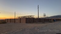
FCC sites (21)
79 m / 0.05 miWPRT720
79 m / 0.05 miWQGI542
79 m / 0.05 miWQGI543
79 m / 0.05 miWQYU521
79 m / 0.05 miWQYU523
79 m / 0.05 miWQXZ546
79 m / 0.05 miWQXZ547
79 m / 0.05 miWREY339
79 m / 0.05 miWREY340
79 m / 0.05 miKNKA657
79 m / 0.05 miWQOW753
80 m / 0.05 miWQOW757
80 m / 0.05 miWPWH447
82 m / 0.05 miWPWH448
82 m / 0.05 miWSLG875
82 m / 0.05 miWSLG877
82 m / 0.05 miWPQR455
84 m / 0.05 miWPUN319
99 m / 0.06 miWPUN640
99 m / 0.06 miWQZY647
99 m / 0.06 mi
Minerals (0)
No nearby records in this radius.
Environmental stations (0)
No nearby records in this radius.
100 m / 0.06 mi (23 records)
Artifacts (2)
FCC sites (21)
79 m / 0.05 miWPRT720
79 m / 0.05 miWQGI542
79 m / 0.05 miWQGI543
79 m / 0.05 miWQYU521
79 m / 0.05 miWQYU523
79 m / 0.05 miWQXZ546
79 m / 0.05 miWQXZ547
79 m / 0.05 miWREY339
79 m / 0.05 miWREY340
79 m / 0.05 miKNKA657
79 m / 0.05 miWQOW753
80 m / 0.05 miWQOW757
80 m / 0.05 miWPWH447
82 m / 0.05 miWPWH448
82 m / 0.05 miWSLG875
82 m / 0.05 miWSLG877
82 m / 0.05 miWPQR455
84 m / 0.05 miWPUN319
99 m / 0.06 miWPUN640
99 m / 0.06 miWQZY647
99 m / 0.06 mi
Minerals (0)
No nearby records in this radius.
Environmental stations (0)
No nearby records in this radius.
250 m / 0.16 mi (23 records)
Artifacts (2)
FCC sites (21)
79 m / 0.05 miWPRT720
79 m / 0.05 miWQGI542
79 m / 0.05 miWQGI543
79 m / 0.05 miWQYU521
79 m / 0.05 miWQYU523
79 m / 0.05 miWQXZ546
79 m / 0.05 miWQXZ547
79 m / 0.05 miWREY339
79 m / 0.05 miWREY340
79 m / 0.05 miKNKA657
79 m / 0.05 miWQOW753
80 m / 0.05 miWQOW757
80 m / 0.05 miWPWH447
82 m / 0.05 miWPWH448
82 m / 0.05 miWSLG875
82 m / 0.05 miWSLG877
82 m / 0.05 miWPQR455
84 m / 0.05 miWPUN319
99 m / 0.06 miWPUN640
99 m / 0.06 miWQZY647
99 m / 0.06 mi
Minerals (0)
No nearby records in this radius.
Environmental stations (0)
No nearby records in this radius.
1 km / 0.62 mi (23 records)
Artifacts (2)
FCC sites (21)
79 m / 0.05 miWPRT720
79 m / 0.05 miWQGI542
79 m / 0.05 miWQGI543
79 m / 0.05 miWQYU521
79 m / 0.05 miWQYU523
79 m / 0.05 miWQXZ546
79 m / 0.05 miWQXZ547
79 m / 0.05 miWREY339
79 m / 0.05 miWREY340
79 m / 0.05 miKNKA657
79 m / 0.05 miWQOW753
80 m / 0.05 miWQOW757
80 m / 0.05 miWPWH447
82 m / 0.05 miWPWH448
82 m / 0.05 miWSLG875
82 m / 0.05 miWSLG877
82 m / 0.05 miWPQR455
84 m / 0.05 miWPUN319
99 m / 0.06 miWPUN640
99 m / 0.06 miWQZY647
99 m / 0.06 mi
Minerals (0)
No nearby records in this radius.
Environmental stations (0)
No nearby records in this radius.
5 km / 3.11 mi (23 records)
Artifacts (2)
FCC sites (21)
79 m / 0.05 miWPRT720
79 m / 0.05 miWQGI542
79 m / 0.05 miWQGI543
79 m / 0.05 miWQYU521
79 m / 0.05 miWQYU523
79 m / 0.05 miWQXZ546
79 m / 0.05 miWQXZ547
79 m / 0.05 miWREY339
79 m / 0.05 miWREY340
79 m / 0.05 miKNKA657
79 m / 0.05 miWQOW753
80 m / 0.05 miWQOW757
80 m / 0.05 miWPWH447
82 m / 0.05 miWPWH448
82 m / 0.05 miWSLG875
82 m / 0.05 miWSLG877
82 m / 0.05 miWPQR455
84 m / 0.05 miWPUN319
99 m / 0.06 miWPUN640
99 m / 0.06 miWQZY647
99 m / 0.06 mi
Minerals (0)
No nearby records in this radius.
Environmental stations (0)
No nearby records in this radius.
