ABOUT CAPTAIN SKYVIEW
One map. The whole picture.
SkyView puts weather, radar, aircraft, radio, geology, and field observations on one interactive map, so you can see what happened, where, and when.
WHY I BUILT IT
I wanted the whole picture, not another disconnected app.
Most useful field data lives in separate systems. Weather is in one place. Aircraft are somewhere else. Radio and FCC records are somewhere else. Geology, mines, environmental stations, photographs, GPS tracks, and local observations all have their own tools and formats.
I built SkyView because the interesting part is often the relationship between those datasets.
If I am standing somewhere and something catches my attention, I want to be able to record it and later ask much bigger questions: What aircraft were overhead? What did radar look like? What weather stations were reporting? What transmitters, mines, mineral records, Wi-Fi observations, or previous SkyView artifacts were nearby? SkyView is my attempt to preserve that context instead of losing it across a dozen unrelated applications.
Almost all of CSV is intended to be open source; some data sources have separate terms. My original photographs are copyrighted.
THE PROBLEMS AND SOLUTIONS
Why each map layer exists
This is not just a list of datasets. Each layer addresses a real question I ran into while working in the field.
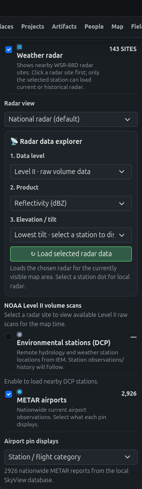
Weather radar and radar explorer
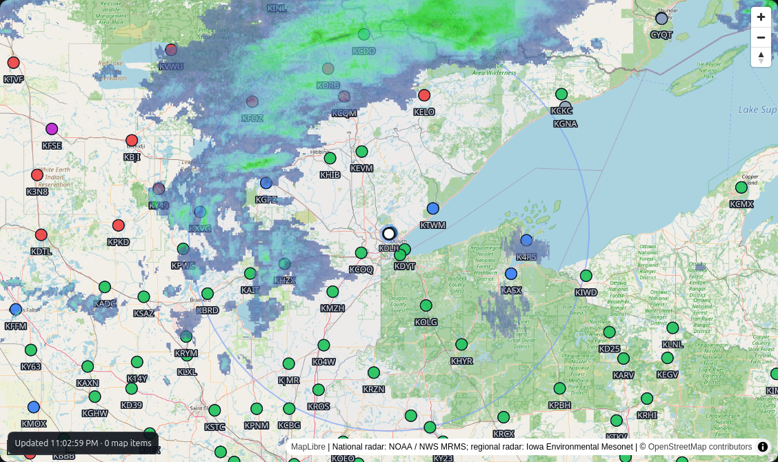
The problem: A radar picture is useful, but a national composite does not explain every local return. The original scans, elevation angle, and product matter.
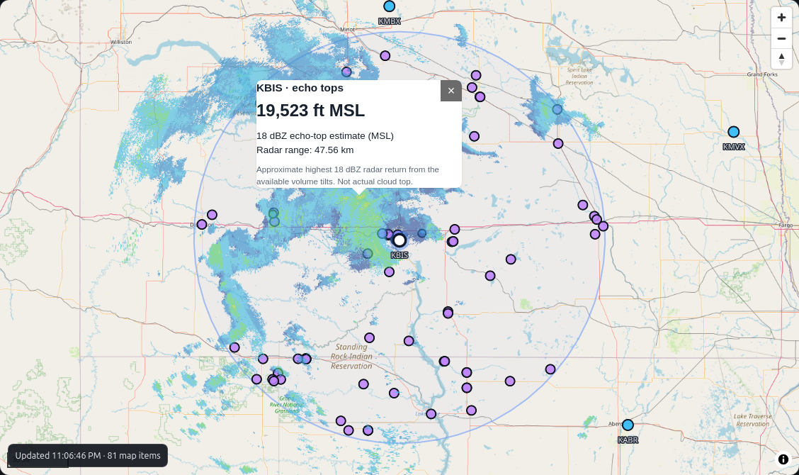
How I approached it: I put the national radar view alongside radar-site selection and Level II volume exploration. You can choose products such as reflectivity and inspect available tilts and echo-top estimates instead of treating a colored image as the complete answer.
How it helps: You can move from a broad view of a storm to questions about a particular radar site and scan. Echo-top estimates describe radar returns, not confirmed cloud-top heights.
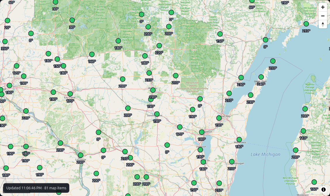
METAR airports
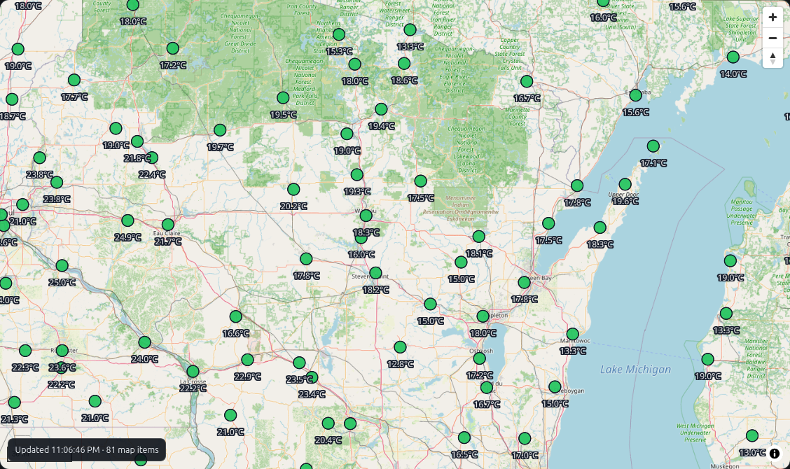
The problem: Aviation weather reports are scattered across airport identifiers, and a nearby report may not represent the conditions at your exact location.
How I approached it: SkyView plots airport METAR reports directly on the map, with selectable pin displays for conditions such as temperature and wind direction.
How it helps: A glance shows how reported conditions vary across a region; selecting an airport gives the station context behind the dot.
Environmental stations (DCP)
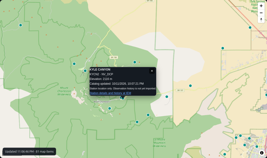
The problem: There are observing stations in remote places that are easy to overlook if you only search for towns or airports. Their records often live in a separate catalog.
How I approached it: I added remote hydrology and weather station locations from the IEM catalog as another selectable map layer, with station identifiers and links to station details and history.
How it helps: Researchers can discover stations they did not know existed, then follow the source link to investigate records. A plotted station does not guarantee that observations have been imported into SkyView.
FCC structures, towers and transmitters
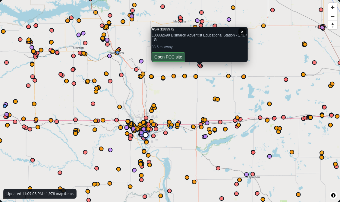
The problem: Seeing a tower on the horizon does not tell you who registered it, whether it is associated with a license, or what nearby records describe it.
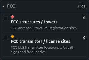
How I approached it: SkyView places FCC antenna structure registrations and transmitter/license sites on the same map. A site can be opened to inspect its stored FCC details, including frequencies when available.
How it helps: It is easier to research nearby radio infrastructure without jumping between separate geographic and regulatory search tools. FCC records are reference data, not proof that equipment is transmitting right now.
Geology, mines, prospects and minerals
The problem: Mine and mineral records are valuable but difficult to interpret as giant tables of names and coordinates. Historical coordinates and status descriptions also need context.
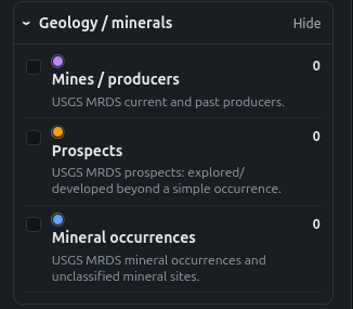
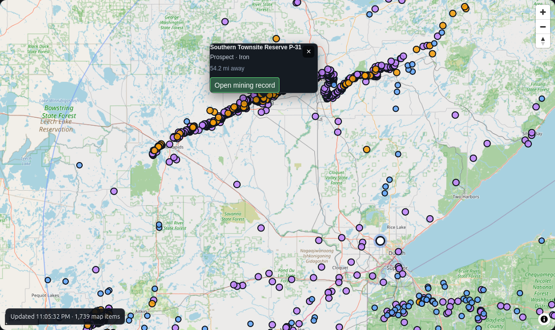
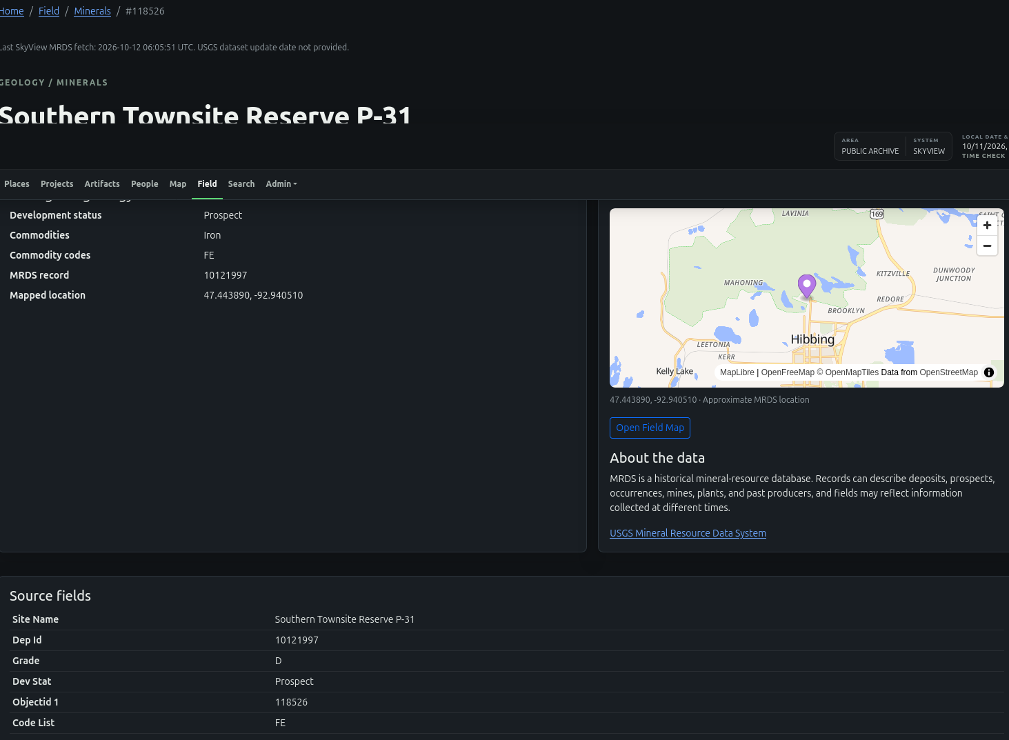
How I approached it: I brought USGS mineral-resource records into searchable map layers for mines and producers, prospects, and mineral occurrences. Selecting a point opens its record, source fields, and a local map.
How it helps: Someone exploring an area can see documented mineral activity nearby and investigate the source record before drawing conclusions. These are historical catalog entries, not verified current operations or permission to enter a site.
Public and private SkyView artifacts
The problem: A photo or field note by itself loses much of its meaning when the location, capture time, and nearby observations are separated from it.
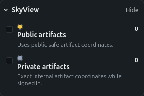
How I approached it: SkyView stores artifacts as records with time and location context. Public artifacts use public-safe coordinates; private artifact locations are shown only with authorized access.
How it helps: An observation becomes something that can be revisited and compared with other information from the same place and period, while keeping nonpublic data separate.
DESIGN GOAL
Collect first. Correlate later.
Not every observation is important when it is captured. The goal is to preserve enough trustworthy time, location, source, and surrounding context that a connection can still be discovered later.
SkyView is an independent field and research project. External datasets remain the responsibility of their original providers, and authoritative aviation, weather, emergency, navigation, or regulatory sources should be used for operational decisions.
OPEN SOURCE AND COPYRIGHT
What is open, and what is protected?
Almost all of Captain SkyView (CSV) is intended to be open source, although the repositories are currently private and access is by request. Some third-party data sources and integrations have separate licensing or redistribution restrictions. Those terms still apply.
My photographs are different. My original photographs and images are copyrighted. All rights reserved unless I explicitly say otherwise. Please request permission before copying, republishing, redistributing, or using them commercially.
Code licensing, outside data rights, and photograph copyright are separate. Check the repository license and source attribution before reuse.
SOURCE REPOSITORIES
Interested in how SkyView is built?
SkyView is developed across three projects. The repositories are currently private, but if you are interested in the code, hardware, or collaborating, ask me about access.
SkyView Web
The website, public field map, archive, and data presentation.
github.com/CaptainJustinB/skyview-webSkyView Pi
The Raspberry Pi field collection and sensor-side software.
github.com/CaptainJustinB/skyview-piSkyView Badge Firmware
Firmware for the SkyView badge hardware.
github.com/CaptainJustinB/skyview-badge-firmwarePrivate GitHub links may display a 404 page unless you have been granted access. Private repository status does not itself define the license terms of the code.
PLACES AND CAPTURES
From a place on the map to the story behind a photograph
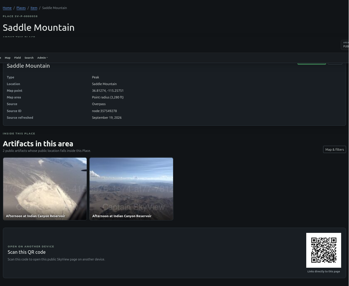
Places: Saddle Mountain and the surrounding area
The problem: A place name alone tells me very little. Its coordinates, source, nearby captures, and local geographic context are often spread across different tools.
How I approached it: SkyView gives each place a record with coordinates, source attribution, geographic area, and related public artifacts. For example, the Saddle Mountain place record connects a mapped peak with nearby field photographs.
How it helps: Someone researching a location can move from its map position to real observations made nearby, instead of treating a named point as the end of the investigation.
Explore Places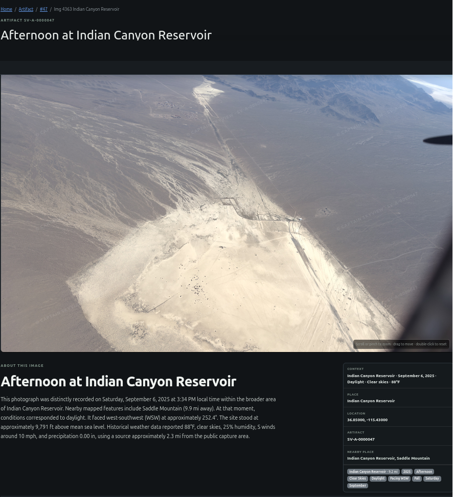
Artifacts: Afternoon at Indian Canyon Reservoir
The problem: A picture is often separated from the facts that make it useful: where it was taken, the date and time, nearby places, weather, and capture conditions.
How I approached it: SkyView keeps the photograph alongside its recorded time and position, an explanation of the scene, local weather context when available, and relationships to places such as Indian Canyon Reservoir.
How it helps: A visitor can study the scene and its context together, follow nearby locations, and compare the capture with other observations. The photo is evidence with a history, not just an image in a gallery.
View This Artifact