ARTIFACT SV-A-0001118
An Evening at Henderson, Looking Northeast
16 page views
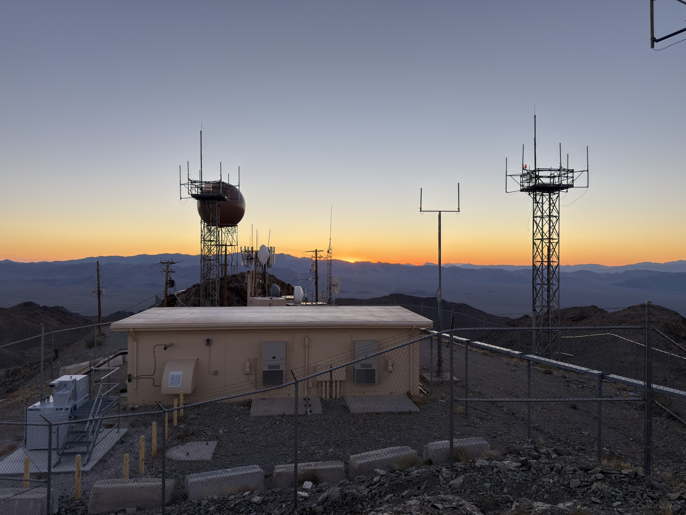
ABOUT THIS IMAGE
An Evening at Henderson, Looking Northeast
This image was quietly made on Friday, October 16, 2026 at 6:07 PM local time during the dusk around Henderson. The image falls within dusk and civil twilight. The recorded camera was a Apple iPhone 17 Pro Max. The frame faced north-northeast (NNE) at approximately 22.7°. The nearest available weather context showed 58°F, clear skies, 33% humidity, W winds around 3 mph, and precipitation 0.00 in, using a source approximately 1.9 mi from the public capture area. Embedded metadata reported a camera altitude of roughly 4,880 ft.
USGS geologic mapping associates the capture location with Undifferentiated Paleoproterozoic rocks, Xm, and Xu. USGS mineral-resource records identify nearby recorded sites including Belmont-Phoenix Mine, Black Mountain Mining Co., Blossom Mine, and Boston Mine. Mine status may be historical because the source database is not an operating-status registry. USGS 3DEP reports terrain elevation at the capture coordinate near 4,898 ft.
TECHNICAL DETAILSMetadata, capture data & integrityExpand
Public Metadata
Place Resolution
| Candidate | Feature | Source | Distance | Score |
|---|---|---|---|---|
| Henderson | place / city | skyview | 23 mi | 37.0 |
| Erie | place / locality | skyview | 23 mi | 10.0 |
| Sloan | place / hamlet | skyview | 23 mi | 10.0 |
| Mack | place / locality | skyview | 25 mi | 10.0 |
| Jimmy Pettyjohn Jr Park | leisure / park | skyview | 26 mi | 10.0 |
| Shark Ridge | natural / ridge | skyview | 26 mi | 10.0 |
| Olympia Sports Park | leisure / park | skyview | 26 mi | 10.0 |
| Goett Family Park | leisure / park | skyview | 27 mi | 10.0 |
| Somerset HIlls Park | leisure / park | skyview | 27 mi | 10.0 |
| United Air Lines Flight 736 | place / aircraft_wreck | skyview | 27 mi | 10.0 |
| Gimme that Nut | highway / path | skyview | 27 mi | 10.0 |
| Union Climb | highway / path | skyview | 27 mi | 10.0 |
| Union Alt. | highway / path | skyview | 27 mi | 10.0 |
| Return from the Darkside | highway / path | skyview | 27 mi | 10.0 |
| RR ATV | highway / track | skyview | 27 mi | 10.0 |
| Bypass | highway / path | skyview | 27 mi | 10.0 |
| DO (white rock sign) | tourism / attraction | skyview | 27 mi | 10.0 |
| "DO" Hillside Letters | highway / path | skyview | 27 mi | 10.0 |
| Waterfalls | highway / path | skyview | 27 mi | 10.0 |
| Union Around | highway / path | skyview | 27 mi | 10.0 |
| Jeep Summit Road | highway / track | skyview | 27 mi | 10.0 |
| Manny's Lookout | highway / path | skyview | 27 mi | 10.0 |
| Scooby-Doo | highway / path | skyview | 27 mi | 10.0 |
| Techno Turns | highway / path | skyview | 27 mi | 10.0 |
| Sidewinder | highway / path | skyview | 27 mi | 10.0 |
Context & Provenance
| Context | Value | Relationship | Source location | Source / provider | Observed / retrieved |
|---|---|---|---|---|---|
| camera_direction capture | 22.73 degrees | nearby | Not location-based | Original Artifact EXIF / Embedded Metadata · GPSImgDirection provider_distance | Retrieved: 2026-10-19 09:52:18.915099+00 |
| Henderson place | nearby | 36.03196, -114.98227 23 mi from public capture point | SkyView Internal Resolver · place:49 point_to_point | Retrieved: 2026-10-19 09:52:05.935926+00 | |
| local_date time | 2026-10-16 | nearby | Not location-based | SkyView Astronomy Engine · solar-v1 provider_distance | Observed: 2026-10-17 01:07:11+00 Retrieved: 2026-10-19 09:52:18.937463+00 |
| local_time time | 6:07 PM | nearby | Not location-based | SkyView Astronomy Engine · solar-v1 provider_distance | Observed: 2026-10-17 01:07:11+00 Retrieved: 2026-10-19 09:52:18.93843+00 |
| month time | October | nearby | Not location-based | SkyView Astronomy Engine · solar-v1 provider_distance | Observed: 2026-10-17 01:07:11+00 Retrieved: 2026-10-19 09:52:18.935634+00 |
| season time | fall | nearby | Not location-based | SkyView Astronomy Engine · solar-v1 provider_distance | Observed: 2026-10-17 01:07:11+00 Retrieved: 2026-10-19 09:52:18.934663+00 |
| solar_azimuth time | 259.95 degrees | nearby | Not location-based | SkyView Astronomy Engine · solar-v1 provider_distance | Observed: 2026-10-17 01:07:11+00 Retrieved: 2026-10-19 09:52:18.940337+00 |
| solar_elevation time | -1.77 degrees | nearby | Not location-based | SkyView Astronomy Engine · solar-v1 provider_distance | Observed: 2026-10-17 01:07:11+00 Retrieved: 2026-10-19 09:52:18.939328+00 |
| solar_period time | civil twilight | nearby | Not location-based | SkyView Astronomy Engine · solar-v1 provider_distance | Observed: 2026-10-17 01:07:11+00 Retrieved: 2026-10-19 09:52:18.931846+00 |
| time_period time | dusk | nearby | Not location-based | SkyView Astronomy Engine · solar-v1 provider_distance | Observed: 2026-10-17 01:07:11+00 Retrieved: 2026-10-19 09:52:18.932778+00 |
| timezone time | America/Los_Angeles | nearby | Not location-based | Open-Meteo · timezone:35.702,-114.890 provider_distance | Effective: 2026-10-17 01:07:11+00 Retrieved: 2026-10-19 09:52:18.928967+00 |
| weekday time | friday | nearby | Not location-based | SkyView Astronomy Engine · solar-v1 provider_distance | Observed: 2026-10-17 01:07:11+00 Retrieved: 2026-10-19 09:52:18.933684+00 |
| year time | 2026 | nearby | Not location-based | SkyView Astronomy Engine · solar-v1 provider_distance | Observed: 2026-10-17 01:07:11+00 Retrieved: 2026-10-19 09:52:18.936579+00 |
| 3DEP EPQS.locationId usgs | 0.00 | nearby | 35.70181, -114.89035 0 ft from public capture point | U.S. Geological Survey — The National Map / 3DEP · 3dep-epqs:35.701814,-114.890350|locationId point_to_point | Retrieved: 2026-10-19 09:52:05.959779+00 |
| 3DEP EPQS.location.spatialReference.latestWkid usgs | 4,326.00 | nearby | 35.70181, -114.89035 0 ft from public capture point | U.S. Geological Survey — The National Map / 3DEP · 3dep-epqs:35.701814,-114.890350|location.spatialReference.latestWkid point_to_point | Retrieved: 2026-10-19 09:52:05.957776+00 |
| 3DEP EPQS.location.spatialReference.wkid usgs | 4,326.00 | nearby | 35.70181, -114.89035 0 ft from public capture point | U.S. Geological Survey — The National Map / 3DEP · 3dep-epqs:35.701814,-114.890350|location.spatialReference.wkid point_to_point | Retrieved: 2026-10-19 09:52:05.956824+00 |
| 3DEP EPQS.location.x usgs | -114.89 | nearby | 35.70181, -114.89035 0 ft from public capture point | U.S. Geological Survey — The National Map / 3DEP · 3dep-epqs:35.701814,-114.890350|location.x point_to_point | Retrieved: 2026-10-19 09:52:05.954683+00 |
| 3DEP EPQS.location.y usgs | 35.70 | nearby | 35.70181, -114.89035 0 ft from public capture point | U.S. Geological Survey — The National Map / 3DEP · 3dep-epqs:35.701814,-114.890350|location.y point_to_point | Retrieved: 2026-10-19 09:52:05.95573+00 |
| 3DEP EPQS.rasterId usgs | 91,037.00 | nearby | 35.70181, -114.89035 0 ft from public capture point | U.S. Geological Survey — The National Map / 3DEP · 3dep-epqs:35.701814,-114.890350|rasterId point_to_point | Retrieved: 2026-10-19 09:52:05.958835+00 |
| 3DEP EPQS.resolution usgs | 1.00 | nearby | 35.70181, -114.89035 0 ft from public capture point | U.S. Geological Survey — The National Map / 3DEP · 3dep-epqs:35.701814,-114.890350|resolution point_to_point | Retrieved: 2026-10-19 09:52:05.960735+00 |
| 3DEP EPQS.value usgs | 1,493.02 | nearby | 35.70181, -114.89035 0 ft from public capture point | U.S. Geological Survey — The National Map / 3DEP · 3dep-epqs:35.701814,-114.890350|value point_to_point | Retrieved: 2026-10-19 09:52:05.953224+00 |
| GNIS.Historical Cultural-Political Points.county_name usgs | Clark | nearby | 35.70181, -114.89035 0 ft from public capture point | U.S. Geological Survey — The National Map / 3DEP · gnis:12:10506|county_name point_to_point | Retrieved: 2026-10-19 09:52:06.969618+00 |
| GNIS.Historical Cultural-Political Points.county_name usgs | Clark | nearby | 35.70181, -114.89035 0 ft from public capture point | U.S. Geological Survey — The National Map / 3DEP · gnis:12:15879|county_name point_to_point | Retrieved: 2026-10-19 09:52:06.980897+00 |
| GNIS.Historical Cultural-Political Points.county_name usgs | Clark | nearby | 35.70181, -114.89035 0 ft from public capture point | U.S. Geological Survey — The National Map / 3DEP · gnis:12:1674|county_name point_to_point | Retrieved: 2026-10-19 09:52:06.91312+00 |
| GNIS.Historical Cultural-Political Points.county_name usgs | Clark | nearby | 35.70181, -114.89035 0 ft from public capture point | U.S. Geological Survey — The National Map / 3DEP · gnis:12:18556|county_name point_to_point | Retrieved: 2026-10-19 09:52:06.991082+00 |
| GNIS.Historical Cultural-Political Points.county_name usgs | Clark | nearby | 35.70181, -114.89035 0 ft from public capture point | U.S. Geological Survey — The National Map / 3DEP · gnis:12:2514|county_name point_to_point | Retrieved: 2026-10-19 09:52:06.923086+00 |
| GNIS.Historical Cultural-Political Points.county_name usgs | Clark | nearby | 35.70181, -114.89035 0 ft from public capture point | U.S. Geological Survey — The National Map / 3DEP · gnis:12:2879|county_name point_to_point | Retrieved: 2026-10-19 09:52:06.93418+00 |
| GNIS.Historical Cultural-Political Points.county_name usgs | Clark | nearby | 35.70181, -114.89035 0 ft from public capture point | U.S. Geological Survey — The National Map / 3DEP · gnis:12:4156|county_name point_to_point | Retrieved: 2026-10-19 09:52:06.944989+00 |
| GNIS.Historical Cultural-Political Points.county_name usgs | Clark | nearby | 35.70181, -114.89035 0 ft from public capture point | U.S. Geological Survey — The National Map / 3DEP · gnis:12:5766|county_name point_to_point | Retrieved: 2026-10-19 09:52:06.955579+00 |
| GNIS.Historical Cultural-Political Points.fcode usgs | 61,500.00 | nearby | 35.70181, -114.89035 0 ft from public capture point | U.S. Geological Survey — The National Map / 3DEP · gnis:12:10506|fcode point_to_point | Retrieved: 2026-10-19 09:52:06.962703+00 |
| GNIS.Historical Cultural-Political Points.fcode usgs | 61,500.00 | nearby | 35.70181, -114.89035 0 ft from public capture point | U.S. Geological Survey — The National Map / 3DEP · gnis:12:15879|fcode point_to_point | Retrieved: 2026-10-19 09:52:06.975365+00 |
| GNIS.Historical Cultural-Political Points.fcode usgs | 61,500.00 | nearby | 35.70181, -114.89035 0 ft from public capture point | U.S. Geological Survey — The National Map / 3DEP · gnis:12:1674|fcode point_to_point | Retrieved: 2026-10-19 09:52:06.90729+00 |
| GNIS.Historical Cultural-Political Points.fcode usgs | 61,500.00 | nearby | 35.70181, -114.89035 0 ft from public capture point | U.S. Geological Survey — The National Map / 3DEP · gnis:12:18556|fcode point_to_point | Retrieved: 2026-10-19 09:52:06.9861+00 |
| GNIS.Historical Cultural-Political Points.fcode usgs | 61,500.00 | nearby | 35.70181, -114.89035 0 ft from public capture point | U.S. Geological Survey — The National Map / 3DEP · gnis:12:2514|fcode point_to_point | Retrieved: 2026-10-19 09:52:06.918113+00 |
| GNIS.Historical Cultural-Political Points.fcode usgs | 61,500.00 | nearby | 35.70181, -114.89035 0 ft from public capture point | U.S. Geological Survey — The National Map / 3DEP · gnis:12:2879|fcode point_to_point | Retrieved: 2026-10-19 09:52:06.928597+00 |
| GNIS.Historical Cultural-Political Points.fcode usgs | 20,500.00 | nearby | 35.70181, -114.89035 0 ft from public capture point | U.S. Geological Survey — The National Map / 3DEP · gnis:12:4156|fcode point_to_point | Retrieved: 2026-10-19 09:52:06.939739+00 |
| GNIS.Historical Cultural-Political Points.fcode usgs | 61,500.00 | nearby | 35.70181, -114.89035 0 ft from public capture point | U.S. Geological Survey — The National Map / 3DEP · gnis:12:5766|fcode point_to_point | Retrieved: 2026-10-19 09:52:06.950219+00 |
| GNIS.Historical Cultural-Political Points.gaz_featureclass usgs | Populated Place | nearby | 35.70181, -114.89035 0 ft from public capture point | U.S. Geological Survey — The National Map / 3DEP · gnis:12:10506|gaz_featureclass point_to_point | Retrieved: 2026-10-19 09:52:06.974258+00 |
| GNIS.Historical Cultural-Political Points.gaz_featureclass usgs | Populated Place | nearby | 35.70181, -114.89035 0 ft from public capture point | U.S. Geological Survey — The National Map / 3DEP · gnis:12:15879|gaz_featureclass point_to_point | Retrieved: 2026-10-19 09:52:06.984982+00 |
| GNIS.Historical Cultural-Political Points.gaz_featureclass usgs | Populated Place | nearby | 35.70181, -114.89035 0 ft from public capture point | U.S. Geological Survey — The National Map / 3DEP · gnis:12:1674|gaz_featureclass point_to_point | Retrieved: 2026-10-19 09:52:06.917111+00 |
| GNIS.Historical Cultural-Political Points.gaz_featureclass usgs | Populated Place | nearby | 35.70181, -114.89035 0 ft from public capture point | U.S. Geological Survey — The National Map / 3DEP · gnis:12:18556|gaz_featureclass point_to_point | Retrieved: 2026-10-19 09:52:06.995054+00 |
| GNIS.Historical Cultural-Political Points.gaz_featureclass usgs | Populated Place | nearby | 35.70181, -114.89035 0 ft from public capture point | U.S. Geological Survey — The National Map / 3DEP · gnis:12:2514|gaz_featureclass point_to_point | Retrieved: 2026-10-19 09:52:06.927536+00 |
| GNIS.Historical Cultural-Political Points.gaz_featureclass usgs | Populated Place | nearby | 35.70181, -114.89035 0 ft from public capture point | U.S. Geological Survey — The National Map / 3DEP · gnis:12:2879|gaz_featureclass point_to_point | Retrieved: 2026-10-19 09:52:06.938507+00 |
| GNIS.Historical Cultural-Political Points.gaz_featureclass usgs | Crossing | nearby | 35.70181, -114.89035 0 ft from public capture point | U.S. Geological Survey — The National Map / 3DEP · gnis:12:4156|gaz_featureclass point_to_point | Retrieved: 2026-10-19 09:52:06.949192+00 |
| GNIS.Historical Cultural-Political Points.gaz_featureclass usgs | Populated Place | nearby | 35.70181, -114.89035 0 ft from public capture point | U.S. Geological Survey — The National Map / 3DEP · gnis:12:5766|gaz_featureclass point_to_point | Retrieved: 2026-10-19 09:52:06.960994+00 |
| GNIS.Historical Cultural-Political Points.gaz_id usgs | 846,650.00 | nearby | 35.70181, -114.89035 0 ft from public capture point | U.S. Geological Survey — The National Map / 3DEP · gnis:12:10506|gaz_id point_to_point | Retrieved: 2026-10-19 09:52:06.964161+00 |
| GNIS.Historical Cultural-Political Points.gaz_id usgs | 846,649.00 | nearby | 35.70181, -114.89035 0 ft from public capture point | U.S. Geological Survey — The National Map / 3DEP · gnis:12:15879|gaz_id point_to_point | Retrieved: 2026-10-19 09:52:06.97642+00 |
| GNIS.Historical Cultural-Political Points.gaz_id usgs | 854,788.00 | nearby | 35.70181, -114.89035 0 ft from public capture point | U.S. Geological Survey — The National Map / 3DEP · gnis:12:1674|gaz_id point_to_point | Retrieved: 2026-10-19 09:52:06.908967+00 |
| GNIS.Historical Cultural-Political Points.gaz_id usgs | 863,845.00 | nearby | 35.70181, -114.89035 0 ft from public capture point | U.S. Geological Survey — The National Map / 3DEP · gnis:12:18556|gaz_id point_to_point | Retrieved: 2026-10-19 09:52:06.987171+00 |
| GNIS.Historical Cultural-Political Points.gaz_id usgs | 858,317.00 | nearby | 35.70181, -114.89035 0 ft from public capture point | U.S. Geological Survey — The National Map / 3DEP · gnis:12:2514|gaz_id point_to_point | Retrieved: 2026-10-19 09:52:06.919109+00 |
| GNIS.Historical Cultural-Political Points.gaz_id usgs | 851,490.00 | nearby | 35.70181, -114.89035 0 ft from public capture point | U.S. Geological Survey — The National Map / 3DEP · gnis:12:2879|gaz_id point_to_point | Retrieved: 2026-10-19 09:52:06.929642+00 |
| GNIS.Historical Cultural-Political Points.gaz_id usgs | 856,492.00 | nearby | 35.70181, -114.89035 0 ft from public capture point | U.S. Geological Survey — The National Map / 3DEP · gnis:12:4156|gaz_id point_to_point | Retrieved: 2026-10-19 09:52:06.940827+00 |
| GNIS.Historical Cultural-Political Points.gaz_id usgs | 846,648.00 | nearby | 35.70181, -114.89035 0 ft from public capture point | U.S. Geological Survey — The National Map / 3DEP · gnis:12:5766|gaz_id point_to_point | Retrieved: 2026-10-19 09:52:06.951283+00 |
| GNIS.Historical Cultural-Political Points.gaz_name usgs | Copper Camp (historical) | nearby | 35.70181, -114.89035 0 ft from public capture point | U.S. Geological Survey — The National Map / 3DEP · gnis:12:10506|gaz_name point_to_point | Retrieved: 2026-10-19 09:52:06.967097+00 |
| GNIS.Historical Cultural-Political Points.gaz_name usgs | Camp Booth (historical) | nearby | 35.70181, -114.89035 0 ft from public capture point | U.S. Geological Survey — The National Map / 3DEP · gnis:12:15879|gaz_name point_to_point | Retrieved: 2026-10-19 09:52:06.978731+00 |
| GNIS.Historical Cultural-Political Points.gaz_name usgs | Camp Dupont (historical) | nearby | 35.70181, -114.89035 0 ft from public capture point | U.S. Geological Survey — The National Map / 3DEP · gnis:12:1674|gaz_name point_to_point | Retrieved: 2026-10-19 09:52:06.911103+00 |
| GNIS.Historical Cultural-Political Points.gaz_name usgs | Hills Camp (historical) | nearby | 35.70181, -114.89035 0 ft from public capture point | U.S. Geological Survey — The National Map / 3DEP · gnis:12:18556|gaz_name point_to_point | Retrieved: 2026-10-19 09:52:06.989134+00 |
| GNIS.Historical Cultural-Political Points.gaz_name usgs | Wallace (historical) | nearby | 35.70181, -114.89035 0 ft from public capture point | U.S. Geological Survey — The National Map / 3DEP · gnis:12:2514|gaz_name point_to_point | Retrieved: 2026-10-19 09:52:06.921116+00 |
| GNIS.Historical Cultural-Political Points.gaz_name usgs | Eldorado Canyon (historical) | nearby | 35.70181, -114.89035 0 ft from public capture point | U.S. Geological Survey — The National Map / 3DEP · gnis:12:2879|gaz_name point_to_point | Retrieved: 2026-10-19 09:52:06.93204+00 |
| GNIS.Historical Cultural-Political Points.gaz_name usgs | Eldorado Ferry (historical) | nearby | 35.70181, -114.89035 0 ft from public capture point | U.S. Geological Survey — The National Map / 3DEP · gnis:12:4156|gaz_name point_to_point | Retrieved: 2026-10-19 09:52:06.942912+00 |
| GNIS.Historical Cultural-Political Points.gaz_name usgs | Camp Duncan (historical) | nearby | 35.70181, -114.89035 0 ft from public capture point | U.S. Geological Survey — The National Map / 3DEP · gnis:12:5766|gaz_name point_to_point | Retrieved: 2026-10-19 09:52:06.95334+00 |
| GNIS.Historical Cultural-Political Points.incounty_id usgs | 611,093.00 | nearby | 35.70181, -114.89035 0 ft from public capture point | U.S. Geological Survey — The National Map / 3DEP · gnis:12:10506|incounty_id point_to_point | Retrieved: 2026-10-19 09:52:06.970887+00 |
| GNIS.Historical Cultural-Political Points.incounty_id usgs | 611,092.00 | nearby | 35.70181, -114.89035 0 ft from public capture point | U.S. Geological Survey — The National Map / 3DEP · gnis:12:15879|incounty_id point_to_point | Retrieved: 2026-10-19 09:52:06.981943+00 |
| GNIS.Historical Cultural-Political Points.incounty_id usgs | 386,378.00 | nearby | 35.70181, -114.89035 0 ft from public capture point | U.S. Geological Survey — The National Map / 3DEP · gnis:12:1674|incounty_id point_to_point | Retrieved: 2026-10-19 09:52:06.914101+00 |
| GNIS.Historical Cultural-Political Points.incounty_id usgs | 119,274.00 | nearby | 35.70181, -114.89035 0 ft from public capture point | U.S. Geological Survey — The National Map / 3DEP · gnis:12:18556|incounty_id point_to_point | Retrieved: 2026-10-19 09:52:06.992102+00 |
| GNIS.Historical Cultural-Political Points.incounty_id usgs | 934,202.00 | nearby | 35.70181, -114.89035 0 ft from public capture point | U.S. Geological Survey — The National Map / 3DEP · gnis:12:2514|incounty_id point_to_point | Retrieved: 2026-10-19 09:52:06.924258+00 |
| GNIS.Historical Cultural-Political Points.incounty_id usgs | 114,535.00 | nearby | 35.70181, -114.89035 0 ft from public capture point | U.S. Geological Survey — The National Map / 3DEP · gnis:12:2879|incounty_id point_to_point | Retrieved: 2026-10-19 09:52:06.935218+00 |
| GNIS.Historical Cultural-Political Points.incounty_id usgs | 2,314,802.00 | nearby | 35.70181, -114.89035 0 ft from public capture point | U.S. Geological Survey — The National Map / 3DEP · gnis:12:4156|incounty_id point_to_point | Retrieved: 2026-10-19 09:52:06.946029+00 |
| GNIS.Historical Cultural-Political Points.incounty_id usgs | 1,133,498.00 | nearby | 35.70181, -114.89035 0 ft from public capture point | U.S. Geological Survey — The National Map / 3DEP · gnis:12:5766|incounty_id point_to_point | Retrieved: 2026-10-19 09:52:06.95686+00 |
| GNIS.Historical Cultural-Political Points.isunknowncoords usgs | 2.00 | nearby | 35.70181, -114.89035 0 ft from public capture point | U.S. Geological Survey — The National Map / 3DEP · gnis:12:10506|isunknowncoords point_to_point | Retrieved: 2026-10-19 09:52:06.973131+00 |
| GNIS.Historical Cultural-Political Points.isunknowncoords usgs | 2.00 | nearby | 35.70181, -114.89035 0 ft from public capture point | U.S. Geological Survey — The National Map / 3DEP · gnis:12:15879|isunknowncoords point_to_point | Retrieved: 2026-10-19 09:52:06.98393+00 |
| GNIS.Historical Cultural-Political Points.isunknowncoords usgs | 2.00 | nearby | 35.70181, -114.89035 0 ft from public capture point | U.S. Geological Survey — The National Map / 3DEP · gnis:12:1674|isunknowncoords point_to_point | Retrieved: 2026-10-19 09:52:06.916111+00 |
| GNIS.Historical Cultural-Political Points.isunknowncoords usgs | 2.00 | nearby | 35.70181, -114.89035 0 ft from public capture point | U.S. Geological Survey — The National Map / 3DEP · gnis:12:18556|isunknowncoords point_to_point | Retrieved: 2026-10-19 09:52:06.994083+00 |
| GNIS.Historical Cultural-Political Points.isunknowncoords usgs | 2.00 | nearby | 35.70181, -114.89035 0 ft from public capture point | U.S. Geological Survey — The National Map / 3DEP · gnis:12:2514|isunknowncoords point_to_point | Retrieved: 2026-10-19 09:52:06.926522+00 |
| GNIS.Historical Cultural-Political Points.isunknowncoords usgs | 2.00 | nearby | 35.70181, -114.89035 0 ft from public capture point | U.S. Geological Survey — The National Map / 3DEP · gnis:12:2879|isunknowncoords point_to_point | Retrieved: 2026-10-19 09:52:06.937284+00 |
| GNIS.Historical Cultural-Political Points.isunknowncoords usgs | 2.00 | nearby | 35.70181, -114.89035 0 ft from public capture point | U.S. Geological Survey — The National Map / 3DEP · gnis:12:4156|isunknowncoords point_to_point | Retrieved: 2026-10-19 09:52:06.948172+00 |
| GNIS.Historical Cultural-Political Points.isunknowncoords usgs | 2.00 | nearby | 35.70181, -114.89035 0 ft from public capture point | U.S. Geological Survey — The National Map / 3DEP · gnis:12:5766|isunknowncoords point_to_point | Retrieved: 2026-10-19 09:52:06.959614+00 |
| GNIS.Historical Cultural-Political Points.OBJECTID usgs | 10,506.00 | nearby | 35.70181, -114.89035 0 ft from public capture point | U.S. Geological Survey — The National Map / 3DEP · gnis:12:10506|OBJECTID point_to_point | Retrieved: 2026-10-19 09:52:06.965881+00 |
| GNIS.Historical Cultural-Political Points.OBJECTID usgs | 15,879.00 | nearby | 35.70181, -114.89035 0 ft from public capture point | U.S. Geological Survey — The National Map / 3DEP · gnis:12:15879|OBJECTID point_to_point | Retrieved: 2026-10-19 09:52:06.977664+00 |
| GNIS.Historical Cultural-Political Points.OBJECTID usgs | 1,674.00 | nearby | 35.70181, -114.89035 0 ft from public capture point | U.S. Geological Survey — The National Map / 3DEP · gnis:12:1674|OBJECTID point_to_point | Retrieved: 2026-10-19 09:52:06.910142+00 |
| GNIS.Historical Cultural-Political Points.OBJECTID usgs | 18,556.00 | nearby | 35.70181, -114.89035 0 ft from public capture point | U.S. Geological Survey — The National Map / 3DEP · gnis:12:18556|OBJECTID point_to_point | Retrieved: 2026-10-19 09:52:06.988123+00 |
| GNIS.Historical Cultural-Political Points.OBJECTID usgs | 2,514.00 | nearby | 35.70181, -114.89035 0 ft from public capture point | U.S. Geological Survey — The National Map / 3DEP · gnis:12:2514|OBJECTID point_to_point | Retrieved: 2026-10-19 09:52:06.920112+00 |
| GNIS.Historical Cultural-Political Points.OBJECTID usgs | 2,879.00 | nearby | 35.70181, -114.89035 0 ft from public capture point | U.S. Geological Survey — The National Map / 3DEP · gnis:12:2879|OBJECTID point_to_point | Retrieved: 2026-10-19 09:52:06.930654+00 |
| GNIS.Historical Cultural-Political Points.OBJECTID usgs | 4,156.00 | nearby | 35.70181, -114.89035 0 ft from public capture point | U.S. Geological Survey — The National Map / 3DEP · gnis:12:4156|OBJECTID point_to_point | Retrieved: 2026-10-19 09:52:06.94194+00 |
| GNIS.Historical Cultural-Political Points.OBJECTID usgs | 5,766.00 | nearby | 35.70181, -114.89035 0 ft from public capture point | U.S. Geological Survey — The National Map / 3DEP · gnis:12:5766|OBJECTID point_to_point | Retrieved: 2026-10-19 09:52:06.952292+00 |
| GNIS.Historical Cultural-Political Points.objectid_1 usgs | 284,440.00 | nearby | 35.70181, -114.89035 0 ft from public capture point | U.S. Geological Survey — The National Map / 3DEP · gnis:12:10506|objectid_1 point_to_point | Retrieved: 2026-10-19 09:52:06.968339+00 |
| GNIS.Historical Cultural-Political Points.objectid_1 usgs | 284,439.00 | nearby | 35.70181, -114.89035 0 ft from public capture point | U.S. Geological Survey — The National Map / 3DEP · gnis:12:15879|objectid_1 point_to_point | Retrieved: 2026-10-19 09:52:06.979849+00 |
| GNIS.Historical Cultural-Political Points.objectid_1 usgs | 285,107.00 | nearby | 35.70181, -114.89035 0 ft from public capture point | U.S. Geological Survey — The National Map / 3DEP · gnis:12:1674|objectid_1 point_to_point | Retrieved: 2026-10-19 09:52:06.912106+00 |
| GNIS.Historical Cultural-Political Points.objectid_1 usgs | 254,037.00 | nearby | 35.70181, -114.89035 0 ft from public capture point | U.S. Geological Survey — The National Map / 3DEP · gnis:12:18556|objectid_1 point_to_point | Retrieved: 2026-10-19 09:52:06.990124+00 |
| GNIS.Historical Cultural-Political Points.objectid_1 usgs | 283,857.00 | nearby | 35.70181, -114.89035 0 ft from public capture point | U.S. Geological Survey — The National Map / 3DEP · gnis:12:2514|objectid_1 point_to_point | Retrieved: 2026-10-19 09:52:06.922108+00 |
| GNIS.Historical Cultural-Political Points.objectid_1 usgs | 285,792.00 | nearby | 35.70181, -114.89035 0 ft from public capture point | U.S. Geological Survey — The National Map / 3DEP · gnis:12:2879|objectid_1 point_to_point | Retrieved: 2026-10-19 09:52:06.933078+00 |
| GNIS.Historical Cultural-Political Points.objectid_1 usgs | 2,299,308.00 | nearby | 35.70181, -114.89035 0 ft from public capture point | U.S. Geological Survey — The National Map / 3DEP · gnis:12:4156|objectid_1 point_to_point | Retrieved: 2026-10-19 09:52:06.944003+00 |
| GNIS.Historical Cultural-Political Points.objectid_1 usgs | 284,438.00 | nearby | 35.70181, -114.89035 0 ft from public capture point | U.S. Geological Survey — The National Map / 3DEP · gnis:12:5766|objectid_1 point_to_point | Retrieved: 2026-10-19 09:52:06.954408+00 |
| GNIS.Historical Cultural-Political Points.state_alpha usgs | NV | nearby | 35.70181, -114.89035 0 ft from public capture point | U.S. Geological Survey — The National Map / 3DEP · gnis:12:10506|state_alpha point_to_point | Retrieved: 2026-10-19 09:52:06.972038+00 |
| GNIS.Historical Cultural-Political Points.state_alpha usgs | NV | nearby | 35.70181, -114.89035 0 ft from public capture point | U.S. Geological Survey — The National Map / 3DEP · gnis:12:15879|state_alpha point_to_point | Retrieved: 2026-10-19 09:52:06.982936+00 |
| GNIS.Historical Cultural-Political Points.state_alpha usgs | NV | nearby | 35.70181, -114.89035 0 ft from public capture point | U.S. Geological Survey — The National Map / 3DEP · gnis:12:1674|state_alpha point_to_point | Retrieved: 2026-10-19 09:52:06.915128+00 |
| GNIS.Historical Cultural-Political Points.state_alpha usgs | NV | nearby | 35.70181, -114.89035 0 ft from public capture point | U.S. Geological Survey — The National Map / 3DEP · gnis:12:18556|state_alpha point_to_point | Retrieved: 2026-10-19 09:52:06.993054+00 |
| GNIS.Historical Cultural-Political Points.state_alpha usgs | NV | nearby | 35.70181, -114.89035 0 ft from public capture point | U.S. Geological Survey — The National Map / 3DEP · gnis:12:2514|state_alpha point_to_point | Retrieved: 2026-10-19 09:52:06.925475+00 |
| GNIS.Historical Cultural-Political Points.state_alpha usgs | NV | nearby | 35.70181, -114.89035 0 ft from public capture point | U.S. Geological Survey — The National Map / 3DEP · gnis:12:2879|state_alpha point_to_point | Retrieved: 2026-10-19 09:52:06.93624+00 |
| GNIS.Historical Cultural-Political Points.state_alpha usgs | NV | nearby | 35.70181, -114.89035 0 ft from public capture point | U.S. Geological Survey — The National Map / 3DEP · gnis:12:4156|state_alpha point_to_point | Retrieved: 2026-10-19 09:52:06.947183+00 |
| GNIS.Historical Cultural-Political Points.state_alpha usgs | NV | nearby | 35.70181, -114.89035 0 ft from public capture point | U.S. Geological Survey — The National Map / 3DEP · gnis:12:5766|state_alpha point_to_point | Retrieved: 2026-10-19 09:52:06.958205+00 |
| GNIS.Incorporated Places (Civil).county_name usgs | Clark | nearby | 35.70181, -114.89035 0 ft from public capture point | U.S. Geological Survey — The National Map / 3DEP · gnis:1:214952|county_name point_to_point | Retrieved: 2026-10-19 09:52:06.448193+00 |
| GNIS.Incorporated Places (Civil).fcode usgs | 61,403.00 | nearby | 35.70181, -114.89035 0 ft from public capture point | U.S. Geological Survey — The National Map / 3DEP · gnis:1:214952|fcode point_to_point | Retrieved: 2026-10-19 09:52:06.442412+00 |
| GNIS.Incorporated Places (Civil).gaz_featureclass usgs | Civil | nearby | 35.70181, -114.89035 0 ft from public capture point | U.S. Geological Survey — The National Map / 3DEP · gnis:1:214952|gaz_featureclass point_to_point | Retrieved: 2026-10-19 09:52:06.453587+00 |
| GNIS.Incorporated Places (Civil).gaz_id usgs | 2,409,884.00 | nearby | 35.70181, -114.89035 0 ft from public capture point | U.S. Geological Survey — The National Map / 3DEP · gnis:1:214952|gaz_id point_to_point | Retrieved: 2026-10-19 09:52:06.443533+00 |
| GNIS.Incorporated Places (Civil).gaz_name usgs | City of Boulder City | nearby | 35.70181, -114.89035 0 ft from public capture point | U.S. Geological Survey — The National Map / 3DEP · gnis:1:214952|gaz_name point_to_point | Retrieved: 2026-10-19 09:52:06.445858+00 |
| GNIS.Incorporated Places (Civil).incounty_id usgs | 2,824,298.00 | nearby | 35.70181, -114.89035 0 ft from public capture point | U.S. Geological Survey — The National Map / 3DEP · gnis:1:214952|incounty_id point_to_point | Retrieved: 2026-10-19 09:52:06.449404+00 |
| GNIS.Incorporated Places (Civil).isunknowncoords usgs | 2.00 | nearby | 35.70181, -114.89035 0 ft from public capture point | U.S. Geological Survey — The National Map / 3DEP · gnis:1:214952|isunknowncoords point_to_point | Retrieved: 2026-10-19 09:52:06.451752+00 |
| GNIS.Incorporated Places (Civil).OBJECTID usgs | 214,952.00 | nearby | 35.70181, -114.89035 0 ft from public capture point | U.S. Geological Survey — The National Map / 3DEP · gnis:1:214952|OBJECTID point_to_point | Retrieved: 2026-10-19 09:52:06.444694+00 |
| GNIS.Incorporated Places (Civil).objectid_1 usgs | 1,907,652.00 | nearby | 35.70181, -114.89035 0 ft from public capture point | U.S. Geological Survey — The National Map / 3DEP · gnis:1:214952|objectid_1 point_to_point | Retrieved: 2026-10-19 09:52:06.447028+00 |
| GNIS.Incorporated Places (Civil).state_alpha usgs | NV | nearby | 35.70181, -114.89035 0 ft from public capture point | U.S. Geological Survey — The National Map / 3DEP · gnis:1:214952|state_alpha point_to_point | Retrieved: 2026-10-19 09:52:06.450543+00 |
| GNIS.Landforms.county_name usgs | Clark | nearby | 35.70181, -114.89035 0 ft from public capture point | U.S. Geological Survey — The National Map / 3DEP · gnis:5:11304|county_name point_to_point | Retrieved: 2026-10-19 09:52:06.533778+00 |
| GNIS.Landforms.county_name usgs | Clark | nearby | 35.70181, -114.89035 0 ft from public capture point | U.S. Geological Survey — The National Map / 3DEP · gnis:5:20901|county_name point_to_point | Retrieved: 2026-10-19 09:52:06.543497+00 |
| GNIS.Landforms.county_name usgs | Clark | nearby | 35.70181, -114.89035 0 ft from public capture point | U.S. Geological Survey — The National Map / 3DEP · gnis:5:2461|county_name point_to_point | Retrieved: 2026-10-19 09:52:06.513746+00 |
| GNIS.Landforms.county_name usgs | Clark | nearby | 35.70181, -114.89035 0 ft from public capture point | U.S. Geological Survey — The National Map / 3DEP · gnis:5:2475|county_name point_to_point | Retrieved: 2026-10-19 09:52:06.523918+00 |
| GNIS.Landforms.county_name usgs | Clark | nearby | 35.70181, -114.89035 0 ft from public capture point | U.S. Geological Survey — The National Map / 3DEP · gnis:5:32800|county_name point_to_point | Retrieved: 2026-10-19 09:52:06.553108+00 |
| GNIS.Landforms.county_name usgs | Clark | nearby | 35.70181, -114.89035 0 ft from public capture point | U.S. Geological Survey — The National Map / 3DEP · gnis:5:42130|county_name point_to_point | Retrieved: 2026-10-19 09:52:06.562959+00 |
| GNIS.Landforms.county_name usgs | Clark | nearby | 35.70181, -114.89035 0 ft from public capture point | U.S. Geological Survey — The National Map / 3DEP · gnis:5:51284|county_name point_to_point | Retrieved: 2026-10-19 09:52:06.572737+00 |
| GNIS.Landforms.county_name usgs | Clark | nearby | 35.70181, -114.89035 0 ft from public capture point | U.S. Geological Survey — The National Map / 3DEP · gnis:5:53533|county_name point_to_point | Retrieved: 2026-10-19 09:52:06.582285+00 |
| GNIS.Landforms.county_name usgs | Clark | nearby | 35.70181, -114.89035 0 ft from public capture point | U.S. Geological Survey — The National Map / 3DEP · gnis:5:63336|county_name point_to_point | Retrieved: 2026-10-19 09:52:06.59181+00 |
| GNIS.Landforms.county_name usgs | Clark | nearby | 35.70181, -114.89035 0 ft from public capture point | U.S. Geological Survey — The National Map / 3DEP · gnis:5:72165|county_name point_to_point | Retrieved: 2026-10-19 09:52:06.601602+00 |
| GNIS.Landforms.county_name usgs | Clark | nearby | 35.70181, -114.89035 0 ft from public capture point | U.S. Geological Survey — The National Map / 3DEP · gnis:5:78306|county_name point_to_point | Retrieved: 2026-10-19 09:52:06.611938+00 |
| GNIS.Landforms.county_name usgs | Mohave | nearby | 35.70181, -114.89035 0 ft from public capture point | U.S. Geological Survey — The National Map / 3DEP · gnis:5:78880|county_name point_to_point | Retrieved: 2026-10-19 09:52:06.621401+00 |
| GNIS.Landforms.fcode usgs | 15,050.00 | nearby | 35.70181, -114.89035 0 ft from public capture point | U.S. Geological Survey — The National Map / 3DEP · gnis:5:11304|fcode point_to_point | Retrieved: 2026-10-19 09:52:06.528071+00 |
| GNIS.Landforms.fcode usgs | 15,050.00 | nearby | 35.70181, -114.89035 0 ft from public capture point | U.S. Geological Survey — The National Map / 3DEP · gnis:5:20901|fcode point_to_point | Retrieved: 2026-10-19 09:52:06.538064+00 |
| GNIS.Landforms.fcode usgs | 15,042.00 | nearby | 35.70181, -114.89035 0 ft from public capture point | U.S. Geological Survey — The National Map / 3DEP · gnis:5:2461|fcode point_to_point | Retrieved: 2026-10-19 09:52:06.50806+00 |
| GNIS.Landforms.fcode usgs | 15,048.00 | nearby | 35.70181, -114.89035 0 ft from public capture point | U.S. Geological Survey — The National Map / 3DEP · gnis:5:2475|fcode point_to_point | Retrieved: 2026-10-19 09:52:06.518299+00 |
| GNIS.Landforms.fcode usgs | 15,010.00 | nearby | 35.70181, -114.89035 0 ft from public capture point | U.S. Geological Survey — The National Map / 3DEP · gnis:5:32800|fcode point_to_point | Retrieved: 2026-10-19 09:52:06.547689+00 |
| GNIS.Landforms.fcode usgs | 15,050.00 | nearby | 35.70181, -114.89035 0 ft from public capture point | U.S. Geological Survey — The National Map / 3DEP · gnis:5:42130|fcode point_to_point | Retrieved: 2026-10-19 09:52:06.557588+00 |
| GNIS.Landforms.fcode usgs | 15,048.00 | nearby | 35.70181, -114.89035 0 ft from public capture point | U.S. Geological Survey — The National Map / 3DEP · gnis:5:51284|fcode point_to_point | Retrieved: 2026-10-19 09:52:06.567394+00 |
| GNIS.Landforms.fcode usgs | 15,006.00 | nearby | 35.70181, -114.89035 0 ft from public capture point | U.S. Geological Survey — The National Map / 3DEP · gnis:5:53533|fcode point_to_point | Retrieved: 2026-10-19 09:52:06.576841+00 |
| GNIS.Landforms.fcode usgs | 15,028.00 | nearby | 35.70181, -114.89035 0 ft from public capture point | U.S. Geological Survey — The National Map / 3DEP · gnis:5:63336|fcode point_to_point | Retrieved: 2026-10-19 09:52:06.586589+00 |
| GNIS.Landforms.fcode usgs | 15,006.00 | nearby | 35.70181, -114.89035 0 ft from public capture point | U.S. Geological Survey — The National Map / 3DEP · gnis:5:72165|fcode point_to_point | Retrieved: 2026-10-19 09:52:06.596279+00 |
| GNIS.Landforms.fcode usgs | 15,048.00 | nearby | 35.70181, -114.89035 0 ft from public capture point | U.S. Geological Survey — The National Map / 3DEP · gnis:5:78306|fcode point_to_point | Retrieved: 2026-10-19 09:52:06.605838+00 |
| GNIS.Landforms.fcode usgs | 15,048.00 | nearby | 35.70181, -114.89035 0 ft from public capture point | U.S. Geological Survey — The National Map / 3DEP · gnis:5:78880|fcode point_to_point | Retrieved: 2026-10-19 09:52:06.61621+00 |
| GNIS.Landforms.gaz_featureclass usgs | Valley | nearby | 35.70181, -114.89035 0 ft from public capture point | U.S. Geological Survey — The National Map / 3DEP · gnis:5:11304|gaz_featureclass point_to_point | Retrieved: 2026-10-19 09:52:06.537003+00 |
| GNIS.Landforms.gaz_featureclass usgs | Valley | nearby | 35.70181, -114.89035 0 ft from public capture point | U.S. Geological Survey — The National Map / 3DEP · gnis:5:20901|gaz_featureclass point_to_point | Retrieved: 2026-10-19 09:52:06.546601+00 |
| GNIS.Landforms.gaz_featureclass usgs | Range | nearby | 35.70181, -114.89035 0 ft from public capture point | U.S. Geological Survey — The National Map / 3DEP · gnis:5:2461|gaz_featureclass point_to_point | Retrieved: 2026-10-19 09:52:06.517159+00 |
| GNIS.Landforms.gaz_featureclass usgs | Summit | nearby | 35.70181, -114.89035 0 ft from public capture point | U.S. Geological Survey — The National Map / 3DEP · gnis:5:2475|gaz_featureclass point_to_point | Retrieved: 2026-10-19 09:52:06.527055+00 |
| GNIS.Landforms.gaz_featureclass usgs | Basin | nearby | 35.70181, -114.89035 0 ft from public capture point | U.S. Geological Survey — The National Map / 3DEP · gnis:5:32800|gaz_featureclass point_to_point | Retrieved: 2026-10-19 09:52:06.556317+00 |
| GNIS.Landforms.gaz_featureclass usgs | Valley | nearby | 35.70181, -114.89035 0 ft from public capture point | U.S. Geological Survey — The National Map / 3DEP · gnis:5:42130|gaz_featureclass point_to_point | Retrieved: 2026-10-19 09:52:06.566225+00 |
| GNIS.Landforms.gaz_featureclass usgs | Summit | nearby | 35.70181, -114.89035 0 ft from public capture point | U.S. Geological Survey — The National Map / 3DEP · gnis:5:51284|gaz_featureclass point_to_point | Retrieved: 2026-10-19 09:52:06.575805+00 |
| GNIS.Landforms.gaz_featureclass usgs | Arroyo | nearby | 35.70181, -114.89035 0 ft from public capture point | U.S. Geological Survey — The National Map / 3DEP · gnis:5:53533|gaz_featureclass point_to_point | Retrieved: 2026-10-19 09:52:06.5855+00 |
| GNIS.Landforms.gaz_featureclass usgs | Flat | nearby | 35.70181, -114.89035 0 ft from public capture point | U.S. Geological Survey — The National Map / 3DEP · gnis:5:63336|gaz_featureclass point_to_point | Retrieved: 2026-10-19 09:52:06.595205+00 |
| GNIS.Landforms.gaz_featureclass usgs | Arroyo | nearby | 35.70181, -114.89035 0 ft from public capture point | U.S. Geological Survey — The National Map / 3DEP · gnis:5:72165|gaz_featureclass point_to_point | Retrieved: 2026-10-19 09:52:06.604795+00 |
| GNIS.Landforms.gaz_featureclass usgs | Summit | nearby | 35.70181, -114.89035 0 ft from public capture point | U.S. Geological Survey — The National Map / 3DEP · gnis:5:78306|gaz_featureclass point_to_point | Retrieved: 2026-10-19 09:52:06.61499+00 |
| GNIS.Landforms.gaz_featureclass usgs | Summit | nearby | 35.70181, -114.89035 0 ft from public capture point | U.S. Geological Survey — The National Map / 3DEP · gnis:5:78880|gaz_featureclass point_to_point | Retrieved: 2026-10-19 09:52:06.624575+00 |
| GNIS.Landforms.gaz_id usgs | 842,579.00 | nearby | 35.70181, -114.89035 0 ft from public capture point | U.S. Geological Survey — The National Map / 3DEP · gnis:5:11304|gaz_id point_to_point | Retrieved: 2026-10-19 09:52:06.529154+00 |
| GNIS.Landforms.gaz_id usgs | 839,669.00 | nearby | 35.70181, -114.89035 0 ft from public capture point | U.S. Geological Survey — The National Map / 3DEP · gnis:5:20901|gaz_id point_to_point | Retrieved: 2026-10-19 09:52:06.539092+00 |
| GNIS.Landforms.gaz_id usgs | 845,316.00 | nearby | 35.70181, -114.89035 0 ft from public capture point | U.S. Geological Survey — The National Map / 3DEP · gnis:5:2461|gaz_id point_to_point | Retrieved: 2026-10-19 09:52:06.509187+00 |
| GNIS.Landforms.gaz_id usgs | 845,879.00 | nearby | 35.70181, -114.89035 0 ft from public capture point | U.S. Geological Survey — The National Map / 3DEP · gnis:5:2475|gaz_id point_to_point | Retrieved: 2026-10-19 09:52:06.519456+00 |
| GNIS.Landforms.gaz_id usgs | 839,668.00 | nearby | 35.70181, -114.89035 0 ft from public capture point | U.S. Geological Survey — The National Map / 3DEP · gnis:5:32800|gaz_id point_to_point | Retrieved: 2026-10-19 09:52:06.548768+00 |
| GNIS.Landforms.gaz_id usgs | 847,323.00 | nearby | 35.70181, -114.89035 0 ft from public capture point | U.S. Geological Survey — The National Map / 3DEP · gnis:5:42130|gaz_id point_to_point | Retrieved: 2026-10-19 09:52:06.558669+00 |
| GNIS.Landforms.gaz_id usgs | 842,625.00 | nearby | 35.70181, -114.89035 0 ft from public capture point | U.S. Geological Survey — The National Map / 3DEP · gnis:5:51284|gaz_id point_to_point | Retrieved: 2026-10-19 09:52:06.568439+00 |
| GNIS.Landforms.gaz_id usgs | 1,738,062.00 | nearby | 35.70181, -114.89035 0 ft from public capture point | U.S. Geological Survey — The National Map / 3DEP · gnis:5:53533|gaz_id point_to_point | Retrieved: 2026-10-19 09:52:06.57797+00 |
| GNIS.Landforms.gaz_id usgs | 840,182.00 | nearby | 35.70181, -114.89035 0 ft from public capture point | U.S. Geological Survey — The National Map / 3DEP · gnis:5:63336|gaz_id point_to_point | Retrieved: 2026-10-19 09:52:06.587776+00 |
| GNIS.Landforms.gaz_id usgs | 849,390.00 | nearby | 35.70181, -114.89035 0 ft from public capture point | U.S. Geological Survey — The National Map / 3DEP · gnis:5:72165|gaz_id point_to_point | Retrieved: 2026-10-19 09:52:06.597365+00 |
| GNIS.Landforms.gaz_id usgs | 843,963.00 | nearby | 35.70181, -114.89035 0 ft from public capture point | U.S. Geological Survey — The National Map / 3DEP · gnis:5:78306|gaz_id point_to_point | Retrieved: 2026-10-19 09:52:06.607073+00 |
| GNIS.Landforms.gaz_id usgs | 42,784.00 | nearby | 35.70181, -114.89035 0 ft from public capture point | U.S. Geological Survey — The National Map / 3DEP · gnis:5:78880|gaz_id point_to_point | Retrieved: 2026-10-19 09:52:06.617321+00 |
| GNIS.Landforms.gaz_name usgs | Oak Creek Canyon | nearby | 35.70181, -114.89035 0 ft from public capture point | U.S. Geological Survey — The National Map / 3DEP · gnis:5:11304|gaz_name point_to_point | Retrieved: 2026-10-19 09:52:06.531157+00 |
| GNIS.Landforms.gaz_name usgs | Copper Canyon | nearby | 35.70181, -114.89035 0 ft from public capture point | U.S. Geological Survey — The National Map / 3DEP · gnis:5:20901|gaz_name point_to_point | Retrieved: 2026-10-19 09:52:06.541303+00 |
| GNIS.Landforms.gaz_name usgs | McCullough Range | nearby | 35.70181, -114.89035 0 ft from public capture point | U.S. Geological Survey — The National Map / 3DEP · gnis:5:2461|gaz_name point_to_point | Retrieved: 2026-10-19 09:52:06.51141+00 |
| GNIS.Landforms.gaz_name usgs | Knob Hill | nearby | 35.70181, -114.89035 0 ft from public capture point | U.S. Geological Survey — The National Map / 3DEP · gnis:5:2475|gaz_name point_to_point | Retrieved: 2026-10-19 09:52:06.521696+00 |
| GNIS.Landforms.gaz_name usgs | Copper Basin | nearby | 35.70181, -114.89035 0 ft from public capture point | U.S. Geological Survey — The National Map / 3DEP · gnis:5:32800|gaz_name point_to_point | Retrieved: 2026-10-19 09:52:06.550868+00 |
| GNIS.Landforms.gaz_name usgs | Eldorado Canyon | nearby | 35.70181, -114.89035 0 ft from public capture point | U.S. Geological Survey — The National Map / 3DEP · gnis:5:42130|gaz_name point_to_point | Retrieved: 2026-10-19 09:52:06.560772+00 |
| GNIS.Landforms.gaz_name usgs | Opal Mountain | nearby | 35.70181, -114.89035 0 ft from public capture point | U.S. Geological Survey — The National Map / 3DEP · gnis:5:51284|gaz_name point_to_point | Retrieved: 2026-10-19 09:52:06.570603+00 |
| GNIS.Landforms.gaz_name usgs | Quail Wash | nearby | 35.70181, -114.89035 0 ft from public capture point | U.S. Geological Survey — The National Map / 3DEP · gnis:5:53533|gaz_name point_to_point | Retrieved: 2026-10-19 09:52:06.580094+00 |
| GNIS.Landforms.gaz_name usgs | Dry Lake | nearby | 35.70181, -114.89035 0 ft from public capture point | U.S. Geological Survey — The National Map / 3DEP · gnis:5:63336|gaz_name point_to_point | Retrieved: 2026-10-19 09:52:06.589774+00 |
| GNIS.Landforms.gaz_name usgs | Gracy Wash | nearby | 35.70181, -114.89035 0 ft from public capture point | U.S. Geological Survey — The National Map / 3DEP · gnis:5:72165|gaz_name point_to_point | Retrieved: 2026-10-19 09:52:06.599514+00 |
| GNIS.Landforms.gaz_name usgs | Mohave Peaks | nearby | 35.70181, -114.89035 0 ft from public capture point | U.S. Geological Survey — The National Map / 3DEP · gnis:5:78306|gaz_name point_to_point | Retrieved: 2026-10-19 09:52:06.609619+00 |
| GNIS.Landforms.gaz_name usgs | Elephant Hill | nearby | 35.70181, -114.89035 0 ft from public capture point | U.S. Geological Survey — The National Map / 3DEP · gnis:5:78880|gaz_name point_to_point | Retrieved: 2026-10-19 09:52:06.619262+00 |
| GNIS.Landforms.isunknowncoords usgs | 2.00 | nearby | 35.70181, -114.89035 0 ft from public capture point | U.S. Geological Survey — The National Map / 3DEP · gnis:5:11304|isunknowncoords point_to_point | Retrieved: 2026-10-19 09:52:06.535951+00 |
| GNIS.Landforms.isunknowncoords usgs | 2.00 | nearby | 35.70181, -114.89035 0 ft from public capture point | U.S. Geological Survey — The National Map / 3DEP · gnis:5:20901|isunknowncoords point_to_point | Retrieved: 2026-10-19 09:52:06.545564+00 |
| GNIS.Landforms.isunknowncoords usgs | 2.00 | nearby | 35.70181, -114.89035 0 ft from public capture point | U.S. Geological Survey — The National Map / 3DEP · gnis:5:2461|isunknowncoords point_to_point | Retrieved: 2026-10-19 09:52:06.515959+00 |
| GNIS.Landforms.isunknowncoords usgs | 2.00 | nearby | 35.70181, -114.89035 0 ft from public capture point | U.S. Geological Survey — The National Map / 3DEP · gnis:5:2475|isunknowncoords point_to_point | Retrieved: 2026-10-19 09:52:06.526073+00 |
| GNIS.Landforms.isunknowncoords usgs | 2.00 | nearby | 35.70181, -114.89035 0 ft from public capture point | U.S. Geological Survey — The National Map / 3DEP · gnis:5:32800|isunknowncoords point_to_point | Retrieved: 2026-10-19 09:52:06.555263+00 |
| GNIS.Landforms.isunknowncoords usgs | 2.00 | nearby | 35.70181, -114.89035 0 ft from public capture point | U.S. Geological Survey — The National Map / 3DEP · gnis:5:42130|isunknowncoords point_to_point | Retrieved: 2026-10-19 09:52:06.565147+00 |
| GNIS.Landforms.isunknowncoords usgs | 2.00 | nearby | 35.70181, -114.89035 0 ft from public capture point | U.S. Geological Survey — The National Map / 3DEP · gnis:5:51284|isunknowncoords point_to_point | Retrieved: 2026-10-19 09:52:06.574799+00 |
| GNIS.Landforms.isunknowncoords usgs | 2.00 | nearby | 35.70181, -114.89035 0 ft from public capture point | U.S. Geological Survey — The National Map / 3DEP · gnis:5:53533|isunknowncoords point_to_point | Retrieved: 2026-10-19 09:52:06.584352+00 |
| GNIS.Landforms.isunknowncoords usgs | 2.00 | nearby | 35.70181, -114.89035 0 ft from public capture point | U.S. Geological Survey — The National Map / 3DEP · gnis:5:63336|isunknowncoords point_to_point | Retrieved: 2026-10-19 09:52:06.594144+00 |
| GNIS.Landforms.isunknowncoords usgs | 2.00 | nearby | 35.70181, -114.89035 0 ft from public capture point | U.S. Geological Survey — The National Map / 3DEP · gnis:5:72165|isunknowncoords point_to_point | Retrieved: 2026-10-19 09:52:06.603704+00 |
| GNIS.Landforms.isunknowncoords usgs | 2.00 | nearby | 35.70181, -114.89035 0 ft from public capture point | U.S. Geological Survey — The National Map / 3DEP · gnis:5:78306|isunknowncoords point_to_point | Retrieved: 2026-10-19 09:52:06.61402+00 |
| GNIS.Landforms.isunknowncoords usgs | 2.00 | nearby | 35.70181, -114.89035 0 ft from public capture point | U.S. Geological Survey — The National Map / 3DEP · gnis:5:78880|isunknowncoords point_to_point | Retrieved: 2026-10-19 09:52:06.623597+00 |
| GNIS.Landforms.OBJECTID usgs | 11,304.00 | nearby | 35.70181, -114.89035 0 ft from public capture point | U.S. Geological Survey — The National Map / 3DEP · gnis:5:11304|OBJECTID point_to_point | Retrieved: 2026-10-19 09:52:06.530173+00 |
| GNIS.Landforms.OBJECTID usgs | 20,901.00 | nearby | 35.70181, -114.89035 0 ft from public capture point | U.S. Geological Survey — The National Map / 3DEP · gnis:5:20901|OBJECTID point_to_point | Retrieved: 2026-10-19 09:52:06.540221+00 |
| GNIS.Landforms.OBJECTID usgs | 2,461.00 | nearby | 35.70181, -114.89035 0 ft from public capture point | U.S. Geological Survey — The National Map / 3DEP · gnis:5:2461|OBJECTID point_to_point | Retrieved: 2026-10-19 09:52:06.510357+00 |
| GNIS.Landforms.OBJECTID usgs | 2,475.00 | nearby | 35.70181, -114.89035 0 ft from public capture point | U.S. Geological Survey — The National Map / 3DEP · gnis:5:2475|OBJECTID point_to_point | Retrieved: 2026-10-19 09:52:06.520575+00 |
| GNIS.Landforms.OBJECTID usgs | 32,800.00 | nearby | 35.70181, -114.89035 0 ft from public capture point | U.S. Geological Survey — The National Map / 3DEP · gnis:5:32800|OBJECTID point_to_point | Retrieved: 2026-10-19 09:52:06.549817+00 |
| GNIS.Landforms.OBJECTID usgs | 42,130.00 | nearby | 35.70181, -114.89035 0 ft from public capture point | U.S. Geological Survey — The National Map / 3DEP · gnis:5:42130|OBJECTID point_to_point | Retrieved: 2026-10-19 09:52:06.55972+00 |
| GNIS.Landforms.OBJECTID usgs | 51,284.00 | nearby | 35.70181, -114.89035 0 ft from public capture point | U.S. Geological Survey — The National Map / 3DEP · gnis:5:51284|OBJECTID point_to_point | Retrieved: 2026-10-19 09:52:06.569514+00 |
| GNIS.Landforms.OBJECTID usgs | 53,533.00 | nearby | 35.70181, -114.89035 0 ft from public capture point | U.S. Geological Survey — The National Map / 3DEP · gnis:5:53533|OBJECTID point_to_point | Retrieved: 2026-10-19 09:52:06.579008+00 |
| GNIS.Landforms.OBJECTID usgs | 63,336.00 | nearby | 35.70181, -114.89035 0 ft from public capture point | U.S. Geological Survey — The National Map / 3DEP · gnis:5:63336|OBJECTID point_to_point | Retrieved: 2026-10-19 09:52:06.588787+00 |
| GNIS.Landforms.OBJECTID usgs | 72,165.00 | nearby | 35.70181, -114.89035 0 ft from public capture point | U.S. Geological Survey — The National Map / 3DEP · gnis:5:72165|OBJECTID point_to_point | Retrieved: 2026-10-19 09:52:06.598389+00 |
| GNIS.Landforms.OBJECTID usgs | 78,306.00 | nearby | 35.70181, -114.89035 0 ft from public capture point | U.S. Geological Survey — The National Map / 3DEP · gnis:5:78306|OBJECTID point_to_point | Retrieved: 2026-10-19 09:52:06.608336+00 |
| GNIS.Landforms.OBJECTID usgs | 78,880.00 | nearby | 35.70181, -114.89035 0 ft from public capture point | U.S. Geological Survey — The National Map / 3DEP · gnis:5:78880|OBJECTID point_to_point | Retrieved: 2026-10-19 09:52:06.618266+00 |
| GNIS.Landforms.objectid_1 usgs | 1,580,242.00 | nearby | 35.70181, -114.89035 0 ft from public capture point | U.S. Geological Survey — The National Map / 3DEP · gnis:5:11304|objectid_1 point_to_point | Retrieved: 2026-10-19 09:52:06.532223+00 |
| GNIS.Landforms.objectid_1 usgs | 1,579,836.00 | nearby | 35.70181, -114.89035 0 ft from public capture point | U.S. Geological Survey — The National Map / 3DEP · gnis:5:20901|objectid_1 point_to_point | Retrieved: 2026-10-19 09:52:06.542371+00 |
| GNIS.Landforms.objectid_1 usgs | 234,096.00 | nearby | 35.70181, -114.89035 0 ft from public capture point | U.S. Geological Survey — The National Map / 3DEP · gnis:5:2461|objectid_1 point_to_point | Retrieved: 2026-10-19 09:52:06.51248+00 |
| GNIS.Landforms.objectid_1 usgs | 1,579,845.00 | nearby | 35.70181, -114.89035 0 ft from public capture point | U.S. Geological Survey — The National Map / 3DEP · gnis:5:2475|objectid_1 point_to_point | Retrieved: 2026-10-19 09:52:06.522788+00 |
| GNIS.Landforms.objectid_1 usgs | 236,397.00 | nearby | 35.70181, -114.89035 0 ft from public capture point | U.S. Geological Survey — The National Map / 3DEP · gnis:5:32800|objectid_1 point_to_point | Retrieved: 2026-10-19 09:52:06.551911+00 |
| GNIS.Landforms.objectid_1 usgs | 1,579,847.00 | nearby | 35.70181, -114.89035 0 ft from public capture point | U.S. Geological Survey — The National Map / 3DEP · gnis:5:42130|objectid_1 point_to_point | Retrieved: 2026-10-19 09:52:06.561913+00 |
| GNIS.Landforms.objectid_1 usgs | 1,666,047.00 | nearby | 35.70181, -114.89035 0 ft from public capture point | U.S. Geological Survey — The National Map / 3DEP · gnis:5:51284|objectid_1 point_to_point | Retrieved: 2026-10-19 09:52:06.571632+00 |
| GNIS.Landforms.objectid_1 usgs | 574,567.00 | nearby | 35.70181, -114.89035 0 ft from public capture point | U.S. Geological Survey — The National Map / 3DEP · gnis:5:53533|objectid_1 point_to_point | Retrieved: 2026-10-19 09:52:06.581174+00 |
| GNIS.Landforms.objectid_1 usgs | 237,627.00 | nearby | 35.70181, -114.89035 0 ft from public capture point | U.S. Geological Survey — The National Map / 3DEP · gnis:5:63336|objectid_1 point_to_point | Retrieved: 2026-10-19 09:52:06.590779+00 |
| GNIS.Landforms.objectid_1 usgs | 272,271.00 | nearby | 35.70181, -114.89035 0 ft from public capture point | U.S. Geological Survey — The National Map / 3DEP · gnis:5:72165|objectid_1 point_to_point | Retrieved: 2026-10-19 09:52:06.600566+00 |
| GNIS.Landforms.objectid_1 usgs | 241,535.00 | nearby | 35.70181, -114.89035 0 ft from public capture point | U.S. Geological Survey — The National Map / 3DEP · gnis:5:78306|objectid_1 point_to_point | Retrieved: 2026-10-19 09:52:06.610703+00 |
| GNIS.Landforms.objectid_1 usgs | 1,579,745.00 | nearby | 35.70181, -114.89035 0 ft from public capture point | U.S. Geological Survey — The National Map / 3DEP · gnis:5:78880|objectid_1 point_to_point | Retrieved: 2026-10-19 09:52:06.620377+00 |
| GNIS.Landforms.state_alpha usgs | NV | nearby | 35.70181, -114.89035 0 ft from public capture point | U.S. Geological Survey — The National Map / 3DEP · gnis:5:11304|state_alpha point_to_point | Retrieved: 2026-10-19 09:52:06.534887+00 |
| GNIS.Landforms.state_alpha usgs | NV | nearby | 35.70181, -114.89035 0 ft from public capture point | U.S. Geological Survey — The National Map / 3DEP · gnis:5:20901|state_alpha point_to_point | Retrieved: 2026-10-19 09:52:06.544549+00 |
| GNIS.Landforms.state_alpha usgs | NV | nearby | 35.70181, -114.89035 0 ft from public capture point | U.S. Geological Survey — The National Map / 3DEP · gnis:5:2461|state_alpha point_to_point | Retrieved: 2026-10-19 09:52:06.514861+00 |
| GNIS.Landforms.state_alpha usgs | NV | nearby | 35.70181, -114.89035 0 ft from public capture point | U.S. Geological Survey — The National Map / 3DEP · gnis:5:2475|state_alpha point_to_point | Retrieved: 2026-10-19 09:52:06.524994+00 |
| GNIS.Landforms.state_alpha usgs | NV | nearby | 35.70181, -114.89035 0 ft from public capture point | U.S. Geological Survey — The National Map / 3DEP · gnis:5:32800|state_alpha point_to_point | Retrieved: 2026-10-19 09:52:06.554168+00 |
| GNIS.Landforms.state_alpha usgs | NV | nearby | 35.70181, -114.89035 0 ft from public capture point | U.S. Geological Survey — The National Map / 3DEP · gnis:5:42130|state_alpha point_to_point | Retrieved: 2026-10-19 09:52:06.564003+00 |
| GNIS.Landforms.state_alpha usgs | NV | nearby | 35.70181, -114.89035 0 ft from public capture point | U.S. Geological Survey — The National Map / 3DEP · gnis:5:51284|state_alpha point_to_point | Retrieved: 2026-10-19 09:52:06.573753+00 |
| GNIS.Landforms.state_alpha usgs | NV | nearby | 35.70181, -114.89035 0 ft from public capture point | U.S. Geological Survey — The National Map / 3DEP · gnis:5:53533|state_alpha point_to_point | Retrieved: 2026-10-19 09:52:06.583324+00 |
| GNIS.Landforms.state_alpha usgs | NV | nearby | 35.70181, -114.89035 0 ft from public capture point | U.S. Geological Survey — The National Map / 3DEP · gnis:5:63336|state_alpha point_to_point | Retrieved: 2026-10-19 09:52:06.592831+00 |
| GNIS.Landforms.state_alpha usgs | NV | nearby | 35.70181, -114.89035 0 ft from public capture point | U.S. Geological Survey — The National Map / 3DEP · gnis:5:72165|state_alpha point_to_point | Retrieved: 2026-10-19 09:52:06.60268+00 |
| GNIS.Landforms.state_alpha usgs | NV | nearby | 35.70181, -114.89035 0 ft from public capture point | U.S. Geological Survey — The National Map / 3DEP · gnis:5:78306|state_alpha point_to_point | Retrieved: 2026-10-19 09:52:06.612984+00 |
| GNIS.Landforms.state_alpha usgs | AZ | nearby | 35.70181, -114.89035 0 ft from public capture point | U.S. Geological Survey — The National Map / 3DEP · gnis:5:78880|state_alpha point_to_point | Retrieved: 2026-10-19 09:52:06.622509+00 |
| GNIS.Other Hydrographic Features.county_name usgs | Mohave | nearby | 35.70181, -114.89035 0 ft from public capture point | U.S. Geological Survey — The National Map / 3DEP · gnis:7:15082|county_name point_to_point | Retrieved: 2026-10-19 09:52:06.845331+00 |
| GNIS.Other Hydrographic Features.county_name usgs | Mohave | nearby | 35.70181, -114.89035 0 ft from public capture point | U.S. Geological Survey — The National Map / 3DEP · gnis:7:15187|county_name point_to_point | Retrieved: 2026-10-19 09:52:06.854622+00 |
| GNIS.Other Hydrographic Features.county_name usgs | Clark | nearby | 35.70181, -114.89035 0 ft from public capture point | U.S. Geological Survey — The National Map / 3DEP · gnis:7:16750|county_name point_to_point | Retrieved: 2026-10-19 09:52:06.863699+00 |
| GNIS.Other Hydrographic Features.county_name usgs | Clark | nearby | 35.70181, -114.89035 0 ft from public capture point | U.S. Geological Survey — The National Map / 3DEP · gnis:7:16751|county_name point_to_point | Retrieved: 2026-10-19 09:52:06.872595+00 |
| GNIS.Other Hydrographic Features.county_name usgs | Clark | nearby | 35.70181, -114.89035 0 ft from public capture point | U.S. Geological Survey — The National Map / 3DEP · gnis:7:16794|county_name point_to_point | Retrieved: 2026-10-19 09:52:06.881408+00 |
| GNIS.Other Hydrographic Features.county_name usgs | Clark | nearby | 35.70181, -114.89035 0 ft from public capture point | U.S. Geological Survey — The National Map / 3DEP · gnis:7:16797|county_name point_to_point | Retrieved: 2026-10-19 09:52:06.890163+00 |
| GNIS.Other Hydrographic Features.county_name usgs | Clark | nearby | 35.70181, -114.89035 0 ft from public capture point | U.S. Geological Survey — The National Map / 3DEP · gnis:7:17733|county_name point_to_point | Retrieved: 2026-10-19 09:52:06.898937+00 |
| GNIS.Other Hydrographic Features.county_name usgs | Clark | nearby | 35.70181, -114.89035 0 ft from public capture point | U.S. Geological Survey — The National Map / 3DEP · gnis:7:2509|county_name point_to_point | Retrieved: 2026-10-19 09:52:06.800285+00 |
| GNIS.Other Hydrographic Features.county_name usgs | Clark | nearby | 35.70181, -114.89035 0 ft from public capture point | U.S. Geological Survey — The National Map / 3DEP · gnis:7:2542|county_name point_to_point | Retrieved: 2026-10-19 09:52:06.809321+00 |
| GNIS.Other Hydrographic Features.county_name usgs | Mohave | nearby | 35.70181, -114.89035 0 ft from public capture point | U.S. Geological Survey — The National Map / 3DEP · gnis:7:6746|county_name point_to_point | Retrieved: 2026-10-19 09:52:06.818219+00 |
| GNIS.Other Hydrographic Features.county_name usgs | Clark | nearby | 35.70181, -114.89035 0 ft from public capture point | U.S. Geological Survey — The National Map / 3DEP · gnis:7:9796|county_name point_to_point | Retrieved: 2026-10-19 09:52:06.827246+00 |
| GNIS.Other Hydrographic Features.county_name usgs | Clark | nearby | 35.70181, -114.89035 0 ft from public capture point | U.S. Geological Survey — The National Map / 3DEP · gnis:7:9889|county_name point_to_point | Retrieved: 2026-10-19 09:52:06.836205+00 |
| GNIS.Other Hydrographic Features.fcode usgs | 31,200.00 | nearby | 35.70181, -114.89035 0 ft from public capture point | U.S. Geological Survey — The National Map / 3DEP · gnis:7:15082|fcode point_to_point | Retrieved: 2026-10-19 09:52:06.840286+00 |
| GNIS.Other Hydrographic Features.fcode usgs | 31,200.00 | nearby | 35.70181, -114.89035 0 ft from public capture point | U.S. Geological Survey — The National Map / 3DEP · gnis:7:15187|fcode point_to_point | Retrieved: 2026-10-19 09:52:06.849644+00 |
| GNIS.Other Hydrographic Features.fcode usgs | 45,800.00 | nearby | 35.70181, -114.89035 0 ft from public capture point | U.S. Geological Survey — The National Map / 3DEP · gnis:7:16750|fcode point_to_point | Retrieved: 2026-10-19 09:52:06.858645+00 |
| GNIS.Other Hydrographic Features.fcode usgs | 39,004.00 | nearby | 35.70181, -114.89035 0 ft from public capture point | U.S. Geological Survey — The National Map / 3DEP · gnis:7:16751|fcode point_to_point | Retrieved: 2026-10-19 09:52:06.867553+00 |
| GNIS.Other Hydrographic Features.fcode usgs | 31,200.00 | nearby | 35.70181, -114.89035 0 ft from public capture point | U.S. Geological Survey — The National Map / 3DEP · gnis:7:16794|fcode point_to_point | Retrieved: 2026-10-19 09:52:06.87656+00 |
| GNIS.Other Hydrographic Features.fcode usgs | 31,200.00 | nearby | 35.70181, -114.89035 0 ft from public capture point | U.S. Geological Survey — The National Map / 3DEP · gnis:7:16797|fcode point_to_point | Retrieved: 2026-10-19 09:52:06.885396+00 |
| GNIS.Other Hydrographic Features.fcode usgs | 45,800.00 | nearby | 35.70181, -114.89035 0 ft from public capture point | U.S. Geological Survey — The National Map / 3DEP · gnis:7:17733|fcode point_to_point | Retrieved: 2026-10-19 09:52:06.894169+00 |
| GNIS.Other Hydrographic Features.fcode usgs | 45,800.00 | nearby | 35.70181, -114.89035 0 ft from public capture point | U.S. Geological Survey — The National Map / 3DEP · gnis:7:2509|fcode point_to_point | Retrieved: 2026-10-19 09:52:06.795044+00 |
| GNIS.Other Hydrographic Features.fcode usgs | 45,800.00 | nearby | 35.70181, -114.89035 0 ft from public capture point | U.S. Geological Survey — The National Map / 3DEP · gnis:7:2542|fcode point_to_point | Retrieved: 2026-10-19 09:52:06.804255+00 |
| GNIS.Other Hydrographic Features.fcode usgs | 31,200.00 | nearby | 35.70181, -114.89035 0 ft from public capture point | U.S. Geological Survey — The National Map / 3DEP · gnis:7:6746|fcode point_to_point | Retrieved: 2026-10-19 09:52:06.813359+00 |
| GNIS.Other Hydrographic Features.fcode usgs | 31,200.00 | nearby | 35.70181, -114.89035 0 ft from public capture point | U.S. Geological Survey — The National Map / 3DEP · gnis:7:9796|fcode point_to_point | Retrieved: 2026-10-19 09:52:06.822301+00 |
| GNIS.Other Hydrographic Features.fcode usgs | 45,800.00 | nearby | 35.70181, -114.89035 0 ft from public capture point | U.S. Geological Survey — The National Map / 3DEP · gnis:7:9889|fcode point_to_point | Retrieved: 2026-10-19 09:52:06.831299+00 |
| GNIS.Other Hydrographic Features.gaz_featureclass usgs | Bay | nearby | 35.70181, -114.89035 0 ft from public capture point | U.S. Geological Survey — The National Map / 3DEP · gnis:7:15082|gaz_featureclass point_to_point | Retrieved: 2026-10-19 09:52:06.848598+00 |
| GNIS.Other Hydrographic Features.gaz_featureclass usgs | Bay | nearby | 35.70181, -114.89035 0 ft from public capture point | U.S. Geological Survey — The National Map / 3DEP · gnis:7:15187|gaz_featureclass point_to_point | Retrieved: 2026-10-19 09:52:06.857624+00 |
| GNIS.Other Hydrographic Features.gaz_featureclass usgs | Spring | nearby | 35.70181, -114.89035 0 ft from public capture point | U.S. Geological Survey — The National Map / 3DEP · gnis:7:16750|gaz_featureclass point_to_point | Retrieved: 2026-10-19 09:52:06.86655+00 |
| GNIS.Other Hydrographic Features.gaz_featureclass usgs | Reservoir | nearby | 35.70181, -114.89035 0 ft from public capture point | U.S. Geological Survey — The National Map / 3DEP · gnis:7:16751|gaz_featureclass point_to_point | Retrieved: 2026-10-19 09:52:06.875443+00 |
| GNIS.Other Hydrographic Features.gaz_featureclass usgs | Bay | nearby | 35.70181, -114.89035 0 ft from public capture point | U.S. Geological Survey — The National Map / 3DEP · gnis:7:16794|gaz_featureclass point_to_point | Retrieved: 2026-10-19 09:52:06.884342+00 |
| GNIS.Other Hydrographic Features.gaz_featureclass usgs | Bay | nearby | 35.70181, -114.89035 0 ft from public capture point | U.S. Geological Survey — The National Map / 3DEP · gnis:7:16797|gaz_featureclass point_to_point | Retrieved: 2026-10-19 09:52:06.893208+00 |
| GNIS.Other Hydrographic Features.gaz_featureclass usgs | Spring | nearby | 35.70181, -114.89035 0 ft from public capture point | U.S. Geological Survey — The National Map / 3DEP · gnis:7:17733|gaz_featureclass point_to_point | Retrieved: 2026-10-19 09:52:06.902118+00 |
| GNIS.Other Hydrographic Features.gaz_featureclass usgs | Spring | nearby | 35.70181, -114.89035 0 ft from public capture point | U.S. Geological Survey — The National Map / 3DEP · gnis:7:2509|gaz_featureclass point_to_point | Retrieved: 2026-10-19 09:52:06.803257+00 |
| GNIS.Other Hydrographic Features.gaz_featureclass usgs | Spring | nearby | 35.70181, -114.89035 0 ft from public capture point | U.S. Geological Survey — The National Map / 3DEP · gnis:7:2542|gaz_featureclass point_to_point | Retrieved: 2026-10-19 09:52:06.812362+00 |
| GNIS.Other Hydrographic Features.gaz_featureclass usgs | Bay | nearby | 35.70181, -114.89035 0 ft from public capture point | U.S. Geological Survey — The National Map / 3DEP · gnis:7:6746|gaz_featureclass point_to_point | Retrieved: 2026-10-19 09:52:06.821205+00 |
| GNIS.Other Hydrographic Features.gaz_featureclass usgs | Bay | nearby | 35.70181, -114.89035 0 ft from public capture point | U.S. Geological Survey — The National Map / 3DEP · gnis:7:9796|gaz_featureclass point_to_point | Retrieved: 2026-10-19 09:52:06.830206+00 |
| GNIS.Other Hydrographic Features.gaz_featureclass usgs | Spring | nearby | 35.70181, -114.89035 0 ft from public capture point | U.S. Geological Survey — The National Map / 3DEP · gnis:7:9889|gaz_featureclass point_to_point | Retrieved: 2026-10-19 09:52:06.839302+00 |
| GNIS.Other Hydrographic Features.gaz_id usgs | 42,989.00 | nearby | 35.70181, -114.89035 0 ft from public capture point | U.S. Geological Survey — The National Map / 3DEP · gnis:7:15082|gaz_id point_to_point | Retrieved: 2026-10-19 09:52:06.841265+00 |
| GNIS.Other Hydrographic Features.gaz_id usgs | 43,085.00 | nearby | 35.70181, -114.89035 0 ft from public capture point | U.S. Geological Survey — The National Map / 3DEP · gnis:7:15187|gaz_id point_to_point | Retrieved: 2026-10-19 09:52:06.850615+00 |
| GNIS.Other Hydrographic Features.gaz_id usgs | 851,540.00 | nearby | 35.70181, -114.89035 0 ft from public capture point | U.S. Geological Survey — The National Map / 3DEP · gnis:7:16750|gaz_id point_to_point | Retrieved: 2026-10-19 09:52:06.85958+00 |
| GNIS.Other Hydrographic Features.gaz_id usgs | 851,545.00 | nearby | 35.70181, -114.89035 0 ft from public capture point | U.S. Geological Survey — The National Map / 3DEP · gnis:7:16751|gaz_id point_to_point | Retrieved: 2026-10-19 09:52:06.868632+00 |
| GNIS.Other Hydrographic Features.gaz_id usgs | 863,658.00 | nearby | 35.70181, -114.89035 0 ft from public capture point | U.S. Geological Survey — The National Map / 3DEP · gnis:7:16794|gaz_id point_to_point | Retrieved: 2026-10-19 09:52:06.877578+00 |
| GNIS.Other Hydrographic Features.gaz_id usgs | 863,702.00 | nearby | 35.70181, -114.89035 0 ft from public capture point | U.S. Geological Survey — The National Map / 3DEP · gnis:7:16797|gaz_id point_to_point | Retrieved: 2026-10-19 09:52:06.886358+00 |
| GNIS.Other Hydrographic Features.gaz_id usgs | 851,496.00 | nearby | 35.70181, -114.89035 0 ft from public capture point | U.S. Geological Survey — The National Map / 3DEP · gnis:7:17733|gaz_id point_to_point | Retrieved: 2026-10-19 09:52:06.895127+00 |
| GNIS.Other Hydrographic Features.gaz_id usgs | 840,990.00 | nearby | 35.70181, -114.89035 0 ft from public capture point | U.S. Geological Survey — The National Map / 3DEP · gnis:7:2509|gaz_id point_to_point | Retrieved: 2026-10-19 09:52:06.796047+00 |
| GNIS.Other Hydrographic Features.gaz_id usgs | 847,368.00 | nearby | 35.70181, -114.89035 0 ft from public capture point | U.S. Geological Survey — The National Map / 3DEP · gnis:7:2542|gaz_id point_to_point | Retrieved: 2026-10-19 09:52:06.805229+00 |
| GNIS.Other Hydrographic Features.gaz_id usgs | 42,991.00 | nearby | 35.70181, -114.89035 0 ft from public capture point | U.S. Geological Survey — The National Map / 3DEP · gnis:7:6746|gaz_id point_to_point | Retrieved: 2026-10-19 09:52:06.81437+00 |
| GNIS.Other Hydrographic Features.gaz_id usgs | 863,698.00 | nearby | 35.70181, -114.89035 0 ft from public capture point | U.S. Geological Survey — The National Map / 3DEP · gnis:7:9796|gaz_id point_to_point | Retrieved: 2026-10-19 09:52:06.82327+00 |
| GNIS.Other Hydrographic Features.gaz_id usgs | 845,929.00 | nearby | 35.70181, -114.89035 0 ft from public capture point | U.S. Geological Survey — The National Map / 3DEP · gnis:7:9889|gaz_id point_to_point | Retrieved: 2026-10-19 09:52:06.832256+00 |
| GNIS.Other Hydrographic Features.gaz_name usgs | Gold Bug Cove | nearby | 35.70181, -114.89035 0 ft from public capture point | U.S. Geological Survey — The National Map / 3DEP · gnis:7:15082|gaz_name point_to_point | Retrieved: 2026-10-19 09:52:06.843333+00 |
| GNIS.Other Hydrographic Features.gaz_name usgs | Great West Cove | nearby | 35.70181, -114.89035 0 ft from public capture point | U.S. Geological Survey — The National Map / 3DEP · gnis:7:15187|gaz_name point_to_point | Retrieved: 2026-10-19 09:52:06.852557+00 |
| GNIS.Other Hydrographic Features.gaz_name usgs | Ten Mile Spring | nearby | 35.70181, -114.89035 0 ft from public capture point | U.S. Geological Survey — The National Map / 3DEP · gnis:7:16750|gaz_name point_to_point | Retrieved: 2026-10-19 09:52:06.861766+00 |
| GNIS.Other Hydrographic Features.gaz_name usgs | C C C Reservoir | nearby | 35.70181, -114.89035 0 ft from public capture point | U.S. Geological Survey — The National Map / 3DEP · gnis:7:16751|gaz_name point_to_point | Retrieved: 2026-10-19 09:52:06.870614+00 |
| GNIS.Other Hydrographic Features.gaz_name usgs | Orion Cove | nearby | 35.70181, -114.89035 0 ft from public capture point | U.S. Geological Survey — The National Map / 3DEP · gnis:7:16794|gaz_name point_to_point | Retrieved: 2026-10-19 09:52:06.879489+00 |
| GNIS.Other Hydrographic Features.gaz_name usgs | Tule Wash Cove | nearby | 35.70181, -114.89035 0 ft from public capture point | U.S. Geological Survey — The National Map / 3DEP · gnis:7:16797|gaz_name point_to_point | Retrieved: 2026-10-19 09:52:06.888241+00 |
| GNIS.Other Hydrographic Features.gaz_name usgs | Jonah Spring | nearby | 35.70181, -114.89035 0 ft from public capture point | U.S. Geological Survey — The National Map / 3DEP · gnis:7:17733|gaz_name point_to_point | Retrieved: 2026-10-19 09:52:06.897008+00 |
| GNIS.Other Hydrographic Features.gaz_name usgs | Highland Spring | nearby | 35.70181, -114.89035 0 ft from public capture point | U.S. Geological Survey — The National Map / 3DEP · gnis:7:2509|gaz_name point_to_point | Retrieved: 2026-10-19 09:52:06.798228+00 |
| GNIS.Other Hydrographic Features.gaz_name usgs | Huse Spring | nearby | 35.70181, -114.89035 0 ft from public capture point | U.S. Geological Survey — The National Map / 3DEP · gnis:7:2542|gaz_name point_to_point | Retrieved: 2026-10-19 09:52:06.807235+00 |
| GNIS.Other Hydrographic Features.gaz_name usgs | Porter Mine Cove | nearby | 35.70181, -114.89035 0 ft from public capture point | U.S. Geological Survey — The National Map / 3DEP · gnis:7:6746|gaz_name point_to_point | Retrieved: 2026-10-19 09:52:06.816321+00 |
| GNIS.Other Hydrographic Features.gaz_name usgs | Red Cap Cove | nearby | 35.70181, -114.89035 0 ft from public capture point | U.S. Geological Survey — The National Map / 3DEP · gnis:7:9796|gaz_name point_to_point | Retrieved: 2026-10-19 09:52:06.825305+00 |
| GNIS.Other Hydrographic Features.gaz_name usgs | Ora Hanna Spring | nearby | 35.70181, -114.89035 0 ft from public capture point | U.S. Geological Survey — The National Map / 3DEP · gnis:7:9889|gaz_name point_to_point | Retrieved: 2026-10-19 09:52:06.834256+00 |
| GNIS.Other Hydrographic Features.isunknowncoords usgs | 2.00 | nearby | 35.70181, -114.89035 0 ft from public capture point | U.S. Geological Survey — The National Map / 3DEP · gnis:7:15082|isunknowncoords point_to_point | Retrieved: 2026-10-19 09:52:06.847542+00 |
| GNIS.Other Hydrographic Features.isunknowncoords usgs | 2.00 | nearby | 35.70181, -114.89035 0 ft from public capture point | U.S. Geological Survey — The National Map / 3DEP · gnis:7:15187|isunknowncoords point_to_point | Retrieved: 2026-10-19 09:52:06.856588+00 |
| GNIS.Other Hydrographic Features.isunknowncoords usgs | 2.00 | nearby | 35.70181, -114.89035 0 ft from public capture point | U.S. Geological Survey — The National Map / 3DEP · gnis:7:16750|isunknowncoords point_to_point | Retrieved: 2026-10-19 09:52:06.865582+00 |
| GNIS.Other Hydrographic Features.isunknowncoords usgs | 2.00 | nearby | 35.70181, -114.89035 0 ft from public capture point | U.S. Geological Survey — The National Map / 3DEP · gnis:7:16751|isunknowncoords point_to_point | Retrieved: 2026-10-19 09:52:06.8745+00 |
| GNIS.Other Hydrographic Features.isunknowncoords usgs | 2.00 | nearby | 35.70181, -114.89035 0 ft from public capture point | U.S. Geological Survey — The National Map / 3DEP · gnis:7:16794|isunknowncoords point_to_point | Retrieved: 2026-10-19 09:52:06.883326+00 |
| GNIS.Other Hydrographic Features.isunknowncoords usgs | 2.00 | nearby | 35.70181, -114.89035 0 ft from public capture point | U.S. Geological Survey — The National Map / 3DEP · gnis:7:16797|isunknowncoords point_to_point | Retrieved: 2026-10-19 09:52:06.892145+00 |
| GNIS.Other Hydrographic Features.isunknowncoords usgs | 2.00 | nearby | 35.70181, -114.89035 0 ft from public capture point | U.S. Geological Survey — The National Map / 3DEP · gnis:7:17733|isunknowncoords point_to_point | Retrieved: 2026-10-19 09:52:06.901166+00 |
| GNIS.Other Hydrographic Features.isunknowncoords usgs | 2.00 | nearby | 35.70181, -114.89035 0 ft from public capture point | U.S. Geological Survey — The National Map / 3DEP · gnis:7:2509|isunknowncoords point_to_point | Retrieved: 2026-10-19 09:52:06.802235+00 |
| GNIS.Other Hydrographic Features.isunknowncoords usgs | 2.00 | nearby | 35.70181, -114.89035 0 ft from public capture point | U.S. Geological Survey — The National Map / 3DEP · gnis:7:2542|isunknowncoords point_to_point | Retrieved: 2026-10-19 09:52:06.811299+00 |
| GNIS.Other Hydrographic Features.isunknowncoords usgs | 2.00 | nearby | 35.70181, -114.89035 0 ft from public capture point | U.S. Geological Survey — The National Map / 3DEP · gnis:7:6746|isunknowncoords point_to_point | Retrieved: 2026-10-19 09:52:06.820215+00 |
| GNIS.Other Hydrographic Features.isunknowncoords usgs | 2.00 | nearby | 35.70181, -114.89035 0 ft from public capture point | U.S. Geological Survey — The National Map / 3DEP · gnis:7:9796|isunknowncoords point_to_point | Retrieved: 2026-10-19 09:52:06.829215+00 |
| GNIS.Other Hydrographic Features.isunknowncoords usgs | 2.00 | nearby | 35.70181, -114.89035 0 ft from public capture point | U.S. Geological Survey — The National Map / 3DEP · gnis:7:9889|isunknowncoords point_to_point | Retrieved: 2026-10-19 09:52:06.838214+00 |
| GNIS.Other Hydrographic Features.OBJECTID usgs | 15,082.00 | nearby | 35.70181, -114.89035 0 ft from public capture point | U.S. Geological Survey — The National Map / 3DEP · gnis:7:15082|OBJECTID point_to_point | Retrieved: 2026-10-19 09:52:06.842207+00 |
| GNIS.Other Hydrographic Features.OBJECTID usgs | 15,187.00 | nearby | 35.70181, -114.89035 0 ft from public capture point | U.S. Geological Survey — The National Map / 3DEP · gnis:7:15187|OBJECTID point_to_point | Retrieved: 2026-10-19 09:52:06.851604+00 |
| GNIS.Other Hydrographic Features.OBJECTID usgs | 16,750.00 | nearby | 35.70181, -114.89035 0 ft from public capture point | U.S. Geological Survey — The National Map / 3DEP · gnis:7:16750|OBJECTID point_to_point | Retrieved: 2026-10-19 09:52:06.860588+00 |
| GNIS.Other Hydrographic Features.OBJECTID usgs | 16,751.00 | nearby | 35.70181, -114.89035 0 ft from public capture point | U.S. Geological Survey — The National Map / 3DEP · gnis:7:16751|OBJECTID point_to_point | Retrieved: 2026-10-19 09:52:06.869656+00 |
| GNIS.Other Hydrographic Features.OBJECTID usgs | 16,794.00 | nearby | 35.70181, -114.89035 0 ft from public capture point | U.S. Geological Survey — The National Map / 3DEP · gnis:7:16794|OBJECTID point_to_point | Retrieved: 2026-10-19 09:52:06.878566+00 |
| GNIS.Other Hydrographic Features.OBJECTID usgs | 16,797.00 | nearby | 35.70181, -114.89035 0 ft from public capture point | U.S. Geological Survey — The National Map / 3DEP · gnis:7:16797|OBJECTID point_to_point | Retrieved: 2026-10-19 09:52:06.887282+00 |
| GNIS.Other Hydrographic Features.OBJECTID usgs | 17,733.00 | nearby | 35.70181, -114.89035 0 ft from public capture point | U.S. Geological Survey — The National Map / 3DEP · gnis:7:17733|OBJECTID point_to_point | Retrieved: 2026-10-19 09:52:06.896071+00 |
| GNIS.Other Hydrographic Features.OBJECTID usgs | 2,509.00 | nearby | 35.70181, -114.89035 0 ft from public capture point | U.S. Geological Survey — The National Map / 3DEP · gnis:7:2509|OBJECTID point_to_point | Retrieved: 2026-10-19 09:52:06.797184+00 |
| GNIS.Other Hydrographic Features.OBJECTID usgs | 2,542.00 | nearby | 35.70181, -114.89035 0 ft from public capture point | U.S. Geological Survey — The National Map / 3DEP · gnis:7:2542|OBJECTID point_to_point | Retrieved: 2026-10-19 09:52:06.806216+00 |
| GNIS.Other Hydrographic Features.OBJECTID usgs | 6,746.00 | nearby | 35.70181, -114.89035 0 ft from public capture point | U.S. Geological Survey — The National Map / 3DEP · gnis:7:6746|OBJECTID point_to_point | Retrieved: 2026-10-19 09:52:06.815325+00 |
| GNIS.Other Hydrographic Features.OBJECTID usgs | 9,796.00 | nearby | 35.70181, -114.89035 0 ft from public capture point | U.S. Geological Survey — The National Map / 3DEP · gnis:7:9796|OBJECTID point_to_point | Retrieved: 2026-10-19 09:52:06.824369+00 |
| GNIS.Other Hydrographic Features.OBJECTID usgs | 9,889.00 | nearby | 35.70181, -114.89035 0 ft from public capture point | U.S. Geological Survey — The National Map / 3DEP · gnis:7:9889|OBJECTID point_to_point | Retrieved: 2026-10-19 09:52:06.833194+00 |
| GNIS.Other Hydrographic Features.objectid_1 usgs | 16,104.00 | nearby | 35.70181, -114.89035 0 ft from public capture point | U.S. Geological Survey — The National Map / 3DEP · gnis:7:15082|objectid_1 point_to_point | Retrieved: 2026-10-19 09:52:06.844314+00 |
| GNIS.Other Hydrographic Features.objectid_1 usgs | 16,525.00 | nearby | 35.70181, -114.89035 0 ft from public capture point | U.S. Geological Survey — The National Map / 3DEP · gnis:7:15187|objectid_1 point_to_point | Retrieved: 2026-10-19 09:52:06.853685+00 |
| GNIS.Other Hydrographic Features.objectid_1 usgs | 281,750.00 | nearby | 35.70181, -114.89035 0 ft from public capture point | U.S. Geological Survey — The National Map / 3DEP · gnis:7:16750|objectid_1 point_to_point | Retrieved: 2026-10-19 09:52:06.862716+00 |
| GNIS.Other Hydrographic Features.objectid_1 usgs | 947,853.00 | nearby | 35.70181, -114.89035 0 ft from public capture point | U.S. Geological Survey — The National Map / 3DEP · gnis:7:16751|objectid_1 point_to_point | Retrieved: 2026-10-19 09:52:06.871546+00 |
| GNIS.Other Hydrographic Features.objectid_1 usgs | 256,483.00 | nearby | 35.70181, -114.89035 0 ft from public capture point | U.S. Geological Survey — The National Map / 3DEP · gnis:7:16794|objectid_1 point_to_point | Retrieved: 2026-10-19 09:52:06.880473+00 |
| GNIS.Other Hydrographic Features.objectid_1 usgs | 257,096.00 | nearby | 35.70181, -114.89035 0 ft from public capture point | U.S. Geological Survey — The National Map / 3DEP · gnis:7:16797|objectid_1 point_to_point | Retrieved: 2026-10-19 09:52:06.889222+00 |
| GNIS.Other Hydrographic Features.objectid_1 usgs | 893,575.00 | nearby | 35.70181, -114.89035 0 ft from public capture point | U.S. Geological Survey — The National Map / 3DEP · gnis:7:17733|objectid_1 point_to_point | Retrieved: 2026-10-19 09:52:06.897977+00 |
| GNIS.Other Hydrographic Features.objectid_1 usgs | 911,858.00 | nearby | 35.70181, -114.89035 0 ft from public capture point | U.S. Geological Survey — The National Map / 3DEP · gnis:7:2509|objectid_1 point_to_point | Retrieved: 2026-10-19 09:52:06.799232+00 |
| GNIS.Other Hydrographic Features.objectid_1 usgs | 914,950.00 | nearby | 35.70181, -114.89035 0 ft from public capture point | U.S. Geological Survey — The National Map / 3DEP · gnis:7:2542|objectid_1 point_to_point | Retrieved: 2026-10-19 09:52:06.808177+00 |
| GNIS.Other Hydrographic Features.objectid_1 usgs | 16,106.00 | nearby | 35.70181, -114.89035 0 ft from public capture point | U.S. Geological Survey — The National Map / 3DEP · gnis:7:6746|objectid_1 point_to_point | Retrieved: 2026-10-19 09:52:06.817258+00 |
| GNIS.Other Hydrographic Features.objectid_1 usgs | 257,093.00 | nearby | 35.70181, -114.89035 0 ft from public capture point | U.S. Geological Survey — The National Map / 3DEP · gnis:7:9796|objectid_1 point_to_point | Retrieved: 2026-10-19 09:52:06.826237+00 |
| GNIS.Other Hydrographic Features.objectid_1 usgs | 913,278.00 | nearby | 35.70181, -114.89035 0 ft from public capture point | U.S. Geological Survey — The National Map / 3DEP · gnis:7:9889|objectid_1 point_to_point | Retrieved: 2026-10-19 09:52:06.835209+00 |
| GNIS.Other Hydrographic Features.state_alpha usgs | AZ | nearby | 35.70181, -114.89035 0 ft from public capture point | U.S. Geological Survey — The National Map / 3DEP · gnis:7:15082|state_alpha point_to_point | Retrieved: 2026-10-19 09:52:06.846451+00 |
| GNIS.Other Hydrographic Features.state_alpha usgs | AZ | nearby | 35.70181, -114.89035 0 ft from public capture point | U.S. Geological Survey — The National Map / 3DEP · gnis:7:15187|state_alpha point_to_point | Retrieved: 2026-10-19 09:52:06.855582+00 |
| GNIS.Other Hydrographic Features.state_alpha usgs | NV | nearby | 35.70181, -114.89035 0 ft from public capture point | U.S. Geological Survey — The National Map / 3DEP · gnis:7:16750|state_alpha point_to_point | Retrieved: 2026-10-19 09:52:06.864633+00 |
| GNIS.Other Hydrographic Features.state_alpha usgs | NV | nearby | 35.70181, -114.89035 0 ft from public capture point | U.S. Geological Survey — The National Map / 3DEP · gnis:7:16751|state_alpha point_to_point | Retrieved: 2026-10-19 09:52:06.873561+00 |
| GNIS.Other Hydrographic Features.state_alpha usgs | NV | nearby | 35.70181, -114.89035 0 ft from public capture point | U.S. Geological Survey — The National Map / 3DEP · gnis:7:16794|state_alpha point_to_point | Retrieved: 2026-10-19 09:52:06.882336+00 |
| GNIS.Other Hydrographic Features.state_alpha usgs | NV | nearby | 35.70181, -114.89035 0 ft from public capture point | U.S. Geological Survey — The National Map / 3DEP · gnis:7:16797|state_alpha point_to_point | Retrieved: 2026-10-19 09:52:06.891124+00 |
| GNIS.Other Hydrographic Features.state_alpha usgs | NV | nearby | 35.70181, -114.89035 0 ft from public capture point | U.S. Geological Survey — The National Map / 3DEP · gnis:7:17733|state_alpha point_to_point | Retrieved: 2026-10-19 09:52:06.900123+00 |
| GNIS.Other Hydrographic Features.state_alpha usgs | NV | nearby | 35.70181, -114.89035 0 ft from public capture point | U.S. Geological Survey — The National Map / 3DEP · gnis:7:2509|state_alpha point_to_point | Retrieved: 2026-10-19 09:52:06.801253+00 |
| GNIS.Other Hydrographic Features.state_alpha usgs | NV | nearby | 35.70181, -114.89035 0 ft from public capture point | U.S. Geological Survey — The National Map / 3DEP · gnis:7:2542|state_alpha point_to_point | Retrieved: 2026-10-19 09:52:06.810378+00 |
| GNIS.Other Hydrographic Features.state_alpha usgs | AZ | nearby | 35.70181, -114.89035 0 ft from public capture point | U.S. Geological Survey — The National Map / 3DEP · gnis:7:6746|state_alpha point_to_point | Retrieved: 2026-10-19 09:52:06.819247+00 |
| GNIS.Other Hydrographic Features.state_alpha usgs | NV | nearby | 35.70181, -114.89035 0 ft from public capture point | U.S. Geological Survey — The National Map / 3DEP · gnis:7:9796|state_alpha point_to_point | Retrieved: 2026-10-19 09:52:06.828211+00 |
| GNIS.Other Hydrographic Features.state_alpha usgs | NV | nearby | 35.70181, -114.89035 0 ft from public capture point | U.S. Geological Survey — The National Map / 3DEP · gnis:7:9889|state_alpha point_to_point | Retrieved: 2026-10-19 09:52:06.837189+00 |
| GNIS.Populated Places.county_name usgs | Clark | nearby | 35.70181, -114.89035 0 ft from public capture point | U.S. Geological Survey — The National Map / 3DEP · gnis:3:13118|county_name point_to_point | Retrieved: 2026-10-19 09:52:06.475954+00 |
| GNIS.Populated Places.county_name usgs | Clark | nearby | 35.70181, -114.89035 0 ft from public capture point | U.S. Geological Survey — The National Map / 3DEP · gnis:3:135576|county_name point_to_point | Retrieved: 2026-10-19 09:52:06.489389+00 |
| GNIS.Populated Places.county_name usgs | Clark | nearby | 35.70181, -114.89035 0 ft from public capture point | U.S. Geological Survey — The National Map / 3DEP · gnis:3:249827|county_name point_to_point | Retrieved: 2026-10-19 09:52:06.501558+00 |
| GNIS.Populated Places.fcode usgs | 61,500.00 | nearby | 35.70181, -114.89035 0 ft from public capture point | U.S. Geological Survey — The National Map / 3DEP · gnis:3:13118|fcode point_to_point | Retrieved: 2026-10-19 09:52:06.468934+00 |
| GNIS.Populated Places.fcode usgs | 61,500.00 | nearby | 35.70181, -114.89035 0 ft from public capture point | U.S. Geological Survey — The National Map / 3DEP · gnis:3:135576|fcode point_to_point | Retrieved: 2026-10-19 09:52:06.483367+00 |
| GNIS.Populated Places.fcode usgs | 61,500.00 | nearby | 35.70181, -114.89035 0 ft from public capture point | U.S. Geological Survey — The National Map / 3DEP · gnis:3:249827|fcode point_to_point | Retrieved: 2026-10-19 09:52:06.495001+00 |
| GNIS.Populated Places.gaz_featureclass usgs | Populated Place | nearby | 35.70181, -114.89035 0 ft from public capture point | U.S. Geological Survey — The National Map / 3DEP · gnis:3:13118|gaz_featureclass point_to_point | Retrieved: 2026-10-19 09:52:06.4822+00 |
| GNIS.Populated Places.gaz_featureclass usgs | Populated Place | nearby | 35.70181, -114.89035 0 ft from public capture point | U.S. Geological Survey — The National Map / 3DEP · gnis:3:135576|gaz_featureclass point_to_point | Retrieved: 2026-10-19 09:52:06.493675+00 |
| GNIS.Populated Places.gaz_featureclass usgs | Populated Place | nearby | 35.70181, -114.89035 0 ft from public capture point | U.S. Geological Survey — The National Map / 3DEP · gnis:3:249827|gaz_featureclass point_to_point | Retrieved: 2026-10-19 09:52:06.505796+00 |
| GNIS.Populated Places.gaz_id usgs | 847,145.00 | nearby | 35.70181, -114.89035 0 ft from public capture point | U.S. Geological Survey — The National Map / 3DEP · gnis:3:13118|gaz_id point_to_point | Retrieved: 2026-10-19 09:52:06.470222+00 |
| GNIS.Populated Places.gaz_id usgs | 854,542.00 | nearby | 35.70181, -114.89035 0 ft from public capture point | U.S. Geological Survey — The National Map / 3DEP · gnis:3:135576|gaz_id point_to_point | Retrieved: 2026-10-19 09:52:06.484619+00 |
| GNIS.Populated Places.gaz_id usgs | 858,370.00 | nearby | 35.70181, -114.89035 0 ft from public capture point | U.S. Geological Survey — The National Map / 3DEP · gnis:3:249827|gaz_id point_to_point | Retrieved: 2026-10-19 09:52:06.496258+00 |
| GNIS.Populated Places.gaz_name usgs | Lucky Jim Camp | nearby | 35.70181, -114.89035 0 ft from public capture point | U.S. Geological Survey — The National Map / 3DEP · gnis:3:13118|gaz_name point_to_point | Retrieved: 2026-10-19 09:52:06.473164+00 |
| GNIS.Populated Places.gaz_name usgs | Nelson | nearby | 35.70181, -114.89035 0 ft from public capture point | U.S. Geological Survey — The National Map / 3DEP · gnis:3:135576|gaz_name point_to_point | Retrieved: 2026-10-19 09:52:06.487005+00 |
| GNIS.Populated Places.gaz_name usgs | Marie Camp | nearby | 35.70181, -114.89035 0 ft from public capture point | U.S. Geological Survey — The National Map / 3DEP · gnis:3:249827|gaz_name point_to_point | Retrieved: 2026-10-19 09:52:06.498553+00 |
| GNIS.Populated Places.incounty_id usgs | 113,989.00 | nearby | 35.70181, -114.89035 0 ft from public capture point | U.S. Geological Survey — The National Map / 3DEP · gnis:3:13118|incounty_id point_to_point | Retrieved: 2026-10-19 09:52:06.477907+00 |
| GNIS.Populated Places.incounty_id usgs | 116,726.00 | nearby | 35.70181, -114.89035 0 ft from public capture point | U.S. Geological Survey — The National Map / 3DEP · gnis:3:135576|incounty_id point_to_point | Retrieved: 2026-10-19 09:52:06.490487+00 |
| GNIS.Populated Places.incounty_id usgs | 934,213.00 | nearby | 35.70181, -114.89035 0 ft from public capture point | U.S. Geological Survey — The National Map / 3DEP · gnis:3:249827|incounty_id point_to_point | Retrieved: 2026-10-19 09:52:06.502708+00 |
| GNIS.Populated Places.isunknowncoords usgs | 2.00 | nearby | 35.70181, -114.89035 0 ft from public capture point | U.S. Geological Survey — The National Map / 3DEP · gnis:3:13118|isunknowncoords point_to_point | Retrieved: 2026-10-19 09:52:06.480787+00 |
| GNIS.Populated Places.isunknowncoords usgs | 2.00 | nearby | 35.70181, -114.89035 0 ft from public capture point | U.S. Geological Survey — The National Map / 3DEP · gnis:3:135576|isunknowncoords point_to_point | Retrieved: 2026-10-19 09:52:06.492618+00 |
| GNIS.Populated Places.isunknowncoords usgs | 2.00 | nearby | 35.70181, -114.89035 0 ft from public capture point | U.S. Geological Survey — The National Map / 3DEP · gnis:3:249827|isunknowncoords point_to_point | Retrieved: 2026-10-19 09:52:06.504833+00 |
| GNIS.Populated Places.OBJECTID usgs | 13,118.00 | nearby | 35.70181, -114.89035 0 ft from public capture point | U.S. Geological Survey — The National Map / 3DEP · gnis:3:13118|OBJECTID point_to_point | Retrieved: 2026-10-19 09:52:06.471735+00 |
| GNIS.Populated Places.OBJECTID usgs | 135,576.00 | nearby | 35.70181, -114.89035 0 ft from public capture point | U.S. Geological Survey — The National Map / 3DEP · gnis:3:135576|OBJECTID point_to_point | Retrieved: 2026-10-19 09:52:06.485939+00 |
| GNIS.Populated Places.OBJECTID usgs | 249,827.00 | nearby | 35.70181, -114.89035 0 ft from public capture point | U.S. Geological Survey — The National Map / 3DEP · gnis:3:249827|OBJECTID point_to_point | Retrieved: 2026-10-19 09:52:06.497471+00 |
| GNIS.Populated Places.objectid_1 usgs | 260,007.00 | nearby | 35.70181, -114.89035 0 ft from public capture point | U.S. Geological Survey — The National Map / 3DEP · gnis:3:13118|objectid_1 point_to_point | Retrieved: 2026-10-19 09:52:06.474548+00 |
| GNIS.Populated Places.objectid_1 usgs | 859,710.00 | nearby | 35.70181, -114.89035 0 ft from public capture point | U.S. Geological Survey — The National Map / 3DEP · gnis:3:135576|objectid_1 point_to_point | Retrieved: 2026-10-19 09:52:06.488226+00 |
| GNIS.Populated Places.objectid_1 usgs | 285,192.00 | nearby | 35.70181, -114.89035 0 ft from public capture point | U.S. Geological Survey — The National Map / 3DEP · gnis:3:249827|objectid_1 point_to_point | Retrieved: 2026-10-19 09:52:06.500422+00 |
| GNIS.Populated Places.state_alpha usgs | NV | nearby | 35.70181, -114.89035 0 ft from public capture point | U.S. Geological Survey — The National Map / 3DEP · gnis:3:13118|state_alpha point_to_point | Retrieved: 2026-10-19 09:52:06.479369+00 |
| GNIS.Populated Places.state_alpha usgs | NV | nearby | 35.70181, -114.89035 0 ft from public capture point | U.S. Geological Survey — The National Map / 3DEP · gnis:3:135576|state_alpha point_to_point | Retrieved: 2026-10-19 09:52:06.491537+00 |
| GNIS.Populated Places.state_alpha usgs | NV | nearby | 35.70181, -114.89035 0 ft from public capture point | U.S. Geological Survey — The National Map / 3DEP · gnis:3:249827|state_alpha point_to_point | Retrieved: 2026-10-19 09:52:06.503811+00 |
| GNIS.Streams (Mouth).county_name usgs | Clark | nearby | 35.70181, -114.89035 0 ft from public capture point | U.S. Geological Survey — The National Map / 3DEP · gnis:6:14460|county_name point_to_point | Retrieved: 2026-10-19 09:52:06.634886+00 |
| GNIS.Streams (Mouth).county_name usgs | Clark | nearby | 35.70181, -114.89035 0 ft from public capture point | U.S. Geological Survey — The National Map / 3DEP · gnis:6:150780|county_name point_to_point | Retrieved: 2026-10-19 09:52:06.67692+00 |
| GNIS.Streams (Mouth).county_name usgs | Clark | nearby | 35.70181, -114.89035 0 ft from public capture point | U.S. Geological Survey — The National Map / 3DEP · gnis:6:162245|county_name point_to_point | Retrieved: 2026-10-19 09:52:06.689393+00 |
| GNIS.Streams (Mouth).county_name usgs | Clark | nearby | 35.70181, -114.89035 0 ft from public capture point | U.S. Geological Survey — The National Map / 3DEP · gnis:6:198515|county_name point_to_point | Retrieved: 2026-10-19 09:52:06.70639+00 |
| GNIS.Streams (Mouth).county_name usgs | Not Determined | nearby | 35.70181, -114.89035 0 ft from public capture point | U.S. Geological Survey — The National Map / 3DEP · gnis:6:219560|county_name point_to_point | Retrieved: 2026-10-19 09:52:06.725111+00 |
| GNIS.Streams (Mouth).county_name usgs | Not Determined | nearby | 35.70181, -114.89035 0 ft from public capture point | U.S. Geological Survey — The National Map / 3DEP · gnis:6:219561|county_name point_to_point | Retrieved: 2026-10-19 09:52:06.740668+00 |
| GNIS.Streams (Mouth).county_name usgs | Yuma | nearby | 35.70181, -114.89035 0 ft from public capture point | U.S. Geological Survey — The National Map / 3DEP · gnis:6:219562|county_name point_to_point | Retrieved: 2026-10-19 09:52:06.756894+00 |
| GNIS.Streams (Mouth).county_name usgs | Imperial | nearby | 35.70181, -114.89035 0 ft from public capture point | U.S. Geological Survey — The National Map / 3DEP · gnis:6:219563|county_name point_to_point | Retrieved: 2026-10-19 09:52:06.772669+00 |
| GNIS.Streams (Mouth).county_name usgs | La Paz | nearby | 35.70181, -114.89035 0 ft from public capture point | U.S. Geological Survey — The National Map / 3DEP · gnis:6:219564|county_name point_to_point | Retrieved: 2026-10-19 09:52:06.788298+00 |
| GNIS.Streams (Mouth).county_name usgs | Clark | nearby | 35.70181, -114.89035 0 ft from public capture point | U.S. Geological Survey — The National Map / 3DEP · gnis:6:39729|county_name point_to_point | Retrieved: 2026-10-19 09:52:06.644537+00 |
| GNIS.Streams (Mouth).county_name usgs | Clark | nearby | 35.70181, -114.89035 0 ft from public capture point | U.S. Geological Survey — The National Map / 3DEP · gnis:6:44003|county_name point_to_point | Retrieved: 2026-10-19 09:52:06.654577+00 |
| GNIS.Streams (Mouth).county_name usgs | Clark | nearby | 35.70181, -114.89035 0 ft from public capture point | U.S. Geological Survey — The National Map / 3DEP · gnis:6:76577|county_name point_to_point | Retrieved: 2026-10-19 09:52:06.664913+00 |
| GNIS.Streams (Mouth).fcode usgs | 46,000.00 | nearby | 35.70181, -114.89035 0 ft from public capture point | U.S. Geological Survey — The National Map / 3DEP · gnis:6:14460|fcode point_to_point | Retrieved: 2026-10-19 09:52:06.62948+00 |
| GNIS.Streams (Mouth).fcode usgs | 46,000.00 | nearby | 35.70181, -114.89035 0 ft from public capture point | U.S. Geological Survey — The National Map / 3DEP · gnis:6:150780|fcode point_to_point | Retrieved: 2026-10-19 09:52:06.66968+00 |
| GNIS.Streams (Mouth).fcode usgs | 46,000.00 | nearby | 35.70181, -114.89035 0 ft from public capture point | U.S. Geological Survey — The National Map / 3DEP · gnis:6:162245|fcode point_to_point | Retrieved: 2026-10-19 09:52:06.682561+00 |
| GNIS.Streams (Mouth).fcode usgs | 46,000.00 | nearby | 35.70181, -114.89035 0 ft from public capture point | U.S. Geological Survey — The National Map / 3DEP · gnis:6:198515|fcode point_to_point | Retrieved: 2026-10-19 09:52:06.694768+00 |
| GNIS.Streams (Mouth).fcode usgs | 46,000.00 | nearby | 35.70181, -114.89035 0 ft from public capture point | U.S. Geological Survey — The National Map / 3DEP · gnis:6:219560|fcode point_to_point | Retrieved: 2026-10-19 09:52:06.714067+00 |
| GNIS.Streams (Mouth).fcode usgs | 46,000.00 | nearby | 35.70181, -114.89035 0 ft from public capture point | U.S. Geological Survey — The National Map / 3DEP · gnis:6:219561|fcode point_to_point | Retrieved: 2026-10-19 09:52:06.730888+00 |
| GNIS.Streams (Mouth).fcode usgs | 46,000.00 | nearby | 35.70181, -114.89035 0 ft from public capture point | U.S. Geological Survey — The National Map / 3DEP · gnis:6:219562|fcode point_to_point | Retrieved: 2026-10-19 09:52:06.746754+00 |
| GNIS.Streams (Mouth).fcode usgs | 46,000.00 | nearby | 35.70181, -114.89035 0 ft from public capture point | U.S. Geological Survey — The National Map / 3DEP · gnis:6:219563|fcode point_to_point | Retrieved: 2026-10-19 09:52:06.762899+00 |
| GNIS.Streams (Mouth).fcode usgs | 46,000.00 | nearby | 35.70181, -114.89035 0 ft from public capture point | U.S. Geological Survey — The National Map / 3DEP · gnis:6:219564|fcode point_to_point | Retrieved: 2026-10-19 09:52:06.77855+00 |
| GNIS.Streams (Mouth).fcode usgs | 46,000.00 | nearby | 35.70181, -114.89035 0 ft from public capture point | U.S. Geological Survey — The National Map / 3DEP · gnis:6:39729|fcode point_to_point | Retrieved: 2026-10-19 09:52:06.638987+00 |
| GNIS.Streams (Mouth).fcode usgs | 46,000.00 | nearby | 35.70181, -114.89035 0 ft from public capture point | U.S. Geological Survey — The National Map / 3DEP · gnis:6:44003|fcode point_to_point | Retrieved: 2026-10-19 09:52:06.648746+00 |
| GNIS.Streams (Mouth).fcode usgs | 46,000.00 | nearby | 35.70181, -114.89035 0 ft from public capture point | U.S. Geological Survey — The National Map / 3DEP · gnis:6:76577|fcode point_to_point | Retrieved: 2026-10-19 09:52:06.659122+00 |
| GNIS.Streams (Mouth).gaz_featureclass usgs | Stream | nearby | 35.70181, -114.89035 0 ft from public capture point | U.S. Geological Survey — The National Map / 3DEP · gnis:6:14460|gaz_featureclass point_to_point | Retrieved: 2026-10-19 09:52:06.637958+00 |
| GNIS.Streams (Mouth).gaz_featureclass usgs | Stream | nearby | 35.70181, -114.89035 0 ft from public capture point | U.S. Geological Survey — The National Map / 3DEP · gnis:6:150780|gaz_featureclass point_to_point | Retrieved: 2026-10-19 09:52:06.681142+00 |
| GNIS.Streams (Mouth).gaz_featureclass usgs | Stream | nearby | 35.70181, -114.89035 0 ft from public capture point | U.S. Geological Survey — The National Map / 3DEP · gnis:6:162245|gaz_featureclass point_to_point | Retrieved: 2026-10-19 09:52:06.693474+00 |
| GNIS.Streams (Mouth).gaz_featureclass usgs | Stream | nearby | 35.70181, -114.89035 0 ft from public capture point | U.S. Geological Survey — The National Map / 3DEP · gnis:6:198515|gaz_featureclass point_to_point | Retrieved: 2026-10-19 09:52:06.712023+00 |
| GNIS.Streams (Mouth).gaz_featureclass usgs | Stream | nearby | 35.70181, -114.89035 0 ft from public capture point | U.S. Geological Survey — The National Map / 3DEP · gnis:6:219560|gaz_featureclass point_to_point | Retrieved: 2026-10-19 09:52:06.728884+00 |
| GNIS.Streams (Mouth).gaz_featureclass usgs | Stream | nearby | 35.70181, -114.89035 0 ft from public capture point | U.S. Geological Survey — The National Map / 3DEP · gnis:6:219561|gaz_featureclass point_to_point | Retrieved: 2026-10-19 09:52:06.744646+00 |
| GNIS.Streams (Mouth).gaz_featureclass usgs | Stream | nearby | 35.70181, -114.89035 0 ft from public capture point | U.S. Geological Survey — The National Map / 3DEP · gnis:6:219562|gaz_featureclass point_to_point | Retrieved: 2026-10-19 09:52:06.760869+00 |
| GNIS.Streams (Mouth).gaz_featureclass usgs | Stream | nearby | 35.70181, -114.89035 0 ft from public capture point | U.S. Geological Survey — The National Map / 3DEP · gnis:6:219563|gaz_featureclass point_to_point | Retrieved: 2026-10-19 09:52:06.776556+00 |
| GNIS.Streams (Mouth).gaz_featureclass usgs | Stream | nearby | 35.70181, -114.89035 0 ft from public capture point | U.S. Geological Survey — The National Map / 3DEP · gnis:6:219564|gaz_featureclass point_to_point | Retrieved: 2026-10-19 09:52:06.792072+00 |
| GNIS.Streams (Mouth).gaz_featureclass usgs | Stream | nearby | 35.70181, -114.89035 0 ft from public capture point | U.S. Geological Survey — The National Map / 3DEP · gnis:6:39729|gaz_featureclass point_to_point | Retrieved: 2026-10-19 09:52:06.647658+00 |
| GNIS.Streams (Mouth).gaz_featureclass usgs | Stream | nearby | 35.70181, -114.89035 0 ft from public capture point | U.S. Geological Survey — The National Map / 3DEP · gnis:6:44003|gaz_featureclass point_to_point | Retrieved: 2026-10-19 09:52:06.657838+00 |
| GNIS.Streams (Mouth).gaz_featureclass usgs | Stream | nearby | 35.70181, -114.89035 0 ft from public capture point | U.S. Geological Survey — The National Map / 3DEP · gnis:6:76577|gaz_featureclass point_to_point | Retrieved: 2026-10-19 09:52:06.668373+00 |
| GNIS.Streams (Mouth).gaz_id usgs | 842,257.00 | nearby | 35.70181, -114.89035 0 ft from public capture point | U.S. Geological Survey — The National Map / 3DEP · gnis:6:14460|gaz_id point_to_point | Retrieved: 2026-10-19 09:52:06.630644+00 |
| GNIS.Streams (Mouth).gaz_id usgs | 1,738,067.00 | nearby | 35.70181, -114.89035 0 ft from public capture point | U.S. Geological Survey — The National Map / 3DEP · gnis:6:150780|gaz_id point_to_point | Retrieved: 2026-10-19 09:52:06.671122+00 |
| GNIS.Streams (Mouth).gaz_id usgs | 844,191.00 | nearby | 35.70181, -114.89035 0 ft from public capture point | U.S. Geological Survey — The National Map / 3DEP · gnis:6:162245|gaz_id point_to_point | Retrieved: 2026-10-19 09:52:06.68405+00 |
| GNIS.Streams (Mouth).gaz_id usgs | 841,359.00 | nearby | 35.70181, -114.89035 0 ft from public capture point | U.S. Geological Survey — The National Map / 3DEP · gnis:6:198515|gaz_id point_to_point | Retrieved: 2026-10-19 09:52:06.696148+00 |
| GNIS.Streams (Mouth).gaz_id usgs | 45,730.00 | nearby | 35.70181, -114.89035 0 ft from public capture point | U.S. Geological Survey — The National Map / 3DEP · gnis:6:219560|gaz_id point_to_point | Retrieved: 2026-10-19 09:52:06.716536+00 |
| GNIS.Streams (Mouth).gaz_id usgs | 45,730.00 | nearby | 35.70181, -114.89035 0 ft from public capture point | U.S. Geological Survey — The National Map / 3DEP · gnis:6:219561|gaz_id point_to_point | Retrieved: 2026-10-19 09:52:06.732742+00 |
| GNIS.Streams (Mouth).gaz_id usgs | 45,730.00 | nearby | 35.70181, -114.89035 0 ft from public capture point | U.S. Geological Survey — The National Map / 3DEP · gnis:6:219562|gaz_id point_to_point | Retrieved: 2026-10-19 09:52:06.748735+00 |
| GNIS.Streams (Mouth).gaz_id usgs | 45,730.00 | nearby | 35.70181, -114.89035 0 ft from public capture point | U.S. Geological Survey — The National Map / 3DEP · gnis:6:219563|gaz_id point_to_point | Retrieved: 2026-10-19 09:52:06.764881+00 |
| GNIS.Streams (Mouth).gaz_id usgs | 45,730.00 | nearby | 35.70181, -114.89035 0 ft from public capture point | U.S. Geological Survey — The National Map / 3DEP · gnis:6:219564|gaz_id point_to_point | Retrieved: 2026-10-19 09:52:06.780416+00 |
| GNIS.Streams (Mouth).gaz_id usgs | 863,735.00 | nearby | 35.70181, -114.89035 0 ft from public capture point | U.S. Geological Survey — The National Map / 3DEP · gnis:6:39729|gaz_id point_to_point | Retrieved: 2026-10-19 09:52:06.640031+00 |
| GNIS.Streams (Mouth).gaz_id usgs | 842,199.00 | nearby | 35.70181, -114.89035 0 ft from public capture point | U.S. Geological Survey — The National Map / 3DEP · gnis:6:44003|gaz_id point_to_point | Retrieved: 2026-10-19 09:52:06.649918+00 |
| GNIS.Streams (Mouth).gaz_id usgs | 841,787.00 | nearby | 35.70181, -114.89035 0 ft from public capture point | U.S. Geological Survey — The National Map / 3DEP · gnis:6:76577|gaz_id point_to_point | Retrieved: 2026-10-19 09:52:06.660386+00 |
| GNIS.Streams (Mouth).gaz_name usgs | Morning Star Wash | nearby | 35.70181, -114.89035 0 ft from public capture point | U.S. Geological Survey — The National Map / 3DEP · gnis:6:14460|gaz_name point_to_point | Retrieved: 2026-10-19 09:52:06.632719+00 |
| GNIS.Streams (Mouth).gaz_name usgs | North Fork Quail Wash | nearby | 35.70181, -114.89035 0 ft from public capture point | U.S. Geological Survey — The National Map / 3DEP · gnis:6:150780|gaz_name point_to_point | Retrieved: 2026-10-19 09:52:06.673989+00 |
| GNIS.Streams (Mouth).gaz_name usgs | Techatticup Wash | nearby | 35.70181, -114.89035 0 ft from public capture point | U.S. Geological Survey — The National Map / 3DEP · gnis:6:162245|gaz_name point_to_point | Retrieved: 2026-10-19 09:52:06.686702+00 |
| GNIS.Streams (Mouth).gaz_name usgs | January Wash | nearby | 35.70181, -114.89035 0 ft from public capture point | U.S. Geological Survey — The National Map / 3DEP · gnis:6:198515|gaz_name point_to_point | Retrieved: 2026-10-19 09:52:06.700788+00 |
| GNIS.Streams (Mouth).gaz_name usgs | Colorado River | nearby | 35.70181, -114.89035 0 ft from public capture point | U.S. Geological Survey — The National Map / 3DEP · gnis:6:219560|gaz_name point_to_point | Retrieved: 2026-10-19 09:52:06.721234+00 |
| GNIS.Streams (Mouth).gaz_name usgs | Colorado River | nearby | 35.70181, -114.89035 0 ft from public capture point | U.S. Geological Survey — The National Map / 3DEP · gnis:6:219561|gaz_name point_to_point | Retrieved: 2026-10-19 09:52:06.736865+00 |
| GNIS.Streams (Mouth).gaz_name usgs | Colorado River | nearby | 35.70181, -114.89035 0 ft from public capture point | U.S. Geological Survey — The National Map / 3DEP · gnis:6:219562|gaz_name point_to_point | Retrieved: 2026-10-19 09:52:06.753021+00 |
| GNIS.Streams (Mouth).gaz_name usgs | Colorado River | nearby | 35.70181, -114.89035 0 ft from public capture point | U.S. Geological Survey — The National Map / 3DEP · gnis:6:219563|gaz_name point_to_point | Retrieved: 2026-10-19 09:52:06.768777+00 |
| GNIS.Streams (Mouth).gaz_name usgs | Colorado River | nearby | 35.70181, -114.89035 0 ft from public capture point | U.S. Geological Survey — The National Map / 3DEP · gnis:6:219564|gaz_name point_to_point | Retrieved: 2026-10-19 09:52:06.784418+00 |
| GNIS.Streams (Mouth).gaz_name usgs | Power Line Wash | nearby | 35.70181, -114.89035 0 ft from public capture point | U.S. Geological Survey — The National Map / 3DEP · gnis:6:39729|gaz_name point_to_point | Retrieved: 2026-10-19 09:52:06.642334+00 |
| GNIS.Streams (Mouth).gaz_name usgs | Montana Wash | nearby | 35.70181, -114.89035 0 ft from public capture point | U.S. Geological Survey — The National Map / 3DEP · gnis:6:44003|gaz_name point_to_point | Retrieved: 2026-10-19 09:52:06.652347+00 |
| GNIS.Streams (Mouth).gaz_name usgs | Lonesome Wash | nearby | 35.70181, -114.89035 0 ft from public capture point | U.S. Geological Survey — The National Map / 3DEP · gnis:6:76577|gaz_name point_to_point | Retrieved: 2026-10-19 09:52:06.662596+00 |
| GNIS.Streams (Mouth).isunknowncoords usgs | 2.00 | nearby | 35.70181, -114.89035 0 ft from public capture point | U.S. Geological Survey — The National Map / 3DEP · gnis:6:14460|isunknowncoords point_to_point | Retrieved: 2026-10-19 09:52:06.636927+00 |
| GNIS.Streams (Mouth).isunknowncoords usgs | 2.00 | nearby | 35.70181, -114.89035 0 ft from public capture point | U.S. Geological Survey — The National Map / 3DEP · gnis:6:150780|isunknowncoords point_to_point | Retrieved: 2026-10-19 09:52:06.67978+00 |
| GNIS.Streams (Mouth).isunknowncoords usgs | 2.00 | nearby | 35.70181, -114.89035 0 ft from public capture point | U.S. Geological Survey — The National Map / 3DEP · gnis:6:162245|isunknowncoords point_to_point | Retrieved: 2026-10-19 09:52:06.691981+00 |
| GNIS.Streams (Mouth).isunknowncoords usgs | 2.00 | nearby | 35.70181, -114.89035 0 ft from public capture point | U.S. Geological Survey — The National Map / 3DEP · gnis:6:198515|isunknowncoords point_to_point | Retrieved: 2026-10-19 09:52:06.710772+00 |
| GNIS.Streams (Mouth).isunknowncoords usgs | 2.00 | nearby | 35.70181, -114.89035 0 ft from public capture point | U.S. Geological Survey — The National Map / 3DEP · gnis:6:219560|isunknowncoords point_to_point | Retrieved: 2026-10-19 09:52:06.726954+00 |
| GNIS.Streams (Mouth).isunknowncoords usgs | 2.00 | nearby | 35.70181, -114.89035 0 ft from public capture point | U.S. Geological Survey — The National Map / 3DEP · gnis:6:219561|isunknowncoords point_to_point | Retrieved: 2026-10-19 09:52:06.742633+00 |
| GNIS.Streams (Mouth).isunknowncoords usgs | 2.00 | nearby | 35.70181, -114.89035 0 ft from public capture point | U.S. Geological Survey — The National Map / 3DEP · gnis:6:219562|isunknowncoords point_to_point | Retrieved: 2026-10-19 09:52:06.758846+00 |
| GNIS.Streams (Mouth).isunknowncoords usgs | 2.00 | nearby | 35.70181, -114.89035 0 ft from public capture point | U.S. Geological Survey — The National Map / 3DEP · gnis:6:219563|isunknowncoords point_to_point | Retrieved: 2026-10-19 09:52:06.774617+00 |
| GNIS.Streams (Mouth).isunknowncoords usgs | 2.00 | nearby | 35.70181, -114.89035 0 ft from public capture point | U.S. Geological Survey — The National Map / 3DEP · gnis:6:219564|isunknowncoords point_to_point | Retrieved: 2026-10-19 09:52:06.790213+00 |
| GNIS.Streams (Mouth).isunknowncoords usgs | 2.00 | nearby | 35.70181, -114.89035 0 ft from public capture point | U.S. Geological Survey — The National Map / 3DEP · gnis:6:39729|isunknowncoords point_to_point | Retrieved: 2026-10-19 09:52:06.646634+00 |
| GNIS.Streams (Mouth).isunknowncoords usgs | 2.00 | nearby | 35.70181, -114.89035 0 ft from public capture point | U.S. Geological Survey — The National Map / 3DEP · gnis:6:44003|isunknowncoords point_to_point | Retrieved: 2026-10-19 09:52:06.656721+00 |
| GNIS.Streams (Mouth).isunknowncoords usgs | 2.00 | nearby | 35.70181, -114.89035 0 ft from public capture point | U.S. Geological Survey — The National Map / 3DEP · gnis:6:76577|isunknowncoords point_to_point | Retrieved: 2026-10-19 09:52:06.667189+00 |
| GNIS.Streams (Mouth).OBJECTID usgs | 14,460.00 | nearby | 35.70181, -114.89035 0 ft from public capture point | U.S. Geological Survey — The National Map / 3DEP · gnis:6:14460|OBJECTID point_to_point | Retrieved: 2026-10-19 09:52:06.631688+00 |
| GNIS.Streams (Mouth).OBJECTID usgs | 150,780.00 | nearby | 35.70181, -114.89035 0 ft from public capture point | U.S. Geological Survey — The National Map / 3DEP · gnis:6:150780|OBJECTID point_to_point | Retrieved: 2026-10-19 09:52:06.672544+00 |
| GNIS.Streams (Mouth).OBJECTID usgs | 162,245.00 | nearby | 35.70181, -114.89035 0 ft from public capture point | U.S. Geological Survey — The National Map / 3DEP · gnis:6:162245|OBJECTID point_to_point | Retrieved: 2026-10-19 09:52:06.685307+00 |
| GNIS.Streams (Mouth).OBJECTID usgs | 198,515.00 | nearby | 35.70181, -114.89035 0 ft from public capture point | U.S. Geological Survey — The National Map / 3DEP · gnis:6:198515|OBJECTID point_to_point | Retrieved: 2026-10-19 09:52:06.698349+00 |
| GNIS.Streams (Mouth).OBJECTID usgs | 219,560.00 | nearby | 35.70181, -114.89035 0 ft from public capture point | U.S. Geological Survey — The National Map / 3DEP · gnis:6:219560|OBJECTID point_to_point | Retrieved: 2026-10-19 09:52:06.718918+00 |
| GNIS.Streams (Mouth).OBJECTID usgs | 219,561.00 | nearby | 35.70181, -114.89035 0 ft from public capture point | U.S. Geological Survey — The National Map / 3DEP · gnis:6:219561|OBJECTID point_to_point | Retrieved: 2026-10-19 09:52:06.734723+00 |
| GNIS.Streams (Mouth).OBJECTID usgs | 219,562.00 | nearby | 35.70181, -114.89035 0 ft from public capture point | U.S. Geological Survey — The National Map / 3DEP · gnis:6:219562|OBJECTID point_to_point | Retrieved: 2026-10-19 09:52:06.750614+00 |
| GNIS.Streams (Mouth).OBJECTID usgs | 219,563.00 | nearby | 35.70181, -114.89035 0 ft from public capture point | U.S. Geological Survey — The National Map / 3DEP · gnis:6:219563|OBJECTID point_to_point | Retrieved: 2026-10-19 09:52:06.766795+00 |
| GNIS.Streams (Mouth).OBJECTID usgs | 219,564.00 | nearby | 35.70181, -114.89035 0 ft from public capture point | U.S. Geological Survey — The National Map / 3DEP · gnis:6:219564|OBJECTID point_to_point | Retrieved: 2026-10-19 09:52:06.782323+00 |
| GNIS.Streams (Mouth).OBJECTID usgs | 39,729.00 | nearby | 35.70181, -114.89035 0 ft from public capture point | U.S. Geological Survey — The National Map / 3DEP · gnis:6:39729|OBJECTID point_to_point | Retrieved: 2026-10-19 09:52:06.641147+00 |
| GNIS.Streams (Mouth).OBJECTID usgs | 44,003.00 | nearby | 35.70181, -114.89035 0 ft from public capture point | U.S. Geological Survey — The National Map / 3DEP · gnis:6:44003|OBJECTID point_to_point | Retrieved: 2026-10-19 09:52:06.651157+00 |
| GNIS.Streams (Mouth).OBJECTID usgs | 76,577.00 | nearby | 35.70181, -114.89035 0 ft from public capture point | U.S. Geological Survey — The National Map / 3DEP · gnis:6:76577|OBJECTID point_to_point | Retrieved: 2026-10-19 09:52:06.66142+00 |
| GNIS.Streams (Mouth).objectid_1 usgs | 232,241.00 | nearby | 35.70181, -114.89035 0 ft from public capture point | U.S. Geological Survey — The National Map / 3DEP · gnis:6:14460|objectid_1 point_to_point | Retrieved: 2026-10-19 09:52:06.633846+00 |
| GNIS.Streams (Mouth).objectid_1 usgs | 574,569.00 | nearby | 35.70181, -114.89035 0 ft from public capture point | U.S. Geological Survey — The National Map / 3DEP · gnis:6:150780|objectid_1 point_to_point | Retrieved: 2026-10-19 09:52:06.675488+00 |
| GNIS.Streams (Mouth).objectid_1 usgs | 236,299.00 | nearby | 35.70181, -114.89035 0 ft from public capture point | U.S. Geological Survey — The National Map / 3DEP · gnis:6:162245|objectid_1 point_to_point | Retrieved: 2026-10-19 09:52:06.688053+00 |
| GNIS.Streams (Mouth).objectid_1 usgs | 264,947.00 | nearby | 35.70181, -114.89035 0 ft from public capture point | U.S. Geological Survey — The National Map / 3DEP · gnis:6:198515|objectid_1 point_to_point | Retrieved: 2026-10-19 09:52:06.703625+00 |
| GNIS.Streams (Mouth).objectid_1 usgs | 1,827,307.00 | nearby | 35.70181, -114.89035 0 ft from public capture point | U.S. Geological Survey — The National Map / 3DEP · gnis:6:219560|objectid_1 point_to_point | Retrieved: 2026-10-19 09:52:06.723169+00 |
| GNIS.Streams (Mouth).objectid_1 usgs | 1,827,307.00 | nearby | 35.70181, -114.89035 0 ft from public capture point | U.S. Geological Survey — The National Map / 3DEP · gnis:6:219561|objectid_1 point_to_point | Retrieved: 2026-10-19 09:52:06.738776+00 |
| GNIS.Streams (Mouth).objectid_1 usgs | 1,827,307.00 | nearby | 35.70181, -114.89035 0 ft from public capture point | U.S. Geological Survey — The National Map / 3DEP · gnis:6:219562|objectid_1 point_to_point | Retrieved: 2026-10-19 09:52:06.755036+00 |
| GNIS.Streams (Mouth).objectid_1 usgs | 1,827,307.00 | nearby | 35.70181, -114.89035 0 ft from public capture point | U.S. Geological Survey — The National Map / 3DEP · gnis:6:219563|objectid_1 point_to_point | Retrieved: 2026-10-19 09:52:06.770682+00 |
| GNIS.Streams (Mouth).objectid_1 usgs | 1,827,307.00 | nearby | 35.70181, -114.89035 0 ft from public capture point | U.S. Geological Survey — The National Map / 3DEP · gnis:6:219564|objectid_1 point_to_point | Retrieved: 2026-10-19 09:52:06.78634+00 |
| GNIS.Streams (Mouth).objectid_1 usgs | 258,089.00 | nearby | 35.70181, -114.89035 0 ft from public capture point | U.S. Geological Survey — The National Map / 3DEP · gnis:6:39729|objectid_1 point_to_point | Retrieved: 2026-10-19 09:52:06.643403+00 |
| GNIS.Streams (Mouth).objectid_1 usgs | 236,777.00 | nearby | 35.70181, -114.89035 0 ft from public capture point | U.S. Geological Survey — The National Map / 3DEP · gnis:6:44003|objectid_1 point_to_point | Retrieved: 2026-10-19 09:52:06.653421+00 |
| GNIS.Streams (Mouth).objectid_1 usgs | 241,932.00 | nearby | 35.70181, -114.89035 0 ft from public capture point | U.S. Geological Survey — The National Map / 3DEP · gnis:6:76577|objectid_1 point_to_point | Retrieved: 2026-10-19 09:52:06.663685+00 |
| GNIS.Streams (Mouth).state_alpha usgs | NV | nearby | 35.70181, -114.89035 0 ft from public capture point | U.S. Geological Survey — The National Map / 3DEP · gnis:6:14460|state_alpha point_to_point | Retrieved: 2026-10-19 09:52:06.635896+00 |
| GNIS.Streams (Mouth).state_alpha usgs | NV | nearby | 35.70181, -114.89035 0 ft from public capture point | U.S. Geological Survey — The National Map / 3DEP · gnis:6:150780|state_alpha point_to_point | Retrieved: 2026-10-19 09:52:06.678395+00 |
| GNIS.Streams (Mouth).state_alpha usgs | NV | nearby | 35.70181, -114.89035 0 ft from public capture point | U.S. Geological Survey — The National Map / 3DEP · gnis:6:162245|state_alpha point_to_point | Retrieved: 2026-10-19 09:52:06.690693+00 |
| GNIS.Streams (Mouth).state_alpha usgs | NV | nearby | 35.70181, -114.89035 0 ft from public capture point | U.S. Geological Survey — The National Map / 3DEP · gnis:6:198515|state_alpha point_to_point | Retrieved: 2026-10-19 09:52:06.708905+00 |
| GNIS.Streams (Mouth).state_alpha usgs | NV | nearby | 35.70181, -114.89035 0 ft from public capture point | U.S. Geological Survey — The National Map / 3DEP · gnis:6:39729|state_alpha point_to_point | Retrieved: 2026-10-19 09:52:06.645573+00 |
| GNIS.Streams (Mouth).state_alpha usgs | NV | nearby | 35.70181, -114.89035 0 ft from public capture point | U.S. Geological Survey — The National Map / 3DEP · gnis:6:44003|state_alpha point_to_point | Retrieved: 2026-10-19 09:52:06.655661+00 |
| GNIS.Streams (Mouth).state_alpha usgs | NV | nearby | 35.70181, -114.89035 0 ft from public capture point | U.S. Geological Survey — The National Map / 3DEP · gnis:6:76577|state_alpha point_to_point | Retrieved: 2026-10-19 09:52:06.666053+00 |
| GNIS.Unincorporated Places (Census).county_name usgs | Clark | nearby | 35.70181, -114.89035 0 ft from public capture point | U.S. Geological Survey — The National Map / 3DEP · gnis:2:92540|county_name point_to_point | Retrieved: 2026-10-19 09:52:06.461805+00 |
| GNIS.Unincorporated Places (Census).fcode usgs | 61,501.00 | nearby | 35.70181, -114.89035 0 ft from public capture point | U.S. Geological Survey — The National Map / 3DEP · gnis:2:92540|fcode point_to_point | Retrieved: 2026-10-19 09:52:06.456012+00 |
| GNIS.Unincorporated Places (Census).gaz_featureclass usgs | Census | nearby | 35.70181, -114.89035 0 ft from public capture point | U.S. Geological Survey — The National Map / 3DEP · gnis:2:92540|gaz_featureclass point_to_point | Retrieved: 2026-10-19 09:52:06.466253+00 |
| GNIS.Unincorporated Places (Census).gaz_id usgs | 2,583,945.00 | nearby | 35.70181, -114.89035 0 ft from public capture point | U.S. Geological Survey — The National Map / 3DEP · gnis:2:92540|gaz_id point_to_point | Retrieved: 2026-10-19 09:52:06.457173+00 |
| GNIS.Unincorporated Places (Census).gaz_name usgs | Nelson Census Designated Place | nearby | 35.70181, -114.89035 0 ft from public capture point | U.S. Geological Survey — The National Map / 3DEP · gnis:2:92540|gaz_name point_to_point | Retrieved: 2026-10-19 09:52:06.459422+00 |
| GNIS.Unincorporated Places (Census).incounty_id usgs | 2,809,998.00 | nearby | 35.70181, -114.89035 0 ft from public capture point | U.S. Geological Survey — The National Map / 3DEP · gnis:2:92540|incounty_id point_to_point | Retrieved: 2026-10-19 09:52:06.462921+00 |
| GNIS.Unincorporated Places (Census).isunknowncoords usgs | 2.00 | nearby | 35.70181, -114.89035 0 ft from public capture point | U.S. Geological Survey — The National Map / 3DEP · gnis:2:92540|isunknowncoords point_to_point | Retrieved: 2026-10-19 09:52:06.465195+00 |
| GNIS.Unincorporated Places (Census).OBJECTID usgs | 92,540.00 | nearby | 35.70181, -114.89035 0 ft from public capture point | U.S. Geological Survey — The National Map / 3DEP · gnis:2:92540|OBJECTID point_to_point | Retrieved: 2026-10-19 09:52:06.458222+00 |
| GNIS.Unincorporated Places (Census).objectid_1 usgs | 1,873,947.00 | nearby | 35.70181, -114.89035 0 ft from public capture point | U.S. Geological Survey — The National Map / 3DEP · gnis:2:92540|objectid_1 point_to_point | Retrieved: 2026-10-19 09:52:06.460597+00 |
| GNIS.Unincorporated Places (Census).state_alpha usgs | NV | nearby | 35.70181, -114.89035 0 ft from public capture point | U.S. Geological Survey — The National Map / 3DEP · gnis:2:92540|state_alpha point_to_point | Retrieved: 2026-10-19 09:52:06.464008+00 |
| Governmental Units.Bureau of Land Management.admintype usgs | 1.00 | nearby | 35.70181, -114.89035 0 ft from public capture point | U.S. Geological Survey — The National Map / 3DEP · governmental-units:36:54416|admintype point_to_point | Retrieved: 2026-10-19 09:52:15.588889+00 |
| Governmental Units.Bureau of Land Management.areasqkm usgs | 9,623.51 | nearby | 35.70181, -114.89035 0 ft from public capture point | U.S. Geological Survey — The National Map / 3DEP · governmental-units:36:54416|areasqkm point_to_point | Retrieved: 2026-10-19 09:52:15.078082+00 |
| Governmental Units.Bureau of Land Management.boundarytype usgs | 1.00 | nearby | 35.70181, -114.89035 0 ft from public capture point | U.S. Geological Survey — The National Map / 3DEP · governmental-units:36:54416|boundarytype point_to_point | Retrieved: 2026-10-19 09:52:15.857064+00 |
| Governmental Units.Bureau of Land Management.data_security usgs | 5.00 | nearby | 35.70181, -114.89035 0 ft from public capture point | U.S. Geological Survey — The National Map / 3DEP · governmental-units:36:54416|data_security point_to_point | Retrieved: 2026-10-19 09:52:16.123508+00 |
| Governmental Units.Bureau of Land Management.distribution_policy usgs | E4 | nearby | 35.70181, -114.89035 0 ft from public capture point | U.S. Geological Survey — The National Map / 3DEP · governmental-units:36:54416|distribution_policy point_to_point | Retrieved: 2026-10-19 09:52:16.600335+00 |
| Governmental Units.Bureau of Land Management.fcode usgs | 67,800.00 | nearby | 35.70181, -114.89035 0 ft from public capture point | U.S. Geological Survey — The National Map / 3DEP · governmental-units:36:54416|fcode point_to_point | Retrieved: 2026-10-19 09:52:14.818742+00 |
| Governmental Units.Bureau of Land Management.ftype usgs | 678.00 | nearby | 35.70181, -114.89035 0 ft from public capture point | U.S. Geological Survey — The National Map / 3DEP · governmental-units:36:54416|ftype point_to_point | Retrieved: 2026-10-19 09:52:14.951128+00 |
| Governmental Units.Bureau of Land Management.globalid usgs | {186F2395-8D18-450E-AE8E-DB3B513918D4} | nearby | 35.70181, -114.89035 0 ft from public capture point | U.S. Geological Survey — The National Map / 3DEP · governmental-units:36:54416|globalid point_to_point | Retrieved: 2026-10-19 09:52:15.210245+00 |
| Governmental Units.Bureau of Land Management labels.admintype usgs | 1.00 | nearby | 35.70181, -114.89035 0 ft from public capture point | U.S. Geological Survey — The National Map / 3DEP · governmental-units:15:54416|admintype point_to_point | Retrieved: 2026-10-19 09:52:10.515061+00 |
| Governmental Units.Bureau of Land Management labels.areasqkm usgs | 9,623.51 | nearby | 35.70181, -114.89035 0 ft from public capture point | U.S. Geological Survey — The National Map / 3DEP · governmental-units:15:54416|areasqkm point_to_point | Retrieved: 2026-10-19 09:52:09.95738+00 |
| Governmental Units.Bureau of Land Management labels.boundarytype usgs | 1.00 | nearby | 35.70181, -114.89035 0 ft from public capture point | U.S. Geological Survey — The National Map / 3DEP · governmental-units:15:54416|boundarytype point_to_point | Retrieved: 2026-10-19 09:52:10.788967+00 |
| Governmental Units.Bureau of Land Management labels.data_security usgs | 5.00 | nearby | 35.70181, -114.89035 0 ft from public capture point | U.S. Geological Survey — The National Map / 3DEP · governmental-units:15:54416|data_security point_to_point | Retrieved: 2026-10-19 09:52:11.055749+00 |
| Governmental Units.Bureau of Land Management labels.distribution_policy usgs | E4 | nearby | 35.70181, -114.89035 0 ft from public capture point | U.S. Geological Survey — The National Map / 3DEP · governmental-units:15:54416|distribution_policy point_to_point | Retrieved: 2026-10-19 09:52:11.586209+00 |
| Governmental Units.Bureau of Land Management labels.fcode usgs | 67,800.00 | nearby | 35.70181, -114.89035 0 ft from public capture point | U.S. Geological Survey — The National Map / 3DEP · governmental-units:15:54416|fcode point_to_point | Retrieved: 2026-10-19 09:52:09.682222+00 |
| Governmental Units.Bureau of Land Management labels.ftype usgs | 678.00 | nearby | 35.70181, -114.89035 0 ft from public capture point | U.S. Geological Survey — The National Map / 3DEP · governmental-units:15:54416|ftype point_to_point | Retrieved: 2026-10-19 09:52:09.825816+00 |
| Governmental Units.Bureau of Land Management labels.globalid usgs | {186F2395-8D18-450E-AE8E-DB3B513918D4} | nearby | 35.70181, -114.89035 0 ft from public capture point | U.S. Geological Survey — The National Map / 3DEP · governmental-units:15:54416|globalid point_to_point | Retrieved: 2026-10-19 09:52:10.087577+00 |
| Governmental Units.Bureau of Land Management labels.loaddate usgs | 1,768,989,755,000.00 | nearby | 35.70181, -114.89035 0 ft from public capture point | U.S. Geological Survey — The National Map / 3DEP · governmental-units:15:54416|loaddate point_to_point | Retrieved: 2026-10-19 09:52:10.220588+00 |
| Governmental Units.Bureau of Land Management labels.name usgs | Las Vegas Field Office | nearby | 35.70181, -114.89035 0 ft from public capture point | U.S. Geological Survey — The National Map / 3DEP · governmental-units:15:54416|name point_to_point | Retrieved: 2026-10-19 09:52:09.550414+00 |
| Governmental Units.Bureau of Land Management labels.objectid usgs | 54,416.00 | nearby | 35.70181, -114.89035 0 ft from public capture point | U.S. Geological Survey — The National Map / 3DEP · governmental-units:15:54416|objectid point_to_point | Retrieved: 2026-10-19 09:52:10.356985+00 |
| Governmental Units.Bureau of Land Management labels.ownerormanagingagency usgs | 3.00 | nearby | 35.70181, -114.89035 0 ft from public capture point | U.S. Geological Survey — The National Map / 3DEP · governmental-units:15:54416|ownerormanagingagency point_to_point | Retrieved: 2026-10-19 09:52:11.853532+00 |
| Governmental Units.Bureau of Land Management labels.permanent_identifier usgs | {58317141-801c-4142-9e1d-b0a013671d1c} | nearby | 35.70181, -114.89035 0 ft from public capture point | U.S. Geological Survey — The National Map / 3DEP · governmental-units:15:54416|permanent_identifier point_to_point | Retrieved: 2026-10-19 09:52:11.717801+00 |
| Governmental Units.Bureau of Land Management labels.shape_Area usgs | 14,785,706,077.04 | nearby | 35.70181, -114.89035 0 ft from public capture point | U.S. Geological Survey — The National Map / 3DEP · governmental-units:15:54416|shape_Area point_to_point | Retrieved: 2026-10-19 09:52:10.651689+00 |
| Governmental Units.Bureau of Land Management labels.shape_Length usgs | 4,217,836.74 | nearby | 35.70181, -114.89035 0 ft from public capture point | U.S. Geological Survey — The National Map / 3DEP · governmental-units:15:54416|shape_Length point_to_point | Retrieved: 2026-10-19 09:52:10.922314+00 |
| Governmental Units.Bureau of Land Management labels.source_datadesc usgs | PAD-US 4.1 | nearby | 35.70181, -114.89035 0 ft from public capture point | U.S. Geological Survey — The National Map / 3DEP · governmental-units:15:54416|source_datadesc point_to_point | Retrieved: 2026-10-19 09:52:11.189863+00 |
| Governmental Units.Bureau of Land Management labels.source_datasetid usgs | {21a95aa8-b4d6-412c-ae11-52989c041c9c} | nearby | 35.70181, -114.89035 0 ft from public capture point | U.S. Geological Survey — The National Map / 3DEP · governmental-units:15:54416|source_datasetid point_to_point | Retrieved: 2026-10-19 09:52:11.314953+00 |
| Governmental Units.Bureau of Land Management labels.source_originator usgs | U.S. Geological Survey (USGS) | nearby | 35.70181, -114.89035 0 ft from public capture point | U.S. Geological Survey — The National Map / 3DEP · governmental-units:15:54416|source_originator point_to_point | Retrieved: 2026-10-19 09:52:11.451557+00 |
| Governmental Units.Bureau of Land Management.loaddate usgs | 1,768,989,755,000.00 | nearby | 35.70181, -114.89035 0 ft from public capture point | U.S. Geological Survey — The National Map / 3DEP · governmental-units:36:54416|loaddate point_to_point | Retrieved: 2026-10-19 09:52:15.326656+00 |
| Governmental Units.Bureau of Land Management.name usgs | Las Vegas Field Office | nearby | 35.70181, -114.89035 0 ft from public capture point | U.S. Geological Survey — The National Map / 3DEP · governmental-units:36:54416|name point_to_point | Retrieved: 2026-10-19 09:52:14.683753+00 |
| Governmental Units.Bureau of Land Management.objectid usgs | 54,416.00 | nearby | 35.70181, -114.89035 0 ft from public capture point | U.S. Geological Survey — The National Map / 3DEP · governmental-units:36:54416|objectid point_to_point | Retrieved: 2026-10-19 09:52:15.460266+00 |
| Governmental Units.Bureau of Land Management.ownerormanagingagency usgs | 3.00 | nearby | 35.70181, -114.89035 0 ft from public capture point | U.S. Geological Survey — The National Map / 3DEP · governmental-units:36:54416|ownerormanagingagency point_to_point | Retrieved: 2026-10-19 09:52:16.84133+00 |
| Governmental Units.Bureau of Land Management.permanent_identifier usgs | {58317141-801c-4142-9e1d-b0a013671d1c} | nearby | 35.70181, -114.89035 0 ft from public capture point | U.S. Geological Survey — The National Map / 3DEP · governmental-units:36:54416|permanent_identifier point_to_point | Retrieved: 2026-10-19 09:52:16.72434+00 |
| Governmental Units.Bureau of Land Management.shape_Area usgs | 14,785,706,077.04 | nearby | 35.70181, -114.89035 0 ft from public capture point | U.S. Geological Survey — The National Map / 3DEP · governmental-units:36:54416|shape_Area point_to_point | Retrieved: 2026-10-19 09:52:15.72246+00 |
| Governmental Units.Bureau of Land Management.shape_Length usgs | 4,217,836.74 | nearby | 35.70181, -114.89035 0 ft from public capture point | U.S. Geological Survey — The National Map / 3DEP · governmental-units:36:54416|shape_Length point_to_point | Retrieved: 2026-10-19 09:52:15.990249+00 |
| Governmental Units.Bureau of Land Management.source_datadesc usgs | PAD-US 4.1 | nearby | 35.70181, -114.89035 0 ft from public capture point | U.S. Geological Survey — The National Map / 3DEP · governmental-units:36:54416|source_datadesc point_to_point | Retrieved: 2026-10-19 09:52:16.239807+00 |
| Governmental Units.Bureau of Land Management.source_datasetid usgs | {21a95aa8-b4d6-412c-ae11-52989c041c9c} | nearby | 35.70181, -114.89035 0 ft from public capture point | U.S. Geological Survey — The National Map / 3DEP · governmental-units:36:54416|source_datasetid point_to_point | Retrieved: 2026-10-19 09:52:16.35736+00 |
| Governmental Units.Bureau of Land Management.source_originator usgs | U.S. Geological Survey (USGS) | nearby | 35.70181, -114.89035 0 ft from public capture point | U.S. Geological Survey — The National Map / 3DEP · governmental-units:36:54416|source_originator point_to_point | Retrieved: 2026-10-19 09:52:16.482337+00 |
| Governmental Units.Congressional District.admintype usgs | 1.00 | nearby | 35.70181, -114.89035 0 ft from public capture point | U.S. Geological Survey — The National Map / 3DEP · governmental-units:41:3048|admintype point_to_point | Retrieved: 2026-10-19 09:52:16.997341+00 |
| Governmental Units.Congressional District.areasqkm usgs | 2,638.92 | nearby | 35.70181, -114.89035 0 ft from public capture point | U.S. Geological Survey — The National Map / 3DEP · governmental-units:41:3048|areasqkm point_to_point | Retrieved: 2026-10-19 09:52:16.958094+00 |
| Governmental Units.Congressional District.data_security usgs | 5.00 | nearby | 35.70181, -114.89035 0 ft from public capture point | U.S. Geological Survey — The National Map / 3DEP · governmental-units:41:3048|data_security point_to_point | Retrieved: 2026-10-19 09:52:17.056193+00 |
| Governmental Units.Congressional District.designation usgs | 119.00 | nearby | 35.70181, -114.89035 0 ft from public capture point | U.S. Geological Survey — The National Map / 3DEP · governmental-units:41:3048|designation point_to_point | Retrieved: 2026-10-19 09:52:17.03666+00 |
| Governmental Units.Congressional District.distribution_policy usgs | E4 | nearby | 35.70181, -114.89035 0 ft from public capture point | U.S. Geological Survey — The National Map / 3DEP · governmental-units:41:3048|distribution_policy point_to_point | Retrieved: 2026-10-19 09:52:17.114561+00 |
| Governmental Units.Congressional District.fcode usgs | 62,800.00 | nearby | 35.70181, -114.89035 0 ft from public capture point | U.S. Geological Survey — The National Map / 3DEP · governmental-units:41:3048|fcode point_to_point | Retrieved: 2026-10-19 09:52:16.937381+00 |
| Governmental Units.Congressional District.ftype usgs | 628.00 | nearby | 35.70181, -114.89035 0 ft from public capture point | U.S. Geological Survey — The National Map / 3DEP · governmental-units:41:3048|ftype point_to_point | Retrieved: 2026-10-19 09:52:16.947967+00 |
| Governmental Units.Congressional District.globalid usgs | {98FFB514-E5EB-46FF-BB0A-576C0F48C058} | nearby | 35.70181, -114.89035 0 ft from public capture point | U.S. Geological Survey — The National Map / 3DEP · governmental-units:41:3048|globalid point_to_point | Retrieved: 2026-10-19 09:52:16.967941+00 |
| Governmental Units.Congressional District labels.admintype usgs | 1.00 | nearby | 35.70181, -114.89035 0 ft from public capture point | U.S. Geological Survey — The National Map / 3DEP · governmental-units:19:3048|admintype point_to_point | Retrieved: 2026-10-19 09:52:12.030781+00 |
| Governmental Units.Congressional District labels.areasqkm usgs | 2,638.92 | nearby | 35.70181, -114.89035 0 ft from public capture point | U.S. Geological Survey — The National Map / 3DEP · governmental-units:19:3048|areasqkm point_to_point | Retrieved: 2026-10-19 09:52:11.993479+00 |
| Governmental Units.Congressional District labels.data_security usgs | 5.00 | nearby | 35.70181, -114.89035 0 ft from public capture point | U.S. Geological Survey — The National Map / 3DEP · governmental-units:19:3048|data_security point_to_point | Retrieved: 2026-10-19 09:52:12.076871+00 |
| Governmental Units.Congressional District labels.designation usgs | 119.00 | nearby | 35.70181, -114.89035 0 ft from public capture point | U.S. Geological Survey — The National Map / 3DEP · governmental-units:19:3048|designation point_to_point | Retrieved: 2026-10-19 09:52:12.058289+00 |
| Governmental Units.Congressional District labels.distribution_policy usgs | E4 | nearby | 35.70181, -114.89035 0 ft from public capture point | U.S. Geological Survey — The National Map / 3DEP · governmental-units:19:3048|distribution_policy point_to_point | Retrieved: 2026-10-19 09:52:12.133049+00 |
| Governmental Units.Congressional District labels.fcode usgs | 62,800.00 | nearby | 35.70181, -114.89035 0 ft from public capture point | U.S. Geological Survey — The National Map / 3DEP · governmental-units:19:3048|fcode point_to_point | Retrieved: 2026-10-19 09:52:11.963234+00 |
| Governmental Units.Congressional District labels.ftype usgs | 628.00 | nearby | 35.70181, -114.89035 0 ft from public capture point | U.S. Geological Survey — The National Map / 3DEP · governmental-units:19:3048|ftype point_to_point | Retrieved: 2026-10-19 09:52:11.983432+00 |
| Governmental Units.Congressional District labels.globalid usgs | {98FFB514-E5EB-46FF-BB0A-576C0F48C058} | nearby | 35.70181, -114.89035 0 ft from public capture point | U.S. Geological Survey — The National Map / 3DEP · governmental-units:19:3048|globalid point_to_point | Retrieved: 2026-10-19 09:52:12.003072+00 |
| Governmental Units.Congressional District labels.loaddate usgs | 1,758,585,600,000.00 | nearby | 35.70181, -114.89035 0 ft from public capture point | U.S. Geological Survey — The National Map / 3DEP · governmental-units:19:3048|loaddate point_to_point | Retrieved: 2026-10-19 09:52:12.012515+00 |
| Governmental Units.Congressional District labels.name usgs | Congressional District 1 | nearby | 35.70181, -114.89035 0 ft from public capture point | U.S. Geological Survey — The National Map / 3DEP · governmental-units:19:3048|name point_to_point | Retrieved: 2026-10-19 09:52:11.948744+00 |
| Governmental Units.Congressional District labels.objectid usgs | 3,048.00 | nearby | 35.70181, -114.89035 0 ft from public capture point | U.S. Geological Survey — The National Map / 3DEP · governmental-units:19:3048|objectid point_to_point | Retrieved: 2026-10-19 09:52:12.021769+00 |
| Governmental Units.Congressional District labels.permanent_identifier usgs | 7468a0f9-47c7-4e5f-bbe2-6198ba84934c | nearby | 35.70181, -114.89035 0 ft from public capture point | U.S. Geological Survey — The National Map / 3DEP · governmental-units:19:3048|permanent_identifier point_to_point | Retrieved: 2026-10-19 09:52:12.142313+00 |
| Governmental Units.Congressional District labels.shape_Area usgs | 4,025,268,626.09 | nearby | 35.70181, -114.89035 0 ft from public capture point | U.S. Geological Survey — The National Map / 3DEP · governmental-units:19:3048|shape_Area point_to_point | Retrieved: 2026-10-19 09:52:12.039955+00 |
| Governmental Units.Congressional District labels.shape_Length usgs | 344,244.46 | nearby | 35.70181, -114.89035 0 ft from public capture point | U.S. Geological Survey — The National Map / 3DEP · governmental-units:19:3048|shape_Length point_to_point | Retrieved: 2026-10-19 09:52:12.067626+00 |
| Governmental Units.Congressional District labels.source_datadesc usgs | 2025 TIGER/Line Shapefile, Congressional Districts, 119th Congress | nearby | 35.70181, -114.89035 0 ft from public capture point | U.S. Geological Survey — The National Map / 3DEP · governmental-units:19:3048|source_datadesc point_to_point | Retrieved: 2026-10-19 09:52:12.09553+00 |
| Governmental Units.Congressional District labels.source_datasetid usgs | fcde1cb4-9b31-4c1c-978d-e45e825fd16d | nearby | 35.70181, -114.89035 0 ft from public capture point | U.S. Geological Survey — The National Map / 3DEP · governmental-units:19:3048|source_datasetid point_to_point | Retrieved: 2026-10-19 09:52:12.104763+00 |
| Governmental Units.Congressional District labels.source_featureid usgs | 3,201.00 | nearby | 35.70181, -114.89035 0 ft from public capture point | U.S. Geological Survey — The National Map / 3DEP · governmental-units:19:3048|source_featureid point_to_point | Retrieved: 2026-10-19 09:52:12.114223+00 |
| Governmental Units.Congressional District labels.source_originator usgs | U.S. Department of Commerce, U.S. Census Bureau, Geography Division | nearby | 35.70181, -114.89035 0 ft from public capture point | U.S. Geological Survey — The National Map / 3DEP · governmental-units:19:3048|source_originator point_to_point | Retrieved: 2026-10-19 09:52:12.123745+00 |
| Governmental Units.Congressional District labels.state_fipscode usgs | 32.00 | nearby | 35.70181, -114.89035 0 ft from public capture point | U.S. Geological Survey — The National Map / 3DEP · governmental-units:19:3048|state_fipscode point_to_point | Retrieved: 2026-10-19 09:52:12.086295+00 |
| Governmental Units.Congressional District labels.state_name usgs | Nevada | nearby | 35.70181, -114.89035 0 ft from public capture point | U.S. Geological Survey — The National Map / 3DEP · governmental-units:19:3048|state_name point_to_point | Retrieved: 2026-10-19 09:52:12.049098+00 |
| Governmental Units.Congressional District.loaddate usgs | 1,758,585,600,000.00 | nearby | 35.70181, -114.89035 0 ft from public capture point | U.S. Geological Survey — The National Map / 3DEP · governmental-units:41:3048|loaddate point_to_point | Retrieved: 2026-10-19 09:52:16.977959+00 |
| Governmental Units.Congressional District.name usgs | Congressional District 1 | nearby | 35.70181, -114.89035 0 ft from public capture point | U.S. Geological Survey — The National Map / 3DEP · governmental-units:41:3048|name point_to_point | Retrieved: 2026-10-19 09:52:16.925735+00 |
| Governmental Units.Congressional District.objectid usgs | 3,048.00 | nearby | 35.70181, -114.89035 0 ft from public capture point | U.S. Geological Survey — The National Map / 3DEP · governmental-units:41:3048|objectid point_to_point | Retrieved: 2026-10-19 09:52:16.987826+00 |
| Governmental Units.Congressional District.permanent_identifier usgs | 7468a0f9-47c7-4e5f-bbe2-6198ba84934c | nearby | 35.70181, -114.89035 0 ft from public capture point | U.S. Geological Survey — The National Map / 3DEP · governmental-units:41:3048|permanent_identifier point_to_point | Retrieved: 2026-10-19 09:52:17.131665+00 |
| Governmental Units.Congressional District.shape_Area usgs | 4,025,268,626.09 | nearby | 35.70181, -114.89035 0 ft from public capture point | U.S. Geological Survey — The National Map / 3DEP · governmental-units:41:3048|shape_Area point_to_point | Retrieved: 2026-10-19 09:52:17.007929+00 |
| Governmental Units.Congressional District.shape_Length usgs | 344,244.46 | nearby | 35.70181, -114.89035 0 ft from public capture point | U.S. Geological Survey — The National Map / 3DEP · governmental-units:41:3048|shape_Length point_to_point | Retrieved: 2026-10-19 09:52:17.046325+00 |
| Governmental Units.Congressional District.source_datadesc usgs | 2025 TIGER/Line Shapefile, Congressional Districts, 119th Congress | nearby | 35.70181, -114.89035 0 ft from public capture point | U.S. Geological Survey — The National Map / 3DEP · governmental-units:41:3048|source_datadesc point_to_point | Retrieved: 2026-10-19 09:52:17.076097+00 |
| Governmental Units.Congressional District.source_datasetid usgs | fcde1cb4-9b31-4c1c-978d-e45e825fd16d | nearby | 35.70181, -114.89035 0 ft from public capture point | U.S. Geological Survey — The National Map / 3DEP · governmental-units:41:3048|source_datasetid point_to_point | Retrieved: 2026-10-19 09:52:17.085498+00 |
| Governmental Units.Congressional District.source_featureid usgs | 3,201.00 | nearby | 35.70181, -114.89035 0 ft from public capture point | U.S. Geological Survey — The National Map / 3DEP · governmental-units:41:3048|source_featureid point_to_point | Retrieved: 2026-10-19 09:52:17.095193+00 |
| Governmental Units.Congressional District.source_originator usgs | U.S. Department of Commerce, U.S. Census Bureau, Geography Division | nearby | 35.70181, -114.89035 0 ft from public capture point | U.S. Geological Survey — The National Map / 3DEP · governmental-units:41:3048|source_originator point_to_point | Retrieved: 2026-10-19 09:52:17.105034+00 |
| Governmental Units.Congressional District.state_fipscode usgs | 32.00 | nearby | 35.70181, -114.89035 0 ft from public capture point | U.S. Geological Survey — The National Map / 3DEP · governmental-units:41:3048|state_fipscode point_to_point | Retrieved: 2026-10-19 09:52:17.066583+00 |
| Governmental Units.Congressional District.state_name usgs | Nevada | nearby | 35.70181, -114.89035 0 ft from public capture point | U.S. Geological Survey — The National Map / 3DEP · governmental-units:41:3048|state_name point_to_point | Retrieved: 2026-10-19 09:52:17.023856+00 |
| Governmental Units.County or Equivalent.areasqkm usgs | 20,877.69 | nearby | 35.70181, -114.89035 0 ft from public capture point | U.S. Geological Survey — The National Map / 3DEP · governmental-units:23:41045|areasqkm point_to_point | Retrieved: 2026-10-19 09:52:13.779475+00 |
| Governmental Units.County or Equivalent.county_fipscode usgs | 3.00 | nearby | 35.70181, -114.89035 0 ft from public capture point | U.S. Geological Survey — The National Map / 3DEP · governmental-units:23:41045|county_fipscode point_to_point | Retrieved: 2026-10-19 09:52:13.94204+00 |
| Governmental Units.County or Equivalent.county_name usgs | Clark | nearby | 35.70181, -114.89035 0 ft from public capture point | U.S. Geological Survey — The National Map / 3DEP · governmental-units:23:41045|county_name point_to_point | Retrieved: 2026-10-19 09:52:13.880888+00 |
| Governmental Units.County or Equivalent.data_security usgs | 5.00 | nearby | 35.70181, -114.89035 0 ft from public capture point | U.S. Geological Survey — The National Map / 3DEP · governmental-units:23:41045|data_security point_to_point | Retrieved: 2026-10-19 09:52:13.905054+00 |
| Governmental Units.County or Equivalent.distribution_policy usgs | E4 | nearby | 35.70181, -114.89035 0 ft from public capture point | U.S. Geological Survey — The National Map / 3DEP · governmental-units:23:41045|distribution_policy point_to_point | Retrieved: 2026-10-19 09:52:14.004089+00 |
| Governmental Units.County or Equivalent.fcode usgs | 61,200.00 | nearby | 35.70181, -114.89035 0 ft from public capture point | U.S. Geological Survey — The National Map / 3DEP · governmental-units:23:41045|fcode point_to_point | Retrieved: 2026-10-19 09:52:13.738436+00 |
| Governmental Units.County or Equivalent.globalid usgs | {02799289-D5E7-452E-AD9B-48E7578E0AC0} | nearby | 35.70181, -114.89035 0 ft from public capture point | U.S. Geological Survey — The National Map / 3DEP · governmental-units:23:41045|globalid point_to_point | Retrieved: 2026-10-19 09:52:13.795875+00 |
| Governmental Units.County or Equivalent.gnis_id usgs | 863,600.00 | nearby | 35.70181, -114.89035 0 ft from public capture point | U.S. Geological Survey — The National Map / 3DEP · governmental-units:23:41045|gnis_id point_to_point | Retrieved: 2026-10-19 09:52:13.761648+00 |
| Governmental Units.County or Equivalent.gnis_name usgs | Clark County | nearby | 35.70181, -114.89035 0 ft from public capture point | U.S. Geological Survey — The National Map / 3DEP · governmental-units:23:41045|gnis_name point_to_point | Retrieved: 2026-10-19 09:52:13.832697+00 |
| Governmental Units.County or Equivalent labels.areasqkm usgs | 20,877.69 | nearby | 35.70181, -114.89035 0 ft from public capture point | U.S. Geological Survey — The National Map / 3DEP · governmental-units:3:41045|areasqkm point_to_point | Retrieved: 2026-10-19 09:52:08.625889+00 |
| Governmental Units.County or Equivalent labels.county_fipscode usgs | 3.00 | nearby | 35.70181, -114.89035 0 ft from public capture point | U.S. Geological Survey — The National Map / 3DEP · governmental-units:3:41045|county_fipscode point_to_point | Retrieved: 2026-10-19 09:52:08.779251+00 |
| Governmental Units.County or Equivalent labels.county_name usgs | Clark | nearby | 35.70181, -114.89035 0 ft from public capture point | U.S. Geological Survey — The National Map / 3DEP · governmental-units:3:41045|county_name point_to_point | Retrieved: 2026-10-19 09:52:08.720941+00 |
| Governmental Units.County or Equivalent labels.data_security usgs | 5.00 | nearby | 35.70181, -114.89035 0 ft from public capture point | U.S. Geological Survey — The National Map / 3DEP · governmental-units:3:41045|data_security point_to_point | Retrieved: 2026-10-19 09:52:08.744073+00 |
| Governmental Units.County or Equivalent labels.distribution_policy usgs | E4 | nearby | 35.70181, -114.89035 0 ft from public capture point | U.S. Geological Survey — The National Map / 3DEP · governmental-units:3:41045|distribution_policy point_to_point | Retrieved: 2026-10-19 09:52:08.839195+00 |
| Governmental Units.County or Equivalent labels.fcode usgs | 61,200.00 | nearby | 35.70181, -114.89035 0 ft from public capture point | U.S. Geological Survey — The National Map / 3DEP · governmental-units:3:41045|fcode point_to_point | Retrieved: 2026-10-19 09:52:08.600648+00 |
| Governmental Units.County or Equivalent labels.globalid usgs | {02799289-D5E7-452E-AD9B-48E7578E0AC0} | nearby | 35.70181, -114.89035 0 ft from public capture point | U.S. Geological Survey — The National Map / 3DEP · governmental-units:3:41045|globalid point_to_point | Retrieved: 2026-10-19 09:52:08.638598+00 |
| Governmental Units.County or Equivalent labels.gnis_id usgs | 863,600.00 | nearby | 35.70181, -114.89035 0 ft from public capture point | U.S. Geological Survey — The National Map / 3DEP · governmental-units:3:41045|gnis_id point_to_point | Retrieved: 2026-10-19 09:52:08.613923+00 |
| Governmental Units.County or Equivalent labels.gnis_name usgs | Clark County | nearby | 35.70181, -114.89035 0 ft from public capture point | U.S. Geological Survey — The National Map / 3DEP · governmental-units:3:41045|gnis_name point_to_point | Retrieved: 2026-10-19 09:52:08.673142+00 |
| Governmental Units.County or Equivalent labels.loaddate usgs | 1,758,585,600,000.00 | nearby | 35.70181, -114.89035 0 ft from public capture point | U.S. Geological Survey — The National Map / 3DEP · governmental-units:3:41045|loaddate point_to_point | Retrieved: 2026-10-19 09:52:08.650143+00 |
| Governmental Units.County or Equivalent labels.objectid usgs | 41,045.00 | nearby | 35.70181, -114.89035 0 ft from public capture point | U.S. Geological Survey — The National Map / 3DEP · governmental-units:3:41045|objectid point_to_point | Retrieved: 2026-10-19 09:52:08.661607+00 |
| Governmental Units.County or Equivalent labels.permanent_identifier usgs | 60df1499-3941-4913-83f9-3e4a0df4ca4b | nearby | 35.70181, -114.89035 0 ft from public capture point | U.S. Geological Survey — The National Map / 3DEP · governmental-units:3:41045|permanent_identifier point_to_point | Retrieved: 2026-10-19 09:52:08.851698+00 |
| Governmental Units.County or Equivalent labels.population usgs | 2,265,461.00 | nearby | 35.70181, -114.89035 0 ft from public capture point | U.S. Geological Survey — The National Map / 3DEP · governmental-units:3:41045|population point_to_point | Retrieved: 2026-10-19 09:52:08.684775+00 |
| Governmental Units.County or Equivalent labels.shape_Area usgs | 32,141,761,841.86 | nearby | 35.70181, -114.89035 0 ft from public capture point | U.S. Geological Survey — The National Map / 3DEP · governmental-units:3:41045|shape_Area point_to_point | Retrieved: 2026-10-19 09:52:08.69694+00 |
| Governmental Units.County or Equivalent labels.shape_Length usgs | 916,024.77 | nearby | 35.70181, -114.89035 0 ft from public capture point | U.S. Geological Survey — The National Map / 3DEP · governmental-units:3:41045|shape_Length point_to_point | Retrieved: 2026-10-19 09:52:08.7324+00 |
| Governmental Units.County or Equivalent labels.source_datadesc usgs | 2025 TIGER/Line Shapefile, Current County and Equivalent | nearby | 35.70181, -114.89035 0 ft from public capture point | U.S. Geological Survey — The National Map / 3DEP · governmental-units:3:41045|source_datadesc point_to_point | Retrieved: 2026-10-19 09:52:08.7909+00 |
| Governmental Units.County or Equivalent labels.source_datasetid usgs | 44c18b8f-65d5-4d88-907e-37c222501829 | nearby | 35.70181, -114.89035 0 ft from public capture point | U.S. Geological Survey — The National Map / 3DEP · governmental-units:3:41045|source_datasetid point_to_point | Retrieved: 2026-10-19 09:52:08.802678+00 |
| Governmental Units.County or Equivalent labels.source_featureid usgs | 32,003.00 | nearby | 35.70181, -114.89035 0 ft from public capture point | U.S. Geological Survey — The National Map / 3DEP · governmental-units:3:41045|source_featureid point_to_point | Retrieved: 2026-10-19 09:52:08.814188+00 |
| Governmental Units.County or Equivalent labels.source_originator usgs | U.S. Department of Commerce, U.S. Census Bureau, Geography Division | nearby | 35.70181, -114.89035 0 ft from public capture point | U.S. Geological Survey — The National Map / 3DEP · governmental-units:3:41045|source_originator point_to_point | Retrieved: 2026-10-19 09:52:08.826185+00 |
| Governmental Units.County or Equivalent labels.state_fipscode usgs | 32.00 | nearby | 35.70181, -114.89035 0 ft from public capture point | U.S. Geological Survey — The National Map / 3DEP · governmental-units:3:41045|state_fipscode point_to_point | Retrieved: 2026-10-19 09:52:08.767417+00 |
| Governmental Units.County or Equivalent labels.state_name usgs | Nevada | nearby | 35.70181, -114.89035 0 ft from public capture point | U.S. Geological Survey — The National Map / 3DEP · governmental-units:3:41045|state_name point_to_point | Retrieved: 2026-10-19 09:52:08.709487+00 |
| Governmental Units.County or Equivalent labels.stco_fipscode usgs | 32,003.00 | nearby | 35.70181, -114.89035 0 ft from public capture point | U.S. Geological Survey — The National Map / 3DEP · governmental-units:3:41045|stco_fipscode point_to_point | Retrieved: 2026-10-19 09:52:08.755603+00 |
| Governmental Units.County or Equivalent.loaddate usgs | 1,758,585,600,000.00 | nearby | 35.70181, -114.89035 0 ft from public capture point | U.S. Geological Survey — The National Map / 3DEP · governmental-units:23:41045|loaddate point_to_point | Retrieved: 2026-10-19 09:52:13.808418+00 |
| Governmental Units.County or Equivalent.objectid usgs | 41,045.00 | nearby | 35.70181, -114.89035 0 ft from public capture point | U.S. Geological Survey — The National Map / 3DEP · governmental-units:23:41045|objectid point_to_point | Retrieved: 2026-10-19 09:52:13.820586+00 |
| Governmental Units.County or Equivalent.permanent_identifier usgs | 60df1499-3941-4913-83f9-3e4a0df4ca4b | nearby | 35.70181, -114.89035 0 ft from public capture point | U.S. Geological Survey — The National Map / 3DEP · governmental-units:23:41045|permanent_identifier point_to_point | Retrieved: 2026-10-19 09:52:14.019598+00 |
| Governmental Units.County or Equivalent.population usgs | 2,265,461.00 | nearby | 35.70181, -114.89035 0 ft from public capture point | U.S. Geological Survey — The National Map / 3DEP · governmental-units:23:41045|population point_to_point | Retrieved: 2026-10-19 09:52:13.845081+00 |
| Governmental Units.County or Equivalent.shape_Area usgs | 32,141,761,841.86 | nearby | 35.70181, -114.89035 0 ft from public capture point | U.S. Geological Survey — The National Map / 3DEP · governmental-units:23:41045|shape_Area point_to_point | Retrieved: 2026-10-19 09:52:13.857117+00 |
| Governmental Units.County or Equivalent.shape_Length usgs | 916,024.77 | nearby | 35.70181, -114.89035 0 ft from public capture point | U.S. Geological Survey — The National Map / 3DEP · governmental-units:23:41045|shape_Length point_to_point | Retrieved: 2026-10-19 09:52:13.892796+00 |
| Governmental Units.County or Equivalent.source_datadesc usgs | 2025 TIGER/Line Shapefile, Current County and Equivalent | nearby | 35.70181, -114.89035 0 ft from public capture point | U.S. Geological Survey — The National Map / 3DEP · governmental-units:23:41045|source_datadesc point_to_point | Retrieved: 2026-10-19 09:52:13.95397+00 |
| Governmental Units.County or Equivalent.source_datasetid usgs | 44c18b8f-65d5-4d88-907e-37c222501829 | nearby | 35.70181, -114.89035 0 ft from public capture point | U.S. Geological Survey — The National Map / 3DEP · governmental-units:23:41045|source_datasetid point_to_point | Retrieved: 2026-10-19 09:52:13.966102+00 |
| Governmental Units.County or Equivalent.source_featureid usgs | 32,003.00 | nearby | 35.70181, -114.89035 0 ft from public capture point | U.S. Geological Survey — The National Map / 3DEP · governmental-units:23:41045|source_featureid point_to_point | Retrieved: 2026-10-19 09:52:13.97785+00 |
| Governmental Units.County or Equivalent.source_originator usgs | U.S. Department of Commerce, U.S. Census Bureau, Geography Division | nearby | 35.70181, -114.89035 0 ft from public capture point | U.S. Geological Survey — The National Map / 3DEP · governmental-units:23:41045|source_originator point_to_point | Retrieved: 2026-10-19 09:52:13.989723+00 |
| Governmental Units.County or Equivalent.state_fipscode usgs | 32.00 | nearby | 35.70181, -114.89035 0 ft from public capture point | U.S. Geological Survey — The National Map / 3DEP · governmental-units:23:41045|state_fipscode point_to_point | Retrieved: 2026-10-19 09:52:13.929445+00 |
| Governmental Units.County or Equivalent.state_name usgs | Nevada | nearby | 35.70181, -114.89035 0 ft from public capture point | U.S. Geological Survey — The National Map / 3DEP · governmental-units:23:41045|state_name point_to_point | Retrieved: 2026-10-19 09:52:13.868769+00 |
| Governmental Units.County or Equivalent.stco_fipscode usgs | 32,003.00 | nearby | 35.70181, -114.89035 0 ft from public capture point | U.S. Geological Survey — The National Map / 3DEP · governmental-units:23:41045|stco_fipscode point_to_point | Retrieved: 2026-10-19 09:52:13.917298+00 |
| Governmental Units.Minor Civil Division.areasqkm usgs | 19,635.33 | nearby | 35.70181, -114.89035 0 ft from public capture point | U.S. Geological Survey — The National Map / 3DEP · governmental-units:26:395281|areasqkm point_to_point | Retrieved: 2026-10-19 09:52:14.106758+00 |
| Governmental Units.Minor Civil Division.data_security usgs | 5.00 | nearby | 35.70181, -114.89035 0 ft from public capture point | U.S. Geological Survey — The National Map / 3DEP · governmental-units:26:395281|data_security point_to_point | Retrieved: 2026-10-19 09:52:14.34389+00 |
| Governmental Units.Minor Civil Division.distribution_policy usgs | E4 | nearby | 35.70181, -114.89035 0 ft from public capture point | U.S. Geological Survey — The National Map / 3DEP · governmental-units:26:395281|distribution_policy point_to_point | Retrieved: 2026-10-19 09:52:14.47851+00 |
| Governmental Units.Minor Civil Division.fcode usgs | 61,308.00 | nearby | 35.70181, -114.89035 0 ft from public capture point | U.S. Geological Survey — The National Map / 3DEP · governmental-units:26:395281|fcode point_to_point | Retrieved: 2026-10-19 09:52:14.050654+00 |
| Governmental Units.Minor Civil Division.globalid usgs | {E443095A-6232-4222-99C8-1D46C5D3CF85} | nearby | 35.70181, -114.89035 0 ft from public capture point | U.S. Geological Survey — The National Map / 3DEP · governmental-units:26:395281|globalid point_to_point | Retrieved: 2026-10-19 09:52:14.131822+00 |
| Governmental Units.Minor Civil Division.gnis_id usgs | 1,937,428.00 | nearby | 35.70181, -114.89035 0 ft from public capture point | U.S. Geological Survey — The National Map / 3DEP · governmental-units:26:395281|gnis_id point_to_point | Retrieved: 2026-10-19 09:52:14.079801+00 |
| Governmental Units.Minor Civil Division.gnis_name usgs | Clark Division | nearby | 35.70181, -114.89035 0 ft from public capture point | U.S. Geological Survey — The National Map / 3DEP · governmental-units:26:395281|gnis_name point_to_point | Retrieved: 2026-10-19 09:52:14.21077+00 |
| Governmental Units.Minor Civil Division labels.areasqkm usgs | 19,635.33 | nearby | 35.70181, -114.89035 0 ft from public capture point | U.S. Geological Survey — The National Map / 3DEP · governmental-units:6:395281|areasqkm point_to_point | Retrieved: 2026-10-19 09:52:08.942061+00 |
| Governmental Units.Minor Civil Division labels.data_security usgs | 5.00 | nearby | 35.70181, -114.89035 0 ft from public capture point | U.S. Geological Survey — The National Map / 3DEP · governmental-units:6:395281|data_security point_to_point | Retrieved: 2026-10-19 09:52:09.187469+00 |
| Governmental Units.Minor Civil Division labels.distribution_policy usgs | E4 | nearby | 35.70181, -114.89035 0 ft from public capture point | U.S. Geological Survey — The National Map / 3DEP · governmental-units:6:395281|distribution_policy point_to_point | Retrieved: 2026-10-19 09:52:09.340526+00 |
| Governmental Units.Minor Civil Division labels.fcode usgs | 61,308.00 | nearby | 35.70181, -114.89035 0 ft from public capture point | U.S. Geological Survey — The National Map / 3DEP · governmental-units:6:395281|fcode point_to_point | Retrieved: 2026-10-19 09:52:08.880107+00 |
| Governmental Units.Minor Civil Division labels.globalid usgs | {E443095A-6232-4222-99C8-1D46C5D3CF85} | nearby | 35.70181, -114.89035 0 ft from public capture point | U.S. Geological Survey — The National Map / 3DEP · governmental-units:6:395281|globalid point_to_point | Retrieved: 2026-10-19 09:52:08.976256+00 |
| Governmental Units.Minor Civil Division labels.gnis_id usgs | 1,937,428.00 | nearby | 35.70181, -114.89035 0 ft from public capture point | U.S. Geological Survey — The National Map / 3DEP · governmental-units:6:395281|gnis_id point_to_point | Retrieved: 2026-10-19 09:52:08.910365+00 |
| Governmental Units.Minor Civil Division labels.gnis_name usgs | Clark Division | nearby | 35.70181, -114.89035 0 ft from public capture point | U.S. Geological Survey — The National Map / 3DEP · governmental-units:6:395281|gnis_name point_to_point | Retrieved: 2026-10-19 09:52:09.054362+00 |
| Governmental Units.Minor Civil Division labels.loaddate usgs | 1,758,844,800,000.00 | nearby | 35.70181, -114.89035 0 ft from public capture point | U.S. Geological Survey — The National Map / 3DEP · governmental-units:6:395281|loaddate point_to_point | Retrieved: 2026-10-19 09:52:09.003332+00 |
| Governmental Units.Minor Civil Division labels.minorcivildivision_fipscode usgs | 3,200,394,182.00 | nearby | 35.70181, -114.89035 0 ft from public capture point | U.S. Geological Survey — The National Map / 3DEP · governmental-units:6:395281|minorcivildivision_fipscode point_to_point | Retrieved: 2026-10-19 09:52:09.421417+00 |
| Governmental Units.Minor Civil Division labels.minorcivildivision_name usgs | Clark | nearby | 35.70181, -114.89035 0 ft from public capture point | U.S. Geological Survey — The National Map / 3DEP · governmental-units:6:395281|minorcivildivision_name point_to_point | Retrieved: 2026-10-19 09:52:09.396321+00 |
| Governmental Units.Minor Civil Division labels.objectid usgs | 395,281.00 | nearby | 35.70181, -114.89035 0 ft from public capture point | U.S. Geological Survey — The National Map / 3DEP · governmental-units:6:395281|objectid point_to_point | Retrieved: 2026-10-19 09:52:09.029938+00 |
| Governmental Units.Minor Civil Division labels.permanent_identifier usgs | 99322788-bb45-45e2-a8fa-a7e5d77efa46 | nearby | 35.70181, -114.89035 0 ft from public capture point | U.S. Geological Survey — The National Map / 3DEP · governmental-units:6:395281|permanent_identifier point_to_point | Retrieved: 2026-10-19 09:52:09.366018+00 |
| Governmental Units.Minor Civil Division labels.population usgs | 250,810.00 | nearby | 35.70181, -114.89035 0 ft from public capture point | U.S. Geological Survey — The National Map / 3DEP · governmental-units:6:395281|population point_to_point | Retrieved: 2026-10-19 09:52:09.081897+00 |
| Governmental Units.Minor Civil Division labels.shape_Area usgs | 30,233,397,434.34 | nearby | 35.70181, -114.89035 0 ft from public capture point | U.S. Geological Survey — The National Map / 3DEP · governmental-units:6:395281|shape_Area point_to_point | Retrieved: 2026-10-19 09:52:09.106868+00 |
| Governmental Units.Minor Civil Division labels.shape_Length usgs | 1,202,009.22 | nearby | 35.70181, -114.89035 0 ft from public capture point | U.S. Geological Survey — The National Map / 3DEP · governmental-units:6:395281|shape_Length point_to_point | Retrieved: 2026-10-19 09:52:09.160972+00 |
| Governmental Units.Minor Civil Division labels.source_datadesc usgs | 2025 TIGER/Line Shapefile, County Subdivision | nearby | 35.70181, -114.89035 0 ft from public capture point | U.S. Geological Survey — The National Map / 3DEP · governmental-units:6:395281|source_datadesc point_to_point | Retrieved: 2026-10-19 09:52:09.22214+00 |
| Governmental Units.Minor Civil Division labels.source_datasetid usgs | d5ad2cf0-3334-4371-ba8f-7fbf12eea558 | nearby | 35.70181, -114.89035 0 ft from public capture point | U.S. Geological Survey — The National Map / 3DEP · governmental-units:6:395281|source_datasetid point_to_point | Retrieved: 2026-10-19 09:52:09.253456+00 |
| Governmental Units.Minor Civil Division labels.source_featureid usgs | 3,200,394,182.00 | nearby | 35.70181, -114.89035 0 ft from public capture point | U.S. Geological Survey — The National Map / 3DEP · governmental-units:6:395281|source_featureid point_to_point | Retrieved: 2026-10-19 09:52:09.278822+00 |
| Governmental Units.Minor Civil Division labels.source_originator usgs | U.S. Department of Commerce, U.S. Census Bureau, Geography Division | nearby | 35.70181, -114.89035 0 ft from public capture point | U.S. Geological Survey — The National Map / 3DEP · governmental-units:6:395281|source_originator point_to_point | Retrieved: 2026-10-19 09:52:09.30597+00 |
| Governmental Units.Minor Civil Division labels.state_name usgs | Nevada | nearby | 35.70181, -114.89035 0 ft from public capture point | U.S. Geological Survey — The National Map / 3DEP · governmental-units:6:395281|state_name point_to_point | Retrieved: 2026-10-19 09:52:09.133853+00 |
| Governmental Units.Minor Civil Division.loaddate usgs | 1,758,844,800,000.00 | nearby | 35.70181, -114.89035 0 ft from public capture point | U.S. Geological Survey — The National Map / 3DEP · governmental-units:26:395281|loaddate point_to_point | Retrieved: 2026-10-19 09:52:14.158884+00 |
| Governmental Units.Minor Civil Division.minorcivildivision_fipscode usgs | 3,200,394,182.00 | nearby | 35.70181, -114.89035 0 ft from public capture point | U.S. Geological Survey — The National Map / 3DEP · governmental-units:26:395281|minorcivildivision_fipscode point_to_point | Retrieved: 2026-10-19 09:52:14.5566+00 |
| Governmental Units.Minor Civil Division.minorcivildivision_name usgs | Clark | nearby | 35.70181, -114.89035 0 ft from public capture point | U.S. Geological Survey — The National Map / 3DEP · governmental-units:26:395281|minorcivildivision_name point_to_point | Retrieved: 2026-10-19 09:52:14.530922+00 |
| Governmental Units.Minor Civil Division.objectid usgs | 395,281.00 | nearby | 35.70181, -114.89035 0 ft from public capture point | U.S. Geological Survey — The National Map / 3DEP · governmental-units:26:395281|objectid point_to_point | Retrieved: 2026-10-19 09:52:14.184943+00 |
| Governmental Units.Minor Civil Division.permanent_identifier usgs | 99322788-bb45-45e2-a8fa-a7e5d77efa46 | nearby | 35.70181, -114.89035 0 ft from public capture point | U.S. Geological Survey — The National Map / 3DEP · governmental-units:26:395281|permanent_identifier point_to_point | Retrieved: 2026-10-19 09:52:14.504266+00 |
| Governmental Units.Minor Civil Division.population usgs | 250,810.00 | nearby | 35.70181, -114.89035 0 ft from public capture point | U.S. Geological Survey — The National Map / 3DEP · governmental-units:26:395281|population point_to_point | Retrieved: 2026-10-19 09:52:14.23763+00 |
| Governmental Units.Minor Civil Division.shape_Area usgs | 30,233,397,434.34 | nearby | 35.70181, -114.89035 0 ft from public capture point | U.S. Geological Survey — The National Map / 3DEP · governmental-units:26:395281|shape_Area point_to_point | Retrieved: 2026-10-19 09:52:14.261038+00 |
| Governmental Units.Minor Civil Division.shape_Length usgs | 1,202,009.22 | nearby | 35.70181, -114.89035 0 ft from public capture point | U.S. Geological Survey — The National Map / 3DEP · governmental-units:26:395281|shape_Length point_to_point | Retrieved: 2026-10-19 09:52:14.318346+00 |
| Governmental Units.Minor Civil Division.source_datadesc usgs | 2025 TIGER/Line Shapefile, County Subdivision | nearby | 35.70181, -114.89035 0 ft from public capture point | U.S. Geological Survey — The National Map / 3DEP · governmental-units:26:395281|source_datadesc point_to_point | Retrieved: 2026-10-19 09:52:14.371536+00 |
| Governmental Units.Minor Civil Division.source_datasetid usgs | d5ad2cf0-3334-4371-ba8f-7fbf12eea558 | nearby | 35.70181, -114.89035 0 ft from public capture point | U.S. Geological Survey — The National Map / 3DEP · governmental-units:26:395281|source_datasetid point_to_point | Retrieved: 2026-10-19 09:52:14.398385+00 |
| Governmental Units.Minor Civil Division.source_featureid usgs | 3,200,394,182.00 | nearby | 35.70181, -114.89035 0 ft from public capture point | U.S. Geological Survey — The National Map / 3DEP · governmental-units:26:395281|source_featureid point_to_point | Retrieved: 2026-10-19 09:52:14.424571+00 |
| Governmental Units.Minor Civil Division.source_originator usgs | U.S. Department of Commerce, U.S. Census Bureau, Geography Division | nearby | 35.70181, -114.89035 0 ft from public capture point | U.S. Geological Survey — The National Map / 3DEP · governmental-units:26:395281|source_originator point_to_point | Retrieved: 2026-10-19 09:52:14.451432+00 |
| Governmental Units.Minor Civil Division.state_name usgs | Nevada | nearby | 35.70181, -114.89035 0 ft from public capture point | U.S. Geological Survey — The National Map / 3DEP · governmental-units:26:395281|state_name point_to_point | Retrieved: 2026-10-19 09:52:14.291312+00 |
| Governmental Units.State or Territory Large-Scale.areasqkm usgs | 286,376.97 | nearby | 35.70181, -114.89035 0 ft from public capture point | U.S. Geological Survey — The National Map / 3DEP · governmental-units:22:1826|areasqkm point_to_point | Retrieved: 2026-10-19 09:52:13.052809+00 |
| Governmental Units.State or Territory Large-Scale.data_security usgs | 5.00 | nearby | 35.70181, -114.89035 0 ft from public capture point | U.S. Geological Survey — The National Map / 3DEP · governmental-units:22:1826|data_security point_to_point | Retrieved: 2026-10-19 09:52:13.411719+00 |
| Governmental Units.State or Territory Large-Scale.distribution_policy usgs | E4 | nearby | 35.70181, -114.89035 0 ft from public capture point | U.S. Geological Survey — The National Map / 3DEP · governmental-units:22:1826|distribution_policy point_to_point | Retrieved: 2026-10-19 09:52:13.658423+00 |
| Governmental Units.State or Territory Large-Scale.fcode usgs | 61,100.00 | nearby | 35.70181, -114.89035 0 ft from public capture point | U.S. Geological Survey — The National Map / 3DEP · governmental-units:22:1826|fcode point_to_point | Retrieved: 2026-10-19 09:52:12.976872+00 |
| Governmental Units.State or Territory Large-Scale.globalid usgs | {CAEFC9EB-1431-4A2F-B399-F83FD53F39B4} | nearby | 35.70181, -114.89035 0 ft from public capture point | U.S. Geological Survey — The National Map / 3DEP · governmental-units:22:1826|globalid point_to_point | Retrieved: 2026-10-19 09:52:13.093805+00 |
| Governmental Units.State or Territory Large-Scale.gnis_id usgs | 1,779,793.00 | nearby | 35.70181, -114.89035 0 ft from public capture point | U.S. Geological Survey — The National Map / 3DEP · governmental-units:22:1826|gnis_id point_to_point | Retrieved: 2026-10-19 09:52:13.017236+00 |
| Governmental Units.State or Territory Large-Scale.gnis_name usgs | State of Nevada | nearby | 35.70181, -114.89035 0 ft from public capture point | U.S. Geological Survey — The National Map / 3DEP · governmental-units:22:1826|gnis_name point_to_point | Retrieved: 2026-10-19 09:52:13.216289+00 |
| Governmental Units.State or Territory Large-Scale labels.areasqkm usgs | 286,376.97 | nearby | 35.70181, -114.89035 0 ft from public capture point | U.S. Geological Survey — The National Map / 3DEP · governmental-units:2:1826|areasqkm point_to_point | Retrieved: 2026-10-19 09:52:07.907646+00 |
| Governmental Units.State or Territory Large-Scale labels.data_security usgs | 5.00 | nearby | 35.70181, -114.89035 0 ft from public capture point | U.S. Geological Survey — The National Map / 3DEP · governmental-units:2:1826|data_security point_to_point | Retrieved: 2026-10-19 09:52:08.270122+00 |
| Governmental Units.State or Territory Large-Scale labels.distribution_policy usgs | E4 | nearby | 35.70181, -114.89035 0 ft from public capture point | U.S. Geological Survey — The National Map / 3DEP · governmental-units:2:1826|distribution_policy point_to_point | Retrieved: 2026-10-19 09:52:08.522583+00 |
| Governmental Units.State or Territory Large-Scale labels.fcode usgs | 61,100.00 | nearby | 35.70181, -114.89035 0 ft from public capture point | U.S. Geological Survey — The National Map / 3DEP · governmental-units:2:1826|fcode point_to_point | Retrieved: 2026-10-19 09:52:07.82857+00 |
| Governmental Units.State or Territory Large-Scale labels.globalid usgs | {CAEFC9EB-1431-4A2F-B399-F83FD53F39B4} | nearby | 35.70181, -114.89035 0 ft from public capture point | U.S. Geological Survey — The National Map / 3DEP · governmental-units:2:1826|globalid point_to_point | Retrieved: 2026-10-19 09:52:07.948437+00 |
| Governmental Units.State or Territory Large-Scale labels.gnis_id usgs | 1,779,793.00 | nearby | 35.70181, -114.89035 0 ft from public capture point | U.S. Geological Survey — The National Map / 3DEP · governmental-units:2:1826|gnis_id point_to_point | Retrieved: 2026-10-19 09:52:07.871404+00 |
| Governmental Units.State or Territory Large-Scale labels.gnis_name usgs | State of Nevada | nearby | 35.70181, -114.89035 0 ft from public capture point | U.S. Geological Survey — The National Map / 3DEP · governmental-units:2:1826|gnis_name point_to_point | Retrieved: 2026-10-19 09:52:08.069168+00 |
| Governmental Units.State or Territory Large-Scale labels.loaddate usgs | 1,758,585,600,000.00 | nearby | 35.70181, -114.89035 0 ft from public capture point | U.S. Geological Survey — The National Map / 3DEP · governmental-units:2:1826|loaddate point_to_point | Retrieved: 2026-10-19 09:52:07.989195+00 |
| Governmental Units.State or Territory Large-Scale labels.objectid usgs | 1,826.00 | nearby | 35.70181, -114.89035 0 ft from public capture point | U.S. Geological Survey — The National Map / 3DEP · governmental-units:2:1826|objectid point_to_point | Retrieved: 2026-10-19 09:52:08.029008+00 |
| Governmental Units.State or Territory Large-Scale labels.permanent_identifier usgs | e0b96557-19f1-40de-9a1a-b1f487b878c2 | nearby | 35.70181, -114.89035 0 ft from public capture point | U.S. Geological Survey — The National Map / 3DEP · governmental-units:2:1826|permanent_identifier point_to_point | Retrieved: 2026-10-19 09:52:08.562794+00 |
| Governmental Units.State or Territory Large-Scale labels.population usgs | 3,104,614.00 | nearby | 35.70181, -114.89035 0 ft from public capture point | U.S. Geological Survey — The National Map / 3DEP · governmental-units:2:1826|population point_to_point | Retrieved: 2026-10-19 09:52:08.109766+00 |
| Governmental Units.State or Territory Large-Scale labels.shape_Area usgs | 480,297,308,163.27 | nearby | 35.70181, -114.89035 0 ft from public capture point | U.S. Geological Survey — The National Map / 3DEP · governmental-units:2:1826|shape_Area point_to_point | Retrieved: 2026-10-19 09:52:08.151964+00 |
| Governmental Units.State or Territory Large-Scale labels.shape_Length usgs | 3,054,888.43 | nearby | 35.70181, -114.89035 0 ft from public capture point | U.S. Geological Survey — The National Map / 3DEP · governmental-units:2:1826|shape_Length point_to_point | Retrieved: 2026-10-19 09:52:08.22915+00 |
| Governmental Units.State or Territory Large-Scale labels.source_datadesc usgs | 2025 TIGER/Line Shapefile, Current State and Equivalent | nearby | 35.70181, -114.89035 0 ft from public capture point | U.S. Geological Survey — The National Map / 3DEP · governmental-units:2:1826|source_datadesc point_to_point | Retrieved: 2026-10-19 09:52:08.357818+00 |
| Governmental Units.State or Territory Large-Scale labels.source_datasetid usgs | 23822857-819f-4676-9aea-4d8d83cc8c2d | nearby | 35.70181, -114.89035 0 ft from public capture point | U.S. Geological Survey — The National Map / 3DEP · governmental-units:2:1826|source_datasetid point_to_point | Retrieved: 2026-10-19 09:52:08.399699+00 |
| Governmental Units.State or Territory Large-Scale labels.source_featureid usgs | 32.00 | nearby | 35.70181, -114.89035 0 ft from public capture point | U.S. Geological Survey — The National Map / 3DEP · governmental-units:2:1826|source_featureid point_to_point | Retrieved: 2026-10-19 09:52:08.440693+00 |
| Governmental Units.State or Territory Large-Scale labels.source_originator usgs | U.S. Department of Commerce, U.S. Census Bureau, Geography Division | nearby | 35.70181, -114.89035 0 ft from public capture point | U.S. Geological Survey — The National Map / 3DEP · governmental-units:2:1826|source_originator point_to_point | Retrieved: 2026-10-19 09:52:08.481875+00 |
| Governmental Units.State or Territory Large-Scale labels.state_fipscode usgs | 32.00 | nearby | 35.70181, -114.89035 0 ft from public capture point | U.S. Geological Survey — The National Map / 3DEP · governmental-units:2:1826|state_fipscode point_to_point | Retrieved: 2026-10-19 09:52:08.313095+00 |
| Governmental Units.State or Territory Large-Scale labels.state_name usgs | Nevada | nearby | 35.70181, -114.89035 0 ft from public capture point | U.S. Geological Survey — The National Map / 3DEP · governmental-units:2:1826|state_name point_to_point | Retrieved: 2026-10-19 09:52:08.189144+00 |
| Governmental Units.State or Territory Large-Scale.loaddate usgs | 1,758,585,600,000.00 | nearby | 35.70181, -114.89035 0 ft from public capture point | U.S. Geological Survey — The National Map / 3DEP · governmental-units:22:1826|loaddate point_to_point | Retrieved: 2026-10-19 09:52:13.135065+00 |
| Governmental Units.State or Territory Large-Scale.objectid usgs | 1,826.00 | nearby | 35.70181, -114.89035 0 ft from public capture point | U.S. Geological Survey — The National Map / 3DEP · governmental-units:22:1826|objectid point_to_point | Retrieved: 2026-10-19 09:52:13.175687+00 |
| Governmental Units.State or Territory Large-Scale.permanent_identifier usgs | e0b96557-19f1-40de-9a1a-b1f487b878c2 | nearby | 35.70181, -114.89035 0 ft from public capture point | U.S. Geological Survey — The National Map / 3DEP · governmental-units:22:1826|permanent_identifier point_to_point | Retrieved: 2026-10-19 09:52:13.698646+00 |
| Governmental Units.State or Territory Large-Scale.population usgs | 3,104,614.00 | nearby | 35.70181, -114.89035 0 ft from public capture point | U.S. Geological Survey — The National Map / 3DEP · governmental-units:22:1826|population point_to_point | Retrieved: 2026-10-19 09:52:13.25957+00 |
| Governmental Units.State or Territory Large-Scale.shape_Area usgs | 480,297,308,163.27 | nearby | 35.70181, -114.89035 0 ft from public capture point | U.S. Geological Survey — The National Map / 3DEP · governmental-units:22:1826|shape_Area point_to_point | Retrieved: 2026-10-19 09:52:13.29604+00 |
| Governmental Units.State or Territory Large-Scale.shape_Length usgs | 3,054,888.43 | nearby | 35.70181, -114.89035 0 ft from public capture point | U.S. Geological Survey — The National Map / 3DEP · governmental-units:22:1826|shape_Length point_to_point | Retrieved: 2026-10-19 09:52:13.37129+00 |
| Governmental Units.State or Territory Large-Scale.source_datadesc usgs | 2025 TIGER/Line Shapefile, Current State and Equivalent | nearby | 35.70181, -114.89035 0 ft from public capture point | U.S. Geological Survey — The National Map / 3DEP · governmental-units:22:1826|source_datadesc point_to_point | Retrieved: 2026-10-19 09:52:13.500445+00 |
| Governmental Units.State or Territory Large-Scale.source_datasetid usgs | 23822857-819f-4676-9aea-4d8d83cc8c2d | nearby | 35.70181, -114.89035 0 ft from public capture point | U.S. Geological Survey — The National Map / 3DEP · governmental-units:22:1826|source_datasetid point_to_point | Retrieved: 2026-10-19 09:52:13.540379+00 |
| Governmental Units.State or Territory Large-Scale.source_featureid usgs | 32.00 | nearby | 35.70181, -114.89035 0 ft from public capture point | U.S. Geological Survey — The National Map / 3DEP · governmental-units:22:1826|source_featureid point_to_point | Retrieved: 2026-10-19 09:52:13.576224+00 |
| Governmental Units.State or Territory Large-Scale.source_originator usgs | U.S. Department of Commerce, U.S. Census Bureau, Geography Division | nearby | 35.70181, -114.89035 0 ft from public capture point | U.S. Geological Survey — The National Map / 3DEP · governmental-units:22:1826|source_originator point_to_point | Retrieved: 2026-10-19 09:52:13.617347+00 |
| Governmental Units.State or Territory Large-Scale.state_fipscode usgs | 32.00 | nearby | 35.70181, -114.89035 0 ft from public capture point | U.S. Geological Survey — The National Map / 3DEP · governmental-units:22:1826|state_fipscode point_to_point | Retrieved: 2026-10-19 09:52:13.45823+00 |
| Governmental Units.State or Territory Large-Scale.state_name usgs | Nevada | nearby | 35.70181, -114.89035 0 ft from public capture point | U.S. Geological Survey — The National Map / 3DEP · governmental-units:22:1826|state_name point_to_point | Retrieved: 2026-10-19 09:52:13.335463+00 |
| Governmental Units.State or Territory Small-Scale.areasqkm usgs | 286,376.97 | nearby | 35.70181, -114.89035 0 ft from public capture point | U.S. Geological Survey — The National Map / 3DEP · governmental-units:21:1826|areasqkm point_to_point | Retrieved: 2026-10-19 09:52:12.258714+00 |
| Governmental Units.State or Territory Small-Scale.data_security usgs | 5.00 | nearby | 35.70181, -114.89035 0 ft from public capture point | U.S. Geological Survey — The National Map / 3DEP · governmental-units:21:1826|data_security point_to_point | Retrieved: 2026-10-19 09:52:12.621552+00 |
| Governmental Units.State or Territory Small-Scale.distribution_policy usgs | E4 | nearby | 35.70181, -114.89035 0 ft from public capture point | U.S. Geological Survey — The National Map / 3DEP · governmental-units:21:1826|distribution_policy point_to_point | Retrieved: 2026-10-19 09:52:12.876488+00 |
| Governmental Units.State or Territory Small-Scale.fcode usgs | 61,100.00 | nearby | 35.70181, -114.89035 0 ft from public capture point | U.S. Geological Survey — The National Map / 3DEP · governmental-units:21:1826|fcode point_to_point | Retrieved: 2026-10-19 09:52:12.175748+00 |
| Governmental Units.State or Territory Small-Scale.globalid usgs | {CAEFC9EB-1431-4A2F-B399-F83FD53F39B4} | nearby | 35.70181, -114.89035 0 ft from public capture point | U.S. Geological Survey — The National Map / 3DEP · governmental-units:21:1826|globalid point_to_point | Retrieved: 2026-10-19 09:52:12.298758+00 |
| Governmental Units.State or Territory Small-Scale.gnis_id usgs | 1,779,793.00 | nearby | 35.70181, -114.89035 0 ft from public capture point | U.S. Geological Survey — The National Map / 3DEP · governmental-units:21:1826|gnis_id point_to_point | Retrieved: 2026-10-19 09:52:12.218034+00 |
| Governmental Units.State or Territory Small-Scale.gnis_name usgs | State of Nevada | nearby | 35.70181, -114.89035 0 ft from public capture point | U.S. Geological Survey — The National Map / 3DEP · governmental-units:21:1826|gnis_name point_to_point | Retrieved: 2026-10-19 09:52:12.424993+00 |
| Governmental Units.State or Territory Small-Scale labels.areasqkm usgs | 286,376.97 | nearby | 35.70181, -114.89035 0 ft from public capture point | U.S. Geological Survey — The National Map / 3DEP · governmental-units:1:1826|areasqkm point_to_point | Retrieved: 2026-10-19 09:52:07.118442+00 |
| Governmental Units.State or Territory Small-Scale labels.data_security usgs | 5.00 | nearby | 35.70181, -114.89035 0 ft from public capture point | U.S. Geological Survey — The National Map / 3DEP · governmental-units:1:1826|data_security point_to_point | Retrieved: 2026-10-19 09:52:07.485091+00 |
| Governmental Units.State or Territory Small-Scale labels.distribution_policy usgs | E4 | nearby | 35.70181, -114.89035 0 ft from public capture point | U.S. Geological Survey — The National Map / 3DEP · governmental-units:1:1826|distribution_policy point_to_point | Retrieved: 2026-10-19 09:52:07.747089+00 |
| Governmental Units.State or Territory Small-Scale labels.fcode usgs | 61,100.00 | nearby | 35.70181, -114.89035 0 ft from public capture point | U.S. Geological Survey — The National Map / 3DEP · governmental-units:1:1826|fcode point_to_point | Retrieved: 2026-10-19 09:52:07.032352+00 |
| Governmental Units.State or Territory Small-Scale labels.globalid usgs | {CAEFC9EB-1431-4A2F-B399-F83FD53F39B4} | nearby | 35.70181, -114.89035 0 ft from public capture point | U.S. Geological Survey — The National Map / 3DEP · governmental-units:1:1826|globalid point_to_point | Retrieved: 2026-10-19 09:52:07.161195+00 |
| Governmental Units.State or Territory Small-Scale labels.gnis_id usgs | 1,779,793.00 | nearby | 35.70181, -114.89035 0 ft from public capture point | U.S. Geological Survey — The National Map / 3DEP · governmental-units:1:1826|gnis_id point_to_point | Retrieved: 2026-10-19 09:52:07.077416+00 |
| Governmental Units.State or Territory Small-Scale labels.gnis_name usgs | State of Nevada | nearby | 35.70181, -114.89035 0 ft from public capture point | U.S. Geological Survey — The National Map / 3DEP · governmental-units:1:1826|gnis_name point_to_point | Retrieved: 2026-10-19 09:52:07.287514+00 |
| Governmental Units.State or Territory Small-Scale labels.loaddate usgs | 1,758,585,600,000.00 | nearby | 35.70181, -114.89035 0 ft from public capture point | U.S. Geological Survey — The National Map / 3DEP · governmental-units:1:1826|loaddate point_to_point | Retrieved: 2026-10-19 09:52:07.199894+00 |
| Governmental Units.State or Territory Small-Scale labels.objectid usgs | 1,826.00 | nearby | 35.70181, -114.89035 0 ft from public capture point | U.S. Geological Survey — The National Map / 3DEP · governmental-units:1:1826|objectid point_to_point | Retrieved: 2026-10-19 09:52:07.246689+00 |
| Governmental Units.State or Territory Small-Scale labels.permanent_identifier usgs | e0b96557-19f1-40de-9a1a-b1f487b878c2 | nearby | 35.70181, -114.89035 0 ft from public capture point | U.S. Geological Survey — The National Map / 3DEP · governmental-units:1:1826|permanent_identifier point_to_point | Retrieved: 2026-10-19 09:52:07.781405+00 |
| Governmental Units.State or Territory Small-Scale labels.population usgs | 3,104,614.00 | nearby | 35.70181, -114.89035 0 ft from public capture point | U.S. Geological Survey — The National Map / 3DEP · governmental-units:1:1826|population point_to_point | Retrieved: 2026-10-19 09:52:07.323498+00 |
| Governmental Units.State or Territory Small-Scale labels.shape_Area usgs | 480,297,308,163.27 | nearby | 35.70181, -114.89035 0 ft from public capture point | U.S. Geological Survey — The National Map / 3DEP · governmental-units:1:1826|shape_Area point_to_point | Retrieved: 2026-10-19 09:52:07.363223+00 |
| Governmental Units.State or Territory Small-Scale labels.shape_Length usgs | 3,054,888.43 | nearby | 35.70181, -114.89035 0 ft from public capture point | U.S. Geological Survey — The National Map / 3DEP · governmental-units:1:1826|shape_Length point_to_point | Retrieved: 2026-10-19 09:52:07.444893+00 |
| Governmental Units.State or Territory Small-Scale labels.source_datadesc usgs | 2025 TIGER/Line Shapefile, Current State and Equivalent | nearby | 35.70181, -114.89035 0 ft from public capture point | U.S. Geological Survey — The National Map / 3DEP · governmental-units:1:1826|source_datadesc point_to_point | Retrieved: 2026-10-19 09:52:07.575518+00 |
| Governmental Units.State or Territory Small-Scale labels.source_datasetid usgs | 23822857-819f-4676-9aea-4d8d83cc8c2d | nearby | 35.70181, -114.89035 0 ft from public capture point | U.S. Geological Survey — The National Map / 3DEP · governmental-units:1:1826|source_datasetid point_to_point | Retrieved: 2026-10-19 09:52:07.616335+00 |
| Governmental Units.State or Territory Small-Scale labels.source_featureid usgs | 32.00 | nearby | 35.70181, -114.89035 0 ft from public capture point | U.S. Geological Survey — The National Map / 3DEP · governmental-units:1:1826|source_featureid point_to_point | Retrieved: 2026-10-19 09:52:07.661364+00 |
| Governmental Units.State or Territory Small-Scale labels.source_originator usgs | U.S. Department of Commerce, U.S. Census Bureau, Geography Division | nearby | 35.70181, -114.89035 0 ft from public capture point | U.S. Geological Survey — The National Map / 3DEP · governmental-units:1:1826|source_originator point_to_point | Retrieved: 2026-10-19 09:52:07.706471+00 |
| Governmental Units.State or Territory Small-Scale labels.state_fipscode usgs | 32.00 | nearby | 35.70181, -114.89035 0 ft from public capture point | U.S. Geological Survey — The National Map / 3DEP · governmental-units:1:1826|state_fipscode point_to_point | Retrieved: 2026-10-19 09:52:07.53553+00 |
| Governmental Units.State or Territory Small-Scale labels.state_name usgs | Nevada | nearby | 35.70181, -114.89035 0 ft from public capture point | U.S. Geological Survey — The National Map / 3DEP · governmental-units:1:1826|state_name point_to_point | Retrieved: 2026-10-19 09:52:07.404125+00 |
| Governmental Units.State or Territory Small-Scale.loaddate usgs | 1,758,585,600,000.00 | nearby | 35.70181, -114.89035 0 ft from public capture point | U.S. Geological Survey — The National Map / 3DEP · governmental-units:21:1826|loaddate point_to_point | Retrieved: 2026-10-19 09:52:12.338934+00 |
| Governmental Units.State or Territory Small-Scale.objectid usgs | 1,826.00 | nearby | 35.70181, -114.89035 0 ft from public capture point | U.S. Geological Survey — The National Map / 3DEP · governmental-units:21:1826|objectid point_to_point | Retrieved: 2026-10-19 09:52:12.384944+00 |
| Governmental Units.State or Territory Small-Scale.permanent_identifier usgs | e0b96557-19f1-40de-9a1a-b1f487b878c2 | nearby | 35.70181, -114.89035 0 ft from public capture point | U.S. Geological Survey — The National Map / 3DEP · governmental-units:21:1826|permanent_identifier point_to_point | Retrieved: 2026-10-19 09:52:12.917596+00 |
| Governmental Units.State or Territory Small-Scale.population usgs | 3,104,614.00 | nearby | 35.70181, -114.89035 0 ft from public capture point | U.S. Geological Survey — The National Map / 3DEP · governmental-units:21:1826|population point_to_point | Retrieved: 2026-10-19 09:52:12.462073+00 |
| Governmental Units.State or Territory Small-Scale.shape_Area usgs | 480,297,308,163.27 | nearby | 35.70181, -114.89035 0 ft from public capture point | U.S. Geological Survey — The National Map / 3DEP · governmental-units:21:1826|shape_Area point_to_point | Retrieved: 2026-10-19 09:52:12.497706+00 |
| Governmental Units.State or Territory Small-Scale.shape_Length usgs | 3,054,888.43 | nearby | 35.70181, -114.89035 0 ft from public capture point | U.S. Geological Survey — The National Map / 3DEP · governmental-units:21:1826|shape_Length point_to_point | Retrieved: 2026-10-19 09:52:12.581235+00 |
| Governmental Units.State or Territory Small-Scale.source_datadesc usgs | 2025 TIGER/Line Shapefile, Current State and Equivalent | nearby | 35.70181, -114.89035 0 ft from public capture point | U.S. Geological Survey — The National Map / 3DEP · governmental-units:21:1826|source_datadesc point_to_point | Retrieved: 2026-10-19 09:52:12.702202+00 |
| Governmental Units.State or Territory Small-Scale.source_datasetid usgs | 23822857-819f-4676-9aea-4d8d83cc8c2d | nearby | 35.70181, -114.89035 0 ft from public capture point | U.S. Geological Survey — The National Map / 3DEP · governmental-units:21:1826|source_datasetid point_to_point | Retrieved: 2026-10-19 09:52:12.743938+00 |
| Governmental Units.State or Territory Small-Scale.source_featureid usgs | 32.00 | nearby | 35.70181, -114.89035 0 ft from public capture point | U.S. Geological Survey — The National Map / 3DEP · governmental-units:21:1826|source_featureid point_to_point | Retrieved: 2026-10-19 09:52:12.79032+00 |
| Governmental Units.State or Territory Small-Scale.source_originator usgs | U.S. Department of Commerce, U.S. Census Bureau, Geography Division | nearby | 35.70181, -114.89035 0 ft from public capture point | U.S. Geological Survey — The National Map / 3DEP · governmental-units:21:1826|source_originator point_to_point | Retrieved: 2026-10-19 09:52:12.831825+00 |
| Governmental Units.State or Territory Small-Scale.state_fipscode usgs | 32.00 | nearby | 35.70181, -114.89035 0 ft from public capture point | U.S. Geological Survey — The National Map / 3DEP · governmental-units:21:1826|state_fipscode point_to_point | Retrieved: 2026-10-19 09:52:12.661592+00 |
| Governmental Units.State or Territory Small-Scale.state_name usgs | Nevada | nearby | 35.70181, -114.89035 0 ft from public capture point | U.S. Geological Survey — The National Map / 3DEP · governmental-units:21:1826|state_name point_to_point | Retrieved: 2026-10-19 09:52:12.539868+00 |
| Hydrography.Area - Large Scale.AREASQKM usgs | 0.02 | nearby | 35.70181, -114.89035 0 ft from public capture point | U.S. Geological Survey — The National Map / 3DEP · hydrography:9:125155|AREASQKM point_to_point | Retrieved: 2026-10-19 09:52:18.554841+00 |
| Hydrography.Area - Large Scale.AREASQKM usgs | 0.66 | nearby | 35.70181, -114.89035 0 ft from public capture point | U.S. Geological Survey — The National Map / 3DEP · hydrography:9:125172|AREASQKM point_to_point | Retrieved: 2026-10-19 09:52:18.609797+00 |
| Hydrography.Area - Large Scale.AREASQKM usgs | 0.00 | nearby | 35.70181, -114.89035 0 ft from public capture point | U.S. Geological Survey — The National Map / 3DEP · hydrography:9:130769|AREASQKM point_to_point | Retrieved: 2026-10-19 09:52:18.71498+00 |
| Hydrography.Area - Large Scale.AREASQKM usgs | 0.02 | nearby | 35.70181, -114.89035 0 ft from public capture point | U.S. Geological Survey — The National Map / 3DEP · hydrography:9:130775|AREASQKM point_to_point | Retrieved: 2026-10-19 09:52:18.736647+00 |
| Hydrography.Area - Large Scale.AREASQKM usgs | 0.07 | nearby | 35.70181, -114.89035 0 ft from public capture point | U.S. Geological Survey — The National Map / 3DEP · hydrography:9:130808|AREASQKM point_to_point | Retrieved: 2026-10-19 09:52:18.760517+00 |
| Hydrography.Area - Large Scale.AREASQKM usgs | 0.12 | nearby | 35.70181, -114.89035 0 ft from public capture point | U.S. Geological Survey — The National Map / 3DEP · hydrography:9:130827|AREASQKM point_to_point | Retrieved: 2026-10-19 09:52:18.796607+00 |
| Hydrography.Area - Large Scale.AREASQKM usgs | 0.18 | nearby | 35.70181, -114.89035 0 ft from public capture point | U.S. Geological Survey — The National Map / 3DEP · hydrography:9:130834|AREASQKM point_to_point | Retrieved: 2026-10-19 09:52:18.828463+00 |
| Hydrography.Area - Large Scale.AREASQKM usgs | 0.03 | nearby | 35.70181, -114.89035 0 ft from public capture point | U.S. Geological Survey — The National Map / 3DEP · hydrography:9:172254|AREASQKM point_to_point | Retrieved: 2026-10-19 09:52:18.870991+00 |
| Hydrography.Area - Large Scale.AREASQKM usgs | 0.00 | nearby | 35.70181, -114.89035 0 ft from public capture point | U.S. Geological Survey — The National Map / 3DEP · hydrography:9:65037|AREASQKM point_to_point | Retrieved: 2026-10-19 09:52:18.443257+00 |
| Hydrography.Area - Large Scale.AREASQKM usgs | 0.03 | nearby | 35.70181, -114.89035 0 ft from public capture point | U.S. Geological Survey — The National Map / 3DEP · hydrography:9:65041|AREASQKM point_to_point | Retrieved: 2026-10-19 09:52:18.456658+00 |
| Hydrography.Area - Large Scale.AREASQKM usgs | 0.25 | nearby | 35.70181, -114.89035 0 ft from public capture point | U.S. Geological Survey — The National Map / 3DEP · hydrography:9:65063|AREASQKM point_to_point | Retrieved: 2026-10-19 09:52:18.482997+00 |
| Hydrography.Area - Large Scale.AREASQKM usgs | 0.18 | nearby | 35.70181, -114.89035 0 ft from public capture point | U.S. Geological Survey — The National Map / 3DEP · hydrography:9:65183|AREASQKM point_to_point | Retrieved: 2026-10-19 09:52:18.520973+00 |
| Hydrography.Area - Large Scale.FCODE usgs | 48,400.00 | nearby | 35.70181, -114.89035 0 ft from public capture point | U.S. Geological Survey — The National Map / 3DEP · hydrography:9:125155|FCODE point_to_point | Retrieved: 2026-10-19 09:52:18.549958+00 |
| Hydrography.Area - Large Scale.FCODE usgs | 48,400.00 | nearby | 35.70181, -114.89035 0 ft from public capture point | U.S. Geological Survey — The National Map / 3DEP · hydrography:9:125172|FCODE point_to_point | Retrieved: 2026-10-19 09:52:18.574026+00 |
| Hydrography.Area - Large Scale.FCODE usgs | 48,400.00 | nearby | 35.70181, -114.89035 0 ft from public capture point | U.S. Geological Survey — The National Map / 3DEP · hydrography:9:130769|FCODE point_to_point | Retrieved: 2026-10-19 09:52:18.710266+00 |
| Hydrography.Area - Large Scale.FCODE usgs | 48,400.00 | nearby | 35.70181, -114.89035 0 ft from public capture point | U.S. Geological Survey — The National Map / 3DEP · hydrography:9:130775|FCODE point_to_point | Retrieved: 2026-10-19 09:52:18.730722+00 |
| Hydrography.Area - Large Scale.FCODE usgs | 48,400.00 | nearby | 35.70181, -114.89035 0 ft from public capture point | U.S. Geological Survey — The National Map / 3DEP · hydrography:9:130808|FCODE point_to_point | Retrieved: 2026-10-19 09:52:18.750078+00 |
| Hydrography.Area - Large Scale.FCODE usgs | 48,400.00 | nearby | 35.70181, -114.89035 0 ft from public capture point | U.S. Geological Survey — The National Map / 3DEP · hydrography:9:130827|FCODE point_to_point | Retrieved: 2026-10-19 09:52:18.789651+00 |
| Hydrography.Area - Large Scale.FCODE usgs | 48,400.00 | nearby | 35.70181, -114.89035 0 ft from public capture point | U.S. Geological Survey — The National Map / 3DEP · hydrography:9:130834|FCODE point_to_point | Retrieved: 2026-10-19 09:52:18.814744+00 |
| Hydrography.Area - Large Scale.FCODE usgs | 48,400.00 | nearby | 35.70181, -114.89035 0 ft from public capture point | U.S. Geological Survey — The National Map / 3DEP · hydrography:9:172254|FCODE point_to_point | Retrieved: 2026-10-19 09:52:18.865811+00 |
| Hydrography.Area - Large Scale.FCODE usgs | 48,400.00 | nearby | 35.70181, -114.89035 0 ft from public capture point | U.S. Geological Survey — The National Map / 3DEP · hydrography:9:65037|FCODE point_to_point | Retrieved: 2026-10-19 09:52:18.439633+00 |
| Hydrography.Area - Large Scale.FCODE usgs | 48,400.00 | nearby | 35.70181, -114.89035 0 ft from public capture point | U.S. Geological Survey — The National Map / 3DEP · hydrography:9:65041|FCODE point_to_point | Retrieved: 2026-10-19 09:52:18.452424+00 |
| Hydrography.Area - Large Scale.FCODE usgs | 48,400.00 | nearby | 35.70181, -114.89035 0 ft from public capture point | U.S. Geological Survey — The National Map / 3DEP · hydrography:9:65063|FCODE point_to_point | Retrieved: 2026-10-19 09:52:18.46978+00 |
| Hydrography.Area - Large Scale.FCODE usgs | 48,400.00 | nearby | 35.70181, -114.89035 0 ft from public capture point | U.S. Geological Survey — The National Map / 3DEP · hydrography:9:65183|FCODE point_to_point | Retrieved: 2026-10-19 09:52:18.513134+00 |
| Hydrography.Area - Large Scale.FDATE usgs | 1,094,745,203,000.00 | nearby | 35.70181, -114.89035 0 ft from public capture point | U.S. Geological Survey — The National Map / 3DEP · hydrography:9:125155|FDATE point_to_point | Retrieved: 2026-10-19 09:52:18.551574+00 |
| Hydrography.Area - Large Scale.FDATE usgs | 1,094,746,201,000.00 | nearby | 35.70181, -114.89035 0 ft from public capture point | U.S. Geological Survey — The National Map / 3DEP · hydrography:9:125172|FDATE point_to_point | Retrieved: 2026-10-19 09:52:18.586494+00 |
| Hydrography.Area - Large Scale.FDATE usgs | 1,095,959,014,000.00 | nearby | 35.70181, -114.89035 0 ft from public capture point | U.S. Geological Survey — The National Map / 3DEP · hydrography:9:130769|FDATE point_to_point | Retrieved: 2026-10-19 09:52:18.711564+00 |
| Hydrography.Area - Large Scale.FDATE usgs | 1,095,959,011,000.00 | nearby | 35.70181, -114.89035 0 ft from public capture point | U.S. Geological Survey — The National Map / 3DEP · hydrography:9:130775|FDATE point_to_point | Retrieved: 2026-10-19 09:52:18.732944+00 |
| Hydrography.Area - Large Scale.FDATE usgs | 1,095,959,012,000.00 | nearby | 35.70181, -114.89035 0 ft from public capture point | U.S. Geological Survey — The National Map / 3DEP · hydrography:9:130808|FDATE point_to_point | Retrieved: 2026-10-19 09:52:18.753787+00 |
| Hydrography.Area - Large Scale.FDATE usgs | 1,095,959,014,000.00 | nearby | 35.70181, -114.89035 0 ft from public capture point | U.S. Geological Survey — The National Map / 3DEP · hydrography:9:130827|FDATE point_to_point | Retrieved: 2026-10-19 09:52:18.792041+00 |
| Hydrography.Area - Large Scale.FDATE usgs | 1,095,959,011,000.00 | nearby | 35.70181, -114.89035 0 ft from public capture point | U.S. Geological Survey — The National Map / 3DEP · hydrography:9:130834|FDATE point_to_point | Retrieved: 2026-10-19 09:52:18.819385+00 |
| Hydrography.Area - Large Scale.FDATE usgs | 1,095,959,012,000.00 | nearby | 35.70181, -114.89035 0 ft from public capture point | U.S. Geological Survey — The National Map / 3DEP · hydrography:9:172254|FDATE point_to_point | Retrieved: 2026-10-19 09:52:18.867609+00 |
| Hydrography.Area - Large Scale.FDATE usgs | 1,095,955,783,000.00 | nearby | 35.70181, -114.89035 0 ft from public capture point | U.S. Geological Survey — The National Map / 3DEP · hydrography:9:65037|FDATE point_to_point | Retrieved: 2026-10-19 09:52:18.440876+00 |
| Hydrography.Area - Large Scale.FDATE usgs | 1,095,959,012,000.00 | nearby | 35.70181, -114.89035 0 ft from public capture point | U.S. Geological Survey — The National Map / 3DEP · hydrography:9:65041|FDATE point_to_point | Retrieved: 2026-10-19 09:52:18.453839+00 |
| Hydrography.Area - Large Scale.FDATE usgs | 1,095,959,010,000.00 | nearby | 35.70181, -114.89035 0 ft from public capture point | U.S. Geological Survey — The National Map / 3DEP · hydrography:9:65063|FDATE point_to_point | Retrieved: 2026-10-19 09:52:18.474323+00 |
| Hydrography.Area - Large Scale.FDATE usgs | 1,095,959,012,000.00 | nearby | 35.70181, -114.89035 0 ft from public capture point | U.S. Geological Survey — The National Map / 3DEP · hydrography:9:65183|FDATE point_to_point | Retrieved: 2026-10-19 09:52:18.515799+00 |
| Hydrography.Area - Large Scale.FTYPE usgs | 484.00 | nearby | 35.70181, -114.89035 0 ft from public capture point | U.S. Geological Survey — The National Map / 3DEP · hydrography:9:125155|FTYPE point_to_point | Retrieved: 2026-10-19 09:52:18.55317+00 |
| Hydrography.Area - Large Scale.FTYPE usgs | 484.00 | nearby | 35.70181, -114.89035 0 ft from public capture point | U.S. Geological Survey — The National Map / 3DEP · hydrography:9:125172|FTYPE point_to_point | Retrieved: 2026-10-19 09:52:18.598418+00 |
| Hydrography.Area - Large Scale.FTYPE usgs | 484.00 | nearby | 35.70181, -114.89035 0 ft from public capture point | U.S. Geological Survey — The National Map / 3DEP · hydrography:9:130769|FTYPE point_to_point | Retrieved: 2026-10-19 09:52:18.712671+00 |
| Hydrography.Area - Large Scale.FTYPE usgs | 484.00 | nearby | 35.70181, -114.89035 0 ft from public capture point | U.S. Geological Survey — The National Map / 3DEP · hydrography:9:130775|FTYPE point_to_point | Retrieved: 2026-10-19 09:52:18.735134+00 |
| Hydrography.Area - Large Scale.FTYPE usgs | 484.00 | nearby | 35.70181, -114.89035 0 ft from public capture point | U.S. Geological Survey — The National Map / 3DEP · hydrography:9:130808|FTYPE point_to_point | Retrieved: 2026-10-19 09:52:18.757164+00 |
| Hydrography.Area - Large Scale.FTYPE usgs | 484.00 | nearby | 35.70181, -114.89035 0 ft from public capture point | U.S. Geological Survey — The National Map / 3DEP · hydrography:9:130827|FTYPE point_to_point | Retrieved: 2026-10-19 09:52:18.794417+00 |
| Hydrography.Area - Large Scale.FTYPE usgs | 484.00 | nearby | 35.70181, -114.89035 0 ft from public capture point | U.S. Geological Survey — The National Map / 3DEP · hydrography:9:130834|FTYPE point_to_point | Retrieved: 2026-10-19 09:52:18.824213+00 |
| Hydrography.Area - Large Scale.FTYPE usgs | 484.00 | nearby | 35.70181, -114.89035 0 ft from public capture point | U.S. Geological Survey — The National Map / 3DEP · hydrography:9:172254|FTYPE point_to_point | Retrieved: 2026-10-19 09:52:18.869295+00 |
| Hydrography.Area - Large Scale.FTYPE usgs | 484.00 | nearby | 35.70181, -114.89035 0 ft from public capture point | U.S. Geological Survey — The National Map / 3DEP · hydrography:9:65037|FTYPE point_to_point | Retrieved: 2026-10-19 09:52:18.441962+00 |
| Hydrography.Area - Large Scale.FTYPE usgs | 484.00 | nearby | 35.70181, -114.89035 0 ft from public capture point | U.S. Geological Survey — The National Map / 3DEP · hydrography:9:65041|FTYPE point_to_point | Retrieved: 2026-10-19 09:52:18.455171+00 |
| Hydrography.Area - Large Scale.FTYPE usgs | 484.00 | nearby | 35.70181, -114.89035 0 ft from public capture point | U.S. Geological Survey — The National Map / 3DEP · hydrography:9:65063|FTYPE point_to_point | Retrieved: 2026-10-19 09:52:18.478686+00 |
| Hydrography.Area - Large Scale.FTYPE usgs | 484.00 | nearby | 35.70181, -114.89035 0 ft from public capture point | U.S. Geological Survey — The National Map / 3DEP · hydrography:9:65183|FTYPE point_to_point | Retrieved: 2026-10-19 09:52:18.518336+00 |
| Hydrography.Area - Large Scale.GLOBALID usgs | {F6CE5DFE-4CA9-11E1-BCF4-0021280458E6} | nearby | 35.70181, -114.89035 0 ft from public capture point | U.S. Geological Survey — The National Map / 3DEP · hydrography:9:125155|GLOBALID point_to_point | Retrieved: 2026-10-19 09:52:18.556394+00 |
| Hydrography.Area - Large Scale.GLOBALID usgs | {F6D22BE5-4CA9-11E1-BCF4-0021280458E6} | nearby | 35.70181, -114.89035 0 ft from public capture point | U.S. Geological Survey — The National Map / 3DEP · hydrography:9:125172|GLOBALID point_to_point | Retrieved: 2026-10-19 09:52:18.621346+00 |
| Hydrography.Area - Large Scale.GLOBALID usgs | {01ECB630-4CAA-11E1-BCF4-0021280458E6} | nearby | 35.70181, -114.89035 0 ft from public capture point | U.S. Geological Survey — The National Map / 3DEP · hydrography:9:130769|GLOBALID point_to_point | Retrieved: 2026-10-19 09:52:18.717134+00 |
| Hydrography.Area - Large Scale.GLOBALID usgs | {01ED698E-4CAA-11E1-BCF4-0021280458E6} | nearby | 35.70181, -114.89035 0 ft from public capture point | U.S. Geological Survey — The National Map / 3DEP · hydrography:9:130775|GLOBALID point_to_point | Retrieved: 2026-10-19 09:52:18.738304+00 |
| Hydrography.Area - Large Scale.GLOBALID usgs | {01F2C3A5-4CAA-11E1-BCF4-0021280458E6} | nearby | 35.70181, -114.89035 0 ft from public capture point | U.S. Geological Survey — The National Map / 3DEP · hydrography:9:130808|GLOBALID point_to_point | Retrieved: 2026-10-19 09:52:18.763837+00 |
| Hydrography.Area - Large Scale.GLOBALID usgs | {01F4EC5E-4CAA-11E1-BCF4-0021280458E6} | nearby | 35.70181, -114.89035 0 ft from public capture point | U.S. Geological Survey — The National Map / 3DEP · hydrography:9:130827|GLOBALID point_to_point | Retrieved: 2026-10-19 09:52:18.799026+00 |
| Hydrography.Area - Large Scale.GLOBALID usgs | {01F5AED5-4CAA-11E1-BCF4-0021280458E6} | nearby | 35.70181, -114.89035 0 ft from public capture point | U.S. Geological Survey — The National Map / 3DEP · hydrography:9:130834|GLOBALID point_to_point | Retrieved: 2026-10-19 09:52:18.835703+00 |
| Hydrography.Area - Large Scale.GLOBALID usgs | {B8832B0C-4CA9-11E1-BCF4-0021280458E6} | nearby | 35.70181, -114.89035 0 ft from public capture point | U.S. Geological Survey — The National Map / 3DEP · hydrography:9:172254|GLOBALID point_to_point | Retrieved: 2026-10-19 09:52:18.872704+00 |
| Hydrography.Area - Large Scale.GLOBALID usgs | {0A20D096-4CAA-11E1-BCF4-0021280458E6} | nearby | 35.70181, -114.89035 0 ft from public capture point | U.S. Geological Survey — The National Map / 3DEP · hydrography:9:65037|GLOBALID point_to_point | Retrieved: 2026-10-19 09:52:18.444327+00 |
| Hydrography.Area - Large Scale.GLOBALID usgs | {0A214DC2-4CAA-11E1-BCF4-0021280458E6} | nearby | 35.70181, -114.89035 0 ft from public capture point | U.S. Geological Survey — The National Map / 3DEP · hydrography:9:65041|GLOBALID point_to_point | Retrieved: 2026-10-19 09:52:18.458058+00 |
| Hydrography.Area - Large Scale.GLOBALID usgs | {0A23F5DB-4CAA-11E1-BCF4-0021280458E6} | nearby | 35.70181, -114.89035 0 ft from public capture point | U.S. Geological Survey — The National Map / 3DEP · hydrography:9:65063|GLOBALID point_to_point | Retrieved: 2026-10-19 09:52:18.486792+00 |
| Hydrography.Area - Large Scale.GLOBALID usgs | {0A31F2C9-4CAA-11E1-BCF4-0021280458E6} | nearby | 35.70181, -114.89035 0 ft from public capture point | U.S. Geological Survey — The National Map / 3DEP · hydrography:9:65183|GLOBALID point_to_point | Retrieved: 2026-10-19 09:52:18.523556+00 |
| Hydrography.Area - Large Scale.OBJECTID usgs | 125,155.00 | nearby | 35.70181, -114.89035 0 ft from public capture point | U.S. Geological Survey — The National Map / 3DEP · hydrography:9:125155|OBJECTID point_to_point | Retrieved: 2026-10-19 09:52:18.558119+00 |
| Hydrography.Area - Large Scale.OBJECTID usgs | 125,172.00 | nearby | 35.70181, -114.89035 0 ft from public capture point | U.S. Geological Survey — The National Map / 3DEP · hydrography:9:125172|OBJECTID point_to_point | Retrieved: 2026-10-19 09:52:18.634157+00 |
| Hydrography.Area - Large Scale.OBJECTID usgs | 130,769.00 | nearby | 35.70181, -114.89035 0 ft from public capture point | U.S. Geological Survey — The National Map / 3DEP · hydrography:9:130769|OBJECTID point_to_point | Retrieved: 2026-10-19 09:52:18.71907+00 |
| Hydrography.Area - Large Scale.OBJECTID usgs | 130,775.00 | nearby | 35.70181, -114.89035 0 ft from public capture point | U.S. Geological Survey — The National Map / 3DEP · hydrography:9:130775|OBJECTID point_to_point | Retrieved: 2026-10-19 09:52:18.739721+00 |
| Hydrography.Area - Large Scale.OBJECTID usgs | 130,808.00 | nearby | 35.70181, -114.89035 0 ft from public capture point | U.S. Geological Survey — The National Map / 3DEP · hydrography:9:130808|OBJECTID point_to_point | Retrieved: 2026-10-19 09:52:18.766946+00 |
| Hydrography.Area - Large Scale.OBJECTID usgs | 130,827.00 | nearby | 35.70181, -114.89035 0 ft from public capture point | U.S. Geological Survey — The National Map / 3DEP · hydrography:9:130827|OBJECTID point_to_point | Retrieved: 2026-10-19 09:52:18.801378+00 |
| Hydrography.Area - Large Scale.OBJECTID usgs | 130,834.00 | nearby | 35.70181, -114.89035 0 ft from public capture point | U.S. Geological Survey — The National Map / 3DEP · hydrography:9:130834|OBJECTID point_to_point | Retrieved: 2026-10-19 09:52:18.840801+00 |
| Hydrography.Area - Large Scale.OBJECTID usgs | 172,254.00 | nearby | 35.70181, -114.89035 0 ft from public capture point | U.S. Geological Survey — The National Map / 3DEP · hydrography:9:172254|OBJECTID point_to_point | Retrieved: 2026-10-19 09:52:18.874324+00 |
| Hydrography.Area - Large Scale.OBJECTID usgs | 65,037.00 | nearby | 35.70181, -114.89035 0 ft from public capture point | U.S. Geological Survey — The National Map / 3DEP · hydrography:9:65037|OBJECTID point_to_point | Retrieved: 2026-10-19 09:52:18.445639+00 |
| Hydrography.Area - Large Scale.OBJECTID usgs | 65,041.00 | nearby | 35.70181, -114.89035 0 ft from public capture point | U.S. Geological Survey — The National Map / 3DEP · hydrography:9:65041|OBJECTID point_to_point | Retrieved: 2026-10-19 09:52:18.459391+00 |
| Hydrography.Area - Large Scale.OBJECTID usgs | 65,063.00 | nearby | 35.70181, -114.89035 0 ft from public capture point | U.S. Geological Survey — The National Map / 3DEP · hydrography:9:65063|OBJECTID point_to_point | Retrieved: 2026-10-19 09:52:18.490503+00 |
| Hydrography.Area - Large Scale.OBJECTID usgs | 65,183.00 | nearby | 35.70181, -114.89035 0 ft from public capture point | U.S. Geological Survey — The National Map / 3DEP · hydrography:9:65183|OBJECTID point_to_point | Retrieved: 2026-10-19 09:52:18.529926+00 |
| Hydrography.Area - Large Scale.PERMANENT_IDENTIFIER usgs | 124,653,681.00 | nearby | 35.70181, -114.89035 0 ft from public capture point | U.S. Geological Survey — The National Map / 3DEP · hydrography:9:125155|PERMANENT_IDENTIFIER point_to_point | Retrieved: 2026-10-19 09:52:18.566124+00 |
| Hydrography.Area - Large Scale.PERMANENT_IDENTIFIER usgs | 124,658,247.00 | nearby | 35.70181, -114.89035 0 ft from public capture point | U.S. Geological Survey — The National Map / 3DEP · hydrography:9:125172|PERMANENT_IDENTIFIER point_to_point | Retrieved: 2026-10-19 09:52:18.7023+00 |
| Hydrography.Area - Large Scale.PERMANENT_IDENTIFIER usgs | 125,635,691.00 | nearby | 35.70181, -114.89035 0 ft from public capture point | U.S. Geological Survey — The National Map / 3DEP · hydrography:9:130769|PERMANENT_IDENTIFIER point_to_point | Retrieved: 2026-10-19 09:52:18.728481+00 |
| Hydrography.Area - Large Scale.PERMANENT_IDENTIFIER usgs | 125,635,651.00 | nearby | 35.70181, -114.89035 0 ft from public capture point | U.S. Geological Survey — The National Map / 3DEP · hydrography:9:130775|PERMANENT_IDENTIFIER point_to_point | Retrieved: 2026-10-19 09:52:18.747189+00 |
| Hydrography.Area - Large Scale.PERMANENT_IDENTIFIER usgs | 125,635,661.00 | nearby | 35.70181, -114.89035 0 ft from public capture point | U.S. Geological Survey — The National Map / 3DEP · hydrography:9:130808|PERMANENT_IDENTIFIER point_to_point | Retrieved: 2026-10-19 09:52:18.786164+00 |
| Hydrography.Area - Large Scale.PERMANENT_IDENTIFIER usgs | 125,635,689.00 | nearby | 35.70181, -114.89035 0 ft from public capture point | U.S. Geological Survey — The National Map / 3DEP · hydrography:9:130827|PERMANENT_IDENTIFIER point_to_point | Retrieved: 2026-10-19 09:52:18.811097+00 |
| Hydrography.Area - Large Scale.PERMANENT_IDENTIFIER usgs | 125,635,649.00 | nearby | 35.70181, -114.89035 0 ft from public capture point | U.S. Geological Survey — The National Map / 3DEP · hydrography:9:130834|PERMANENT_IDENTIFIER point_to_point | Retrieved: 2026-10-19 09:52:18.862663+00 |
| Hydrography.Area - Large Scale.PERMANENT_IDENTIFIER usgs | 125,635,665.00 | nearby | 35.70181, -114.89035 0 ft from public capture point | U.S. Geological Survey — The National Map / 3DEP · hydrography:9:172254|PERMANENT_IDENTIFIER point_to_point | Retrieved: 2026-10-19 09:52:18.883089+00 |
| Hydrography.Area - Large Scale.PERMANENT_IDENTIFIER usgs | 125,622,488.00 | nearby | 35.70181, -114.89035 0 ft from public capture point | U.S. Geological Survey — The National Map / 3DEP · hydrography:9:65037|PERMANENT_IDENTIFIER point_to_point | Retrieved: 2026-10-19 09:52:18.451315+00 |
| Hydrography.Area - Large Scale.PERMANENT_IDENTIFIER usgs | 125,635,670.00 | nearby | 35.70181, -114.89035 0 ft from public capture point | U.S. Geological Survey — The National Map / 3DEP · hydrography:9:65041|PERMANENT_IDENTIFIER point_to_point | Retrieved: 2026-10-19 09:52:18.466495+00 |
| Hydrography.Area - Large Scale.PERMANENT_IDENTIFIER usgs | 125,635,645.00 | nearby | 35.70181, -114.89035 0 ft from public capture point | U.S. Geological Survey — The National Map / 3DEP · hydrography:9:65063|PERMANENT_IDENTIFIER point_to_point | Retrieved: 2026-10-19 09:52:18.508892+00 |
| Hydrography.Area - Large Scale.PERMANENT_IDENTIFIER usgs | 125,635,664.00 | nearby | 35.70181, -114.89035 0 ft from public capture point | U.S. Geological Survey — The National Map / 3DEP · hydrography:9:65183|PERMANENT_IDENTIFIER point_to_point | Retrieved: 2026-10-19 09:52:18.547757+00 |
| Hydrography.Area - Large Scale.RESOLUTION usgs | 2.00 | nearby | 35.70181, -114.89035 0 ft from public capture point | U.S. Geological Survey — The National Map / 3DEP · hydrography:9:125155|RESOLUTION point_to_point | Retrieved: 2026-10-19 09:52:18.55971+00 |
| Hydrography.Area - Large Scale.RESOLUTION usgs | 2.00 | nearby | 35.70181, -114.89035 0 ft from public capture point | U.S. Geological Survey — The National Map / 3DEP · hydrography:9:125172|RESOLUTION point_to_point | Retrieved: 2026-10-19 09:52:18.648204+00 |
| Hydrography.Area - Large Scale.RESOLUTION usgs | 2.00 | nearby | 35.70181, -114.89035 0 ft from public capture point | U.S. Geological Survey — The National Map / 3DEP · hydrography:9:130769|RESOLUTION point_to_point | Retrieved: 2026-10-19 09:52:18.721056+00 |
| Hydrography.Area - Large Scale.RESOLUTION usgs | 2.00 | nearby | 35.70181, -114.89035 0 ft from public capture point | U.S. Geological Survey — The National Map / 3DEP · hydrography:9:130775|RESOLUTION point_to_point | Retrieved: 2026-10-19 09:52:18.741171+00 |
| Hydrography.Area - Large Scale.RESOLUTION usgs | 2.00 | nearby | 35.70181, -114.89035 0 ft from public capture point | U.S. Geological Survey — The National Map / 3DEP · hydrography:9:130808|RESOLUTION point_to_point | Retrieved: 2026-10-19 09:52:18.770285+00 |
| Hydrography.Area - Large Scale.RESOLUTION usgs | 2.00 | nearby | 35.70181, -114.89035 0 ft from public capture point | U.S. Geological Survey — The National Map / 3DEP · hydrography:9:130827|RESOLUTION point_to_point | Retrieved: 2026-10-19 09:52:18.803623+00 |
| Hydrography.Area - Large Scale.RESOLUTION usgs | 2.00 | nearby | 35.70181, -114.89035 0 ft from public capture point | U.S. Geological Survey — The National Map / 3DEP · hydrography:9:130834|RESOLUTION point_to_point | Retrieved: 2026-10-19 09:52:18.845756+00 |
| Hydrography.Area - Large Scale.RESOLUTION usgs | 2.00 | nearby | 35.70181, -114.89035 0 ft from public capture point | U.S. Geological Survey — The National Map / 3DEP · hydrography:9:172254|RESOLUTION point_to_point | Retrieved: 2026-10-19 09:52:18.876002+00 |
| Hydrography.Area - Large Scale.RESOLUTION usgs | 2.00 | nearby | 35.70181, -114.89035 0 ft from public capture point | U.S. Geological Survey — The National Map / 3DEP · hydrography:9:65037|RESOLUTION point_to_point | Retrieved: 2026-10-19 09:52:18.446848+00 |
| Hydrography.Area - Large Scale.RESOLUTION usgs | 2.00 | nearby | 35.70181, -114.89035 0 ft from public capture point | U.S. Geological Survey — The National Map / 3DEP · hydrography:9:65041|RESOLUTION point_to_point | Retrieved: 2026-10-19 09:52:18.46083+00 |
| Hydrography.Area - Large Scale.RESOLUTION usgs | 2.00 | nearby | 35.70181, -114.89035 0 ft from public capture point | U.S. Geological Survey — The National Map / 3DEP · hydrography:9:65063|RESOLUTION point_to_point | Retrieved: 2026-10-19 09:52:18.494208+00 |
| Hydrography.Area - Large Scale.RESOLUTION usgs | 2.00 | nearby | 35.70181, -114.89035 0 ft from public capture point | U.S. Geological Survey — The National Map / 3DEP · hydrography:9:65183|RESOLUTION point_to_point | Retrieved: 2026-10-19 09:52:18.534578+00 |
| Hydrography.Area - Large Scale.SHAPE_Area usgs | 27,319.90 | nearby | 35.70181, -114.89035 0 ft from public capture point | U.S. Geological Survey — The National Map / 3DEP · hydrography:9:125155|SHAPE_Area point_to_point | Retrieved: 2026-10-19 09:52:18.561284+00 |
| Hydrography.Area - Large Scale.SHAPE_Area usgs | 997,264.14 | nearby | 35.70181, -114.89035 0 ft from public capture point | U.S. Geological Survey — The National Map / 3DEP · hydrography:9:125172|SHAPE_Area point_to_point | Retrieved: 2026-10-19 09:52:18.660692+00 |
| Hydrography.Area - Large Scale.SHAPE_Area usgs | 3,908.67 | nearby | 35.70181, -114.89035 0 ft from public capture point | U.S. Geological Survey — The National Map / 3DEP · hydrography:9:130769|SHAPE_Area point_to_point | Retrieved: 2026-10-19 09:52:18.722899+00 |
| Hydrography.Area - Large Scale.SHAPE_Area usgs | 30,368.88 | nearby | 35.70181, -114.89035 0 ft from public capture point | U.S. Geological Survey — The National Map / 3DEP · hydrography:9:130775|SHAPE_Area point_to_point | Retrieved: 2026-10-19 09:52:18.742545+00 |
| Hydrography.Area - Large Scale.SHAPE_Area usgs | 103,980.74 | nearby | 35.70181, -114.89035 0 ft from public capture point | U.S. Geological Survey — The National Map / 3DEP · hydrography:9:130808|SHAPE_Area point_to_point | Retrieved: 2026-10-19 09:52:18.774009+00 |
| Hydrography.Area - Large Scale.SHAPE_Area usgs | 175,894.18 | nearby | 35.70181, -114.89035 0 ft from public capture point | U.S. Geological Survey — The National Map / 3DEP · hydrography:9:130827|SHAPE_Area point_to_point | Retrieved: 2026-10-19 09:52:18.80581+00 |
| Hydrography.Area - Large Scale.SHAPE_Area usgs | 276,828.78 | nearby | 35.70181, -114.89035 0 ft from public capture point | U.S. Geological Survey — The National Map / 3DEP · hydrography:9:130834|SHAPE_Area point_to_point | Retrieved: 2026-10-19 09:52:18.850193+00 |
| Hydrography.Area - Large Scale.SHAPE_Area usgs | 40,907.68 | nearby | 35.70181, -114.89035 0 ft from public capture point | U.S. Geological Survey — The National Map / 3DEP · hydrography:9:172254|SHAPE_Area point_to_point | Retrieved: 2026-10-19 09:52:18.877811+00 |
| Hydrography.Area - Large Scale.SHAPE_Area usgs | 3,582.07 | nearby | 35.70181, -114.89035 0 ft from public capture point | U.S. Geological Survey — The National Map / 3DEP · hydrography:9:65037|SHAPE_Area point_to_point | Retrieved: 2026-10-19 09:52:18.44807+00 |
| Hydrography.Area - Large Scale.SHAPE_Area usgs | 44,821.61 | nearby | 35.70181, -114.89035 0 ft from public capture point | U.S. Geological Survey — The National Map / 3DEP · hydrography:9:65041|SHAPE_Area point_to_point | Retrieved: 2026-10-19 09:52:18.462257+00 |
| Hydrography.Area - Large Scale.SHAPE_Area usgs | 373,851.03 | nearby | 35.70181, -114.89035 0 ft from public capture point | U.S. Geological Survey — The National Map / 3DEP · hydrography:9:65063|SHAPE_Area point_to_point | Retrieved: 2026-10-19 09:52:18.497806+00 |
| Hydrography.Area - Large Scale.SHAPE_Area usgs | 271,657.17 | nearby | 35.70181, -114.89035 0 ft from public capture point | U.S. Geological Survey — The National Map / 3DEP · hydrography:9:65183|SHAPE_Area point_to_point | Retrieved: 2026-10-19 09:52:18.538184+00 |
| Hydrography.Area - Large Scale.SHAPE_Length usgs | 1,432.63 | nearby | 35.70181, -114.89035 0 ft from public capture point | U.S. Geological Survey — The National Map / 3DEP · hydrography:9:125155|SHAPE_Length point_to_point | Retrieved: 2026-10-19 09:52:18.562845+00 |
| Hydrography.Area - Large Scale.SHAPE_Length usgs | 35,151.29 | nearby | 35.70181, -114.89035 0 ft from public capture point | U.S. Geological Survey — The National Map / 3DEP · hydrography:9:125172|SHAPE_Length point_to_point | Retrieved: 2026-10-19 09:52:18.673468+00 |
| Hydrography.Area - Large Scale.SHAPE_Length usgs | 288.83 | nearby | 35.70181, -114.89035 0 ft from public capture point | U.S. Geological Survey — The National Map / 3DEP · hydrography:9:130769|SHAPE_Length point_to_point | Retrieved: 2026-10-19 09:52:18.724889+00 |
| Hydrography.Area - Large Scale.SHAPE_Length usgs | 2,119.29 | nearby | 35.70181, -114.89035 0 ft from public capture point | U.S. Geological Survey — The National Map / 3DEP · hydrography:9:130775|SHAPE_Length point_to_point | Retrieved: 2026-10-19 09:52:18.744089+00 |
| Hydrography.Area - Large Scale.SHAPE_Length usgs | 4,503.49 | nearby | 35.70181, -114.89035 0 ft from public capture point | U.S. Geological Survey — The National Map / 3DEP · hydrography:9:130808|SHAPE_Length point_to_point | Retrieved: 2026-10-19 09:52:18.778012+00 |
| Hydrography.Area - Large Scale.SHAPE_Length usgs | 5,031.55 | nearby | 35.70181, -114.89035 0 ft from public capture point | U.S. Geological Survey — The National Map / 3DEP · hydrography:9:130827|SHAPE_Length point_to_point | Retrieved: 2026-10-19 09:52:18.807569+00 |
| Hydrography.Area - Large Scale.SHAPE_Length usgs | 11,315.40 | nearby | 35.70181, -114.89035 0 ft from public capture point | U.S. Geological Survey — The National Map / 3DEP · hydrography:9:130834|SHAPE_Length point_to_point | Retrieved: 2026-10-19 09:52:18.854662+00 |
| Hydrography.Area - Large Scale.SHAPE_Length usgs | 1,708.14 | nearby | 35.70181, -114.89035 0 ft from public capture point | U.S. Geological Survey — The National Map / 3DEP · hydrography:9:172254|SHAPE_Length point_to_point | Retrieved: 2026-10-19 09:52:18.879543+00 |
| Hydrography.Area - Large Scale.SHAPE_Length usgs | 382.38 | nearby | 35.70181, -114.89035 0 ft from public capture point | U.S. Geological Survey — The National Map / 3DEP · hydrography:9:65037|SHAPE_Length point_to_point | Retrieved: 2026-10-19 09:52:18.449249+00 |
| Hydrography.Area - Large Scale.SHAPE_Length usgs | 2,274.44 | nearby | 35.70181, -114.89035 0 ft from public capture point | U.S. Geological Survey — The National Map / 3DEP · hydrography:9:65041|SHAPE_Length point_to_point | Retrieved: 2026-10-19 09:52:18.463665+00 |
| Hydrography.Area - Large Scale.SHAPE_Length usgs | 14,729.98 | nearby | 35.70181, -114.89035 0 ft from public capture point | U.S. Geological Survey — The National Map / 3DEP · hydrography:9:65063|SHAPE_Length point_to_point | Retrieved: 2026-10-19 09:52:18.501453+00 |
| Hydrography.Area - Large Scale.SHAPE_Length usgs | 12,839.89 | nearby | 35.70181, -114.89035 0 ft from public capture point | U.S. Geological Survey — The National Map / 3DEP · hydrography:9:65183|SHAPE_Length point_to_point | Retrieved: 2026-10-19 09:52:18.541817+00 |
| Hydrography.Area - Large Scale.VISIBILITYFILTER usgs | 5,000,000.00 | nearby | 35.70181, -114.89035 0 ft from public capture point | U.S. Geological Survey — The National Map / 3DEP · hydrography:9:125155|VISIBILITYFILTER point_to_point | Retrieved: 2026-10-19 09:52:18.564501+00 |
| Hydrography.Area - Large Scale.VISIBILITYFILTER usgs | 5,000,000.00 | nearby | 35.70181, -114.89035 0 ft from public capture point | U.S. Geological Survey — The National Map / 3DEP · hydrography:9:125172|VISIBILITYFILTER point_to_point | Retrieved: 2026-10-19 09:52:18.685232+00 |
| Hydrography.Area - Large Scale.VISIBILITYFILTER usgs | 5,000,000.00 | nearby | 35.70181, -114.89035 0 ft from public capture point | U.S. Geological Survey — The National Map / 3DEP · hydrography:9:130769|VISIBILITYFILTER point_to_point | Retrieved: 2026-10-19 09:52:18.726616+00 |
| Hydrography.Area - Large Scale.VISIBILITYFILTER usgs | 5,000,000.00 | nearby | 35.70181, -114.89035 0 ft from public capture point | U.S. Geological Survey — The National Map / 3DEP · hydrography:9:130775|VISIBILITYFILTER point_to_point | Retrieved: 2026-10-19 09:52:18.745664+00 |
| Hydrography.Area - Large Scale.VISIBILITYFILTER usgs | 5,000,000.00 | nearby | 35.70181, -114.89035 0 ft from public capture point | U.S. Geological Survey — The National Map / 3DEP · hydrography:9:130808|VISIBILITYFILTER point_to_point | Retrieved: 2026-10-19 09:52:18.781985+00 |
| Hydrography.Area - Large Scale.VISIBILITYFILTER usgs | 5,000,000.00 | nearby | 35.70181, -114.89035 0 ft from public capture point | U.S. Geological Survey — The National Map / 3DEP · hydrography:9:130827|VISIBILITYFILTER point_to_point | Retrieved: 2026-10-19 09:52:18.809285+00 |
| Hydrography.Area - Large Scale.VISIBILITYFILTER usgs | 5,000,000.00 | nearby | 35.70181, -114.89035 0 ft from public capture point | U.S. Geological Survey — The National Map / 3DEP · hydrography:9:130834|VISIBILITYFILTER point_to_point | Retrieved: 2026-10-19 09:52:18.858649+00 |
| Hydrography.Area - Large Scale.VISIBILITYFILTER usgs | 5,000,000.00 | nearby | 35.70181, -114.89035 0 ft from public capture point | U.S. Geological Survey — The National Map / 3DEP · hydrography:9:172254|VISIBILITYFILTER point_to_point | Retrieved: 2026-10-19 09:52:18.881344+00 |
| Hydrography.Area - Large Scale.VISIBILITYFILTER usgs | 5,000,000.00 | nearby | 35.70181, -114.89035 0 ft from public capture point | U.S. Geological Survey — The National Map / 3DEP · hydrography:9:65037|VISIBILITYFILTER point_to_point | Retrieved: 2026-10-19 09:52:18.450346+00 |
| Hydrography.Area - Large Scale.VISIBILITYFILTER usgs | 5,000,000.00 | nearby | 35.70181, -114.89035 0 ft from public capture point | U.S. Geological Survey — The National Map / 3DEP · hydrography:9:65041|VISIBILITYFILTER point_to_point | Retrieved: 2026-10-19 09:52:18.46503+00 |
| Hydrography.Area - Large Scale.VISIBILITYFILTER usgs | 5,000,000.00 | nearby | 35.70181, -114.89035 0 ft from public capture point | U.S. Geological Survey — The National Map / 3DEP · hydrography:9:65063|VISIBILITYFILTER point_to_point | Retrieved: 2026-10-19 09:52:18.505143+00 |
| Hydrography.Area - Large Scale.VISIBILITYFILTER usgs | 5,000,000.00 | nearby | 35.70181, -114.89035 0 ft from public capture point | U.S. Geological Survey — The National Map / 3DEP · hydrography:9:65183|VISIBILITYFILTER point_to_point | Retrieved: 2026-10-19 09:52:18.545117+00 |
| Hydrography.Flow Direction.fcode usgs | 46,007.00 | nearby | 35.70181, -114.89035 0 ft from public capture point | U.S. Geological Survey — The National Map / 3DEP · hydrography:3:1388835|fcode point_to_point | Retrieved: 2026-10-19 09:52:17.405438+00 |
| Hydrography.Flow Direction.fcode usgs | 46,007.00 | nearby | 35.70181, -114.89035 0 ft from public capture point | U.S. Geological Survey — The National Map / 3DEP · hydrography:3:1389002|fcode point_to_point | Retrieved: 2026-10-19 09:52:17.425701+00 |
| Hydrography.Flow Direction.fcode usgs | 46,007.00 | nearby | 35.70181, -114.89035 0 ft from public capture point | U.S. Geological Survey — The National Map / 3DEP · hydrography:3:1612421|fcode point_to_point | Retrieved: 2026-10-19 09:52:17.445291+00 |
| Hydrography.Flow Direction.fcode usgs | 46,007.00 | nearby | 35.70181, -114.89035 0 ft from public capture point | U.S. Geological Survey — The National Map / 3DEP · hydrography:3:2283335|fcode point_to_point | Retrieved: 2026-10-19 09:52:17.480816+00 |
| Hydrography.Flow Direction.fcode usgs | 46,007.00 | nearby | 35.70181, -114.89035 0 ft from public capture point | U.S. Geological Survey — The National Map / 3DEP · hydrography:3:2283475|fcode point_to_point | Retrieved: 2026-10-19 09:52:17.496091+00 |
| Hydrography.Flow Direction.fcode usgs | 46,007.00 | nearby | 35.70181, -114.89035 0 ft from public capture point | U.S. Geological Survey — The National Map / 3DEP · hydrography:3:2283553|fcode point_to_point | Retrieved: 2026-10-19 09:52:17.514532+00 |
| Hydrography.Flow Direction.fcode usgs | 46,007.00 | nearby | 35.70181, -114.89035 0 ft from public capture point | U.S. Geological Survey — The National Map / 3DEP · hydrography:3:2729177|fcode point_to_point | Retrieved: 2026-10-19 09:52:17.536279+00 |
| Hydrography.Flow Direction.fcode usgs | 46,007.00 | nearby | 35.70181, -114.89035 0 ft from public capture point | U.S. Geological Survey — The National Map / 3DEP · hydrography:3:2953031|fcode point_to_point | Retrieved: 2026-10-19 09:52:17.554316+00 |
| Hydrography.Flow Direction.fcode usgs | 46,007.00 | nearby | 35.70181, -114.89035 0 ft from public capture point | U.S. Geological Survey — The National Map / 3DEP · hydrography:3:306108|fcode point_to_point | Retrieved: 2026-10-19 09:52:17.354421+00 |
| Hydrography.Flow Direction.fcode usgs | 46,007.00 | nearby | 35.70181, -114.89035 0 ft from public capture point | U.S. Geological Survey — The National Map / 3DEP · hydrography:3:3399488|fcode point_to_point | Retrieved: 2026-10-19 09:52:17.572337+00 |
| Hydrography.Flow Direction.fcode usgs | 46,007.00 | nearby | 35.70181, -114.89035 0 ft from public capture point | U.S. Geological Survey — The National Map / 3DEP · hydrography:3:3622723|fcode point_to_point | Retrieved: 2026-10-19 09:52:17.590975+00 |
| Hydrography.Flow Direction.fcode usgs | 46,007.00 | nearby | 35.70181, -114.89035 0 ft from public capture point | U.S. Geological Survey — The National Map / 3DEP · hydrography:3:4070811|fcode point_to_point | Retrieved: 2026-10-19 09:52:17.60515+00 |
| Hydrography.Flow Direction.fcode usgs | 46,007.00 | nearby | 35.70181, -114.89035 0 ft from public capture point | U.S. Geological Survey — The National Map / 3DEP · hydrography:3:4070975|fcode point_to_point | Retrieved: 2026-10-19 09:52:17.620381+00 |
| Hydrography.Flow Direction.fcode usgs | 46,007.00 | nearby | 35.70181, -114.89035 0 ft from public capture point | U.S. Geological Survey — The National Map / 3DEP · hydrography:3:4518541|fcode point_to_point | Retrieved: 2026-10-19 09:52:17.637463+00 |
| Hydrography.Flow Direction.fcode usgs | 46,007.00 | nearby | 35.70181, -114.89035 0 ft from public capture point | U.S. Geological Survey — The National Map / 3DEP · hydrography:3:4518644|fcode point_to_point | Retrieved: 2026-10-19 09:52:17.670008+00 |
| Hydrography.Flow Direction.fcode usgs | 46,007.00 | nearby | 35.70181, -114.89035 0 ft from public capture point | U.S. Geological Survey — The National Map / 3DEP · hydrography:3:4742021|fcode point_to_point | Retrieved: 2026-10-19 09:52:17.690242+00 |
| Hydrography.Flow Direction.fcode usgs | 46,007.00 | nearby | 35.70181, -114.89035 0 ft from public capture point | U.S. Geological Survey — The National Map / 3DEP · hydrography:3:4742030|fcode point_to_point | Retrieved: 2026-10-19 09:52:17.709493+00 |
| Hydrography.Flow Direction.fcode usgs | 46,007.00 | nearby | 35.70181, -114.89035 0 ft from public capture point | U.S. Geological Survey — The National Map / 3DEP · hydrography:3:48057|fcode point_to_point | Retrieved: 2026-10-19 09:52:17.334358+00 |
| Hydrography.Flow Direction.fcode usgs | 46,007.00 | nearby | 35.70181, -114.89035 0 ft from public capture point | U.S. Geological Survey — The National Map / 3DEP · hydrography:3:494434|fcode point_to_point | Retrieved: 2026-10-19 09:52:17.379169+00 |
| Hydrography.Flow Direction.fcode usgs | 46,007.00 | nearby | 35.70181, -114.89035 0 ft from public capture point | U.S. Geological Survey — The National Map / 3DEP · hydrography:3:4965660|fcode point_to_point | Retrieved: 2026-10-19 09:52:17.737734+00 |
| Hydrography.Flow Direction.fdate usgs | 1,449,059,079,000.00 | nearby | 35.70181, -114.89035 0 ft from public capture point | U.S. Geological Survey — The National Map / 3DEP · hydrography:3:1388835|fdate point_to_point | Retrieved: 2026-10-19 09:52:17.406597+00 |
| Hydrography.Flow Direction.fdate usgs | 1,449,062,299,000.00 | nearby | 35.70181, -114.89035 0 ft from public capture point | U.S. Geological Survey — The National Map / 3DEP · hydrography:3:1389002|fdate point_to_point | Retrieved: 2026-10-19 09:52:17.427065+00 |
| Hydrography.Flow Direction.fdate usgs | 1,449,063,026,000.00 | nearby | 35.70181, -114.89035 0 ft from public capture point | U.S. Geological Survey — The National Map / 3DEP · hydrography:3:1612421|fdate point_to_point | Retrieved: 2026-10-19 09:52:17.448244+00 |
| Hydrography.Flow Direction.fdate usgs | 1,449,060,590,000.00 | nearby | 35.70181, -114.89035 0 ft from public capture point | U.S. Geological Survey — The National Map / 3DEP · hydrography:3:2283335|fdate point_to_point | Retrieved: 2026-10-19 09:52:17.481839+00 |
| Hydrography.Flow Direction.fdate usgs | 1,449,060,125,000.00 | nearby | 35.70181, -114.89035 0 ft from public capture point | U.S. Geological Survey — The National Map / 3DEP · hydrography:3:2283475|fdate point_to_point | Retrieved: 2026-10-19 09:52:17.497266+00 |
| Hydrography.Flow Direction.fdate usgs | 1,449,067,584,000.00 | nearby | 35.70181, -114.89035 0 ft from public capture point | U.S. Geological Survey — The National Map / 3DEP · hydrography:3:2283553|fdate point_to_point | Retrieved: 2026-10-19 09:52:17.516059+00 |
| Hydrography.Flow Direction.fdate usgs | 1,449,060,157,000.00 | nearby | 35.70181, -114.89035 0 ft from public capture point | U.S. Geological Survey — The National Map / 3DEP · hydrography:3:2729177|fdate point_to_point | Retrieved: 2026-10-19 09:52:17.537408+00 |
| Hydrography.Flow Direction.fdate usgs | 1,449,062,052,000.00 | nearby | 35.70181, -114.89035 0 ft from public capture point | U.S. Geological Survey — The National Map / 3DEP · hydrography:3:2953031|fdate point_to_point | Retrieved: 2026-10-19 09:52:17.55572+00 |
| Hydrography.Flow Direction.fdate usgs | 1,641,772,800,000.00 | nearby | 35.70181, -114.89035 0 ft from public capture point | U.S. Geological Survey — The National Map / 3DEP · hydrography:3:306108|fdate point_to_point | Retrieved: 2026-10-19 09:52:17.356407+00 |
| Hydrography.Flow Direction.fdate usgs | 1,449,061,639,000.00 | nearby | 35.70181, -114.89035 0 ft from public capture point | U.S. Geological Survey — The National Map / 3DEP · hydrography:3:3399488|fdate point_to_point | Retrieved: 2026-10-19 09:52:17.573663+00 |
| Hydrography.Flow Direction.fdate usgs | 1,449,064,897,000.00 | nearby | 35.70181, -114.89035 0 ft from public capture point | U.S. Geological Survey — The National Map / 3DEP · hydrography:3:3622723|fdate point_to_point | Retrieved: 2026-10-19 09:52:17.591932+00 |
| Hydrography.Flow Direction.fdate usgs | 1,449,065,678,000.00 | nearby | 35.70181, -114.89035 0 ft from public capture point | U.S. Geological Survey — The National Map / 3DEP · hydrography:3:4070811|fdate point_to_point | Retrieved: 2026-10-19 09:52:17.606283+00 |
| Hydrography.Flow Direction.fdate usgs | 1,449,066,269,000.00 | nearby | 35.70181, -114.89035 0 ft from public capture point | U.S. Geological Survey — The National Map / 3DEP · hydrography:3:4070975|fdate point_to_point | Retrieved: 2026-10-19 09:52:17.621601+00 |
| Hydrography.Flow Direction.fdate usgs | 1,449,063,889,000.00 | nearby | 35.70181, -114.89035 0 ft from public capture point | U.S. Geological Survey — The National Map / 3DEP · hydrography:3:4518541|fdate point_to_point | Retrieved: 2026-10-19 09:52:17.638877+00 |
| Hydrography.Flow Direction.fdate usgs | 1,449,063,706,000.00 | nearby | 35.70181, -114.89035 0 ft from public capture point | U.S. Geological Survey — The National Map / 3DEP · hydrography:3:4518644|fdate point_to_point | Retrieved: 2026-10-19 09:52:17.671427+00 |
| Hydrography.Flow Direction.fdate usgs | 1,449,059,047,000.00 | nearby | 35.70181, -114.89035 0 ft from public capture point | U.S. Geological Survey — The National Map / 3DEP · hydrography:3:4742021|fdate point_to_point | Retrieved: 2026-10-19 09:52:17.691401+00 |
| Hydrography.Flow Direction.fdate usgs | 1,449,063,944,000.00 | nearby | 35.70181, -114.89035 0 ft from public capture point | U.S. Geological Survey — The National Map / 3DEP · hydrography:3:4742030|fdate point_to_point | Retrieved: 2026-10-19 09:52:17.711908+00 |
| Hydrography.Flow Direction.fdate usgs | 1,585,180,800,000.00 | nearby | 35.70181, -114.89035 0 ft from public capture point | U.S. Geological Survey — The National Map / 3DEP · hydrography:3:48057|fdate point_to_point | Retrieved: 2026-10-19 09:52:17.335798+00 |
| Hydrography.Flow Direction.fdate usgs | 1,449,068,900,000.00 | nearby | 35.70181, -114.89035 0 ft from public capture point | U.S. Geological Survey — The National Map / 3DEP · hydrography:3:494434|fdate point_to_point | Retrieved: 2026-10-19 09:52:17.381021+00 |
| Hydrography.Flow Direction.fdate usgs | 1,449,064,072,000.00 | nearby | 35.70181, -114.89035 0 ft from public capture point | U.S. Geological Survey — The National Map / 3DEP · hydrography:3:4965660|fdate point_to_point | Retrieved: 2026-10-19 09:52:17.739088+00 |
| Hydrography.Flow Direction.flowdir usgs | 1.00 | nearby | 35.70181, -114.89035 0 ft from public capture point | U.S. Geological Survey — The National Map / 3DEP · hydrography:3:1388835|flowdir point_to_point | Retrieved: 2026-10-19 09:52:17.408925+00 |
| Hydrography.Flow Direction.flowdir usgs | 1.00 | nearby | 35.70181, -114.89035 0 ft from public capture point | U.S. Geological Survey — The National Map / 3DEP · hydrography:3:1389002|flowdir point_to_point | Retrieved: 2026-10-19 09:52:17.429855+00 |
| Hydrography.Flow Direction.flowdir usgs | 1.00 | nearby | 35.70181, -114.89035 0 ft from public capture point | U.S. Geological Survey — The National Map / 3DEP · hydrography:3:1612421|flowdir point_to_point | Retrieved: 2026-10-19 09:52:17.454852+00 |
| Hydrography.Flow Direction.flowdir usgs | 1.00 | nearby | 35.70181, -114.89035 0 ft from public capture point | U.S. Geological Survey — The National Map / 3DEP · hydrography:3:2283335|flowdir point_to_point | Retrieved: 2026-10-19 09:52:17.483908+00 |
| Hydrography.Flow Direction.flowdir usgs | 1.00 | nearby | 35.70181, -114.89035 0 ft from public capture point | U.S. Geological Survey — The National Map / 3DEP · hydrography:3:2283475|flowdir point_to_point | Retrieved: 2026-10-19 09:52:17.500624+00 |
| Hydrography.Flow Direction.flowdir usgs | 1.00 | nearby | 35.70181, -114.89035 0 ft from public capture point | U.S. Geological Survey — The National Map / 3DEP · hydrography:3:2283553|flowdir point_to_point | Retrieved: 2026-10-19 09:52:17.519182+00 |
| Hydrography.Flow Direction.flowdir usgs | 1.00 | nearby | 35.70181, -114.89035 0 ft from public capture point | U.S. Geological Survey — The National Map / 3DEP · hydrography:3:2729177|flowdir point_to_point | Retrieved: 2026-10-19 09:52:17.539736+00 |
| Hydrography.Flow Direction.flowdir usgs | 1.00 | nearby | 35.70181, -114.89035 0 ft from public capture point | U.S. Geological Survey — The National Map / 3DEP · hydrography:3:2953031|flowdir point_to_point | Retrieved: 2026-10-19 09:52:17.558077+00 |
| Hydrography.Flow Direction.flowdir usgs | 1.00 | nearby | 35.70181, -114.89035 0 ft from public capture point | U.S. Geological Survey — The National Map / 3DEP · hydrography:3:306108|flowdir point_to_point | Retrieved: 2026-10-19 09:52:17.360054+00 |
| Hydrography.Flow Direction.flowdir usgs | 1.00 | nearby | 35.70181, -114.89035 0 ft from public capture point | U.S. Geological Survey — The National Map / 3DEP · hydrography:3:3399488|flowdir point_to_point | Retrieved: 2026-10-19 09:52:17.57624+00 |
| Hydrography.Flow Direction.flowdir usgs | 1.00 | nearby | 35.70181, -114.89035 0 ft from public capture point | U.S. Geological Survey — The National Map / 3DEP · hydrography:3:3622723|flowdir point_to_point | Retrieved: 2026-10-19 09:52:17.593852+00 |
| Hydrography.Flow Direction.flowdir usgs | 1.00 | nearby | 35.70181, -114.89035 0 ft from public capture point | U.S. Geological Survey — The National Map / 3DEP · hydrography:3:4070811|flowdir point_to_point | Retrieved: 2026-10-19 09:52:17.608405+00 |
| Hydrography.Flow Direction.flowdir usgs | 1.00 | nearby | 35.70181, -114.89035 0 ft from public capture point | U.S. Geological Survey — The National Map / 3DEP · hydrography:3:4070975|flowdir point_to_point | Retrieved: 2026-10-19 09:52:17.623993+00 |
| Hydrography.Flow Direction.flowdir usgs | 1.00 | nearby | 35.70181, -114.89035 0 ft from public capture point | U.S. Geological Survey — The National Map / 3DEP · hydrography:3:4518541|flowdir point_to_point | Retrieved: 2026-10-19 09:52:17.642188+00 |
| Hydrography.Flow Direction.flowdir usgs | 1.00 | nearby | 35.70181, -114.89035 0 ft from public capture point | U.S. Geological Survey — The National Map / 3DEP · hydrography:3:4518644|flowdir point_to_point | Retrieved: 2026-10-19 09:52:17.674676+00 |
| Hydrography.Flow Direction.flowdir usgs | 1.00 | nearby | 35.70181, -114.89035 0 ft from public capture point | U.S. Geological Survey — The National Map / 3DEP · hydrography:3:4742021|flowdir point_to_point | Retrieved: 2026-10-19 09:52:17.693791+00 |
| Hydrography.Flow Direction.flowdir usgs | 1.00 | nearby | 35.70181, -114.89035 0 ft from public capture point | U.S. Geological Survey — The National Map / 3DEP · hydrography:3:4742030|flowdir point_to_point | Retrieved: 2026-10-19 09:52:17.716484+00 |
| Hydrography.Flow Direction.flowdir usgs | 0.00 | nearby | 35.70181, -114.89035 0 ft from public capture point | U.S. Geological Survey — The National Map / 3DEP · hydrography:3:48057|flowdir point_to_point | Retrieved: 2026-10-19 09:52:17.338517+00 |
| Hydrography.Flow Direction.flowdir usgs | 1.00 | nearby | 35.70181, -114.89035 0 ft from public capture point | U.S. Geological Survey — The National Map / 3DEP · hydrography:3:494434|flowdir point_to_point | Retrieved: 2026-10-19 09:52:17.384364+00 |
| Hydrography.Flow Direction.flowdir usgs | 1.00 | nearby | 35.70181, -114.89035 0 ft from public capture point | U.S. Geological Survey — The National Map / 3DEP · hydrography:3:4965660|flowdir point_to_point | Retrieved: 2026-10-19 09:52:17.742142+00 |
| Hydrography.Flow Direction.ftype usgs | 460.00 | nearby | 35.70181, -114.89035 0 ft from public capture point | U.S. Geological Survey — The National Map / 3DEP · hydrography:3:1388835|ftype point_to_point | Retrieved: 2026-10-19 09:52:17.407661+00 |
| Hydrography.Flow Direction.ftype usgs | 460.00 | nearby | 35.70181, -114.89035 0 ft from public capture point | U.S. Geological Survey — The National Map / 3DEP · hydrography:3:1389002|ftype point_to_point | Retrieved: 2026-10-19 09:52:17.428591+00 |
| Hydrography.Flow Direction.ftype usgs | 460.00 | nearby | 35.70181, -114.89035 0 ft from public capture point | U.S. Geological Survey — The National Map / 3DEP · hydrography:3:1612421|ftype point_to_point | Retrieved: 2026-10-19 09:52:17.451666+00 |
| Hydrography.Flow Direction.ftype usgs | 460.00 | nearby | 35.70181, -114.89035 0 ft from public capture point | U.S. Geological Survey — The National Map / 3DEP · hydrography:3:2283335|ftype point_to_point | Retrieved: 2026-10-19 09:52:17.48283+00 |
| Hydrography.Flow Direction.ftype usgs | 460.00 | nearby | 35.70181, -114.89035 0 ft from public capture point | U.S. Geological Survey — The National Map / 3DEP · hydrography:3:2283475|ftype point_to_point | Retrieved: 2026-10-19 09:52:17.49893+00 |
| Hydrography.Flow Direction.ftype usgs | 460.00 | nearby | 35.70181, -114.89035 0 ft from public capture point | U.S. Geological Survey — The National Map / 3DEP · hydrography:3:2283553|ftype point_to_point | Retrieved: 2026-10-19 09:52:17.5176+00 |
| Hydrography.Flow Direction.ftype usgs | 460.00 | nearby | 35.70181, -114.89035 0 ft from public capture point | U.S. Geological Survey — The National Map / 3DEP · hydrography:3:2729177|ftype point_to_point | Retrieved: 2026-10-19 09:52:17.538573+00 |
| Hydrography.Flow Direction.ftype usgs | 460.00 | nearby | 35.70181, -114.89035 0 ft from public capture point | U.S. Geological Survey — The National Map / 3DEP · hydrography:3:2953031|ftype point_to_point | Retrieved: 2026-10-19 09:52:17.556883+00 |
| Hydrography.Flow Direction.ftype usgs | 460.00 | nearby | 35.70181, -114.89035 0 ft from public capture point | U.S. Geological Survey — The National Map / 3DEP · hydrography:3:306108|ftype point_to_point | Retrieved: 2026-10-19 09:52:17.358153+00 |
| Hydrography.Flow Direction.ftype usgs | 460.00 | nearby | 35.70181, -114.89035 0 ft from public capture point | U.S. Geological Survey — The National Map / 3DEP · hydrography:3:3399488|ftype point_to_point | Retrieved: 2026-10-19 09:52:17.574931+00 |
| Hydrography.Flow Direction.ftype usgs | 460.00 | nearby | 35.70181, -114.89035 0 ft from public capture point | U.S. Geological Survey — The National Map / 3DEP · hydrography:3:3622723|ftype point_to_point | Retrieved: 2026-10-19 09:52:17.592879+00 |
| Hydrography.Flow Direction.ftype usgs | 460.00 | nearby | 35.70181, -114.89035 0 ft from public capture point | U.S. Geological Survey — The National Map / 3DEP · hydrography:3:4070811|ftype point_to_point | Retrieved: 2026-10-19 09:52:17.607336+00 |
| Hydrography.Flow Direction.ftype usgs | 460.00 | nearby | 35.70181, -114.89035 0 ft from public capture point | U.S. Geological Survey — The National Map / 3DEP · hydrography:3:4070975|ftype point_to_point | Retrieved: 2026-10-19 09:52:17.622813+00 |
| Hydrography.Flow Direction.ftype usgs | 460.00 | nearby | 35.70181, -114.89035 0 ft from public capture point | U.S. Geological Survey — The National Map / 3DEP · hydrography:3:4518541|ftype point_to_point | Retrieved: 2026-10-19 09:52:17.64065+00 |
| Hydrography.Flow Direction.ftype usgs | 460.00 | nearby | 35.70181, -114.89035 0 ft from public capture point | U.S. Geological Survey — The National Map / 3DEP · hydrography:3:4518644|ftype point_to_point | Retrieved: 2026-10-19 09:52:17.672815+00 |
| Hydrography.Flow Direction.ftype usgs | 460.00 | nearby | 35.70181, -114.89035 0 ft from public capture point | U.S. Geological Survey — The National Map / 3DEP · hydrography:3:4742021|ftype point_to_point | Retrieved: 2026-10-19 09:52:17.692557+00 |
| Hydrography.Flow Direction.ftype usgs | 460.00 | nearby | 35.70181, -114.89035 0 ft from public capture point | U.S. Geological Survey — The National Map / 3DEP · hydrography:3:4742030|ftype point_to_point | Retrieved: 2026-10-19 09:52:17.714194+00 |
| Hydrography.Flow Direction.ftype usgs | 460.00 | nearby | 35.70181, -114.89035 0 ft from public capture point | U.S. Geological Survey — The National Map / 3DEP · hydrography:3:48057|ftype point_to_point | Retrieved: 2026-10-19 09:52:17.337145+00 |
| Hydrography.Flow Direction.ftype usgs | 460.00 | nearby | 35.70181, -114.89035 0 ft from public capture point | U.S. Geological Survey — The National Map / 3DEP · hydrography:3:494434|ftype point_to_point | Retrieved: 2026-10-19 09:52:17.382679+00 |
| Hydrography.Flow Direction.ftype usgs | 460.00 | nearby | 35.70181, -114.89035 0 ft from public capture point | U.S. Geological Survey — The National Map / 3DEP · hydrography:3:4965660|ftype point_to_point | Retrieved: 2026-10-19 09:52:17.740469+00 |
| Hydrography.Flow Direction.globalid usgs | {8FDA0AE9-4C76-11E1-BCF4-0021280458E6} | nearby | 35.70181, -114.89035 0 ft from public capture point | U.S. Geological Survey — The National Map / 3DEP · hydrography:3:1388835|globalid point_to_point | Retrieved: 2026-10-19 09:52:17.411572+00 |
| Hydrography.Flow Direction.globalid usgs | {8EF0FC4B-4C9A-11E1-BCF4-0021280458E6} | nearby | 35.70181, -114.89035 0 ft from public capture point | U.S. Geological Survey — The National Map / 3DEP · hydrography:3:1389002|globalid point_to_point | Retrieved: 2026-10-19 09:52:17.432445+00 |
| Hydrography.Flow Direction.globalid usgs | {B0F126A9-4C8E-11E1-BCF4-0021280458E6} | nearby | 35.70181, -114.89035 0 ft from public capture point | U.S. Geological Survey — The National Map / 3DEP · hydrography:3:1612421|globalid point_to_point | Retrieved: 2026-10-19 09:52:17.459836+00 |
| Hydrography.Flow Direction.globalid usgs | {A57AC906-4C80-11E1-BCF4-0021280458E6} | nearby | 35.70181, -114.89035 0 ft from public capture point | U.S. Geological Survey — The National Map / 3DEP · hydrography:3:2283335|globalid point_to_point | Retrieved: 2026-10-19 09:52:17.485929+00 |
| Hydrography.Flow Direction.globalid usgs | {B89082C6-4C9B-11E1-BCF4-0021280458E6} | nearby | 35.70181, -114.89035 0 ft from public capture point | U.S. Geological Survey — The National Map / 3DEP · hydrography:3:2283475|globalid point_to_point | Retrieved: 2026-10-19 09:52:17.50368+00 |
| Hydrography.Flow Direction.globalid usgs | {A063D05D-4C96-11E1-BCF4-0021280458E6} | nearby | 35.70181, -114.89035 0 ft from public capture point | U.S. Geological Survey — The National Map / 3DEP · hydrography:3:2283553|globalid point_to_point | Retrieved: 2026-10-19 09:52:17.522381+00 |
| Hydrography.Flow Direction.globalid usgs | {3C9D82C7-4C71-11E1-BCF4-0021280458E6} | nearby | 35.70181, -114.89035 0 ft from public capture point | U.S. Geological Survey — The National Map / 3DEP · hydrography:3:2729177|globalid point_to_point | Retrieved: 2026-10-19 09:52:17.542197+00 |
| Hydrography.Flow Direction.globalid usgs | {C82461DA-4C8D-11E1-BCF4-0021280458E6} | nearby | 35.70181, -114.89035 0 ft from public capture point | U.S. Geological Survey — The National Map / 3DEP · hydrography:3:2953031|globalid point_to_point | Retrieved: 2026-10-19 09:52:17.560578+00 |
| Hydrography.Flow Direction.globalid usgs | {7717F82D-4C84-11E1-BCF4-0021280458E6} | nearby | 35.70181, -114.89035 0 ft from public capture point | U.S. Geological Survey — The National Map / 3DEP · hydrography:3:306108|globalid point_to_point | Retrieved: 2026-10-19 09:52:17.363784+00 |
| Hydrography.Flow Direction.globalid usgs | {0E5B9646-4C7C-11E1-BCF4-0021280458E6} | nearby | 35.70181, -114.89035 0 ft from public capture point | U.S. Geological Survey — The National Map / 3DEP · hydrography:3:3399488|globalid point_to_point | Retrieved: 2026-10-19 09:52:17.578948+00 |
| Hydrography.Flow Direction.globalid usgs | {3C9D99E5-4C71-11E1-BCF4-0021280458E6} | nearby | 35.70181, -114.89035 0 ft from public capture point | U.S. Geological Survey — The National Map / 3DEP · hydrography:3:3622723|globalid point_to_point | Retrieved: 2026-10-19 09:52:17.595787+00 |
| Hydrography.Flow Direction.globalid usgs | {3E843FF1-4C80-11E1-BCF4-0021280458E6} | nearby | 35.70181, -114.89035 0 ft from public capture point | U.S. Geological Survey — The National Map / 3DEP · hydrography:3:4070811|globalid point_to_point | Retrieved: 2026-10-19 09:52:17.610431+00 |
| Hydrography.Flow Direction.globalid usgs | {805AA106-4C95-11E1-BCF4-0021280458E6} | nearby | 35.70181, -114.89035 0 ft from public capture point | U.S. Geological Survey — The National Map / 3DEP · hydrography:3:4070975|globalid point_to_point | Retrieved: 2026-10-19 09:52:17.626324+00 |
| Hydrography.Flow Direction.globalid usgs | {B9056A55-4C7F-11E1-BCF4-0021280458E6} | nearby | 35.70181, -114.89035 0 ft from public capture point | U.S. Geological Survey — The National Map / 3DEP · hydrography:3:4518541|globalid point_to_point | Retrieved: 2026-10-19 09:52:17.649578+00 |
| Hydrography.Flow Direction.globalid usgs | {2ADFDF97-4C78-11E1-BCF4-0021280458E6} | nearby | 35.70181, -114.89035 0 ft from public capture point | U.S. Geological Survey — The National Map / 3DEP · hydrography:3:4518644|globalid point_to_point | Retrieved: 2026-10-19 09:52:17.67768+00 |
| Hydrography.Flow Direction.globalid usgs | {24BE4F11-4C76-11E1-BCF4-0021280458E6} | nearby | 35.70181, -114.89035 0 ft from public capture point | U.S. Geological Survey — The National Map / 3DEP · hydrography:3:4742021|globalid point_to_point | Retrieved: 2026-10-19 09:52:17.696069+00 |
| Hydrography.Flow Direction.globalid usgs | {DA02F055-4C80-11E1-BCF4-0021280458E6} | nearby | 35.70181, -114.89035 0 ft from public capture point | U.S. Geological Survey — The National Map / 3DEP · hydrography:3:4742030|globalid point_to_point | Retrieved: 2026-10-19 09:52:17.7206+00 |
| Hydrography.Flow Direction.globalid usgs | {52A861F5-4C79-11E1-BCF4-0021280458E6} | nearby | 35.70181, -114.89035 0 ft from public capture point | U.S. Geological Survey — The National Map / 3DEP · hydrography:3:48057|globalid point_to_point | Retrieved: 2026-10-19 09:52:17.341155+00 |
| Hydrography.Flow Direction.globalid usgs | {041B7A87-4C8D-11E1-BCF4-0021280458E6} | nearby | 35.70181, -114.89035 0 ft from public capture point | U.S. Geological Survey — The National Map / 3DEP · hydrography:3:494434|globalid point_to_point | Retrieved: 2026-10-19 09:52:17.387913+00 |
| Hydrography.Flow Direction.globalid usgs | {41CE22A2-4C85-11E1-BCF4-0021280458E6} | nearby | 35.70181, -114.89035 0 ft from public capture point | U.S. Geological Survey — The National Map / 3DEP · hydrography:3:4965660|globalid point_to_point | Retrieved: 2026-10-19 09:52:17.744846+00 |
| Hydrography.Flow Direction.innetwork usgs | 1.00 | nearby | 35.70181, -114.89035 0 ft from public capture point | U.S. Geological Survey — The National Map / 3DEP · hydrography:3:1388835|innetwork point_to_point | Retrieved: 2026-10-19 09:52:17.415544+00 |
| Hydrography.Flow Direction.innetwork usgs | 1.00 | nearby | 35.70181, -114.89035 0 ft from public capture point | U.S. Geological Survey — The National Map / 3DEP · hydrography:3:1389002|innetwork point_to_point | Retrieved: 2026-10-19 09:52:17.436192+00 |
| Hydrography.Flow Direction.innetwork usgs | 1.00 | nearby | 35.70181, -114.89035 0 ft from public capture point | U.S. Geological Survey — The National Map / 3DEP · hydrography:3:1612421|innetwork point_to_point | Retrieved: 2026-10-19 09:52:17.467558+00 |
| Hydrography.Flow Direction.innetwork usgs | 1.00 | nearby | 35.70181, -114.89035 0 ft from public capture point | U.S. Geological Survey — The National Map / 3DEP · hydrography:3:2283335|innetwork point_to_point | Retrieved: 2026-10-19 09:52:17.489319+00 |
| Hydrography.Flow Direction.innetwork usgs | 1.00 | nearby | 35.70181, -114.89035 0 ft from public capture point | U.S. Geological Survey — The National Map / 3DEP · hydrography:3:2283475|innetwork point_to_point | Retrieved: 2026-10-19 09:52:17.507287+00 |
| Hydrography.Flow Direction.innetwork usgs | 1.00 | nearby | 35.70181, -114.89035 0 ft from public capture point | U.S. Geological Survey — The National Map / 3DEP · hydrography:3:2283553|innetwork point_to_point | Retrieved: 2026-10-19 09:52:17.527146+00 |
| Hydrography.Flow Direction.innetwork usgs | 1.00 | nearby | 35.70181, -114.89035 0 ft from public capture point | U.S. Geological Survey — The National Map / 3DEP · hydrography:3:2729177|innetwork point_to_point | Retrieved: 2026-10-19 09:52:17.545712+00 |
| Hydrography.Flow Direction.innetwork usgs | 1.00 | nearby | 35.70181, -114.89035 0 ft from public capture point | U.S. Geological Survey — The National Map / 3DEP · hydrography:3:2953031|innetwork point_to_point | Retrieved: 2026-10-19 09:52:17.564167+00 |
| Hydrography.Flow Direction.innetwork usgs | 1.00 | nearby | 35.70181, -114.89035 0 ft from public capture point | U.S. Geological Survey — The National Map / 3DEP · hydrography:3:306108|innetwork point_to_point | Retrieved: 2026-10-19 09:52:17.368946+00 |
| Hydrography.Flow Direction.innetwork usgs | 1.00 | nearby | 35.70181, -114.89035 0 ft from public capture point | U.S. Geological Survey — The National Map / 3DEP · hydrography:3:3399488|innetwork point_to_point | Retrieved: 2026-10-19 09:52:17.583139+00 |
| Hydrography.Flow Direction.innetwork usgs | 1.00 | nearby | 35.70181, -114.89035 0 ft from public capture point | U.S. Geological Survey — The National Map / 3DEP · hydrography:3:3622723|innetwork point_to_point | Retrieved: 2026-10-19 09:52:17.598915+00 |
| Hydrography.Flow Direction.innetwork usgs | 1.00 | nearby | 35.70181, -114.89035 0 ft from public capture point | U.S. Geological Survey — The National Map / 3DEP · hydrography:3:4070811|innetwork point_to_point | Retrieved: 2026-10-19 09:52:17.613778+00 |
| Hydrography.Flow Direction.innetwork usgs | 1.00 | nearby | 35.70181, -114.89035 0 ft from public capture point | U.S. Geological Survey — The National Map / 3DEP · hydrography:3:4070975|innetwork point_to_point | Retrieved: 2026-10-19 09:52:17.629986+00 |
| Hydrography.Flow Direction.innetwork usgs | 1.00 | nearby | 35.70181, -114.89035 0 ft from public capture point | U.S. Geological Survey — The National Map / 3DEP · hydrography:3:4518541|innetwork point_to_point | Retrieved: 2026-10-19 09:52:17.658588+00 |
| Hydrography.Flow Direction.innetwork usgs | 1.00 | nearby | 35.70181, -114.89035 0 ft from public capture point | U.S. Geological Survey — The National Map / 3DEP · hydrography:3:4518644|innetwork point_to_point | Retrieved: 2026-10-19 09:52:17.682079+00 |
| Hydrography.Flow Direction.innetwork usgs | 1.00 | nearby | 35.70181, -114.89035 0 ft from public capture point | U.S. Geological Survey — The National Map / 3DEP · hydrography:3:4742021|innetwork point_to_point | Retrieved: 2026-10-19 09:52:17.70049+00 |
| Hydrography.Flow Direction.innetwork usgs | 1.00 | nearby | 35.70181, -114.89035 0 ft from public capture point | U.S. Geological Survey — The National Map / 3DEP · hydrography:3:4742030|innetwork point_to_point | Retrieved: 2026-10-19 09:52:17.726766+00 |
| Hydrography.Flow Direction.innetwork usgs | 0.00 | nearby | 35.70181, -114.89035 0 ft from public capture point | U.S. Geological Survey — The National Map / 3DEP · hydrography:3:48057|innetwork point_to_point | Retrieved: 2026-10-19 09:52:17.345057+00 |
| Hydrography.Flow Direction.innetwork usgs | 1.00 | nearby | 35.70181, -114.89035 0 ft from public capture point | U.S. Geological Survey — The National Map / 3DEP · hydrography:3:494434|innetwork point_to_point | Retrieved: 2026-10-19 09:52:17.394424+00 |
| Hydrography.Flow Direction.innetwork usgs | 1.00 | nearby | 35.70181, -114.89035 0 ft from public capture point | U.S. Geological Survey — The National Map / 3DEP · hydrography:3:4965660|innetwork point_to_point | Retrieved: 2026-10-19 09:52:17.749008+00 |
| Hydrography.Flow Direction.lengthkm usgs | 0.24 | nearby | 35.70181, -114.89035 0 ft from public capture point | U.S. Geological Survey — The National Map / 3DEP · hydrography:3:1388835|lengthkm point_to_point | Retrieved: 2026-10-19 09:52:17.412926+00 |
| Hydrography.Flow Direction.lengthkm usgs | 0.85 | nearby | 35.70181, -114.89035 0 ft from public capture point | U.S. Geological Survey — The National Map / 3DEP · hydrography:3:1389002|lengthkm point_to_point | Retrieved: 2026-10-19 09:52:17.433744+00 |
| Hydrography.Flow Direction.lengthkm usgs | 4.77 | nearby | 35.70181, -114.89035 0 ft from public capture point | U.S. Geological Survey — The National Map / 3DEP · hydrography:3:1612421|lengthkm point_to_point | Retrieved: 2026-10-19 09:52:17.462433+00 |
| Hydrography.Flow Direction.lengthkm usgs | 0.53 | nearby | 35.70181, -114.89035 0 ft from public capture point | U.S. Geological Survey — The National Map / 3DEP · hydrography:3:2283335|lengthkm point_to_point | Retrieved: 2026-10-19 09:52:17.48695+00 |
| Hydrography.Flow Direction.lengthkm usgs | 0.81 | nearby | 35.70181, -114.89035 0 ft from public capture point | U.S. Geological Survey — The National Map / 3DEP · hydrography:3:2283475|lengthkm point_to_point | Retrieved: 2026-10-19 09:52:17.50493+00 |
| Hydrography.Flow Direction.lengthkm usgs | 1.20 | nearby | 35.70181, -114.89035 0 ft from public capture point | U.S. Geological Survey — The National Map / 3DEP · hydrography:3:2283553|lengthkm point_to_point | Retrieved: 2026-10-19 09:52:17.523883+00 |
| Hydrography.Flow Direction.lengthkm usgs | 0.71 | nearby | 35.70181, -114.89035 0 ft from public capture point | U.S. Geological Survey — The National Map / 3DEP · hydrography:3:2729177|lengthkm point_to_point | Retrieved: 2026-10-19 09:52:17.543403+00 |
| Hydrography.Flow Direction.lengthkm usgs | 0.85 | nearby | 35.70181, -114.89035 0 ft from public capture point | U.S. Geological Survey — The National Map / 3DEP · hydrography:3:2953031|lengthkm point_to_point | Retrieved: 2026-10-19 09:52:17.561733+00 |
| Hydrography.Flow Direction.lengthkm usgs | 1.00 | nearby | 35.70181, -114.89035 0 ft from public capture point | U.S. Geological Survey — The National Map / 3DEP · hydrography:3:306108|lengthkm point_to_point | Retrieved: 2026-10-19 09:52:17.365583+00 |
| Hydrography.Flow Direction.lengthkm usgs | 1.05 | nearby | 35.70181, -114.89035 0 ft from public capture point | U.S. Geological Survey — The National Map / 3DEP · hydrography:3:3399488|lengthkm point_to_point | Retrieved: 2026-10-19 09:52:17.580357+00 |
| Hydrography.Flow Direction.lengthkm usgs | 0.03 | nearby | 35.70181, -114.89035 0 ft from public capture point | U.S. Geological Survey — The National Map / 3DEP · hydrography:3:3622723|lengthkm point_to_point | Retrieved: 2026-10-19 09:52:17.596857+00 |
| Hydrography.Flow Direction.lengthkm usgs | 0.05 | nearby | 35.70181, -114.89035 0 ft from public capture point | U.S. Geological Survey — The National Map / 3DEP · hydrography:3:4070811|lengthkm point_to_point | Retrieved: 2026-10-19 09:52:17.611458+00 |
| Hydrography.Flow Direction.lengthkm usgs | 0.56 | nearby | 35.70181, -114.89035 0 ft from public capture point | U.S. Geological Survey — The National Map / 3DEP · hydrography:3:4070975|lengthkm point_to_point | Retrieved: 2026-10-19 09:52:17.627549+00 |
| Hydrography.Flow Direction.lengthkm usgs | 1.69 | nearby | 35.70181, -114.89035 0 ft from public capture point | U.S. Geological Survey — The National Map / 3DEP · hydrography:3:4518541|lengthkm point_to_point | Retrieved: 2026-10-19 09:52:17.65269+00 |
| Hydrography.Flow Direction.lengthkm usgs | 0.95 | nearby | 35.70181, -114.89035 0 ft from public capture point | U.S. Geological Survey — The National Map / 3DEP · hydrography:3:4518644|lengthkm point_to_point | Retrieved: 2026-10-19 09:52:17.67908+00 |
| Hydrography.Flow Direction.lengthkm usgs | 0.52 | nearby | 35.70181, -114.89035 0 ft from public capture point | U.S. Geological Survey — The National Map / 3DEP · hydrography:3:4742021|lengthkm point_to_point | Retrieved: 2026-10-19 09:52:17.697314+00 |
| Hydrography.Flow Direction.lengthkm usgs | 2.44 | nearby | 35.70181, -114.89035 0 ft from public capture point | U.S. Geological Survey — The National Map / 3DEP · hydrography:3:4742030|lengthkm point_to_point | Retrieved: 2026-10-19 09:52:17.722628+00 |
| Hydrography.Flow Direction.lengthkm usgs | 0.91 | nearby | 35.70181, -114.89035 0 ft from public capture point | U.S. Geological Survey — The National Map / 3DEP · hydrography:3:48057|lengthkm point_to_point | Retrieved: 2026-10-19 09:52:17.342437+00 |
| Hydrography.Flow Direction.lengthkm usgs | 3.38 | nearby | 35.70181, -114.89035 0 ft from public capture point | U.S. Geological Survey — The National Map / 3DEP · hydrography:3:494434|lengthkm point_to_point | Retrieved: 2026-10-19 09:52:17.390067+00 |
| Hydrography.Flow Direction.lengthkm usgs | 1.65 | nearby | 35.70181, -114.89035 0 ft from public capture point | U.S. Geological Survey — The National Map / 3DEP · hydrography:3:4965660|lengthkm point_to_point | Retrieved: 2026-10-19 09:52:17.746226+00 |
| Hydrography.Flow Direction.mainpath usgs | 0.00 | nearby | 35.70181, -114.89035 0 ft from public capture point | U.S. Geological Survey — The National Map / 3DEP · hydrography:3:1388835|mainpath point_to_point | Retrieved: 2026-10-19 09:52:17.414129+00 |
| Hydrography.Flow Direction.mainpath usgs | 0.00 | nearby | 35.70181, -114.89035 0 ft from public capture point | U.S. Geological Survey — The National Map / 3DEP · hydrography:3:1389002|mainpath point_to_point | Retrieved: 2026-10-19 09:52:17.434974+00 |
| Hydrography.Flow Direction.mainpath usgs | 0.00 | nearby | 35.70181, -114.89035 0 ft from public capture point | U.S. Geological Survey — The National Map / 3DEP · hydrography:3:1612421|mainpath point_to_point | Retrieved: 2026-10-19 09:52:17.465022+00 |
| Hydrography.Flow Direction.mainpath usgs | 0.00 | nearby | 35.70181, -114.89035 0 ft from public capture point | U.S. Geological Survey — The National Map / 3DEP · hydrography:3:2283335|mainpath point_to_point | Retrieved: 2026-10-19 09:52:17.488248+00 |
| Hydrography.Flow Direction.mainpath usgs | 0.00 | nearby | 35.70181, -114.89035 0 ft from public capture point | U.S. Geological Survey — The National Map / 3DEP · hydrography:3:2283475|mainpath point_to_point | Retrieved: 2026-10-19 09:52:17.506089+00 |
| Hydrography.Flow Direction.mainpath usgs | 0.00 | nearby | 35.70181, -114.89035 0 ft from public capture point | U.S. Geological Survey — The National Map / 3DEP · hydrography:3:2283553|mainpath point_to_point | Retrieved: 2026-10-19 09:52:17.525609+00 |
| Hydrography.Flow Direction.mainpath usgs | 0.00 | nearby | 35.70181, -114.89035 0 ft from public capture point | U.S. Geological Survey — The National Map / 3DEP · hydrography:3:2729177|mainpath point_to_point | Retrieved: 2026-10-19 09:52:17.544543+00 |
| Hydrography.Flow Direction.mainpath usgs | 0.00 | nearby | 35.70181, -114.89035 0 ft from public capture point | U.S. Geological Survey — The National Map / 3DEP · hydrography:3:2953031|mainpath point_to_point | Retrieved: 2026-10-19 09:52:17.562969+00 |
| Hydrography.Flow Direction.mainpath usgs | 0.00 | nearby | 35.70181, -114.89035 0 ft from public capture point | U.S. Geological Survey — The National Map / 3DEP · hydrography:3:306108|mainpath point_to_point | Retrieved: 2026-10-19 09:52:17.367317+00 |
| Hydrography.Flow Direction.mainpath usgs | 0.00 | nearby | 35.70181, -114.89035 0 ft from public capture point | U.S. Geological Survey — The National Map / 3DEP · hydrography:3:3399488|mainpath point_to_point | Retrieved: 2026-10-19 09:52:17.581779+00 |
| Hydrography.Flow Direction.mainpath usgs | 0.00 | nearby | 35.70181, -114.89035 0 ft from public capture point | U.S. Geological Survey — The National Map / 3DEP · hydrography:3:3622723|mainpath point_to_point | Retrieved: 2026-10-19 09:52:17.597891+00 |
| Hydrography.Flow Direction.mainpath usgs | 0.00 | nearby | 35.70181, -114.89035 0 ft from public capture point | U.S. Geological Survey — The National Map / 3DEP · hydrography:3:4070811|mainpath point_to_point | Retrieved: 2026-10-19 09:52:17.612721+00 |
| Hydrography.Flow Direction.mainpath usgs | 0.00 | nearby | 35.70181, -114.89035 0 ft from public capture point | U.S. Geological Survey — The National Map / 3DEP · hydrography:3:4070975|mainpath point_to_point | Retrieved: 2026-10-19 09:52:17.62876+00 |
| Hydrography.Flow Direction.mainpath usgs | 0.00 | nearby | 35.70181, -114.89035 0 ft from public capture point | U.S. Geological Survey — The National Map / 3DEP · hydrography:3:4518541|mainpath point_to_point | Retrieved: 2026-10-19 09:52:17.655775+00 |
| Hydrography.Flow Direction.mainpath usgs | 0.00 | nearby | 35.70181, -114.89035 0 ft from public capture point | U.S. Geological Survey — The National Map / 3DEP · hydrography:3:4518644|mainpath point_to_point | Retrieved: 2026-10-19 09:52:17.680625+00 |
| Hydrography.Flow Direction.mainpath usgs | 0.00 | nearby | 35.70181, -114.89035 0 ft from public capture point | U.S. Geological Survey — The National Map / 3DEP · hydrography:3:4742021|mainpath point_to_point | Retrieved: 2026-10-19 09:52:17.698512+00 |
| Hydrography.Flow Direction.mainpath usgs | 0.00 | nearby | 35.70181, -114.89035 0 ft from public capture point | U.S. Geological Survey — The National Map / 3DEP · hydrography:3:4742030|mainpath point_to_point | Retrieved: 2026-10-19 09:52:17.724732+00 |
| Hydrography.Flow Direction.mainpath usgs | 0.00 | nearby | 35.70181, -114.89035 0 ft from public capture point | U.S. Geological Survey — The National Map / 3DEP · hydrography:3:48057|mainpath point_to_point | Retrieved: 2026-10-19 09:52:17.343802+00 |
| Hydrography.Flow Direction.mainpath usgs | 0.00 | nearby | 35.70181, -114.89035 0 ft from public capture point | U.S. Geological Survey — The National Map / 3DEP · hydrography:3:494434|mainpath point_to_point | Retrieved: 2026-10-19 09:52:17.392288+00 |
| Hydrography.Flow Direction.mainpath usgs | 0.00 | nearby | 35.70181, -114.89035 0 ft from public capture point | U.S. Geological Survey — The National Map / 3DEP · hydrography:3:4965660|mainpath point_to_point | Retrieved: 2026-10-19 09:52:17.747595+00 |
| Hydrography.Flow Direction.OBJECTID usgs | 1,388,835.00 | nearby | 35.70181, -114.89035 0 ft from public capture point | U.S. Geological Survey — The National Map / 3DEP · hydrography:3:1388835|OBJECTID point_to_point | Retrieved: 2026-10-19 09:52:17.410307+00 |
| Hydrography.Flow Direction.OBJECTID usgs | 1,389,002.00 | nearby | 35.70181, -114.89035 0 ft from public capture point | U.S. Geological Survey — The National Map / 3DEP · hydrography:3:1389002|OBJECTID point_to_point | Retrieved: 2026-10-19 09:52:17.431163+00 |
| Hydrography.Flow Direction.OBJECTID usgs | 1,612,421.00 | nearby | 35.70181, -114.89035 0 ft from public capture point | U.S. Geological Survey — The National Map / 3DEP · hydrography:3:1612421|OBJECTID point_to_point | Retrieved: 2026-10-19 09:52:17.457412+00 |
| Hydrography.Flow Direction.OBJECTID usgs | 2,283,335.00 | nearby | 35.70181, -114.89035 0 ft from public capture point | U.S. Geological Survey — The National Map / 3DEP · hydrography:3:2283335|OBJECTID point_to_point | Retrieved: 2026-10-19 09:52:17.484896+00 |
| Hydrography.Flow Direction.OBJECTID usgs | 2,283,475.00 | nearby | 35.70181, -114.89035 0 ft from public capture point | U.S. Geological Survey — The National Map / 3DEP · hydrography:3:2283475|OBJECTID point_to_point | Retrieved: 2026-10-19 09:52:17.501849+00 |
| Hydrography.Flow Direction.OBJECTID usgs | 2,283,553.00 | nearby | 35.70181, -114.89035 0 ft from public capture point | U.S. Geological Survey — The National Map / 3DEP · hydrography:3:2283553|OBJECTID point_to_point | Retrieved: 2026-10-19 09:52:17.520812+00 |
| Hydrography.Flow Direction.OBJECTID usgs | 2,729,177.00 | nearby | 35.70181, -114.89035 0 ft from public capture point | U.S. Geological Survey — The National Map / 3DEP · hydrography:3:2729177|OBJECTID point_to_point | Retrieved: 2026-10-19 09:52:17.54097+00 |
| Hydrography.Flow Direction.OBJECTID usgs | 2,953,031.00 | nearby | 35.70181, -114.89035 0 ft from public capture point | U.S. Geological Survey — The National Map / 3DEP · hydrography:3:2953031|OBJECTID point_to_point | Retrieved: 2026-10-19 09:52:17.559343+00 |
| Hydrography.Flow Direction.OBJECTID usgs | 306,108.00 | nearby | 35.70181, -114.89035 0 ft from public capture point | U.S. Geological Survey — The National Map / 3DEP · hydrography:3:306108|OBJECTID point_to_point | Retrieved: 2026-10-19 09:52:17.361895+00 |
| Hydrography.Flow Direction.OBJECTID usgs | 3,399,488.00 | nearby | 35.70181, -114.89035 0 ft from public capture point | U.S. Geological Survey — The National Map / 3DEP · hydrography:3:3399488|OBJECTID point_to_point | Retrieved: 2026-10-19 09:52:17.577631+00 |
| Hydrography.Flow Direction.OBJECTID usgs | 3,622,723.00 | nearby | 35.70181, -114.89035 0 ft from public capture point | U.S. Geological Survey — The National Map / 3DEP · hydrography:3:3622723|OBJECTID point_to_point | Retrieved: 2026-10-19 09:52:17.594778+00 |
| Hydrography.Flow Direction.OBJECTID usgs | 4,070,811.00 | nearby | 35.70181, -114.89035 0 ft from public capture point | U.S. Geological Survey — The National Map / 3DEP · hydrography:3:4070811|OBJECTID point_to_point | Retrieved: 2026-10-19 09:52:17.609438+00 |
| Hydrography.Flow Direction.OBJECTID usgs | 4,070,975.00 | nearby | 35.70181, -114.89035 0 ft from public capture point | U.S. Geological Survey — The National Map / 3DEP · hydrography:3:4070975|OBJECTID point_to_point | Retrieved: 2026-10-19 09:52:17.625131+00 |
| Hydrography.Flow Direction.OBJECTID usgs | 4,518,541.00 | nearby | 35.70181, -114.89035 0 ft from public capture point | U.S. Geological Survey — The National Map / 3DEP · hydrography:3:4518541|OBJECTID point_to_point | Retrieved: 2026-10-19 09:52:17.646105+00 |
| Hydrography.Flow Direction.OBJECTID usgs | 4,518,644.00 | nearby | 35.70181, -114.89035 0 ft from public capture point | U.S. Geological Survey — The National Map / 3DEP · hydrography:3:4518644|OBJECTID point_to_point | Retrieved: 2026-10-19 09:52:17.676122+00 |
| Hydrography.Flow Direction.OBJECTID usgs | 4,742,021.00 | nearby | 35.70181, -114.89035 0 ft from public capture point | U.S. Geological Survey — The National Map / 3DEP · hydrography:3:4742021|OBJECTID point_to_point | Retrieved: 2026-10-19 09:52:17.694907+00 |
| Hydrography.Flow Direction.OBJECTID usgs | 4,742,030.00 | nearby | 35.70181, -114.89035 0 ft from public capture point | U.S. Geological Survey — The National Map / 3DEP · hydrography:3:4742030|OBJECTID point_to_point | Retrieved: 2026-10-19 09:52:17.718523+00 |
| Hydrography.Flow Direction.OBJECTID usgs | 48,057.00 | nearby | 35.70181, -114.89035 0 ft from public capture point | U.S. Geological Survey — The National Map / 3DEP · hydrography:3:48057|OBJECTID point_to_point | Retrieved: 2026-10-19 09:52:17.339868+00 |
| Hydrography.Flow Direction.OBJECTID usgs | 494,434.00 | nearby | 35.70181, -114.89035 0 ft from public capture point | U.S. Geological Survey — The National Map / 3DEP · hydrography:3:494434|OBJECTID point_to_point | Retrieved: 2026-10-19 09:52:17.385907+00 |
| Hydrography.Flow Direction.OBJECTID usgs | 4,965,660.00 | nearby | 35.70181, -114.89035 0 ft from public capture point | U.S. Geological Survey — The National Map / 3DEP · hydrography:3:4965660|OBJECTID point_to_point | Retrieved: 2026-10-19 09:52:17.743529+00 |
| Hydrography.Flow Direction.permanent_identifier usgs | 125,622,521.00 | nearby | 35.70181, -114.89035 0 ft from public capture point | U.S. Geological Survey — The National Map / 3DEP · hydrography:3:1388835|permanent_identifier point_to_point | Retrieved: 2026-10-19 09:52:17.423845+00 |
| Hydrography.Flow Direction.permanent_identifier usgs | 125,622,514.00 | nearby | 35.70181, -114.89035 0 ft from public capture point | U.S. Geological Survey — The National Map / 3DEP · hydrography:3:1389002|permanent_identifier point_to_point | Retrieved: 2026-10-19 09:52:17.442702+00 |
| Hydrography.Flow Direction.permanent_identifier usgs | 125,622,862.00 | nearby | 35.70181, -114.89035 0 ft from public capture point | U.S. Geological Survey — The National Map / 3DEP · hydrography:3:1612421|permanent_identifier point_to_point | Retrieved: 2026-10-19 09:52:17.479102+00 |
| Hydrography.Flow Direction.permanent_identifier usgs | 125,622,662.00 | nearby | 35.70181, -114.89035 0 ft from public capture point | U.S. Geological Survey — The National Map / 3DEP · hydrography:3:2283335|permanent_identifier point_to_point | Retrieved: 2026-10-19 09:52:17.494936+00 |
| Hydrography.Flow Direction.permanent_identifier usgs | 125,622,909.00 | nearby | 35.70181, -114.89035 0 ft from public capture point | U.S. Geological Survey — The National Map / 3DEP · hydrography:3:2283475|permanent_identifier point_to_point | Retrieved: 2026-10-19 09:52:17.513184+00 |
| Hydrography.Flow Direction.permanent_identifier usgs | 125,622,917.00 | nearby | 35.70181, -114.89035 0 ft from public capture point | U.S. Geological Survey — The National Map / 3DEP · hydrography:3:2283553|permanent_identifier point_to_point | Retrieved: 2026-10-19 09:52:17.534891+00 |
| Hydrography.Flow Direction.permanent_identifier usgs | 125,622,920.00 | nearby | 35.70181, -114.89035 0 ft from public capture point | U.S. Geological Survey — The National Map / 3DEP · hydrography:3:2729177|permanent_identifier point_to_point | Retrieved: 2026-10-19 09:52:17.552778+00 |
| Hydrography.Flow Direction.permanent_identifier usgs | 125,623,002.00 | nearby | 35.70181, -114.89035 0 ft from public capture point | U.S. Geological Survey — The National Map / 3DEP · hydrography:3:2953031|permanent_identifier point_to_point | Retrieved: 2026-10-19 09:52:17.57076+00 |
| Hydrography.Flow Direction.permanent_identifier usgs | 124,653,769.00 | nearby | 35.70181, -114.89035 0 ft from public capture point | U.S. Geological Survey — The National Map / 3DEP · hydrography:3:306108|permanent_identifier point_to_point | Retrieved: 2026-10-19 09:52:17.37753+00 |
| Hydrography.Flow Direction.permanent_identifier usgs | 125,622,940.00 | nearby | 35.70181, -114.89035 0 ft from public capture point | U.S. Geological Survey — The National Map / 3DEP · hydrography:3:3399488|permanent_identifier point_to_point | Retrieved: 2026-10-19 09:52:17.589811+00 |
| Hydrography.Flow Direction.permanent_identifier usgs | 125,622,961.00 | nearby | 35.70181, -114.89035 0 ft from public capture point | U.S. Geological Survey — The National Map / 3DEP · hydrography:3:3622723|permanent_identifier point_to_point | Retrieved: 2026-10-19 09:52:17.604073+00 |
| Hydrography.Flow Direction.permanent_identifier usgs | 125,622,669.00 | nearby | 35.70181, -114.89035 0 ft from public capture point | U.S. Geological Survey — The National Map / 3DEP · hydrography:3:4070811|permanent_identifier point_to_point | Retrieved: 2026-10-19 09:52:17.619178+00 |
| Hydrography.Flow Direction.permanent_identifier usgs | 125,622,686.00 | nearby | 35.70181, -114.89035 0 ft from public capture point | U.S. Geological Survey — The National Map / 3DEP · hydrography:3:4070975|permanent_identifier point_to_point | Retrieved: 2026-10-19 09:52:17.6361+00 |
| Hydrography.Flow Direction.permanent_identifier usgs | 125,623,011.00 | nearby | 35.70181, -114.89035 0 ft from public capture point | U.S. Geological Survey — The National Map / 3DEP · hydrography:3:4518541|permanent_identifier point_to_point | Retrieved: 2026-10-19 09:52:17.668448+00 |
| Hydrography.Flow Direction.permanent_identifier usgs | 125,622,945.00 | nearby | 35.70181, -114.89035 0 ft from public capture point | U.S. Geological Survey — The National Map / 3DEP · hydrography:3:4518644|permanent_identifier point_to_point | Retrieved: 2026-10-19 09:52:17.688976+00 |
| Hydrography.Flow Direction.permanent_identifier usgs | 125,622,902.00 | nearby | 35.70181, -114.89035 0 ft from public capture point | U.S. Geological Survey — The National Map / 3DEP · hydrography:3:4742021|permanent_identifier point_to_point | Retrieved: 2026-10-19 09:52:17.707386+00 |
| Hydrography.Flow Direction.permanent_identifier usgs | 125,622,903.00 | nearby | 35.70181, -114.89035 0 ft from public capture point | U.S. Geological Survey — The National Map / 3DEP · hydrography:3:4742030|permanent_identifier point_to_point | Retrieved: 2026-10-19 09:52:17.736023+00 |
| Hydrography.Flow Direction.permanent_identifier usgs | 125,628,313.00 | nearby | 35.70181, -114.89035 0 ft from public capture point | U.S. Geological Survey — The National Map / 3DEP · hydrography:3:48057|permanent_identifier point_to_point | Retrieved: 2026-10-19 09:52:17.352405+00 |
| Hydrography.Flow Direction.permanent_identifier usgs | 125,623,013.00 | nearby | 35.70181, -114.89035 0 ft from public capture point | U.S. Geological Survey — The National Map / 3DEP · hydrography:3:494434|permanent_identifier point_to_point | Retrieved: 2026-10-19 09:52:17.404041+00 |
| Hydrography.Flow Direction.permanent_identifier usgs | 125,622,964.00 | nearby | 35.70181, -114.89035 0 ft from public capture point | U.S. Geological Survey — The National Map / 3DEP · hydrography:3:4965660|permanent_identifier point_to_point | Retrieved: 2026-10-19 09:52:17.756461+00 |
| Hydrography.Flow Direction.reachcode usgs | 16,060,015,027,357.00 | nearby | 35.70181, -114.89035 0 ft from public capture point | U.S. Geological Survey — The National Map / 3DEP · hydrography:3:1388835|reachcode point_to_point | Retrieved: 2026-10-19 09:52:17.417237+00 |
| Hydrography.Flow Direction.reachcode usgs | 16,060,015,027,351.00 | nearby | 35.70181, -114.89035 0 ft from public capture point | U.S. Geological Survey — The National Map / 3DEP · hydrography:3:1389002|reachcode point_to_point | Retrieved: 2026-10-19 09:52:17.437419+00 |
| Hydrography.Flow Direction.reachcode usgs | 16,060,015,027,485.00 | nearby | 35.70181, -114.89035 0 ft from public capture point | U.S. Geological Survey — The National Map / 3DEP · hydrography:3:1612421|reachcode point_to_point | Retrieved: 2026-10-19 09:52:17.469921+00 |
| Hydrography.Flow Direction.reachcode usgs | 16,060,015,027,422.00 | nearby | 35.70181, -114.89035 0 ft from public capture point | U.S. Geological Survey — The National Map / 3DEP · hydrography:3:2283335|reachcode point_to_point | Retrieved: 2026-10-19 09:52:17.490476+00 |
| Hydrography.Flow Direction.reachcode usgs | 16,060,015,027,427.00 | nearby | 35.70181, -114.89035 0 ft from public capture point | U.S. Geological Survey — The National Map / 3DEP · hydrography:3:2283475|reachcode point_to_point | Retrieved: 2026-10-19 09:52:17.508471+00 |
| Hydrography.Flow Direction.reachcode usgs | 16,060,015,027,505.00 | nearby | 35.70181, -114.89035 0 ft from public capture point | U.S. Geological Survey — The National Map / 3DEP · hydrography:3:2283553|reachcode point_to_point | Retrieved: 2026-10-19 09:52:17.52863+00 |
| Hydrography.Flow Direction.reachcode usgs | 16,060,015,027,507.00 | nearby | 35.70181, -114.89035 0 ft from public capture point | U.S. Geological Survey — The National Map / 3DEP · hydrography:3:2729177|reachcode point_to_point | Retrieved: 2026-10-19 09:52:17.546954+00 |
| Hydrography.Flow Direction.reachcode usgs | 16,060,015,027,536.00 | nearby | 35.70181, -114.89035 0 ft from public capture point | U.S. Geological Survey — The National Map / 3DEP · hydrography:3:2953031|reachcode point_to_point | Retrieved: 2026-10-19 09:52:17.565661+00 |
| Hydrography.Flow Direction.reachcode usgs | 15,030,101,008,113.00 | nearby | 35.70181, -114.89035 0 ft from public capture point | U.S. Geological Survey — The National Map / 3DEP · hydrography:3:306108|reachcode point_to_point | Retrieved: 2026-10-19 09:52:17.370678+00 |
| Hydrography.Flow Direction.reachcode usgs | 16,060,015,027,432.00 | nearby | 35.70181, -114.89035 0 ft from public capture point | U.S. Geological Survey — The National Map / 3DEP · hydrography:3:3399488|reachcode point_to_point | Retrieved: 2026-10-19 09:52:17.584431+00 |
| Hydrography.Flow Direction.reachcode usgs | 16,060,015,027,519.00 | nearby | 35.70181, -114.89035 0 ft from public capture point | U.S. Geological Survey — The National Map / 3DEP · hydrography:3:3622723|reachcode point_to_point | Retrieved: 2026-10-19 09:52:17.59991+00 |
| Hydrography.Flow Direction.reachcode usgs | 16,060,015,027,354.00 | nearby | 35.70181, -114.89035 0 ft from public capture point | U.S. Geological Survey — The National Map / 3DEP · hydrography:3:4070811|reachcode point_to_point | Retrieved: 2026-10-19 09:52:17.614829+00 |
| Hydrography.Flow Direction.reachcode usgs | 16,060,015,000,261.00 | nearby | 35.70181, -114.89035 0 ft from public capture point | U.S. Geological Survey — The National Map / 3DEP · hydrography:3:4070975|reachcode point_to_point | Retrieved: 2026-10-19 09:52:17.631203+00 |
| Hydrography.Flow Direction.reachcode usgs | 16,060,015,027,539.00 | nearby | 35.70181, -114.89035 0 ft from public capture point | U.S. Geological Survey — The National Map / 3DEP · hydrography:3:4518541|reachcode point_to_point | Retrieved: 2026-10-19 09:52:17.660568+00 |
| Hydrography.Flow Direction.reachcode usgs | 16,060,015,027,516.00 | nearby | 35.70181, -114.89035 0 ft from public capture point | U.S. Geological Survey — The National Map / 3DEP · hydrography:3:4518644|reachcode point_to_point | Retrieved: 2026-10-19 09:52:17.683517+00 |
| Hydrography.Flow Direction.reachcode usgs | 16,060,015,027,351.00 | nearby | 35.70181, -114.89035 0 ft from public capture point | U.S. Geological Survey — The National Map / 3DEP · hydrography:3:4742021|reachcode point_to_point | Retrieved: 2026-10-19 09:52:17.70202+00 |
| Hydrography.Flow Direction.reachcode usgs | 16,060,015,027,482.00 | nearby | 35.70181, -114.89035 0 ft from public capture point | U.S. Geological Survey — The National Map / 3DEP · hydrography:3:4742030|reachcode point_to_point | Retrieved: 2026-10-19 09:52:17.728641+00 |
| Hydrography.Flow Direction.reachcode usgs | 16,060,015,030,193.00 | nearby | 35.70181, -114.89035 0 ft from public capture point | U.S. Geological Survey — The National Map / 3DEP · hydrography:3:48057|reachcode point_to_point | Retrieved: 2026-10-19 09:52:17.346563+00 |
| Hydrography.Flow Direction.reachcode usgs | 16,060,015,027,540.00 | nearby | 35.70181, -114.89035 0 ft from public capture point | U.S. Geological Survey — The National Map / 3DEP · hydrography:3:494434|reachcode point_to_point | Retrieved: 2026-10-19 09:52:17.396443+00 |
| Hydrography.Flow Direction.reachcode usgs | 16,060,015,027,519.00 | nearby | 35.70181, -114.89035 0 ft from public capture point | U.S. Geological Survey — The National Map / 3DEP · hydrography:3:4965660|reachcode point_to_point | Retrieved: 2026-10-19 09:52:17.750439+00 |
| Hydrography.Flow Direction.resolution usgs | 2.00 | nearby | 35.70181, -114.89035 0 ft from public capture point | U.S. Geological Survey — The National Map / 3DEP · hydrography:3:1388835|resolution point_to_point | Retrieved: 2026-10-19 09:52:17.418927+00 |
| Hydrography.Flow Direction.resolution usgs | 2.00 | nearby | 35.70181, -114.89035 0 ft from public capture point | U.S. Geological Survey — The National Map / 3DEP · hydrography:3:1389002|resolution point_to_point | Retrieved: 2026-10-19 09:52:17.438738+00 |
| Hydrography.Flow Direction.resolution usgs | 2.00 | nearby | 35.70181, -114.89035 0 ft from public capture point | U.S. Geological Survey — The National Map / 3DEP · hydrography:3:1612421|resolution point_to_point | Retrieved: 2026-10-19 09:52:17.47217+00 |
| Hydrography.Flow Direction.resolution usgs | 2.00 | nearby | 35.70181, -114.89035 0 ft from public capture point | U.S. Geological Survey — The National Map / 3DEP · hydrography:3:2283335|resolution point_to_point | Retrieved: 2026-10-19 09:52:17.491559+00 |
| Hydrography.Flow Direction.resolution usgs | 2.00 | nearby | 35.70181, -114.89035 0 ft from public capture point | U.S. Geological Survey — The National Map / 3DEP · hydrography:3:2283475|resolution point_to_point | Retrieved: 2026-10-19 09:52:17.509714+00 |
| Hydrography.Flow Direction.resolution usgs | 2.00 | nearby | 35.70181, -114.89035 0 ft from public capture point | U.S. Geological Survey — The National Map / 3DEP · hydrography:3:2283553|resolution point_to_point | Retrieved: 2026-10-19 09:52:17.530106+00 |
| Hydrography.Flow Direction.resolution usgs | 2.00 | nearby | 35.70181, -114.89035 0 ft from public capture point | U.S. Geological Survey — The National Map / 3DEP · hydrography:3:2729177|resolution point_to_point | Retrieved: 2026-10-19 09:52:17.54841+00 |
| Hydrography.Flow Direction.resolution usgs | 2.00 | nearby | 35.70181, -114.89035 0 ft from public capture point | U.S. Geological Survey — The National Map / 3DEP · hydrography:3:2953031|resolution point_to_point | Retrieved: 2026-10-19 09:52:17.566922+00 |
| Hydrography.Flow Direction.resolution usgs | 2.00 | nearby | 35.70181, -114.89035 0 ft from public capture point | U.S. Geological Survey — The National Map / 3DEP · hydrography:3:306108|resolution point_to_point | Retrieved: 2026-10-19 09:52:17.372364+00 |
| Hydrography.Flow Direction.resolution usgs | 2.00 | nearby | 35.70181, -114.89035 0 ft from public capture point | U.S. Geological Survey — The National Map / 3DEP · hydrography:3:3399488|resolution point_to_point | Retrieved: 2026-10-19 09:52:17.585813+00 |
| Hydrography.Flow Direction.resolution usgs | 2.00 | nearby | 35.70181, -114.89035 0 ft from public capture point | U.S. Geological Survey — The National Map / 3DEP · hydrography:3:3622723|resolution point_to_point | Retrieved: 2026-10-19 09:52:17.600917+00 |
| Hydrography.Flow Direction.resolution usgs | 2.00 | nearby | 35.70181, -114.89035 0 ft from public capture point | U.S. Geological Survey — The National Map / 3DEP · hydrography:3:4070811|resolution point_to_point | Retrieved: 2026-10-19 09:52:17.615995+00 |
| Hydrography.Flow Direction.resolution usgs | 2.00 | nearby | 35.70181, -114.89035 0 ft from public capture point | U.S. Geological Survey — The National Map / 3DEP · hydrography:3:4070975|resolution point_to_point | Retrieved: 2026-10-19 09:52:17.632517+00 |
| Hydrography.Flow Direction.resolution usgs | 2.00 | nearby | 35.70181, -114.89035 0 ft from public capture point | U.S. Geological Survey — The National Map / 3DEP · hydrography:3:4518541|resolution point_to_point | Retrieved: 2026-10-19 09:52:17.662614+00 |
| Hydrography.Flow Direction.resolution usgs | 2.00 | nearby | 35.70181, -114.89035 0 ft from public capture point | U.S. Geological Survey — The National Map / 3DEP · hydrography:3:4518644|resolution point_to_point | Retrieved: 2026-10-19 09:52:17.684899+00 |
| Hydrography.Flow Direction.resolution usgs | 2.00 | nearby | 35.70181, -114.89035 0 ft from public capture point | U.S. Geological Survey — The National Map / 3DEP · hydrography:3:4742021|resolution point_to_point | Retrieved: 2026-10-19 09:52:17.703626+00 |
| Hydrography.Flow Direction.resolution usgs | 2.00 | nearby | 35.70181, -114.89035 0 ft from public capture point | U.S. Geological Survey — The National Map / 3DEP · hydrography:3:4742030|resolution point_to_point | Retrieved: 2026-10-19 09:52:17.730511+00 |
| Hydrography.Flow Direction.resolution usgs | 2.00 | nearby | 35.70181, -114.89035 0 ft from public capture point | U.S. Geological Survey — The National Map / 3DEP · hydrography:3:48057|resolution point_to_point | Retrieved: 2026-10-19 09:52:17.348054+00 |
| Hydrography.Flow Direction.resolution usgs | 2.00 | nearby | 35.70181, -114.89035 0 ft from public capture point | U.S. Geological Survey — The National Map / 3DEP · hydrography:3:494434|resolution point_to_point | Retrieved: 2026-10-19 09:52:17.398228+00 |
| Hydrography.Flow Direction.resolution usgs | 2.00 | nearby | 35.70181, -114.89035 0 ft from public capture point | U.S. Geological Survey — The National Map / 3DEP · hydrography:3:4965660|resolution point_to_point | Retrieved: 2026-10-19 09:52:17.751845+00 |
| Hydrography.Flow Direction.Shape_Length usgs | 298.58 | nearby | 35.70181, -114.89035 0 ft from public capture point | U.S. Geological Survey — The National Map / 3DEP · hydrography:3:1388835|Shape_Length point_to_point | Retrieved: 2026-10-19 09:52:17.420501+00 |
| Hydrography.Flow Direction.Shape_Length usgs | 1,046.49 | nearby | 35.70181, -114.89035 0 ft from public capture point | U.S. Geological Survey — The National Map / 3DEP · hydrography:3:1389002|Shape_Length point_to_point | Retrieved: 2026-10-19 09:52:17.440043+00 |
| Hydrography.Flow Direction.Shape_Length usgs | 5,913.21 | nearby | 35.70181, -114.89035 0 ft from public capture point | U.S. Geological Survey — The National Map / 3DEP · hydrography:3:1612421|Shape_Length point_to_point | Retrieved: 2026-10-19 09:52:17.474388+00 |
| Hydrography.Flow Direction.Shape_Length usgs | 659.28 | nearby | 35.70181, -114.89035 0 ft from public capture point | U.S. Geological Survey — The National Map / 3DEP · hydrography:3:2283335|Shape_Length point_to_point | Retrieved: 2026-10-19 09:52:17.492746+00 |
| Hydrography.Flow Direction.Shape_Length usgs | 992.80 | nearby | 35.70181, -114.89035 0 ft from public capture point | U.S. Geological Survey — The National Map / 3DEP · hydrography:3:2283475|Shape_Length point_to_point | Retrieved: 2026-10-19 09:52:17.51087+00 |
| Hydrography.Flow Direction.Shape_Length usgs | 1,468.57 | nearby | 35.70181, -114.89035 0 ft from public capture point | U.S. Geological Survey — The National Map / 3DEP · hydrography:3:2283553|Shape_Length point_to_point | Retrieved: 2026-10-19 09:52:17.531625+00 |
| Hydrography.Flow Direction.Shape_Length usgs | 879.62 | nearby | 35.70181, -114.89035 0 ft from public capture point | U.S. Geological Survey — The National Map / 3DEP · hydrography:3:2729177|Shape_Length point_to_point | Retrieved: 2026-10-19 09:52:17.549904+00 |
| Hydrography.Flow Direction.Shape_Length usgs | 1,050.09 | nearby | 35.70181, -114.89035 0 ft from public capture point | U.S. Geological Survey — The National Map / 3DEP · hydrography:3:2953031|Shape_Length point_to_point | Retrieved: 2026-10-19 09:52:17.568195+00 |
| Hydrography.Flow Direction.Shape_Length usgs | 1,232.74 | nearby | 35.70181, -114.89035 0 ft from public capture point | U.S. Geological Survey — The National Map / 3DEP · hydrography:3:306108|Shape_Length point_to_point | Retrieved: 2026-10-19 09:52:17.374058+00 |
| Hydrography.Flow Direction.Shape_Length usgs | 1,294.71 | nearby | 35.70181, -114.89035 0 ft from public capture point | U.S. Geological Survey — The National Map / 3DEP · hydrography:3:3399488|Shape_Length point_to_point | Retrieved: 2026-10-19 09:52:17.587127+00 |
| Hydrography.Flow Direction.Shape_Length usgs | 41.86 | nearby | 35.70181, -114.89035 0 ft from public capture point | U.S. Geological Survey — The National Map / 3DEP · hydrography:3:3622723|Shape_Length point_to_point | Retrieved: 2026-10-19 09:52:17.601872+00 |
| Hydrography.Flow Direction.Shape_Length usgs | 63.37 | nearby | 35.70181, -114.89035 0 ft from public capture point | U.S. Geological Survey — The National Map / 3DEP · hydrography:3:4070811|Shape_Length point_to_point | Retrieved: 2026-10-19 09:52:17.617059+00 |
| Hydrography.Flow Direction.Shape_Length usgs | 690.56 | nearby | 35.70181, -114.89035 0 ft from public capture point | U.S. Geological Survey — The National Map / 3DEP · hydrography:3:4070975|Shape_Length point_to_point | Retrieved: 2026-10-19 09:52:17.633852+00 |
| Hydrography.Flow Direction.Shape_Length usgs | 2,077.30 | nearby | 35.70181, -114.89035 0 ft from public capture point | U.S. Geological Survey — The National Map / 3DEP · hydrography:3:4518541|Shape_Length point_to_point | Retrieved: 2026-10-19 09:52:17.664748+00 |
| Hydrography.Flow Direction.Shape_Length usgs | 1,172.68 | nearby | 35.70181, -114.89035 0 ft from public capture point | U.S. Geological Survey — The National Map / 3DEP · hydrography:3:4518644|Shape_Length point_to_point | Retrieved: 2026-10-19 09:52:17.686325+00 |
| Hydrography.Flow Direction.Shape_Length usgs | 632.99 | nearby | 35.70181, -114.89035 0 ft from public capture point | U.S. Geological Survey — The National Map / 3DEP · hydrography:3:4742021|Shape_Length point_to_point | Retrieved: 2026-10-19 09:52:17.704819+00 |
| Hydrography.Flow Direction.Shape_Length usgs | 3,000.42 | nearby | 35.70181, -114.89035 0 ft from public capture point | U.S. Geological Survey — The National Map / 3DEP · hydrography:3:4742030|Shape_Length point_to_point | Retrieved: 2026-10-19 09:52:17.73235+00 |
| Hydrography.Flow Direction.Shape_Length usgs | 1,121.61 | nearby | 35.70181, -114.89035 0 ft from public capture point | U.S. Geological Survey — The National Map / 3DEP · hydrography:3:48057|Shape_Length point_to_point | Retrieved: 2026-10-19 09:52:17.349505+00 |
| Hydrography.Flow Direction.Shape_Length usgs | 4,172.80 | nearby | 35.70181, -114.89035 0 ft from public capture point | U.S. Geological Survey — The National Map / 3DEP · hydrography:3:494434|Shape_Length point_to_point | Retrieved: 2026-10-19 09:52:17.400266+00 |
| Hydrography.Flow Direction.Shape_Length usgs | 2,048.16 | nearby | 35.70181, -114.89035 0 ft from public capture point | U.S. Geological Survey — The National Map / 3DEP · hydrography:3:4965660|Shape_Length point_to_point | Retrieved: 2026-10-19 09:52:17.753489+00 |
| Hydrography.Flow Direction.visibilityfilter usgs | 100,000.00 | nearby | 35.70181, -114.89035 0 ft from public capture point | U.S. Geological Survey — The National Map / 3DEP · hydrography:3:1388835|visibilityfilter point_to_point | Retrieved: 2026-10-19 09:52:17.422119+00 |
| Hydrography.Flow Direction.visibilityfilter usgs | 0.00 | nearby | 35.70181, -114.89035 0 ft from public capture point | U.S. Geological Survey — The National Map / 3DEP · hydrography:3:1389002|visibilityfilter point_to_point | Retrieved: 2026-10-19 09:52:17.441437+00 |
| Hydrography.Flow Direction.visibilityfilter usgs | 24,000.00 | nearby | 35.70181, -114.89035 0 ft from public capture point | U.S. Geological Survey — The National Map / 3DEP · hydrography:3:1612421|visibilityfilter point_to_point | Retrieved: 2026-10-19 09:52:17.476639+00 |
| Hydrography.Flow Direction.visibilityfilter usgs | 100,000.00 | nearby | 35.70181, -114.89035 0 ft from public capture point | U.S. Geological Survey — The National Map / 3DEP · hydrography:3:2283335|visibilityfilter point_to_point | Retrieved: 2026-10-19 09:52:17.49389+00 |
| Hydrography.Flow Direction.visibilityfilter usgs | 24,000.00 | nearby | 35.70181, -114.89035 0 ft from public capture point | U.S. Geological Survey — The National Map / 3DEP · hydrography:3:2283475|visibilityfilter point_to_point | Retrieved: 2026-10-19 09:52:17.512056+00 |
| Hydrography.Flow Direction.visibilityfilter usgs | 0.00 | nearby | 35.70181, -114.89035 0 ft from public capture point | U.S. Geological Survey — The National Map / 3DEP · hydrography:3:2283553|visibilityfilter point_to_point | Retrieved: 2026-10-19 09:52:17.533099+00 |
| Hydrography.Flow Direction.visibilityfilter usgs | 100,000.00 | nearby | 35.70181, -114.89035 0 ft from public capture point | U.S. Geological Survey — The National Map / 3DEP · hydrography:3:2729177|visibilityfilter point_to_point | Retrieved: 2026-10-19 09:52:17.551334+00 |
| Hydrography.Flow Direction.visibilityfilter usgs | 24,000.00 | nearby | 35.70181, -114.89035 0 ft from public capture point | U.S. Geological Survey — The National Map / 3DEP · hydrography:3:2953031|visibilityfilter point_to_point | Retrieved: 2026-10-19 09:52:17.569456+00 |
| Hydrography.Flow Direction.visibilityfilter usgs | 0.00 | nearby | 35.70181, -114.89035 0 ft from public capture point | U.S. Geological Survey — The National Map / 3DEP · hydrography:3:306108|visibilityfilter point_to_point | Retrieved: 2026-10-19 09:52:17.375717+00 |
| Hydrography.Flow Direction.visibilityfilter usgs | 0.00 | nearby | 35.70181, -114.89035 0 ft from public capture point | U.S. Geological Survey — The National Map / 3DEP · hydrography:3:3399488|visibilityfilter point_to_point | Retrieved: 2026-10-19 09:52:17.588466+00 |
| Hydrography.Flow Direction.visibilityfilter usgs | 0.00 | nearby | 35.70181, -114.89035 0 ft from public capture point | U.S. Geological Survey — The National Map / 3DEP · hydrography:3:3622723|visibilityfilter point_to_point | Retrieved: 2026-10-19 09:52:17.603027+00 |
| Hydrography.Flow Direction.visibilityfilter usgs | 100,000.00 | nearby | 35.70181, -114.89035 0 ft from public capture point | U.S. Geological Survey — The National Map / 3DEP · hydrography:3:4070811|visibilityfilter point_to_point | Retrieved: 2026-10-19 09:52:17.618141+00 |
| Hydrography.Flow Direction.visibilityfilter usgs | 100,000.00 | nearby | 35.70181, -114.89035 0 ft from public capture point | U.S. Geological Survey — The National Map / 3DEP · hydrography:3:4070975|visibilityfilter point_to_point | Retrieved: 2026-10-19 09:52:17.63496+00 |
| Hydrography.Flow Direction.visibilityfilter usgs | 0.00 | nearby | 35.70181, -114.89035 0 ft from public capture point | U.S. Geological Survey — The National Map / 3DEP · hydrography:3:4518541|visibilityfilter point_to_point | Retrieved: 2026-10-19 09:52:17.666656+00 |
| Hydrography.Flow Direction.visibilityfilter usgs | 0.00 | nearby | 35.70181, -114.89035 0 ft from public capture point | U.S. Geological Survey — The National Map / 3DEP · hydrography:3:4518644|visibilityfilter point_to_point | Retrieved: 2026-10-19 09:52:17.687665+00 |
| Hydrography.Flow Direction.visibilityfilter usgs | 0.00 | nearby | 35.70181, -114.89035 0 ft from public capture point | U.S. Geological Survey — The National Map / 3DEP · hydrography:3:4742021|visibilityfilter point_to_point | Retrieved: 2026-10-19 09:52:17.70614+00 |
| Hydrography.Flow Direction.visibilityfilter usgs | 0.00 | nearby | 35.70181, -114.89035 0 ft from public capture point | U.S. Geological Survey — The National Map / 3DEP · hydrography:3:4742030|visibilityfilter point_to_point | Retrieved: 2026-10-19 09:52:17.73416+00 |
| Hydrography.Flow Direction.visibilityfilter usgs | 0.00 | nearby | 35.70181, -114.89035 0 ft from public capture point | U.S. Geological Survey — The National Map / 3DEP · hydrography:3:48057|visibilityfilter point_to_point | Retrieved: 2026-10-19 09:52:17.35093+00 |
| Hydrography.Flow Direction.visibilityfilter usgs | 24,000.00 | nearby | 35.70181, -114.89035 0 ft from public capture point | U.S. Geological Survey — The National Map / 3DEP · hydrography:3:494434|visibilityfilter point_to_point | Retrieved: 2026-10-19 09:52:17.402129+00 |
| Hydrography.Flow Direction.visibilityfilter usgs | 0.00 | nearby | 35.70181, -114.89035 0 ft from public capture point | U.S. Geological Survey — The National Map / 3DEP · hydrography:3:4965660|visibilityfilter point_to_point | Retrieved: 2026-10-19 09:52:17.75501+00 |
| Hydrography.Flowline - Large Scale.fcode usgs | 46,007.00 | nearby | 35.70181, -114.89035 0 ft from public capture point | U.S. Geological Survey — The National Map / 3DEP · hydrography:6:1388835|fcode point_to_point | Retrieved: 2026-10-19 09:52:18.031537+00 |
| Hydrography.Flowline - Large Scale.fcode usgs | 46,007.00 | nearby | 35.70181, -114.89035 0 ft from public capture point | U.S. Geological Survey — The National Map / 3DEP · hydrography:6:1389002|fcode point_to_point | Retrieved: 2026-10-19 09:52:18.047604+00 |
| Hydrography.Flowline - Large Scale.fcode usgs | 46,007.00 | nearby | 35.70181, -114.89035 0 ft from public capture point | U.S. Geological Survey — The National Map / 3DEP · hydrography:6:1612421|fcode point_to_point | Retrieved: 2026-10-19 09:52:18.068244+00 |
| Hydrography.Flowline - Large Scale.fcode usgs | 46,007.00 | nearby | 35.70181, -114.89035 0 ft from public capture point | U.S. Geological Survey — The National Map / 3DEP · hydrography:6:2283335|fcode point_to_point | Retrieved: 2026-10-19 09:52:18.113299+00 |
| Hydrography.Flowline - Large Scale.fcode usgs | 46,007.00 | nearby | 35.70181, -114.89035 0 ft from public capture point | U.S. Geological Survey — The National Map / 3DEP · hydrography:6:2283475|fcode point_to_point | Retrieved: 2026-10-19 09:52:18.12905+00 |
| Hydrography.Flowline - Large Scale.fcode usgs | 46,007.00 | nearby | 35.70181, -114.89035 0 ft from public capture point | U.S. Geological Survey — The National Map / 3DEP · hydrography:6:2283553|fcode point_to_point | Retrieved: 2026-10-19 09:52:18.148066+00 |
| Hydrography.Flowline - Large Scale.fcode usgs | 46,007.00 | nearby | 35.70181, -114.89035 0 ft from public capture point | U.S. Geological Survey — The National Map / 3DEP · hydrography:6:2729177|fcode point_to_point | Retrieved: 2026-10-19 09:52:18.171299+00 |
| Hydrography.Flowline - Large Scale.fcode usgs | 46,007.00 | nearby | 35.70181, -114.89035 0 ft from public capture point | U.S. Geological Survey — The National Map / 3DEP · hydrography:6:2953031|fcode point_to_point | Retrieved: 2026-10-19 09:52:18.190247+00 |
| Hydrography.Flowline - Large Scale.fcode usgs | 46,007.00 | nearby | 35.70181, -114.89035 0 ft from public capture point | U.S. Geological Survey — The National Map / 3DEP · hydrography:6:306108|fcode point_to_point | Retrieved: 2026-10-19 09:52:17.976371+00 |
| Hydrography.Flowline - Large Scale.fcode usgs | 46,007.00 | nearby | 35.70181, -114.89035 0 ft from public capture point | U.S. Geological Survey — The National Map / 3DEP · hydrography:6:3399488|fcode point_to_point | Retrieved: 2026-10-19 09:52:18.208017+00 |
| Hydrography.Flowline - Large Scale.fcode usgs | 46,007.00 | nearby | 35.70181, -114.89035 0 ft from public capture point | U.S. Geological Survey — The National Map / 3DEP · hydrography:6:3622723|fcode point_to_point | Retrieved: 2026-10-19 09:52:18.227928+00 |
| Hydrography.Flowline - Large Scale.fcode usgs | 46,007.00 | nearby | 35.70181, -114.89035 0 ft from public capture point | U.S. Geological Survey — The National Map / 3DEP · hydrography:6:4070811|fcode point_to_point | Retrieved: 2026-10-19 09:52:18.254881+00 |
| Hydrography.Flowline - Large Scale.fcode usgs | 46,007.00 | nearby | 35.70181, -114.89035 0 ft from public capture point | U.S. Geological Survey — The National Map / 3DEP · hydrography:6:4070975|fcode point_to_point | Retrieved: 2026-10-19 09:52:18.270062+00 |
| Hydrography.Flowline - Large Scale.fcode usgs | 46,007.00 | nearby | 35.70181, -114.89035 0 ft from public capture point | U.S. Geological Survey — The National Map / 3DEP · hydrography:6:4518541|fcode point_to_point | Retrieved: 2026-10-19 09:52:18.288131+00 |
| Hydrography.Flowline - Large Scale.fcode usgs | 46,007.00 | nearby | 35.70181, -114.89035 0 ft from public capture point | U.S. Geological Survey — The National Map / 3DEP · hydrography:6:4518644|fcode point_to_point | Retrieved: 2026-10-19 09:52:18.313238+00 |
| Hydrography.Flowline - Large Scale.fcode usgs | 46,007.00 | nearby | 35.70181, -114.89035 0 ft from public capture point | U.S. Geological Survey — The National Map / 3DEP · hydrography:6:4742021|fcode point_to_point | Retrieved: 2026-10-19 09:52:18.338831+00 |
| Hydrography.Flowline - Large Scale.fcode usgs | 46,007.00 | nearby | 35.70181, -114.89035 0 ft from public capture point | U.S. Geological Survey — The National Map / 3DEP · hydrography:6:4742030|fcode point_to_point | Retrieved: 2026-10-19 09:52:18.362582+00 |
| Hydrography.Flowline - Large Scale.fcode usgs | 46,007.00 | nearby | 35.70181, -114.89035 0 ft from public capture point | U.S. Geological Survey — The National Map / 3DEP · hydrography:6:48057|fcode point_to_point | Retrieved: 2026-10-19 09:52:17.956015+00 |
| Hydrography.Flowline - Large Scale.fcode usgs | 46,007.00 | nearby | 35.70181, -114.89035 0 ft from public capture point | U.S. Geological Survey — The National Map / 3DEP · hydrography:6:494434|fcode point_to_point | Retrieved: 2026-10-19 09:52:18.009298+00 |
| Hydrography.Flowline - Large Scale.fcode usgs | 46,007.00 | nearby | 35.70181, -114.89035 0 ft from public capture point | U.S. Geological Survey — The National Map / 3DEP · hydrography:6:4965660|fcode point_to_point | Retrieved: 2026-10-19 09:52:18.400296+00 |
| Hydrography.Flowline - Large Scale.fdate usgs | 1,449,059,079,000.00 | nearby | 35.70181, -114.89035 0 ft from public capture point | U.S. Geological Survey — The National Map / 3DEP · hydrography:6:1388835|fdate point_to_point | Retrieved: 2026-10-19 09:52:18.032595+00 |
| Hydrography.Flowline - Large Scale.fdate usgs | 1,449,062,299,000.00 | nearby | 35.70181, -114.89035 0 ft from public capture point | U.S. Geological Survey — The National Map / 3DEP · hydrography:6:1389002|fdate point_to_point | Retrieved: 2026-10-19 09:52:18.048923+00 |
| Hydrography.Flowline - Large Scale.fdate usgs | 1,449,063,026,000.00 | nearby | 35.70181, -114.89035 0 ft from public capture point | U.S. Geological Survey — The National Map / 3DEP · hydrography:6:1612421|fdate point_to_point | Retrieved: 2026-10-19 09:52:18.071199+00 |
| Hydrography.Flowline - Large Scale.fdate usgs | 1,449,060,590,000.00 | nearby | 35.70181, -114.89035 0 ft from public capture point | U.S. Geological Survey — The National Map / 3DEP · hydrography:6:2283335|fdate point_to_point | Retrieved: 2026-10-19 09:52:18.114353+00 |
| Hydrography.Flowline - Large Scale.fdate usgs | 1,449,060,125,000.00 | nearby | 35.70181, -114.89035 0 ft from public capture point | U.S. Geological Survey — The National Map / 3DEP · hydrography:6:2283475|fdate point_to_point | Retrieved: 2026-10-19 09:52:18.13033+00 |
| Hydrography.Flowline - Large Scale.fdate usgs | 1,449,067,584,000.00 | nearby | 35.70181, -114.89035 0 ft from public capture point | U.S. Geological Survey — The National Map / 3DEP · hydrography:6:2283553|fdate point_to_point | Retrieved: 2026-10-19 09:52:18.149827+00 |
| Hydrography.Flowline - Large Scale.fdate usgs | 1,449,060,157,000.00 | nearby | 35.70181, -114.89035 0 ft from public capture point | U.S. Geological Survey — The National Map / 3DEP · hydrography:6:2729177|fdate point_to_point | Retrieved: 2026-10-19 09:52:18.172686+00 |
| Hydrography.Flowline - Large Scale.fdate usgs | 1,449,062,052,000.00 | nearby | 35.70181, -114.89035 0 ft from public capture point | U.S. Geological Survey — The National Map / 3DEP · hydrography:6:2953031|fdate point_to_point | Retrieved: 2026-10-19 09:52:18.191659+00 |
| Hydrography.Flowline - Large Scale.fdate usgs | 1,641,772,800,000.00 | nearby | 35.70181, -114.89035 0 ft from public capture point | U.S. Geological Survey — The National Map / 3DEP · hydrography:6:306108|fdate point_to_point | Retrieved: 2026-10-19 09:52:17.978523+00 |
| Hydrography.Flowline - Large Scale.fdate usgs | 1,449,061,639,000.00 | nearby | 35.70181, -114.89035 0 ft from public capture point | U.S. Geological Survey — The National Map / 3DEP · hydrography:6:3399488|fdate point_to_point | Retrieved: 2026-10-19 09:52:18.209393+00 |
| Hydrography.Flowline - Large Scale.fdate usgs | 1,449,064,897,000.00 | nearby | 35.70181, -114.89035 0 ft from public capture point | U.S. Geological Survey — The National Map / 3DEP · hydrography:6:3622723|fdate point_to_point | Retrieved: 2026-10-19 09:52:18.229029+00 |
| Hydrography.Flowline - Large Scale.fdate usgs | 1,449,065,678,000.00 | nearby | 35.70181, -114.89035 0 ft from public capture point | U.S. Geological Survey — The National Map / 3DEP · hydrography:6:4070811|fdate point_to_point | Retrieved: 2026-10-19 09:52:18.255968+00 |
| Hydrography.Flowline - Large Scale.fdate usgs | 1,449,066,269,000.00 | nearby | 35.70181, -114.89035 0 ft from public capture point | U.S. Geological Survey — The National Map / 3DEP · hydrography:6:4070975|fdate point_to_point | Retrieved: 2026-10-19 09:52:18.271254+00 |
| Hydrography.Flowline - Large Scale.fdate usgs | 1,449,063,889,000.00 | nearby | 35.70181, -114.89035 0 ft from public capture point | U.S. Geological Survey — The National Map / 3DEP · hydrography:6:4518541|fdate point_to_point | Retrieved: 2026-10-19 09:52:18.289874+00 |
| Hydrography.Flowline - Large Scale.fdate usgs | 1,449,063,706,000.00 | nearby | 35.70181, -114.89035 0 ft from public capture point | U.S. Geological Survey — The National Map / 3DEP · hydrography:6:4518644|fdate point_to_point | Retrieved: 2026-10-19 09:52:18.315009+00 |
| Hydrography.Flowline - Large Scale.fdate usgs | 1,449,059,047,000.00 | nearby | 35.70181, -114.89035 0 ft from public capture point | U.S. Geological Survey — The National Map / 3DEP · hydrography:6:4742021|fdate point_to_point | Retrieved: 2026-10-19 09:52:18.340451+00 |
| Hydrography.Flowline - Large Scale.fdate usgs | 1,449,063,944,000.00 | nearby | 35.70181, -114.89035 0 ft from public capture point | U.S. Geological Survey — The National Map / 3DEP · hydrography:6:4742030|fdate point_to_point | Retrieved: 2026-10-19 09:52:18.365552+00 |
| Hydrography.Flowline - Large Scale.fdate usgs | 1,585,180,800,000.00 | nearby | 35.70181, -114.89035 0 ft from public capture point | U.S. Geological Survey — The National Map / 3DEP · hydrography:6:48057|fdate point_to_point | Retrieved: 2026-10-19 09:52:17.95769+00 |
| Hydrography.Flowline - Large Scale.fdate usgs | 1,449,068,900,000.00 | nearby | 35.70181, -114.89035 0 ft from public capture point | U.S. Geological Survey — The National Map / 3DEP · hydrography:6:494434|fdate point_to_point | Retrieved: 2026-10-19 09:52:18.01096+00 |
| Hydrography.Flowline - Large Scale.fdate usgs | 1,449,064,072,000.00 | nearby | 35.70181, -114.89035 0 ft from public capture point | U.S. Geological Survey — The National Map / 3DEP · hydrography:6:4965660|fdate point_to_point | Retrieved: 2026-10-19 09:52:18.401943+00 |
| Hydrography.Flowline - Large Scale.flowdir usgs | 1.00 | nearby | 35.70181, -114.89035 0 ft from public capture point | U.S. Geological Survey — The National Map / 3DEP · hydrography:6:1388835|flowdir point_to_point | Retrieved: 2026-10-19 09:52:18.035166+00 |
| Hydrography.Flowline - Large Scale.flowdir usgs | 1.00 | nearby | 35.70181, -114.89035 0 ft from public capture point | U.S. Geological Survey — The National Map / 3DEP · hydrography:6:1389002|flowdir point_to_point | Retrieved: 2026-10-19 09:52:18.051724+00 |
| Hydrography.Flowline - Large Scale.flowdir usgs | 1.00 | nearby | 35.70181, -114.89035 0 ft from public capture point | U.S. Geological Survey — The National Map / 3DEP · hydrography:6:1612421|flowdir point_to_point | Retrieved: 2026-10-19 09:52:18.076846+00 |
| Hydrography.Flowline - Large Scale.flowdir usgs | 1.00 | nearby | 35.70181, -114.89035 0 ft from public capture point | U.S. Geological Survey — The National Map / 3DEP · hydrography:6:2283335|flowdir point_to_point | Retrieved: 2026-10-19 09:52:18.116687+00 |
| Hydrography.Flowline - Large Scale.flowdir usgs | 1.00 | nearby | 35.70181, -114.89035 0 ft from public capture point | U.S. Geological Survey — The National Map / 3DEP · hydrography:6:2283475|flowdir point_to_point | Retrieved: 2026-10-19 09:52:18.132976+00 |
| Hydrography.Flowline - Large Scale.flowdir usgs | 1.00 | nearby | 35.70181, -114.89035 0 ft from public capture point | U.S. Geological Survey — The National Map / 3DEP · hydrography:6:2283553|flowdir point_to_point | Retrieved: 2026-10-19 09:52:18.153144+00 |
| Hydrography.Flowline - Large Scale.flowdir usgs | 1.00 | nearby | 35.70181, -114.89035 0 ft from public capture point | U.S. Geological Survey — The National Map / 3DEP · hydrography:6:2729177|flowdir point_to_point | Retrieved: 2026-10-19 09:52:18.175624+00 |
| Hydrography.Flowline - Large Scale.flowdir usgs | 1.00 | nearby | 35.70181, -114.89035 0 ft from public capture point | U.S. Geological Survey — The National Map / 3DEP · hydrography:6:2953031|flowdir point_to_point | Retrieved: 2026-10-19 09:52:18.194497+00 |
| Hydrography.Flowline - Large Scale.flowdir usgs | 1.00 | nearby | 35.70181, -114.89035 0 ft from public capture point | U.S. Geological Survey — The National Map / 3DEP · hydrography:6:306108|flowdir point_to_point | Retrieved: 2026-10-19 09:52:17.982422+00 |
| Hydrography.Flowline - Large Scale.flowdir usgs | 1.00 | nearby | 35.70181, -114.89035 0 ft from public capture point | U.S. Geological Survey — The National Map / 3DEP · hydrography:6:3399488|flowdir point_to_point | Retrieved: 2026-10-19 09:52:18.212151+00 |
| Hydrography.Flowline - Large Scale.flowdir usgs | 1.00 | nearby | 35.70181, -114.89035 0 ft from public capture point | U.S. Geological Survey — The National Map / 3DEP · hydrography:6:3622723|flowdir point_to_point | Retrieved: 2026-10-19 09:52:18.235193+00 |
| Hydrography.Flowline - Large Scale.flowdir usgs | 1.00 | nearby | 35.70181, -114.89035 0 ft from public capture point | U.S. Geological Survey — The National Map / 3DEP · hydrography:6:4070811|flowdir point_to_point | Retrieved: 2026-10-19 09:52:18.258092+00 |
| Hydrography.Flowline - Large Scale.flowdir usgs | 1.00 | nearby | 35.70181, -114.89035 0 ft from public capture point | U.S. Geological Survey — The National Map / 3DEP · hydrography:6:4070975|flowdir point_to_point | Retrieved: 2026-10-19 09:52:18.273519+00 |
| Hydrography.Flowline - Large Scale.flowdir usgs | 1.00 | nearby | 35.70181, -114.89035 0 ft from public capture point | U.S. Geological Survey — The National Map / 3DEP · hydrography:6:4518541|flowdir point_to_point | Retrieved: 2026-10-19 09:52:18.293379+00 |
| Hydrography.Flowline - Large Scale.flowdir usgs | 1.00 | nearby | 35.70181, -114.89035 0 ft from public capture point | U.S. Geological Survey — The National Map / 3DEP · hydrography:6:4518644|flowdir point_to_point | Retrieved: 2026-10-19 09:52:18.318666+00 |
| Hydrography.Flowline - Large Scale.flowdir usgs | 1.00 | nearby | 35.70181, -114.89035 0 ft from public capture point | U.S. Geological Survey — The National Map / 3DEP · hydrography:6:4742021|flowdir point_to_point | Retrieved: 2026-10-19 09:52:18.343757+00 |
| Hydrography.Flowline - Large Scale.flowdir usgs | 1.00 | nearby | 35.70181, -114.89035 0 ft from public capture point | U.S. Geological Survey — The National Map / 3DEP · hydrography:6:4742030|flowdir point_to_point | Retrieved: 2026-10-19 09:52:18.37118+00 |
| Hydrography.Flowline - Large Scale.flowdir usgs | 0.00 | nearby | 35.70181, -114.89035 0 ft from public capture point | U.S. Geological Survey — The National Map / 3DEP · hydrography:6:48057|flowdir point_to_point | Retrieved: 2026-10-19 09:52:17.960332+00 |
| Hydrography.Flowline - Large Scale.flowdir usgs | 1.00 | nearby | 35.70181, -114.89035 0 ft from public capture point | U.S. Geological Survey — The National Map / 3DEP · hydrography:6:494434|flowdir point_to_point | Retrieved: 2026-10-19 09:52:18.013991+00 |
| Hydrography.Flowline - Large Scale.flowdir usgs | 1.00 | nearby | 35.70181, -114.89035 0 ft from public capture point | U.S. Geological Survey — The National Map / 3DEP · hydrography:6:4965660|flowdir point_to_point | Retrieved: 2026-10-19 09:52:18.40498+00 |
| Hydrography.Flowline - Large Scale.ftype usgs | 460.00 | nearby | 35.70181, -114.89035 0 ft from public capture point | U.S. Geological Survey — The National Map / 3DEP · hydrography:6:1388835|ftype point_to_point | Retrieved: 2026-10-19 09:52:18.034014+00 |
| Hydrography.Flowline - Large Scale.ftype usgs | 460.00 | nearby | 35.70181, -114.89035 0 ft from public capture point | U.S. Geological Survey — The National Map / 3DEP · hydrography:6:1389002|ftype point_to_point | Retrieved: 2026-10-19 09:52:18.050331+00 |
| Hydrography.Flowline - Large Scale.ftype usgs | 460.00 | nearby | 35.70181, -114.89035 0 ft from public capture point | U.S. Geological Survey — The National Map / 3DEP · hydrography:6:1612421|ftype point_to_point | Retrieved: 2026-10-19 09:52:18.074083+00 |
| Hydrography.Flowline - Large Scale.ftype usgs | 460.00 | nearby | 35.70181, -114.89035 0 ft from public capture point | U.S. Geological Survey — The National Map / 3DEP · hydrography:6:2283335|ftype point_to_point | Retrieved: 2026-10-19 09:52:18.115494+00 |
| Hydrography.Flowline - Large Scale.ftype usgs | 460.00 | nearby | 35.70181, -114.89035 0 ft from public capture point | U.S. Geological Survey — The National Map / 3DEP · hydrography:6:2283475|ftype point_to_point | Retrieved: 2026-10-19 09:52:18.131696+00 |
| Hydrography.Flowline - Large Scale.ftype usgs | 460.00 | nearby | 35.70181, -114.89035 0 ft from public capture point | U.S. Geological Survey — The National Map / 3DEP · hydrography:6:2283553|ftype point_to_point | Retrieved: 2026-10-19 09:52:18.151695+00 |
| Hydrography.Flowline - Large Scale.ftype usgs | 460.00 | nearby | 35.70181, -114.89035 0 ft from public capture point | U.S. Geological Survey — The National Map / 3DEP · hydrography:6:2729177|ftype point_to_point | Retrieved: 2026-10-19 09:52:18.173966+00 |
| Hydrography.Flowline - Large Scale.ftype usgs | 460.00 | nearby | 35.70181, -114.89035 0 ft from public capture point | U.S. Geological Survey — The National Map / 3DEP · hydrography:6:2953031|ftype point_to_point | Retrieved: 2026-10-19 09:52:18.193062+00 |
| Hydrography.Flowline - Large Scale.ftype usgs | 460.00 | nearby | 35.70181, -114.89035 0 ft from public capture point | U.S. Geological Survey — The National Map / 3DEP · hydrography:6:306108|ftype point_to_point | Retrieved: 2026-10-19 09:52:17.980496+00 |
| Hydrography.Flowline - Large Scale.ftype usgs | 460.00 | nearby | 35.70181, -114.89035 0 ft from public capture point | U.S. Geological Survey — The National Map / 3DEP · hydrography:6:3399488|ftype point_to_point | Retrieved: 2026-10-19 09:52:18.210774+00 |
| Hydrography.Flowline - Large Scale.ftype usgs | 460.00 | nearby | 35.70181, -114.89035 0 ft from public capture point | U.S. Geological Survey — The National Map / 3DEP · hydrography:6:3622723|ftype point_to_point | Retrieved: 2026-10-19 09:52:18.232044+00 |
| Hydrography.Flowline - Large Scale.ftype usgs | 460.00 | nearby | 35.70181, -114.89035 0 ft from public capture point | U.S. Geological Survey — The National Map / 3DEP · hydrography:6:4070811|ftype point_to_point | Retrieved: 2026-10-19 09:52:18.257062+00 |
| Hydrography.Flowline - Large Scale.ftype usgs | 460.00 | nearby | 35.70181, -114.89035 0 ft from public capture point | U.S. Geological Survey — The National Map / 3DEP · hydrography:6:4070975|ftype point_to_point | Retrieved: 2026-10-19 09:52:18.27238+00 |
| Hydrography.Flowline - Large Scale.ftype usgs | 460.00 | nearby | 35.70181, -114.89035 0 ft from public capture point | U.S. Geological Survey — The National Map / 3DEP · hydrography:6:4518541|ftype point_to_point | Retrieved: 2026-10-19 09:52:18.291691+00 |
| Hydrography.Flowline - Large Scale.ftype usgs | 460.00 | nearby | 35.70181, -114.89035 0 ft from public capture point | U.S. Geological Survey — The National Map / 3DEP · hydrography:6:4518644|ftype point_to_point | Retrieved: 2026-10-19 09:52:18.316849+00 |
| Hydrography.Flowline - Large Scale.ftype usgs | 460.00 | nearby | 35.70181, -114.89035 0 ft from public capture point | U.S. Geological Survey — The National Map / 3DEP · hydrography:6:4742021|ftype point_to_point | Retrieved: 2026-10-19 09:52:18.342106+00 |
| Hydrography.Flowline - Large Scale.ftype usgs | 460.00 | nearby | 35.70181, -114.89035 0 ft from public capture point | U.S. Geological Survey — The National Map / 3DEP · hydrography:6:4742030|ftype point_to_point | Retrieved: 2026-10-19 09:52:18.368395+00 |
| Hydrography.Flowline - Large Scale.ftype usgs | 460.00 | nearby | 35.70181, -114.89035 0 ft from public capture point | U.S. Geological Survey — The National Map / 3DEP · hydrography:6:48057|ftype point_to_point | Retrieved: 2026-10-19 09:52:17.959092+00 |
| Hydrography.Flowline - Large Scale.ftype usgs | 460.00 | nearby | 35.70181, -114.89035 0 ft from public capture point | U.S. Geological Survey — The National Map / 3DEP · hydrography:6:494434|ftype point_to_point | Retrieved: 2026-10-19 09:52:18.012527+00 |
| Hydrography.Flowline - Large Scale.ftype usgs | 460.00 | nearby | 35.70181, -114.89035 0 ft from public capture point | U.S. Geological Survey — The National Map / 3DEP · hydrography:6:4965660|ftype point_to_point | Retrieved: 2026-10-19 09:52:18.403462+00 |
| Hydrography.Flowline - Large Scale.globalid usgs | {8FDA0AE9-4C76-11E1-BCF4-0021280458E6} | nearby | 35.70181, -114.89035 0 ft from public capture point | U.S. Geological Survey — The National Map / 3DEP · hydrography:6:1388835|globalid point_to_point | Retrieved: 2026-10-19 09:52:18.037445+00 |
| Hydrography.Flowline - Large Scale.globalid usgs | {8EF0FC4B-4C9A-11E1-BCF4-0021280458E6} | nearby | 35.70181, -114.89035 0 ft from public capture point | U.S. Geological Survey — The National Map / 3DEP · hydrography:6:1389002|globalid point_to_point | Retrieved: 2026-10-19 09:52:18.05447+00 |
| Hydrography.Flowline - Large Scale.globalid usgs | {B0F126A9-4C8E-11E1-BCF4-0021280458E6} | nearby | 35.70181, -114.89035 0 ft from public capture point | U.S. Geological Survey — The National Map / 3DEP · hydrography:6:1612421|globalid point_to_point | Retrieved: 2026-10-19 09:52:18.083032+00 |
| Hydrography.Flowline - Large Scale.globalid usgs | {A57AC906-4C80-11E1-BCF4-0021280458E6} | nearby | 35.70181, -114.89035 0 ft from public capture point | U.S. Geological Survey — The National Map / 3DEP · hydrography:6:2283335|globalid point_to_point | Retrieved: 2026-10-19 09:52:18.118854+00 |
| Hydrography.Flowline - Large Scale.globalid usgs | {B89082C6-4C9B-11E1-BCF4-0021280458E6} | nearby | 35.70181, -114.89035 0 ft from public capture point | U.S. Geological Survey — The National Map / 3DEP · hydrography:6:2283475|globalid point_to_point | Retrieved: 2026-10-19 09:52:18.135681+00 |
| Hydrography.Flowline - Large Scale.globalid usgs | {A063D05D-4C96-11E1-BCF4-0021280458E6} | nearby | 35.70181, -114.89035 0 ft from public capture point | U.S. Geological Survey — The National Map / 3DEP · hydrography:6:2283553|globalid point_to_point | Retrieved: 2026-10-19 09:52:18.156073+00 |
| Hydrography.Flowline - Large Scale.globalid usgs | {3C9D82C7-4C71-11E1-BCF4-0021280458E6} | nearby | 35.70181, -114.89035 0 ft from public capture point | U.S. Geological Survey — The National Map / 3DEP · hydrography:6:2729177|globalid point_to_point | Retrieved: 2026-10-19 09:52:18.178258+00 |
| Hydrography.Flowline - Large Scale.globalid usgs | {C82461DA-4C8D-11E1-BCF4-0021280458E6} | nearby | 35.70181, -114.89035 0 ft from public capture point | U.S. Geological Survey — The National Map / 3DEP · hydrography:6:2953031|globalid point_to_point | Retrieved: 2026-10-19 09:52:18.19709+00 |
| Hydrography.Flowline - Large Scale.globalid usgs | {7717F82D-4C84-11E1-BCF4-0021280458E6} | nearby | 35.70181, -114.89035 0 ft from public capture point | U.S. Geological Survey — The National Map / 3DEP · hydrography:6:306108|globalid point_to_point | Retrieved: 2026-10-19 09:52:17.986339+00 |
| Hydrography.Flowline - Large Scale.globalid usgs | {0E5B9646-4C7C-11E1-BCF4-0021280458E6} | nearby | 35.70181, -114.89035 0 ft from public capture point | U.S. Geological Survey — The National Map / 3DEP · hydrography:6:3399488|globalid point_to_point | Retrieved: 2026-10-19 09:52:18.215007+00 |
| Hydrography.Flowline - Large Scale.globalid usgs | {3C9D99E5-4C71-11E1-BCF4-0021280458E6} | nearby | 35.70181, -114.89035 0 ft from public capture point | U.S. Geological Survey — The National Map / 3DEP · hydrography:6:3622723|globalid point_to_point | Retrieved: 2026-10-19 09:52:18.242076+00 |
| Hydrography.Flowline - Large Scale.globalid usgs | {3E843FF1-4C80-11E1-BCF4-0021280458E6} | nearby | 35.70181, -114.89035 0 ft from public capture point | U.S. Geological Survey — The National Map / 3DEP · hydrography:6:4070811|globalid point_to_point | Retrieved: 2026-10-19 09:52:18.260123+00 |
| Hydrography.Flowline - Large Scale.globalid usgs | {805AA106-4C95-11E1-BCF4-0021280458E6} | nearby | 35.70181, -114.89035 0 ft from public capture point | U.S. Geological Survey — The National Map / 3DEP · hydrography:6:4070975|globalid point_to_point | Retrieved: 2026-10-19 09:52:18.275676+00 |
| Hydrography.Flowline - Large Scale.globalid usgs | {B9056A55-4C7F-11E1-BCF4-0021280458E6} | nearby | 35.70181, -114.89035 0 ft from public capture point | U.S. Geological Survey — The National Map / 3DEP · hydrography:6:4518541|globalid point_to_point | Retrieved: 2026-10-19 09:52:18.296865+00 |
| Hydrography.Flowline - Large Scale.globalid usgs | {2ADFDF97-4C78-11E1-BCF4-0021280458E6} | nearby | 35.70181, -114.89035 0 ft from public capture point | U.S. Geological Survey — The National Map / 3DEP · hydrography:6:4518644|globalid point_to_point | Retrieved: 2026-10-19 09:52:18.322169+00 |
| Hydrography.Flowline - Large Scale.globalid usgs | {24BE4F11-4C76-11E1-BCF4-0021280458E6} | nearby | 35.70181, -114.89035 0 ft from public capture point | U.S. Geological Survey — The National Map / 3DEP · hydrography:6:4742021|globalid point_to_point | Retrieved: 2026-10-19 09:52:18.346988+00 |
| Hydrography.Flowline - Large Scale.globalid usgs | {DA02F055-4C80-11E1-BCF4-0021280458E6} | nearby | 35.70181, -114.89035 0 ft from public capture point | U.S. Geological Survey — The National Map / 3DEP · hydrography:6:4742030|globalid point_to_point | Retrieved: 2026-10-19 09:52:18.376406+00 |
| Hydrography.Flowline - Large Scale.globalid usgs | {52A861F5-4C79-11E1-BCF4-0021280458E6} | nearby | 35.70181, -114.89035 0 ft from public capture point | U.S. Geological Survey — The National Map / 3DEP · hydrography:6:48057|globalid point_to_point | Retrieved: 2026-10-19 09:52:17.963028+00 |
| Hydrography.Flowline - Large Scale.globalid usgs | {041B7A87-4C8D-11E1-BCF4-0021280458E6} | nearby | 35.70181, -114.89035 0 ft from public capture point | U.S. Geological Survey — The National Map / 3DEP · hydrography:6:494434|globalid point_to_point | Retrieved: 2026-10-19 09:52:18.01699+00 |
| Hydrography.Flowline - Large Scale.globalid usgs | {41CE22A2-4C85-11E1-BCF4-0021280458E6} | nearby | 35.70181, -114.89035 0 ft from public capture point | U.S. Geological Survey — The National Map / 3DEP · hydrography:6:4965660|globalid point_to_point | Retrieved: 2026-10-19 09:52:18.40806+00 |
| Hydrography.Flowline - Large Scale.innetwork usgs | 1.00 | nearby | 35.70181, -114.89035 0 ft from public capture point | U.S. Geological Survey — The National Map / 3DEP · hydrography:6:1388835|innetwork point_to_point | Retrieved: 2026-10-19 09:52:18.040845+00 |
| Hydrography.Flowline - Large Scale.innetwork usgs | 1.00 | nearby | 35.70181, -114.89035 0 ft from public capture point | U.S. Geological Survey — The National Map / 3DEP · hydrography:6:1389002|innetwork point_to_point | Retrieved: 2026-10-19 09:52:18.058585+00 |
| Hydrography.Flowline - Large Scale.innetwork usgs | 1.00 | nearby | 35.70181, -114.89035 0 ft from public capture point | U.S. Geological Survey — The National Map / 3DEP · hydrography:6:1612421|innetwork point_to_point | Retrieved: 2026-10-19 09:52:18.096549+00 |
| Hydrography.Flowline - Large Scale.innetwork usgs | 1.00 | nearby | 35.70181, -114.89035 0 ft from public capture point | U.S. Geological Survey — The National Map / 3DEP · hydrography:6:2283335|innetwork point_to_point | Retrieved: 2026-10-19 09:52:18.122083+00 |
| Hydrography.Flowline - Large Scale.innetwork usgs | 1.00 | nearby | 35.70181, -114.89035 0 ft from public capture point | U.S. Geological Survey — The National Map / 3DEP · hydrography:6:2283475|innetwork point_to_point | Retrieved: 2026-10-19 09:52:18.139537+00 |
| Hydrography.Flowline - Large Scale.innetwork usgs | 1.00 | nearby | 35.70181, -114.89035 0 ft from public capture point | U.S. Geological Survey — The National Map / 3DEP · hydrography:6:2283553|innetwork point_to_point | Retrieved: 2026-10-19 09:52:18.160515+00 |
| Hydrography.Flowline - Large Scale.innetwork usgs | 1.00 | nearby | 35.70181, -114.89035 0 ft from public capture point | U.S. Geological Survey — The National Map / 3DEP · hydrography:6:2729177|innetwork point_to_point | Retrieved: 2026-10-19 09:52:18.182462+00 |
| Hydrography.Flowline - Large Scale.innetwork usgs | 1.00 | nearby | 35.70181, -114.89035 0 ft from public capture point | U.S. Geological Survey — The National Map / 3DEP · hydrography:6:2953031|innetwork point_to_point | Retrieved: 2026-10-19 09:52:18.200484+00 |
| Hydrography.Flowline - Large Scale.innetwork usgs | 1.00 | nearby | 35.70181, -114.89035 0 ft from public capture point | U.S. Geological Survey — The National Map / 3DEP · hydrography:6:306108|innetwork point_to_point | Retrieved: 2026-10-19 09:52:17.994711+00 |
| Hydrography.Flowline - Large Scale.innetwork usgs | 1.00 | nearby | 35.70181, -114.89035 0 ft from public capture point | U.S. Geological Survey — The National Map / 3DEP · hydrography:6:3399488|innetwork point_to_point | Retrieved: 2026-10-19 09:52:18.219279+00 |
| Hydrography.Flowline - Large Scale.innetwork usgs | 1.00 | nearby | 35.70181, -114.89035 0 ft from public capture point | U.S. Geological Survey — The National Map / 3DEP · hydrography:6:3622723|innetwork point_to_point | Retrieved: 2026-10-19 09:52:18.246903+00 |
| Hydrography.Flowline - Large Scale.innetwork usgs | 1.00 | nearby | 35.70181, -114.89035 0 ft from public capture point | U.S. Geological Survey — The National Map / 3DEP · hydrography:6:4070811|innetwork point_to_point | Retrieved: 2026-10-19 09:52:18.263451+00 |
| Hydrography.Flowline - Large Scale.innetwork usgs | 1.00 | nearby | 35.70181, -114.89035 0 ft from public capture point | U.S. Geological Survey — The National Map / 3DEP · hydrography:6:4070975|innetwork point_to_point | Retrieved: 2026-10-19 09:52:18.279704+00 |
| Hydrography.Flowline - Large Scale.innetwork usgs | 1.00 | nearby | 35.70181, -114.89035 0 ft from public capture point | U.S. Geological Survey — The National Map / 3DEP · hydrography:6:4518541|innetwork point_to_point | Retrieved: 2026-10-19 09:52:18.301965+00 |
| Hydrography.Flowline - Large Scale.innetwork usgs | 1.00 | nearby | 35.70181, -114.89035 0 ft from public capture point | U.S. Geological Survey — The National Map / 3DEP · hydrography:6:4518644|innetwork point_to_point | Retrieved: 2026-10-19 09:52:18.327666+00 |
| Hydrography.Flowline - Large Scale.innetwork usgs | 1.00 | nearby | 35.70181, -114.89035 0 ft from public capture point | U.S. Geological Survey — The National Map / 3DEP · hydrography:6:4742021|innetwork point_to_point | Retrieved: 2026-10-19 09:52:18.35211+00 |
| Hydrography.Flowline - Large Scale.innetwork usgs | 1.00 | nearby | 35.70181, -114.89035 0 ft from public capture point | U.S. Geological Survey — The National Map / 3DEP · hydrography:6:4742030|innetwork point_to_point | Retrieved: 2026-10-19 09:52:18.384576+00 |
| Hydrography.Flowline - Large Scale.innetwork usgs | 0.00 | nearby | 35.70181, -114.89035 0 ft from public capture point | U.S. Geological Survey — The National Map / 3DEP · hydrography:6:48057|innetwork point_to_point | Retrieved: 2026-10-19 09:52:17.966941+00 |
| Hydrography.Flowline - Large Scale.innetwork usgs | 1.00 | nearby | 35.70181, -114.89035 0 ft from public capture point | U.S. Geological Survey — The National Map / 3DEP · hydrography:6:494434|innetwork point_to_point | Retrieved: 2026-10-19 09:52:18.021898+00 |
| Hydrography.Flowline - Large Scale.innetwork usgs | 1.00 | nearby | 35.70181, -114.89035 0 ft from public capture point | U.S. Geological Survey — The National Map / 3DEP · hydrography:6:4965660|innetwork point_to_point | Retrieved: 2026-10-19 09:52:18.414519+00 |
| Hydrography.Flowline - Large Scale.lengthkm usgs | 0.24 | nearby | 35.70181, -114.89035 0 ft from public capture point | U.S. Geological Survey — The National Map / 3DEP · hydrography:6:1388835|lengthkm point_to_point | Retrieved: 2026-10-19 09:52:18.038541+00 |
| Hydrography.Flowline - Large Scale.lengthkm usgs | 0.85 | nearby | 35.70181, -114.89035 0 ft from public capture point | U.S. Geological Survey — The National Map / 3DEP · hydrography:6:1389002|lengthkm point_to_point | Retrieved: 2026-10-19 09:52:18.055895+00 |
| Hydrography.Flowline - Large Scale.lengthkm usgs | 4.77 | nearby | 35.70181, -114.89035 0 ft from public capture point | U.S. Geological Survey — The National Map / 3DEP · hydrography:6:1612421|lengthkm point_to_point | Retrieved: 2026-10-19 09:52:18.088306+00 |
| Hydrography.Flowline - Large Scale.lengthkm usgs | 0.53 | nearby | 35.70181, -114.89035 0 ft from public capture point | U.S. Geological Survey — The National Map / 3DEP · hydrography:6:2283335|lengthkm point_to_point | Retrieved: 2026-10-19 09:52:18.119881+00 |
| Hydrography.Flowline - Large Scale.lengthkm usgs | 0.81 | nearby | 35.70181, -114.89035 0 ft from public capture point | U.S. Geological Survey — The National Map / 3DEP · hydrography:6:2283475|lengthkm point_to_point | Retrieved: 2026-10-19 09:52:18.13695+00 |
| Hydrography.Flowline - Large Scale.lengthkm usgs | 1.20 | nearby | 35.70181, -114.89035 0 ft from public capture point | U.S. Geological Survey — The National Map / 3DEP · hydrography:6:2283553|lengthkm point_to_point | Retrieved: 2026-10-19 09:52:18.157518+00 |
| Hydrography.Flowline - Large Scale.lengthkm usgs | 0.71 | nearby | 35.70181, -114.89035 0 ft from public capture point | U.S. Geological Survey — The National Map / 3DEP · hydrography:6:2729177|lengthkm point_to_point | Retrieved: 2026-10-19 09:52:18.179724+00 |
| Hydrography.Flowline - Large Scale.lengthkm usgs | 0.85 | nearby | 35.70181, -114.89035 0 ft from public capture point | U.S. Geological Survey — The National Map / 3DEP · hydrography:6:2953031|lengthkm point_to_point | Retrieved: 2026-10-19 09:52:18.198257+00 |
| Hydrography.Flowline - Large Scale.lengthkm usgs | 1.00 | nearby | 35.70181, -114.89035 0 ft from public capture point | U.S. Geological Survey — The National Map / 3DEP · hydrography:6:306108|lengthkm point_to_point | Retrieved: 2026-10-19 09:52:17.988581+00 |
| Hydrography.Flowline - Large Scale.lengthkm usgs | 1.05 | nearby | 35.70181, -114.89035 0 ft from public capture point | U.S. Geological Survey — The National Map / 3DEP · hydrography:6:3399488|lengthkm point_to_point | Retrieved: 2026-10-19 09:52:18.216482+00 |
| Hydrography.Flowline - Large Scale.lengthkm usgs | 0.03 | nearby | 35.70181, -114.89035 0 ft from public capture point | U.S. Geological Survey — The National Map / 3DEP · hydrography:6:3622723|lengthkm point_to_point | Retrieved: 2026-10-19 09:52:18.2434+00 |
| Hydrography.Flowline - Large Scale.lengthkm usgs | 0.05 | nearby | 35.70181, -114.89035 0 ft from public capture point | U.S. Geological Survey — The National Map / 3DEP · hydrography:6:4070811|lengthkm point_to_point | Retrieved: 2026-10-19 09:52:18.261223+00 |
| Hydrography.Flowline - Large Scale.lengthkm usgs | 0.56 | nearby | 35.70181, -114.89035 0 ft from public capture point | U.S. Geological Survey — The National Map / 3DEP · hydrography:6:4070975|lengthkm point_to_point | Retrieved: 2026-10-19 09:52:18.276916+00 |
| Hydrography.Flowline - Large Scale.lengthkm usgs | 1.69 | nearby | 35.70181, -114.89035 0 ft from public capture point | U.S. Geological Survey — The National Map / 3DEP · hydrography:6:4518541|lengthkm point_to_point | Retrieved: 2026-10-19 09:52:18.298532+00 |
| Hydrography.Flowline - Large Scale.lengthkm usgs | 0.95 | nearby | 35.70181, -114.89035 0 ft from public capture point | U.S. Geological Survey — The National Map / 3DEP · hydrography:6:4518644|lengthkm point_to_point | Retrieved: 2026-10-19 09:52:18.324026+00 |
| Hydrography.Flowline - Large Scale.lengthkm usgs | 0.52 | nearby | 35.70181, -114.89035 0 ft from public capture point | U.S. Geological Survey — The National Map / 3DEP · hydrography:6:4742021|lengthkm point_to_point | Retrieved: 2026-10-19 09:52:18.348784+00 |
| Hydrography.Flowline - Large Scale.lengthkm usgs | 2.44 | nearby | 35.70181, -114.89035 0 ft from public capture point | U.S. Geological Survey — The National Map / 3DEP · hydrography:6:4742030|lengthkm point_to_point | Retrieved: 2026-10-19 09:52:18.379178+00 |
| Hydrography.Flowline - Large Scale.lengthkm usgs | 0.91 | nearby | 35.70181, -114.89035 0 ft from public capture point | U.S. Geological Survey — The National Map / 3DEP · hydrography:6:48057|lengthkm point_to_point | Retrieved: 2026-10-19 09:52:17.964302+00 |
| Hydrography.Flowline - Large Scale.lengthkm usgs | 3.38 | nearby | 35.70181, -114.89035 0 ft from public capture point | U.S. Geological Survey — The National Map / 3DEP · hydrography:6:494434|lengthkm point_to_point | Retrieved: 2026-10-19 09:52:18.018548+00 |
| Hydrography.Flowline - Large Scale.lengthkm usgs | 1.65 | nearby | 35.70181, -114.89035 0 ft from public capture point | U.S. Geological Survey — The National Map / 3DEP · hydrography:6:4965660|lengthkm point_to_point | Retrieved: 2026-10-19 09:52:18.410196+00 |
| Hydrography.Flowline - Large Scale.mainpath usgs | 0.00 | nearby | 35.70181, -114.89035 0 ft from public capture point | U.S. Geological Survey — The National Map / 3DEP · hydrography:6:1388835|mainpath point_to_point | Retrieved: 2026-10-19 09:52:18.039695+00 |
| Hydrography.Flowline - Large Scale.mainpath usgs | 0.00 | nearby | 35.70181, -114.89035 0 ft from public capture point | U.S. Geological Survey — The National Map / 3DEP · hydrography:6:1389002|mainpath point_to_point | Retrieved: 2026-10-19 09:52:18.057203+00 |
| Hydrography.Flowline - Large Scale.mainpath usgs | 0.00 | nearby | 35.70181, -114.89035 0 ft from public capture point | U.S. Geological Survey — The National Map / 3DEP · hydrography:6:1612421|mainpath point_to_point | Retrieved: 2026-10-19 09:52:18.092946+00 |
| Hydrography.Flowline - Large Scale.mainpath usgs | 0.00 | nearby | 35.70181, -114.89035 0 ft from public capture point | U.S. Geological Survey — The National Map / 3DEP · hydrography:6:2283335|mainpath point_to_point | Retrieved: 2026-10-19 09:52:18.121007+00 |
| Hydrography.Flowline - Large Scale.mainpath usgs | 0.00 | nearby | 35.70181, -114.89035 0 ft from public capture point | U.S. Geological Survey — The National Map / 3DEP · hydrography:6:2283475|mainpath point_to_point | Retrieved: 2026-10-19 09:52:18.138216+00 |
| Hydrography.Flowline - Large Scale.mainpath usgs | 0.00 | nearby | 35.70181, -114.89035 0 ft from public capture point | U.S. Geological Survey — The National Map / 3DEP · hydrography:6:2283553|mainpath point_to_point | Retrieved: 2026-10-19 09:52:18.158971+00 |
| Hydrography.Flowline - Large Scale.mainpath usgs | 0.00 | nearby | 35.70181, -114.89035 0 ft from public capture point | U.S. Geological Survey — The National Map / 3DEP · hydrography:6:2729177|mainpath point_to_point | Retrieved: 2026-10-19 09:52:18.18115+00 |
| Hydrography.Flowline - Large Scale.mainpath usgs | 0.00 | nearby | 35.70181, -114.89035 0 ft from public capture point | U.S. Geological Survey — The National Map / 3DEP · hydrography:6:2953031|mainpath point_to_point | Retrieved: 2026-10-19 09:52:18.199364+00 |
| Hydrography.Flowline - Large Scale.mainpath usgs | 0.00 | nearby | 35.70181, -114.89035 0 ft from public capture point | U.S. Geological Survey — The National Map / 3DEP · hydrography:6:306108|mainpath point_to_point | Retrieved: 2026-10-19 09:52:17.991472+00 |
| Hydrography.Flowline - Large Scale.mainpath usgs | 0.00 | nearby | 35.70181, -114.89035 0 ft from public capture point | U.S. Geological Survey — The National Map / 3DEP · hydrography:6:3399488|mainpath point_to_point | Retrieved: 2026-10-19 09:52:18.217916+00 |
| Hydrography.Flowline - Large Scale.mainpath usgs | 0.00 | nearby | 35.70181, -114.89035 0 ft from public capture point | U.S. Geological Survey — The National Map / 3DEP · hydrography:6:3622723|mainpath point_to_point | Retrieved: 2026-10-19 09:52:18.245133+00 |
| Hydrography.Flowline - Large Scale.mainpath usgs | 0.00 | nearby | 35.70181, -114.89035 0 ft from public capture point | U.S. Geological Survey — The National Map / 3DEP · hydrography:6:4070811|mainpath point_to_point | Retrieved: 2026-10-19 09:52:18.262435+00 |
| Hydrography.Flowline - Large Scale.mainpath usgs | 0.00 | nearby | 35.70181, -114.89035 0 ft from public capture point | U.S. Geological Survey — The National Map / 3DEP · hydrography:6:4070975|mainpath point_to_point | Retrieved: 2026-10-19 09:52:18.278323+00 |
| Hydrography.Flowline - Large Scale.mainpath usgs | 0.00 | nearby | 35.70181, -114.89035 0 ft from public capture point | U.S. Geological Survey — The National Map / 3DEP · hydrography:6:4518541|mainpath point_to_point | Retrieved: 2026-10-19 09:52:18.30013+00 |
| Hydrography.Flowline - Large Scale.mainpath usgs | 0.00 | nearby | 35.70181, -114.89035 0 ft from public capture point | U.S. Geological Survey — The National Map / 3DEP · hydrography:6:4518644|mainpath point_to_point | Retrieved: 2026-10-19 09:52:18.325946+00 |
| Hydrography.Flowline - Large Scale.mainpath usgs | 0.00 | nearby | 35.70181, -114.89035 0 ft from public capture point | U.S. Geological Survey — The National Map / 3DEP · hydrography:6:4742021|mainpath point_to_point | Retrieved: 2026-10-19 09:52:18.350454+00 |
| Hydrography.Flowline - Large Scale.mainpath usgs | 0.00 | nearby | 35.70181, -114.89035 0 ft from public capture point | U.S. Geological Survey — The National Map / 3DEP · hydrography:6:4742030|mainpath point_to_point | Retrieved: 2026-10-19 09:52:18.381901+00 |
| Hydrography.Flowline - Large Scale.mainpath usgs | 0.00 | nearby | 35.70181, -114.89035 0 ft from public capture point | U.S. Geological Survey — The National Map / 3DEP · hydrography:6:48057|mainpath point_to_point | Retrieved: 2026-10-19 09:52:17.965631+00 |
| Hydrography.Flowline - Large Scale.mainpath usgs | 0.00 | nearby | 35.70181, -114.89035 0 ft from public capture point | U.S. Geological Survey — The National Map / 3DEP · hydrography:6:494434|mainpath point_to_point | Retrieved: 2026-10-19 09:52:18.020212+00 |
| Hydrography.Flowline - Large Scale.mainpath usgs | 0.00 | nearby | 35.70181, -114.89035 0 ft from public capture point | U.S. Geological Survey — The National Map / 3DEP · hydrography:6:4965660|mainpath point_to_point | Retrieved: 2026-10-19 09:52:18.412652+00 |
| Hydrography.Flowline - Large Scale.OBJECTID usgs | 1,388,835.00 | nearby | 35.70181, -114.89035 0 ft from public capture point | U.S. Geological Survey — The National Map / 3DEP · hydrography:6:1388835|OBJECTID point_to_point | Retrieved: 2026-10-19 09:52:18.03636+00 |
| Hydrography.Flowline - Large Scale.OBJECTID usgs | 1,389,002.00 | nearby | 35.70181, -114.89035 0 ft from public capture point | U.S. Geological Survey — The National Map / 3DEP · hydrography:6:1389002|OBJECTID point_to_point | Retrieved: 2026-10-19 09:52:18.05306+00 |
| Hydrography.Flowline - Large Scale.OBJECTID usgs | 1,612,421.00 | nearby | 35.70181, -114.89035 0 ft from public capture point | U.S. Geological Survey — The National Map / 3DEP · hydrography:6:1612421|OBJECTID point_to_point | Retrieved: 2026-10-19 09:52:18.079684+00 |
| Hydrography.Flowline - Large Scale.OBJECTID usgs | 2,283,335.00 | nearby | 35.70181, -114.89035 0 ft from public capture point | U.S. Geological Survey — The National Map / 3DEP · hydrography:6:2283335|OBJECTID point_to_point | Retrieved: 2026-10-19 09:52:18.117761+00 |
| Hydrography.Flowline - Large Scale.OBJECTID usgs | 2,283,475.00 | nearby | 35.70181, -114.89035 0 ft from public capture point | U.S. Geological Survey — The National Map / 3DEP · hydrography:6:2283475|OBJECTID point_to_point | Retrieved: 2026-10-19 09:52:18.134359+00 |
| Hydrography.Flowline - Large Scale.OBJECTID usgs | 2,283,553.00 | nearby | 35.70181, -114.89035 0 ft from public capture point | U.S. Geological Survey — The National Map / 3DEP · hydrography:6:2283553|OBJECTID point_to_point | Retrieved: 2026-10-19 09:52:18.154607+00 |
| Hydrography.Flowline - Large Scale.OBJECTID usgs | 2,729,177.00 | nearby | 35.70181, -114.89035 0 ft from public capture point | U.S. Geological Survey — The National Map / 3DEP · hydrography:6:2729177|OBJECTID point_to_point | Retrieved: 2026-10-19 09:52:18.17696+00 |
| Hydrography.Flowline - Large Scale.OBJECTID usgs | 2,953,031.00 | nearby | 35.70181, -114.89035 0 ft from public capture point | U.S. Geological Survey — The National Map / 3DEP · hydrography:6:2953031|OBJECTID point_to_point | Retrieved: 2026-10-19 09:52:18.195954+00 |
| Hydrography.Flowline - Large Scale.OBJECTID usgs | 306,108.00 | nearby | 35.70181, -114.89035 0 ft from public capture point | U.S. Geological Survey — The National Map / 3DEP · hydrography:6:306108|OBJECTID point_to_point | Retrieved: 2026-10-19 09:52:17.98426+00 |
| Hydrography.Flowline - Large Scale.OBJECTID usgs | 3,399,488.00 | nearby | 35.70181, -114.89035 0 ft from public capture point | U.S. Geological Survey — The National Map / 3DEP · hydrography:6:3399488|OBJECTID point_to_point | Retrieved: 2026-10-19 09:52:18.213619+00 |
| Hydrography.Flowline - Large Scale.OBJECTID usgs | 3,622,723.00 | nearby | 35.70181, -114.89035 0 ft from public capture point | U.S. Geological Survey — The National Map / 3DEP · hydrography:6:3622723|OBJECTID point_to_point | Retrieved: 2026-10-19 09:52:18.239113+00 |
| Hydrography.Flowline - Large Scale.OBJECTID usgs | 4,070,811.00 | nearby | 35.70181, -114.89035 0 ft from public capture point | U.S. Geological Survey — The National Map / 3DEP · hydrography:6:4070811|OBJECTID point_to_point | Retrieved: 2026-10-19 09:52:18.259084+00 |
| Hydrography.Flowline - Large Scale.OBJECTID usgs | 4,070,975.00 | nearby | 35.70181, -114.89035 0 ft from public capture point | U.S. Geological Survey — The National Map / 3DEP · hydrography:6:4070975|OBJECTID point_to_point | Retrieved: 2026-10-19 09:52:18.274589+00 |
| Hydrography.Flowline - Large Scale.OBJECTID usgs | 4,518,541.00 | nearby | 35.70181, -114.89035 0 ft from public capture point | U.S. Geological Survey — The National Map / 3DEP · hydrography:6:4518541|OBJECTID point_to_point | Retrieved: 2026-10-19 09:52:18.295013+00 |
| Hydrography.Flowline - Large Scale.OBJECTID usgs | 4,518,644.00 | nearby | 35.70181, -114.89035 0 ft from public capture point | U.S. Geological Survey — The National Map / 3DEP · hydrography:6:4518644|OBJECTID point_to_point | Retrieved: 2026-10-19 09:52:18.320406+00 |
| Hydrography.Flowline - Large Scale.OBJECTID usgs | 4,742,021.00 | nearby | 35.70181, -114.89035 0 ft from public capture point | U.S. Geological Survey — The National Map / 3DEP · hydrography:6:4742021|OBJECTID point_to_point | Retrieved: 2026-10-19 09:52:18.345297+00 |
| Hydrography.Flowline - Large Scale.OBJECTID usgs | 4,742,030.00 | nearby | 35.70181, -114.89035 0 ft from public capture point | U.S. Geological Survey — The National Map / 3DEP · hydrography:6:4742030|OBJECTID point_to_point | Retrieved: 2026-10-19 09:52:18.373801+00 |
| Hydrography.Flowline - Large Scale.OBJECTID usgs | 48,057.00 | nearby | 35.70181, -114.89035 0 ft from public capture point | U.S. Geological Survey — The National Map / 3DEP · hydrography:6:48057|OBJECTID point_to_point | Retrieved: 2026-10-19 09:52:17.961662+00 |
| Hydrography.Flowline - Large Scale.OBJECTID usgs | 494,434.00 | nearby | 35.70181, -114.89035 0 ft from public capture point | U.S. Geological Survey — The National Map / 3DEP · hydrography:6:494434|OBJECTID point_to_point | Retrieved: 2026-10-19 09:52:18.015527+00 |
| Hydrography.Flowline - Large Scale.OBJECTID usgs | 4,965,660.00 | nearby | 35.70181, -114.89035 0 ft from public capture point | U.S. Geological Survey — The National Map / 3DEP · hydrography:6:4965660|OBJECTID point_to_point | Retrieved: 2026-10-19 09:52:18.406535+00 |
| Hydrography.Flowline - Large Scale.permanent_identifier usgs | 125,622,521.00 | nearby | 35.70181, -114.89035 0 ft from public capture point | U.S. Geological Survey — The National Map / 3DEP · hydrography:6:1388835|permanent_identifier point_to_point | Retrieved: 2026-10-19 09:52:18.046454+00 |
| Hydrography.Flowline - Large Scale.permanent_identifier usgs | 125,622,514.00 | nearby | 35.70181, -114.89035 0 ft from public capture point | U.S. Geological Survey — The National Map / 3DEP · hydrography:6:1389002|permanent_identifier point_to_point | Retrieved: 2026-10-19 09:52:18.065481+00 |
| Hydrography.Flowline - Large Scale.permanent_identifier usgs | 125,622,862.00 | nearby | 35.70181, -114.89035 0 ft from public capture point | U.S. Geological Survey — The National Map / 3DEP · hydrography:6:1612421|permanent_identifier point_to_point | Retrieved: 2026-10-19 09:52:18.111514+00 |
| Hydrography.Flowline - Large Scale.permanent_identifier usgs | 125,622,662.00 | nearby | 35.70181, -114.89035 0 ft from public capture point | U.S. Geological Survey — The National Map / 3DEP · hydrography:6:2283335|permanent_identifier point_to_point | Retrieved: 2026-10-19 09:52:18.127826+00 |
| Hydrography.Flowline - Large Scale.permanent_identifier usgs | 125,622,909.00 | nearby | 35.70181, -114.89035 0 ft from public capture point | U.S. Geological Survey — The National Map / 3DEP · hydrography:6:2283475|permanent_identifier point_to_point | Retrieved: 2026-10-19 09:52:18.146409+00 |
| Hydrography.Flowline - Large Scale.permanent_identifier usgs | 125,622,917.00 | nearby | 35.70181, -114.89035 0 ft from public capture point | U.S. Geological Survey — The National Map / 3DEP · hydrography:6:2283553|permanent_identifier point_to_point | Retrieved: 2026-10-19 09:52:18.169775+00 |
| Hydrography.Flowline - Large Scale.permanent_identifier usgs | 125,622,920.00 | nearby | 35.70181, -114.89035 0 ft from public capture point | U.S. Geological Survey — The National Map / 3DEP · hydrography:6:2729177|permanent_identifier point_to_point | Retrieved: 2026-10-19 09:52:18.188899+00 |
| Hydrography.Flowline - Large Scale.permanent_identifier usgs | 125,623,002.00 | nearby | 35.70181, -114.89035 0 ft from public capture point | U.S. Geological Survey — The National Map / 3DEP · hydrography:6:2953031|permanent_identifier point_to_point | Retrieved: 2026-10-19 09:52:18.206604+00 |
| Hydrography.Flowline - Large Scale.permanent_identifier usgs | 124,653,769.00 | nearby | 35.70181, -114.89035 0 ft from public capture point | U.S. Geological Survey — The National Map / 3DEP · hydrography:6:306108|permanent_identifier point_to_point | Retrieved: 2026-10-19 09:52:18.007597+00 |
| Hydrography.Flowline - Large Scale.permanent_identifier usgs | 125,622,940.00 | nearby | 35.70181, -114.89035 0 ft from public capture point | U.S. Geological Survey — The National Map / 3DEP · hydrography:6:3399488|permanent_identifier point_to_point | Retrieved: 2026-10-19 09:52:18.226681+00 |
| Hydrography.Flowline - Large Scale.permanent_identifier usgs | 125,622,961.00 | nearby | 35.70181, -114.89035 0 ft from public capture point | U.S. Geological Survey — The National Map / 3DEP · hydrography:6:3622723|permanent_identifier point_to_point | Retrieved: 2026-10-19 09:52:18.253795+00 |
| Hydrography.Flowline - Large Scale.permanent_identifier usgs | 125,622,669.00 | nearby | 35.70181, -114.89035 0 ft from public capture point | U.S. Geological Survey — The National Map / 3DEP · hydrography:6:4070811|permanent_identifier point_to_point | Retrieved: 2026-10-19 09:52:18.268992+00 |
| Hydrography.Flowline - Large Scale.permanent_identifier usgs | 125,622,686.00 | nearby | 35.70181, -114.89035 0 ft from public capture point | U.S. Geological Survey — The National Map / 3DEP · hydrography:6:4070975|permanent_identifier point_to_point | Retrieved: 2026-10-19 09:52:18.286575+00 |
| Hydrography.Flowline - Large Scale.permanent_identifier usgs | 125,623,011.00 | nearby | 35.70181, -114.89035 0 ft from public capture point | U.S. Geological Survey — The National Map / 3DEP · hydrography:6:4518541|permanent_identifier point_to_point | Retrieved: 2026-10-19 09:52:18.311389+00 |
| Hydrography.Flowline - Large Scale.permanent_identifier usgs | 125,622,945.00 | nearby | 35.70181, -114.89035 0 ft from public capture point | U.S. Geological Survey — The National Map / 3DEP · hydrography:6:4518644|permanent_identifier point_to_point | Retrieved: 2026-10-19 09:52:18.336989+00 |
| Hydrography.Flowline - Large Scale.permanent_identifier usgs | 125,622,902.00 | nearby | 35.70181, -114.89035 0 ft from public capture point | U.S. Geological Survey — The National Map / 3DEP · hydrography:6:4742021|permanent_identifier point_to_point | Retrieved: 2026-10-19 09:52:18.359921+00 |
| Hydrography.Flowline - Large Scale.permanent_identifier usgs | 125,622,903.00 | nearby | 35.70181, -114.89035 0 ft from public capture point | U.S. Geological Survey — The National Map / 3DEP · hydrography:6:4742030|permanent_identifier point_to_point | Retrieved: 2026-10-19 09:52:18.397772+00 |
| Hydrography.Flowline - Large Scale.permanent_identifier usgs | 125,628,313.00 | nearby | 35.70181, -114.89035 0 ft from public capture point | U.S. Geological Survey — The National Map / 3DEP · hydrography:6:48057|permanent_identifier point_to_point | Retrieved: 2026-10-19 09:52:17.974041+00 |
| Hydrography.Flowline - Large Scale.permanent_identifier usgs | 125,623,013.00 | nearby | 35.70181, -114.89035 0 ft from public capture point | U.S. Geological Survey — The National Map / 3DEP · hydrography:6:494434|permanent_identifier point_to_point | Retrieved: 2026-10-19 09:52:18.030131+00 |
| Hydrography.Flowline - Large Scale.permanent_identifier usgs | 125,622,964.00 | nearby | 35.70181, -114.89035 0 ft from public capture point | U.S. Geological Survey — The National Map / 3DEP · hydrography:6:4965660|permanent_identifier point_to_point | Retrieved: 2026-10-19 09:52:18.42363+00 |
| Hydrography.Flowline - Large Scale.reachcode usgs | 16,060,015,027,357.00 | nearby | 35.70181, -114.89035 0 ft from public capture point | U.S. Geological Survey — The National Map / 3DEP · hydrography:6:1388835|reachcode point_to_point | Retrieved: 2026-10-19 09:52:18.041908+00 |
| Hydrography.Flowline - Large Scale.reachcode usgs | 16,060,015,027,351.00 | nearby | 35.70181, -114.89035 0 ft from public capture point | U.S. Geological Survey — The National Map / 3DEP · hydrography:6:1389002|reachcode point_to_point | Retrieved: 2026-10-19 09:52:18.059876+00 |
| Hydrography.Flowline - Large Scale.reachcode usgs | 16,060,015,027,485.00 | nearby | 35.70181, -114.89035 0 ft from public capture point | U.S. Geological Survey — The National Map / 3DEP · hydrography:6:1612421|reachcode point_to_point | Retrieved: 2026-10-19 09:52:18.10012+00 |
| Hydrography.Flowline - Large Scale.reachcode usgs | 16,060,015,027,422.00 | nearby | 35.70181, -114.89035 0 ft from public capture point | U.S. Geological Survey — The National Map / 3DEP · hydrography:6:2283335|reachcode point_to_point | Retrieved: 2026-10-19 09:52:18.123222+00 |
| Hydrography.Flowline - Large Scale.reachcode usgs | 16,060,015,027,427.00 | nearby | 35.70181, -114.89035 0 ft from public capture point | U.S. Geological Survey — The National Map / 3DEP · hydrography:6:2283475|reachcode point_to_point | Retrieved: 2026-10-19 09:52:18.14084+00 |
| Hydrography.Flowline - Large Scale.reachcode usgs | 16,060,015,027,505.00 | nearby | 35.70181, -114.89035 0 ft from public capture point | U.S. Geological Survey — The National Map / 3DEP · hydrography:6:2283553|reachcode point_to_point | Retrieved: 2026-10-19 09:52:18.161946+00 |
| Hydrography.Flowline - Large Scale.reachcode usgs | 16,060,015,027,507.00 | nearby | 35.70181, -114.89035 0 ft from public capture point | U.S. Geological Survey — The National Map / 3DEP · hydrography:6:2729177|reachcode point_to_point | Retrieved: 2026-10-19 09:52:18.183802+00 |
| Hydrography.Flowline - Large Scale.reachcode usgs | 16,060,015,027,536.00 | nearby | 35.70181, -114.89035 0 ft from public capture point | U.S. Geological Survey — The National Map / 3DEP · hydrography:6:2953031|reachcode point_to_point | Retrieved: 2026-10-19 09:52:18.201772+00 |
| Hydrography.Flowline - Large Scale.reachcode usgs | 15,030,101,008,113.00 | nearby | 35.70181, -114.89035 0 ft from public capture point | U.S. Geological Survey — The National Map / 3DEP · hydrography:6:306108|reachcode point_to_point | Retrieved: 2026-10-19 09:52:17.997871+00 |
| Hydrography.Flowline - Large Scale.reachcode usgs | 16,060,015,027,432.00 | nearby | 35.70181, -114.89035 0 ft from public capture point | U.S. Geological Survey — The National Map / 3DEP · hydrography:6:3399488|reachcode point_to_point | Retrieved: 2026-10-19 09:52:18.2207+00 |
| Hydrography.Flowline - Large Scale.reachcode usgs | 16,060,015,027,519.00 | nearby | 35.70181, -114.89035 0 ft from public capture point | U.S. Geological Survey — The National Map / 3DEP · hydrography:6:3622723|reachcode point_to_point | Retrieved: 2026-10-19 09:52:18.248151+00 |
| Hydrography.Flowline - Large Scale.reachcode usgs | 16,060,015,027,354.00 | nearby | 35.70181, -114.89035 0 ft from public capture point | U.S. Geological Survey — The National Map / 3DEP · hydrography:6:4070811|reachcode point_to_point | Retrieved: 2026-10-19 09:52:18.26457+00 |
| Hydrography.Flowline - Large Scale.reachcode usgs | 16,060,015,000,261.00 | nearby | 35.70181, -114.89035 0 ft from public capture point | U.S. Geological Survey — The National Map / 3DEP · hydrography:6:4070975|reachcode point_to_point | Retrieved: 2026-10-19 09:52:18.281056+00 |
| Hydrography.Flowline - Large Scale.reachcode usgs | 16,060,015,027,539.00 | nearby | 35.70181, -114.89035 0 ft from public capture point | U.S. Geological Survey — The National Map / 3DEP · hydrography:6:4518541|reachcode point_to_point | Retrieved: 2026-10-19 09:52:18.303751+00 |
| Hydrography.Flowline - Large Scale.reachcode usgs | 16,060,015,027,516.00 | nearby | 35.70181, -114.89035 0 ft from public capture point | U.S. Geological Survey — The National Map / 3DEP · hydrography:6:4518644|reachcode point_to_point | Retrieved: 2026-10-19 09:52:18.329382+00 |
| Hydrography.Flowline - Large Scale.reachcode usgs | 16,060,015,027,351.00 | nearby | 35.70181, -114.89035 0 ft from public capture point | U.S. Geological Survey — The National Map / 3DEP · hydrography:6:4742021|reachcode point_to_point | Retrieved: 2026-10-19 09:52:18.353749+00 |
| Hydrography.Flowline - Large Scale.reachcode usgs | 16,060,015,027,482.00 | nearby | 35.70181, -114.89035 0 ft from public capture point | U.S. Geological Survey — The National Map / 3DEP · hydrography:6:4742030|reachcode point_to_point | Retrieved: 2026-10-19 09:52:18.387076+00 |
| Hydrography.Flowline - Large Scale.reachcode usgs | 16,060,015,030,193.00 | nearby | 35.70181, -114.89035 0 ft from public capture point | U.S. Geological Survey — The National Map / 3DEP · hydrography:6:48057|reachcode point_to_point | Retrieved: 2026-10-19 09:52:17.968227+00 |
| Hydrography.Flowline - Large Scale.reachcode usgs | 16,060,015,027,540.00 | nearby | 35.70181, -114.89035 0 ft from public capture point | U.S. Geological Survey — The National Map / 3DEP · hydrography:6:494434|reachcode point_to_point | Retrieved: 2026-10-19 09:52:18.023461+00 |
| Hydrography.Flowline - Large Scale.reachcode usgs | 16,060,015,027,519.00 | nearby | 35.70181, -114.89035 0 ft from public capture point | U.S. Geological Survey — The National Map / 3DEP · hydrography:6:4965660|reachcode point_to_point | Retrieved: 2026-10-19 09:52:18.416468+00 |
| Hydrography.Flowline - Large Scale.resolution usgs | 2.00 | nearby | 35.70181, -114.89035 0 ft from public capture point | U.S. Geological Survey — The National Map / 3DEP · hydrography:6:1388835|resolution point_to_point | Retrieved: 2026-10-19 09:52:18.043051+00 |
| Hydrography.Flowline - Large Scale.resolution usgs | 2.00 | nearby | 35.70181, -114.89035 0 ft from public capture point | U.S. Geological Survey — The National Map / 3DEP · hydrography:6:1389002|resolution point_to_point | Retrieved: 2026-10-19 09:52:18.061282+00 |
| Hydrography.Flowline - Large Scale.resolution usgs | 2.00 | nearby | 35.70181, -114.89035 0 ft from public capture point | U.S. Geological Survey — The National Map / 3DEP · hydrography:6:1612421|resolution point_to_point | Retrieved: 2026-10-19 09:52:18.103012+00 |
| Hydrography.Flowline - Large Scale.resolution usgs | 2.00 | nearby | 35.70181, -114.89035 0 ft from public capture point | U.S. Geological Survey — The National Map / 3DEP · hydrography:6:2283335|resolution point_to_point | Retrieved: 2026-10-19 09:52:18.124291+00 |
| Hydrography.Flowline - Large Scale.resolution usgs | 2.00 | nearby | 35.70181, -114.89035 0 ft from public capture point | U.S. Geological Survey — The National Map / 3DEP · hydrography:6:2283475|resolution point_to_point | Retrieved: 2026-10-19 09:52:18.14214+00 |
| Hydrography.Flowline - Large Scale.resolution usgs | 2.00 | nearby | 35.70181, -114.89035 0 ft from public capture point | U.S. Geological Survey — The National Map / 3DEP · hydrography:6:2283553|resolution point_to_point | Retrieved: 2026-10-19 09:52:18.164108+00 |
| Hydrography.Flowline - Large Scale.resolution usgs | 2.00 | nearby | 35.70181, -114.89035 0 ft from public capture point | U.S. Geological Survey — The National Map / 3DEP · hydrography:6:2729177|resolution point_to_point | Retrieved: 2026-10-19 09:52:18.185081+00 |
| Hydrography.Flowline - Large Scale.resolution usgs | 2.00 | nearby | 35.70181, -114.89035 0 ft from public capture point | U.S. Geological Survey — The National Map / 3DEP · hydrography:6:2953031|resolution point_to_point | Retrieved: 2026-10-19 09:52:18.202918+00 |
| Hydrography.Flowline - Large Scale.resolution usgs | 2.00 | nearby | 35.70181, -114.89035 0 ft from public capture point | U.S. Geological Survey — The National Map / 3DEP · hydrography:6:306108|resolution point_to_point | Retrieved: 2026-10-19 09:52:18.000617+00 |
| Hydrography.Flowline - Large Scale.resolution usgs | 2.00 | nearby | 35.70181, -114.89035 0 ft from public capture point | U.S. Geological Survey — The National Map / 3DEP · hydrography:6:3399488|resolution point_to_point | Retrieved: 2026-10-19 09:52:18.22218+00 |
| Hydrography.Flowline - Large Scale.resolution usgs | 2.00 | nearby | 35.70181, -114.89035 0 ft from public capture point | U.S. Geological Survey — The National Map / 3DEP · hydrography:6:3622723|resolution point_to_point | Retrieved: 2026-10-19 09:52:18.249779+00 |
| Hydrography.Flowline - Large Scale.resolution usgs | 2.00 | nearby | 35.70181, -114.89035 0 ft from public capture point | U.S. Geological Survey — The National Map / 3DEP · hydrography:6:4070811|resolution point_to_point | Retrieved: 2026-10-19 09:52:18.265616+00 |
| Hydrography.Flowline - Large Scale.resolution usgs | 2.00 | nearby | 35.70181, -114.89035 0 ft from public capture point | U.S. Geological Survey — The National Map / 3DEP · hydrography:6:4070975|resolution point_to_point | Retrieved: 2026-10-19 09:52:18.28245+00 |
| Hydrography.Flowline - Large Scale.resolution usgs | 2.00 | nearby | 35.70181, -114.89035 0 ft from public capture point | U.S. Geological Survey — The National Map / 3DEP · hydrography:6:4518541|resolution point_to_point | Retrieved: 2026-10-19 09:52:18.305569+00 |
| Hydrography.Flowline - Large Scale.resolution usgs | 2.00 | nearby | 35.70181, -114.89035 0 ft from public capture point | U.S. Geological Survey — The National Map / 3DEP · hydrography:6:4518644|resolution point_to_point | Retrieved: 2026-10-19 09:52:18.331424+00 |
| Hydrography.Flowline - Large Scale.resolution usgs | 2.00 | nearby | 35.70181, -114.89035 0 ft from public capture point | U.S. Geological Survey — The National Map / 3DEP · hydrography:6:4742021|resolution point_to_point | Retrieved: 2026-10-19 09:52:18.355337+00 |
| Hydrography.Flowline - Large Scale.resolution usgs | 2.00 | nearby | 35.70181, -114.89035 0 ft from public capture point | U.S. Geological Survey — The National Map / 3DEP · hydrography:6:4742030|resolution point_to_point | Retrieved: 2026-10-19 09:52:18.389645+00 |
| Hydrography.Flowline - Large Scale.resolution usgs | 2.00 | nearby | 35.70181, -114.89035 0 ft from public capture point | U.S. Geological Survey — The National Map / 3DEP · hydrography:6:48057|resolution point_to_point | Retrieved: 2026-10-19 09:52:17.969584+00 |
| Hydrography.Flowline - Large Scale.resolution usgs | 2.00 | nearby | 35.70181, -114.89035 0 ft from public capture point | U.S. Geological Survey — The National Map / 3DEP · hydrography:6:494434|resolution point_to_point | Retrieved: 2026-10-19 09:52:18.025138+00 |
| Hydrography.Flowline - Large Scale.resolution usgs | 2.00 | nearby | 35.70181, -114.89035 0 ft from public capture point | U.S. Geological Survey — The National Map / 3DEP · hydrography:6:4965660|resolution point_to_point | Retrieved: 2026-10-19 09:52:18.418266+00 |
| Hydrography.Flowline - Large Scale.Shape_Length usgs | 298.58 | nearby | 35.70181, -114.89035 0 ft from public capture point | U.S. Geological Survey — The National Map / 3DEP · hydrography:6:1388835|Shape_Length point_to_point | Retrieved: 2026-10-19 09:52:18.044194+00 |
| Hydrography.Flowline - Large Scale.Shape_Length usgs | 1,046.49 | nearby | 35.70181, -114.89035 0 ft from public capture point | U.S. Geological Survey — The National Map / 3DEP · hydrography:6:1389002|Shape_Length point_to_point | Retrieved: 2026-10-19 09:52:18.062685+00 |
| Hydrography.Flowline - Large Scale.Shape_Length usgs | 5,913.21 | nearby | 35.70181, -114.89035 0 ft from public capture point | U.S. Geological Survey — The National Map / 3DEP · hydrography:6:1612421|Shape_Length point_to_point | Retrieved: 2026-10-19 09:52:18.105701+00 |
| Hydrography.Flowline - Large Scale.Shape_Length usgs | 659.28 | nearby | 35.70181, -114.89035 0 ft from public capture point | U.S. Geological Survey — The National Map / 3DEP · hydrography:6:2283335|Shape_Length point_to_point | Retrieved: 2026-10-19 09:52:18.125373+00 |
| Hydrography.Flowline - Large Scale.Shape_Length usgs | 992.80 | nearby | 35.70181, -114.89035 0 ft from public capture point | U.S. Geological Survey — The National Map / 3DEP · hydrography:6:2283475|Shape_Length point_to_point | Retrieved: 2026-10-19 09:52:18.143669+00 |
| Hydrography.Flowline - Large Scale.Shape_Length usgs | 1,468.57 | nearby | 35.70181, -114.89035 0 ft from public capture point | U.S. Geological Survey — The National Map / 3DEP · hydrography:6:2283553|Shape_Length point_to_point | Retrieved: 2026-10-19 09:52:18.165931+00 |
| Hydrography.Flowline - Large Scale.Shape_Length usgs | 879.62 | nearby | 35.70181, -114.89035 0 ft from public capture point | U.S. Geological Survey — The National Map / 3DEP · hydrography:6:2729177|Shape_Length point_to_point | Retrieved: 2026-10-19 09:52:18.186462+00 |
| Hydrography.Flowline - Large Scale.Shape_Length usgs | 1,050.09 | nearby | 35.70181, -114.89035 0 ft from public capture point | U.S. Geological Survey — The National Map / 3DEP · hydrography:6:2953031|Shape_Length point_to_point | Retrieved: 2026-10-19 09:52:18.204111+00 |
| Hydrography.Flowline - Large Scale.Shape_Length usgs | 1,232.74 | nearby | 35.70181, -114.89035 0 ft from public capture point | U.S. Geological Survey — The National Map / 3DEP · hydrography:6:306108|Shape_Length point_to_point | Retrieved: 2026-10-19 09:52:18.003475+00 |
| Hydrography.Flowline - Large Scale.Shape_Length usgs | 1,294.71 | nearby | 35.70181, -114.89035 0 ft from public capture point | U.S. Geological Survey — The National Map / 3DEP · hydrography:6:3399488|Shape_Length point_to_point | Retrieved: 2026-10-19 09:52:18.223661+00 |
| Hydrography.Flowline - Large Scale.Shape_Length usgs | 41.86 | nearby | 35.70181, -114.89035 0 ft from public capture point | U.S. Geological Survey — The National Map / 3DEP · hydrography:6:3622723|Shape_Length point_to_point | Retrieved: 2026-10-19 09:52:18.251527+00 |
| Hydrography.Flowline - Large Scale.Shape_Length usgs | 63.37 | nearby | 35.70181, -114.89035 0 ft from public capture point | U.S. Geological Survey — The National Map / 3DEP · hydrography:6:4070811|Shape_Length point_to_point | Retrieved: 2026-10-19 09:52:18.266687+00 |
| Hydrography.Flowline - Large Scale.Shape_Length usgs | 690.56 | nearby | 35.70181, -114.89035 0 ft from public capture point | U.S. Geological Survey — The National Map / 3DEP · hydrography:6:4070975|Shape_Length point_to_point | Retrieved: 2026-10-19 09:52:18.283783+00 |
| Hydrography.Flowline - Large Scale.Shape_Length usgs | 2,077.30 | nearby | 35.70181, -114.89035 0 ft from public capture point | U.S. Geological Survey — The National Map / 3DEP · hydrography:6:4518541|Shape_Length point_to_point | Retrieved: 2026-10-19 09:52:18.307556+00 |
| Hydrography.Flowline - Large Scale.Shape_Length usgs | 1,172.68 | nearby | 35.70181, -114.89035 0 ft from public capture point | U.S. Geological Survey — The National Map / 3DEP · hydrography:6:4518644|Shape_Length point_to_point | Retrieved: 2026-10-19 09:52:18.333456+00 |
| Hydrography.Flowline - Large Scale.Shape_Length usgs | 632.99 | nearby | 35.70181, -114.89035 0 ft from public capture point | U.S. Geological Survey — The National Map / 3DEP · hydrography:6:4742021|Shape_Length point_to_point | Retrieved: 2026-10-19 09:52:18.356864+00 |
| Hydrography.Flowline - Large Scale.Shape_Length usgs | 3,000.42 | nearby | 35.70181, -114.89035 0 ft from public capture point | U.S. Geological Survey — The National Map / 3DEP · hydrography:6:4742030|Shape_Length point_to_point | Retrieved: 2026-10-19 09:52:18.392257+00 |
| Hydrography.Flowline - Large Scale.Shape_Length usgs | 1,121.61 | nearby | 35.70181, -114.89035 0 ft from public capture point | U.S. Geological Survey — The National Map / 3DEP · hydrography:6:48057|Shape_Length point_to_point | Retrieved: 2026-10-19 09:52:17.970936+00 |
| Hydrography.Flowline - Large Scale.Shape_Length usgs | 4,172.80 | nearby | 35.70181, -114.89035 0 ft from public capture point | U.S. Geological Survey — The National Map / 3DEP · hydrography:6:494434|Shape_Length point_to_point | Retrieved: 2026-10-19 09:52:18.026813+00 |
| Hydrography.Flowline - Large Scale.Shape_Length usgs | 2,048.16 | nearby | 35.70181, -114.89035 0 ft from public capture point | U.S. Geological Survey — The National Map / 3DEP · hydrography:6:4965660|Shape_Length point_to_point | Retrieved: 2026-10-19 09:52:18.420054+00 |
| Hydrography.Flowline - Large Scale.visibilityfilter usgs | 100,000.00 | nearby | 35.70181, -114.89035 0 ft from public capture point | U.S. Geological Survey — The National Map / 3DEP · hydrography:6:1388835|visibilityfilter point_to_point | Retrieved: 2026-10-19 09:52:18.045326+00 |
| Hydrography.Flowline - Large Scale.visibilityfilter usgs | 0.00 | nearby | 35.70181, -114.89035 0 ft from public capture point | U.S. Geological Survey — The National Map / 3DEP · hydrography:6:1389002|visibilityfilter point_to_point | Retrieved: 2026-10-19 09:52:18.064043+00 |
| Hydrography.Flowline - Large Scale.visibilityfilter usgs | 24,000.00 | nearby | 35.70181, -114.89035 0 ft from public capture point | U.S. Geological Survey — The National Map / 3DEP · hydrography:6:1612421|visibilityfilter point_to_point | Retrieved: 2026-10-19 09:52:18.108941+00 |
| Hydrography.Flowline - Large Scale.visibilityfilter usgs | 100,000.00 | nearby | 35.70181, -114.89035 0 ft from public capture point | U.S. Geological Survey — The National Map / 3DEP · hydrography:6:2283335|visibilityfilter point_to_point | Retrieved: 2026-10-19 09:52:18.126433+00 |
| Hydrography.Flowline - Large Scale.visibilityfilter usgs | 24,000.00 | nearby | 35.70181, -114.89035 0 ft from public capture point | U.S. Geological Survey — The National Map / 3DEP · hydrography:6:2283475|visibilityfilter point_to_point | Retrieved: 2026-10-19 09:52:18.145057+00 |
| Hydrography.Flowline - Large Scale.visibilityfilter usgs | 0.00 | nearby | 35.70181, -114.89035 0 ft from public capture point | U.S. Geological Survey — The National Map / 3DEP · hydrography:6:2283553|visibilityfilter point_to_point | Retrieved: 2026-10-19 09:52:18.167763+00 |
| Hydrography.Flowline - Large Scale.visibilityfilter usgs | 100,000.00 | nearby | 35.70181, -114.89035 0 ft from public capture point | U.S. Geological Survey — The National Map / 3DEP · hydrography:6:2729177|visibilityfilter point_to_point | Retrieved: 2026-10-19 09:52:18.187688+00 |
| Hydrography.Flowline - Large Scale.visibilityfilter usgs | 24,000.00 | nearby | 35.70181, -114.89035 0 ft from public capture point | U.S. Geological Survey — The National Map / 3DEP · hydrography:6:2953031|visibilityfilter point_to_point | Retrieved: 2026-10-19 09:52:18.20532+00 |
| Hydrography.Flowline - Large Scale.visibilityfilter usgs | 0.00 | nearby | 35.70181, -114.89035 0 ft from public capture point | U.S. Geological Survey — The National Map / 3DEP · hydrography:6:306108|visibilityfilter point_to_point | Retrieved: 2026-10-19 09:52:18.005723+00 |
| Hydrography.Flowline - Large Scale.visibilityfilter usgs | 0.00 | nearby | 35.70181, -114.89035 0 ft from public capture point | U.S. Geological Survey — The National Map / 3DEP · hydrography:6:3399488|visibilityfilter point_to_point | Retrieved: 2026-10-19 09:52:18.225104+00 |
| Hydrography.Flowline - Large Scale.visibilityfilter usgs | 0.00 | nearby | 35.70181, -114.89035 0 ft from public capture point | U.S. Geological Survey — The National Map / 3DEP · hydrography:6:3622723|visibilityfilter point_to_point | Retrieved: 2026-10-19 09:52:18.252676+00 |
| Hydrography.Flowline - Large Scale.visibilityfilter usgs | 100,000.00 | nearby | 35.70181, -114.89035 0 ft from public capture point | U.S. Geological Survey — The National Map / 3DEP · hydrography:6:4070811|visibilityfilter point_to_point | Retrieved: 2026-10-19 09:52:18.267888+00 |
| Hydrography.Flowline - Large Scale.visibilityfilter usgs | 100,000.00 | nearby | 35.70181, -114.89035 0 ft from public capture point | U.S. Geological Survey — The National Map / 3DEP · hydrography:6:4070975|visibilityfilter point_to_point | Retrieved: 2026-10-19 09:52:18.285204+00 |
| Hydrography.Flowline - Large Scale.visibilityfilter usgs | 0.00 | nearby | 35.70181, -114.89035 0 ft from public capture point | U.S. Geological Survey — The National Map / 3DEP · hydrography:6:4518541|visibilityfilter point_to_point | Retrieved: 2026-10-19 09:52:18.309343+00 |
| Hydrography.Flowline - Large Scale.visibilityfilter usgs | 0.00 | nearby | 35.70181, -114.89035 0 ft from public capture point | U.S. Geological Survey — The National Map / 3DEP · hydrography:6:4518644|visibilityfilter point_to_point | Retrieved: 2026-10-19 09:52:18.335208+00 |
| Hydrography.Flowline - Large Scale.visibilityfilter usgs | 0.00 | nearby | 35.70181, -114.89035 0 ft from public capture point | U.S. Geological Survey — The National Map / 3DEP · hydrography:6:4742021|visibilityfilter point_to_point | Retrieved: 2026-10-19 09:52:18.358406+00 |
| Hydrography.Flowline - Large Scale.visibilityfilter usgs | 0.00 | nearby | 35.70181, -114.89035 0 ft from public capture point | U.S. Geological Survey — The National Map / 3DEP · hydrography:6:4742030|visibilityfilter point_to_point | Retrieved: 2026-10-19 09:52:18.394985+00 |
| Hydrography.Flowline - Large Scale.visibilityfilter usgs | 0.00 | nearby | 35.70181, -114.89035 0 ft from public capture point | U.S. Geological Survey — The National Map / 3DEP · hydrography:6:48057|visibilityfilter point_to_point | Retrieved: 2026-10-19 09:52:17.972519+00 |
| Hydrography.Flowline - Large Scale.visibilityfilter usgs | 24,000.00 | nearby | 35.70181, -114.89035 0 ft from public capture point | U.S. Geological Survey — The National Map / 3DEP · hydrography:6:494434|visibilityfilter point_to_point | Retrieved: 2026-10-19 09:52:18.028536+00 |
| Hydrography.Flowline - Large Scale.visibilityfilter usgs | 0.00 | nearby | 35.70181, -114.89035 0 ft from public capture point | U.S. Geological Survey — The National Map / 3DEP · hydrography:6:4965660|visibilityfilter point_to_point | Retrieved: 2026-10-19 09:52:18.421999+00 |
| Hydrography.Flowline - Small Scale.ArbolateSu usgs | 3.16 | nearby | 35.70181, -114.89035 0 ft from public capture point | U.S. Geological Survey — The National Map / 3DEP · hydrography:4: |ArbolateSu point_to_point | Retrieved: 2026-10-19 09:52:17.9152+00 |
| Hydrography.Flowline - Small Scale.AreaSqKM usgs | 20.49 | nearby | 35.70181, -114.89035 0 ft from public capture point | U.S. Geological Survey — The National Map / 3DEP · hydrography:4: |AreaSqKM point_to_point | Retrieved: 2026-10-19 09:52:17.900258+00 |
| Hydrography.Flowline - Small Scale.COMID usgs | 21,434,741.00 | nearby | 35.70181, -114.89035 0 ft from public capture point | U.S. Geological Survey — The National Map / 3DEP · hydrography:4: |COMID point_to_point | Retrieved: 2026-10-19 09:52:17.759598+00 |
| Hydrography.Flowline - Small Scale.DivDASqKM usgs | 20.49 | nearby | 35.70181, -114.89035 0 ft from public capture point | U.S. Geological Survey — The National Map / 3DEP · hydrography:4: |DivDASqKM point_to_point | Retrieved: 2026-10-19 09:52:17.908137+00 |
| Hydrography.Flowline - Small Scale.Divergence usgs | 0.00 | nearby | 35.70181, -114.89035 0 ft from public capture point | U.S. Geological Survey — The National Map / 3DEP · hydrography:4: |Divergence point_to_point | Retrieved: 2026-10-19 09:52:17.916584+00 |
| Hydrography.Flowline - Small Scale.DnDrainCou usgs | 1.00 | nearby | 35.70181, -114.89035 0 ft from public capture point | U.S. Geological Survey — The National Map / 3DEP · hydrography:4: |DnDrainCou point_to_point | Retrieved: 2026-10-19 09:52:17.917858+00 |
| Hydrography.Flowline - Small Scale.DnHydroseq usgs | 720,049,455.00 | nearby | 35.70181, -114.89035 0 ft from public capture point | U.S. Geological Survey — The National Map / 3DEP · hydrography:4: |DnHydroseq point_to_point | Retrieved: 2026-10-19 09:52:17.919167+00 |
| Hydrography.Flowline - Small Scale.DnLevel usgs | 6.00 | nearby | 35.70181, -114.89035 0 ft from public capture point | U.S. Geological Survey — The National Map / 3DEP · hydrography:4: |DnLevel point_to_point | Retrieved: 2026-10-19 09:52:17.896469+00 |
| Hydrography.Flowline - Small Scale.DnLevelPat usgs | 720,031,600.00 | nearby | 35.70181, -114.89035 0 ft from public capture point | U.S. Geological Survey — The National Map / 3DEP · hydrography:4: |DnLevelPat point_to_point | Retrieved: 2026-10-19 09:52:17.9206+00 |
| Hydrography.Flowline - Small Scale.DnMinorHyd usgs | 0.00 | nearby | 35.70181, -114.89035 0 ft from public capture point | U.S. Geological Survey — The National Map / 3DEP · hydrography:4: |DnMinorHyd point_to_point | Retrieved: 2026-10-19 09:52:17.922027+00 |
| Hydrography.Flowline - Small Scale.ELEVFIXED usgs | 0.00 | nearby | 35.70181, -114.89035 0 ft from public capture point | U.S. Geological Survey — The National Map / 3DEP · hydrography:4: |ELEVFIXED point_to_point | Retrieved: 2026-10-19 09:52:17.909393+00 |
| Hydrography.Flowline - Small Scale.Enabled usgs | 1.00 | nearby | 35.70181, -114.89035 0 ft from public capture point | U.S. Geological Survey — The National Map / 3DEP · hydrography:4: |Enabled point_to_point | Retrieved: 2026-10-19 09:52:17.897709+00 |
| Hydrography.Flowline - Small Scale.FCODE usgs | 46,003.00 | nearby | 35.70181, -114.89035 0 ft from public capture point | U.S. Geological Survey — The National Map / 3DEP · hydrography:4: |FCODE point_to_point | Retrieved: 2026-10-19 09:52:17.761018+00 |
| Hydrography.Flowline - Small Scale.FDATE usgs | 1,091,145,600,000.00 | nearby | 35.70181, -114.89035 0 ft from public capture point | U.S. Geological Survey — The National Map / 3DEP · hydrography:4: |FDATE point_to_point | Retrieved: 2026-10-19 09:52:17.762339+00 |
| Hydrography.Flowline - Small Scale.FLOWDIR usgs | With Digitized | nearby | 35.70181, -114.89035 0 ft from public capture point | U.S. Geological Survey — The National Map / 3DEP · hydrography:4: |FLOWDIR point_to_point | Retrieved: 2026-10-19 09:52:17.898959+00 |
| Hydrography.Flowline - Small Scale.FromMeas usgs | 26.82 | nearby | 35.70181, -114.89035 0 ft from public capture point | U.S. Geological Survey — The National Map / 3DEP · hydrography:4: |FromMeas point_to_point | Retrieved: 2026-10-19 09:52:17.90163+00 |
| Hydrography.Flowline - Small Scale.FromNode usgs | 720,096,783.00 | nearby | 35.70181, -114.89035 0 ft from public capture point | U.S. Geological Survey — The National Map / 3DEP · hydrography:4: |FromNode point_to_point | Retrieved: 2026-10-19 09:52:17.902878+00 |
| Hydrography.Flowline - Small Scale.FTYPE usgs | StreamRiver | nearby | 35.70181, -114.89035 0 ft from public capture point | U.S. Geological Survey — The National Map / 3DEP · hydrography:4: |FTYPE point_to_point | Retrieved: 2026-10-19 09:52:17.763648+00 |
| Hydrography.Flowline - Small Scale.HWNodeSqKM usgs | 5.13 | nearby | 35.70181, -114.89035 0 ft from public capture point | U.S. Geological Survey — The National Map / 3DEP · hydrography:4: |HWNodeSqKM point_to_point | Retrieved: 2026-10-19 09:52:17.923413+00 |
| Hydrography.Flowline - Small Scale.HWTYPE usgs | H | nearby | 35.70181, -114.89035 0 ft from public capture point | U.S. Geological Survey — The National Map / 3DEP · hydrography:4: |HWTYPE point_to_point | Retrieved: 2026-10-19 09:52:17.889753+00 |
| Hydrography.Flowline - Small Scale.Hydroseq usgs | 720,065,921.00 | nearby | 35.70181, -114.89035 0 ft from public capture point | U.S. Geological Survey — The National Map / 3DEP · hydrography:4: |Hydroseq point_to_point | Retrieved: 2026-10-19 09:52:17.904245+00 |
| Hydrography.Flowline - Small Scale.LENGTHKM usgs | 3.16 | nearby | 35.70181, -114.89035 0 ft from public capture point | U.S. Geological Survey — The National Map / 3DEP · hydrography:4: |LENGTHKM point_to_point | Retrieved: 2026-10-19 09:52:17.905626+00 |
| Hydrography.Flowline - Small Scale.LevelPathI usgs | 720,031,600.00 | nearby | 35.70181, -114.89035 0 ft from public capture point | U.S. Geological Survey — The National Map / 3DEP · hydrography:4: |LevelPathI point_to_point | Retrieved: 2026-10-19 09:52:17.925489+00 |
| Hydrography.Flowline - Small Scale.MAXELEVRAW usgs | 102,285.00 | nearby | 35.70181, -114.89035 0 ft from public capture point | U.S. Geological Survey — The National Map / 3DEP · hydrography:4: |MAXELEVRAW point_to_point | Retrieved: 2026-10-19 09:52:17.927018+00 |
| Hydrography.Flowline - Small Scale.MAXELEVSMO usgs | 102,285.00 | nearby | 35.70181, -114.89035 0 ft from public capture point | U.S. Geological Survey — The National Map / 3DEP · hydrography:4: |MAXELEVSMO point_to_point | Retrieved: 2026-10-19 09:52:17.928431+00 |
| Hydrography.Flowline - Small Scale.MINELEVRAW usgs | 80,419.00 | nearby | 35.70181, -114.89035 0 ft from public capture point | U.S. Geological Survey — The National Map / 3DEP · hydrography:4: |MINELEVRAW point_to_point | Retrieved: 2026-10-19 09:52:17.930241+00 |
| Hydrography.Flowline - Small Scale.MINELEVSMO usgs | 80,419.00 | nearby | 35.70181, -114.89035 0 ft from public capture point | U.S. Geological Survey — The National Map / 3DEP · hydrography:4: |MINELEVSMO point_to_point | Retrieved: 2026-10-19 09:52:17.931613+00 |
| Hydrography.Flowline - Small Scale.OBJECTID usgs | 2,161,649.00 | nearby | 35.70181, -114.89035 0 ft from public capture point | U.S. Geological Survey — The National Map / 3DEP · hydrography:4: |OBJECTID point_to_point | Retrieved: 2026-10-19 09:52:17.906843+00 |
| Hydrography.Flowline - Small Scale.Pathlength usgs | 526.15 | nearby | 35.70181, -114.89035 0 ft from public capture point | U.S. Geological Survey — The National Map / 3DEP · hydrography:4: |Pathlength point_to_point | Retrieved: 2026-10-19 09:52:17.932977+00 |
| Hydrography.Flowline - Small Scale.QA_01 usgs | 0.28 | nearby | 35.70181, -114.89035 0 ft from public capture point | U.S. Geological Survey — The National Map / 3DEP · hydrography:4: |QA_01 point_to_point | Retrieved: 2026-10-19 09:52:17.764978+00 |
| Hydrography.Flowline - Small Scale.QA_02 usgs | 0.43 | nearby | 35.70181, -114.89035 0 ft from public capture point | U.S. Geological Survey — The National Map / 3DEP · hydrography:4: |QA_02 point_to_point | Retrieved: 2026-10-19 09:52:17.766307+00 |
| Hydrography.Flowline - Small Scale.QA_03 usgs | 0.36 | nearby | 35.70181, -114.89035 0 ft from public capture point | U.S. Geological Survey — The National Map / 3DEP · hydrography:4: |QA_03 point_to_point | Retrieved: 2026-10-19 09:52:17.767625+00 |
| Hydrography.Flowline - Small Scale.QA_04 usgs | 0.00 | nearby | 35.70181, -114.89035 0 ft from public capture point | U.S. Geological Survey — The National Map / 3DEP · hydrography:4: |QA_04 point_to_point | Retrieved: 2026-10-19 09:52:17.769145+00 |
| Hydrography.Flowline - Small Scale.QA_05 usgs | 0.00 | nearby | 35.70181, -114.89035 0 ft from public capture point | U.S. Geological Survey — The National Map / 3DEP · hydrography:4: |QA_05 point_to_point | Retrieved: 2026-10-19 09:52:17.770514+00 |
| Hydrography.Flowline - Small Scale.QA_06 usgs | 0.00 | nearby | 35.70181, -114.89035 0 ft from public capture point | U.S. Geological Survey — The National Map / 3DEP · hydrography:4: |QA_06 point_to_point | Retrieved: 2026-10-19 09:52:17.771944+00 |
| Hydrography.Flowline - Small Scale.QA_07 usgs | 0.28 | nearby | 35.70181, -114.89035 0 ft from public capture point | U.S. Geological Survey — The National Map / 3DEP · hydrography:4: |QA_07 point_to_point | Retrieved: 2026-10-19 09:52:17.77333+00 |
| Hydrography.Flowline - Small Scale.QA_08 usgs | 0.28 | nearby | 35.70181, -114.89035 0 ft from public capture point | U.S. Geological Survey — The National Map / 3DEP · hydrography:4: |QA_08 point_to_point | Retrieved: 2026-10-19 09:52:17.774648+00 |
| Hydrography.Flowline - Small Scale.QA_09 usgs | 0.28 | nearby | 35.70181, -114.89035 0 ft from public capture point | U.S. Geological Survey — The National Map / 3DEP · hydrography:4: |QA_09 point_to_point | Retrieved: 2026-10-19 09:52:17.77594+00 |
| Hydrography.Flowline - Small Scale.QA_10 usgs | 0.16 | nearby | 35.70181, -114.89035 0 ft from public capture point | U.S. Geological Survey — The National Map / 3DEP · hydrography:4: |QA_10 point_to_point | Retrieved: 2026-10-19 09:52:17.777314+00 |
| Hydrography.Flowline - Small Scale.QA_11 usgs | 0.28 | nearby | 35.70181, -114.89035 0 ft from public capture point | U.S. Geological Survey — The National Map / 3DEP · hydrography:4: |QA_11 point_to_point | Retrieved: 2026-10-19 09:52:17.778634+00 |
| Hydrography.Flowline - Small Scale.QA_12 usgs | 0.28 | nearby | 35.70181, -114.89035 0 ft from public capture point | U.S. Geological Survey — The National Map / 3DEP · hydrography:4: |QA_12 point_to_point | Retrieved: 2026-10-19 09:52:17.779935+00 |
| Hydrography.Flowline - Small Scale.QA_MA usgs | 0.22 | nearby | 35.70181, -114.89035 0 ft from public capture point | U.S. Geological Survey — The National Map / 3DEP · hydrography:4: |QA_MA point_to_point | Retrieved: 2026-10-19 09:52:17.781389+00 |
| Hydrography.Flowline - Small Scale.QC_01 usgs | 0.28 | nearby | 35.70181, -114.89035 0 ft from public capture point | U.S. Geological Survey — The National Map / 3DEP · hydrography:4: |QC_01 point_to_point | Retrieved: 2026-10-19 09:52:17.782691+00 |
| Hydrography.Flowline - Small Scale.QC_02 usgs | 0.43 | nearby | 35.70181, -114.89035 0 ft from public capture point | U.S. Geological Survey — The National Map / 3DEP · hydrography:4: |QC_02 point_to_point | Retrieved: 2026-10-19 09:52:17.784284+00 |
| Hydrography.Flowline - Small Scale.QC_03 usgs | 0.36 | nearby | 35.70181, -114.89035 0 ft from public capture point | U.S. Geological Survey — The National Map / 3DEP · hydrography:4: |QC_03 point_to_point | Retrieved: 2026-10-19 09:52:17.785709+00 |
| Hydrography.Flowline - Small Scale.QC_04 usgs | 0.00 | nearby | 35.70181, -114.89035 0 ft from public capture point | U.S. Geological Survey — The National Map / 3DEP · hydrography:4: |QC_04 point_to_point | Retrieved: 2026-10-19 09:52:17.787142+00 |
| Hydrography.Flowline - Small Scale.QC_05 usgs | 0.00 | nearby | 35.70181, -114.89035 0 ft from public capture point | U.S. Geological Survey — The National Map / 3DEP · hydrography:4: |QC_05 point_to_point | Retrieved: 2026-10-19 09:52:17.788654+00 |
| Hydrography.Flowline - Small Scale.QC_06 usgs | 0.00 | nearby | 35.70181, -114.89035 0 ft from public capture point | U.S. Geological Survey — The National Map / 3DEP · hydrography:4: |QC_06 point_to_point | Retrieved: 2026-10-19 09:52:17.79012+00 |
| Hydrography.Flowline - Small Scale.QC_07 usgs | 0.28 | nearby | 35.70181, -114.89035 0 ft from public capture point | U.S. Geological Survey — The National Map / 3DEP · hydrography:4: |QC_07 point_to_point | Retrieved: 2026-10-19 09:52:17.791562+00 |
| Hydrography.Flowline - Small Scale.QC_08 usgs | 0.28 | nearby | 35.70181, -114.89035 0 ft from public capture point | U.S. Geological Survey — The National Map / 3DEP · hydrography:4: |QC_08 point_to_point | Retrieved: 2026-10-19 09:52:17.792857+00 |
| Hydrography.Flowline - Small Scale.QC_09 usgs | 0.14 | nearby | 35.70181, -114.89035 0 ft from public capture point | U.S. Geological Survey — The National Map / 3DEP · hydrography:4: |QC_09 point_to_point | Retrieved: 2026-10-19 09:52:17.794354+00 |
| Hydrography.Flowline - Small Scale.QC_10 usgs | 0.12 | nearby | 35.70181, -114.89035 0 ft from public capture point | U.S. Geological Survey — The National Map / 3DEP · hydrography:4: |QC_10 point_to_point | Retrieved: 2026-10-19 09:52:17.795729+00 |
| Hydrography.Flowline - Small Scale.QC_11 usgs | 0.39 | nearby | 35.70181, -114.89035 0 ft from public capture point | U.S. Geological Survey — The National Map / 3DEP · hydrography:4: |QC_11 point_to_point | Retrieved: 2026-10-19 09:52:17.797065+00 |
| Hydrography.Flowline - Small Scale.QC_12 usgs | 0.28 | nearby | 35.70181, -114.89035 0 ft from public capture point | U.S. Geological Survey — The National Map / 3DEP · hydrography:4: |QC_12 point_to_point | Retrieved: 2026-10-19 09:52:17.79855+00 |
| Hydrography.Flowline - Small Scale.QC_MA usgs | 0.22 | nearby | 35.70181, -114.89035 0 ft from public capture point | U.S. Geological Survey — The National Map / 3DEP · hydrography:4: |QC_MA point_to_point | Retrieved: 2026-10-19 09:52:17.800077+00 |
| Hydrography.Flowline - Small Scale.QE_01 usgs | 0.28 | nearby | 35.70181, -114.89035 0 ft from public capture point | U.S. Geological Survey — The National Map / 3DEP · hydrography:4: |QE_01 point_to_point | Retrieved: 2026-10-19 09:52:17.801478+00 |
| Hydrography.Flowline - Small Scale.QE_02 usgs | 0.43 | nearby | 35.70181, -114.89035 0 ft from public capture point | U.S. Geological Survey — The National Map / 3DEP · hydrography:4: |QE_02 point_to_point | Retrieved: 2026-10-19 09:52:17.802896+00 |
| Hydrography.Flowline - Small Scale.QE_03 usgs | 0.36 | nearby | 35.70181, -114.89035 0 ft from public capture point | U.S. Geological Survey — The National Map / 3DEP · hydrography:4: |QE_03 point_to_point | Retrieved: 2026-10-19 09:52:17.804252+00 |
| Hydrography.Flowline - Small Scale.QE_04 usgs | 0.00 | nearby | 35.70181, -114.89035 0 ft from public capture point | U.S. Geological Survey — The National Map / 3DEP · hydrography:4: |QE_04 point_to_point | Retrieved: 2026-10-19 09:52:17.80585+00 |
| Hydrography.Flowline - Small Scale.QE_05 usgs | 0.00 | nearby | 35.70181, -114.89035 0 ft from public capture point | U.S. Geological Survey — The National Map / 3DEP · hydrography:4: |QE_05 point_to_point | Retrieved: 2026-10-19 09:52:17.80725+00 |
| Hydrography.Flowline - Small Scale.QE_06 usgs | 0.00 | nearby | 35.70181, -114.89035 0 ft from public capture point | U.S. Geological Survey — The National Map / 3DEP · hydrography:4: |QE_06 point_to_point | Retrieved: 2026-10-19 09:52:17.808574+00 |
| Hydrography.Flowline - Small Scale.QE_07 usgs | 0.28 | nearby | 35.70181, -114.89035 0 ft from public capture point | U.S. Geological Survey — The National Map / 3DEP · hydrography:4: |QE_07 point_to_point | Retrieved: 2026-10-19 09:52:17.809878+00 |
| Hydrography.Flowline - Small Scale.QE_08 usgs | 0.28 | nearby | 35.70181, -114.89035 0 ft from public capture point | U.S. Geological Survey — The National Map / 3DEP · hydrography:4: |QE_08 point_to_point | Retrieved: 2026-10-19 09:52:17.811296+00 |
| Hydrography.Flowline - Small Scale.QE_09 usgs | 0.14 | nearby | 35.70181, -114.89035 0 ft from public capture point | U.S. Geological Survey — The National Map / 3DEP · hydrography:4: |QE_09 point_to_point | Retrieved: 2026-10-19 09:52:17.812603+00 |
| Hydrography.Flowline - Small Scale.QE_10 usgs | 0.12 | nearby | 35.70181, -114.89035 0 ft from public capture point | U.S. Geological Survey — The National Map / 3DEP · hydrography:4: |QE_10 point_to_point | Retrieved: 2026-10-19 09:52:17.813977+00 |
| Hydrography.Flowline - Small Scale.QE_11 usgs | 0.39 | nearby | 35.70181, -114.89035 0 ft from public capture point | U.S. Geological Survey — The National Map / 3DEP · hydrography:4: |QE_11 point_to_point | Retrieved: 2026-10-19 09:52:17.81553+00 |
| Hydrography.Flowline - Small Scale.QE_12 usgs | 0.28 | nearby | 35.70181, -114.89035 0 ft from public capture point | U.S. Geological Survey — The National Map / 3DEP · hydrography:4: |QE_12 point_to_point | Retrieved: 2026-10-19 09:52:17.816883+00 |
| Hydrography.Flowline - Small Scale.QE_MA usgs | 0.22 | nearby | 35.70181, -114.89035 0 ft from public capture point | U.S. Geological Survey — The National Map / 3DEP · hydrography:4: |QE_MA point_to_point | Retrieved: 2026-10-19 09:52:17.818264+00 |
| Hydrography.Flowline - Small Scale.REACHCODE usgs | 15,030,101,001,882.00 | nearby | 35.70181, -114.89035 0 ft from public capture point | U.S. Geological Survey — The National Map / 3DEP · hydrography:4: |REACHCODE point_to_point | Retrieved: 2026-10-19 09:52:17.910804+00 |
| Hydrography.Flowline - Small Scale.RESOLUTION usgs | Medium | nearby | 35.70181, -114.89035 0 ft from public capture point | U.S. Geological Survey — The National Map / 3DEP · hydrography:4: |RESOLUTION point_to_point | Retrieved: 2026-10-19 09:52:17.934336+00 |
| Hydrography.Flowline - Small Scale.RPUID usgs | 15b | nearby | 35.70181, -114.89035 0 ft from public capture point | U.S. Geological Survey — The National Map / 3DEP · hydrography:4: |RPUID point_to_point | Retrieved: 2026-10-19 09:52:17.819711+00 |
| Hydrography.Flowline - Small Scale.RtnDiv usgs | 0.00 | nearby | 35.70181, -114.89035 0 ft from public capture point | U.S. Geological Survey — The National Map / 3DEP · hydrography:4: |RtnDiv point_to_point | Retrieved: 2026-10-19 09:52:17.890995+00 |
| Hydrography.Flowline - Small Scale.Shape_Length usgs | 3,912.32 | nearby | 35.70181, -114.89035 0 ft from public capture point | U.S. Geological Survey — The National Map / 3DEP · hydrography:4: |Shape_Length point_to_point | Retrieved: 2026-10-19 09:52:17.948033+00 |
| Hydrography.Flowline - Small Scale.SLOPE usgs | 0.07 | nearby | 35.70181, -114.89035 0 ft from public capture point | U.S. Geological Survey — The National Map / 3DEP · hydrography:4: |SLOPE point_to_point | Retrieved: 2026-10-19 09:52:17.821086+00 |
| Hydrography.Flowline - Small Scale.SLOPELENKM usgs | 3.01 | nearby | 35.70181, -114.89035 0 ft from public capture point | U.S. Geological Survey — The National Map / 3DEP · hydrography:4: |SLOPELENKM point_to_point | Retrieved: 2026-10-19 09:52:17.935672+00 |
| Hydrography.Flowline - Small Scale.StartFlag usgs | 1.00 | nearby | 35.70181, -114.89035 0 ft from public capture point | U.S. Geological Survey — The National Map / 3DEP · hydrography:4: |StartFlag point_to_point | Retrieved: 2026-10-19 09:52:17.912103+00 |
| Hydrography.Flowline - Small Scale.StreamCalc usgs | 1.00 | nearby | 35.70181, -114.89035 0 ft from public capture point | U.S. Geological Survey — The National Map / 3DEP · hydrography:4: |StreamCalc point_to_point | Retrieved: 2026-10-19 09:52:17.936994+00 |
| Hydrography.Flowline - Small Scale.StreamLeve usgs | 6.00 | nearby | 35.70181, -114.89035 0 ft from public capture point | U.S. Geological Survey — The National Map / 3DEP · hydrography:4: |StreamLeve point_to_point | Retrieved: 2026-10-19 09:52:17.938407+00 |
| Hydrography.Flowline - Small Scale.StreamOrde usgs | 1.00 | nearby | 35.70181, -114.89035 0 ft from public capture point | U.S. Geological Survey — The National Map / 3DEP · hydrography:4: |StreamOrde point_to_point | Retrieved: 2026-10-19 09:52:17.939802+00 |
| Hydrography.Flowline - Small Scale.TerminalFl usgs | 0.00 | nearby | 35.70181, -114.89035 0 ft from public capture point | U.S. Geological Survey — The National Map / 3DEP · hydrography:4: |TerminalFl point_to_point | Retrieved: 2026-10-19 09:52:17.941196+00 |
| Hydrography.Flowline - Small Scale.TerminalPa usgs | 720,000,024.00 | nearby | 35.70181, -114.89035 0 ft from public capture point | U.S. Geological Survey — The National Map / 3DEP · hydrography:4: |TerminalPa point_to_point | Retrieved: 2026-10-19 09:52:17.942595+00 |
| Hydrography.Flowline - Small Scale.ToMeas usgs | 100.00 | nearby | 35.70181, -114.89035 0 ft from public capture point | U.S. Geological Survey — The National Map / 3DEP · hydrography:4: |ToMeas point_to_point | Retrieved: 2026-10-19 09:52:17.892672+00 |
| Hydrography.Flowline - Small Scale.ToNode usgs | 720,052,292.00 | nearby | 35.70181, -114.89035 0 ft from public capture point | U.S. Geological Survey — The National Map / 3DEP · hydrography:4: |ToNode point_to_point | Retrieved: 2026-10-19 09:52:17.89395+00 |
| Hydrography.Flowline - Small Scale.TotDASqKM usgs | 20.49 | nearby | 35.70181, -114.89035 0 ft from public capture point | U.S. Geological Survey — The National Map / 3DEP · hydrography:4: |TotDASqKM point_to_point | Retrieved: 2026-10-19 09:52:17.91366+00 |
| Hydrography.Flowline - Small Scale.UpHydroseq usgs | 0.00 | nearby | 35.70181, -114.89035 0 ft from public capture point | U.S. Geological Survey — The National Map / 3DEP · hydrography:4: |UpHydroseq point_to_point | Retrieved: 2026-10-19 09:52:17.943885+00 |
| Hydrography.Flowline - Small Scale.UpLevelPat usgs | 0.00 | nearby | 35.70181, -114.89035 0 ft from public capture point | U.S. Geological Survey — The National Map / 3DEP · hydrography:4: |UpLevelPat point_to_point | Retrieved: 2026-10-19 09:52:17.945208+00 |
| Hydrography.Flowline - Small Scale.VA_01 usgs | 1.12 | nearby | 35.70181, -114.89035 0 ft from public capture point | U.S. Geological Survey — The National Map / 3DEP · hydrography:4: |VA_01 point_to_point | Retrieved: 2026-10-19 09:52:17.822452+00 |
| Hydrography.Flowline - Small Scale.VA_02 usgs | 1.33 | nearby | 35.70181, -114.89035 0 ft from public capture point | U.S. Geological Survey — The National Map / 3DEP · hydrography:4: |VA_02 point_to_point | Retrieved: 2026-10-19 09:52:17.823861+00 |
| Hydrography.Flowline - Small Scale.VA_03 usgs | 1.24 | nearby | 35.70181, -114.89035 0 ft from public capture point | U.S. Geological Survey — The National Map / 3DEP · hydrography:4: |VA_03 point_to_point | Retrieved: 2026-10-19 09:52:17.825214+00 |
| Hydrography.Flowline - Small Scale.VA_04 usgs | 0.31 | nearby | 35.70181, -114.89035 0 ft from public capture point | U.S. Geological Survey — The National Map / 3DEP · hydrography:4: |VA_04 point_to_point | Retrieved: 2026-10-19 09:52:17.826593+00 |
| Hydrography.Flowline - Small Scale.VA_05 usgs | 0.31 | nearby | 35.70181, -114.89035 0 ft from public capture point | U.S. Geological Survey — The National Map / 3DEP · hydrography:4: |VA_05 point_to_point | Retrieved: 2026-10-19 09:52:17.828059+00 |
| Hydrography.Flowline - Small Scale.VA_06 usgs | 0.31 | nearby | 35.70181, -114.89035 0 ft from public capture point | U.S. Geological Survey — The National Map / 3DEP · hydrography:4: |VA_06 point_to_point | Retrieved: 2026-10-19 09:52:17.829498+00 |
| Hydrography.Flowline - Small Scale.VA_07 usgs | 1.12 | nearby | 35.70181, -114.89035 0 ft from public capture point | U.S. Geological Survey — The National Map / 3DEP · hydrography:4: |VA_07 point_to_point | Retrieved: 2026-10-19 09:52:17.831025+00 |
| Hydrography.Flowline - Small Scale.VA_08 usgs | 1.12 | nearby | 35.70181, -114.89035 0 ft from public capture point | U.S. Geological Survey — The National Map / 3DEP · hydrography:4: |VA_08 point_to_point | Retrieved: 2026-10-19 09:52:17.832505+00 |
| Hydrography.Flowline - Small Scale.VA_09 usgs | 1.12 | nearby | 35.70181, -114.89035 0 ft from public capture point | U.S. Geological Survey — The National Map / 3DEP · hydrography:4: |VA_09 point_to_point | Retrieved: 2026-10-19 09:52:17.833943+00 |
| Hydrography.Flowline - Small Scale.VA_10 usgs | 0.92 | nearby | 35.70181, -114.89035 0 ft from public capture point | U.S. Geological Survey — The National Map / 3DEP · hydrography:4: |VA_10 point_to_point | Retrieved: 2026-10-19 09:52:17.835301+00 |
| Hydrography.Flowline - Small Scale.VA_11 usgs | 1.12 | nearby | 35.70181, -114.89035 0 ft from public capture point | U.S. Geological Survey — The National Map / 3DEP · hydrography:4: |VA_11 point_to_point | Retrieved: 2026-10-19 09:52:17.836797+00 |
| Hydrography.Flowline - Small Scale.VA_12 usgs | 1.12 | nearby | 35.70181, -114.89035 0 ft from public capture point | U.S. Geological Survey — The National Map / 3DEP · hydrography:4: |VA_12 point_to_point | Retrieved: 2026-10-19 09:52:17.838168+00 |
| Hydrography.Flowline - Small Scale.VA_MA usgs | 1.02 | nearby | 35.70181, -114.89035 0 ft from public capture point | U.S. Geological Survey — The National Map / 3DEP · hydrography:4: |VA_MA point_to_point | Retrieved: 2026-10-19 09:52:17.839551+00 |
| Hydrography.Flowline - Small Scale.VC_01 usgs | 1.12 | nearby | 35.70181, -114.89035 0 ft from public capture point | U.S. Geological Survey — The National Map / 3DEP · hydrography:4: |VC_01 point_to_point | Retrieved: 2026-10-19 09:52:17.840948+00 |
| Hydrography.Flowline - Small Scale.VC_02 usgs | 1.33 | nearby | 35.70181, -114.89035 0 ft from public capture point | U.S. Geological Survey — The National Map / 3DEP · hydrography:4: |VC_02 point_to_point | Retrieved: 2026-10-19 09:52:17.842309+00 |
| Hydrography.Flowline - Small Scale.VC_03 usgs | 1.24 | nearby | 35.70181, -114.89035 0 ft from public capture point | U.S. Geological Survey — The National Map / 3DEP · hydrography:4: |VC_03 point_to_point | Retrieved: 2026-10-19 09:52:17.843668+00 |
| Hydrography.Flowline - Small Scale.VC_04 usgs | 0.31 | nearby | 35.70181, -114.89035 0 ft from public capture point | U.S. Geological Survey — The National Map / 3DEP · hydrography:4: |VC_04 point_to_point | Retrieved: 2026-10-19 09:52:17.845067+00 |
| Hydrography.Flowline - Small Scale.VC_05 usgs | 0.31 | nearby | 35.70181, -114.89035 0 ft from public capture point | U.S. Geological Survey — The National Map / 3DEP · hydrography:4: |VC_05 point_to_point | Retrieved: 2026-10-19 09:52:17.846747+00 |
| Hydrography.Flowline - Small Scale.VC_06 usgs | 0.31 | nearby | 35.70181, -114.89035 0 ft from public capture point | U.S. Geological Survey — The National Map / 3DEP · hydrography:4: |VC_06 point_to_point | Retrieved: 2026-10-19 09:52:17.849988+00 |
| Hydrography.Flowline - Small Scale.VC_07 usgs | 1.12 | nearby | 35.70181, -114.89035 0 ft from public capture point | U.S. Geological Survey — The National Map / 3DEP · hydrography:4: |VC_07 point_to_point | Retrieved: 2026-10-19 09:52:17.853501+00 |
| Hydrography.Flowline - Small Scale.VC_08 usgs | 1.12 | nearby | 35.70181, -114.89035 0 ft from public capture point | U.S. Geological Survey — The National Map / 3DEP · hydrography:4: |VC_08 point_to_point | Retrieved: 2026-10-19 09:52:17.856755+00 |
| Hydrography.Flowline - Small Scale.VC_09 usgs | 0.86 | nearby | 35.70181, -114.89035 0 ft from public capture point | U.S. Geological Survey — The National Map / 3DEP · hydrography:4: |VC_09 point_to_point | Retrieved: 2026-10-19 09:52:17.859285+00 |
| Hydrography.Flowline - Small Scale.VC_10 usgs | 0.82 | nearby | 35.70181, -114.89035 0 ft from public capture point | U.S. Geological Survey — The National Map / 3DEP · hydrography:4: |VC_10 point_to_point | Retrieved: 2026-10-19 09:52:17.861395+00 |
| Hydrography.Flowline - Small Scale.VC_11 usgs | 1.28 | nearby | 35.70181, -114.89035 0 ft from public capture point | U.S. Geological Survey — The National Map / 3DEP · hydrography:4: |VC_11 point_to_point | Retrieved: 2026-10-19 09:52:17.863242+00 |
| Hydrography.Flowline - Small Scale.VC_12 usgs | 1.12 | nearby | 35.70181, -114.89035 0 ft from public capture point | U.S. Geological Survey — The National Map / 3DEP · hydrography:4: |VC_12 point_to_point | Retrieved: 2026-10-19 09:52:17.865192+00 |
| Hydrography.Flowline - Small Scale.VC_MA usgs | 1.02 | nearby | 35.70181, -114.89035 0 ft from public capture point | U.S. Geological Survey — The National Map / 3DEP · hydrography:4: |VC_MA point_to_point | Retrieved: 2026-10-19 09:52:17.867066+00 |
| Hydrography.Flowline - Small Scale.VE_01 usgs | 1.12 | nearby | 35.70181, -114.89035 0 ft from public capture point | U.S. Geological Survey — The National Map / 3DEP · hydrography:4: |VE_01 point_to_point | Retrieved: 2026-10-19 09:52:17.868874+00 |
| Hydrography.Flowline - Small Scale.VE_02 usgs | 1.33 | nearby | 35.70181, -114.89035 0 ft from public capture point | U.S. Geological Survey — The National Map / 3DEP · hydrography:4: |VE_02 point_to_point | Retrieved: 2026-10-19 09:52:17.870449+00 |
| Hydrography.Flowline - Small Scale.VE_03 usgs | 1.24 | nearby | 35.70181, -114.89035 0 ft from public capture point | U.S. Geological Survey — The National Map / 3DEP · hydrography:4: |VE_03 point_to_point | Retrieved: 2026-10-19 09:52:17.872015+00 |
| Hydrography.Flowline - Small Scale.VE_04 usgs | 0.31 | nearby | 35.70181, -114.89035 0 ft from public capture point | U.S. Geological Survey — The National Map / 3DEP · hydrography:4: |VE_04 point_to_point | Retrieved: 2026-10-19 09:52:17.87354+00 |
| Hydrography.Flowline - Small Scale.VE_05 usgs | 0.31 | nearby | 35.70181, -114.89035 0 ft from public capture point | U.S. Geological Survey — The National Map / 3DEP · hydrography:4: |VE_05 point_to_point | Retrieved: 2026-10-19 09:52:17.874981+00 |
| Hydrography.Flowline - Small Scale.VE_06 usgs | 0.31 | nearby | 35.70181, -114.89035 0 ft from public capture point | U.S. Geological Survey — The National Map / 3DEP · hydrography:4: |VE_06 point_to_point | Retrieved: 2026-10-19 09:52:17.876561+00 |
| Hydrography.Flowline - Small Scale.VE_07 usgs | 1.12 | nearby | 35.70181, -114.89035 0 ft from public capture point | U.S. Geological Survey — The National Map / 3DEP · hydrography:4: |VE_07 point_to_point | Retrieved: 2026-10-19 09:52:17.878084+00 |
| Hydrography.Flowline - Small Scale.VE_08 usgs | 1.12 | nearby | 35.70181, -114.89035 0 ft from public capture point | U.S. Geological Survey — The National Map / 3DEP · hydrography:4: |VE_08 point_to_point | Retrieved: 2026-10-19 09:52:17.879458+00 |
| Hydrography.Flowline - Small Scale.VE_09 usgs | 0.86 | nearby | 35.70181, -114.89035 0 ft from public capture point | U.S. Geological Survey — The National Map / 3DEP · hydrography:4: |VE_09 point_to_point | Retrieved: 2026-10-19 09:52:17.880827+00 |
| Hydrography.Flowline - Small Scale.VE_10 usgs | 0.82 | nearby | 35.70181, -114.89035 0 ft from public capture point | U.S. Geological Survey — The National Map / 3DEP · hydrography:4: |VE_10 point_to_point | Retrieved: 2026-10-19 09:52:17.882057+00 |
| Hydrography.Flowline - Small Scale.VE_11 usgs | 1.28 | nearby | 35.70181, -114.89035 0 ft from public capture point | U.S. Geological Survey — The National Map / 3DEP · hydrography:4: |VE_11 point_to_point | Retrieved: 2026-10-19 09:52:17.883453+00 |
| Hydrography.Flowline - Small Scale.VE_12 usgs | 1.12 | nearby | 35.70181, -114.89035 0 ft from public capture point | U.S. Geological Survey — The National Map / 3DEP · hydrography:4: |VE_12 point_to_point | Retrieved: 2026-10-19 09:52:17.884738+00 |
| Hydrography.Flowline - Small Scale.VE_MA usgs | 1.02 | nearby | 35.70181, -114.89035 0 ft from public capture point | U.S. Geological Survey — The National Map / 3DEP · hydrography:4: |VE_MA point_to_point | Retrieved: 2026-10-19 09:52:17.88597+00 |
| Hydrography.Flowline - Small Scale.VPUID usgs | 15.00 | nearby | 35.70181, -114.89035 0 ft from public capture point | U.S. Geological Survey — The National Map / 3DEP · hydrography:4: |VPUID point_to_point | Retrieved: 2026-10-19 09:52:17.887208+00 |
| Hydrography.Flowline - Small Scale.VPUIn usgs | 0.00 | nearby | 35.70181, -114.89035 0 ft from public capture point | U.S. Geological Survey — The National Map / 3DEP · hydrography:4: |VPUIn point_to_point | Retrieved: 2026-10-19 09:52:17.88854+00 |
| Hydrography.Flowline - Small Scale.VPUOut usgs | 0.00 | nearby | 35.70181, -114.89035 0 ft from public capture point | U.S. Geological Survey — The National Map / 3DEP · hydrography:4: |VPUOut point_to_point | Retrieved: 2026-10-19 09:52:17.895148+00 |
| Hydrography.Flowline - Small Scale.WBAREACOMI usgs | 0.00 | nearby | 35.70181, -114.89035 0 ft from public capture point | U.S. Geological Survey — The National Map / 3DEP · hydrography:4: |WBAREACOMI point_to_point | Retrieved: 2026-10-19 09:52:17.946699+00 |
| Hydrography.Point.FCODE usgs | 48,800.00 | nearby | 35.70181, -114.89035 0 ft from public capture point | U.S. Geological Survey — The National Map / 3DEP · hydrography:0:00840012|FCODE point_to_point | Retrieved: 2026-10-19 09:52:17.295645+00 |
| Hydrography.Point.FCODE usgs | 45,800.00 | nearby | 35.70181, -114.89035 0 ft from public capture point | U.S. Geological Survey — The National Map / 3DEP · hydrography:0:00851505|FCODE point_to_point | Retrieved: 2026-10-19 09:52:17.286567+00 |
| Hydrography.Point.FCODE usgs | 48,800.00 | nearby | 35.70181, -114.89035 0 ft from public capture point | U.S. Geological Survey — The National Map / 3DEP · hydrography:0:141758|FCODE point_to_point | Retrieved: 2026-10-19 09:52:17.257909+00 |
| Hydrography.Point.FCODE usgs | 48,800.00 | nearby | 35.70181, -114.89035 0 ft from public capture point | U.S. Geological Survey — The National Map / 3DEP · hydrography:0:141760|FCODE point_to_point | Retrieved: 2026-10-19 09:52:17.265073+00 |
| Hydrography.Point.FCODE usgs | 48,800.00 | nearby | 35.70181, -114.89035 0 ft from public capture point | U.S. Geological Survey — The National Map / 3DEP · hydrography:0:141761|FCODE point_to_point | Retrieved: 2026-10-19 09:52:17.271836+00 |
| Hydrography.Point.FCODE usgs | 45,800.00 | nearby | 35.70181, -114.89035 0 ft from public capture point | U.S. Geological Survey — The National Map / 3DEP · hydrography:0:141762|FCODE point_to_point | Retrieved: 2026-10-19 09:52:17.279378+00 |
| Hydrography.Point.FCODE usgs | 45,800.00 | nearby | 35.70181, -114.89035 0 ft from public capture point | U.S. Geological Survey — The National Map / 3DEP · hydrography:0:258485|FCODE point_to_point | Retrieved: 2026-10-19 09:52:17.305226+00 |
| Hydrography.Point.FCODE usgs | 48,800.00 | nearby | 35.70181, -114.89035 0 ft from public capture point | U.S. Geological Survey — The National Map / 3DEP · hydrography:0:258491|FCODE point_to_point | Retrieved: 2026-10-19 09:52:17.312229+00 |
| Hydrography.Point.FCODE usgs | 48,800.00 | nearby | 35.70181, -114.89035 0 ft from public capture point | U.S. Geological Survey — The National Map / 3DEP · hydrography:0:258495|FCODE point_to_point | Retrieved: 2026-10-19 09:52:17.319524+00 |
| Hydrography.Point.FDATE usgs | 1,095,955,905,000.00 | nearby | 35.70181, -114.89035 0 ft from public capture point | U.S. Geological Survey — The National Map / 3DEP · hydrography:0:00840012|FDATE point_to_point | Retrieved: 2026-10-19 09:52:17.296867+00 |
| Hydrography.Point.FDATE usgs | 1,094,746,267,000.00 | nearby | 35.70181, -114.89035 0 ft from public capture point | U.S. Geological Survey — The National Map / 3DEP · hydrography:0:00851505|FDATE point_to_point | Retrieved: 2026-10-19 09:52:17.287536+00 |
| Hydrography.Point.FDATE usgs | 1,094,745,261,000.00 | nearby | 35.70181, -114.89035 0 ft from public capture point | U.S. Geological Survey — The National Map / 3DEP · hydrography:0:141758|FDATE point_to_point | Retrieved: 2026-10-19 09:52:17.259037+00 |
| Hydrography.Point.FDATE usgs | 1,094,745,261,000.00 | nearby | 35.70181, -114.89035 0 ft from public capture point | U.S. Geological Survey — The National Map / 3DEP · hydrography:0:141760|FDATE point_to_point | Retrieved: 2026-10-19 09:52:17.266047+00 |
| Hydrography.Point.FDATE usgs | 1,094,745,261,000.00 | nearby | 35.70181, -114.89035 0 ft from public capture point | U.S. Geological Survey — The National Map / 3DEP · hydrography:0:141761|FDATE point_to_point | Retrieved: 2026-10-19 09:52:17.272753+00 |
| Hydrography.Point.FDATE usgs | 1,094,745,261,000.00 | nearby | 35.70181, -114.89035 0 ft from public capture point | U.S. Geological Survey — The National Map / 3DEP · hydrography:0:141762|FDATE point_to_point | Retrieved: 2026-10-19 09:52:17.280397+00 |
| Hydrography.Point.FDATE usgs | 1,094,745,202,000.00 | nearby | 35.70181, -114.89035 0 ft from public capture point | U.S. Geological Survey — The National Map / 3DEP · hydrography:0:258485|FDATE point_to_point | Retrieved: 2026-10-19 09:52:17.306236+00 |
| Hydrography.Point.FDATE usgs | 1,094,745,261,000.00 | nearby | 35.70181, -114.89035 0 ft from public capture point | U.S. Geological Survey — The National Map / 3DEP · hydrography:0:258491|FDATE point_to_point | Retrieved: 2026-10-19 09:52:17.313217+00 |
| Hydrography.Point.FDATE usgs | 1,094,745,261,000.00 | nearby | 35.70181, -114.89035 0 ft from public capture point | U.S. Geological Survey — The National Map / 3DEP · hydrography:0:258495|FDATE point_to_point | Retrieved: 2026-10-19 09:52:17.320554+00 |
| Hydrography.Point.FTYPE usgs | 488.00 | nearby | 35.70181, -114.89035 0 ft from public capture point | U.S. Geological Survey — The National Map / 3DEP · hydrography:0:00840012|FTYPE point_to_point | Retrieved: 2026-10-19 09:52:17.297931+00 |
| Hydrography.Point.FTYPE usgs | 458.00 | nearby | 35.70181, -114.89035 0 ft from public capture point | U.S. Geological Survey — The National Map / 3DEP · hydrography:0:00851505|FTYPE point_to_point | Retrieved: 2026-10-19 09:52:17.288507+00 |
| Hydrography.Point.FTYPE usgs | 488.00 | nearby | 35.70181, -114.89035 0 ft from public capture point | U.S. Geological Survey — The National Map / 3DEP · hydrography:0:141758|FTYPE point_to_point | Retrieved: 2026-10-19 09:52:17.260057+00 |
| Hydrography.Point.FTYPE usgs | 488.00 | nearby | 35.70181, -114.89035 0 ft from public capture point | U.S. Geological Survey — The National Map / 3DEP · hydrography:0:141760|FTYPE point_to_point | Retrieved: 2026-10-19 09:52:17.266961+00 |
| Hydrography.Point.FTYPE usgs | 488.00 | nearby | 35.70181, -114.89035 0 ft from public capture point | U.S. Geological Survey — The National Map / 3DEP · hydrography:0:141761|FTYPE point_to_point | Retrieved: 2026-10-19 09:52:17.27368+00 |
| Hydrography.Point.FTYPE usgs | 458.00 | nearby | 35.70181, -114.89035 0 ft from public capture point | U.S. Geological Survey — The National Map / 3DEP · hydrography:0:141762|FTYPE point_to_point | Retrieved: 2026-10-19 09:52:17.28135+00 |
| Hydrography.Point.FTYPE usgs | 458.00 | nearby | 35.70181, -114.89035 0 ft from public capture point | U.S. Geological Survey — The National Map / 3DEP · hydrography:0:258485|FTYPE point_to_point | Retrieved: 2026-10-19 09:52:17.307215+00 |
| Hydrography.Point.FTYPE usgs | 488.00 | nearby | 35.70181, -114.89035 0 ft from public capture point | U.S. Geological Survey — The National Map / 3DEP · hydrography:0:258491|FTYPE point_to_point | Retrieved: 2026-10-19 09:52:17.314181+00 |
| Hydrography.Point.FTYPE usgs | 488.00 | nearby | 35.70181, -114.89035 0 ft from public capture point | U.S. Geological Survey — The National Map / 3DEP · hydrography:0:258495|FTYPE point_to_point | Retrieved: 2026-10-19 09:52:17.321651+00 |
| Hydrography.Point.GLOBALID usgs | {31643E4E-4CA9-11E1-BCF4-0021280458E6} | nearby | 35.70181, -114.89035 0 ft from public capture point | U.S. Geological Survey — The National Map / 3DEP · hydrography:0:00840012|GLOBALID point_to_point | Retrieved: 2026-10-19 09:52:17.30006+00 |
| Hydrography.Point.GLOBALID usgs | {EC279BB3-4CA8-11E1-BCF4-0021280458E6} | nearby | 35.70181, -114.89035 0 ft from public capture point | U.S. Geological Survey — The National Map / 3DEP · hydrography:0:00851505|GLOBALID point_to_point | Retrieved: 2026-10-19 09:52:17.290498+00 |
| Hydrography.Point.GLOBALID usgs | {EC23E8CB-4CA8-11E1-BCF4-0021280458E6} | nearby | 35.70181, -114.89035 0 ft from public capture point | U.S. Geological Survey — The National Map / 3DEP · hydrography:0:141758|GLOBALID point_to_point | Retrieved: 2026-10-19 09:52:17.261059+00 |
| Hydrography.Point.GLOBALID usgs | {EC242149-4CA8-11E1-BCF4-0021280458E6} | nearby | 35.70181, -114.89035 0 ft from public capture point | U.S. Geological Survey — The National Map / 3DEP · hydrography:0:141760|GLOBALID point_to_point | Retrieved: 2026-10-19 09:52:17.267915+00 |
| Hydrography.Point.GLOBALID usgs | {EC243873-4CA8-11E1-BCF4-0021280458E6} | nearby | 35.70181, -114.89035 0 ft from public capture point | U.S. Geological Survey — The National Map / 3DEP · hydrography:0:141761|GLOBALID point_to_point | Retrieved: 2026-10-19 09:52:17.274715+00 |
| Hydrography.Point.GLOBALID usgs | {EC245849-4CA8-11E1-BCF4-0021280458E6} | nearby | 35.70181, -114.89035 0 ft from public capture point | U.S. Geological Survey — The National Map / 3DEP · hydrography:0:141762|GLOBALID point_to_point | Retrieved: 2026-10-19 09:52:17.282301+00 |
| Hydrography.Point.GLOBALID usgs | {31926A88-4CA9-11E1-BCF4-0021280458E6} | nearby | 35.70181, -114.89035 0 ft from public capture point | U.S. Geological Survey — The National Map / 3DEP · hydrography:0:258485|GLOBALID point_to_point | Retrieved: 2026-10-19 09:52:17.308194+00 |
| Hydrography.Point.GLOBALID usgs | {31932525-4CA9-11E1-BCF4-0021280458E6} | nearby | 35.70181, -114.89035 0 ft from public capture point | U.S. Geological Survey — The National Map / 3DEP · hydrography:0:258491|GLOBALID point_to_point | Retrieved: 2026-10-19 09:52:17.315208+00 |
| Hydrography.Point.GLOBALID usgs | {3193985D-4CA9-11E1-BCF4-0021280458E6} | nearby | 35.70181, -114.89035 0 ft from public capture point | U.S. Geological Survey — The National Map / 3DEP · hydrography:0:258495|GLOBALID point_to_point | Retrieved: 2026-10-19 09:52:17.322783+00 |
| Hydrography.Point.GNIS_ID usgs | 840,012.00 | nearby | 35.70181, -114.89035 0 ft from public capture point | U.S. Geological Survey — The National Map / 3DEP · hydrography:0:00840012|GNIS_ID point_to_point | Retrieved: 2026-10-19 09:52:17.298916+00 |
| Hydrography.Point.GNIS_ID usgs | 851,505.00 | nearby | 35.70181, -114.89035 0 ft from public capture point | U.S. Geological Survey — The National Map / 3DEP · hydrography:0:00851505|GNIS_ID point_to_point | Retrieved: 2026-10-19 09:52:17.289453+00 |
| Hydrography.Point.GNIS_NAME usgs | Desert Queen Well | nearby | 35.70181, -114.89035 0 ft from public capture point | U.S. Geological Survey — The National Map / 3DEP · hydrography:0:00840012|GNIS_NAME point_to_point | Retrieved: 2026-10-19 09:52:17.302147+00 |
| Hydrography.Point.GNIS_NAME usgs | Eldorado Rover Spring | nearby | 35.70181, -114.89035 0 ft from public capture point | U.S. Geological Survey — The National Map / 3DEP · hydrography:0:00851505|GNIS_NAME point_to_point | Retrieved: 2026-10-19 09:52:17.292545+00 |
| Hydrography.Point.OBJECTID usgs | 258,091.00 | nearby | 35.70181, -114.89035 0 ft from public capture point | U.S. Geological Survey — The National Map / 3DEP · hydrography:0:00840012|OBJECTID point_to_point | Retrieved: 2026-10-19 09:52:17.301123+00 |
| Hydrography.Point.OBJECTID usgs | 141,791.00 | nearby | 35.70181, -114.89035 0 ft from public capture point | U.S. Geological Survey — The National Map / 3DEP · hydrography:0:00851505|OBJECTID point_to_point | Retrieved: 2026-10-19 09:52:17.291539+00 |
| Hydrography.Point.OBJECTID usgs | 141,758.00 | nearby | 35.70181, -114.89035 0 ft from public capture point | U.S. Geological Survey — The National Map / 3DEP · hydrography:0:141758|OBJECTID point_to_point | Retrieved: 2026-10-19 09:52:17.262194+00 |
| Hydrography.Point.OBJECTID usgs | 141,760.00 | nearby | 35.70181, -114.89035 0 ft from public capture point | U.S. Geological Survey — The National Map / 3DEP · hydrography:0:141760|OBJECTID point_to_point | Retrieved: 2026-10-19 09:52:17.268902+00 |
| Hydrography.Point.OBJECTID usgs | 141,761.00 | nearby | 35.70181, -114.89035 0 ft from public capture point | U.S. Geological Survey — The National Map / 3DEP · hydrography:0:141761|OBJECTID point_to_point | Retrieved: 2026-10-19 09:52:17.276241+00 |
| Hydrography.Point.OBJECTID usgs | 141,762.00 | nearby | 35.70181, -114.89035 0 ft from public capture point | U.S. Geological Survey — The National Map / 3DEP · hydrography:0:141762|OBJECTID point_to_point | Retrieved: 2026-10-19 09:52:17.283413+00 |
| Hydrography.Point.OBJECTID usgs | 258,485.00 | nearby | 35.70181, -114.89035 0 ft from public capture point | U.S. Geological Survey — The National Map / 3DEP · hydrography:0:258485|OBJECTID point_to_point | Retrieved: 2026-10-19 09:52:17.309187+00 |
| Hydrography.Point.OBJECTID usgs | 258,491.00 | nearby | 35.70181, -114.89035 0 ft from public capture point | U.S. Geological Survey — The National Map / 3DEP · hydrography:0:258491|OBJECTID point_to_point | Retrieved: 2026-10-19 09:52:17.316245+00 |
| Hydrography.Point.OBJECTID usgs | 258,495.00 | nearby | 35.70181, -114.89035 0 ft from public capture point | U.S. Geological Survey — The National Map / 3DEP · hydrography:0:258495|OBJECTID point_to_point | Retrieved: 2026-10-19 09:52:17.323812+00 |
| Hydrography.Point.PERMANENT_IDENTIFIER usgs | 125,623,111.00 | nearby | 35.70181, -114.89035 0 ft from public capture point | U.S. Geological Survey — The National Map / 3DEP · hydrography:0:00840012|PERMANENT_IDENTIFIER point_to_point | Retrieved: 2026-10-19 09:52:17.304233+00 |
| Hydrography.Point.PERMANENT_IDENTIFIER usgs | 124,658,424.00 | nearby | 35.70181, -114.89035 0 ft from public capture point | U.S. Geological Survey — The National Map / 3DEP · hydrography:0:00851505|PERMANENT_IDENTIFIER point_to_point | Retrieved: 2026-10-19 09:52:17.294533+00 |
| Hydrography.Point.PERMANENT_IDENTIFIER usgs | 124,654,025.00 | nearby | 35.70181, -114.89035 0 ft from public capture point | U.S. Geological Survey — The National Map / 3DEP · hydrography:0:141758|PERMANENT_IDENTIFIER point_to_point | Retrieved: 2026-10-19 09:52:17.264123+00 |
| Hydrography.Point.PERMANENT_IDENTIFIER usgs | 124,654,029.00 | nearby | 35.70181, -114.89035 0 ft from public capture point | U.S. Geological Survey — The National Map / 3DEP · hydrography:0:141760|PERMANENT_IDENTIFIER point_to_point | Retrieved: 2026-10-19 09:52:17.270863+00 |
| Hydrography.Point.PERMANENT_IDENTIFIER usgs | 124,654,031.00 | nearby | 35.70181, -114.89035 0 ft from public capture point | U.S. Geological Survey — The National Map / 3DEP · hydrography:0:141761|PERMANENT_IDENTIFIER point_to_point | Retrieved: 2026-10-19 09:52:17.278354+00 |
| Hydrography.Point.PERMANENT_IDENTIFIER usgs | 124,654,033.00 | nearby | 35.70181, -114.89035 0 ft from public capture point | U.S. Geological Survey — The National Map / 3DEP · hydrography:0:141762|PERMANENT_IDENTIFIER point_to_point | Retrieved: 2026-10-19 09:52:17.28553+00 |
| Hydrography.Point.PERMANENT_IDENTIFIER usgs | 124,653,655.00 | nearby | 35.70181, -114.89035 0 ft from public capture point | U.S. Geological Survey — The National Map / 3DEP · hydrography:0:258485|PERMANENT_IDENTIFIER point_to_point | Retrieved: 2026-10-19 09:52:17.311255+00 |
| Hydrography.Point.PERMANENT_IDENTIFIER usgs | 124,654,024.00 | nearby | 35.70181, -114.89035 0 ft from public capture point | U.S. Geological Survey — The National Map / 3DEP · hydrography:0:258491|PERMANENT_IDENTIFIER point_to_point | Retrieved: 2026-10-19 09:52:17.318472+00 |
| Hydrography.Point.PERMANENT_IDENTIFIER usgs | 124,654,032.00 | nearby | 35.70181, -114.89035 0 ft from public capture point | U.S. Geological Survey — The National Map / 3DEP · hydrography:0:258495|PERMANENT_IDENTIFIER point_to_point | Retrieved: 2026-10-19 09:52:17.325777+00 |
| Hydrography.Point.RESOLUTION usgs | 2.00 | nearby | 35.70181, -114.89035 0 ft from public capture point | U.S. Geological Survey — The National Map / 3DEP · hydrography:0:00840012|RESOLUTION point_to_point | Retrieved: 2026-10-19 09:52:17.303264+00 |
| Hydrography.Point.RESOLUTION usgs | 2.00 | nearby | 35.70181, -114.89035 0 ft from public capture point | U.S. Geological Survey — The National Map / 3DEP · hydrography:0:00851505|RESOLUTION point_to_point | Retrieved: 2026-10-19 09:52:17.293522+00 |
| Hydrography.Point.RESOLUTION usgs | 2.00 | nearby | 35.70181, -114.89035 0 ft from public capture point | U.S. Geological Survey — The National Map / 3DEP · hydrography:0:141758|RESOLUTION point_to_point | Retrieved: 2026-10-19 09:52:17.26315+00 |
| Hydrography.Point.RESOLUTION usgs | 2.00 | nearby | 35.70181, -114.89035 0 ft from public capture point | U.S. Geological Survey — The National Map / 3DEP · hydrography:0:141760|RESOLUTION point_to_point | Retrieved: 2026-10-19 09:52:17.2699+00 |
| Hydrography.Point.RESOLUTION usgs | 2.00 | nearby | 35.70181, -114.89035 0 ft from public capture point | U.S. Geological Survey — The National Map / 3DEP · hydrography:0:141761|RESOLUTION point_to_point | Retrieved: 2026-10-19 09:52:17.277331+00 |
| Hydrography.Point.RESOLUTION usgs | 2.00 | nearby | 35.70181, -114.89035 0 ft from public capture point | U.S. Geological Survey — The National Map / 3DEP · hydrography:0:141762|RESOLUTION point_to_point | Retrieved: 2026-10-19 09:52:17.28456+00 |
| Hydrography.Point.RESOLUTION usgs | 2.00 | nearby | 35.70181, -114.89035 0 ft from public capture point | U.S. Geological Survey — The National Map / 3DEP · hydrography:0:258485|RESOLUTION point_to_point | Retrieved: 2026-10-19 09:52:17.310186+00 |
| Hydrography.Point.RESOLUTION usgs | 2.00 | nearby | 35.70181, -114.89035 0 ft from public capture point | U.S. Geological Survey — The National Map / 3DEP · hydrography:0:258491|RESOLUTION point_to_point | Retrieved: 2026-10-19 09:52:17.317376+00 |
| Hydrography.Point.RESOLUTION usgs | 2.00 | nearby | 35.70181, -114.89035 0 ft from public capture point | U.S. Geological Survey — The National Map / 3DEP · hydrography:0:258495|RESOLUTION point_to_point | Retrieved: 2026-10-19 09:52:17.324796+00 |
| Hydrography.Waterbody - Large Scale.AREASQKM usgs | 0.00 | nearby | 35.70181, -114.89035 0 ft from public capture point | U.S. Geological Survey — The National Map / 3DEP · hydrography:12:4887504|AREASQKM point_to_point | Retrieved: 2026-10-19 09:52:18.892004+00 |
| Hydrography.Waterbody - Large Scale.FCODE usgs | 43,604.00 | nearby | 35.70181, -114.89035 0 ft from public capture point | U.S. Geological Survey — The National Map / 3DEP · hydrography:12:4887504|FCODE point_to_point | Retrieved: 2026-10-19 09:52:18.888659+00 |
| Hydrography.Waterbody - Large Scale.FDATE usgs | 1,094,748,774,000.00 | nearby | 35.70181, -114.89035 0 ft from public capture point | U.S. Geological Survey — The National Map / 3DEP · hydrography:12:4887504|FDATE point_to_point | Retrieved: 2026-10-19 09:52:18.889838+00 |
| Hydrography.Waterbody - Large Scale.FTYPE usgs | 436.00 | nearby | 35.70181, -114.89035 0 ft from public capture point | U.S. Geological Survey — The National Map / 3DEP · hydrography:12:4887504|FTYPE point_to_point | Retrieved: 2026-10-19 09:52:18.890892+00 |
| Hydrography.Waterbody - Large Scale.GLOBALID usgs | {21A049B1-4CBC-11E1-BCF4-0021280458E6} | nearby | 35.70181, -114.89035 0 ft from public capture point | U.S. Geological Survey — The National Map / 3DEP · hydrography:12:4887504|GLOBALID point_to_point | Retrieved: 2026-10-19 09:52:18.893157+00 |
| Hydrography.Waterbody - Large Scale.OBJECTID usgs | 4,887,504.00 | nearby | 35.70181, -114.89035 0 ft from public capture point | U.S. Geological Survey — The National Map / 3DEP · hydrography:12:4887504|OBJECTID point_to_point | Retrieved: 2026-10-19 09:52:18.894536+00 |
| Hydrography.Waterbody - Large Scale.PERMANENT_IDENTIFIER usgs | 124,653,680.00 | nearby | 35.70181, -114.89035 0 ft from public capture point | U.S. Geological Survey — The National Map / 3DEP · hydrography:12:4887504|PERMANENT_IDENTIFIER point_to_point | Retrieved: 2026-10-19 09:52:18.901305+00 |
| Hydrography.Waterbody - Large Scale.REACHCODE usgs | 15,030,101,009,497.00 | nearby | 35.70181, -114.89035 0 ft from public capture point | U.S. Geological Survey — The National Map / 3DEP · hydrography:12:4887504|REACHCODE point_to_point | Retrieved: 2026-10-19 09:52:18.895618+00 |
| Hydrography.Waterbody - Large Scale.RESOLUTION usgs | 2.00 | nearby | 35.70181, -114.89035 0 ft from public capture point | U.S. Geological Survey — The National Map / 3DEP · hydrography:12:4887504|RESOLUTION point_to_point | Retrieved: 2026-10-19 09:52:18.896753+00 |
| Hydrography.Waterbody - Large Scale.SHAPE_Area usgs | 1,203.34 | nearby | 35.70181, -114.89035 0 ft from public capture point | U.S. Geological Survey — The National Map / 3DEP · hydrography:12:4887504|SHAPE_Area point_to_point | Retrieved: 2026-10-19 09:52:18.89789+00 |
| Hydrography.Waterbody - Large Scale.SHAPE_Length usgs | 133.56 | nearby | 35.70181, -114.89035 0 ft from public capture point | U.S. Geological Survey — The National Map / 3DEP · hydrography:12:4887504|SHAPE_Length point_to_point | Retrieved: 2026-10-19 09:52:18.899044+00 |
| Hydrography.Waterbody - Large Scale.VISIBILITYFILTER usgs | 5,000,000.00 | nearby | 35.70181, -114.89035 0 ft from public capture point | U.S. Geological Survey — The National Map / 3DEP · hydrography:12:4887504|VISIBILITYFILTER point_to_point | Retrieved: 2026-10-19 09:52:18.900178+00 |
| MRDS.Mineral Resource.code_list usgs | AU | nearby | 35.70181, -114.89035 0 ft from public capture point | U.S. Geological Survey — The National Map / 3DEP · mrds:10037139|code_list point_to_point | Retrieved: 2026-10-19 09:52:06.022529+00 |
| MRDS.Mineral Resource.code_list usgs | AU AG | nearby | 35.70181, -114.89035 0 ft from public capture point | U.S. Geological Survey — The National Map / 3DEP · mrds:10037143|code_list point_to_point | Retrieved: 2026-10-19 09:52:06.089444+00 |
| MRDS.Mineral Resource.code_list usgs | AU | nearby | 35.70181, -114.89035 0 ft from public capture point | U.S. Geological Survey — The National Map / 3DEP · mrds:10037144|code_list point_to_point | Retrieved: 2026-10-19 09:52:06.125179+00 |
| MRDS.Mineral Resource.code_list usgs | AG AU PB CU | nearby | 35.70181, -114.89035 0 ft from public capture point | U.S. Geological Survey — The National Map / 3DEP · mrds:10037156|code_list point_to_point | Retrieved: 2026-10-19 09:52:06.171431+00 |
| MRDS.Mineral Resource.code_list usgs | CU AU | nearby | 35.70181, -114.89035 0 ft from public capture point | U.S. Geological Survey — The National Map / 3DEP · mrds:10037157|code_list point_to_point | Retrieved: 2026-10-19 09:52:06.190729+00 |
| MRDS.Mineral Resource.code_list usgs | AU AG | nearby | 35.70181, -114.89035 0 ft from public capture point | U.S. Geological Survey — The National Map / 3DEP · mrds:10037159|code_list point_to_point | Retrieved: 2026-10-19 09:52:06.215443+00 |
| MRDS.Mineral Resource.code_list usgs | AU | nearby | 35.70181, -114.89035 0 ft from public capture point | U.S. Geological Survey — The National Map / 3DEP · mrds:10037160|code_list point_to_point | Retrieved: 2026-10-19 09:52:06.240135+00 |
| MRDS.Mineral Resource.code_list usgs | AU AG | nearby | 35.70181, -114.89035 0 ft from public capture point | U.S. Geological Survey — The National Map / 3DEP · mrds:10037161|code_list point_to_point | Retrieved: 2026-10-19 09:52:06.259362+00 |
| MRDS.Mineral Resource.code_list usgs | AU | nearby | 35.70181, -114.89035 0 ft from public capture point | U.S. Geological Survey — The National Map / 3DEP · mrds:10037162|code_list point_to_point | Retrieved: 2026-10-19 09:52:06.286046+00 |
| MRDS.Mineral Resource.code_list usgs | AU | nearby | 35.70181, -114.89035 0 ft from public capture point | U.S. Geological Survey — The National Map / 3DEP · mrds:10037163|code_list point_to_point | Retrieved: 2026-10-19 09:52:06.313476+00 |
| MRDS.Mineral Resource.code_list usgs | AU AG | nearby | 35.70181, -114.89035 0 ft from public capture point | U.S. Geological Survey — The National Map / 3DEP · mrds:10037164|code_list point_to_point | Retrieved: 2026-10-19 09:52:06.336427+00 |
| MRDS.Mineral Resource.code_list usgs | AU | nearby | 35.70181, -114.89035 0 ft from public capture point | U.S. Geological Survey — The National Map / 3DEP · mrds:10037194|code_list point_to_point | Retrieved: 2026-10-19 09:52:06.354151+00 |
| MRDS.Mineral Resource.code_list usgs | AU | nearby | 35.70181, -114.89035 0 ft from public capture point | U.S. Geological Survey — The National Map / 3DEP · mrds:10037195|code_list point_to_point | Retrieved: 2026-10-19 09:52:06.371844+00 |
| MRDS.Mineral Resource.code_list usgs | HG AU | nearby | 35.70181, -114.89035 0 ft from public capture point | U.S. Geological Survey — The National Map / 3DEP · mrds:10040452|code_list point_to_point | Retrieved: 2026-10-19 09:52:06.382089+00 |
| MRDS.Mineral Resource.code_list usgs | AU AG | nearby | 35.70181, -114.89035 0 ft from public capture point | U.S. Geological Survey — The National Map / 3DEP · mrds:10046988|code_list point_to_point | Retrieved: 2026-10-19 09:52:06.391785+00 |
| MRDS.Mineral Resource.code_list usgs | AU | nearby | 35.70181, -114.89035 0 ft from public capture point | U.S. Geological Survey — The National Map / 3DEP · mrds:10084963|code_list point_to_point | Retrieved: 2026-10-19 09:52:06.400573+00 |
| MRDS.Mineral Resource.code_list usgs | AU AG | nearby | 35.70181, -114.89035 0 ft from public capture point | U.S. Geological Survey — The National Map / 3DEP · mrds:10084964|code_list point_to_point | Retrieved: 2026-10-19 09:52:06.4092+00 |
| MRDS.Mineral Resource.code_list usgs | AU | nearby | 35.70181, -114.89035 0 ft from public capture point | U.S. Geological Survey — The National Map / 3DEP · mrds:10084968|code_list point_to_point | Retrieved: 2026-10-19 09:52:06.417528+00 |
| MRDS.Mineral Resource.code_list usgs | CU AU | nearby | 35.70181, -114.89035 0 ft from public capture point | U.S. Geological Survey — The National Map / 3DEP · mrds:10098362|code_list point_to_point | Retrieved: 2026-10-19 09:52:06.425916+00 |
| MRDS.Mineral Resource.code_list usgs | AU AG | nearby | 35.70181, -114.89035 0 ft from public capture point | U.S. Geological Survey — The National Map / 3DEP · mrds:10103555|code_list point_to_point | Retrieved: 2026-10-19 09:52:06.43571+00 |
| MRDS.Mineral Resource.dep_id usgs | 10,037,139.00 | nearby | 35.70181, -114.89035 0 ft from public capture point | U.S. Geological Survey — The National Map / 3DEP · mrds:10037139|dep_id point_to_point | Retrieved: 2026-10-19 09:52:06.01875+00 |
| MRDS.Mineral Resource.dep_id usgs | 10,037,143.00 | nearby | 35.70181, -114.89035 0 ft from public capture point | U.S. Geological Survey — The National Map / 3DEP · mrds:10037143|dep_id point_to_point | Retrieved: 2026-10-19 09:52:06.083634+00 |
| MRDS.Mineral Resource.dep_id usgs | 10,037,144.00 | nearby | 35.70181, -114.89035 0 ft from public capture point | U.S. Geological Survey — The National Map / 3DEP · mrds:10037144|dep_id point_to_point | Retrieved: 2026-10-19 09:52:06.118228+00 |
| MRDS.Mineral Resource.dep_id usgs | 10,037,156.00 | nearby | 35.70181, -114.89035 0 ft from public capture point | U.S. Geological Survey — The National Map / 3DEP · mrds:10037156|dep_id point_to_point | Retrieved: 2026-10-19 09:52:06.164251+00 |
| MRDS.Mineral Resource.dep_id usgs | 10,037,157.00 | nearby | 35.70181, -114.89035 0 ft from public capture point | U.S. Geological Survey — The National Map / 3DEP · mrds:10037157|dep_id point_to_point | Retrieved: 2026-10-19 09:52:06.185493+00 |
| MRDS.Mineral Resource.dep_id usgs | 10,037,159.00 | nearby | 35.70181, -114.89035 0 ft from public capture point | U.S. Geological Survey — The National Map / 3DEP · mrds:10037159|dep_id point_to_point | Retrieved: 2026-10-19 09:52:06.209292+00 |
| MRDS.Mineral Resource.dep_id usgs | 10,037,160.00 | nearby | 35.70181, -114.89035 0 ft from public capture point | U.S. Geological Survey — The National Map / 3DEP · mrds:10037160|dep_id point_to_point | Retrieved: 2026-10-19 09:52:06.236469+00 |
| MRDS.Mineral Resource.dep_id usgs | 10,037,161.00 | nearby | 35.70181, -114.89035 0 ft from public capture point | U.S. Geological Survey — The National Map / 3DEP · mrds:10037161|dep_id point_to_point | Retrieved: 2026-10-19 09:52:06.250482+00 |
| MRDS.Mineral Resource.dep_id usgs | 10,037,162.00 | nearby | 35.70181, -114.89035 0 ft from public capture point | U.S. Geological Survey — The National Map / 3DEP · mrds:10037162|dep_id point_to_point | Retrieved: 2026-10-19 09:52:06.279432+00 |
| MRDS.Mineral Resource.dep_id usgs | 10,037,163.00 | nearby | 35.70181, -114.89035 0 ft from public capture point | U.S. Geological Survey — The National Map / 3DEP · mrds:10037163|dep_id point_to_point | Retrieved: 2026-10-19 09:52:06.30753+00 |
| MRDS.Mineral Resource.dep_id usgs | 10,037,164.00 | nearby | 35.70181, -114.89035 0 ft from public capture point | U.S. Geological Survey — The National Map / 3DEP · mrds:10037164|dep_id point_to_point | Retrieved: 2026-10-19 09:52:06.333027+00 |
| MRDS.Mineral Resource.dep_id usgs | 10,037,194.00 | nearby | 35.70181, -114.89035 0 ft from public capture point | U.S. Geological Survey — The National Map / 3DEP · mrds:10037194|dep_id point_to_point | Retrieved: 2026-10-19 09:52:06.350563+00 |
| MRDS.Mineral Resource.dep_id usgs | 10,037,195.00 | nearby | 35.70181, -114.89035 0 ft from public capture point | U.S. Geological Survey — The National Map / 3DEP · mrds:10037195|dep_id point_to_point | Retrieved: 2026-10-19 09:52:06.366023+00 |
| MRDS.Mineral Resource.dep_id usgs | 10,040,452.00 | nearby | 35.70181, -114.89035 0 ft from public capture point | U.S. Geological Survey — The National Map / 3DEP · mrds:10040452|dep_id point_to_point | Retrieved: 2026-10-19 09:52:06.379822+00 |
| MRDS.Mineral Resource.dep_id usgs | 10,046,988.00 | nearby | 35.70181, -114.89035 0 ft from public capture point | U.S. Geological Survey — The National Map / 3DEP · mrds:10046988|dep_id point_to_point | Retrieved: 2026-10-19 09:52:06.389868+00 |
| MRDS.Mineral Resource.dep_id usgs | 10,084,963.00 | nearby | 35.70181, -114.89035 0 ft from public capture point | U.S. Geological Survey — The National Map / 3DEP · mrds:10084963|dep_id point_to_point | Retrieved: 2026-10-19 09:52:06.398537+00 |
| MRDS.Mineral Resource.dep_id usgs | 10,084,964.00 | nearby | 35.70181, -114.89035 0 ft from public capture point | U.S. Geological Survey — The National Map / 3DEP · mrds:10084964|dep_id point_to_point | Retrieved: 2026-10-19 09:52:06.406977+00 |
| MRDS.Mineral Resource.dep_id usgs | 10,084,968.00 | nearby | 35.70181, -114.89035 0 ft from public capture point | U.S. Geological Survey — The National Map / 3DEP · mrds:10084968|dep_id point_to_point | Retrieved: 2026-10-19 09:52:06.415608+00 |
| MRDS.Mineral Resource.dep_id usgs | 10,098,362.00 | nearby | 35.70181, -114.89035 0 ft from public capture point | U.S. Geological Survey — The National Map / 3DEP · mrds:10098362|dep_id point_to_point | Retrieved: 2026-10-19 09:52:06.42398+00 |
| MRDS.Mineral Resource.dep_id usgs | 10,103,555.00 | nearby | 35.70181, -114.89035 0 ft from public capture point | U.S. Geological Survey — The National Map / 3DEP · mrds:10103555|dep_id point_to_point | Retrieved: 2026-10-19 09:52:06.433567+00 |
| MRDS.Mineral Resource.dev_stat usgs | Past Producer | nearby | 35.70181, -114.89035 0 ft from public capture point | U.S. Geological Survey — The National Map / 3DEP · mrds:10037139|dev_stat point_to_point | Retrieved: 2026-10-19 09:52:06.020689+00 |
| MRDS.Mineral Resource.dev_stat usgs | Occurrence | nearby | 35.70181, -114.89035 0 ft from public capture point | U.S. Geological Survey — The National Map / 3DEP · mrds:10037143|dev_stat point_to_point | Retrieved: 2026-10-19 09:52:06.086553+00 |
| MRDS.Mineral Resource.dev_stat usgs | Occurrence | nearby | 35.70181, -114.89035 0 ft from public capture point | U.S. Geological Survey — The National Map / 3DEP · mrds:10037144|dev_stat point_to_point | Retrieved: 2026-10-19 09:52:06.121603+00 |
| MRDS.Mineral Resource.dev_stat usgs | Past Producer | nearby | 35.70181, -114.89035 0 ft from public capture point | U.S. Geological Survey — The National Map / 3DEP · mrds:10037156|dev_stat point_to_point | Retrieved: 2026-10-19 09:52:06.168138+00 |
| MRDS.Mineral Resource.dev_stat usgs | Occurrence | nearby | 35.70181, -114.89035 0 ft from public capture point | U.S. Geological Survey — The National Map / 3DEP · mrds:10037157|dev_stat point_to_point | Retrieved: 2026-10-19 09:52:06.188167+00 |
| MRDS.Mineral Resource.dev_stat usgs | Past Producer | nearby | 35.70181, -114.89035 0 ft from public capture point | U.S. Geological Survey — The National Map / 3DEP · mrds:10037159|dev_stat point_to_point | Retrieved: 2026-10-19 09:52:06.211242+00 |
| MRDS.Mineral Resource.dev_stat usgs | Past Producer | nearby | 35.70181, -114.89035 0 ft from public capture point | U.S. Geological Survey — The National Map / 3DEP · mrds:10037160|dev_stat point_to_point | Retrieved: 2026-10-19 09:52:06.238013+00 |
| MRDS.Mineral Resource.dev_stat usgs | Past Producer | nearby | 35.70181, -114.89035 0 ft from public capture point | U.S. Geological Survey — The National Map / 3DEP · mrds:10037161|dev_stat point_to_point | Retrieved: 2026-10-19 09:52:06.254367+00 |
| MRDS.Mineral Resource.dev_stat usgs | Past Producer | nearby | 35.70181, -114.89035 0 ft from public capture point | U.S. Geological Survey — The National Map / 3DEP · mrds:10037162|dev_stat point_to_point | Retrieved: 2026-10-19 09:52:06.283911+00 |
| MRDS.Mineral Resource.dev_stat usgs | Occurrence | nearby | 35.70181, -114.89035 0 ft from public capture point | U.S. Geological Survey — The National Map / 3DEP · mrds:10037163|dev_stat point_to_point | Retrieved: 2026-10-19 09:52:06.310695+00 |
| MRDS.Mineral Resource.dev_stat usgs | Past Producer | nearby | 35.70181, -114.89035 0 ft from public capture point | U.S. Geological Survey — The National Map / 3DEP · mrds:10037164|dev_stat point_to_point | Retrieved: 2026-10-19 09:52:06.334345+00 |
| MRDS.Mineral Resource.dev_stat usgs | Occurrence | nearby | 35.70181, -114.89035 0 ft from public capture point | U.S. Geological Survey — The National Map / 3DEP · mrds:10037194|dev_stat point_to_point | Retrieved: 2026-10-19 09:52:06.352865+00 |
| MRDS.Mineral Resource.dev_stat usgs | Occurrence | nearby | 35.70181, -114.89035 0 ft from public capture point | U.S. Geological Survey — The National Map / 3DEP · mrds:10037195|dev_stat point_to_point | Retrieved: 2026-10-19 09:52:06.370695+00 |
| MRDS.Mineral Resource.dev_stat usgs | Occurrence | nearby | 35.70181, -114.89035 0 ft from public capture point | U.S. Geological Survey — The National Map / 3DEP · mrds:10040452|dev_stat point_to_point | Retrieved: 2026-10-19 09:52:06.380997+00 |
| MRDS.Mineral Resource.dev_stat usgs | Past Producer | nearby | 35.70181, -114.89035 0 ft from public capture point | U.S. Geological Survey — The National Map / 3DEP · mrds:10046988|dev_stat point_to_point | Retrieved: 2026-10-19 09:52:06.390832+00 |
| MRDS.Mineral Resource.dev_stat usgs | Occurrence | nearby | 35.70181, -114.89035 0 ft from public capture point | U.S. Geological Survey — The National Map / 3DEP · mrds:10084963|dev_stat point_to_point | Retrieved: 2026-10-19 09:52:06.399548+00 |
| MRDS.Mineral Resource.dev_stat usgs | Occurrence | nearby | 35.70181, -114.89035 0 ft from public capture point | U.S. Geological Survey — The National Map / 3DEP · mrds:10084964|dev_stat point_to_point | Retrieved: 2026-10-19 09:52:06.408209+00 |
| MRDS.Mineral Resource.dev_stat usgs | Occurrence | nearby | 35.70181, -114.89035 0 ft from public capture point | U.S. Geological Survey — The National Map / 3DEP · mrds:10084968|dev_stat point_to_point | Retrieved: 2026-10-19 09:52:06.416588+00 |
| MRDS.Mineral Resource.dev_stat usgs | Past Producer | nearby | 35.70181, -114.89035 0 ft from public capture point | U.S. Geological Survey — The National Map / 3DEP · mrds:10098362|dev_stat point_to_point | Retrieved: 2026-10-19 09:52:06.42497+00 |
| MRDS.Mineral Resource.dev_stat usgs | Past Producer | nearby | 35.70181, -114.89035 0 ft from public capture point | U.S. Geological Survey — The National Map / 3DEP · mrds:10103555|dev_stat point_to_point | Retrieved: 2026-10-19 09:52:06.434672+00 |
| MRDS.Mineral Resource.grade usgs | C | nearby | 35.70181, -114.89035 0 ft from public capture point | U.S. Geological Survey — The National Map / 3DEP · mrds:10037139|grade point_to_point | Retrieved: 2026-10-19 09:52:06.017402+00 |
| MRDS.Mineral Resource.grade usgs | C | nearby | 35.70181, -114.89035 0 ft from public capture point | U.S. Geological Survey — The National Map / 3DEP · mrds:10037143|grade point_to_point | Retrieved: 2026-10-19 09:52:06.07774+00 |
| MRDS.Mineral Resource.grade usgs | C | nearby | 35.70181, -114.89035 0 ft from public capture point | U.S. Geological Survey — The National Map / 3DEP · mrds:10037144|grade point_to_point | Retrieved: 2026-10-19 09:52:06.114655+00 |
| MRDS.Mineral Resource.grade usgs | C | nearby | 35.70181, -114.89035 0 ft from public capture point | U.S. Geological Survey — The National Map / 3DEP · mrds:10037156|grade point_to_point | Retrieved: 2026-10-19 09:52:06.157405+00 |
| MRDS.Mineral Resource.grade usgs | C | nearby | 35.70181, -114.89035 0 ft from public capture point | U.S. Geological Survey — The National Map / 3DEP · mrds:10037157|grade point_to_point | Retrieved: 2026-10-19 09:52:06.183036+00 |
| MRDS.Mineral Resource.grade usgs | C | nearby | 35.70181, -114.89035 0 ft from public capture point | U.S. Geological Survey — The National Map / 3DEP · mrds:10037159|grade point_to_point | Retrieved: 2026-10-19 09:52:06.205128+00 |
| MRDS.Mineral Resource.grade usgs | C | nearby | 35.70181, -114.89035 0 ft from public capture point | U.S. Geological Survey — The National Map / 3DEP · mrds:10037160|grade point_to_point | Retrieved: 2026-10-19 09:52:06.233189+00 |
| MRDS.Mineral Resource.grade usgs | C | nearby | 35.70181, -114.89035 0 ft from public capture point | U.S. Geological Survey — The National Map / 3DEP · mrds:10037161|grade point_to_point | Retrieved: 2026-10-19 09:52:06.248248+00 |
| MRDS.Mineral Resource.grade usgs | C | nearby | 35.70181, -114.89035 0 ft from public capture point | U.S. Geological Survey — The National Map / 3DEP · mrds:10037162|grade point_to_point | Retrieved: 2026-10-19 09:52:06.276186+00 |
| MRDS.Mineral Resource.grade usgs | C | nearby | 35.70181, -114.89035 0 ft from public capture point | U.S. Geological Survey — The National Map / 3DEP · mrds:10037163|grade point_to_point | Retrieved: 2026-10-19 09:52:06.304556+00 |
| MRDS.Mineral Resource.grade usgs | B | nearby | 35.70181, -114.89035 0 ft from public capture point | U.S. Geological Survey — The National Map / 3DEP · mrds:10037164|grade point_to_point | Retrieved: 2026-10-19 09:52:06.331335+00 |
| MRDS.Mineral Resource.grade usgs | C | nearby | 35.70181, -114.89035 0 ft from public capture point | U.S. Geological Survey — The National Map / 3DEP · mrds:10037194|grade point_to_point | Retrieved: 2026-10-19 09:52:06.349332+00 |
| MRDS.Mineral Resource.grade usgs | C | nearby | 35.70181, -114.89035 0 ft from public capture point | U.S. Geological Survey — The National Map / 3DEP · mrds:10037195|grade point_to_point | Retrieved: 2026-10-19 09:52:06.36361+00 |
| MRDS.Mineral Resource.grade usgs | C | nearby | 35.70181, -114.89035 0 ft from public capture point | U.S. Geological Survey — The National Map / 3DEP · mrds:10040452|grade point_to_point | Retrieved: 2026-10-19 09:52:06.378639+00 |
| MRDS.Mineral Resource.grade usgs | B | nearby | 35.70181, -114.89035 0 ft from public capture point | U.S. Geological Survey — The National Map / 3DEP · mrds:10046988|grade point_to_point | Retrieved: 2026-10-19 09:52:06.38877+00 |
| MRDS.Mineral Resource.grade usgs | D | nearby | 35.70181, -114.89035 0 ft from public capture point | U.S. Geological Survey — The National Map / 3DEP · mrds:10084963|grade point_to_point | Retrieved: 2026-10-19 09:52:06.397561+00 |
| MRDS.Mineral Resource.grade usgs | D | nearby | 35.70181, -114.89035 0 ft from public capture point | U.S. Geological Survey — The National Map / 3DEP · mrds:10084964|grade point_to_point | Retrieved: 2026-10-19 09:52:06.406023+00 |
| MRDS.Mineral Resource.grade usgs | D | nearby | 35.70181, -114.89035 0 ft from public capture point | U.S. Geological Survey — The National Map / 3DEP · mrds:10084968|grade point_to_point | Retrieved: 2026-10-19 09:52:06.414601+00 |
| MRDS.Mineral Resource.grade usgs | C | nearby | 35.70181, -114.89035 0 ft from public capture point | U.S. Geological Survey — The National Map / 3DEP · mrds:10098362|grade point_to_point | Retrieved: 2026-10-19 09:52:06.422941+00 |
| MRDS.Mineral Resource.grade usgs | C | nearby | 35.70181, -114.89035 0 ft from public capture point | U.S. Geological Survey — The National Map / 3DEP · mrds:10103555|grade point_to_point | Retrieved: 2026-10-19 09:52:06.432455+00 |
| MRDS.Mineral Resource.objectid_1 usgs | 35,982.00 | nearby | 35.70181, -114.89035 0 ft from public capture point | U.S. Geological Survey — The National Map / 3DEP · mrds:10037139|objectid_1 point_to_point | Retrieved: 2026-10-19 09:52:06.029437+00 |
| MRDS.Mineral Resource.objectid_1 usgs | 35,986.00 | nearby | 35.70181, -114.89035 0 ft from public capture point | U.S. Geological Survey — The National Map / 3DEP · mrds:10037143|objectid_1 point_to_point | Retrieved: 2026-10-19 09:52:06.098424+00 |
| MRDS.Mineral Resource.objectid_1 usgs | 35,987.00 | nearby | 35.70181, -114.89035 0 ft from public capture point | U.S. Geological Survey — The National Map / 3DEP · mrds:10037144|objectid_1 point_to_point | Retrieved: 2026-10-19 09:52:06.136603+00 |
| MRDS.Mineral Resource.objectid_1 usgs | 35,999.00 | nearby | 35.70181, -114.89035 0 ft from public capture point | U.S. Geological Survey — The National Map / 3DEP · mrds:10037156|objectid_1 point_to_point | Retrieved: 2026-10-19 09:52:06.176108+00 |
| MRDS.Mineral Resource.objectid_1 usgs | 36,000.00 | nearby | 35.70181, -114.89035 0 ft from public capture point | U.S. Geological Survey — The National Map / 3DEP · mrds:10037157|objectid_1 point_to_point | Retrieved: 2026-10-19 09:52:06.19699+00 |
| MRDS.Mineral Resource.objectid_1 usgs | 36,001.00 | nearby | 35.70181, -114.89035 0 ft from public capture point | U.S. Geological Survey — The National Map / 3DEP · mrds:10037159|objectid_1 point_to_point | Retrieved: 2026-10-19 09:52:06.22283+00 |
| MRDS.Mineral Resource.objectid_1 usgs | 36,002.00 | nearby | 35.70181, -114.89035 0 ft from public capture point | U.S. Geological Survey — The National Map / 3DEP · mrds:10037160|objectid_1 point_to_point | Retrieved: 2026-10-19 09:52:06.243354+00 |
| MRDS.Mineral Resource.objectid_1 usgs | 36,003.00 | nearby | 35.70181, -114.89035 0 ft from public capture point | U.S. Geological Survey — The National Map / 3DEP · mrds:10037161|objectid_1 point_to_point | Retrieved: 2026-10-19 09:52:06.265948+00 |
| MRDS.Mineral Resource.objectid_1 usgs | 36,004.00 | nearby | 35.70181, -114.89035 0 ft from public capture point | U.S. Geological Survey — The National Map / 3DEP · mrds:10037162|objectid_1 point_to_point | Retrieved: 2026-10-19 09:52:06.29179+00 |
| MRDS.Mineral Resource.objectid_1 usgs | 36,005.00 | nearby | 35.70181, -114.89035 0 ft from public capture point | U.S. Geological Survey — The National Map / 3DEP · mrds:10037163|objectid_1 point_to_point | Retrieved: 2026-10-19 09:52:06.321399+00 |
| MRDS.Mineral Resource.objectid_1 usgs | 36,006.00 | nearby | 35.70181, -114.89035 0 ft from public capture point | U.S. Geological Survey — The National Map / 3DEP · mrds:10037164|objectid_1 point_to_point | Retrieved: 2026-10-19 09:52:06.339841+00 |
| MRDS.Mineral Resource.objectid_1 usgs | 36,036.00 | nearby | 35.70181, -114.89035 0 ft from public capture point | U.S. Geological Survey — The National Map / 3DEP · mrds:10037194|objectid_1 point_to_point | Retrieved: 2026-10-19 09:52:06.356385+00 |
| MRDS.Mineral Resource.objectid_1 usgs | 36,037.00 | nearby | 35.70181, -114.89035 0 ft from public capture point | U.S. Geological Survey — The National Map / 3DEP · mrds:10037195|objectid_1 point_to_point | Retrieved: 2026-10-19 09:52:06.374285+00 |
| MRDS.Mineral Resource.objectid_1 usgs | 39,221.00 | nearby | 35.70181, -114.89035 0 ft from public capture point | U.S. Geological Survey — The National Map / 3DEP · mrds:10040452|objectid_1 point_to_point | Retrieved: 2026-10-19 09:52:06.384233+00 |
| MRDS.Mineral Resource.objectid_1 usgs | 45,674.00 | nearby | 35.70181, -114.89035 0 ft from public capture point | U.S. Geological Survey — The National Map / 3DEP · mrds:10046988|objectid_1 point_to_point | Retrieved: 2026-10-19 09:52:06.394055+00 |
| MRDS.Mineral Resource.objectid_1 usgs | 82,599.00 | nearby | 35.70181, -114.89035 0 ft from public capture point | U.S. Geological Survey — The National Map / 3DEP · mrds:10084963|objectid_1 point_to_point | Retrieved: 2026-10-19 09:52:06.402547+00 |
| MRDS.Mineral Resource.objectid_1 usgs | 82,600.00 | nearby | 35.70181, -114.89035 0 ft from public capture point | U.S. Geological Survey — The National Map / 3DEP · mrds:10084964|objectid_1 point_to_point | Retrieved: 2026-10-19 09:52:06.411165+00 |
| MRDS.Mineral Resource.objectid_1 usgs | 82,604.00 | nearby | 35.70181, -114.89035 0 ft from public capture point | U.S. Geological Survey — The National Map / 3DEP · mrds:10084968|objectid_1 point_to_point | Retrieved: 2026-10-19 09:52:06.419493+00 |
| MRDS.Mineral Resource.objectid_1 usgs | 95,714.00 | nearby | 35.70181, -114.89035 0 ft from public capture point | U.S. Geological Survey — The National Map / 3DEP · mrds:10098362|objectid_1 point_to_point | Retrieved: 2026-10-19 09:52:06.428404+00 |
| MRDS.Mineral Resource.objectid_1 usgs | 100,776.00 | nearby | 35.70181, -114.89035 0 ft from public capture point | U.S. Geological Survey — The National Map / 3DEP · mrds:10103555|objectid_1 point_to_point | Retrieved: 2026-10-19 09:52:06.437799+00 |
| MRDS.Mineral Resource.site_name usgs | J. E. T. | nearby | 35.70181, -114.89035 0 ft from public capture point | U.S. Geological Survey — The National Map / 3DEP · mrds:10037139|site_name point_to_point | Retrieved: 2026-10-19 09:52:06.024159+00 |
| MRDS.Mineral Resource.site_name usgs | Southern Nevada Mine | nearby | 35.70181, -114.89035 0 ft from public capture point | U.S. Geological Survey — The National Map / 3DEP · mrds:10037143|site_name point_to_point | Retrieved: 2026-10-19 09:52:06.094186+00 |
| MRDS.Mineral Resource.site_name usgs | Virginian Prospect | nearby | 35.70181, -114.89035 0 ft from public capture point | U.S. Geological Survey — The National Map / 3DEP · mrds:10037144|site_name point_to_point | Retrieved: 2026-10-19 09:52:06.130676+00 |
| MRDS.Mineral Resource.site_name usgs | Belmont-Phoenix Mine | nearby | 35.70181, -114.89035 0 ft from public capture point | U.S. Geological Survey — The National Map / 3DEP · mrds:10037156|site_name point_to_point | Retrieved: 2026-10-19 09:52:06.17386+00 |
| MRDS.Mineral Resource.site_name usgs | Buster Claim | nearby | 35.70181, -114.89035 0 ft from public capture point | U.S. Geological Survey — The National Map / 3DEP · mrds:10037157|site_name point_to_point | Retrieved: 2026-10-19 09:52:06.193364+00 |
| MRDS.Mineral Resource.site_name usgs | Eldorado Rover Mining Co. | nearby | 35.70181, -114.89035 0 ft from public capture point | U.S. Geological Survey — The National Map / 3DEP · mrds:10037159|site_name point_to_point | Retrieved: 2026-10-19 09:52:06.219849+00 |
| MRDS.Mineral Resource.site_name usgs | Eldorado Empire Mining Co. | nearby | 35.70181, -114.89035 0 ft from public capture point | U.S. Geological Survey — The National Map / 3DEP · mrds:10037160|site_name point_to_point | Retrieved: 2026-10-19 09:52:06.241888+00 |
| MRDS.Mineral Resource.site_name usgs | Golden Empire | nearby | 35.70181, -114.89035 0 ft from public capture point | U.S. Geological Survey — The National Map / 3DEP · mrds:10037161|site_name point_to_point | Retrieved: 2026-10-19 09:52:06.264699+00 |
| MRDS.Mineral Resource.site_name usgs | Jubilee Mine | nearby | 35.70181, -114.89035 0 ft from public capture point | U.S. Geological Survey — The National Map / 3DEP · mrds:10037162|site_name point_to_point | Retrieved: 2026-10-19 09:52:06.289867+00 |
| MRDS.Mineral Resource.site_name usgs | Montana Claim | nearby | 35.70181, -114.89035 0 ft from public capture point | U.S. Geological Survey — The National Map / 3DEP · mrds:10037163|site_name point_to_point | Retrieved: 2026-10-19 09:52:06.317862+00 |
| MRDS.Mineral Resource.site_name usgs | Wall Street Mine | nearby | 35.70181, -114.89035 0 ft from public capture point | U.S. Geological Survey — The National Map / 3DEP · mrds:10037164|site_name point_to_point | Retrieved: 2026-10-19 09:52:06.337618+00 |
| MRDS.Mineral Resource.site_name usgs | Black Mountain Mining Co. | nearby | 35.70181, -114.89035 0 ft from public capture point | U.S. Geological Survey — The National Map / 3DEP · mrds:10037194|site_name point_to_point | Retrieved: 2026-10-19 09:52:06.355299+00 |
| MRDS.Mineral Resource.site_name usgs | Camp Dupont Group | nearby | 35.70181, -114.89035 0 ft from public capture point | U.S. Geological Survey — The National Map / 3DEP · mrds:10037195|site_name point_to_point | Retrieved: 2026-10-19 09:52:06.372968+00 |
| MRDS.Mineral Resource.site_name usgs | Patsy Prospect | nearby | 35.70181, -114.89035 0 ft from public capture point | U.S. Geological Survey — The National Map / 3DEP · mrds:10040452|site_name point_to_point | Retrieved: 2026-10-19 09:52:06.383235+00 |
| MRDS.Mineral Resource.site_name usgs | Blossom Mine | nearby | 35.70181, -114.89035 0 ft from public capture point | U.S. Geological Survey — The National Map / 3DEP · mrds:10046988|site_name point_to_point | Retrieved: 2026-10-19 09:52:06.392969+00 |
| MRDS.Mineral Resource.site_name usgs | Techatticup Mine | nearby | 35.70181, -114.89035 0 ft from public capture point | U.S. Geological Survey — The National Map / 3DEP · mrds:10084963|site_name point_to_point | Retrieved: 2026-10-19 09:52:06.401599+00 |
| MRDS.Mineral Resource.site_name usgs | Yucca Mine/Desert Queen Mill | nearby | 35.70181, -114.89035 0 ft from public capture point | U.S. Geological Survey — The National Map / 3DEP · mrds:10084964|site_name point_to_point | Retrieved: 2026-10-19 09:52:06.410169+00 |
| MRDS.Mineral Resource.site_name usgs | Willoro Project | nearby | 35.70181, -114.89035 0 ft from public capture point | U.S. Geological Survey — The National Map / 3DEP · mrds:10084968|site_name point_to_point | Retrieved: 2026-10-19 09:52:06.418529+00 |
| MRDS.Mineral Resource.site_name usgs | Boston Mine | nearby | 35.70181, -114.89035 0 ft from public capture point | U.S. Geological Survey — The National Map / 3DEP · mrds:10098362|site_name point_to_point | Retrieved: 2026-10-19 09:52:06.427195+00 |
| MRDS.Mineral Resource.site_name usgs | Pompeii Mine | nearby | 35.70181, -114.89035 0 ft from public capture point | U.S. Geological Survey — The National Map / 3DEP · mrds:10103555|site_name point_to_point | Retrieved: 2026-10-19 09:52:06.436752+00 |
| National Geology.Earth Surface.age usgs | Early Proterozoic | nearby | 35.70181, -114.89035 0 ft from public capture point | U.S. Geological Survey — The National Map / 3DEP · national-geology:0|age point_to_point | Retrieved: 2026-10-19 09:52:05.964337+00 |
| National Geology.Earth Surface.description usgs | Gneiss and schist and lesser amounts of gneissic granite, pyroxenite, hornblendite, migmatite, pegmatite, and marble. Includes highly folded granite lenses 1740 +- 25 Ma (L.T. Silver, oral communication, 1973). In southern Nye County, may be Precambrian Z rocks metamorphosed during the Mesozoic | nearby | 35.70181, -114.89035 0 ft from public capture point | U.S. Geological Survey — The National Map / 3DEP · national-geology:0|description point_to_point | Retrieved: 2026-10-19 09:52:05.977159+00 |
| National Geology.Earth Surface.f_mapunitpolys_id usgs | 744,731.00 | nearby | 35.70181, -114.89035 0 ft from public capture point | U.S. Geological Survey — The National Map / 3DEP · national-geology:0|f_mapunitpolys_id point_to_point | Retrieved: 2026-10-19 09:52:05.989903+00 |
| National Geology.Earth Surface.f_synthesissources_id usgs | 2.00 | nearby | 35.70181, -114.89035 0 ft from public capture point | U.S. Geological Survey — The National Map / 3DEP · national-geology:0|f_synthesissources_id point_to_point | Retrieved: 2026-10-19 09:52:05.998225+00 |
| National Geology.Earth Surface.geomaterial usgs | Medium and high-grade regional metamorphic rock, of unspecified origin | nearby | 35.70181, -114.89035 0 ft from public capture point | U.S. Geological Survey — The National Map / 3DEP · national-geology:0|geomaterial point_to_point | Retrieved: 2026-10-19 09:52:05.978242+00 |
| National Geology.Earth Surface.geomaterialconfidence usgs | Medium | nearby | 35.70181, -114.89035 0 ft from public capture point | U.S. Geological Survey — The National Map / 3DEP · national-geology:0|geomaterialconfidence point_to_point | Retrieved: 2026-10-19 09:52:05.999348+00 |
| National Geology.Earth Surface.geomaterial_sym usgs | 21.00 | nearby | 35.70181, -114.89035 0 ft from public capture point | U.S. Geological Survey — The National Map / 3DEP · national-geology:0|geomaterial_sym point_to_point | Retrieved: 2026-10-19 09:52:05.987869+00 |
| National Geology.Earth Surface.label_geomaterial usgs | Rmhm | nearby | 35.70181, -114.89035 0 ft from public capture point | U.S. Geological Survey — The National Map / 3DEP · national-geology:0|label_geomaterial point_to_point | Retrieved: 2026-10-19 09:52:05.991126+00 |
| National Geology.Earth Surface.label_max_age usgs | PR-P | nearby | 35.70181, -114.89035 0 ft from public capture point | U.S. Geological Survey — The National Map / 3DEP · national-geology:0|label_max_age point_to_point | Retrieved: 2026-10-19 09:52:05.984619+00 |
| National Geology.Earth Surface.label_min_age usgs | PR-P | nearby | 35.70181, -114.89035 0 ft from public capture point | U.S. Geological Survey — The National Map / 3DEP · national-geology:0|label_min_age point_to_point | Retrieved: 2026-10-19 09:52:05.985642+00 |
| National Geology.Earth Surface.label_source usgs | Xm | nearby | 35.70181, -114.89035 0 ft from public capture point | U.S. Geological Survey — The National Map / 3DEP · national-geology:0|label_source point_to_point | Retrieved: 2026-10-19 09:52:05.981497+00 |
| National Geology.Earth Surface.label_synthesis usgs | Xu | nearby | 35.70181, -114.89035 0 ft from public capture point | U.S. Geological Survey — The National Map / 3DEP · national-geology:0|label_synthesis point_to_point | Retrieved: 2026-10-19 09:52:05.988897+00 |
| National Geology.Earth Surface.map_citation usgs | Stewart, J.H, and Carlson, J.E., 1978, Geologic Map of Nevada: U.S. Geological Survey, scale 1:500,000. | nearby | 35.70181, -114.89035 0 ft from public capture point | U.S. Geological Survey — The National Map / 3DEP · national-geology:0|map_citation point_to_point | Retrieved: 2026-10-19 09:52:05.98254+00 |
| National Geology.Earth Surface.mapunit usgs | Xm | nearby | 35.70181, -114.89035 0 ft from public capture point | U.S. Geological Survey — The National Map / 3DEP · national-geology:0|mapunit point_to_point | Retrieved: 2026-10-19 09:52:05.966607+00 |
| National Geology.Earth Surface.max_age usgs | Paleoproterozoic | nearby | 35.70181, -114.89035 0 ft from public capture point | U.S. Geological Survey — The National Map / 3DEP · national-geology:0|max_age point_to_point | Retrieved: 2026-10-19 09:52:05.970771+00 |
| National Geology.Earth Surface.max_age_sym usgs | 58.00 | nearby | 35.70181, -114.89035 0 ft from public capture point | U.S. Geological Survey — The National Map / 3DEP · national-geology:0|max_age_sym point_to_point | Retrieved: 2026-10-19 09:52:05.979413+00 |
| National Geology.Earth Surface.min_age usgs | Paleoproterozoic | nearby | 35.70181, -114.89035 0 ft from public capture point | U.S. Geological Survey — The National Map / 3DEP · national-geology:0|min_age point_to_point | Retrieved: 2026-10-19 09:52:05.971897+00 |
| National Geology.Earth Surface.min_age_sym usgs | 55.00 | nearby | 35.70181, -114.89035 0 ft from public capture point | U.S. Geological Survey — The National Map / 3DEP · national-geology:0|min_age_sym point_to_point | Retrieved: 2026-10-19 09:52:05.980438+00 |
| National Geology.Earth Surface.name usgs | Metamorphic rocks | nearby | 35.70181, -114.89035 0 ft from public capture point | U.S. Geological Survey — The National Map / 3DEP · national-geology:0|name point_to_point | Retrieved: 2026-10-19 09:52:05.965395+00 |
| National Geology.Earth Surface.name_sym usgs | 3,590.00 | nearby | 35.70181, -114.89035 0 ft from public capture point | U.S. Geological Survey — The National Map / 3DEP · national-geology:0|name_sym point_to_point | Retrieved: 2026-10-19 09:52:05.972991+00 |
| National Geology.Earth Surface.ngmdb_url usgs | https://ngmdb.usgs.gov/Prodesc/proddesc_16377.htm | nearby | 35.70181, -114.89035 0 ft from public capture point | U.S. Geological Survey — The National Map / 3DEP · national-geology:0|ngmdb_url point_to_point | Retrieved: 2026-10-19 09:52:05.975112+00 |
| National Geology.Earth Surface.objectid usgs | 409,541.00 | nearby | 35.70181, -114.89035 0 ft from public capture point | U.S. Geological Survey — The National Map / 3DEP · national-geology:0|objectid point_to_point | Retrieved: 2026-10-19 09:52:05.974081+00 |
| National Geology.Earth Surface.SHAPE__Area usgs | 25,867,462.91 | nearby | 35.70181, -114.89035 0 ft from public capture point | U.S. Geological Survey — The National Map / 3DEP · national-geology:0|SHAPE__Area point_to_point | Retrieved: 2026-10-19 09:52:05.976131+00 |
| National Geology.Earth Surface.SHAPE__Length usgs | 27,422.46 | nearby | 35.70181, -114.89035 0 ft from public capture point | U.S. Geological Survey — The National Map / 3DEP · national-geology:0|SHAPE__Length point_to_point | Retrieved: 2026-10-19 09:52:05.98362+00 |
| National Geology.Earth Surface.source_fgdc_symbol usgs | 31.00 | nearby | 35.70181, -114.89035 0 ft from public capture point | U.S. Geological Survey — The National Map / 3DEP · national-geology:0|source_fgdc_symbol point_to_point | Retrieved: 2026-10-19 09:52:05.996031+00 |
| National Geology.Earth Surface.synthesis_citation usgs | Colgan, J.P., Johnstone, S.A., Campos, J.-M., Platt, B.W, Hirtz, J.A.M., Barrette, N.C., and Roe, W.P., 2025, Cooperative National Geologic Map—Earth’s surface geology (ver. 2.0, 2026): U.S. Geological Survey data release, https://doi.org/10.5066/P146VGVM. | nearby | 35.70181, -114.89035 0 ft from public capture point | U.S. Geological Survey — The National Map / 3DEP · national-geology:0|synthesis_citation point_to_point | Retrieved: 2026-10-19 09:52:05.997053+00 |
| National Geology.Earth Surface.synthesis_description usgs | Undifferentiated Paleoproterozoic rocks, mostly generalized metamorphic units. | nearby | 35.70181, -114.89035 0 ft from public capture point | U.S. Geological Survey — The National Map / 3DEP · national-geology:0|synthesis_description point_to_point | Retrieved: 2026-10-19 09:52:06.000926+00 |
| National Geology.Earth Surface.synthesis_fgdc_symbol usgs | 689.00 | nearby | 35.70181, -114.89035 0 ft from public capture point | U.S. Geological Survey — The National Map / 3DEP · national-geology:0|synthesis_fgdc_symbol point_to_point | Retrieved: 2026-10-19 09:52:06.002247+00 |
| National Geology.Earth Surface.synthesis_mapunit usgs | Xu | nearby | 35.70181, -114.89035 0 ft from public capture point | U.S. Geological Survey — The National Map / 3DEP · national-geology:0|synthesis_mapunit point_to_point | Retrieved: 2026-10-19 09:52:05.992209+00 |
| National Geology.Earth Surface.synthesis_mapunitname usgs | Undifferentiated Paleoproterozoic rocks | nearby | 35.70181, -114.89035 0 ft from public capture point | U.S. Geological Survey — The National Map / 3DEP · national-geology:0|synthesis_mapunitname point_to_point | Retrieved: 2026-10-19 09:52:06.003529+00 |
| National Geology.Earth Surface.synthesis_mapunitname_sym usgs | 89.00 | nearby | 35.70181, -114.89035 0 ft from public capture point | U.S. Geological Survey — The National Map / 3DEP · national-geology:0|synthesis_mapunitname_sym point_to_point | Retrieved: 2026-10-19 09:52:06.007632+00 |
| National Geology.Earth Surface.synthesis_url usgs | https://doi.org/10.5066/P146VGVM | nearby | 35.70181, -114.89035 0 ft from public capture point | U.S. Geological Survey — The National Map / 3DEP · national-geology:0|synthesis_url point_to_point | Retrieved: 2026-10-19 09:52:05.986796+00 |
| SkyView + USGS.Derived.uncorrected_altitude_difference_m usgs | -5.56 | nearby | 35.70181, -114.89035 0 ft from public capture point | U.S. Geological Survey — The National Map / 3DEP · derived-altitude-difference:35.701814,-114.890350|uncorrected_altitude_difference_m point_to_point | Retrieved: 2026-10-19 09:52:05.961868+00 |
| Transportation.Local Road labels.globalid usgs | {45416F97-3E94-4378-9A79-F0295E625696} | nearby | 35.70181, -114.89035 0 ft from public capture point | U.S. Geological Survey — The National Map / 3DEP · transportation:21:4279636|globalid point_to_point | Retrieved: 2026-10-19 09:52:17.161071+00 |
| Transportation.Local Road labels.loaddate usgs | 1,529,395,632,000.00 | nearby | 35.70181, -114.89035 0 ft from public capture point | U.S. Geological Survey — The National Map / 3DEP · transportation:21:4279636|loaddate point_to_point | Retrieved: 2026-10-19 09:52:17.162812+00 |
| Transportation.Local Road labels.mtfcc_code usgs | S1400 | nearby | 35.70181, -114.89035 0 ft from public capture point | U.S. Geological Survey — The National Map / 3DEP · transportation:21:4279636|mtfcc_code point_to_point | Retrieved: 2026-10-19 09:52:17.166063+00 |
| Transportation.Local Road labels.objectid usgs | 4,279,636.00 | nearby | 35.70181, -114.89035 0 ft from public capture point | U.S. Geological Survey — The National Map / 3DEP · transportation:21:4279636|objectid point_to_point | Retrieved: 2026-10-19 09:52:17.164458+00 |
| Transportation.Local Road labels.permanent_identifier usgs | 7cd5115a-e38f-4379-b861-e3e97ce5faba | nearby | 35.70181, -114.89035 0 ft from public capture point | U.S. Geological Survey — The National Map / 3DEP · transportation:21:4279636|permanent_identifier point_to_point | Retrieved: 2026-10-19 09:52:17.17784+00 |
| Transportation.Local Road labels.shape_Length usgs | 2,420.09 | nearby | 35.70181, -114.89035 0 ft from public capture point | U.S. Geological Survey — The National Map / 3DEP · transportation:21:4279636|shape_Length point_to_point | Retrieved: 2026-10-19 09:52:17.16752+00 |
| Transportation.Local Road labels.source_datadesc usgs | 2018 Feb MAFTIGER | nearby | 35.70181, -114.89035 0 ft from public capture point | U.S. Geological Survey — The National Map / 3DEP · transportation:21:4279636|source_datadesc point_to_point | Retrieved: 2026-10-19 09:52:17.170515+00 |
| Transportation.Local Road labels.source_datasetid usgs | {1E53D6B5-16BF-46C7-9719-4CA3A3154CE5} | nearby | 35.70181, -114.89035 0 ft from public capture point | U.S. Geological Survey — The National Map / 3DEP · transportation:21:4279636|source_datasetid point_to_point | Retrieved: 2026-10-19 09:52:17.171896+00 |
| Transportation.Local Road labels.source_featureid usgs | 110,686,796,207.00 | nearby | 35.70181, -114.89035 0 ft from public capture point | U.S. Geological Survey — The National Map / 3DEP · transportation:21:4279636|source_featureid point_to_point | Retrieved: 2026-10-19 09:52:17.173713+00 |
| Transportation.Local Road labels.source_originator usgs | U.S. Department of Commerce, U.S. Census Bureau, Geography Division | nearby | 35.70181, -114.89035 0 ft from public capture point | U.S. Geological Survey — The National Map / 3DEP · transportation:21:4279636|source_originator point_to_point | Retrieved: 2026-10-19 09:52:17.176258+00 |
| Transportation.Local Road labels.stco_fipscode usgs | 32,003.00 | nearby | 35.70181, -114.89035 0 ft from public capture point | U.S. Geological Survey — The National Map / 3DEP · transportation:21:4279636|stco_fipscode point_to_point | Retrieved: 2026-10-19 09:52:17.169006+00 |
| Transportation.Local Road labels.tnmfrc usgs | 4.00 | nearby | 35.70181, -114.89035 0 ft from public capture point | U.S. Geological Survey — The National Map / 3DEP · transportation:21:4279636|tnmfrc point_to_point | Retrieved: 2026-10-19 09:52:17.159106+00 |
| Transportation.Local Roads.globalid usgs | {45416F97-3E94-4378-9A79-F0295E625696} | nearby | 35.70181, -114.89035 0 ft from public capture point | U.S. Geological Survey — The National Map / 3DEP · transportation:32:4279636|globalid point_to_point | Retrieved: 2026-10-19 09:52:17.189994+00 |
| Transportation.Local Roads.loaddate usgs | 1,529,395,632,000.00 | nearby | 35.70181, -114.89035 0 ft from public capture point | U.S. Geological Survey — The National Map / 3DEP · transportation:32:4279636|loaddate point_to_point | Retrieved: 2026-10-19 09:52:17.1915+00 |
| Transportation.Local Roads.mtfcc_code usgs | S1400 | nearby | 35.70181, -114.89035 0 ft from public capture point | U.S. Geological Survey — The National Map / 3DEP · transportation:32:4279636|mtfcc_code point_to_point | Retrieved: 2026-10-19 09:52:17.194034+00 |
| Transportation.Local Roads.objectid usgs | 4,279,636.00 | nearby | 35.70181, -114.89035 0 ft from public capture point | U.S. Geological Survey — The National Map / 3DEP · transportation:32:4279636|objectid point_to_point | Retrieved: 2026-10-19 09:52:17.192795+00 |
| Transportation.Local Roads.permanent_identifier usgs | 7cd5115a-e38f-4379-b861-e3e97ce5faba | nearby | 35.70181, -114.89035 0 ft from public capture point | U.S. Geological Survey — The National Map / 3DEP · transportation:32:4279636|permanent_identifier point_to_point | Retrieved: 2026-10-19 09:52:17.202734+00 |
| Transportation.Local Roads.shape_Length usgs | 2,420.09 | nearby | 35.70181, -114.89035 0 ft from public capture point | U.S. Geological Survey — The National Map / 3DEP · transportation:32:4279636|shape_Length point_to_point | Retrieved: 2026-10-19 09:52:17.195297+00 |
| Transportation.Local Roads.source_datadesc usgs | 2018 Feb MAFTIGER | nearby | 35.70181, -114.89035 0 ft from public capture point | U.S. Geological Survey — The National Map / 3DEP · transportation:32:4279636|source_datadesc point_to_point | Retrieved: 2026-10-19 09:52:17.197808+00 |
| Transportation.Local Roads.source_datasetid usgs | {1E53D6B5-16BF-46C7-9719-4CA3A3154CE5} | nearby | 35.70181, -114.89035 0 ft from public capture point | U.S. Geological Survey — The National Map / 3DEP · transportation:32:4279636|source_datasetid point_to_point | Retrieved: 2026-10-19 09:52:17.199051+00 |
| Transportation.Local Roads.source_featureid usgs | 110,686,796,207.00 | nearby | 35.70181, -114.89035 0 ft from public capture point | U.S. Geological Survey — The National Map / 3DEP · transportation:32:4279636|source_featureid point_to_point | Retrieved: 2026-10-19 09:52:17.200351+00 |
| Transportation.Local Roads.source_originator usgs | U.S. Department of Commerce, U.S. Census Bureau, Geography Division | nearby | 35.70181, -114.89035 0 ft from public capture point | U.S. Geological Survey — The National Map / 3DEP · transportation:32:4279636|source_originator point_to_point | Retrieved: 2026-10-19 09:52:17.20157+00 |
| Transportation.Local Roads.stco_fipscode usgs | 32,003.00 | nearby | 35.70181, -114.89035 0 ft from public capture point | U.S. Geological Survey — The National Map / 3DEP · transportation:32:4279636|stco_fipscode point_to_point | Retrieved: 2026-10-19 09:52:17.196493+00 |
| Transportation.Local Roads.tnmfrc usgs | 4.00 | nearby | 35.70181, -114.89035 0 ft from public capture point | U.S. Geological Survey — The National Map / 3DEP · transportation:32:4279636|tnmfrc point_to_point | Retrieved: 2026-10-19 09:52:17.188713+00 |
| precipitation weather | 0.00 inch | nearby | 35.67662, -114.90347 1.9 mi from public capture point | Open-Meteo · grid:35.6766,-114.9035:2026-10-16-18 point_to_point | Observed: 2026-10-17 01:07:11+00 Retrieved: 2026-10-19 09:52:18.922994+00 |
| relative_humidity weather | 33.00 % | nearby | 35.67662, -114.90347 1.9 mi from public capture point | Open-Meteo · grid:35.6766,-114.9035:2026-10-16-18 point_to_point | Observed: 2026-10-17 01:07:11+00 Retrieved: 2026-10-19 09:52:18.921916+00 |
| surface_pressure weather | 25.48 inHg | nearby | 35.67662, -114.90347 1.9 mi from public capture point | Open-Meteo · grid:35.6766,-114.9035:2026-10-16-18 point_to_point | Observed: 2026-10-17 01:07:11+00 Retrieved: 2026-10-19 09:52:18.924018+00 |
| temperature weather | 57.70 °F | nearby | 35.67662, -114.90347 1.9 mi from public capture point | Open-Meteo · grid:35.6766,-114.9035:2026-10-16-18 point_to_point | Observed: 2026-10-17 01:07:11+00 Retrieved: 2026-10-19 09:52:18.920837+00 |
| weather_condition weather | clear skies | nearby | 35.67662, -114.90347 1.9 mi from public capture point | Open-Meteo · grid:35.6766,-114.9035:2026-10-16-18 point_to_point | Observed: 2026-10-17 01:07:11+00 Retrieved: 2026-10-19 09:52:18.927115+00 |
| wind_direction weather | 252.00 degrees | nearby | 35.67662, -114.90347 1.9 mi from public capture point | Open-Meteo · grid:35.6766,-114.9035:2026-10-16-18 point_to_point | Observed: 2026-10-17 01:07:11+00 Retrieved: 2026-10-19 09:52:18.926137+00 |
| wind_speed weather | 2.90 mp/h | nearby | 35.67662, -114.90347 1.9 mi from public capture point | Open-Meteo · grid:35.6766,-114.9035:2026-10-16-18 point_to_point | Observed: 2026-10-17 01:07:11+00 Retrieved: 2026-10-19 09:52:18.925072+00 |
Integrity
1724d76199e0e694b5ed65ded8af6f87c0fda468b7229058c44e945f16654a25Nearby SkyView data
Geographic relationships around this record, using published coordinates. Distances are approximate and source locations may have different accuracy.
The radius with the most records opens automatically. All other radii remain available below.
500 m / 0.31 mi (58 records)
Artifacts (20)
 An Evening at Henderson, Looking North
0 m / 0.00 mi · 2026-10-17 01:07:06+00
 An Evening at Henderson, Looking East
0 m / 0.00 mi · 2026-10-17 01:06:59+00
 An Evening at Henderson, Looking Northeast
0 m / 0.00 mi · 2026-10-17 01:07:03+00
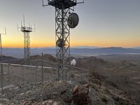 An Evening at Henderson, Looking Northeast
1 m / 0.00 mi · 2026-10-17 01:07:01+00
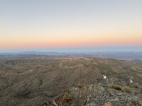 An Evening at Henderson, Looking South
1 m / 0.00 mi · 2026-10-17 01:06:54+00
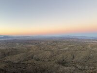 An Evening at Henderson, Looking Southeast
1 m / 0.00 mi · 2026-10-17 01:06:56+00
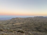 An Evening at Henderson, Looking West
1 m / 0.00 mi · 2026-10-17 01:06:47+00
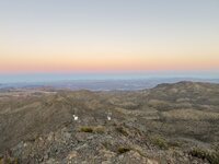 An Evening at Henderson, Looking Southwest
1 m / 0.00 mi · 2026-10-17 01:06:50+00
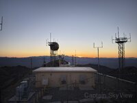 An Evening at Henderson, Looking North
1 m / 0.00 mi · 2026-10-17 01:06:25+00
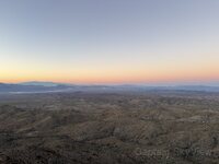 An Evening at Henderson, Looking Southeast
2 m / 0.00 mi · 2026-10-17 01:05:12+00
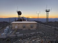 An Evening at Henderson, Looking North
2 m / 0.00 mi · 2026-10-17 01:05:20+00
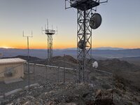 An Evening at Henderson, Looking Northeast
2 m / 0.00 mi · 2026-10-17 01:05:17+00
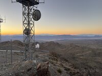 An Evening at Henderson, Looking East
2 m / 0.00 mi · 2026-10-17 01:05:14+00
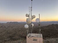 An Evening at Henderson, Looking Northwest
3 m / 0.00 mi · 2026-10-17 01:05:04+00
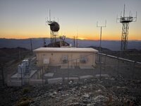 An Evening at Henderson, Looking North
4 m / 0.00 mi · 2026-10-17 01:06:20+00
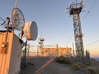 An Evening at Henderson, Looking South
56 m / 0.03 mi · 2026-10-17 00:57:56+00
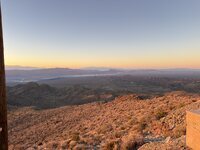 An Evening at Henderson, Looking East
56 m / 0.03 mi · 2026-10-17 00:57:25+00
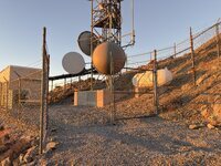 An Evening at Henderson, Looking Southeast
180 m / 0.11 mi · 2026-10-17 00:55:39+00
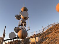 An Evening at Henderson, Looking Southeast
180 m / 0.11 mi · 2026-10-17 00:55:41+00
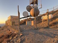 An Evening at Henderson, Looking East
180 m / 0.11 mi · 2026-10-17 00:55:44+00
FCC sites (37)
16 m / 0.01 miWQYI534
16 m / 0.01 miKYN49
46 m / 0.03 miKZS38
46 m / 0.03 miWHR201
46 m / 0.03 miWRCJ358
51 m / 0.03 miWRCJ368
51 m / 0.03 miWRCJ369
51 m / 0.03 miWRFP648
51 m / 0.03 miWRFP658
51 m / 0.03 miWSIJ529
51 m / 0.03 miWSIJ564
51 m / 0.03 miWSIJ566
51 m / 0.03 miWRAU469
55 m / 0.03 miWRAU470
55 m / 0.03 miKNKA368
55 m / 0.03 miKYN50
65 m / 0.04 miWOG63
65 m / 0.04 miWNEL239
151 m / 0.09 miWNEQ312
151 m / 0.09 miWNEQ313
151 m / 0.09 miWNTZ736
151 m / 0.09 miWQAM465
151 m / 0.09 miWQAM477
151 m / 0.09 miWQAM479
151 m / 0.09 miWNEQ595
162 m / 0.10 miWQFX223
162 m / 0.10 miWQFX363
162 m / 0.10 miWBU80
167 m / 0.10 miWNEQ594
167 m / 0.10 miWNTC491
167 m / 0.10 miWNEQ595
167 m / 0.10 mi1300422
168 m / 0.10 miKOJ39
171 m / 0.11 miWNEW315
171 m / 0.11 miWNEW317
171 m / 0.11 mi1055929
250 m / 0.16 mi
Minerals (0)
No nearby records in this radius.
Environmental stations (1)
100 m / 0.06 mi (35 records)
Artifacts (17)
An Evening at Henderson, Looking North0 m / 0.00 mi · 2026-10-17 01:07:06+00
An Evening at Henderson, Looking East0 m / 0.00 mi · 2026-10-17 01:06:59+00
An Evening at Henderson, Looking Northeast0 m / 0.00 mi · 2026-10-17 01:07:03+00
An Evening at Henderson, Looking Northeast1 m / 0.00 mi · 2026-10-17 01:07:01+00
An Evening at Henderson, Looking South1 m / 0.00 mi · 2026-10-17 01:06:54+00
An Evening at Henderson, Looking Southeast1 m / 0.00 mi · 2026-10-17 01:06:56+00
An Evening at Henderson, Looking West1 m / 0.00 mi · 2026-10-17 01:06:47+00
An Evening at Henderson, Looking Southwest1 m / 0.00 mi · 2026-10-17 01:06:50+00
An Evening at Henderson, Looking North1 m / 0.00 mi · 2026-10-17 01:06:25+00
An Evening at Henderson, Looking Southeast2 m / 0.00 mi · 2026-10-17 01:05:12+00
An Evening at Henderson, Looking North2 m / 0.00 mi · 2026-10-17 01:05:20+00
An Evening at Henderson, Looking Northeast2 m / 0.00 mi · 2026-10-17 01:05:17+00
An Evening at Henderson, Looking East2 m / 0.00 mi · 2026-10-17 01:05:14+00
An Evening at Henderson, Looking Northwest3 m / 0.00 mi · 2026-10-17 01:05:04+00
An Evening at Henderson, Looking North4 m / 0.00 mi · 2026-10-17 01:06:20+00
An Evening at Henderson, Looking South56 m / 0.03 mi · 2026-10-17 00:57:56+00
An Evening at Henderson, Looking East56 m / 0.03 mi · 2026-10-17 00:57:25+00
FCC sites (18)
16 m / 0.01 miWQYI534
16 m / 0.01 miKYN49
46 m / 0.03 miKZS38
46 m / 0.03 miWHR201
46 m / 0.03 miWRCJ358
51 m / 0.03 miWRCJ368
51 m / 0.03 miWRCJ369
51 m / 0.03 miWRFP648
51 m / 0.03 miWRFP658
51 m / 0.03 miWSIJ529
51 m / 0.03 miWSIJ564
51 m / 0.03 miWSIJ566
51 m / 0.03 miWRAU469
55 m / 0.03 miWRAU470
55 m / 0.03 miKNKA368
55 m / 0.03 miKYN50
65 m / 0.04 miWOG63
65 m / 0.04 mi
Minerals (0)
No nearby records in this radius.
Environmental stations (0)
No nearby records in this radius.
250 m / 0.16 mi (57 records)
Artifacts (20)
An Evening at Henderson, Looking North0 m / 0.00 mi · 2026-10-17 01:07:06+00
An Evening at Henderson, Looking East0 m / 0.00 mi · 2026-10-17 01:06:59+00
An Evening at Henderson, Looking Northeast0 m / 0.00 mi · 2026-10-17 01:07:03+00
An Evening at Henderson, Looking Northeast1 m / 0.00 mi · 2026-10-17 01:07:01+00
An Evening at Henderson, Looking South1 m / 0.00 mi · 2026-10-17 01:06:54+00
An Evening at Henderson, Looking Southeast1 m / 0.00 mi · 2026-10-17 01:06:56+00
An Evening at Henderson, Looking West1 m / 0.00 mi · 2026-10-17 01:06:47+00
An Evening at Henderson, Looking Southwest1 m / 0.00 mi · 2026-10-17 01:06:50+00
An Evening at Henderson, Looking North1 m / 0.00 mi · 2026-10-17 01:06:25+00
An Evening at Henderson, Looking Southeast2 m / 0.00 mi · 2026-10-17 01:05:12+00
An Evening at Henderson, Looking North2 m / 0.00 mi · 2026-10-17 01:05:20+00
An Evening at Henderson, Looking Northeast2 m / 0.00 mi · 2026-10-17 01:05:17+00
An Evening at Henderson, Looking East2 m / 0.00 mi · 2026-10-17 01:05:14+00
An Evening at Henderson, Looking Northwest3 m / 0.00 mi · 2026-10-17 01:05:04+00
An Evening at Henderson, Looking North4 m / 0.00 mi · 2026-10-17 01:06:20+00
An Evening at Henderson, Looking South56 m / 0.03 mi · 2026-10-17 00:57:56+00
An Evening at Henderson, Looking East56 m / 0.03 mi · 2026-10-17 00:57:25+00
An Evening at Henderson, Looking Southeast180 m / 0.11 mi · 2026-10-17 00:55:39+00
An Evening at Henderson, Looking Southeast180 m / 0.11 mi · 2026-10-17 00:55:41+00
An Evening at Henderson, Looking East180 m / 0.11 mi · 2026-10-17 00:55:44+00
FCC sites (36)
16 m / 0.01 miWQYI534
16 m / 0.01 miKYN49
46 m / 0.03 miKZS38
46 m / 0.03 miWHR201
46 m / 0.03 miWRCJ358
51 m / 0.03 miWRCJ368
51 m / 0.03 miWRCJ369
51 m / 0.03 miWRFP648
51 m / 0.03 miWRFP658
51 m / 0.03 miWSIJ529
51 m / 0.03 miWSIJ564
51 m / 0.03 miWSIJ566
51 m / 0.03 miWRAU469
55 m / 0.03 miWRAU470
55 m / 0.03 miKNKA368
55 m / 0.03 miKYN50
65 m / 0.04 miWOG63
65 m / 0.04 miWNEL239
151 m / 0.09 miWNEQ312
151 m / 0.09 miWNEQ313
151 m / 0.09 miWNTZ736
151 m / 0.09 miWQAM465
151 m / 0.09 miWQAM477
151 m / 0.09 miWQAM479
151 m / 0.09 miWNEQ595
162 m / 0.10 miWQFX223
162 m / 0.10 miWQFX363
162 m / 0.10 miWBU80
167 m / 0.10 miWNEQ594
167 m / 0.10 miWNTC491
167 m / 0.10 miWNEQ595
167 m / 0.10 mi1300422
168 m / 0.10 miKOJ39
171 m / 0.11 miWNEW315
171 m / 0.11 miWNEW317
171 m / 0.11 mi
Minerals (0)
No nearby records in this radius.
Environmental stations (1)
1 km / 0.62 mi (58 records)
Artifacts (20)
An Evening at Henderson, Looking North0 m / 0.00 mi · 2026-10-17 01:07:06+00
An Evening at Henderson, Looking East0 m / 0.00 mi · 2026-10-17 01:06:59+00
An Evening at Henderson, Looking Northeast0 m / 0.00 mi · 2026-10-17 01:07:03+00
An Evening at Henderson, Looking Northeast1 m / 0.00 mi · 2026-10-17 01:07:01+00
An Evening at Henderson, Looking South1 m / 0.00 mi · 2026-10-17 01:06:54+00
An Evening at Henderson, Looking Southeast1 m / 0.00 mi · 2026-10-17 01:06:56+00
An Evening at Henderson, Looking West1 m / 0.00 mi · 2026-10-17 01:06:47+00
An Evening at Henderson, Looking Southwest1 m / 0.00 mi · 2026-10-17 01:06:50+00
An Evening at Henderson, Looking North1 m / 0.00 mi · 2026-10-17 01:06:25+00
An Evening at Henderson, Looking Southeast2 m / 0.00 mi · 2026-10-17 01:05:12+00
An Evening at Henderson, Looking North2 m / 0.00 mi · 2026-10-17 01:05:20+00
An Evening at Henderson, Looking Northeast2 m / 0.00 mi · 2026-10-17 01:05:17+00
An Evening at Henderson, Looking East2 m / 0.00 mi · 2026-10-17 01:05:14+00
An Evening at Henderson, Looking Northwest3 m / 0.00 mi · 2026-10-17 01:05:04+00
An Evening at Henderson, Looking North4 m / 0.00 mi · 2026-10-17 01:06:20+00
An Evening at Henderson, Looking South56 m / 0.03 mi · 2026-10-17 00:57:56+00
An Evening at Henderson, Looking East56 m / 0.03 mi · 2026-10-17 00:57:25+00
An Evening at Henderson, Looking Southeast180 m / 0.11 mi · 2026-10-17 00:55:39+00
An Evening at Henderson, Looking Southeast180 m / 0.11 mi · 2026-10-17 00:55:41+00
An Evening at Henderson, Looking East180 m / 0.11 mi · 2026-10-17 00:55:44+00
FCC sites (37)
16 m / 0.01 miWQYI534
16 m / 0.01 miKYN49
46 m / 0.03 miKZS38
46 m / 0.03 miWHR201
46 m / 0.03 miWRCJ358
51 m / 0.03 miWRCJ368
51 m / 0.03 miWRCJ369
51 m / 0.03 miWRFP648
51 m / 0.03 miWRFP658
51 m / 0.03 miWSIJ529
51 m / 0.03 miWSIJ564
51 m / 0.03 miWSIJ566
51 m / 0.03 miWRAU469
55 m / 0.03 miWRAU470
55 m / 0.03 miKNKA368
55 m / 0.03 miKYN50
65 m / 0.04 miWOG63
65 m / 0.04 miWNEL239
151 m / 0.09 miWNEQ312
151 m / 0.09 miWNEQ313
151 m / 0.09 miWNTZ736
151 m / 0.09 miWQAM465
151 m / 0.09 miWQAM477
151 m / 0.09 miWQAM479
151 m / 0.09 miWNEQ595
162 m / 0.10 miWQFX223
162 m / 0.10 miWQFX363
162 m / 0.10 miWBU80
167 m / 0.10 miWNEQ594
167 m / 0.10 miWNTC491
167 m / 0.10 miWNEQ595
167 m / 0.10 mi1300422
168 m / 0.10 miKOJ39
171 m / 0.11 miWNEW315
171 m / 0.11 miWNEW317
171 m / 0.11 mi1055929
250 m / 0.16 mi
Minerals (0)
No nearby records in this radius.
Environmental stations (1)
5 km / 3.11 mi (59 records)
Artifacts (21)
An Evening at Henderson, Looking North0 m / 0.00 mi · 2026-10-17 01:07:06+00
An Evening at Henderson, Looking East0 m / 0.00 mi · 2026-10-17 01:06:59+00
An Evening at Henderson, Looking Northeast0 m / 0.00 mi · 2026-10-17 01:07:03+00
An Evening at Henderson, Looking Northeast1 m / 0.00 mi · 2026-10-17 01:07:01+00
An Evening at Henderson, Looking South1 m / 0.00 mi · 2026-10-17 01:06:54+00
An Evening at Henderson, Looking Southeast1 m / 0.00 mi · 2026-10-17 01:06:56+00
An Evening at Henderson, Looking West1 m / 0.00 mi · 2026-10-17 01:06:47+00
An Evening at Henderson, Looking Southwest1 m / 0.00 mi · 2026-10-17 01:06:50+00
An Evening at Henderson, Looking North1 m / 0.00 mi · 2026-10-17 01:06:25+00
An Evening at Henderson, Looking Southeast2 m / 0.00 mi · 2026-10-17 01:05:12+00
An Evening at Henderson, Looking North2 m / 0.00 mi · 2026-10-17 01:05:20+00
An Evening at Henderson, Looking Northeast2 m / 0.00 mi · 2026-10-17 01:05:17+00
An Evening at Henderson, Looking East2 m / 0.00 mi · 2026-10-17 01:05:14+00
An Evening at Henderson, Looking Northwest3 m / 0.00 mi · 2026-10-17 01:05:04+00
An Evening at Henderson, Looking North4 m / 0.00 mi · 2026-10-17 01:06:20+00
An Evening at Henderson, Looking South56 m / 0.03 mi · 2026-10-17 00:57:56+00
An Evening at Henderson, Looking East56 m / 0.03 mi · 2026-10-17 00:57:25+00
An Evening at Henderson, Looking Southeast180 m / 0.11 mi · 2026-10-17 00:55:39+00
An Evening at Henderson, Looking Southeast180 m / 0.11 mi · 2026-10-17 00:55:41+00
An Evening at Henderson, Looking East180 m / 0.11 mi · 2026-10-17 00:55:44+00
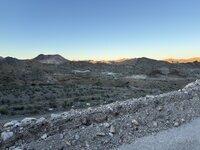 An Evening at Henderson, Looking Southeast
4.07 km / 2.53 mi · 2026-10-17 00:39:59+00
FCC sites (37)
16 m / 0.01 miWQYI534
16 m / 0.01 miKYN49
46 m / 0.03 miKZS38
46 m / 0.03 miWHR201
46 m / 0.03 miWRCJ358
51 m / 0.03 miWRCJ368
51 m / 0.03 miWRCJ369
51 m / 0.03 miWRFP648
51 m / 0.03 miWRFP658
51 m / 0.03 miWSIJ529
51 m / 0.03 miWSIJ564
51 m / 0.03 miWSIJ566
51 m / 0.03 miWRAU469
55 m / 0.03 miWRAU470
55 m / 0.03 miKNKA368
55 m / 0.03 miKYN50
65 m / 0.04 miWOG63
65 m / 0.04 miWNEL239
151 m / 0.09 miWNEQ312
151 m / 0.09 miWNEQ313
151 m / 0.09 miWNTZ736
151 m / 0.09 miWQAM465
151 m / 0.09 miWQAM477
151 m / 0.09 miWQAM479
151 m / 0.09 miWNEQ595
162 m / 0.10 miWQFX223
162 m / 0.10 miWQFX363
162 m / 0.10 miWBU80
167 m / 0.10 miWNEQ594
167 m / 0.10 miWNTC491
167 m / 0.10 miWNEQ595
167 m / 0.10 mi1300422
168 m / 0.10 miKOJ39
171 m / 0.11 miWNEW315
171 m / 0.11 miWNEW317
171 m / 0.11 mi1055929
250 m / 0.16 mi
Minerals (0)
No nearby records in this radius.
Environmental stations (1)
